final flexibility summary document 011206 · and designers to look beyond basic transportation...
TRANSCRIPT

Understanding Flexibility In Transportation DesignSummary Document
Washington StateDepartment of Transportation


TA B L E O F CO N T E N T S
Introduction 1
Responding to Community Values 2
Accommodating Pedestrians 6
Accommodating Transit Users and Transit Vehicles 8
Accommodating Bicyclists 10
Accommodating Motorists 12
Accommodating Freight Carriers 15
Working with Limitations 17
1
O N E O F T H E B I G G E S T T R A N S P O R TAT I O N C H A L L E N G E S TO DAY . . .
is fi nding safe, aff ordable, and effi cient ways to accommodate all of the ways of getting around in increasingly limited space.
In the past this challenge was not as diffi cult because the focus was on getting the maximum number of vehicles through a given area. Unfortunately this approach did not always provide the appropriate level of attention to economic vitality, sense of place, or environmental impacts.
Over time, our understanding of the relationship between land use form and function and transportation design has evolved. For example, we know more about transportation-efficient land use patterns and have developed innovative designs that allow the transportation system to operate more effi ciently. As a result, project teams now include a wider range of specialty disciplines -- planners, architects, and environmental experts. Community involvement has taken center stage, as it becomes more and more important to make certain that all aff ected stakeholders are informed and engaged in the design process. Vehicle mobility must be balanced against numerous other considerations, including economic vitality, environmental protection, aesthetics, pedestrian and bicyclist safety, and preserving a community’s “sense of place.”
Understanding Flexibility in Transportation Design - Washington is a guidebook for planners and designers facing the complexities and challenges inherent in today’s transportation projects. It discusses design context in detail, outlines other considerations, and provides a wide range of tools and strategies to balance competing needs. When used with its companion document, Building Projects that Build Communities, Understanding Flexibility in Transportation Design serves as a guide to designing transportation projects that effectively and efficiently move people, and deliver goods and services while – at the same time – meeting the diverse needs of communities.
Understanding Flexibility in Transportation Design - Washington was created to broaden the focus of the project development process. It encourages transportation planners and designers to look beyond basic transportation issues and develop projects that are integrated with unique contexts within a project setting. While it can be diffi cult to evaluate, and eventually design a project that balances competing needs, the fl exibility document provides a toolbox to help the designer meet this challenge. And numerous examples from communities throughout the State of Washington demonstrate that, indeed, it can be done.
Th is document is a summary of the larger guidebook. It includes a brief overview of the issues, other considerations that are inherent in most of today’s transportation projects, and it provides solutions that can help designers meet those very interesting challenges. While those directly involved in project design are likely to fi nd this summary helpful, it has also been created to assist interested citizens, elected offi cials, business owners, and others who may be keenly involved in the planning and design of transportation projects that either intersect, or are adjacent to, their communities.
I N T RO D U C T I O N
2
R E S P O N D I N G T O C O M M U N I T Y VA L U E S
Transportation projects from planning through construction, whether urban, rural, or suburban, must respond to community values. Th e core of Context Sensitive Design is balancing the range of transportation needs within the aff ected community.
While every community has a unique set of values, a number of common threads often emerge as communities engage in the design process. Almost every community wants to make certain that:
– Natural resources and human health are protected
– Th e proposed transportation project is aesthetically pleasing and preserves the cultural and historic features of the community
– Economic growth is enhanced and sustained, and
– The transportation project supports not only the current land use, but future land use plans as well.
Important components to consider when balancing community values include:
I . N AT U R A L R E S O U RC E S A N D H U M A N H E A LT HThe Washington State Environmental Policy Act (SEPA), in combination with the National Environmental Policy Act (NEPA), help to ensure that all transportation projects are designed and built in a way that both minimizes impacts on the environment and eff ectively mitigates for any impacts that do occur. Forests, wetlands, water bodies, and the protection of human health and wildlife are primary areas of focus for these environmental review processes. The following is a brief summary of two issues (refer to the full version of Understanding Flexibility in Transportation Design for more discussion):
Protection of Water Bodies. Stormwater run-off from highways is often a primary concern to communities involved in road improvements. Numerous regulations govern how stormwater should be collected and treated. Several mitigation measures actively supported by state, regional, and local agencies involved in transportation projects include:
– Low Impact Development options for stormwater treatment (e.g., bioswales, vegetated planting strips that allow rainwater to infi ltrate naturally into the ground rather than increasing run-off ), and
– Constructed wetlands that provide wildlife habitat, and allow for natural infi ltration of rainwater.
Incorporating these features into a project may increase the project’s overall cost and require additional time.
Several examples of effective partnerships for stormwater treatment and for environmental improvements that mitigate negative project impacts are illustrated here.
Protection of Human Health. Air pollution, vibration, and night sky illumination are all environmental issues that can be of concern to those who live and work in the vicinity of a major roadway. These issues are carefully reviewed through both the NEPA and SEPA processes; planners and designers must be able to demonstrate that they are doing everything possible to reduce the impacts of motor vehicle travel on these important health considerations.
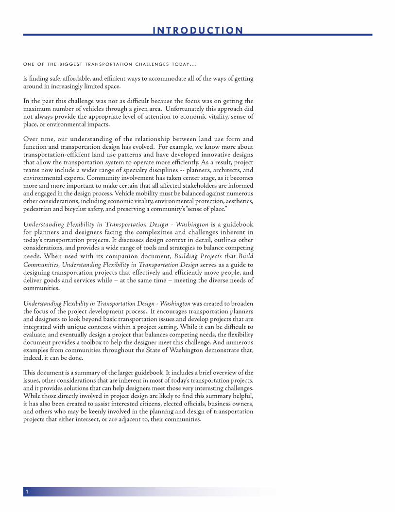
Bioswale in Seattle.
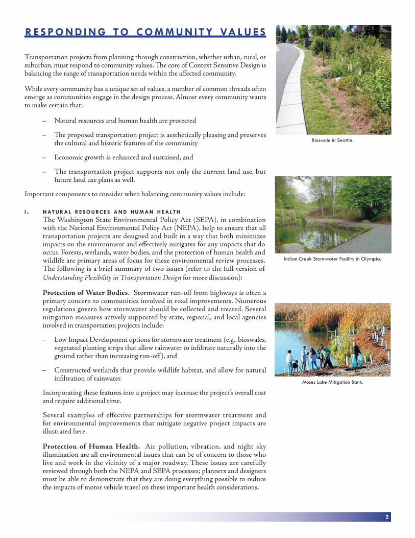
Indian Creek Stormwater Facility in Olympia.
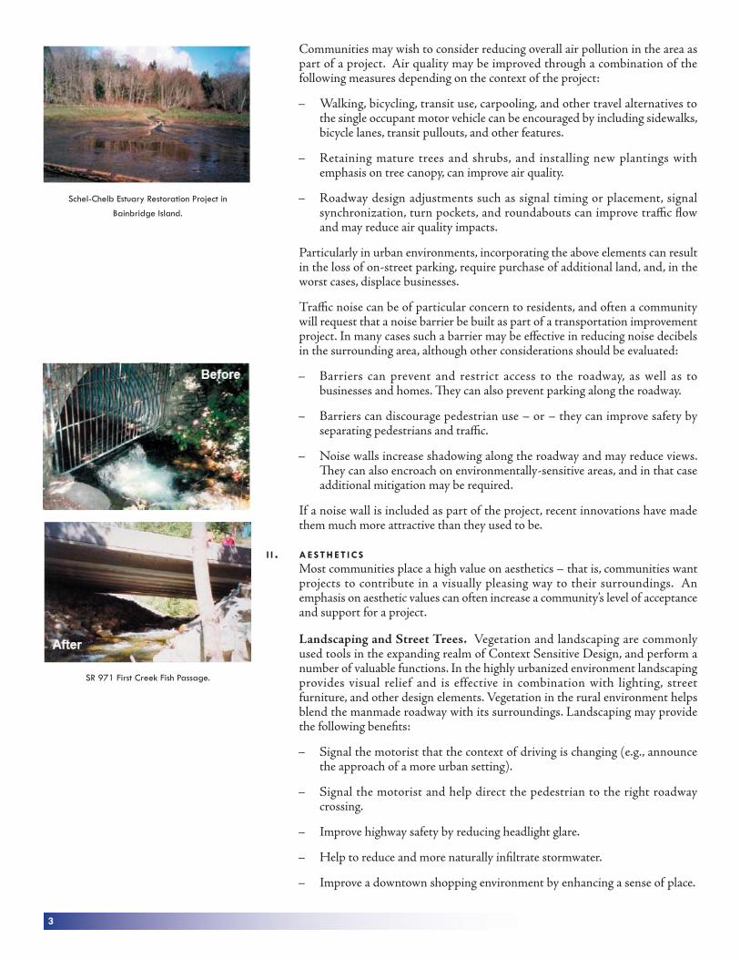
Moses Lake Mitigation Bank.
3
Communities may wish to consider reducing overall air pollution in the area as part of a project. Air quality may be improved through a combination of the following measures depending on the context of the project:
– Walking, bicycling, transit use, carpooling, and other travel alternatives to the single occupant motor vehicle can be encouraged by including sidewalks, bicycle lanes, transit pullouts, and other features.
– Retaining mature trees and shrubs, and installing new plantings with emphasis on tree canopy, can improve air quality.
– Roadway design adjustments such as signal timing or placement, signal synchronization, turn pockets, and roundabouts can improve traffi c fl ow and may reduce air quality impacts.
Particularly in urban environments, incorporating the above elements can result in the loss of on-street parking, require purchase of additional land, and, in the worst cases, displace businesses.
Traffi c noise can be of particular concern to residents, and often a community will request that a noise barrier be built as part of a transportation improvement project. In many cases such a barrier may be eff ective in reducing noise decibels in the surrounding area, although other considerations should be evaluated:
– Barriers can prevent and restrict access to the roadway, as well as to businesses and homes. Th ey can also prevent parking along the roadway.
– Barriers can discourage pedestrian use – or – they can improve safety by separating pedestrians and traffi c.
– Noise walls increase shadowing along the roadway and may reduce views. Th ey can also encroach on environmentally-sensitive areas, and in that case additional mitigation may be required.
If a noise wall is included as part of the project, recent innovations have made them much more attractive than they used to be.
I I . A E S T H E T I C SMost communities place a high value on aesthetics – that is, communities want projects to contribute in a visually pleasing way to their surroundings. An emphasis on aesthetic values can often increase a community’s level of acceptance and support for a project.
Landscaping and Street Trees. Vegetation and landscaping are commonly used tools in the expanding realm of Context Sensitive Design, and perform a number of valuable functions. In the highly urbanized environment landscaping provides visual relief and is effective in combination with lighting, street furniture, and other design elements. Vegetation in the rural environment helps blend the manmade roadway with its surroundings. Landscaping may provide the following benefi ts:
– Signal the motorist that the context of driving is changing (e.g., announce the approach of a more urban setting).
– Signal the motorist and help direct the pedestrian to the right roadway crossing.
– Improve highway safety by reducing headlight glare.
– Help to reduce and more naturally infi ltrate stormwater.
– Improve a downtown shopping environment by enhancing a sense of place.
SR 971 First Creek Fish Passage.
Schel-Chelb Estuary Restoration Project in
Bainbridge Island.

4
– Increase security for pedestrians and bicyclists by physically separating them from motor vehicle traffi c.
Communities often ask for street trees. For many people, street trees connote a pleasant neighborhood, a well-defi ned sense of place, and good quality of life. Th e benefi ts of street trees include:
– Trees provide shade, impede erosion, reduce runoff, and improve both water and air quality. Th ey soften the landscape and add human scale to the surroundings.
– In shopping districts with street trees, studies indicate that shoppers spend more on the same products, stay longer, and return more frequently compared to shopping districts without trees.
– Studies have shown that people who live in areas with trees have signifi cantly better relationships with their neighbors, are signifi cantly less violent, know more people, and have more visitors than people who live in areas without trees.
Several other considerations include:
– Large trees may encroach on the “clearzone”. Th is means that on higher speed roadways trees need to be further from the road.
– Where traffi c volumes and travel speeds are high, trees may block sight distance of motorists. Limited sight distance can increase the number of collisions.
– Trees and other landscaping must be well-maintained. Supplemental water is always necessary. Pruning and leaf disposal must be performed regularly to ensure that the landscaped area does not become an eyesore.
– Care must be taken to select tree species that will not be overly intrusive in the future. Steps should be taken to ensure that tree roots do not crack pavement and sidewalks.
Streetscape Amenities. Rural town centers, as well as suburban and urban contexts benefi t from street furniture, lighting, artwork, and other amenities. Th ey contribute to economic vitality. Th ey can serve as part of a gateway, and they can increase both pedestrian traffi c and the amount of time that visitors remain in an area.
Several other considerations include:
– Streetscape amenities can reduce motorist sight distance or create a distraction. Consider sight distance, particularly on high speed roads.
– Some types of streetscape amenities require funding and resources for long-term maintenance. Select streetscaping features that will stand the test of time and consider creative options for maintaining these features.
I I I . E C O N O M I C V I TA L I T Y Previous chapters emphasized the need to support the economic health of the area. Transportation planners and designers must constantly balance mobility needs with community economic priorities – whether it be in a rural small town, a re-emerging downtown area, or a major urban center. Other factors that contribute to sustained economic vitality are discussed in other chapters of this Summary, but a brief list includes:
Patterned noise wall in Mill Creek.
Architectural wall treatment along SR 202.
Broad leaf pattern on noise wall at the Sunset
Interchange on I-90 in Issaquah.
Logger silhouettes in Raymond.

5
– Transition areas and gateways. Th ese are signals to motorists that a change in context is coming, and that this might be a good place to take a break from driving, eat lunch, and shop.
– Traffic calming. Various strategies that slow motorists down and encourage them to stop and linger in a community’s economic center.
– Landscaping and streetscaping. Vegetation, artwork, and other amenities that create a more pleasant environment to gather, linger, and shop.
– Diversity of travel modes. Design that extends beyond the needs of the motorist to include bikes, pedestrians, and transit users.
– Access. Intersections, designated freight routes, and other design elements that provide a framework for smooth freight deliveries to business owners.
I V . R E G I O N A L A N D LO C A L L A N D U S E P L A N SHow do transportation planners and designers ensure that their transportation projects contribute to a greater “sense of place” for a community? Diverse project teams that include architectural, environmental, landscaping, and other expertise help to ensure that community values will be incorporated into the design process.
Essential for consistency with community values, however, is a vigorous public involvement process. Project teams need to plan and schedule their work to include frequent, meaningful opportunities for the community to contribute to planning, design, and implementation. Th is includes community meetings, hands-on sessions called design charrettes with designers and architects, websites that provide an easy mechanism for feedback, and numerous other public involvement techniques.
During project development, it is important to focus on the future land use in the area as well as current and future traffi c patterns. Remember that future land use plans are not always accurately refl ected in current traffi c counts or future traffi c scenarios. Consider how land use plans and sub-area plans suggest that development will change over time. Consider the transportation solutions that will best support planned and zoned land use in the area. Consider community history, historic sites, and cultural landmarks. Both regional and local, as well as short and long-term land use plans for the area, should be reviewed with the public as part of the context-sensitive-design discussion. Th e following chapters describe how to assess a community’s needs, prepare for the future, and accommodate a diversity of user groups. Transportation solutions stand a much better chance of being implemented, being eff ective, and lasting if they incorporate community values.
Illumination fi xtures in Tacoma.
Signage & trees used to direct users in Lacey.
Streetscape enhancements in Des Moines.

6
AC C O M M O DAT I N G P E D E S T R I A N S
For most people, every trip begins and ends with walking. In the State of Washington, the majority of transportation projects must accommodate pedestrians. Washington’s Growth Management Act requires local agencies to include bicycle and pedestrian projects and programs in the Transportation Element of their Comprehensive Plans. As a result, many cities and counties in Washington State are establishing street-design standards that include specifi cations addressing pedestrian facilities. Most communities have additional policies and programs that refl ect their residents’ desire to have a safe system of walkways. The safety and number of people walking are infl uenced by two elements:
– A “physical safety” element that protects pedestrians from motor vehicles, and
– A “psychological” element that simply makes the act of walking an enjoyable and secure experience.
Important context questions to ask include:
Where are pedestrians walking?
Are there existing or planned pedestrian starting points and destinations such as: retail/commercial districts, residential areas, transit stops, hotels, drinking establishments, schools, recreational areas, libraries, senior citizen centers, deli-mart stores, fast food restaurants, and skateboard parks ?
Are there at-risk groups such as the young, aging or disabled that use or will use this facility?
Have we provided for crossing opportunities?
Have we included pedestrian level lighting?
Key design components include:
I . M A N AG E T R A F F I C S P E E D S At twenty miles per hour, about 5% of all vehicle/pedestrian collisions result in a pedestrian fatality. At forty miles per hour, fatalities jump to 90%. Consider minimizing motor vehicle speeds in areas of high pedestrian use. Eff ective ways of managing speed include: enforcement, street closures, speed humps, chicanes, traffi c curbs, and diverters, which all contribute to the safety of pedestrians. Changing posted speeds without modifying the design speed of the roadway has little eff ect.
When design speeds are modifi ed to improve safety for pedestrians, level of service for motor vehicles and freight may be aff ected.
I I . PAY PA RT I C U L A R AT T E N T I O N T O C RO S S I N G S A N D I N T E R S E C T I O N SMost direct interactions and confl icts between pedestrians and motorists occur at roadway crossings and intersections. Consider whether a crossing at an intersection will be safer and used more frequently than a mid-block crossing. To increase pedestrian safety:
Signing. Alert drivers that pedestrians may be crossing. Provide advance stop lines, pedestrian warning signs and speed limit postings.
Pedestrian crossing at a roundabout in Lacey.
An artistic pedestrian bridge in Seattle.
Marked crosswalk with median refuge.

7
Identified Crosswalks. Clearly indicate to both motorists and pedestrians a location for pedestrians to cross the roadway.
Median Refuges. Raised medians allow pedestrians to cross multiple traffi c lanes in stages, one direction at a time.
Pedestrian Phases at Signalized Intersections. Walk/Don’t Walk signs and push buttons greatly enhance the safety of pedestrians at signalized intersections when adequate crossing time is allowed.
Increased Visibility. Reduce the risk of collisions by limiting parking at intersections and near crossings. Use fluorescent yellow-green pedestrian crossing signs and overhead and in-pavement fl ashing lights. Lighting in areas where pedestrians are expected is also important. Overhead lighting and up lighting at pedestrian crossings both improve the visibility of pedestrians.
Signal Timing. Provide adequate time for pedestrians to cross. Consider the age of pedestrians in the area when establishing crossing time.
I I I . S E PA R AT E P E D E S T R I A N S F RO M T H E ROA D WAYThere are many ways to separate pedestrians from the roadway. Effective separation will depend on the type of roadway. Sidewalks are important for pedestrian safety in many circumstances. Buff er zones are strips that serve to separate sidewalks from vehicular traffi c in the roadway. Buff er zones can simply be landscaped areas, or, in urban environments, buff ers with street furniture improve the walking experience and, at the same time, provide strong visual cues regarding the most desirable roadway crossings. Vegetation may provide a sense of security for pedestrians, but some types of vegetation reduce visibility for motorists.
Walkways, trails, and grade-separated pedestrian facilities can greatly enhance the walking experience. While these facilities are sometimes costly, the benefi ts that accrue to both pedestrians and motorists often far outweigh the initial investments.
I V . E N S U R E WA L K WAY C O N T I N U I T YIt is important to understand the starting points and destinations of pedestrians within a specific project area in order to provide interconnected walkways. Providing these connections can increase the cost of a project. Th e benefi ts in terms of safety and mobility that could be achieved need to be considered with costs in project development.
V. REMEMBER YOUNGER PEOPLE, THE AGING AND PERSONS WITH DISABILITIESYounger pedestrians may not exercise good judgment in crossing roadways. Special care must be taken to protect young people. A number of regulations guide the design of school crossings and other intersections where students are likely to be present. Likewise, the Americans with Disabilities Act requires that this group of pedestrians be accommodated in all transportation projects per current standards.
V I . TA K E P R E C AU T I O N S F O R BAC K I N G V E H I C L E SMany pedestrian/motorist collisions involve backing vehicles. Th ese collisions often occur as motorists back over sidewalks from driveways or parking lots. Consider limiting the height of vegetation, increasing lighting, installing signage or signals that indicate backing vehicles, and other treatments to help reduce these confl icts.
Landscaping at an intersection that facilitates
pedestrian visibility.
Pedestrian refuge in Tumwater.
Walkways, trails, and grade-separated pedestrian facilities can greatly enhance the walking experience. While these are sometimes costly, the benefi ts that accrue to both pedestrians and motor vehicle operators often far outweigh any initial investments.

8
AC C O M M O DAT I N G T R A N S I T U S E R S A N D T R A N S I T V E H I C L E S
Transit is broadly defi ned as public and private services ranging from on-demand van transport to buses to passenger rail systems. The Understanding Flexibility in Transportation Design document focuses on the integration of public bus systems into transportation projects rather than on rail or other forms of transit. Th is is because buses are most common in Washington State and have the greatest daily impact on roadway operation.
Important context questions to ask include:
Is this project in an urban or rural area and what types of transit serve this area (e.g., buses, vans, trains, public, private)?
What is the frequency of transit service in the area?
How can we ensure that transit frequency is maintained?
Are stops, stations, and center locations coordinated with other supporting elements of the transportation system (e.g., sidewalks, crossings, parking, trails)?
What can be done to improve the safety and security of transit users?
How easy is it to transition between buses and other modes of transportation?
Key design components include:
I . S E L E C T T H E R I G H T M I X O F S TO P , C E N T E R A N D S TAT I O N LO C AT I O N SToo few of the right type of service locations may mean that transit riders are unaware of the service in their area, are forced to walk too far, or have to wait too long to board, often without shelter. Th is can increase the amount of time that the bus has to wait at the stop. Studies show that excessive walking distance is a barrier to sustained transit use. Too many locations, even of the right type, may increase overall trip times for transit riders and delays for motorists because more time is needed for acceleration, deceleration, and the dwell times at each stop. Too many stops, centers, or stations may mean that not every location is near a clearly identifi ed crosswalk, putting people trying to catch buses at greater risk.
Sidewalks, clear crossing locations, and other supporting features should be in place or added near transit stops, stations, and centers whenever possible to meet the needs of transit users.
I I . G I V E T R A N S I T V E H I C L E S A D E Q UAT E S PAC EIn some cases, it is desirable to allow buses to stop in the roadway as opposed to requiring the driver to use a pullout. Stopping in the roadway avoids the delay of trying to re-enter traffi c. However, providing this accommodation may delay motorists on congested roadways. Exclusive bus lanes increase the reliability and speed of transit service, and are typically used in highly urbanized areas.
If bus pullouts are incorporated into a project, ensure adequate space. Many buses provide bicycle racks. If pullouts or other transit facilities are included in a project, provide space for cyclists to get their bikes safely on and off the bus rack. Additionally, allow for sidewalk space to accommodate transit users with disabilities when they board and depart the bus.
Transit center in Olympia.
Transit users at a station in Lakewood.
On-street transit stop in Tacoma.

9
I I I . P ROV I D E A C L E A N, W E L L L I G H T E D P L AC E T O WA I TGood signage and lighting are important for the safety of transit users and motorists, but can inconvenience nearby residents and businesses. Use uniform colors for signage to let passengers know where they need to be and where the bus will be taking them. Stops, centers, and stations should be well connected with other transportation infrastructure, provide protection from the weather, and convey a sense of safety and security. Many communities have designed transit centers or stations that provide centralized locations to connect to numerous routes and with other transportation modes.
I V . E N S U R E E A S Y T R A N S I T I O N S B E T W E E N M O D E SMany transit users are also carpoolers, pedestrians, and bicycle riders. Comprehensive planning is necessary to ensure that the transit system is well-connected to areas of high pedestrian activity and distribution points for other modes of transportation. Bicyclists will be more enthusiastic about riding transit if bikes can be carried on the bus and if the system as a whole is connected to bicycle routes. And, the public as a whole will be more attracted to transit if there is an ease of transition and a sense of continuity between the bus and other modes of transportation – whether it be a car, ferry, airport, or train station.
Off-street transit center in Vancouver.
Bus pullout at transit stop in Tumwater.

10
A bike tunnel in Lacey.
AC C O M M O DAT I N G B I C YC L I S T S
Many agencies have policies and programs focused on improving safety for bicyclists and on increasing the number of people bicycling for reasons ranging from improving public health to increasing transportation access. Bicycle lanes are required along and across most sections of state routes, county roads, and city streets. Facilities for bicyclists are an integral part of Washington’s transportation system. Washington’s Growth Management Act requires local agencies to include bicycle and pedestrian projects and programs in the Transportation Element of their Comprehensive Plans.
Important context questions to ask include:
Is this bicycle facility in an urban or rural setting?
Is this bicycle facility identifi ed in a local, state or regional transportation plan (indicating importance to local bicyclists)?
What types of bicyclists will likely use the facility (e.g., commuters, young or inexperienced cyclists, bicycle touring, recreational cyclists, others)?
Will this facility be used by others (e.g., pedestrians, equestrians, skaters, dog walkers, etc…)?
Key design components include:
I . P ROV I D E B OT H O N-ROA D A N D S E PA R AT E D FAC I L I T I E S Talk to the bicyclists in your community to understand their preferences and determine common destinations to ensure the most direct routes possible. When separated paths are narrow there may be a higher number of collisions because cyclists may encounter pedestrians, skaters, equestrians, and other cyclists with varying skill levels without adequate stopping distance. In most urban areas with higher numbers of bicycle riders, both on-road and separated facilities are necessary in order to safely accommodate cyclists.
I I . M I N I M I Z E C O N F L I C T P O I N T S Substantial confl icts can arise between bicyclists and motorists at intersections. Consider placement of signs and stripes for bicycle lanes, especially those that enable the bicyclist to make a “motor vehicle style” turn or proceed through an intersection to the left of a right turn lane. Single Point Urban Interchanges are diffi cult for bicyclists to negotiate. If they must be used, signal timing should be adjusted to accommodate the bicyclist. Take care to properly mark, sign, and signalize those areas where the trail and roadway intersect. Avoid using one facility to accommodate motor vehicles and bicycles where possible and appropriate.
I I I . E L I M I N AT E BA R R I E R SNumerous obstacles can be more signifi cant barriers to bicycles than motorists. Shoulders should be wide, well-paved, and kept free of litter and debris. On-street parking makes it diffi cult for a bicyclist to maintain an adequate sight distance and to maneuver through traffic, especially when lane widths are inadequate to accommodate all modes of travel. Railroad tracks can trap bicycle tires, as can rough pavement, drainage grates, and bridge expansion joints. Removal of barriers to accommodate bicyclists can be expensive. Th e cost of safety and mobility benefi ts that could be achieved need to be considered in project development.
Bike and pedestrian facility in Seattle.

11
It is important to provide both an on-road and a separated option for bicyclists wherever possible. Even in designated, separate areas, care must be taken to mark, sign, and signalize those areas where the trail and roadway intersect.
I V . P ROV I D E C O N T I N U I T YKey to a convenient bicycle commute is continuity of facilities. Evaluate the way in which a bicycle facility ties into other bicycle paths and routes in the region, as well as to transit service. Providing continuity for bicycle commuters may take additional time in project development and may require acquisition of additional right of way.
A LWAYS A S K T H E U S E R !
All transportation projects benefi t from the active involvement of those who live, work, or will use the project being designed. It is important to engage these citizens early and as thoroughly as possible throughout the design process. In the case of bicyclists, a number of organized stakeholder groups will work with you. Bicycle clubs throughout Washington State, as well as WSDOT’s Bicycle and Pedestrian Advisory Committee, serve as valuable resources. Also, understand that the design of bicycle facilities is relatively new in the U.S., and research is underway to determine better ways to accommodate this important, and growing, group of users. Don’t hesitate to ask for assistance!
The Lake Wilderness Trail underpass in Maple Valley.

12
AC C O M M O DAT I N G M OTO R I S T S
It is important that the design of streets, roads, and highways refl ect the character of the communities they serve, adjacent, and planned land uses and the needs of the traveling public. Well-designed facilities enable safe and effi cient travel and enhance communities.
Important context questions to ask include:
What do drivers expect along specifi c sections of roadway?
What other functions does a specifi c section of roadway serve and how well does it serve those functions? For example:
What types of housing or commercial development are adjacent to this roadway and what is planned?
What are motorist access needs for businesses and residences?
How does this section of roadway integrate other modes with motor vehicles?
What types of vehicles will be using this facility?
Key design components include:
I . D E S I G N F O R T H E R I G H T M I X O F V E H I C L E S Design the roadway for the mix of vehicles that regularly travel it. Intelligent design improves traffic flow. If you design for all small vehicles, traffic disruptions can occur when larger vehicles pass through. If you design only for larger vehicles, pedestrian crossing distances, and impervious surfaces can be needlessly increased.
I I . M A N AG E T R A F F I C S P E E D Make sure the street, road, or highway is designed to encourage safe and appropriate driving speeds. Safe driving speed depends on factors such as the roadway’s classifi cation, terrain type, current and planned land use, access management, and traffi c volumes. If the design speed is too fast or too slow, the safety of motorists and others may be compromised.
I I I . C R E AT E T R A N S I T I O N A R E A S A N D G AT E WAY S Transition areas alert motorists to changes in road conditions, urban/rural settings, access, and speed. Design elements corresponding to transitional areas alert drivers to upcoming changes in conditions and help change their behavior and response. Changing drivers’ behavior is particularly important in the transition between a high-speed rural setting and a lower-speed urban roadway. You can alert drivers to upcoming changes with:
Roadway Widths. Changing widths alert motorists to changes in a road’s characteristics or context. Narrowing roadways with medians, curb extensions, and other treatments informs motorists that they are entering or leaving a particular context.
Access Control and Management. Mechanisms that control entering and crossing traffi c tell motorists of transitions to which they need to respond.
Alignment. Shifts in a roadway’s alignment notify drivers of upcoming changes. For example, curves or straight-aways indicate to slow down or speed up, respectively. Roadway alignment notifi es motorists that they are entering urban/rural transitions.
Multifunction roadway on SR 169 in Maple Valley.
Center islands with and without landscaping at Bethel
Ave/SR 166/Mile Hill Drive and SR 203/Novelty Hill
Road, Duvall.

13
Vegetation. Use the type, design, and location of landscaping to indicate changes in the roadway. Vary the height and spacing of plantings to inform and guide motorists.
Roadside Features. The strategic placement of structural features alerts motorists to transitions.
Traffic Calming. Design features and devices such as textured pavement or speed humps alert motorists that they are approaching a new array of activities and land uses that warrant slower speeds.
Gateways. These provide motorists with visual cues about changes in land use. Th ey also enhance a community’s sense of place. Th ey can blend design elements from adjacent areas by transitioning vegetation species and layout, and by incorporating lighting fi xtures or street furnishings.
I V . U S E S A F E A N D E F F E C T I V E ROA D WAY D E S I G N E L E M E N T SA few basics of balanced roadway design include:
Lane Widths. Th e width of travel lanes tells motorists how fast they can safely and comfortably drive. Where truck volumes are high or desired travel speeds are fast, lanes as wide as 12 feet may be appropriate. Lanes as narrow as 10 feet are appropriate where slower driving speeds are desired or where right of way is restricted, such as in city centers. Appropriate width will be determined by adjacent and planned land uses, desired speeds, traffi c volumes, and the presence of freight carriers, pedestrians, bicyclists, and buses.
Lane Safety Elements. Roadway and centerline rumble strips and pavement markings alert motorists to unsafe conditions and defi ne vehicular boundaries.
Medians. Th ese provide separation from opposing traffi c, increasing drivers’ safety. Th ey can also reduce headlight glare, especially when the medians are wide and include earth mounds, plants, concrete barriers, and glare screens. Median barriers protect against cross-over crashes.
Shoulders. In rural and suburban areas, shoulders serve multiple functions. Th ey allow motorists to pull off the roadway. Th ey also provide a space for biking and walking when bike lanes and sidewalks are not available. Shoulders provide erosion protection to the roadbed and can reduce reconstruction costs. However, they may require acquisition of additional right-of-way.
V. C O N S I D E R AU X I L I A RY FAC I L I T I E SAuxiliary facilities address particular roadway needs, such as acceleration/deceleration lanes, turning lanes, and truck climbing and passing lanes. However, they often add signifi cant cost to a transportation project.
V I . PAY C LO S E AT T E N T I O N T O I N T E R S E C T I O N S Intersections inevitably create more opportunity for conflict as they bring into contact opposing directions of traffi c as well as pedestrians and bicyclists. Intersections require special design consideration in order to operate safely and effi ciently for motorists and non-motorists. Intersection controls range from stop signs to fl ashing signals, traffi c lights, and roundabouts. Sight distance is another important consideration when designing intersections. Adding turn lanes can greatly increase the mobility, capacity, and safety of motorists at intersections. However, additional turn lanes may increase the distance pedestrians must cross.
V I I . L I M I T A N D M A N AG E ROA D WAY AC C E S S Studies show that regulating and limiting access to highways and roadways cost-eff ectively helps maintain the motor vehicle safety and capacity of most facilities. Along some principle arterials and highways access can be managed by routing
Two-lane roundabout in Lacey.
The goal is to balance the needs of these competing uses: providing motorists with suffi cient mobility and, at the same time, ensuring that safety and ease of movement for other roadway users i s not compromised.
Yield control in Lacey.
Urban traffi c calming on US 395 in Colville.

14
traffic to frontage roads and other alternative routes, and encouraging the internal shared circulation of adjacent developments. However, this can mean more traffi c cutting through parking lots. It can also result in motorists using neighborhood streets with more driveway confl ict points and limited sidewalks. Another approach to access management often used on arterials is installation of sidewalks and raised medians. Business owners may initially oppose this type of access management because it may mean only one or two vehicle entry points into their business. However, it can increase pedestrian access to businesses.
National statist ics indicate that when access management elements such as raised medians and exclusive left-turn lanes are put into place, reductions in collisions range from 18-88%.
Neighborhood traffi c circle in Olympia.

15
AC C O M M O DAT I N G F R E I G H T C A R R I E R S
Freight mobility is essential to the economic health of virtually all Washington State communities. Th is summary and the Understanding Flexibility in Transportation Design document focus primarily on freight carried by trucks vs. rail, barge, etc. because trucks most directly aff ect the state’s system of highways and roadways. Th e needs of trucks carrying freight must be balanced with the needs of motorists, pedestrians, transit, and bicyclists. Accommodating freight carriers is a very important consideration in highway design.
Freight carriers are not only eighteen-wheelers moving between ports and regional distribution centers; they are more commonly smaller delivery vehicles like those of UPS and FedEX, as well as resource vehicles like gravel trucks.
Many communities in Washington State have developed a system of designated roadway freight routes to best serve the freight carriers in their areas.
Important context questions to ask about freight mobility include:
Does this project fall on a designated freight route?
What businesses need to be served and what types of trucks make deliveries to those businesses?
What time of day do peak freight volumes arrive and depart?
How can freight access be managed most eff ectively for those businesses?
Are there high-volume freight origins or destinations like warehouses or modal transfer facilities in the area of this project?
Who else uses the streets in these key business locations: other motorists, pedestrians, transit, and bicyclists?
What are the traffi c volumes on these freight-delivery streets, and how fast is everyone traveling?
Key design components include:
I . K N O W YO U R B U S I N E S S C O M M U N I T Y It’s important to understand the needs of the businesses in the area of the transportation project, and to design the roadway to accommodate the most common vehicle. When intersections are too small (very tight turning radii), some large trucks may go up on curbs and sidewalks when making turns, which poses a danger to pedestrians and contributes to traffi c congestion. On the other hand, designing intersections for only the occasional very large truck means that pedestrians have a much wider roadway to cross. Know your business community and design appropriately to accommodate the needs of all types of transportation.
I I . L O O K F O R L I M I T E D AC C E S S O P P O RT U N I T I E S Access management has numerous benefits in terms of reducing traffic congestion, in addition to improving safety and overall livability. Consider designated access areas for freight deliveries. Carriers appreciate the designations and other motorists appreciate the higher levels of overall mobility that they generally experience when freight access is limited to certain areas. However, some types of access management may limit the mobility and add to the travel time of pedestrians, bicyclists, and transit users
Truck loading & Angled parking in Tacoma.
Truck offtracking.

16
I I I . C R E AT E D E S I G N AT E D F R E I G H T RO U T E S In highly-congested urban areas, consider a designated freight route. Freight routes move many slow moving trucks off the road and may free roadway capacity. Th is can improve conditions for other motorists, pedestrians, and bicyclists. Th ese freight routes may also provide for better freight access, which helps bolster business success. However, even with a designated freight route, trucks are typically not prohibited from most public roads. And once established, designated freight routes may require additional access management to ensure that new development does not increase the number of confl ict points.

17
Historic downtown revitalization in Wenatchee.
Street furniture - clock, bike rack,
and trash can in Palouse.
Finished roundabout in Colville.
WO R K I N G W I T H L I M I TAT I O N S
With all of the emphasis on flexibility within Context Sensitive Design and on balancing the needs of all the transportation modes, it is easy to lose sight of limitations that exist with any project.
Important context questions to ask include:
What are the requirements and limitations of the funding for this project?
Considering current and planned development, is the functional classifi cation of the roadway still appropriate?
Has the community been informed about the limitations of funding, timelines, and highway classifi cation for the project?
Is the project following accepted design standards?
If decisions are made to deviate from adopted standards, are they well founded and documented?
Important considerations to remember when striving for a balance among limitations and liabilities and community values include:
I . U N D E R S TA N D T H E C O LO R O F M O N E YRoad projects in Washington State are usually funded through a combination of federal, state, and local funds. Many of these funding sources, including road project funding, specify eligibility criteria for pedestrian safety or transit improvements. Designers don’t always have the fl exibility to make associated improvements if the money has been appropriated with strict conditions or a pre-defined scope of work. Alternative funding should be pursued if the community determines associated improvements are important to the overall success of the project.
I I . U S E A S O U N D, P ROV E N F R A M E WO R K F O R P RO J E C T D E V E LO P M E N T Understanding Flexibility in Transportation Design, as well as Building Projects that Build Communities, include detailed descriptions for how projects should be developed, starting with the identification of project needs through the development of alternatives resulting in a fi nal design. Th ese documents describe methods for working together effectively and for documenting decisions throughout project development. Adhering to a clear process from start to fi nish strengthens decisions and supports well-designed projects that meet community needs.
I I I . M A K E T H E D E S I G N F I T T H E T Y P E O R C L A S S O F ROA D Early in project development, clearly identify the type of roadway you are working with and reaffi rm that it is the most appropriate roadway classifi cation given the context. Work closely with your team to make certain that the alternatives you develop are appropriate for the type of roadway.
I V . WO R K W I T H PA RT N E R S E A R LYDo the research and outreach necessary to thoroughly understand and explain the design features under consideration and how they relate to specific site conditions. Early in project development inform the community about constraints of the project schedule, requirements of the funding for this project, and any budget or timeline limitations. Take time to listen. Clarify the key issues and concerns of the community early and often throughout the process.

18
Northern gateway into Colfax.
V. T H O RO U G H LY D O C U M E N T D E C I S I O N SRisk of tort claims does not mean that projects cannot take into account a full range of community needs and values. Case law indicates that when decisions have been thoroughly documented, liability risks are decreased signifi cantly. Carefully document how alternatives were developed, what questions and issues were raised, how they were resolved, and the decisions that generated the design recommendations.
Finished patterned sidewalk and public art in Tacoma.
Southern gateway into Oroville.