final - department of biodiversity, conservation and attractions · 2.4.2 water supply 14 2.4.3...
TRANSCRIPT

Onslow Structure PlanFinal
September 2003

ONSLOW Structure Plan
ii
© State of Western Australia
Published by theWestern Australian Planning CommissionAlbert Facey House469 Wellington StreetPerth, Western Australia 6000
Published September 2003
ISBN 0 7309 9382 5
Internet: http://www.wapc.wa.gov.auemail: [email protected]
Tel: (08) 9264 7777Fax: (08) 9264 7566TTY: (08) 9264 7535Infoline: 1800 626 477
Western Australian Planning Commission owns allphotography in this document unless otherwise stated.
Copies of this document are available in alternative formatson application to the Disability Services Co-ordinator.
Disclaimer
This document has been published by the WesternAustralian Planning Commission. Any representation,statement, opinion or advice expressed or implied in thispublication is made in good faith and on the basis that theGovernment, its employees and agents are not liable for anydamage or loss whatsoever which may occur as a result ofaction taken or not taken (as the case may be) in respect ofany representation, statement, opinion or advice referred toherein. Professional advice should be obtained beforeapplying the information contained in this document toparticular circumstances.

iii
ONSLOW Structure Plan
FOREWORD vii1. INTRODUCTION 1
1.1 Background and Planning Context 11.2 Objectives 21.3 Scope 21.4 Community Consultation 21.5 Implementation 2
2. PLANNING CONSIDERATIONS 32.1 Population and Housing 3
2.1.1 Population 32.1.2 Housing 42.1.3 Land Supply 42.1.4 Growth Projections 5
2.2 Social and Community Considerations 52.2.1 Lifestyle 52.2.2 Fly-In Fly-Out Workforces 62.2.3 Education, Health, Recreation and Community Services 62.2.4 Culture and Heritage 8
2.3 The Natural Environment 102.3.1 Climate 102.3.2 Cyclonic Activity and Storm Surge 102.3.3 Conservation Areas and CALM Estate 112.3.4 Offshore Islands 112.3.5 Landscape 132.3.6 Groundwater 13
2.4 Existing and Proposed Infrastructure 132.4.1 Power Generation 132.4.2 Water Supply 142.4.3 Wastewater 142.4.4 Beadon Creek Harbour 142.4.5 Airport 142.4.6 Roads and Transport 152.4.7 Shipping and Port Facilities 152.4.8 Landfill 15
2.5 Economic Development 152.5.1 Onslow Community Economic Development Plan 152.5.2 Tourism 162.5.3 Pastoral Industry 162.5.4 Fisheries 172.5.5 Onslow Solar Salt Project 172.5.6 Oil and Gas Industry 18

iv
ONSLOW Structure Plan
3. ONSLOW STRUCTURE PLAN 193.1 Future Development 19
3.1.1 Growth Projections 193.1.2 Community, Culture and Social Services 203.1.3 Natural Environment 21
3.2 Proposed Land Uses 213.2.1 Residential and Transient Workforce Accommodation 213.2.2 Commercial 233.2.3 Industrial 233.2.4 Environment, Recreation and Conservation 243.2.5 Tourism 243.2.6 Community Purposes 24
3.3 Public Utilities and Reserves 253.3.1 Power 253.3.2 Water 253.3.3 Wastewater 263.3.4 Beadon Creek Harbour 263.3.5 Airport 263.3.6 Roads and Transport 273.3.7 Shipping and Port Facilities 273.3.8 Landfill 27
4. CONCLUSIONS AND RECOMMENDATIONS 284.1 Conclusions 28
4.1.1 Physical Capability 284.1.2 Provision of Community Infrastructure 284.1.3 Use of Demographic Profile Model 284.1.4 Use of Fly-In Fly-Out Workforces 284.1.5 Onslow Community 28
4.2 Recommendations 29
APPENDIX A 33Extract from Shire of Ashburton Town Planning Scheme No. 7Provisions relating to Onslow Coastal Hazard Area
APPENDIX B 35Profile of potential industries in OnslowExtract from Halpern Glick Maunsell report Review of Development Factors for Potential Onslow Industrial Estate, 1999
APPENDIX C 37Shire of Ashburton Transient Workforce Accommodation Policy
REFERENCES 40
LIST OF ABBREVIATIONS 41

v
ONSLOW Structure Plan
TABLESTable 1 - Census Counts, Shire of Ashburton and Onslow 1976-2001 3Table 2 - Selected Population Characteristics of Onslow, the Pilbara and WA 3Table 3 - Selected Medians for Onslow, the Pilbara and WA 3Table 4 - Onslow Housing Types 4Table 5 - Demographic Profile Model 5Table 6 - Social Services in Onslow 7Table 7 - Shire of Ashburton Municipal Heritage Inventory - Onslow Area 10Table 8 - Selected Climatic Comparison of Onslow and Perth 10Table 9 - Summary of Onslow Community Economic Development Plan 16Table 10 - Projected Permanent Population Growth for Various Industry Scenarios 20Table 11 - Application of Demographic Profile Model to Industrial Scenarios
(Married Workers Only) 20Table 12 - Land Requirements for Industrial Scenarios 22
MAPSMap 1 - Study Area 42Map 2 - Aerial Photograph 43Map 3 - Land Use Plan 44Map 4 - Land Tenure and Native Title Claims 45 Map 5 - Town Planning Scheme No. 7 46 Map 6 - Environmental Features 47 Map 7 - Existing and Proposed Infrastructure 48 Map 8 - Onslow Townsite Structure Plan 49 Map 9 - Greater Onslow Area Plan 50Map 10 - Vegetation (Beards) 51

ONSLOW Structure Plan
vi

FOREWORDThe Onslow area has been home for thousands of years to the Thalanyi,Nhuwala and Burama people, who come from the Cane and Ashburton Riverarea. The area now known as Onslow was first established by Europeansettlers at the mouth of the Ashburton River in 1883 as a service centre for thepastoral and gold mining industries.
Onslow has the unusual distinction of now being located some 20 kilometreseast of where it was first established. By 1925, the silting of the AshburtonRiver was causing problems in the loading and unloading of ships, and thepresent site adjacent to Beadon Creek was chosen for its access to deep water.
Onslow is now a small coastal community, which supports a population of approximately 700people. The town has a significant fishing industry and the recently developed Onslow Solar SaltProject, which is expected to produce 2.5 million tones of salt per annum.
The greater Onslow area also hosts onshore gas processing facilities at Tubridgi, using gas from avariety of offshore fields. Gas from the onshore facilities links to the Dampier to Bunbury GasPipeline, which supplies reticulated natural gas to communities in the south of the State.
The proximity to the gas and salt projects presents a number of opportunities for the development ofstrategic industry in the Onslow area, and this plan has made provision for the development of landand associated infrastructure for this purpose.
Onslow is a popular tourist destination for winter visitors to the Pilbara, attracted by the mildnorthern winters and quiet coastal outlook Onslow offers. Some of the tourist attractions are fishing,the nearby Mackerel Islands, the Ashburton River, Old Onslow and Sunrise and Sunset Beaches. Thisplan supports further development of the tourism industry.
The Onslow Structure Plan was first released as a draft for public comment in July 2000. It examinesall important regional issues in the Onslow area and sets out a framework to guide State decision-making and detailed planning at the local level, with a planning horizon of 20-25 years.
Terry MartinChairman
Western Australian Planning Commission
ONSLOW Structure Plan
vii

ONSLOW Structure Plan
viii

ONSLOW Structure Plan
1
1. INTRODUCTIONThe original Onslow was proclaimed a town in1883 and named after Sir Alexander Onslow,the acting Governor and Chief Magistrate ofWestern Australia at the time. It supported thenearby pastoral stations that had beenestablished along the Ashburton River and thegoldmines that had developed in thehinterland.
One of the first recorded stations wasMinderoo, established in 1882. By 1890, allland along the river had been taken up,running mainly sheep, but also a few cattle.Today, it is predominantly cattle with a fewsheep. In the early settlement days good pearlswere found in the Exmouth Gulf and the townbecame the home port to a fleet of pearlingluggers.
By 1925, the port facilities at the mouth of theAshburton River were affected by siltingcausing more and more problems in theloading and unloading of visiting ships.Surveys proved that there was deep water atBeadon Point and so the town was movedabout 20k ms to the east to its present location.
By the late 1990s Onslow had developed into asmall coastal town supporting the oil and gasindustry, various fisheries and the OnslowSolar Salt Project. The development of the saltproject and the proximity to oil and gasresources has presented a range ofdevelopment opportunities in and aroundOnslow.
1.1 Background and Planning Context
In 1997, the Western Australian PlanningCommission (WAPC) released the StatePlanning Strategy, which forms part of theState’s planning framework. The State PlanningStrategy is a broad strategic document thatidentifies a vision for the State’s developmentuntil 2029. The vision for the Pilbara Region is:
“In the next three decades, the PilbaraRegion will be a world leading resourcedevelopment area focusing on mineralextraction, petroleum exploration andproduction and the primary stages of
downstream processing. The region’spopulation will grow in the future, fuelledby specific resource development projects,the sustainable development of Karrathaand Port Hedland and a more diverseeconomy. A growing tourism industry willhave developed based on the region’sunique natural environment.”
Also in 1997, the Pilbara DevelopmentCommission released the Pilbara Land UseStrategy (PLUS). This study noted that Onslowmight experience growth if the proposed solarsalt project proceed. This project has now beencompleted and Onslow is under increasedpressure to accommodate additional growth.The Onslow Solar Salt Project providespermanent employment for approximately 65people.
One of the key recommendations from thePLUS relating to planning for growth inPilbara towns is to “Prepare structure plans andrezone land identified for future urban purposes(Ministry for Planning, local governmentauthority)”. The Onslow Structure Plan is aresponse to this recommendation.
In December 1998, the Shire of Ashburton andthe WAPC endorsed a proposal to prepare astructure plan for Onslow and surroundingareas. The plan is to have an outlook of 20-25years.
The Shire of Ashburton Town PlanningScheme No. 7, covers the entire localgovernment area. A town planning scheme(TPS) has an outlook of five years and zonesland for certain purposes, in accordance withthe orderly and proper planning of an area. ATPS is a statutory document, which has effectunder the Town Planning and Development Act1928. Conversely, a structure plan is a strategic,non-statutory document, with a longer timehorizon (usually 15-30 years), and is based onpolicy objectives and prescriptions. While it isdesirable that the Shire of Ashburton endorsesa structure plan as a “blueprint” for futuredevelopment in the townsite, the plan does nothave statutory effect. However, the findingsand recommendations from the structure planhave been incorporated into the Shire ofAshburton TPS No. 7 where appropriate.

ONSLOW Structure Plan
2
1.2 Objectives
The objectives in preparing a structure plan forOnslow are to:
• enhance the character of Onslow;
• encourage economic growth having regard to current environmental standards;
• protect areas of environmental significance;
• provide utility and community services in a co-ordinated and timely manner; and
• provide a basis for future town planning schemes.
1.3 Scope
The structure plan has two main areas ofinterest:
1. The Onslow townsite; and
2. The greater Onslow area, which is loosely defined by the Indian Ocean and Onslow’s Offshore Islands, BHP and Chevron’s onshore gas facilities to the west of Onslow, the area to the east of Beadon Creek, and the North West Coastal Highway.
Map 1 shows the greater Onslow area and Map2 shows an aerial photograph of the Onslowtownsite with an overlay of cadastralboundaries.
1.4 Community Consultation
A discussion paper was prepared, and releasedin August 1999. This raised a number of issuesrelating to the Onslow townsite and surrounds.The discussion paper did not contain land useplanning proposals or recommendations, buthighlighted some land use issues that mayconfront Onslow in years to come. The releaseof the discussion paper was followed by apublic meeting in Onslow. This meeting was
attended by about 20 residents of the town, aswell as members of the study team. One letterwas received in response to the discussionpaper.
A second public meeting was held in January2000. Members of the Onslow community weregiven a briefing on the industrial land useplanning being undertaken by the thenDepartment of Resources Development (DRD),and information was provided by the Shire ofAshburton on how the structure plan processwould relate to the preparation of TPS No. 7.
1.5 Implementation
There are a number of options forimplementing the final document. Theseinclude:
Option 1A Cabinet-endorsed plan, which guideslocal strategic and statutory planningand relies significantly on the provisionsof Shire of Ashburton Town PlanningScheme No. 7 for implementation.
Option 2A plan endorsed by the Shire ofAshburton and the WAPC, which guideslocal strategic and statutory planningand relies significantly on the provisionsand zoning plans of Shire of AshburtonTown Planning Scheme No. 7 forimplementation.
Option 3Using processes, policies, regulationsand instruments of planning andmanagement agencies.
Option 2 has been selected as the mostappropriate approach for this project.

ONSLOW Structure Plan
3
Table 1 - Census Counts, Shire of Ashburton and Onslow 1976-2001
1976 1981 1986 1991 1996 2001Onslow 220 594 750 881 588 739Tom Price 3,193 3,540 3,435 3,634 3,872 3,074Shire of Ashburton (total) 9,297 8,499 8,783 6,888Source: Australian Bureau of Statistics
Table 2 - Selected Population Characteristics of Onslow, the Pilbara and WA
Onslow (no.) Onslow % Pilbara% WA %Aged 15 and over 524 89 74 78 Aboriginal and/or Torres Strait Islanders TSI) 70 12 12 3 Australian born 435 74 73 68 Labour Force Participation rate * 48 68 62 In private dwelling 551 94 90 96 In non-private dwelling 37 6 10 4 Same address 5 years ago 294 56 42 55(people aged over 15) Different address 5 years ago 193 37 69 59(people aged over 15) *The labour force participation rate is determined by dividing the number of people in the labour force by the number of people aged over 15.
Source: Australian Bureau of Statistics
Table 3 - Selected Medians for Onslow, the Pilbara and WA
Onslow Pilbara WA Shire of Ashburton
Median Age 47 33 33 31 Median Weekly Individual Income $200-299 $500-599 $300-399 - Median Weekly Household Income $500-699 $1000-1499 $500-699 - Average Household Size 2.4 3 2.7 - Source: Australian Bureau of Statistics (1996)
2. PLANNING CONSIDERATIONS
2.1 Population and Housing
2.1.1 Population
The 2001 Census of Population and Housingconducted by the Australian Bureau ofStatistics (ABS), indicates that the populationof Onslow is 739 people, up from 588 people in1996.
This recent increase can be attributed to theconstruction and permanent workforceassociated with Onslow Solar Salt project. It
should be noted that the 1996 population wassignificantly lower than 1991. This was partlydue to the movement of Aboriginal peoplefrom Onslow to their traditional lands in theinland Pilbara around Tom Price.
It should be noted that there are somedifficulties in accurately relating populationnumbers and movements in the townsite thesize of Onslow. This is because the Censusapplies to one night only in a five year period.
Table 2 provides some demographic details ofOnslow in comparison with the State andPilbara averages.
The number of Aboriginal and/or Torres StraitIslander (TSI) people in Onslow according tothe 1996 Census is not considered accurate.The population of Bindi Bindi community was80 people in 2000, which is a slight decreasesince 1996. In addition to the people living inBindi Bindi, there is a significant Aboriginalpopulation in the Onslow townsite. Localcommunity service providers suggest that onlyseven or eight families have moved east toTom Price, which would constitute apopulation decrease of about 60 people. Thisindicates that overall population decrease in

ONSLOW Structure Plan
4
Table 4 - Onslow Housing Types
Occupied Unoccupied TOTAL Separate Homes 122 24 146 Caravans, Cabins 102 0 102 Not Stated 22 3 25 TOTAL 246 27 273 Note: The high number of caravans and cabins in the townsite may
be attributed to self-drive tourists. The Census data indicatesthat of the 100 people living in caravans or cabins, 88 werevisitors to the townsite.
Onslow (as shown in Table 1) may not be ashigh as recorded by the ABS. One possibleexplanation is that collection of household datamay not have been pursued as vigorously asnecessary.
Table 2 shows that the population of Onslow isconsiderably older than the populations of thePilbara and the State overall. This is supportedby Table 3, which shows that the median ageof Onslow residents is 47, which is about 15years higher than the median ages for the Stateand the Pilbara.
The population of Onslow is significantly more“stable” than the average duration ofoccupancy, with 56 per cent of all residentsliving in the same place as they did five yearsago. This indicates that Onslow has a muchlower transient population than most urbancentres in the Pilbara.
2.1.2 Housing
The following statistics are derived from the1996 Census of Population and Housing.Of the 122 occupied separate homes in Onslow,approximately 40 per cent are owned or beingpurchased, which is considerably lower thanthe State average. A similar proportion ofhomes are rented, and the remainder of tenureoptions were ‘not stated’.
The average household size in Onslow is 2.4people. This is lower than the State average of2.7, and the Pilbara average of 3.
2.1.3 Land Supply
IndustryThe Department of Land Administration(DOLA) has produced a design for anextension to the industrial area, whichprovides 10 lots ranging is size from 2,500m2 to6,000m2. Action to progress the subdivisionmay occur only with the agreement of thenative title claimants. The topography of thesite restricts design flexibility, however, theroad layout may be reassessed prior todevelopment. Development costs for thepresent site may be prohibitive. Sufficientfunds should be available to undertake part ofthe development once native title issues havebeen resolved. At present, there are no vacantlight industrial lots available.
ResidentialIn July 2000, there were 35 residential lotsavailable for sale in the Onslow townsite.These lots ranged in size from 790m2 to1,533m2 and were priced from $31,000 to$44,000. Onslow Salt has since taken up themajority of these lots for its permanentworkforce.
CommercialAt present, the Onslow town centre isgenerally located in Second Avenue in a strip-development style. The existing town planningscheme allocates 51 lots for commercialdevelopment. However, a significant numberof these allotments are currently used forsingle residential purposes.
TourismTPS No. 7 zones several caravan parks andholiday accommodation Tourism zone, whichprovides greater diversity in the types of landuse permitted. Transient workforceaccommodation is a discretionary use in thiszone.
Map 3 shows existing land uses in the Onslowtownsite. The land use survey was conductedin September 1999.

ONSLOW Structure Plan
5
2.1.4 Growth Projections
If current trends were to continue, it is unlikelythat Onslow would experience an increase inpopulation. The Onslow Solar Salt Project hasrecently been completed and providesemployment opportunities in the Onslowtownsite. The development of the salt projectand the proximity to oil and gas resourcespresent a range of development opportunitiesin and around Onslow.
The critical issue for growth projections is theability of Onslow to absorb a significantincrease in population. TPS No. 7 has allocatedapproximately 60ha of new land for residentialdevelopment, which is more than capable ofaccommodating significant growth. Based oneight dwellings per hectare, which includesprovision of roads, parks, public utilities, some480 dwellings may be accommodated. Thiswould support a population of between 1,150and 1,440 people, depending on the number ofpeople per dwelling.
In addition to the directly employedworkforce, there is indirect and consequentialemployment. The Department of Industry andResources (DIR) has developed the followingassumptions:
Indirect employment is that generated by thedevelopment and operation of a new project.Indirect employment associated with theoperational phase of a project for Onslowwould be expected to be approximately 25-30%of the total workforce. This allowance is madefor employment in areas of associated lightindustry, maintenance contractors, projectmaterials and equipment suppliers.
Consequential employment is generated bythe increase in population to a town or district.Again, an allowance of 25-30% consequentialemployment is made for permanent direct andindirect workforces. Consequentialemployment is generated in commercialenterprises serving the community and ingovernment services such as education, healthand administration.
The DIR assumes that an industry workforce inOnslow has a 70:30 ratio of married to singlepeople, which is based on similar ratiosexperienced by other resource companies inthe Pilbara Region. Of the married component,an average family size of three people per
household (Pilbara average) is assumed. Then,applying the married to single ratio of 70:30and multiplying the married component bythree (persons per household), the figurearrived at is the “married” population. Addingthe single component gives the totalpopulation increase.
The DIR has also developed a demographicprofile model for the estimated three peopleper household:
This same model may be used for a variety ofindustrial workforce projections, workingbackwards from a total number of workers.The ratio of married to single workers mayalso be varied to meet the needs of a particularproject or community.
2.2 Social and Community Considerations
2.2.1 Lifestyle
The Pilbara Region has a unique lifestyle thatsupports a strong community spirit, oftenbased around sporting and recreation activities.This is certainly the case in Onslow, whereresidents and visitors alike enjoy Onslow’scoastal outlook through a range of marine-based recreation such as swimming, fishingand diving. So too, Onslow has a range ofleisure and sporting facilities which arecomplemented by the mild winter climate. Thevenues include Sunrise and Sunset Beaches,Four Mile Creek, the Mackerel Islands and the
Table 5 - Demographic Profile Model
Family No. of people Total number of peopleStructure per/household (based on a hypothetical
married workforceof 100 people)
Worker and partner 2 200 Infants (under 5 yrs) 0.3 30 Primary Students 0.5 50 Secondary Students 0.2 20 TOTAL FAMILY UNIT 3 300 peopleSource: Department of Industry and Resources

ONSLOW Structure Plan
6
Ashburton River. These natural features are anintegral part of the Onslow lifestyle and areimportant to the local community.
While many people may be attracted to thePilbara through employment opportunities(although this is not especially the case withOnslow), it is undoubtedly the lifestyle thatkeeps people in the region. Naturally, asignificant increase in population, and thedevelopment of strategic industrial projectswould have an impact on the Onslow lifestyle.
Strategic industrial development is capable ofproviding many economic opportunities interms of jobs and business growth. Growthmay also result in the provision of additionalcommunity services and facilities.
2.2.2 Fly-In Fly-Out Workforces
The State Government has generally indicateda preference against the use of fly-in fly-outworkforces where possible. Where industryonce created towns to accommodate workersand their families, this is no longer the case,and remote mine sites such as Murrin Murrinand Nifty Copper employ workers exclusivelyon a fly-in fly-out basis. It is reasonable tosuggest that towns such as Pannawonica andParaburdoo would not have been created intoday’s environment. This is particularly thecase where these towns may not have a long-term future, as was the case with Goldsworthyand Shay Gap.
Onslow’s existence and long-term future arenot solely dependent on the resourcesdevelopment industry. However, if the town isto grow, it will rely on resource development.Improvements in the level of servicing andfacilities in the town will be inexorably linkedto the development of those industries.
As such, Onslow will receive the most benefitfrom industry in terms of servicing andfacilities, if the majority of workers on industryprojects are housed permanently in thetownsite, along with their families. Yet thelocation of permanent workers in the townsitewill have a significant cost implication forindustry proponents and government. Thismay make the use of fly-in fly-out workforcesmore attractive.
It may be more appropriate to suggest agreater proportion of workers be employed ona fly-in fly-out basis through variation to thedemographic profile model. Regardless of howthe workers are employed, Onslow will stillneed to accommodate them, whether it is inpermanent homes with their families, or inworkforce accommodation camps, whichwould also become permanent fixtures to thetown.
2.2.3 Education, Health, Recreation and Community Services
Onslow has a range of community servicesand facilities and is quite well servicedconsidering its population and isolation.Although Onslow is technically located in thePilbara Region, it has good links to theGascoyne Region, reflected by the fact thatmany services are delivered from Exmouthand Carnarvon.
Table 6 illustrates the services available to theOnslow community, and shows where thoseservices originate.
As Table 6 illustrates, Onslow does not enjoythe range of services and facilities that mostpeople take for granted, even in other Pilbaratowns. Where services are provided outsideOnslow, they can be provided from a variety ofcentres, including Carnarvon, Exmouth, PortHedland and Karratha. While Onslow islocated in the Pilbara Region, somegovernment departments provide “headoffice” services from the Gascoyne Region or amixture of both. This can lead to a lack ofcommunication between agencies, anddifficulties for residents if they need to travelto access these services, which may be indifferent directions from Onslow.
The level of servicing is due partly to the sizeof the town, and its relative isolation.Regardless, the relative lack of services, andthe difficulty in accessing them from othercentres are a source of frustration for theOnslow community. This may also haveimplications for Onslow’s ability to attract andretain new residents. While potential newresidents from other country areas couldappreciate the servicing issues, the majority ofcity residents would find it difficult to acceptthe servicing trade-offs that come with livingin a remote and isolated town.

ONSLOW Structure Plan
7
Table 6 - Social Services in Onslow
Service How often, how many, what cost etc. Service source or comments Doctor Monday, Tuesday and Thursday. Patients treated as Exmouth (practitioners fly-in fly-out)
outpatients from hospital, so generally bulk-billed. The patient must pay for pharmaceutical items. Alternatively, prescriptions can be sent to Exmouth on the doctor’s plane and collected and paid for at Postie’s General Store.
Dentist Once a month for one week Exmouth Pediatrician Monthly for a couple of days Perth Podiatrist Every second month Perth Ophthalmologist Every third month Perth Ear, Nose and Throat Every third month Perth Audiologist Every third month Perth Physician Every second month Perth Dermatologist Twice yearly Perth Optometrist Every second month, or as advertised Karratha Postal Service Agent only. Post comes to town every day, except Sunday Onslow, but collected from North
and Monday. No home delivery service - PO Boxes only. West Coastal Highway.(Approx. 220)
Bank (or agent) BankWest and Commonwealth Bank agent. Hours Nearest banks Karrathacorrespond with Postie’s General Store i.e. 9am-5pm weekdays, 9am-12 noon Saturday and 11am-12 noon Sunday.
Centrelink 8am-12 noon weekdays at Bindi Bindi Aboriginal Village Closest full service Karratha Health Services Community health nurse Monday, Tuesday and Thursday Exmouth Youth Services Youth centre available Wednesday to Saturday, evening only, Onslow
free service Newspaper Provided day after issue. Not available Monday Onslow, but collected from North
West Coastal HighwayTelevision ABC, GWN No WIN channel Radio ABC, North-West Radio No FM service Primary School 100 students, including pre-primary Onslow High School 29 students up to Year 11 Onslow, full senior high school at
Karratha Child Care Onslow Occasional Day Care. Available 9am-1pm Tuesday Onslow
to Friday. 12 places maximum Hospital (beds) 8 beds Onslow - Regional Hospital at Port
Hedland or Carnarvon Sports Ovals One oval used for football and cricket Onslow Sport Courts 2 basketball, 2 netball, 2 tennis, 1 bowling green Onslow Swimming Pool None Karratha TAFE, further None Karrathaeducation Bus Greyhound Pioneer, daily service, pick-up from highway North West Coastal Highway
- 80km from town Taxi Onslow Taxis, Nifty’s Cabs, two taxis each Onslow, also provides a service to
bus stop on North West Coastal Highway
Restaurant Nikki’s Licensed Restaurant First Avenue; and Beadon Bay Onslow Hotel
Motel Mackerel Motel, Sun Chalets Onslow Caravan Park Beadon Bay Caravan Park and Ocean View Caravan Park OnslowPolice 5 Police Officers Onslow SES Volunteer Service Onslow

ONSLOW Structure Plan
8
2.2.4 Culture and Heritage
Recent Aboriginal History
The introduction of the pastoral award in 1968led to large numbers of Aboriginal peoplehaving to leave their traditional lands which,with the arrival of Europeans in the 19thcentury, had been taken up as pastoral stations.While most Aboriginal people lived in inlandareas, the Government established camps inthe coastal areas of Onslow and Roebourne. Assuch, Onslow accommodates Aboriginalpeople from the inland Pilbara. The main tribalgroups in town are:
• Punjima (Bunjima) and Innawonga - from the Wittenoom and Tom Price area
• Nhuwala, Thalanyji and Burama - from the Cane and Ashburton River area
• Yindjibarndi - people from the Millstream area (one of the larger language groups)
• Ngarluma - from the Roebourne and Whim Creek area
• Martuthinira - traditionally from the coast around the mouth of the Fortescue River and south to the Robe River.
Aboriginal people are now moving back totheir traditional homeland areas, which has ledto a decrease in the population of Onslow.
Implications of the Aboriginal Heritage Act1972
The Aboriginal Heritage Act 1972 requires thatmanagement or research on Aboriginal sites besubject to permission under Section 16 from theAboriginal Cultural Materials Committee. This is an advisory body to the Minister forIndigenous Affairs. Permission is usuallyconditional on the approval and involvementof the Aboriginal custodians of the site, and onthe input of a professional heritageconservator.
Table 6 - Social Services in Onslow - continued
Service How often how many what cost etc. Service source or comments St John Volunteer Service - including Royal Flying Doctor Service All weather service at Nanutarra andAmbulance Fortescue Roadhouse ATSIC One local representative Head office in South Hedland Department of Local service Onslow, but specialty services fromCommunity KarrathaDevelopment Department of No local service KarrathaHousing andWorks Department of No local service, visits as needed/available KarrathaSport and Recreation Main Roads No local service, visits as needed/available South Hedland – local roads/ Western Carnarvon – State roads AustraliaWater Local representative Head office Karratha Corporation Department of No local service, visits as needed/available KarrathaEnvironmental Protection Water No local service, visits as needed/available Karrathaand Rivers Commission Department of No local service, visits as needed/available Karratha Agriculture CALM No local service, visits as needed/available Karratha Department of No local service, visits as needed/available Karratha Fisheries WASource: Department for Planning and Infrastructure, Karratha 1998-99

ONSLOW Structure Plan
9
Sometimes Aboriginal sites are also popularrecreation or tourism areas. For example,coastal sand dunes used for beach access oftencontain cultural material, and rock art sites aretourist attractions in their own right. This maylead to site damage, for instance by traffic andpedestrian impact, loss of vegetation,pollution, graffiti, or litter. In such cases,management may be required.
The involvement of Aboriginal people in themanagement of their heritage is paramount.Moreover, there is a need for sensitivity in thetreatment of cultural material, which can oftenonly be ensured by the involvement of aheritage consultant.
Development of vacant land generally requiresclearance under the Act.
Implications of the Native Title Act 1993
The Native Title Act 1993 was created torecognise and protect Aboriginal and TorresStrait Islander people’s native title rights andinterests. The amended Act continues toprovide ways to determine native title andprotect the existing rights of governments,industry and the general public. The Act alsoprovides ways to negotiate future publicworks and business activity on land or waterswhere indigenous people may have native titlerights and interests.
Most of the area in and surrounding Onslow issubject to native title claim, althoughdeveloped areas of the Onslow townsite areexempt from claim. Map 4 shows those areassubject to claim under the Act, which includesthe marine environment.
European Built Heritage
Onslow and surrounds have a range ofEuropean heritage sites. The Old Onslowtownsite is currently being considered forinclusion on the Register of the NationalEstate. Restoration works to the old police andgaol complex are currently being undertakento stabilise the ruins and conserve thestructure. In 1998, the Shire of Ashburtonadopted a conservation plan for Old Onslowtownsite, which provides guidance in thepreservation and enhancement of an importanthistorical feature in the region. Theconservation plan details a series of projectsthat could be undertaken to secure the history
of the region and ensure that tourists visitingthe site gain a greater appreciation of thetownsite. The primary objectives of the OldOnslow conservation plan have been adoptedby the Shire of Ashburton as a policy, whichformalises Council’s stance on the site andassists in the implementation of theconservation plan. An important focus of thepolicy is the management of tourists and thedevelopment of facilities (e.g. camping, toilets,BBQs) along the Ashburton River approach.However, these are to be kept to a minimumdistance of 500m from the townsite.
The Shire of Ashburton has prepared aMunicipal Heritage Inventory in accordance withthe Heritage of Western Australia Act 1990,which was adopted by Council in August 1999.Twenty-nine sites have been nominated withinthe Shire, and Table 7 shows thesites/buildings located within the Onslowarea.
The Shire of Ashburton reviews the MunicipalHeritage Inventory every five years. Council hasidentified several additional sites in theOnslow area, which may be considered as partof the next review.
In addition to the Municipal Heritage Inventory,the Peedamulla Homestead ruin is listed onthe Heritage Council of Western Australia’sRegister of Heritage Places.
Townscape
Townscape is a planning and social response tocommunity needs and a vision of the way acommunity wants its town to develop. It isexpressed by creating, modifying or enhancingthe physical environment. One of the mainaims of townscape programs is to improve theimage and identity of a town and generatefeelings of community pride and care.
Townscape is not just about the physicalenvironment, but a response to a range ofsocial and cultural needs. Townscape mayapply to a whole town, region, or thecommunity may define the area. Suchprograms may look at things like roads,footpaths, parking, shop-fronts, parks andpublic open space, public art, street furnitureetc.

ONSLOW Structure Plan
10
The Shire of Ashburton has recently engaged aconsultant to prepare a townscape plan forOnslow. The townscape plan is expected to becompleted by August 2003. Implementation ofthe townscape program may significantlyenhance the appearance of Onslow and expressthe town's unique culture and lifestyle.
2.3 The Natural Environment
2.3.1 Climate
Table 8 shows some of Onslow’s climaticcharacteristics, compared with Perth. Asshown, Onslow has a semi-arid climate, withhigh temperatures and irregular rainfall.Notwithstanding the warm summers, Onslowenjoys a mild winter season, which attractsmany tourists from colder southern climates.
2.3.2 Cyclonic Activity and Storm Surge
Onslow is in a cyclone area, with cyclonesmost prevalent between November and April.Cyclones may cause damage in three mainways:
• collapse of buildings and other structures due to fluctuating wind pressure;
• loose objects becoming airborne projectiles from high wind speeds; and
• flooding occurring as a result of ocean storm surge, heavy rainfall in river catchments or a combination of both.
Table 7 - Shire of Ashburton Municipal Heritage Inventory - Onslow Area
Place No. Name of Place Locality Address1 Beadon Hotel Onslow Lot 1 Second Ave, Onslow 2 Former Police Residence Onslow 1-3 Second Ave, Onslow 3 Former Post Office and Residence Onslow 19 Second Ave, Onslow 4 Old Onslow Townsite Onslow Via Onslow 5 Onslow Goods Shed / Museum Onslow Second Ave, Onslow 6 Residence: 26 Third Avenue Onslow 26 Third Ave, Onslow 7 Residence: Sweeting Onslow 18 Third Ave, Onslow 8 Residence: Turner Onslow 65 Second Ave, Onslow 9 St Nicholas Church Onslow 19 Third Ave, Onslow
West of North West Coastal Highway 1 Ashburton River Road Bridge Ashburton Ashburton River, Minderoo Station 2 Minderoo Homestead Ashburton c/- Post Office, Onslow 3 Peedamulla Homestead Ashburton Peedamulla Pastoral Station 4 Permanent Pools in the Ashburton River (includes
Three Mile Pool, Five Mile Pool and Ten Mile Pool) Ashburton Ashburton River, Minderoo Station 5 Yanrey Station Ashburton Yanrey Pastoral Station, via
Carnarvon 6 Yaraloola Homestead Ashburton PO Box 145, Pannawonica
Source: Shire of Ashburton Town Planning Scheme
Table 8 - Selected Climatic Comparison of Onslow and Perth
Climate Mean Mean Mean Mean HighestDaily Days Days Rainfall MonthlyMax. Temp Temp (mm) RainfallTemp >30C >40C (mm)(C)
Onslow 31.3 206 17.7 106.7 544.6 Perth 23.3 58.4 2.2 869.4 476.1 Source: Bureau of Meteorology
The townsite of Onslow regularly experiencesthe impact of cyclones and cyclonic activity,including high winds, saltwater inundationand wave action. A large area of the existingtownsite is in a storm surge hazard area andthe State Government and the Shire ofAshburton have a responsibility for the safetyof the community and should not allowdevelopment which may cause impacts as aconsequence of flooding or storm surge.
Under the Building Code of Australiaprovisions, Onslow is in Region D, a Category2 area. Most of northern Australia is in RegionD. The Category 2 rating relates to the likelyferocity of winds in the area should a cycloneoccur and is the highest rating for winds. Thisrating applies generally between Onslow andCape Keraudren.
In 1994, the then Department of Planning andUrban Development released the OnslowCoastal Plan. This plan examined a number ofplanning alternatives for the futuredevelopment of the town, recognising thatmost of the present town and desirablelocations for tourist developments are in astorm surge hazard area. The keyrecommendation from the report was toimpose strict development conditions in thehazard area. TPS No. 7 has a number ofprovisions relating to the Onslow CoastalHazard Area. These are included as AppendixA. Map 5 shows the town planning scheme,including the coastal hazard area.
The plan estimated that storm surge events canraise the sea level to approximately 4m AHD,which proved to be accurate when TropicalCyclone Vance crossed the coast in March 1999with an estimated surge of 4m. Although the1994 plan was produced with the bestinformation available at the time, it isacknowledged that new modelling techniquesmay provide more up-to-date information onthe risk of storm surge to the Onslow townsite.
The Shire of Ashburton has completed a stormsurge study to determine “safe” developmentlevels and possible surge mitigationapproaches and the development of emergencyevacuation plans for areas subject toinundation. Further, the State Governmentprovided funding for construction ofseawall/breakwater structures, which hasrecently been completed.
2.3.3 Conservation Areas and CALM Estate
The Department of Conservation and LandManagement (CALM) has two main interestsin the Onslow area:
1. The Cane River and Mt Minnie Pastoral Stations, as well as a part of Nanutarra Station, were purchased by CALM in 1998. It is proposed that these properties be given an appropriate conservation vesting within the CALM Estate at some stage; and
2. The coastal strip along the Onslow coast, particularly east of Beadon Creek, which contains mangrove communities, but is not part of the CALM Estate.
The pastoral stations were purchased withCommonwealth funds and certaincommitments in respect of the land have beenmade between CALM and the CommonwealthGovernment.
The Onslow area is home to several species ofmangrove. Mangroves are plant formations,which inhabit sheltered tropical and sub-tropical coastlines. They act as nursery, feedingand breeding grounds, and as buffer zonesagainst wave action, thereby reducing erosionand storm surge damage to coastal areas. Theyare considered an integral part of coastal andmarine processes. The EnvironmentalProtection Authority (EPA) has a guidancestatement for the protection of tropical aridzone mangroves along the Pilbara coastline.Map 6 shows major conservation areas and theoffshore islands.
2.3.4 Offshore Islands
There are a number of islands off the Onslowcoastline. They serve as an importantrecreation area for Onslow residents andtourists, and in some cases, are utilised by theoil and gas industry facilities.
Thevenard Island
The majority of Thevenard Island is a naturereserve that extends to the low-water mark andis vested with CALM for the conservation offlora and fauna. The south-eastern portion ofthe island was leased to Mackerel Islands P/L
ONSLOW Structure Plan
11

ONSLOW Structure Plan
12
for a holiday resort in 1965 and the airstrip in1970. These are DOLA leases and both are stillheld by Mackerel Islands. Western AustralianPetroleum was granted a lease over the north-eastern portion of the island in July 1988 for anonshore oil and gas facility.
Major conservation values on ThevenardIsland include beaches used by nesting turtles,particularly green and flatbacks, the presenceof Thevenard Island mouse and good examplesof sandy habitats. Domestic mice are alsopresent on the island and CALM is planningan eradication program. Breeding records forCaspian Tern, Fairy Tern and Osprey have alsobeen collected by CALM. These recordsindicate that terns will abandon nests if theyare disturbed, and will abandon a colonyentirely if it is continually disturbed. Theisland is also surrounded by coral reefs, whichare sub-tidal and not protected, as well as reefflats.
Camping, fires and pets are prohibited onThevenard Island, as on all nature reserves.Thus, the only recreational use is on theMackerel Islands lease area, which hosts anumber of huts and is serviced by weekly boattrips from Onslow for tourists. Fresh water andpower are provided by Chevron. The naturereserve is off limits to visitors except forbeaches and a track that runs down the centreof the island to the western end. It isunderstood that this track was severelydegraded by Tropical Cyclone Vance in March1999.
Serrurier Island
Serrurier Island is a nature reserve, extendingto low-water mark and vested with CALM forconservation of flora and fauna. Majorconservation values include turtle nesting, atranslocated colony of Thevenard Islandmouse, shearwater nesting, excellent coral reefsand other marine habitats (most of which aresub-tidal and not protected) and a resting areafor dugong, which are specially protectedfauna. Breeding records have been collected onthis island for Eastern Reef Egret, Fairy Tern,Osprey, Pied Oystercatcher, Silver Gull andWedge-tailed Shearwater. Shearwaters burrowinto sand to nest and burrows will easilycollapse underfoot if people walk through acolony. Burrows are in use from approximatelyAugust to February.
Camping is permitted on Serrurier Island onlyby permission from CALM through the districtmanager in Exmouth. Fires and pets are notpermitted on the island. Charter operatorsfrom Onslow and Exmouth often moor insheltered bays to gain access to the island.
Airlie Island
This is a nature reserve vested in CALM for theconservation of flora and fauna. Apache Oilhas a small lease on the island for an onshoreoil and gas processing facility. Airlie Island ishome to the endemic skink found only onAirlie Island and in the vicinity of RoebuckBay. Breeding records have been kept for SilverGull, Wedge-tailed Shearwater and White-bellied Sea Eagle. Camping is not permittedand the island is too far from shore to alloweasy access from Onslow.
Ashburton Island
This island is unallocated Crown land (UCL)and is close to shore. Onslow residents oftenvisit it for recreation. It is home to the nativerat, and turtles use the beaches for nesting.Breeding records have been kept for BridledTern and Silver Gull.
Bessieres Island
This island is also known as Anchor Island andis UCL. It is located to the north-east ofSerrurier Island but is unlikely to be used forrecreation, as it is difficult to access. Breedingrecords have been kept for Osprey and Wedge-tailed Shearwater.
Direction Island
This is mostly UCL with a small lease toMackerel Islands, which has one holiday shack.There is an old communications tower on thewestern end of the island. Breeding recordshave been kept for Osprey.
Tortoise Island
This island is shaped like a tortoise with adomed middle and is UCL. It is unlikely to beused for recreation, as it is difficult to access.Breeding records have been kept for CaspianTern and White-bellied Sea Eagle.

2.3.5 Landscape
The greater Onslow area forms part of theCarnarvon Botanical District and ischaracterised by low-lying scrub and spinifexwith some small shrubs and trees. (See Maps 7and 10). The soil is mostly clay, although thereare some significant dune systems towards thecoast. Much of the coastal area consists of low-lying salt flat area, with minimal vegetation.Numerous termite mounds dot the landscapearound Onslow.
There have been no detailed landform studiesundertaken for land north and east of MtMinnie Station. (See Map 9). However, aninventory and condition survey of rangelandsin the Ashburton River catchment wasundertaken by the then Department ofAgriculture of Western Australia in 1982.
This survey indicated that most of the OnslowStructure Plan area is located within a coastalplains province, which is characterised byextensive sandy plains with longitudinal dunestrending north-east or north and by broad clayplains and circular grassy depressions.
Relief in the western parts of the province isvery subdued although occasional dune crestsmay be up to 30m higher than the surroundingplains.
The Ashburton River meanders through theplains of the northern part of the province in anorth-north-west direction for about 110km tothe Indian Ocean near Onslow. No tributariesof any consequence flow into the AshburtonRiver over this distance.
Many of the land systems of the province areold floodplain deposits of the Ashburton Riverthat appears to have altered course across theplains a number of times. Alluvial plainsystems flank the river to the width of up to8-9kms. However, the river does not flood outmore than 4-5kms from its course on to thesesystems, at the present time.
2.3.6 Groundwater
Drinking water for the Onslow townsite issupplied by the Cane River wellfield, locatedabout 30km to the east of Onslow. Water issupplied to the town from Water Corporationbores in alluvial deposits of the river. In 1999,
the Water and Rivers Commission (WRC)released the Cane River Water Reserve WaterSource Protection Plan. This plan recommendedthat the existing water reserve should beextended to incorporate all existing bores, andallow for the southern extension of theborefield. The proposed reserve is shown onMap 6 and is classified as a Priority 1 watersource protection area, which means that nodevelopment is permitted in that area.
The water source protection area contains 14bores, and covers an area of approximately7,356ha. The licensed allocation from the CaneRiver is 350ML per annum. The WRCestimated that the Cane River aquifer wascapable of a 550ML per annum yields.
The WRC released the Pilbara Region WaterResources Review and Development Plan in 1996.This plan suggests a number of ground andsurface water options for the Pilbara Region.There are ample water resources in the Pilbara,but the issue is the cost of developing thesources. The review suggested that there waspotential for future development of the CaneRiver aquifer, but that investigations wererequired to define the capacity of the resourceadequately.
2.4 Existing and Proposed Infrastructure
Map 7 shows the location of existing andproposed infrastructure in the greater Onslowarea, outside the townsite.
2.4.1 Power Generation
A 3.36MW private gas-fired power station wascommissioned in Onslow in October 1999. Theimpetus for this station was the Onslow SolarSalt Project, but power will also be used fortown supply. This will allow the existing dieselstation to be decommissioned. The new powerstation is owned and operated by OnslowElectric Power, an independent powerproducer that was established for the AzkoNobel Onslow Solar Salt Project. The gas isprovided via an underground pipeline fromthe Tubridgi gas processing facility.The capacity of the power station will besufficient to meet anticipated growth in
ONSLOW Structure Plan
13

ONSLOW Structure Plan
14
Onslow up to 2008-09 with provision forfurther expansion. Any substantial industrialdevelopments will need to make arrangementsfor power generation.
2.4.2 Water Supply
Three existing bores were re-drilled in 1997-98and three others are on the WaterCorporation’s capital program to be re-drilledwhen needed. In 1997-98 a geophysicalinvestigation was carried out, which wasfollowed by an investigative drilling programto extend the Cane River borefield in a south-easterly direction. This exercise hasencouraged Water Corporation to extend thesource to meet future town growth. Thecurrent bores are licensed for 350ML perannum.
An Onslow water supply scheme review wasundertaken in September 1999. This reviewrecommended modifications to the existingsystem to improve efficiency. This modificationwork included some duplication of shortsections of town mains, subject to capitalfunding approval. The review alsorecommended other upgrading, including theconstruction of a new 2000m3 storage tank atTank No. 1, although timing of this work issubject to the recommended improvementsand monitoring of town demand and growth.
2.4.3 Wastewater
The infill sewerage program for Onslow iscomplete and the system has beencommissioned. The Onslow wastewatertreatment plant (WWTP) has a capacity for1,000EP (equivalent population), which isconsidered sufficient to cater for naturalgrowth in the town.
The WWTP provides significant benefits to thecommunity and the environment, such as:
• improved public health and amenity;
• more efficient utilisation of land and certainty for the land development industry;
• improved recycling, re-use and recovery of useful by-products, e.g. biosolids.
To ensure the protection of an essential piece ofpublic infrastructure from encroachment ofincompatible land uses, there is a 500m bufferzone around the WWTP. Use of treated effluentfrom the WWTP will be discussed with theShire should the need arise.
2.4.4 Beadon Creek Harbour
Beadon Creek Harbour is Onslow’s mainlocation for boating activity. The creek is hometo a small number of fishing vessels, andsupports some tourist activity in the form offishing charters, and “hire and drive”operations. Beadon Creek is also the mainboat-launching area for the large number ofrecreational craft that utilise the waters off theOnslow coast.
A new floating jetty has been provided forBeadon Creek. This was funded under the thenDepartment of Transport (DOT) recreationalboating facilities scheme dollar-for-dollarfunding arrangement with local governments.
The Department for Planning andInfrastructure (DPI) also contributed $1.3million to various projects within BeadonCreek, including the re-dredging of the creekand installing a new pile mooring system forvessels using the facilities.
2.4.5 Airport
Onslow is served by a small airstrip to thesouth of the townsite. The airport is subject totidal inundation, and as it has no lights, canonly be used during daylight hours. Flares canbe used for medical emergencies. The airport isused by small charter craft and the RoyalFlying Doctor Service. An obstacle limitationsurface has been determined for the existingairport and is shown on Map 5.
To determine the long-term future of theairport, an airport options study wascommissioned by the Shire of Ashburton in1999. The study examined possiblerealignment of the airport runway.Construction of the realignment of the airportrunway has now been completed. It wasdetermined that relocation of the airport to anew site was not a viable option at this stage.

ONSLOW Structure Plan
15
Onslow Airport now has a 1,600m raised stripmade from gravel, with lighting so that it canbe a 24-hour facility.
In February 2000, the Shire of Ashburtonresolved to begin Stage 1 of the OnslowAerodrome Development, at a cost of $1.8m.Stage 1 involves relocation of the runway toslightly higher ground within the existingairport, which will allow the strip to be used inall weather. This proposal has been assisted bycontributions from the DPI under its regionalairports development scheme and from theDepartment of Premier and Cabinet as part ofthe Cyclone Vance Recovery Fund.
2.4.6 Roads and Transport
Road access to Onslow is via Onslow Road, an80km branch off the North West CoastalHighway. Main Roads Western Australia isresponsible for this road.
Twitchen Road also provides an unsealed linkto the highway, although this is not accessibleat all times of the year. Another road in thearea is the Old Onslow Road, which providesaccess to the Old Onslow townsite, and to theonshore gas facilities at Tubridgi.
There is no public transport in Onslow per se,but there are two local taxi services thatoperate four vehicles between them, one ofwhich is a standard to accommodate executiveor special event travel. These operators arelicensed by the DPI.
Greyhound Pioneer McCafferty’s provides adaily bus service to the Onslow turn-off at theNorth West Coastal Highway which is 80kmfrom the town. To provide a “bus” service tothe Greyhound ‘terminal’, the DPI has issued acontract for a bus service for Greyhoundpassengers. The local taxi operators currentlyhold this contract. This service is subsidised bythe DPI and passengers are able to travel to theterminal for $26.50 one way for children andpensioners and $30 for adults. However, as thetaxi must be pre-booked, the service is notentirely flexible.
2.4.7 Shipping and Port Facilities
Onslow Solar Salt Pty Ltd has constructed ajetty and loading platform to the west ofBeadon Point, and a 10km shipping channeldredged to a depth of approximately -6.5mAHD has been created to allow the export ofsalt from the solar salt project. It is notanticipated that third-party access to thesefacilities will be permitted. The Beadon CreekHarbour provides access and support tosmaller vessels, with an approach area dredgedto approximately -3m AHD.
2.4.8 Landfill
Onslow has a landfill site located to the southof the proposed urban extension area. Thefacility is licensed by the Department ofEnvironmental Protection as a Class 2 site.This means that it can cater only for putresciblewaste and low-level hazardous material. Thissite has nearing the end of its operational lifeand the Shire of Ashburton is presentlyundertaking action to relocate the site furthersouth."
2.5 Economic Development
2.5.1 Onslow Community Economic Development Plan
In 1996, the Pilbara Development Commissionreleased the Onslow Community EconomicDevelopment Plan. All the ideas, priorities andrecommendations were gathered from theOnslow community during a series ofconsultation exercises. The report identifiedkey areas for action, and ranked them.
This summary provides a useful indication ofcommunity priorities in 1996 and indicates thatthe Shire of Ashburton, in conjunction withother agencies, has progressed many of thepriority items. The Onslow Community EconomicDevelopment Plan suggests the formation of anOnslow Development Steering Committee,although this has not occurred to date.

ONSLOW Structure Plan
16
2.5.2 Tourism
Tourism is a small but significant economicactivity in Onslow, especially between Apriland September. As with most of the North-West, the tourism market caters mainly for self-drive tourists. Attractions in and aroundOnslow include fishing and boating, andtourists may visit Old Onslow and the nearbyMackerel Islands. There are currently two “hireand drive” boats available in town and thisindustry is considered to have good growthpotential.
In terms of tourism infrastructure, Onslow hastwo caravan parks and two motels, as well as arange of commercial and community servicesadequate to cater for the annual tourismseason. There is also vacant land zonedTourism that could meet future growth in thetourism industry. These are shown on Map 5.
2.5.3 Pastoral Industry
A number of pastoral stations operate aroundthe Onslow area, including Minderoo,Peedamulla and Urala. These stations useOnslow as a service centre and are the onlypastoral stations with post office boxes inOnslow, demonstrating their close relationshipwith the town. Minderoo Station runs amixture of sheep and cattle, Urala runs sheepand Peedamulla is a cattle station.
The Land Administration Act 1997 (LAA) coversthe tenure and operational arrangements ofpastoral stations. Part 7 of the LAA covers the
administration of pastoral leases. It establisheda Pastoral Lands Board, and requires greateremphasis on land use, ecologically sustainabledevelopment, prevention of degradation andrehabilitation of degraded and erodedrangelands. Pastoralists are required to managetheir lease to its best advantage as a pastoralenterprise. It is essential that improvements aremaintained and the Board may require lesseesto submit a development plan for theprogressive achievement of improvements.Annual stock and improvement declarationsmust be submitted each financial year.
The LAA also provides opportunities forenterprise diversification through a permitsystem. A lessee may apply for a permit forclearing, sowing of non-indigenous pastures,other agricultural uses and pastoral-basedtourism activities. The permit is available onlyto the pastoral lessee and is not transferable. Ifan outside investor is sought for adiversification project, the land must beexcluded from the pastoral lease and a generalpurpose lease negotiated with DOLA.
Urala Station currently operates anaccommodation facility, which caters for fly-infly-out workers involved in the gas industry atTubridgi. This station also operates a smallcontracting service, which caters for theonshore gas industry.
The Cane River and Mt Minnie Stations haverecently been vested with CALM forconservation purposes.
Table 9 - Summary of Onslow Community Economic Development Plan
Activity Status Development of recreational programs and facilities Commenced by Shire, funding ongoingto improve opportunities Development of tourism opportunities and facilities Commenced by Shire, funding ongoing Establish marina development Discussions under way, no formal agreement in placeUpgrade Beadon Creek facilities Completed in conjunction with DPI Establish more housing Market driven Relocate/upgrade airport Study completed, funding applications submitted, funds
committedMore realistic pricing for DOLA residential land Market driven Establish townscape plan To be considered in 2002/03 budget updateExpand employment opportunities Partially addressed through CDEP and JobstartOnslow Solar Salt Project Completed Invite politicians to town to discuss “across the board” Ongoingdevelopment opportunities

ONSLOW Structure Plan
17
2.5.4 Fisheries
Onslow Prawn Fishery
This fishery is divided into three restrictedzones off the coast near Onslow. It harvestsmainly tiger prawns inshore, with a lessercatch of king, banana and endeavour prawnsfurther offshore. Eight licensed vessels haveaccess to designated areas from Locker Islandwest of Onslow to Dampier to the east. Thefishery operates from February to October. In1996, the catch value (to the fishers) was $1.2million.
The catch is affected by similar environmentalfactors operating in Exmouth and the successof tiger prawn breeding stock management.The five-year average annual catch of tigerprawn is 58t, king prawn 46t, endeavourprawn 15t and banana prawn 12t.Environmental factors can also vary catchcomposition in this fishery - high rainfall yearsmay result in a decline of tiger prawn catchand a corresponding increase in the bananaprawn catch. In 1996, 94t of prawns werecaught in this fishery.
Onslow was the last prawn fishery to bedeclared limited-entry in Western Australia,gazetted in 1991. One zone has been reservedsince 1976 for the exclusive use of residentfishermen (at specific times) and is activelytrawled by four vessels. The other two zonesare fished by appropriately endorsed vesselsfrom other fisheries, such as Nickol Bay.
Pilbara Fin Fish Trawling
The Department of Environmental Protection’sState of the Environment Report provided somedetails on the Pilbara Fin Fish Trawling fishery.This fishery produced 3,201t of fish in 1996,and is considered to be an over exploitedfishery. At present, three fishing charter boats,five prawn trawlers and three wetline fishingvessels are based in Onslow.
2.5.5 Onslow Solar Salt Project
Onslow Solar Salt Pty Ltd, part of theinternational Akzo Nobel group, has recentlystarted operating a 2.5 million tonne perannum solar salt field. The proposal was firstraised in the 1960s, although development didnot progress until 1989, when Gulf HoldingsP/L submitted a proposal to the EPA to
produce and ship salt from Onslow. Theproject cost $80 million. The location of the siteis shown on Map 9.
The project involves the pumping of seawaterfrom Beadon Creek into a system of condenserponds where the seawater migrates, with theaid of gravity, through ponds. As the seawatermoves through the system, wind and solarevaporation work to increase the salt levels toa point that allows the liquid to be pumpedinto one of eight salt crystalisers. Here saltcrystals grow over a period of months to apoint where the thickness is sufficient to allowharvesting to occur. The residual liquor(known as bitterns) is then discharged intoMiddle Creek to the west of Onslow. Theharvested salt is trucked to a wash plant andthen conveyed to an 800t capacity stockpile.The salt is stored on the stockpile for three tofour months to allow remaining moisture todrain. When ready for export, the salt is takenfrom the stockpile with a reclaimer andtransported via overland conveyer to thewaiting vessel, which is 1.3km offshore.
The Onslow Solar Salt Project was developedunder the provisions of the Onslow Solar SaltAgreement Act 1992. Construction of thecrystalliser and concentrator pondscommenced in July 1997 and construction ofthe plant, jetty and infrastructure commencedin 1998.
Commissioning of the seawater pumpsoccurred in November 1997. Two and a halfmillion tonnes per annum (MTPA) is exportedas washed salt. Onslow Solar Salt hasidentified areas further to the west of theproject for additional concentrator ponds andhas arranged tenure over these areas, as wellas a potential corridor to connect to establishedareas. This may result in an increase inproduction to 6MTPA. Specific projectinfrastructure includes a 2.5MTPA wash plant,salt stockpile area, ship-loading jetty andconveyors and a 10km dredged shippingchannel to cater for 45,000 deadweight tonnageships.
The project has provided a significant boost tothe Onslow economy, and has seenconsiderable activity in the town. The projectrequired the construction of approximately 35homes in the town. A construction “boom”, italso provided a significant addition to thetown’s population, which had been in decline.

ONSLOW Structure Plan
18
The Onslow Solar Salt Agreement Act 1992 andthe EPA environmental conditions that havebeen applied to the Onslow Solar Salt Projectalso set out a number of communityinfrastructure contributions to be made by theproponent. Section 14 of the Act requires thecompany to:
“… achieve assimilation of workersemployed by the company into Onslow;and pay the State the capital cost ofestablishing and providing additionalservices, works and facilities andassociated equipment where thoseadditional items are made necessary dueto the operations of the company inOnslow”.
These conditions and agreements contribute toan improved level of services and facilities inOnslow, and provide additional employmentopportunities for local residents.
2.5.6 Oil and Gas Industry
The DRD publication Western Australian Oil andGas Industry, 2000 details the oil and gasprojects operating in the vicinity of Onslow.These are:
• the Griffin, Chinook, Scinian oil and gas fields, owned by BHP, Mobil and Impex Alpha, approximately 68km north of Onslow; and
• the Chevron-owned Roller/Skate oil and gas fields 20km north-west of Onslow.
The Griffin fields produce primarily oil, butcontain an estimated 82PJ of natural gasreserves. These reserves are sold into thedomestic gas pipeline system or re-injected intothe field or used as fuel in the Griffin venture.The Griffin gas plant is located about 30kmsouth of Onslow and is an onshore gasprocessing facility. The gas is transported toshore from the Griffin venture via a 68kmpipeline and is processed at the plant to meetgas specification standards.
The liquefied petroleum gas (LPG) componentof this process is piped 24km to a loadingterminal adjoining Onslow Road and is sold byWesfarmers Kleenheat Gas P/L to the domesticmarket. Up to 68t of LPG can be provided perday.
In 1997, the Griffin gas plant began processingthird-party gas sourced from the Thevenardand Tubridgi permit areas. Gas from the Griffinventure is metered and sold to the Tubridgijoint venture participants, who deliver it intothe Dampier Bunbury Natural Gas Pipeline viaa 90km feed pipeline.
Gas and oil from the Roller/Skate fields isconditioned and compressed at ThevenardIsland. Gas from this and other fields (Saladin,Crest, Yammaderry and Cowle) is transportedvia a 44km pipeline at Thevenard Island to themainland, and then overland to the Tubridgigas processing facilities. Gas from this facilityfeeds into the Dampier Bunbury Natural GasPipeline.
The onshore Tubridgi gas field beganproduction in 1991. The Tubridgi projectincorporates gas production and gas-gatheringoperations. Conditioned gas from the plant ispiped 90km to the Dampier Bunbury NaturalGas Pipeline. The Tubridgi joint venture had a10 year contract to supply AlintaGas with 56PJof gas. This contract ended in 2001. There isalso a Griffin third party project, which enablesTubridgi and Chevron gas to be processed orblended by the Griffin gas plant to meet salesgas specifications. As such, the Tubridgi hubwas connected to the Griffin plant in 1997.
The location of the Tubridgi facility and thespare pipeline capacity might assist in thetransport of limited quantities of new offshoreoil and gas fields in the highly prospectivesouthern area of the Carnarvon Basin.
It is anticipated that storage and shippingfacilities on Thevenard and Airlie Islands maybe decommissioned in the next 10-15 years.This would present opportunities for tourismand the decommissioning should beundertaken with this in mind. However, thereis a possibility that Thevenard Island maycontinue to be utilised for gas processingfacilities in the future.

ONSLOW Structure Plan
19
3. ONSLOW STRUCTURE PLAN
3.1 Future Development
3.1.1 Growth Projections
In July 1998, the then DRD commissioned aconsultant to review industrial developmentpotential in the Onslow area. The result wasthe report Onslow - Potential Development Sitesfor Processing Industry and Offshore Support. Itcontended that, due to the Onslow Solar SaltProject and the established and potential oiland gas industries in the Onslow area, therewas potential for strategic industry such as apetrochemical plant or mineral resourceprocessing. The report also indicated potentialfor further port development for industry. This,in conjunction with offshore oil/gas activityand the local fishing industry might justify thedevelopment of a supply base/secure harbourat Onslow.
The proposals in the report outlined severaldevelopment options in and around theOnslow townsite, which include:
• a strategic industrial estate in the vicinity of 350ha (five site options);
• a marine facility - supply harbour (three options, including one at Beadon Point);
• a supply base land support area in the vicinity of 80ha; and
• additional port facilities.
This level of industrial activity would have anenormous impact on the town of Onslow. Theeconomic benefits of industrial developmentmust be acknowledged, but there is a need toconsider the characteristics that make Onslowunique and attractive to residents and tourists.
Further research occurred in 1999, through theDRD commissioned Review of DevelopmentFactors for Potential Onslow Industrial-Estate.This report identified a preferred site forstrategic industry and support services, andoutlines a number of development scenariosfor various industries that could locate in theOnslow area in the long term. These are:
Scenario 1 - A petrochemical plant
Scenario 2 - A petrochemical plant, plus a magnesium plant
Scenario 3 - Mixed industry group, including a petrochemical plant, magnesium plant, sodium cyanide plant, ammonia urea plant and a gas to liquids plant
The principal plants identified are generallyconsidered as stand-alone developments.However, a number of synergies may berealised between the projects due to thebenefits of proximity. For example, surplusammonia from the ammonia urea process canbe an input to the sodium cyanide process, andthe shared use of infrastructure such as gasdelivery, power generation, water supply, bulkliquid port storage facility and shippingfacilities.
While Onslow is a potential location for thissuite of industries, other sites are beingconsidered in alternative locations in thePilbara Region. A full description of theindustry options is included as Appendix B.
DIR has provided information on the projectedpermanent population figures that would beassociated with the industry options. The“multiplier” figures are based on theassumptions outlined in Section 2.1.4.
Therefore, the following permanent populationincreases could be expected with the followingscenarios:
Scenario 1- Petrochemical plant only - 768 people plus existing population; total 1,356 people
Scenario 2 - Petrochemical plant & magnesium - 1,251 people plus existing population; total 1,839 people
Scenario 3 - All projects proceed -2,211 people plus existing population; total 2,794 people
ONSLOW Structure Plan
20
In addition to these figures, a peakconstruction workforce of 2,000 people wouldalso need to be accommodated in the town, orin a camp close to town.
Any of the three options would require thetown to have a greater level of servicing,facilities and significantly alter the scale ofdevelopment in Onslow.
3.1.2 Community, Culture and Social Services
The population increases outlined in Table 10would have a significant impact on thecommunity of Onslow on a number of levels,including the demographic profile, levels ofservice provision, and availability of housingand accommodation, for permanent andtemporary workers and their families. Usingthe demographic profile model outlined insection 2.1.4, Table 11 shows the estimatednumber of children that Onslow would need toaccommodate (based on married workforceonly).
Table 10 - Projected Permanent Population Growth for Various Industry Scenarios
Petrochemical Magnesium Sodium Cyanide Ammonia Urea Gas to LiquidsPlant
Direct 200 125 50 100 100 Indirect 60 38 15 30 30 Consequential 60 38 15 30 30 Sub-Total 320 201 80 160 160 70% Married 224 141 56 112 112 30% Single 96 60 24 48 48 70% Married x 3 672 423 168 336 336 Total 768 483 192 384 384 Grand Total * 2211 Source: Department of Resources Development, 1999
* It should be noted that these figures do not include construction workforces. Figures provided by the DIRindicate that none of the projects is likely to be constructed concurrently, and that the peak constructionworkforce would be 2,000 people. This applies to the petrochemical plant project, with other projects assumedto attract a construction workforce in the vicinity of 1,000 people.
Another point to recognise is that although a worker may be employed as a single person, and be offeredaccommodation accordingly, that worker may actually have a partner or family that they wish to relocate toOnslow. This is not reflected in the figures, but may have a significant impact on the local housing market andsocial services’ ability to meet increased demand.
Table 11 - Application of Demographic Profile Model to Industrial Scenarios (Married Workers Only)
Family unit 2 people 0.3 0.5 0.2 3 people Married Worker Infant Primary School Secondary Total
and Partner (under 5 years) (6-12 years) School (12-17 years)
Petrochemical Plant 448 67 112 45 672 Magnesium 282 12 71 28 393 Sodium Cyanide 112 17 28 11 168 Ammonia Urea 224 34 56 22 336 Gas to Liquids 224 34 56 22 336
Scenario 1 (petrochemical plant) 448 67 112 45 672 Scenario 2 (petrochemical plant and magnesium) 730 110 183 73 1,096 Scenario 3 (all projects proceed) 1,290 194 323 129 1,936

ONSLOW Structure Plan
21
Based on the assumptions outlined in Table 11,Onslow could expect an increase of up to 194children aged under five, 323 new primaryschool students, and 129 new secondary schoolstudents. This kind of increase would triple thenumber of primary school students andquadruple the number of secondary students.Such a significant impact on local health andeducation facilities would require an upgradeor relocation of existing facilities.
Table 6 indicated the current level of socialservices available in Onslow. The populationincreases shown in Tables 10 and 11 are fargreater than Onslow could currently cope with.In order to accommodate this populationincrease there would need to be a significantincrease in the services and facilities offered inOnslow.
Should Onslow experience increasedpopulation, it would provide an opportunity toidentify and enhance the town’s culture interms of Aboriginal and European heritage.This could be achieved through a townscapeprogram and would have the added benefit ofimproving the aesthetic appearance of thetownsite. A townscape project for Onslow iscurrently being investigated by the Shire ofAshburton and is supported by this Plan.
Aboriginal heritage and culture is formallyprotected through the provisions of theAboriginal Heritage Act 1972 and the Native TitleAct 1993. The determination of native titleclaims in the Onslow area may present short-term uncertainty in terms of land supply andaccess. However, it is hoped that agreementsbetween native title claimants and the StateGovernment over the use of land that is underclaim will result in economic opportunities forAboriginal people, as well as the ability tomaintain access to traditional lands and waters.
3.1.3 Natural Environment
The State of the Environment Report indicatedthat priority environmental issues for thePilbara are dust, loss of fringing vegetation,stratospheric ozone depletion, enhancedgreenhouse effect, maintaining biodiversity,erosion and sedimentation. Accordingly, futuredevelopment needs to take into account themaintenance or sustainability of ecologicalprocesses and be mindful of cumulativeimpacts.
3.2 Proposed Land UsesAll land uses discussed in this section form thebasis of the Onslow Structure Plan, (for thetownsite area see Map 8; and for the greaterOnslow area see Map 9).
3.2.1 Residential and Transient Workforce Accommodation
The Plan provides for an additional 60ha ofresidential land, which may be utilised forpermanent and temporary residentialaccommodation in the form of chalet homesand transportable homes. However, it ispreferable that the residential area be used forpermanent accommodation.
Transient workforce accommodation cangenerally be accommodated in the touristzones (in TPS No. 7) along the Onslowforeshore, as it is already a discretionary use inthis zone.
The following assumptions have been made inaccommodating new residents in Onslow:
• Residential land for single homes will be developed to a net density of 10 dwelling units (du) per hectare. This may result in a maximum gross density of 30du per hectare.
• Single workers will generally be employed on a fly-in fly-out basis and will be accommodated either in chalet homes or single persons’ quarters (SPQ).
• Approximately 50% of single workers will be accommodated in SPQ and the remainder in self-contained chalets or temporary transportable homes. This will provide flexibility for those people who do not wish to live in a workforce camp.
• Workers living in chalet homes/ transportable homes will share those homes at a rate of two people per dwelling. Chalet/ transportable homes can achieve a density of 22du per hectare, based on the density assumptions used in the Shire of Roebourne Accommodation Inventory.

ONSLOW Structure Plan
22
• Workers living in SPQ camps may be accommodated at a density of 100 people per hectare, based on the following requirements per person:
25m2 private living area, including ensuite;
25m2 parking, including bay, turning area, common road area and visitors’ parking;
25m2 for communal open space and clothes drying;
0.4m2 for laundry space;
12m2 for dining areas, including kitchen and storage; and
10m2 for indoor recreation areas such as common room, wet mess and gym.
These figures were used in the accommodationinventory, and reflect local by-laws that governworkforce accommodation camps. However,this density is a guide only, and it may bepossible to accommodate between 80-120people per hectare, depending on localconditions. The Shire of Ashburton hasendorsed a Transient Workforce AccommodationPolicy, which is included as Appendix C.
Table 12 sets out the land requirements for thevarious industrial scenarios, based on theworkforce numbers shown in Tables 10 and 11,and using the assumptions noted above.
For Scenarios 1 and 2, there is adequateresidential land to accommodate marriedworkers and their families. Scenario 3, whichrequires 64.5ha of residential land forpermanent housing may be more difficult toaccommodate, although with a shortfall ofonly 4.5ha, it should be possible toaccommodate all the homes required.
Single workers can be accommodated in landthat is appropriately vested and zoned:
Lot 557 Parsley Street, Onslow, 2.76ha(Beadon Bay Village); and
Lot 674 Second Avenue, Onslow, 2.34ha(vacant).
The sites are zoned for “Tourism” in TPS No.7. However, if these sites are to be used fortransient workforce accommodation, Councilwill require the proponent to provide amanagement statement for the development.The statement is required to provide an outlineof the quality of life, internal and external tothe facility. The statement would also provideadvice on the transport of workers to and fromthe site, access to and egress from the site,
Table 12 - Land Requirements for Industrial Scenarios
Residential Residential Chalet No. of SPQ SPQ Total TotalLand (ha) Units Accommodation Chalets Accommodation units LAND UNITS(Married (ha) (ha)workers) (50% of single (50% of single
workers) workers) Petrochemical Plant 22.4 224 1.1 24 0.48 48 23.98 296 Magnesium 14.1 141 0.7 15 0.3 30 15.1 186 Sodium Cyanide 5.6 56 0.3 6 0.12 12 6.02 74 Ammonia Urea 11.2 112 0.54 12 0.24 24 11.98 148 Gas to Liquids 11.2 112 0.54 12 0.24 24 11.98 148 Scenario 1Petrochemical Plant 22.4 224 1.1 24 0.48 48 23.98 296 Scenario 2Petrochemical Plant and Magnesium 36.5 365 1.8 39 0.78 78 39.08 482 Scenario 3All projects proceed 64.5 645 3.18 69 1.38 138 69.06 852

catering requirements, emergency managementand security issues. The statement also needsto provide an indication of the time frame ofthe transient workforce accommodation as wellas the future rehabilitation and conversion ofthe site.
While permanent workers may beaccommodated in Onslow, there is also a needto accommodate a construction workforce ofup to 2,000 people. Based on land userequirements for such a facility, 20ha’s of landis required. There is insufficient land in theTourism zone to accommodate a workforceaccommodation camp of this size. A preferredoption for this facility is in the Future Urbanzone to the south of the existing residentialarea. A site in this zone would be in proximityto services, and would be distant from thecoastal hazard area. This facility is required tocope with a peak workforce of 2,000 and couldbe rationalised from time to time to meetreduced demand. Development of a workforceaccommodation camp in the Future Urbanzone would not necessarily preclude fulldevelopment of this area under Scenario 3, asthe peak workforce numbers are predicted tooccur during development of Scenario 1 andwould be greatly reduced should Scenario 3eventuate.
3.2.2 Commercial
There are nine vacant lots, 12 commercial lotsand three civic lots in the Commercial zone,with the remainder of lots in this zone used forresidential purposes. This is shown on the landuse survey (Map 3). This Plan is in keepingwith TPS No. 7, and shows an increase incommercial lots along Second Avenue. It isunlikely that the commercial zoning of lots inTPS No. 7 will result in commercial expansionin the short term. However, it does provideopportunities for the town centre to expand ifnecessary. A comparison between Map 3 andMap 5 highlights the number of lots used forcommercial purposes and those zoned forcommercial purposes.
3.2.3 Industrial
The Plan makes provision for two types ofindustrial land:
1. Strategic Industry - A Future Strategic Industry Development zone is shown on Map 8 with an area of approximately 475ha. This site can accommodate the following generic industries:
• petrochemical plant - 150ha
• magnesium plant - 50ha
• sodium Cyanide plant - 80ha
• ammonia Urea Plant - 50ha
• gas to Liquids Plant - 50ha
This site also makes allowance for a nominal buffer zone of 3km. This buffer allows for noise and risk factors and can be refined as project details are developed, and environmental approvals sought.
2. General and Light Industry - The current industrial area adjacent to Beadon Creek is currently developed to capacity, and a new light industrialarea is required in the medium to long term. The proposed light industrial area is located to the west of the salt plant access road in the vicinity of the Onslow Power Station,and at 25ha is nearly double the size of the existing industrial area. This is more than adequate to cater for increased demand for light industrial land. Given the area’s proximity to the Future Strategic Industrial Development zone and the power station, no caretaker’s accommodation will be permitted in the new zone. This land allocation would allow Onslow to cater for a range of industries, while retaining the caretaker function in the existing industrial area.
The short-term proposal to extend theexisting industrial area with an additional 10 lots is supported as a means to meet immediate demand and should proceed regardless of whether industrial projects advance.
ONSLOW Structure Plan
23
ONSLOW Structure Plan
24
3.2.4 Environment, Recreation and Conservation
Significant areas of land in Onslow are alreadyzoned or reserved for recreation andconservation purposes. This includes therecent major addition of the Mt Minnie andCane River Stations. Map 9 shows existing andproposed recreation and conservation areasoutside the Onslow townsite.
The existing coastal hazard area reflects theresults of the Shire of Ashburton OnslowInundation Study. These results areincorporated in TPS No. 7.
3.2.5 Tourism
A number of sites are shown as “tourism” inthe coastal parts of Onslow. While thepreferred use for these sites is tourism, theymay be used for transient workforceaccommodation in the short to medium term.These lots are not considered suitable forpermanent residential development, as theyare located in the coastal hazard area.
The lots that may be developed for transientworkforce accommodation are located to theeast of the existing townsite, and are referredto in greater detail in Section 3.2.1. The OceanView Caravan Park, Onslow Sun Chalets,Beadon Bay Hotel and Onslow Mackerel Motelshould retain their tourist/commercialfunction, so that Onslow may still meetseasonal tourist demand. These sites may beable to absorb a component of temporaryaccommodation if an industrial projectproceeds, but it is important that touristdemand continues to be met, to ensure theongoing success of Onslow as a touristdestination.
The continued implementation of the OldOnslow Conservation Plan as a policy willprovide a greater level of management andservices to Old Onslow. Old Onslow has greatpotential as a tourist attraction, and animproved level of servicing will enhance thispotential. The offshore islands also have greatpotential for increased use as touristdestinations - either for day trips or short-stay(Mackerel Islands) accommodation, as doesAirlie Island, when the gas facilities aredecommissioned.
The permanent pools in the Ashburton Riveralso provide a significant camping touristdestination for Onslow. These sites requireimproved management to ensure that theirunique values are not eroded.
3.2.6 Community Purposes
An increase in population under Scenario 1, 2or 3 will have an enormous impact on existingcommunity services and facilities in theOnslow townsite. A dramatic increase inpopulation, either temporary or permanent,will require a considerable influx of capital toupgrade, extend and provide a better range ofcommunity services and facilities. Theseimprovements would be largely project driven,but do not have a huge impact in terms of theland required.
The State Government has committed $7million to replace the existing primary school.It is likely that the new school will be built onthe western side of the existing school site.However if relocation is required, a 7ha CrownReserve exists on the corner of Wooley andMcGrath Roads. The new school is expected tobe completed in 2005.
Other community purpose sites may berequired if Onslow experiences significantpopulation growth. This may includeextensions to existing sports or communityfacilities or provision of new ones. Forexample, Onslow currently has one child carecentre, but this has limited operation times andcaters for only 12 children at a time. Thiscentre is currently operating at capacity. Anincrease in population will require theprovision of a new or larger building to caterfor more children and increased staffing andexpertise. So, while Onslow may require onlyone childcare centre in total, significantupgrades to the existing facility will berequired to meet a slight increase in demand.This applies to a number of communityservices in the Onslow area.
An increase in population may require theprovision of additional services for familiesand single people. Department of CommunityDevelopment may need to assess its currentlevel of servicing to meet increased populationgrowth as outlined in Scenarios 1 to 3. Afamily services plan should be developedbased on the various growth scenarios. Aswith the health expansion plan, this work

ONSLOW Structure Plan
25
should have as its catalyst the release of anEPA Bulletin for a new industrial project. Thepopulation and workforce numbers should beupdated as new information becomesavailable.
New recreation land and facilities can beprovided through the 10 per cent public openspace provision in new subdivision areas.Other facilities may form part of workforceaccommodation camps. An indoor recreationcentre is proposed adjacent to the EmergencyServices building on McGrath Road and thereis sufficient capacity in the townsite toaccommodate new premises for communitypurposes. Onslow is relatively well servicedwith recreation facilities, and townsite growthwill provide a better range of options in thisregard. Some consideration should be given tothe provision of a public swimming pool. Thiswould be a valuable social facility, given theclimate and location of the town.
The Shire of Ashburton has also indicated thatland may be required for a new civic centre inthe long term. As the inland Pilbara towns ofTom Price, Paraburdoo and Pannawonica winddown in line with the iron ore industry, theremay be a need for the Shire of Ashburton’sadministration to move back to Onslow. Themost suitable site is adjacent to the EmergencyServices building. It would establish this areaas a civic and cultural precinct, with the school,hospital, civic centre and recreation centre inthe vicinity. These buildings could also serve asemergency evacuation, should the need arise,as the site is located on high land and wouldprovide protection from storm surge as well ashigh winds.
At present, Fire and Rescue Services, StateEmergency Service, Ambulance, and SeaSearch and Rescue are operated on a volunteerbasis. It is expected that population growthwould see the need for increased volunteerlevels for these groups.
3.3 Public Utilities and Reserves
3.3.1 Power
The existing power station has a capacity of3.3MW. An estimated 1MW is used fortownsite supply. Western Power indicates thatthe power station can increase its powergeneration to 4.5MW. Power needs in excess ofthis amount would require the provision of anew power station.
Therefore, the Onslow Power Station couldaccommodate Scenario 1 in terms of permanentpopulation. However, it would not be able toaccommodate the transient workforceaccommodation camp associated with Scenario1. This also means that Scenarios 2 and 3 couldnot be serviced by the existing power station.
Regardless of domestic supply, any industrylocating in or around Onslow would need toconstruct a power station for its plant.Domestic supply would need to be consideredin this equation. This has the potential to resultin a fairly convoluted domestic network, with avariety of private suppliers, but there is noreason why this could not occur.
3.3.2 Water
While the existing source is capable of meetingcurrent demand for domestic water supply,population increase associated with industrialdevelopment will require extension of the CaneRiver source to meet increased townsitedemand. The Department of Environmentestimate that the Cane River aquifer can yield550ML a year, which would not be adequate tomeet growth for Scenarios 1, 2 or 3. In additionto this, the borefield may have capacity foronly an additional five years, and may requirerelocation within the aquifer.
In June 1994, the then Western AustralianWater Authority carried out a reconnaissanceinvestigation drilling program, under thegroundwater exploration initiative program.The drilling aimed to explore for low-salinitygroundwater in the Carnarvon Basin, wherethe Cane River traverses it. Drilling was donein an area up to 4km laterally from the CaneRiver, between 1-10km downstream of theNorth West Coastal Highway.

ONSLOW Structure Plan
26
The report Hydrogeological Report 32 – UpperCane River Drilling Program held by theWaterCorp concluded that a low-salinitygroundwater resource existed in theexploration area. However, more drilling wasrequired to quantify the extent of the resource.Another potential source of potable water wasthe groundwater discharged from Robe RiverIron Ore Associates’ mining operation at MesaJ. This was an unused resource that amountedto 7.7GL in 1999. The availability of thisresource will depend on the life of the mine.
These new water sources need to beinvestigated further to establish capacity and todetermine the extent that they can meetincreased demand resulting from Scenarios 1, 2and 3.
The development of major industrial projectswill require additional water sources. Watersource development for industry purposes isthe responsibility of industrial proponents andnon-potable water could be used for non-domestic supply. Options for industrial supplyinclude the Robe River, Birdrong aquifer andseawater desalination.
3.3.3 Wastewater
The Onslow WWTP has capacity of 1,000EP. IfOnslow experiences a significant increase inpopulation, the existing WWTP would need tobe upgraded and extended.
WWTP capacity can be extended by installingadditional ponds and by developing aneffluent re-use scheme. The Water Corporationis able to utilise a range of treatmentapproaches to meet permanent and temporarydemand. For example, the use of aerators and atreated effluent scheme would take pressure offthe pond system for a temporary populationincrease (for workforce accommodation) andallow the WWTP to cope with increaseddemand.
A permanent population increase wouldrequire an extension to the pond system andexisting WWTP reserve. This should occur tothe south of the existing site, away from thefuture urban area. The existing pressure mainmay also need to be upgraded and additionalpump stations constructed.
A 2,000 person workforce accommodationcamp could operate with a stand-alonetreatment facility. However. this kind of campmay be located in the town and could beconnected to the town WWTP. The impact ofan additional 2,000 users on the WWTP wouldrequire the implementation of a treated effluentscheme, to be developed and maintained bythe Shire of Ashburton.
Therefore, the wastewater treatment needs ofScenarios 1 to 3 can be met by the OnslowWWTP, with upgrades to infrastructure andtechnology.
3.3.4 Beadon Creek Harbour
With a substantial increase in industrialactivity and population, the Beadon CreekHarbour will come under increased pressure.While no expansion of the fishing industry isproposed, increases in marine service activityand recreational use of the boat-launching areaare anticipated.
While there are separate facilities forrecreational and commercial craft, potential fortransport conflict remains from increasing theamount of traffic in the area. This may beresolved through appropriate managementbetween Beadon Creek users, the DPI and theShire of Ashburton.
3.3.5 Airport
The Onslow Airport will come underincreasing pressure with additionaldevelopment in Onslow. Current plans toupgrade the airport to a lit, all weather stripwill greatly improve its standard and viability.
If large-scale development is to occur inOnslow, some consideration may need to begiven to creation of a new airport site thatcould accommodate large commercial craft,rather than using charter aircraft out ofKarratha.

ONSLOW Structure Plan
27
3.3.6 Roads and Transport
Main Roads WA’s blueprint for the Pilbararoad network is Roads 2020 - Regional RoadDevelopment Strategy Pilbara Region. This reportsets out funding priorities for nationalhighways, State roads, local government roadsand review proposals. No new roads or roadupgrades were proposed in the OnslowStructure Plan area, and this position issupported.
The existing road network was consideredadequate to meet existing and proposeddemand. Although, crossing upgrades on theOnslow Road could be undertaken from timeto time to improve road access during times ofheavy rain. Unsealed roads in the greaterOnslow area may become impassable, but thisis seasonal and a common occurrence on manyunsealed Pilbara roads.
Twitchen Road serves a tourist function andprovides alternative access to the Onslowtownsite. Upgrading of this road to achieve all-weather status is not viable as a significantportion of the road is located within theAshburton River floodplain.
A larger population in Onslow may demand ahigher level of servicing in terms of the taxiservices, although such upgrades will be left tothe private market. The provision of a publicphone box at the Onslow turn-off, where buspassengers are usually dropped off and pickedup, should be investigated. This would providea greater level of flexibility to users of the busnetwork.
3.3.7 Shipping and Port Facilities
If additional shipping and port facilities arerequired for industrial development, it ispreferable that they be located as close aspossible to the Onslow Solar Salt facility at theeasternmost end of the beach. This is to protectthe amenity of Sunset Beach, which is wellutilised by local residents and is an importantrecreation area.
It is also preferable that any shipping and/orport facilities be multi-user facilities. This willensure that expensive infrastructure is notduplicated. This would be beneficial in termsof cost sharing and would minimise the impactof such a facility on a well-used public beacharea.
A nominal shipping facility is shown on Map 8.
3.3.8 Landfill
A new landfill site has been identified in thebuffer zone of the proposed Future StrategicIndustrial Development zone and is shown onMap 8. This will be used for townsite andindustrial waste, and will be larger than theexisting landfill. A nominal area of 15ha hasbeen allocated to the site. Additionalinvestigation will be required in terms ofgeological surveys, water testing and EPAapproval.

ONSLOW Structure Plan
28
4. CONCLUSIONS AND RECOMMENDATIONS
Onslow is a small town at present, but iscapable of accommodating a considerableincrease in population, as well as futurestrategic industrial development. Populationincrease would result in an improved level ofservices and facilities in Onslow and wouldprovide economic benefits to the town.However, such growth would also change theform and nature of Onslow.
4.1 Conclusions
4.1.1 Physical Capability
In examining the various industrial scenariosfor Onslow, it is apparent that the town isphysically capable of the type of growthoutlined in Scenarios 1 to 3. Scenario 3 wouldplace Onslow close to capacity, but it would bepossible. A significant outlay in capital workswould be required to meet increased demandson public utility infrastructure, schools, healthservices, entertainment and recreation.
4.1.2 Provision of Community Infrastructure
An issue arises in the context of provision ofcommunity infrastructure by proponents. Theneed to provide an extensive range ofcommunity infrastructure to accommodatepermanent workers and their families maylead proponents to consider the use of fly-infly-out workforces. This would mean thatOnslow would have an increased temporarypopulation in workforce accommodationcamps. However, it would not receive thebenefit of greatly improved communityinfrastructure that would come withpermanent workers and their families.
4.1.3 Use of Demographic Profile Model
The demographic profile model used tocalculate permanent population growth mayneed to be reviewed. The model used is basedon experiences in Karratha and Port Hedlandthat has a ratio of married to single of 70:30.Onslow is significantly different from thesetowns in respect of size, location and level ofservicing. Therefore, it may be necessary tomodify the demographic profile model.
If Onslow does experience industrial growthand if the town does grow significantly, it maybe that the demographic profile model willresemble the experience of Karratha and PortHedland. However, in the short to mediumterm, it is not considered appropriate to usesuch a high proportion of married to singleworkers when calculating potential populationgrowth, as it is unlikely that this would occurin Onslow.
4.1.4 Use of Fly-In Fly-Out Workforces
Growth and improvement of service facilitiesin Onslow will depend on the development ofresources. Onslow would receive the mostbenefit from resource developments in terms ofservicing and facilities if the majority ofworkers were housed permanently in thetownsite, along with their families. However,the location of permanent workers will havesignificant cost implications for industryproponents and government. This may makethe use of fly-in-fly out workforces moreattractive.
Regardless of how workers are employed,Onslow will still need to accommodate them,whether it is in permanent homes with theirfamilies, or in workforce accommodationcamps.
4.1.5 Onslow Community
Onslow is unique in the context of the Pilbaraand efforts should be made to recognise itslifestyle and character. There is a need for asocial impact assessment of future strategicindustrial development on Onslow in light ofthe type and scale of development outlined inScenarios 1 to 3. This could provide someindication of the cumulative impact of futurestrategic industrial development, and generalcommunity feedback on proposals.

ONSLOW Structure Plan
29
4.2 Recommendations
A number of recommendations are includedfor implementation. The principle agenciesinvolved in the recommendations are listed,with the lead agency or agencies indicated inbold lettering.
Extend existing industrial area to meetshort-term growth (DOLA, LG)
Undertake appropriate conservationvesting of Mt Minnie and Cane Riverpastoral stations (CALM, DOLA)
Support growth of tourism industry andits development and promotion (LG,PTA, PDC)
Provide additional tourisminfrastructure at and around OldOnslow (LG, HCWA)
Determine land requirements for newcivic centre in Onslow (LG)
Prepare health expansion plan based onScenarios 1 to 3, with release of EPABulletin for new industrial project as acatalyst (DH, DPI, DIR)
Prepare family services plan based onScenarios 1 to 3, with release of EPABulletin for new industrial project as acatalyst (DCD, DPI, DIR)
Provide public swimming pool (LG,DSR)
Undertake townscape program forOnslow (LG, DPI)
Investigate ultimate capacity of CaneRiver groundwater reserve (WC)
Investigate additional groundwaterresources and their capacity (WC)
Establish new landfill site (LG, DE)
Continue to upgrade and improveOnslow Aerodrome (LG)
Prepare social impact assessments for allstrategic industrial proponents (DIR,DPI, LG)
Investigate need for OnslowDevelopment Steering Committee toguide future growth and funding relatedto industrial development (PDC, DIR)
Investigate areas suitable forconservation of biophysical systems(CALM, DE)
Investigate possible wastewater re-usescheme between Water Corporation,Shire of Ashburton and industry. (WC,LG)

ONSLOW Structure Plan
30

ONSLOW Structure Plan
31
APPENDICES, REFERENCES,LIST OF ABBREVIATIONS
and MAPS

ONSLOW Structure Plan
32

APPENDIX A
Extract from Shire of AshburtonTown Planning Scheme No. 7
Provisions relating to OnslowCoastal Hazard Area
7.4 Onslow Coastal Hazard Area
7.4.1 The Special Control Area applies to allland up to 4m AHD in the coastal zoneand 5m AHD in the frontal dune areas ofthe townsite, between Four Mile Creekin the south-west and Beadon Creek inthe north-east.
7.4.2 Applications for planning approval forland within the Special Control Areashall be assessed in the context of coastalplans, where these have been preparedand endorsed by the WAPC, for eachsector of the Special Control Area anddevelopment shall conform to therequirements of the endorsed plan.
7.4.3 Applications for planning approval notin conformity with the plan shall bereferred to the Ministry for Planning andthe Registrar of Aboriginal Sites foradvice.
7.4.4 In areas not subject to clause 7.2, andCouncil considers the form ofdevelopment the subject of a planningapplication to be potentiallyincompatible with and prone to floodand storm surge events, it may haveregard for information about theseevents and may permit, with or withoutconditions, or refuse proposals at itsdiscretion.
7.4.5 Council shall consult with the relevantagencies regarding the most up-to-dateinformation available about potentialflood and storm surge events as relevantto the land subject to particularapplications for planning approval.
7.4.6 Council may require applications forplanning approval to include anassessment, prepared to its satisfaction,
of the impact of potential flood andstorm surge events on the proposeddevelopment.
Note: Flood and storm surge advice isavailable for some areas from the Bureauof Meteorology and the Water andRivers Commission.
7.4.7 After receipt of advice orrecommendations from the agenciesreferred to in subclause 7.4.3, theCouncil may, notwithstanding any otherprovision of the Scheme:
(a) approve the development proposal,
(b) refuse the development proposal, or
(c) approve the development proposal subject to conditions, which may include the requirement to prepare and implement a foreshore management plan.
7.4.8 In considering applications for planningapproval, Council shall have regard forthe following matters:
(a) That development andredevelopment be permitted in thehazard area subject to floor levelsbeing raised above 4m AHD in thegeneral hazard areas and 5m AHDin the frontal hazard area.
(b) That appropriate coastal reserves be established around Onslow and that they be carefully managed.
(c) That any new commercial or touristdevelopment shall be raised tocomply with the 4m AHD floorlevel requirement or 5m AHDrequirement in the frontal areas.
(d) That there shall be no increaseddensity of residential developmentin the hazard areas.
(e) That non-habitable permanentstructures such as ablution facilitiesin caravan parks shall be permittedto have floor levels at the existingground level.
ONSLOW Structure Plan
33

ONSLOW Structure Plan
34
(f) That any land filling shall besubject to an assessment of impacton the drainage pattern so as toretain the natural drainage toBeadon Creek.
(g) That any building development orbuilding alteration approval in thehazard area be endorsed with thefollowing:
“The developer undertakes toabsolve the State and the LocalGovernment Authority fromliability and hence financialrelief in the event of damagecaused by natural events.”

ONSLOW Structure Plan
35
APPENDIX B
Profile of potential industries in Onslow
Extract from Halpern GlickMaunsell report review ofDevelopment Factors forPotential Onslow IndustrialEstate, 1999(All uses listed in Appendix B are subject tothe Native Title Act 1993 in addition to arange of planning and environmentalapprovals)
Industry 1 - Petrochemical Plant
The petrochemical plant would cover an areaof 150ha and is the largest of all facilities beingconsidered for the Onslow area. The proposedplant would use gas from offshore gas fieldsand salt from the Onslow Solar Salt Project.
The plant would process about 760,000t a yearof salt, resulting in the production of 500,000t ayear of caustic soda and 440,000t a year ofchlorine. The petrochemical plant would alsouse natural gas to produce methanol (3.5 Mt ayear), some of which would be refined andused as a feedstock for the production ofethylene (225,000t a year) and propylene(260,000t a year) in the methanol to olifensprocess. Approximately 170,000t a year ofethylene would then be reacted with chlorineto produce 590,000t a year of ethylenedichloride.
The plant would produce its own electricityfrom on-site gas turbines and potable watercould be supplied from the Robe River aquifer,some 80km from the site.
Industry 2 - Magnesium Plant
A magnesium plant would require an area upto 50ha. The plant would use gas from offshoregas fields and bitterns from the Onslow SolarSalt project. A typical plant could produceabout 50,000t a year of billet magnesium and105,000t a year of unrefined chlorine gas.
A magnesium plant would require anoperating workforce of approximately 125.Construction and operational personnel wouldbe accommodated at Onslow townsite.
A magnesium plant would require 0.3 Mm3 ayear of potable water, 2.5 Mm3 of brackishwater and 1 Mm3 of soft water. The plantwould also require 1,100GWh of power with apeak load of 150MW. The magnesium plantwould have both gaseous emissions and liquidemissions. Gaseous emissions would be in theform of bromine, chlorine, dust, hydrochloricacid and sulphur dioxide. Up to 800,000t a yearof wastewater would also be produced. Thiswould be disposed of in a wastewatertreatment plant.
Industry 3 - Sodium Cyanide Plant
A typical sodium cyanide plant requires 50-80ha of land, would use gas from offshorefields and could make use of ammonia fromthe proposed ammonia urea Plant. A sodiumcyanide plant would produce about 45,000t ayear of solid sodium cyanide briquettes.Sodium cyanide manufacture occurs byreacting natural gas, ammonia and air over acatalyst to form a gas stream containinghydrogen cyanide.
It is estimated that a sodium cyanide plantwould require a peak construction workforceof 800 personnel and an operating workforce ofapproximately 50. Construction andoperational personnel would beaccommodated at Onslow.
There would be gaseous wastes emitted fromthe flare, the scrubber, the natural gas-fired airheater and the cooling tower air stream. Thesewould be vented to the atmosphere. Gasesdischarged from the flare would be watervapour, carbon dioxide and nitrogen.
To store discharge wastewater and run-off,1.5ha of lined evaporation ponds would be
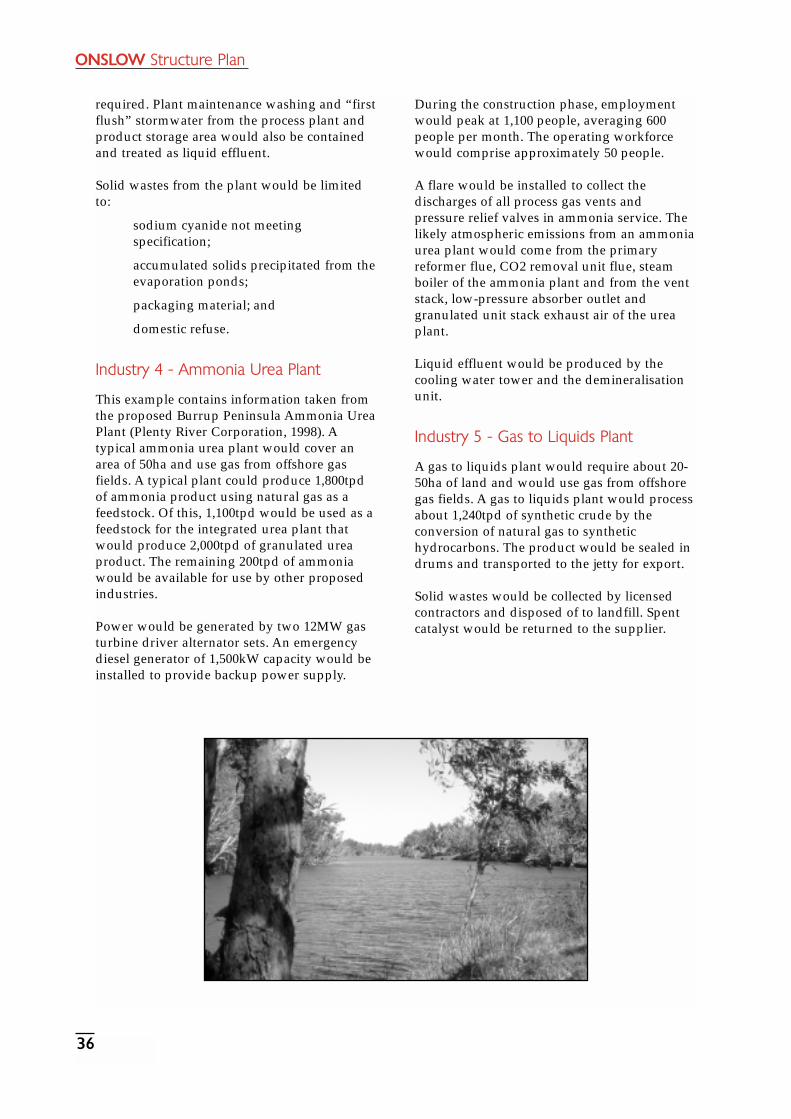
ONSLOW Structure Plan
36
required. Plant maintenance washing and “firstflush” stormwater from the process plant andproduct storage area would also be containedand treated as liquid effluent.
Solid wastes from the plant would be limitedto:
sodium cyanide not meetingspecification;
accumulated solids precipitated from theevaporation ponds;
packaging material; and
domestic refuse.
Industry 4 - Ammonia Urea Plant
This example contains information taken fromthe proposed Burrup Peninsula Ammonia UreaPlant (Plenty River Corporation, 1998). Atypical ammonia urea plant would cover anarea of 50ha and use gas from offshore gasfields. A typical plant could produce 1,800tpdof ammonia product using natural gas as afeedstock. Of this, 1,100tpd would be used as afeedstock for the integrated urea plant thatwould produce 2,000tpd of granulated ureaproduct. The remaining 200tpd of ammoniawould be available for use by other proposedindustries.
Power would be generated by two 12MW gasturbine driver alternator sets. An emergencydiesel generator of 1,500kW capacity would beinstalled to provide backup power supply.
During the construction phase, employmentwould peak at 1,100 people, averaging 600people per month. The operating workforcewould comprise approximately 50 people.
A flare would be installed to collect thedischarges of all process gas vents andpressure relief valves in ammonia service. Thelikely atmospheric emissions from an ammoniaurea plant would come from the primaryreformer flue, CO2 removal unit flue, steamboiler of the ammonia plant and from the ventstack, low-pressure absorber outlet andgranulated unit stack exhaust air of the ureaplant.
Liquid effluent would be produced by thecooling water tower and the demineralisationunit.
Industry 5 - Gas to Liquids Plant
A gas to liquids plant would require about 20-50ha of land and would use gas from offshoregas fields. A gas to liquids plant would processabout 1,240tpd of synthetic crude by theconversion of natural gas to synthetichydrocarbons. The product would be sealed indrums and transported to the jetty for export.
Solid wastes would be collected by licensedcontractors and disposed of to landfill. Spentcatalyst would be returned to the supplier.

ONSLOW Structure Plan
37
APPENDIX C
Shire of Ashburton TransientWorkforce AccommodationPolicy
Title: Transient Workforce Accommodation
File No.: OR.CM1
Minute No.: 9.9.230
Date: 15 September 1998
Objectives:
To provide for the establishment ofaccommodation for groups of transientworkers who are temporarily orintermittently based in the vicinity of theworkplace (accommodation is normallyassociated with, but not limited to,construction of plant and infrastructurefor major resource companies).
To reasonably limit and encourage theestablishment of such accommodation toexisting townsites, settlements or otherdevelopment nodes.
To encourage the use of existingestablished accommodation within atownsite, settlement, or otherdevelopment node and to discourage thedevelopment of transient workforceaccommodation on the outskirts oftownsites, if accommodation is readilyavailable in town.
Where transient workforceaccommodation is established intownsites or other built-up areas, toprovide quality accommodation within apleasant living environment.
To ensure that the amenity of thecommunity is not adversely affected interms of noise or other disturbance,aesthetics, environmental impacts orhealth.
To encourage development ofaccommodation that can be used forother purposes when no longer requiredfor the transient workforce.
Where Transient WorkforceAccommodation is not located in atownsite or built-up area, to ensure thatenvironmental impact is minimal andthat the area is rehabilitated after the usehas ceased (some applications may alsorequire EPA approval).
To ensure that transient workforceaccommodation is not provided to thedetriment of availability of touristaccommodation.
Clarify which zones and areas thattransient workforce accommodation maybe permitted within.
Policy:
Definition
For the purposes of this Policy, transientworkforce accommodation shall have thefollowing definition:
“Dwellings intended for the temporaryaccommodation of transient workers and maybe designed to allow transition to another use,or may be designed as a permanent facility fortransient workers, and includes a contractor’scamp and transportable units.”
Location
Transient workforce accommodation is a usethat is not listed within the Shire ofAshburton’s town planning schemes for TomPrice, Paraburdoo or Onslow and is notspecifically referred to in Council’s InterimDevelopment Order which covers the rest ofthe land within the Shire. As such, Councilmay (by an absolute majority) permit transientworkforce accommodation in any zone or area.
Each application shall be considered in thelight of its individual merits however, Councilwill generally apply the following guidelines:
No transient workforce accommodationshall be permitted within any ServiceTrades or Industrial Zones in the TomPrice, Paraburdoo or Onslow SchemeAreas.
Transient workforce accommodationmay be established within any zone inthe Tom Price, Paraburdoo or OnslowScheme Areas where residentialdevelopment is permitted to bedeveloped (with the exception of the

ONSLOW Structure Plan
38
Service Trades and Industrial Zones).The proposed density must comply withresidential planning codes designatedfor the site, if applicable.
Transient workforce accommodationmay be permitted in existing touristaccommodation, caravan parks etc, butnot to the detriment of the amenity ofother permanent residents or tourists.Where caravan park or other holidayaccommodation leases are controlled byCouncil, lease provisions are likely toinclude requirements for a minimumnumber or percentage of sites alwaysbeing made available for tourists. In theinterests of the growing tourismindustry within the Shire, all otheroperators of tourist accommodationfacilities are encouraged to adopt asimilar approach in their managementpractices.
Within the Interim Development OrderArea, the establishment of transientworkforce accommodation will generallyonly be supported at existing settlementsand nodes of development (e.g.Pannawonica, near roadhouses andother camps) however, transientworkforce accommodation may beconsidered in remote areas if theapplicant successfully demonstrates thatit cannot be feasibly located within atownsite, settlement or developmentnode.
Approval and DelegationPlanning approval is required for all proposalsfor transient workforce accommodation withthe following exceptions:
Where existing approved on siteaccommodation units are to be used andno other buildings, structures,infrastructure or facilities are proposed.
Where such accommodation has beenexcluded from the planning process by aState Agreement Act.
Where it involves camps used fordefence purposes or wayside camps ofdrovers or teamsters.
Where less than 25 persons are to beaccommodated over a period of less than6 months, not necessarily in the samelocation.
Where planning approval is not requiredfor transient workforce accommodation,applicants shall notify Council in writingof the details of the number of personsto be accommodated and a date whenthe use is to commence. Furthermore,written notification shall be given whenthe use has ceased.
In all cases, Council’s Building and Healthapprovals will be required.
Under Part IV of the Environmental ProtectionAct, Council may refer an application to theEPA for approval if it appears that it will havea significant impact on the environment.
All applications requiring the planningapproval of Council shall be considered by fullCouncil. Applications for facilities ancillary totemporary workers camps and other transientworkforce accommodation within the InterimDevelopment Order area, may be dealt with bythe Chief Executive Officer under theprovisions of Council’s Policy TDS008 -Delegated Authority Dealing with PlanningMatters.
Applications requiring the planning approvalof Council within the town planning schemeareas of the Shire, shall be advertised for publiccomment by the erection of a sign/s on thesite, advertisements in the local newspaper,notices on public noticeboards and contactwith adjoining/nearby neighbours ifconsidered necessary.
Planning applications for temporary structuresto provide transient workforce accommodationshall, to Council’s satisfaction, be accompaniedby information and plans indicating how andwhen the development will be removed andthe site rehabilitated or developed for adifferent use intended for the site.
All applications are required to supply amanagement statement for the complex forconsideration by Council addressing thefollowing matters:
Transport of workers to and from thesite;
Site access and egress;
Catering and hygiene;
Emergency management;
Security.

ONSLOW Structure Plan
39
Council may require, by signed agreement, acommitment to the date and details ofrehabilitation and conversion as mentionedabove.
Assessment
In addition to any town planning schemerequirements and the objectives of this Policy,Council shall consider the following matterswhen assessing transient workforceaccommodation:
Compliance with the Building Code ofAustralia, the Health Act, the CaravanParks and Camping GroundsRegulations, Construction CampRegulations and the Local Law relatingto Holiday Accommodation.
Regard shall be given to proposedtreatment of vehicular and pedestrianaccess and landscaping areas (whereappropriate).
Any submissions received during apublic advertising period.
The impact the development will haveon adjoining/surrounding uses.
The length of time the use is to beoperational.
The design form.
The ability of the management plan tomaintain quality of life both internal andexternal to the facility.

ONSLOW Structure Plan
40
REFERENCESAustralian Bureau of Statistics, Census ofPopulation and Housing, 1996.
Connell Wagner Pty Ltd, Onslow AerodromeOptions Study. Unpublished Report preparedfor Ashburton Shire Council, 1999.
Department of Agriculture of WesternAustralia, An Inventory and Condition Survey ofRangelands in the Ashburton River Catchment,Western Australia, Technical Bulletin No.62,1982.
Department of Planning and UrbanDevelopment, Onslow Coastal Plan, 1994.
Department of Environmental Protection, Stateof the Environment Report, 1998.
Department of Health, Housing andCommunity Services, Locational DisadvantageResearch Program - Onslow, Western Australia,1992.
Department of Resources Development;Onslow - Potential Development Sites forProcessing Industry and Offshore Support, 1998.
Department of Resources Development,Western Australian Oil and Gas Industry, May2000.
Department of Resources Development, Reviewof Development Factors for Potential OnslowIndustrial Estate, 1999.
Environmental Protection Authority; OnslowSolar Salt Project, EPA Bulletin 857, 1997.
Main Roads Western Australia, Roads 2020Regional Road Development Strategy, 1994.
Pilbara Development Commission, OnslowCommunity Economic Development Plan, 1996.
Pilbara Development Commission, OnslowCommunity Profile, 1994.
Pilbara Development Commission, Pilbara LandUse Strategy, 1997.
Shire of Ashburton, Municipal HeritageInventory, 1999.
Shire of Ashburton, Onslow Storm Surge Study,July 2000.
Shire of Roebourne, Accommodation Inventory,February 1998.
Tourism Development Sub-Committee, OnslowTourism Development Plan, 1987.
Water Corporation, Onslow Source Review 1999Cane River Borefield, June 1999.
Water and Rivers Commission, Cane RiverBorefield, Geophysical Investigation, 1996.
Water and Rivers Commission, Cane RiverWater Reserve - Water Source Protection Plan,1999.
Water and Rivers Commission, Pilbara RegionWater Resources Review and Development Plan,1996.
Western Australian Planning Commission,State Planning Strategy, 1997.

LIST OF ABBREVIATIONSAAD Aboriginal Affairs Department
(now Department of Indigenous Affairs)
ABS Australian Bureau of Statistics
AGWA Agriculture Western Australia (now Department of Agriculture)
AHD Australian Height Datum
ATSIC Aboriginal and Torres Strait Islander Commission
BHP Broken Hill Proprietary
CALM Department of Conservation and Land Management
CDEP Community Development Employment Program
DCD Department for Community Development
DE Department of Environment
DEP Department of Environmental Protection (now Department of Environment)
DH Department of Health
DIA Department of Indigenous Affairs
DIR Department of Industry and Resources
DOLA Department of Land Administration
DOT Department of Transport (now Department for Planning and Infrastructure)
DPI Department for Planning and Infrastructure
DPUD Department of Planning and Urban Development (now Department for Planning and Infrastructure)
DRD Department of Resources Development (now Department of Industry Resources)
DSR Department of Sport and Recreation
du dwelling unit
EP estimated population
EPA Environmental Protection Authority
FCS Family and Children’s Services (now Department for Community Development
GL gigalitre
GWh Gigawatt hours
ha hectares
HCWA Heritage Council of Western Australia
HDWA Health Department of Western Australia (now Department of Health)
km kilometre
KW Kilowatt
LAA Land Administration Act 1997
LG local government
LPG liquified petroleum gas
MfP Ministry for Planning (now Department for Planning and Infrastructure)
ML Mega litre
MRWA Main Roads Western Australia
MTPA Million tonnes per annum
MW Megawatt
PDC Pilbara Development Commission
PJ Pascal
PLUS Pilbara Land Use Strategy
PTA Pilbara Tourism Association
RFDS Royal Flying Doctor Service
SHS senior high school
SPQ single persons’ quarters
t tonnes
tpa tonnes per annum
tpd tones per day
TPS Town Planning Scheme
UCL unallocated crown land
WAPC Western Australian Planning Commission
WAPET Western Australian Petroleum
WC Water Corporation
WRC Water and Rivers Commission (now Department of Environment, Water and Catchment Protection)
WWTP wastewater treatment plant
ONSLOW Structure Plan
41

ON
SLOW
Structure Plan
42
URALA
KOORDARRIE
MINDEROO
MT. MINNIE
PEEDAMULLA
INDIAN OCEAN
PILBARA
MID-WEST
GASCOYNE
WHEATBELT
GREAT SOUTHERNSOUTH-WEST
PEELPERTH
GOLDFIELDS-ESPERANCE
KIMBERLEY
Index to Study Area
0 5
LEGEND
10 15
N
Kilometres
ONSLOWSTRUCTURE PLAN
AREAntw-map11\ \strat_pol\ \onslow\ \onsl_fpub1.dgn
CANERIVER
MINDEROO
URALA
ONSLOW
OLDONSLOW
PEEDAMULLAPastoral Lease Boundary
Primary/Secondary Road
Minor Road/Track
Homestead
Department of Land Information, W.A.Pastoral Lease Data supplied byLandsat Imagery, Topographic and
Road Pattern derived from DLI 1:250000Topographic Data
LockerPoint
GEOCENTRIC DATUM OF AUSTRALIA
Produced by Project Mapping Section,Planning Information - Mapping and Spatial,Department for Planning and Infrastructure, on behalf of the Western Australian Planning Commission, Perth, W.A. February 2003
MT. MINNIE
ONSLOW
ROAD
URALAURALA ROAD
ROAD
OLDOLDONSLOWONSLOWROAD
ROAD
URALAURALA
ROADROAD
ROAD
ROAD
TWIT
CHIN
TWIT
CHIN
ASH
BU
RTO
N
RIV
ER
CANE
RIVER
Map 1: Study A
rea

ON
SLOW
Structure Plan
43
Map 2: A
erial Photograph

ONSLOW Structure Plan
44
Indian Ocean
Beadon Point
Sunrise BeachM
RT
T
T
SH
WT PS
C
H
EC
DC
HO
P
FIRST
AVE
ST
THIRD
SIM
PSO
N
ST
CAMERON
AVE
HOOLEY
BIDAN
STTHIRD
ST
WATS
ONLAPTHORN
AVE
FIRST
BEADON
CREEK
EAGLE NEST
ONS
LOW
DR
AVE
ONSLOW
AVE
AVE
SECOND
Cre
ekBe
adon
Beadon CreekPort
A
PILBARA
MID-WEST
GASCOYNE
WHEATBELT
GREAT SOUTHERNSOUTH-WEST
PEELPERTH
GOLDFIELDS-ESPERANCE
KIMBERLEY
Index to Study Area
0
LEGEND
Metres
Commercial
N
Cadastral Data supplied by Department ofLand Information, W.A.
100 200 300 400 500 Residential
Parks and Recreation
Industry
Vacant
Public Purposes
Drainage
C
DC
Emergency CentreEC
H
HO
M
P
PS
Community
Day Care
Hall
Hospital
Museum
Police
Primary School
RT
SH
WT
Shire
Rubbish Tip
Telstra
Water Tank
T
500m Buffer for
Short-TermAccommodation
Treatment PlantWastewater
out by Ministry for Planning, Sept. 1999Land Use derived from Field Survey carried
A AirportGEOCENTRIC DATUM OF AUSTRALIA
ntw-map11\ \strat_pol\ \onslow\ \onsl_fpub3.dgn
Produced by Project Mapping Section,Planning Information - Mapping and Spatial,Department for Planning and Infrastructure,on behalf of the Western Australian Planning Commission, Perth, W.A. February 2003
RD
RD
RD
Map 3: Land Use Plan

ON
SLOW
Structure Plan
45
URALA
KOORDARRIE
MINDEROO
MT. MINNIE
PEEDAMULLA
TWIT
CH
EN
ROAD
ONSLOW
ROAD
OLD ONSLOW
URALA
ROAD
URALA ROAD
OldOnslow
Indian Ocean
River
Ashburton
Cane
River
Direction IslandBessieres Island
Observation Island
Brown Island
Fly Island
Tent Point
Locker Island(Nature Reserve)
Ashburton Island
Entrance Point
CoolgraPoint
LockerIsland
TubridgiPoint
Beadon Bay
GNULLI (WC97 028)
THALANYJI 2 (WC96 082)
THALANYJI 2 (WC96 082)
SerrurierIsland
ONSLOW
THALANYJI(WC95 002)
Urala
RD
THALANYJI
(WC95 002)
Minderoo
PeedamullaLockerPoint
STRUCTURE PLANAREA
PILBARA
MID-WEST
GASCOYNE
WHEATBELT
GREAT SOUTHERNSOUTH-WEST
PEELPERTH
GOLDFIELDS-ESPERANCE
KIMBERLEY
Index to Study Area
Native Title Claim Accepted
Crown Reserve
Crown Lease
Unallocated Crown Land
Private Freehold Land
State Government
Commonwealth Government
0 5
LEGEND
10 15
N
Kilometres
Homestead
Minor Road/Track
Primary/Secondary Road
Pastoral Lease Boundary
Cadastral, Pastoral Lease, and Native Title Datasupplied by Department of Land Information, W.A.
Road Pattern derived from DLI 1:250000Topographic Data
NORTH
WES
TC
OAS
TAL
HWY
GEOCENTRIC DATUM OF AUSTRALIA
ntw-map11\ \strat_pol\ \onslow\ \onsl_fpub4.dgn
Thevenard Island
(Nature Reserve)
Produced by Project Mapping Section,Planning Information - Mapping and Spatial,Department for Planning and Infrastructure,on behalf of the Western Australian Planning Commission, Perth, W.A. February 2003
Mt. Minnie
NB: This Land Tenure information has been derived from DPI’s simplified version of DOLA’s Spatial Cadastral Database, and may contain inaccuracies
Map 4: Land Tenure and N
ative Title Claim
s

ON
SLOW
Structure Plan
46
I
I
WDT
C
H
CC
WD
WD
WD
T
A
C
C
P
C
ED
WDTWD
I
I
Onslow Airport Height RestrictionsSpecial Control Area
Onslow Coastal HazardSpecial Control Area
Onslow Coastal HazardSpecial Control Area
WDT
SECOND
Indian Ocean
ONS
LOW
SEAVIEW
DRIVE
AVE
Beadon Bay
RD
ED
P
P
LEGENDLEGEND
Reservations
District Road
Conservation, Recreationand Natural Landscape
Residential
Urban Development
Tourism
Rural
Zones
Commercial and Civic
Rural Living
Parks, Recreationand Drainage
PILBARA
MID-WEST
GASCOYNE
WHEATBELT
GREAT SOUTHERNSOUTH-WEST
PEELPERTH
GOLDFIELDS-ESPERANCE
KIMBERLEY
Index to Study Area
GEOCENTRIC DATUM OF AUSTRALIA
0 1
N
Kilometres
0.5 1.5
ntw-map11\ \strat_pol\ \onslow\ \onsl_fpub5.dgn
Other Purposesdenoted as follows:
I Infrastructure
Public Purposesdenoted as follows:
A
C
ED
H
Airport
Community
Education
Health
P
T
WD
Health
Port Facilities
Telecommunications
WDT
Waste Disposal and Treatment
Industry
Strategic Industry CREEK
BEADON
RD
Onslow Strategic Industrial Buffer - SCA
Produced by Project Mapping Section,Planning Information - Mapping and Spatial,Department for Planning and Infrastructure,on behalf of the Western Australian PlanningCommission, Perth, W. A. July 2003
Cadastral Data supplied by Departmentof Land Information, Western Australia
Airport Height Restrictions Special Control Area definition supplied by Shire of Ashburton.
Town Planning Scheme No.7 supplied by Shire of Ashburton
NB: Due to map scale, TPS information has been simplified
I
Map 5: Tow
n Planning Scheme N
o. 7

ON
SLOW
Structure Plan
47
URALA
KOORDARRIE
MINDEROO
MT. MINNIE
PEEDAMULLA
TWIT
CH
EN
ROAD
ONSLOW
ROAD
OLD ONSLOW
URALA
ROAD
OldOnslow
Indian Ocean
River
Ashburton
Cane
River
Direction Island
Bessieres Island
Flat Island
Observation Island
Brown Island
Fly Island
Tent Point
Locker Island(Nature Reserve)
Ashburton Island
Entrance Point
CoolgraPoint
LockerIsland
TubridgiPoint
Beadon Bay
Serrurier
Island
Urala
RD
Minderoo
LockerPoint
ONSLOWPILBARA
MID-WEST
GASCOYNE
WHEATBELT
GREAT SOUTHERNSOUTH-WEST
PEELPERTH
GOLDFIELDS-ESPERANCE
KIMBERLEY
Index to Study Area
0 5
LEGEND
10 15
N
Kilometres
Subject to Inundation
Intertidal Flat
Intertidal Ledge
Mangroves
Dry Lake
Submerged Reef
Peedamulla
Cane River Water SourceProtection Area
Swamp (non-perennial)
Primary/Secondary Road
Minor Road/Track
ONSLOWSTRUCTURE PLAN
AREA
Homestead
Pastoral Lease Boundary
Cadastral, Topographic, and Pastoral LeaseData supplied by Department of LandInformation, W.A.
Road Pattern derived from DLI 1:250000Topographic Data
NORTH
WES
TC
OAS
TAL
HWY
GEOCENTRIC DATUM OF AUSTRALIA
ntw-map11\ \strat_pol\ \onslow\ \onsl_fpub6.dgn
Coastal Sand
Produced by Project Mapping Section,Planning Information - Mapping and Spatial,
Department for Planning and Infrastructure,on behalf of the Western Australian Planning Commission, Perth, W.A. February 2003
Mt. Minnie
Map 6: Environm
ental Features

ON
SLOW
Structure Plan
48
URALA
KOORDARRIE
MINDEROO
MT. MINNIE
PEEDAMULLA
TWIT
CH
EN
ROAD
ONSLOW
ROAD
OLD ONSLOW
URALA
ROAD
OldOnslow
River
Ashburton
Cane
River
Direction IslandBessieres
Island
Flat Island
Observation Island
Brown Island
Fly Island
Tent Point
Locker Island(Nature Reserve)
Ashburton Island
CoolgraPoint
LockerIsland
TubridgiPoint
MARYANNE
CR
EE
K
SerrurierIsland
Urala
RD
Minderoo
PeedamullaLockerPoint
Pond 1
Pond 2Pond 3Pond 5
ShippingChannel
Indian Ocean
Entrance Point
NORTH
WES
TC
OAS
TAL
HWY
PILBARA
MID-WEST
GASCOYNE
WHEATBELT
GREAT SOUTHERNSOUTH-WEST
PEELPERTH
GOLDFIELDS-ESPERANCE
KIMBERLEY
Index to Study Area
Crown Reserve
Crown Lease
Unallocated Crown Land
Private Freehold Land
State Government
Commonwealth Government
0 5
LEGEND
10 15
N
Kilometres
Gas Pipeline
Water Pipeline
Department of Land Information, W.A.Cadastral and Topographic Data supplied by
Homestead
Road Pattern derived from DLI 1:250000Topographic Data
Pastoral Lease Boundary
Primary/Secondary Road
Minor Road/Track
Onslow Salt Project - Stage 1
Onslow Salt Project - Stage 2
Onslow Port Area Boundary
Future Brine/Access Corridor
ONSLOWSTRUCTURE PLAN
AREA
GEOCENTRIC DATUM OF AUSTRALIA
ntw-map11\ \strat_pol\ \onslow\ \onsl_fpub7.dgn
Infrastructure Detail supplied by Departmentof Mineral and Petroleum Resources, W.A.
Produced by Project Mapping Section,Planning Information - Mapping and Spatial,Department for Planning and Infrastructure,on behalf of the Western Australian Planning Commission, Perth, W.A. February 2003
Mt. Minnie
NB: This Land Tenure information has been derived from DPI’s simplified version of DOLA’s Spatial Cadastral Database, and may contain inaccuracies
Map 7: Existing and Proposed Infrastructure

ONSLOW Structure Plan
49
Onslow Airport Height RestrictionsSpecial Control Area
Onslow Coastal HazardSpecial Control Area
SECOND
AVENUE
BEADON CREEK
Indian Ocean
Onslow SaltConcentrator Ponds
ONSLOW
Loading Wharf
Conveyer
Dry La
kes
SEAVIEW
DRIVE
ROAD
ONS
LOW
Beadon CreekPort
Shipping
Channel
Bead
onC
reek
Future Jetty and Wharf
Onslow Coastal HazardSpecial Control Area
Scenario 1
Scenario 2
Scenario 3
Future
3 km Radius Industry Buffer
3km
Radius Industr y Buffer
16 ha
30 ha
24 ha
500
m B
uff
er
Development Plans will be required prior to anyintensification of land use in accordance withthe Shire of Ashburton Town Planning SchemeNo. 7 requirements.
500
m B
uffe
r
500
m B
uffe
r
✶
✶
✶
✶✶
✶
SaltStockpile
Beadon Bay
ROAD
GEOCENTRIC DATUM OF AUSTRALIA
P
I
I
C
H
CWD
C
WD
WD
WD
T
A
I
C
C
P
C
C
WD
P
P
P
C
I
I
G
WDT
WWTP
✭
Landfill
LandfillWDT
WDTProposed
Rural
Rural Living
LEGEND
Parks, Recreation and Drainage
Reservations
Gas Pipeline
Residential - Existing
Townsite Development
Tourist Node
Town Centre
Port Facilities
Telecommunications
Energy
Water and Drainage
Waste Disposal and Treatment
Cemetery
Infrastructure
P
T
E
WDT
WD
C
I
Community
Health
C
H
A Airport
Future Community and Civic
Public Purposes
Community
Industry - Existing
Regional Road
Private Road
0
Metres
N
250 500 750 1000
PILBARA
MID-WEST
GASCOYNE
WHEATBELT
GREAT SOUTHERNSOUTH-WEST
PEELPERTH
GOLDFIELDS-ESPERANCE
KIMBERLEY
Index to Study Area
Conservation, Recreationand Natural Landscape
Power Station✭
Buffer
G Gravel
Onslow SaltConcentrator Ponds
Future StrategicIndustrial Development
WWTP Wastewater Treatment Plant
Future Light Industry
ntw-map11\ \strat_pol\ \onslow\ \onsl_fpub8.dgn
Produced by Project Mapping Section,Planning Information - Mapping and Spatial,Department for Planning and Infrastructure,on behalf of the Western Australian PlanningCommission, Perth, W. A. February 2003
Airport Height Restrictions definition supplied by Shire of Ashburton
Infrastructure Detail supplied by Department of Mineral and Petroleum Resources, W.A.
Cadastral and Topographic Data supplied by Department of Land Information, W.A.
Map 8: Onslow Townsite Structure Plan

ONSLOW Structure Plan
50
URALA
KOORDARRIE
MINDEROO
MT. MINNIE
PEEDAMULLA
TWIT
CH
EN
ROAD
ONSLOW
ROAD
OLD ONSLOW
URALA
ROAD
OldOnslow
Indian Ocean
River
Ashburton
Cane
River
Direction Island
Bessieres Island
Flat Island
Observation Island
Brown Island
Fly Island
Tent Point
Locker Island(Nature Reserve)
Ashburton Island
Entrance Point
CoolgraPoint
LockerIsland
TubridgiPoint
Beadon Bay
SerrurierIsland
Urala
RD
Minderoo
LockerPoint
ONSLOW
Peedamulla
ShippingChannel
Pond 1
Pond 2Pond 3
Pond 4Pond 5
Crystallisers
✭
✭
✭
PILBARA
MID-WEST
GASCOYNE
WHEATBELT
GREAT SOUTHERNSOUTH-WEST
PEELPERTH
GOLDFIELDS-ESPERANCE
KIMBERLEY
Index to Study Area
0 5
LEGEND
10
N
Kilometres
Subject to Inundation
Intertidal Flat
Intertidal Ledge
Mangroves
Sand
Dry Lake
Submerged Reef
Cane River Water SourceProtection Area
Gas Pipeline
Water Pipeline
Industry - Existing
Public Purposes
Community
✭ Power & Gas Facilities
Future StrategicIndustrial Development
Future Light andService Industry
Onslow Townsite Structure PlanGeneralised Land Use 2000
Greater Onslow Plan
Urban
Future Urban
Swamp (non-perennial)
Homestead
Pastoral Lease Boundary
ONSLOWSTRUCTURE PLAN
AREA
Cadastral, Topographic,Environmental andPastoral Lease Data supplied by Departmentof Land Information, W.A.
Road Pattern derived from DLI 1:250000Topographic Data
Onslow Salt Project - Stage 1
Onslow Salt Project - Stage 2
Primary/Secondary Road
NORTH
WES
TC
OAS
TAL
HWY
Future Brine/Access Corridor
Minor Road/Track
Onslow Port Area Boundary
GEOCENTRIC DATUM OF AUSTRALIA
ntw-map11\ \strat_pol\ \onslow\ \onsl_fpub9.dgn
CALM Estate
Thevenard Island
(Nature Reserve)
Infrastructure Detail supplied by Departmentof Mineral and Petroleum Resources, W.A.
Produced by Project Mapping Section,Planning Information - Mapping and Spatial,Department for Planning and Infrastructure,on behalf of the Western Australian Planning Commission, Perth, W.A. February 2003
Mt. Minnie
Infrastructure and Environmental Detail
Map 9: Greater Onslow Area Plan

ONSLOW Structure Plan
51
TWIT
CH
EN
ROAD
ONSLOW
ROAD
OLD ONSLOW
URALA
ROAD
OldOnslow
Indian Ocean
River
Ashburton
Cane
RiverDirection Island
Bessieres Island
Flat Island
Observation Island
Brown Island
Fly Island
Tent Point
Locker Island
Ashburton Island
Entrance Point
CoolgraPoint
LockerIsland
TubridgiPoint
Beadon Bay
SerrurierIsland
Urala
RD
Minderoo
LockerPoint
ONSLOW
Peedamulla
NORTH
WES
TC
OAS
TAL
HWY
PILBARA
MID-WEST
GASCOYNE
WHEATBELT
GREAT SOUTHERNSOUTH-WEST
PEELPERTH
GOLDFIELDS-ESPERANCE
KIMBERLEY
Index to Study Area
0 5
LEGEND
10
N
Kilometres
GEOCENTRIC DATUM OF AUSTRALIA
ntw-map11\ \strat_pol\ \onslow\ \onsl_fpub10.dgn
Topographic and Local GovernmentBoundary Data supplied by Departmentof Land Information, W.A.
Woodland, Wheatbelt
Low Woodland, Open Lowand Sparse Woodland
Low Woodland,Open Low Woodland
Mangroves
Riverine Sedgeland/Grassland with Trees
Shrub Steppe
Spares Shrub Steppe
Grass Steppe
Samphire with Thicket/ScrubHalosarcia with Melaleuca
Samphire Halosarcia Communitiesin Saline Areas
Tidal Mud Flats
Rock
Mosaic: Grasslands, Short BunchGrass Savanna Low Tree
Mosaic: Shrublands
Mosaic: Shrublands, Snakewoodand Acacia Victoriae Scrub
Primary/Secondary Road
Minor Road/Track
Produced by Project Mapping Section,Planning Information - Mapping and Spatial,Department for Planning and Infrastructure,on behalf of the Western Australian Planning Commission, Perth, W.A. February 2003
Vegetation Data captured from originalmapping by J. S. Beard (1969 -1984)and supplied by Agriculture, W.A.
STRUCTURE PLANONSLOW
AREA
Mt. Minnie
Map 10: Vegetation (Beards)