excellence in infrastructure 2014 - overview
TRANSCRIPT
BIM in Infrastructure | Excellence 2014
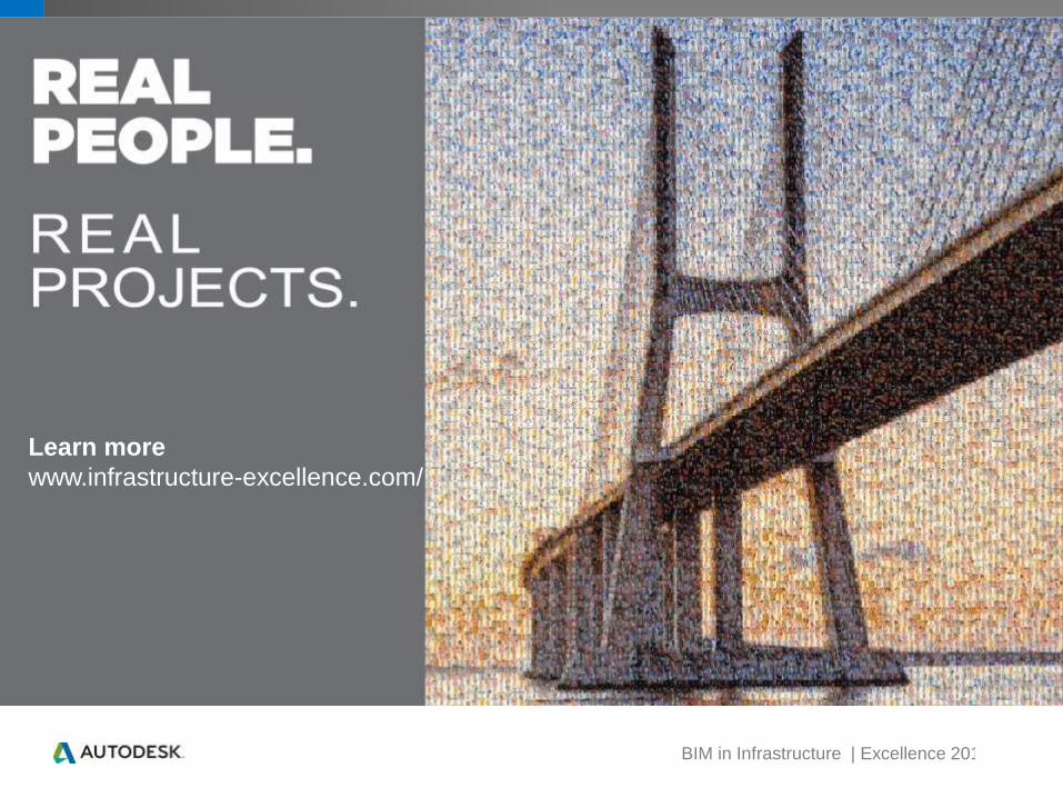
Learn more
www.infrastructure-excellence.com/
BIM in Infrastructure | Excellence 2014
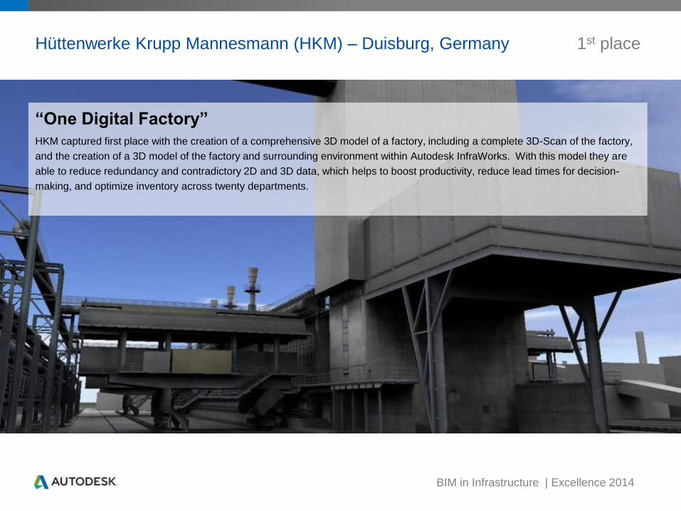
Hüttenwerke Krupp Mannesmann (HKM) – Duisburg, Germany
“One Digital Factory”
HKM captured first place with the creation of a comprehensive 3D model of a factory, including a complete 3D-Scan of the factory,
and the creation of a 3D model of the factory and surrounding environment within Autodesk InfraWorks. With this model they are
able to reduce redundancy and contradictory 2D and 3D data, which helps to boost productivity, reduce lead times for decision-
making, and optimize inventory across twenty departments.
1st place

BIM in Infrastructure | Excellence 2014
Dewberry – Loudoun County VA, US 2nd place
Potomac Water Supply Program Visualization
Dewberry helped Loudoun Water to more effectively communicate the mission of the Potomac Water Supply Program. Using
Autodesk design and visualization tools to assist in the development of a community outreach video for the program. They
integrated BIM data from multiple design teams and provided a comprehensive visualization to showcase the program’s various
design elements, geographic footprint, and sustainable design features.

BIM in Infrastructure | Excellence 2014
Huitt-Zollars – Orange County CA, US
La Pata Gap Closure
Huitt-Zollars working with Orange County Public Works used AutoCAD Civil 3D to help reduce the cost by an estimated $10 million
on a multi-million dollar roadway project in the hilly terrain between the cities of San Juan Capistrano and San Clemente. With
Autodesk InfraWorks they are now starting to communicate with an update stakeholders during construction.
3rd place
BIM in Infrastructure | Excellence 2014
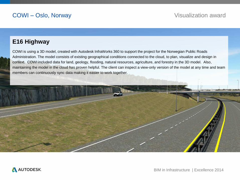
COWI – Oslo, Norway
E16 Highway
COWI is using a 3D model, created with Autodesk InfraWorks 360 to support the project for the Norwegian Public Roads
Administration. The model consists of existing geographical conditions connected to the cloud, to plan, visualize and design in
context. COWI included data for land, geology, flooding, natural resources, agriculture, and forestry in the 3D model. Also,
maintaining the model in the cloud has proven helpful. The client can inspect a view-only version of the model at any time and team
members can continuously sync data making it easier to work together.
Visualization award
BIM in Infrastructure | Excellence 2014
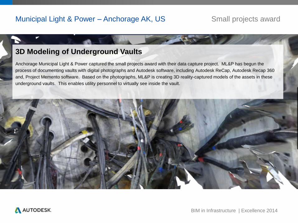
Municipal Light & Power – Anchorage AK, US Small projects award
3D Modeling of Underground Vaults
Anchorage Municipal Light & Power captured the small projects award with their data capture project. ML&P has begun the
process of documenting vaults with digital photographs and Autodesk software, including Autodesk ReCap, Autodesk Recap 360
and, Project Memento software. Based on the photographs, ML&P is creating 3D reality-captured models of the assets in these
underground vaults. This enables utility personnel to virtually see inside the vault.
BIM in Infrastructure | Excellence 2014
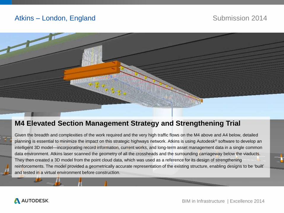
Atkins – London, England Submission 2014
M4 Elevated Section Management Strategy and Strengthening Trial
Given the breadth and complexities of the work required and the very high traffic flows on the M4 above and A4 below, detailed
planning is essential to minimize the impact on this strategic highways network. Atkins is using Autodesk® software to develop an
intelligent 3D model—incorporating record information, current works, and long-term asset management data in a single common
data environment. Atkins laser scanned the geometry of all the crossheads and the surrounding carriageway below the viaducts.
They then created a 3D model from the point cloud data, which was used as a reference for its design of strengthening
reinforcements. The model provided a geometrically accurate representation of the existing structure, enabling designs to be ‘built’
and tested in a virtual environment before construction.
BIM in Infrastructure | Excellence 2014
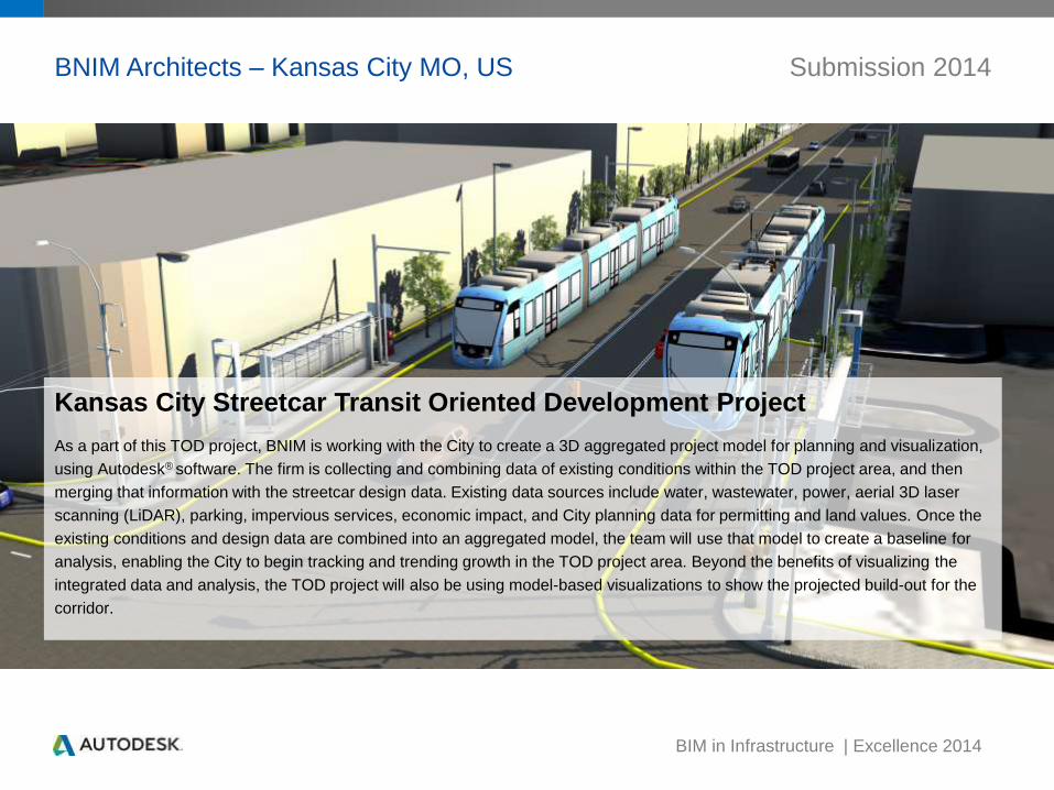
BNIM Architects – Kansas City MO, US Submission 2014
Kansas City Streetcar Transit Oriented Development Project
As a part of this TOD project, BNIM is working with the City to create a 3D aggregated project model for planning and visualization,
using Autodesk® software. The firm is collecting and combining data of existing conditions within the TOD project area, and then
merging that information with the streetcar design data. Existing data sources include water, wastewater, power, aerial 3D laser
scanning (LiDAR), parking, impervious services, economic impact, and City planning data for permitting and land values. Once the
existing conditions and design data are combined into an aggregated model, the team will use that model to create a baseline for
analysis, enabling the City to begin tracking and trending growth in the TOD project area. Beyond the benefits of visualizing the
integrated data and analysis, the TOD project will also be using model-based visualizations to show the projected build-out for the
corridor.

BIM in Infrastructure | Excellence 2014
China Railway Eryuan Engineering Group – Sichuan, China Submission 2014
Jiangyou Station
China Railway Eryuan Engineering Group recently used Autodesk® software on the railway station in the southwest part of China's
Sichuan Province—to explore the use of BIM model-based processes for its design and construction. The project included the
modeling of the railway bed, culvert, station buildings, and so on, in the area of the station. The average thickness of the track’s
subgrade formation is more than 11 meters, with 39 layers of materials. The team’s use of BIM on this project led to more seamless
design-to-construction workflows and the ability to minimize impacts on the environment and water resources through virtual
design, analysis, and construction planning and simulation. At the end of the project, the team estimated it saved 10 percent of the
normal time required for subgrade modeling and 15 percent of standard construction costs.
BIM in Infrastructure | Excellence 2014
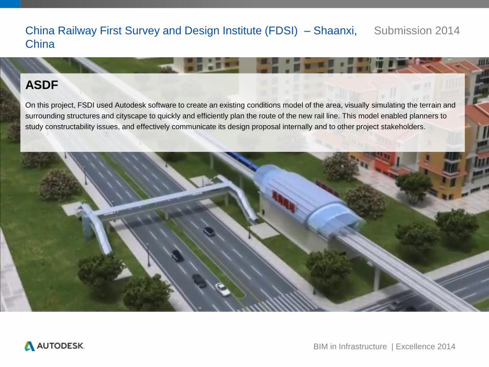
China Railway First Survey and Design Institute (FDSI) – Shaanxi,
China
Submission 2014
ASDF
On this project, FSDI used Autodesk software to create an existing conditions model of the area, visually simulating the terrain and
surrounding structures and cityscape to quickly and efficiently plan the route of the new rail line. This model enabled planners to
study constructability issues, and effectively communicate its design proposal internally and to other project stakeholders.
BIM in Infrastructure | Excellence 2014
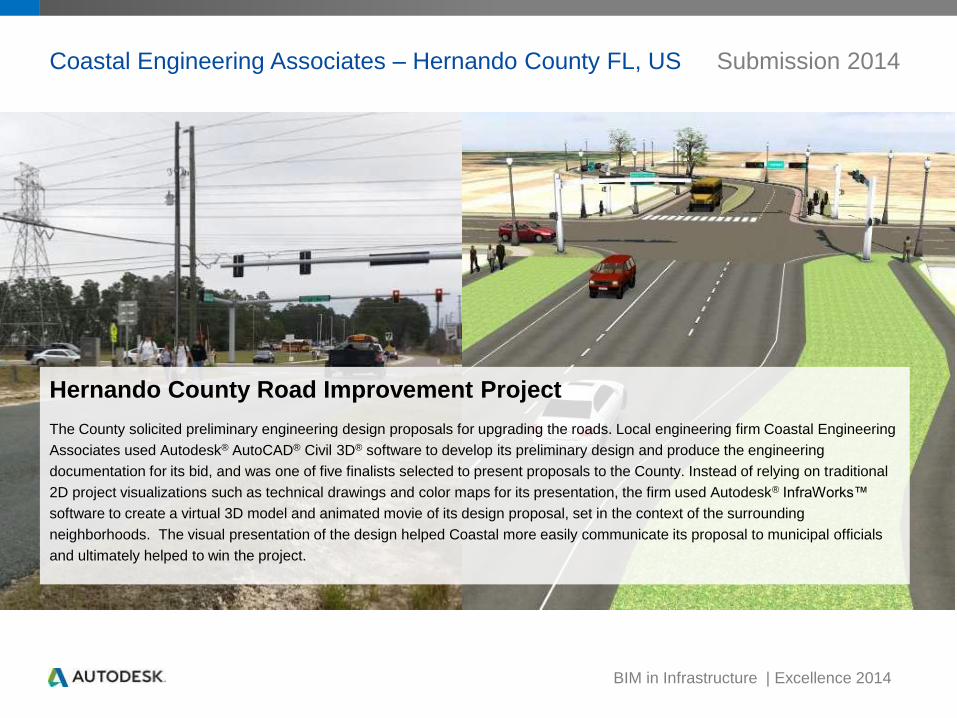
Hernando County Road Improvement Project
The County solicited preliminary engineering design proposals for upgrading the roads. Local engineering firm Coastal Engineering
Associates used Autodesk® AutoCAD® Civil 3D® software to develop its preliminary design and produce the engineering
documentation for its bid, and was one of five finalists selected to present proposals to the County. Instead of relying on traditional
2D project visualizations such as technical drawings and color maps for its presentation, the firm used Autodesk® InfraWorks™
software to create a virtual 3D model and animated movie of its design proposal, set in the context of the surrounding
neighborhoods. The visual presentation of the design helped Coastal more easily communicate its proposal to municipal officials
and ultimately helped to win the project.
Coastal Engineering Associates – Hernando County FL, US Submission 2014
BIM in Infrastructure | Excellence 2014
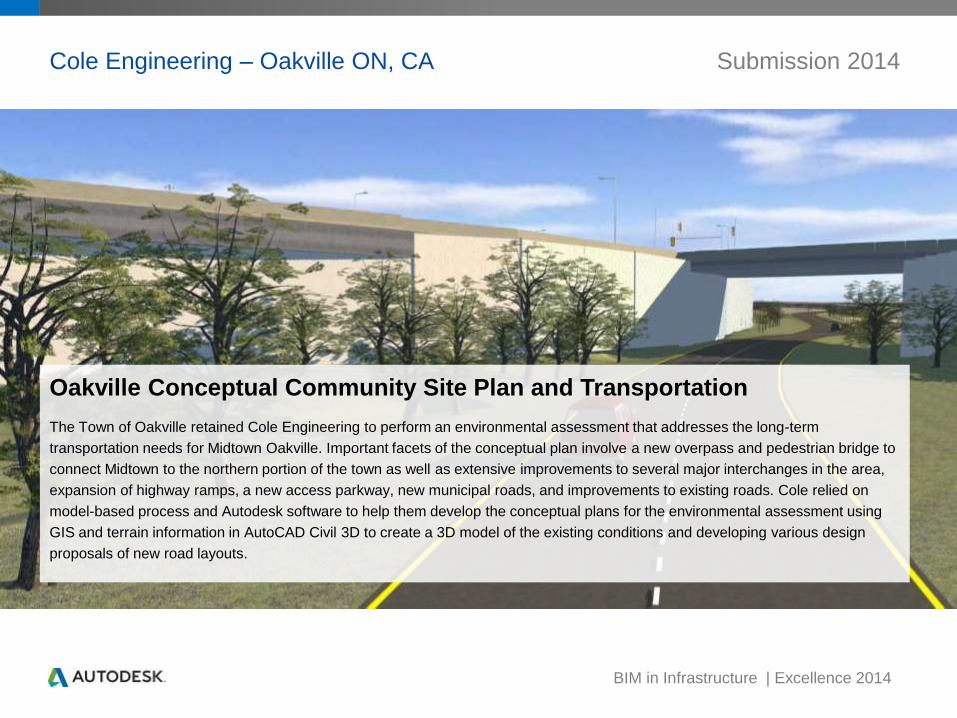
Cole Engineering – Oakville ON, CA Submission 2014
Oakville Conceptual Community Site Plan and Transportation
The Town of Oakville retained Cole Engineering to perform an environmental assessment that addresses the long-term
transportation needs for Midtown Oakville. Important facets of the conceptual plan involve a new overpass and pedestrian bridge to
connect Midtown to the northern portion of the town as well as extensive improvements to several major interchanges in the area,
expansion of highway ramps, a new access parkway, new municipal roads, and improvements to existing roads. Cole relied on
model-based process and Autodesk software to help them develop the conceptual plans for the environmental assessment using
GIS and terrain information in AutoCAD Civil 3D to create a 3D model of the existing conditions and developing various design
proposals of new road layouts.
BIM in Infrastructure | Excellence 2014
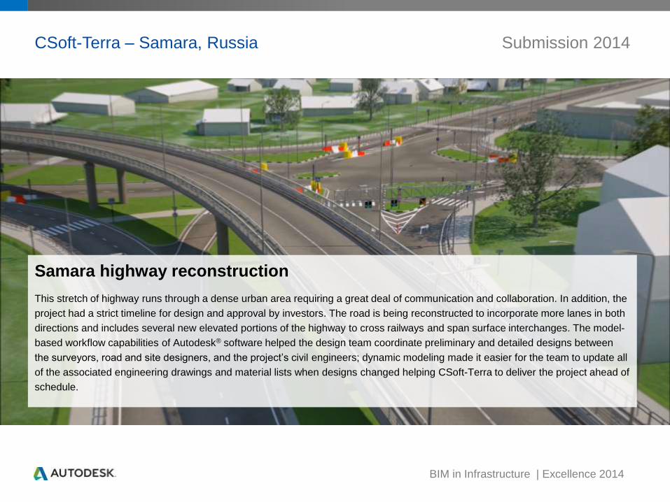
CSoft-Terra – Samara, Russia Submission 2014
Samara highway reconstruction
This stretch of highway runs through a dense urban area requiring a great deal of communication and collaboration. In addition, the
project had a strict timeline for design and approval by investors. The road is being reconstructed to incorporate more lanes in both
directions and includes several new elevated portions of the highway to cross railways and span surface interchanges. The model-
based workflow capabilities of Autodesk® software helped the design team coordinate preliminary and detailed designs between
the surveyors, road and site designers, and the project’s civil engineers; dynamic modeling made it easier for the team to update all
of the associated engineering drawings and material lists when designs changed helping CSoft-Terra to deliver the project ahead of
schedule.
BIM in Infrastructure | Excellence 2014
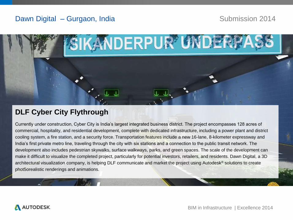
Dawn Digital – Gurgaon, India Submission 2014
DLF Cyber City Flythrough
Currently under construction, Cyber City is India’s largest integrated business district. The project encompasses 128 acres of
commercial, hospitality, and residential development, complete with dedicated infrastructure, including a power plant and district
cooling system, a fire station, and a security force. Transportation features include a new 16-lane, 8-kilometer expressway and
India’s first private metro line, traveling through the city with six stations and a connection to the public transit network. The
development also includes pedestrian skywalks, surface walkways, parks, and green spaces. The scale of the development can
make it difficult to visualize the completed project, particularly for potential investors, retailers, and residents. Dawn Digital, a 3D
architectural visualization company, is helping DLF communicate and market the project using Autodesk® solutions to create
phot5orealistic renderings and animations.
BIM in Infrastructure | Excellence 2014
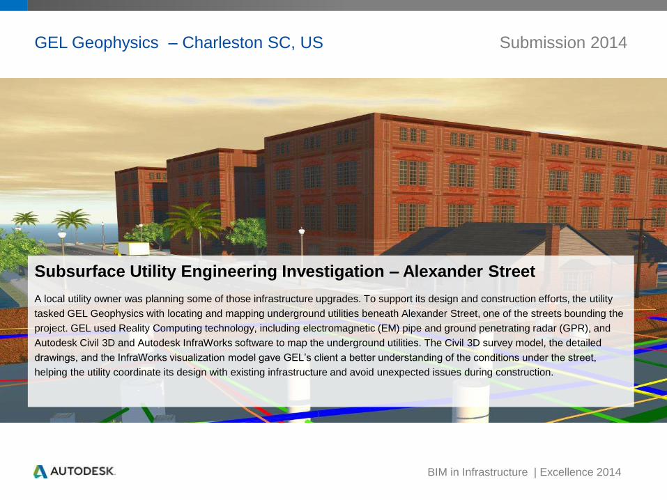
GEL Geophysics – Charleston SC, US Submission 2014
Subsurface Utility Engineering Investigation – Alexander Street
A local utility owner was planning some of those infrastructure upgrades. To support its design and construction efforts, the utility
tasked GEL Geophysics with locating and mapping underground utilities beneath Alexander Street, one of the streets bounding the
project. GEL used Reality Computing technology, including electromagnetic (EM) pipe and ground penetrating radar (GPR), and
Autodesk Civil 3D and Autodesk InfraWorks software to map the underground utilities. The Civil 3D survey model, the detailed
drawings, and the InfraWorks visualization model gave GEL’s client a better understanding of the conditions under the street,
helping the utility coordinate its design with existing infrastructure and avoid unexpected issues during construction.

BIM in Infrastructure | Excellence 2014
GEL Geophysics – Charleston SC, US Submission 2014
Subsurface Utility Engineering Investigation - MUSC Central Energy Plant
Charleston Water Systems was planning drainage improvements adjacent to the Medical University of South Carolina’s (MUSC)
Central Energy Plant, including the design of a drop shaft for storm water distribution to the utility’s storm water drainage tunnel.
Construction in downtown Charleston is always challenging due to the underground infrastructure congestion, and some of the
utilities in this area were developed more than 200 years ago. The investigation included the use of radio-frequency
electromagnetic (EM) pipe and cable locators and ground penetrating radar (GPR) technologies to map buried infrastructure. For its
investigation, GEL used Autodesk® software to create a 3D model of the underground features, referencing reality-captured data
from the underground survey and visualizations that showed cutaways of the underground utilities in the context of surrounding
MUSC buildings and Charleston neighborhoods.
BIM in Infrastructure | Excellence 2014
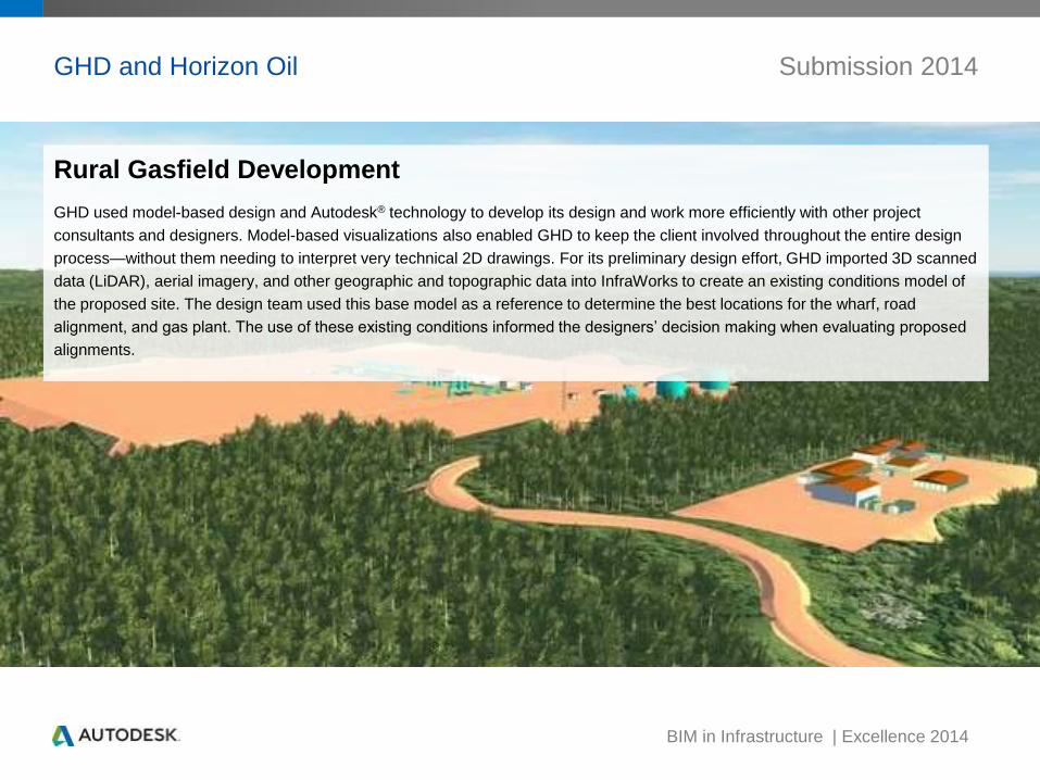
Rural Gasfield Development
GHD used model-based design and Autodesk® technology to develop its design and work more efficiently with other project
consultants and designers. Model-based visualizations also enabled GHD to keep the client involved throughout the entire design
process—without them needing to interpret very technical 2D drawings. For its preliminary design effort, GHD imported 3D scanned
data (LiDAR), aerial imagery, and other geographic and topographic data into InfraWorks to create an existing conditions model of
the proposed site. The design team used this base model as a reference to determine the best locations for the wharf, road
alignment, and gas plant. The use of these existing conditions informed the designers’ decision making when evaluating proposed
alignments.
GHD and Horizon Oil Submission 2014

BIM in Infrastructure | Excellence 2014
GRAFF3D – Buenos Aires, Argentina Submission 2014
La Isla Demarchi – Audiovisual Hub
August 2012, the Argentine government announced the creation of an audiovisual hub on Demarchi Island. This hub is envisioned
to include a hotel, museums, an arena stadium, parks, restaurants, and TV studios. Existing industrial buildings will be turned into
film and TV studios, archives, as well as storage units for machinery, props, and costumes. GRAFF3D used Autodesk® software to
create a 3D model–based animated visualization for Oficina Urbana, an Argentine architectural and urban planning firm, as part of
its presentation package for the project.
BIM in Infrastructure | Excellence 2014
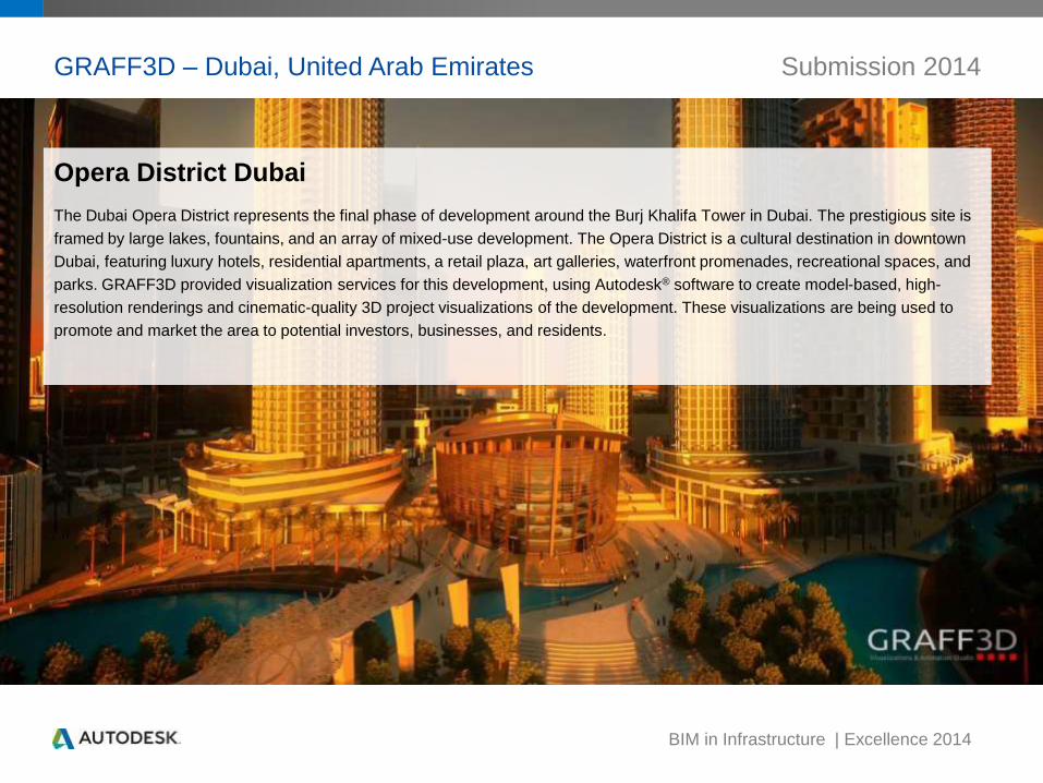
GRAFF3D – Dubai, United Arab Emirates Submission 2014
Opera District Dubai
The Dubai Opera District represents the final phase of development around the Burj Khalifa Tower in Dubai. The prestigious site is
framed by large lakes, fountains, and an array of mixed-use development. The Opera District is a cultural destination in downtown
Dubai, featuring luxury hotels, residential apartments, a retail plaza, art galleries, waterfront promenades, recreational spaces, and
parks. GRAFF3D provided visualization services for this development, using Autodesk® software to create model-based, high-
resolution renderings and cinematic-quality 3D project visualizations of the development. These visualizations are being used to
promote and market the area to potential investors, businesses, and residents.
BIM in Infrastructure | Excellence 2014
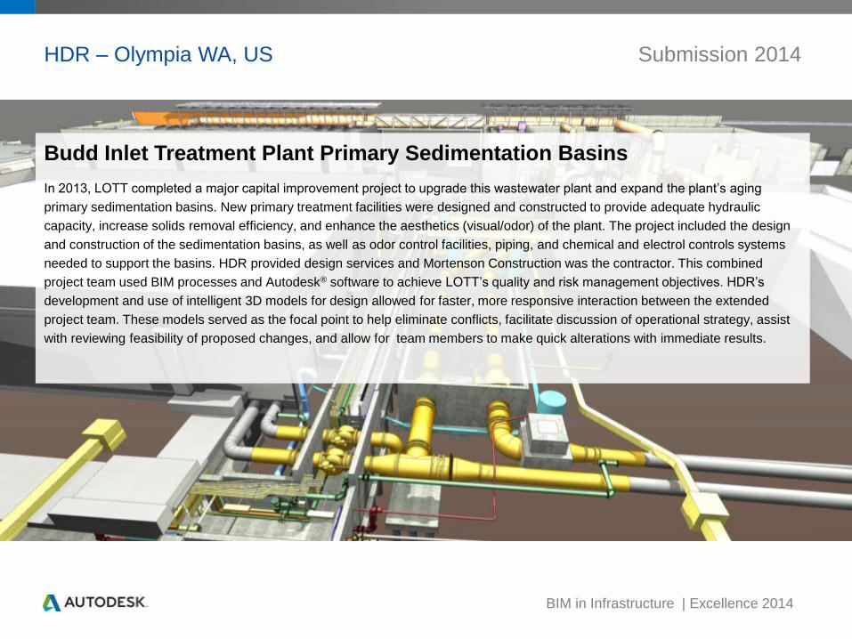
HDR – Olympia WA, US Submission 2014
Budd Inlet Treatment Plant Primary Sedimentation Basins
In 2013, LOTT completed a major capital improvement project to upgrade this wastewater plant and expand the plant’s aging
primary sedimentation basins. New primary treatment facilities were designed and constructed to provide adequate hydraulic
capacity, increase solids removal efficiency, and enhance the aesthetics (visual/odor) of the plant. The project included the design
and construction of the sedimentation basins, as well as odor control facilities, piping, and chemical and electrol controls systems
needed to support the basins. HDR provided design services and Mortenson Construction was the contractor. This combined
project team used BIM processes and Autodesk® software to achieve LOTT’s quality and risk management objectives. HDR’s
development and use of intelligent 3D models for design allowed for faster, more responsive interaction between the extended
project team. These models served as the focal point to help eliminate conflicts, facilitate discussion of operational strategy, assist
with reviewing feasibility of proposed changes, and allow for team members to make quick alterations with immediate results.
BIM in Infrastructure | Excellence 2014
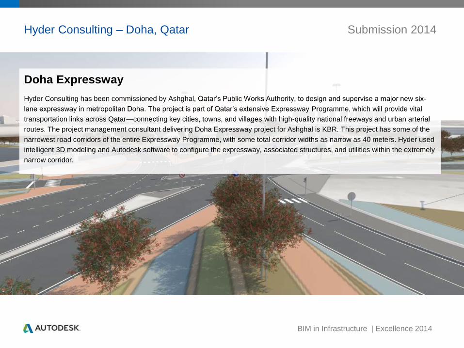
Hyder Consulting – Doha, Qatar Submission 2014
Doha Expressway
Hyder Consulting has been commissioned by Ashghal, Qatar’s Public Works Authority, to design and supervise a major new six-
lane expressway in metropolitan Doha. The project is part of Qatar’s extensive Expressway Programme, which will provide vital
transportation links across Qatar—connecting key cities, towns, and villages with high-quality national freeways and urban arterial
routes. The project management consultant delivering Doha Expressway project for Ashghal is KBR. This project has some of the
narrowest road corridors of the entire Expressway Programme, with some total corridor widths as narrow as 40 meters. Hyder used
intelligent 3D modeling and Autodesk software to configure the expressway, associated structures, and utilities within the extremely
narrow corridor.
BIM in Infrastructure | Excellence 2014
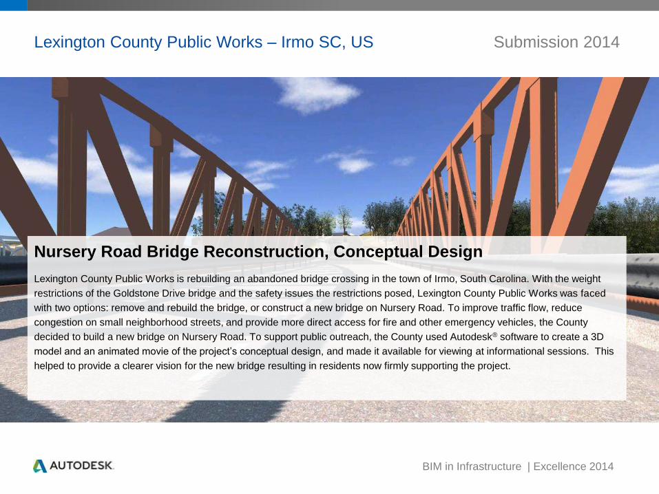
Lexington County Public Works – Irmo SC, US Submission 2014
Nursery Road Bridge Reconstruction, Conceptual Design
Lexington County Public Works is rebuilding an abandoned bridge crossing in the town of Irmo, South Carolina. With the weight
restrictions of the Goldstone Drive bridge and the safety issues the restrictions posed, Lexington County Public Works was faced
with two options: remove and rebuild the bridge, or construct a new bridge on Nursery Road. To improve traffic flow, reduce
congestion on small neighborhood streets, and provide more direct access for fire and other emergency vehicles, the County
decided to build a new bridge on Nursery Road. To support public outreach, the County used Autodesk® software to create a 3D
model and an animated movie of the project’s conceptual design, and made it available for viewing at informational sessions. This
helped to provide a clearer vision for the new bridge resulting in residents now firmly supporting the project.
BIM in Infrastructure | Excellence 2014
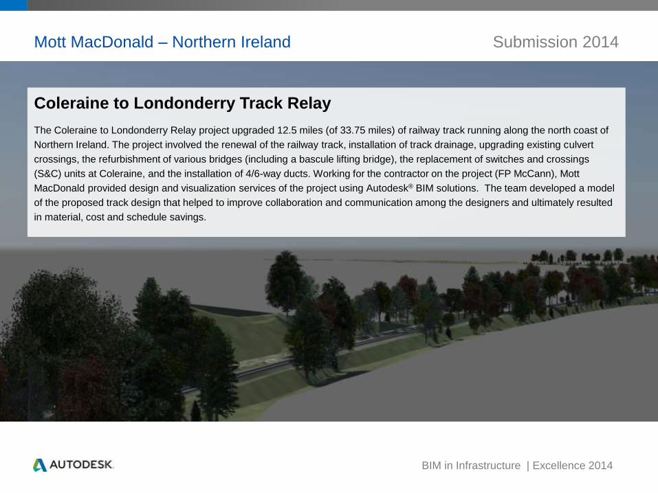
Mott MacDonald – Northern Ireland Submission 2014
Coleraine to Londonderry Track Relay
The Coleraine to Londonderry Relay project upgraded 12.5 miles (of 33.75 miles) of railway track running along the north coast of
Northern Ireland. The project involved the renewal of the railway track, installation of track drainage, upgrading existing culvert
crossings, the refurbishment of various bridges (including a bascule lifting bridge), the replacement of switches and crossings
(S&C) units at Coleraine, and the installation of 4/6-way ducts. Working for the contractor on the project (FP McCann), Mott
MacDonald provided design and visualization services of the project using Autodesk® BIM solutions. The team developed a model
of the proposed track design that helped to improve collaboration and communication among the designers and ultimately resulted
in material, cost and schedule savings.
BIM in Infrastructure | Excellence 2014
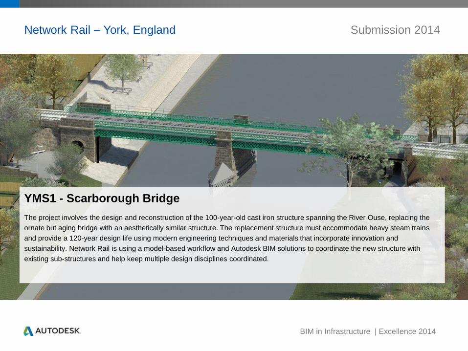
Network Rail – York, England Submission 2014
YMS1 - Scarborough Bridge
The project involves the design and reconstruction of the 100-year-old cast iron structure spanning the River Ouse, replacing the
ornate but aging bridge with an aesthetically similar structure. The replacement structure must accommodate heavy steam trains
and provide a 120-year design life using modern engineering techniques and materials that incorporate innovation and
sustainability. Network Rail is using a model-based workflow and Autodesk BIM solutions to coordinate the new structure with
existing sub-structures and help keep multiple design disciplines coordinated.
BIM in Infrastructure | Excellence 2014
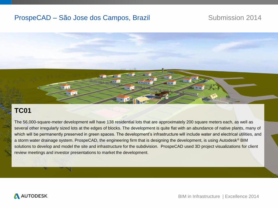
ProspeCAD – São Jose dos Campos, Brazil Submission 2014
TC01
The 56,000-square-meter development will have 138 residential lots that are approximately 200 square meters each, as well as
several other irregularly sized lots at the edges of blocks. The development is quite flat with an abundance of native plants, many of
which will be permanently preserved in green spaces. The development’s infrastructure will include water and electrical utilities, and
a storm water drainage system. ProspeCAD, the engineering firm that is designing the development, is using Autodesk® BIM
solutions to develop and model the site and infrastructure for the subdivision. ProspeCAD used 3D project visualizations for client
review meetings and investor presentations to market the development.
BIM in Infrastructure | Excellence 2014
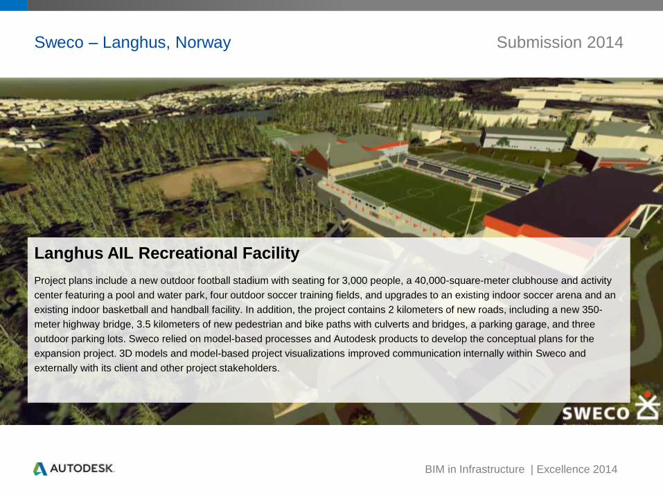
Sweco – Langhus, Norway Submission 2014
Langhus AIL Recreational Facility
Project plans include a new outdoor football stadium with seating for 3,000 people, a 40,000-square-meter clubhouse and activity
center featuring a pool and water park, four outdoor soccer training fields, and upgrades to an existing indoor soccer arena and an
existing indoor basketball and handball facility. In addition, the project contains 2 kilometers of new roads, including a new 350-
meter highway bridge, 3.5 kilometers of new pedestrian and bike paths with culverts and bridges, a parking garage, and three
outdoor parking lots. Sweco relied on model-based processes and Autodesk products to develop the conceptual plans for the
expansion project. 3D models and model-based project visualizations improved communication internally within Sweco and
externally with its client and other project stakeholders.
BIM in Infrastructure | Excellence 2014
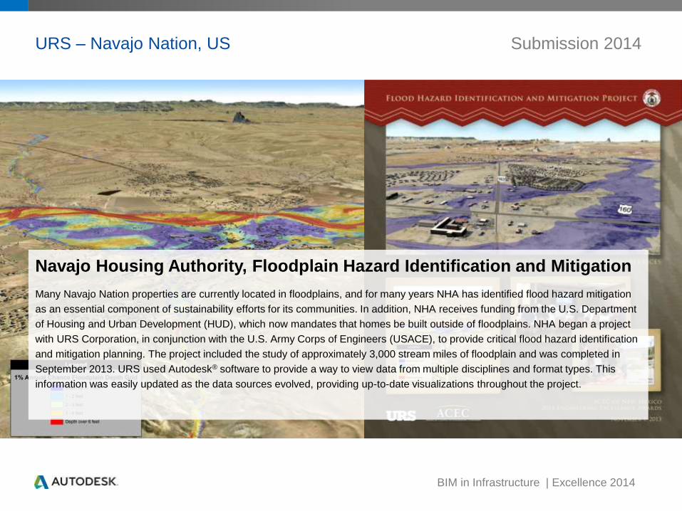
URS – Navajo Nation, US Submission 2014
Navajo Housing Authority, Floodplain Hazard Identification and Mitigation
Many Navajo Nation properties are currently located in floodplains, and for many years NHA has identified flood hazard mitigation
as an essential component of sustainability efforts for its communities. In addition, NHA receives funding from the U.S. Department
of Housing and Urban Development (HUD), which now mandates that homes be built outside of floodplains. NHA began a project
with URS Corporation, in conjunction with the U.S. Army Corps of Engineers (USACE), to provide critical flood hazard identification
and mitigation planning. The project included the study of approximately 3,000 stream miles of floodplain and was completed in
September 2013. URS used Autodesk® software to provide a way to view data from multiple disciplines and format types. This
information was easily updated as the data sources evolved, providing up-to-date visualizations throughout the project.

BIM in Infrastructure | Excellence 2014
Vanasse Hangen Brustlin, Inc. – Middlebury VT, US Submission 2014
Middlebury Railway Tunnel Project
VTrans, the State of Vermont’s transportation agency, needs to replace two bridges that span the Vermont Railway line in
Middlebury, Vermont. The bridges and grade-separated rail line are in prominent areas of Middlebury, and town residents wanted to
ensure that the new structures would blend seamlessly with the downtown area. VHB used InfraWorks to generate a model of
existing conditions from all that data and then added the design data of the two proposals to the model. Renderings and videos of
the alternatives helped VHB present the project enabled the design team to bring all the project stakeholders into the planning
process.

BIM in Infrastructure | Excellence 2014
Vera Quintana – Samborondon, Guayas, Ecuador Submission 2014
Samborondon Avenue
One of the main commuter routes to Guayaquil is Samborondon Avenue, which is just across the River Guayas from Guayaquil. To
reduce traffic backups and accident rates, this thoroughfare is slated for major enhancements and restructuring. Plans for the 17-
kilometer road include four high-speed lanes on its central axis and two service lanes on each side, four flyover ramps, two
exchanger return ramps, as well as special access roads. Vera Quintana Asociados is providing BIM modeling services on this
project using Autodesk software to create a model of the actual roadway including the new design options to boost project
communication and collaboration.
BIM in Infrastructure | Excellence 2014
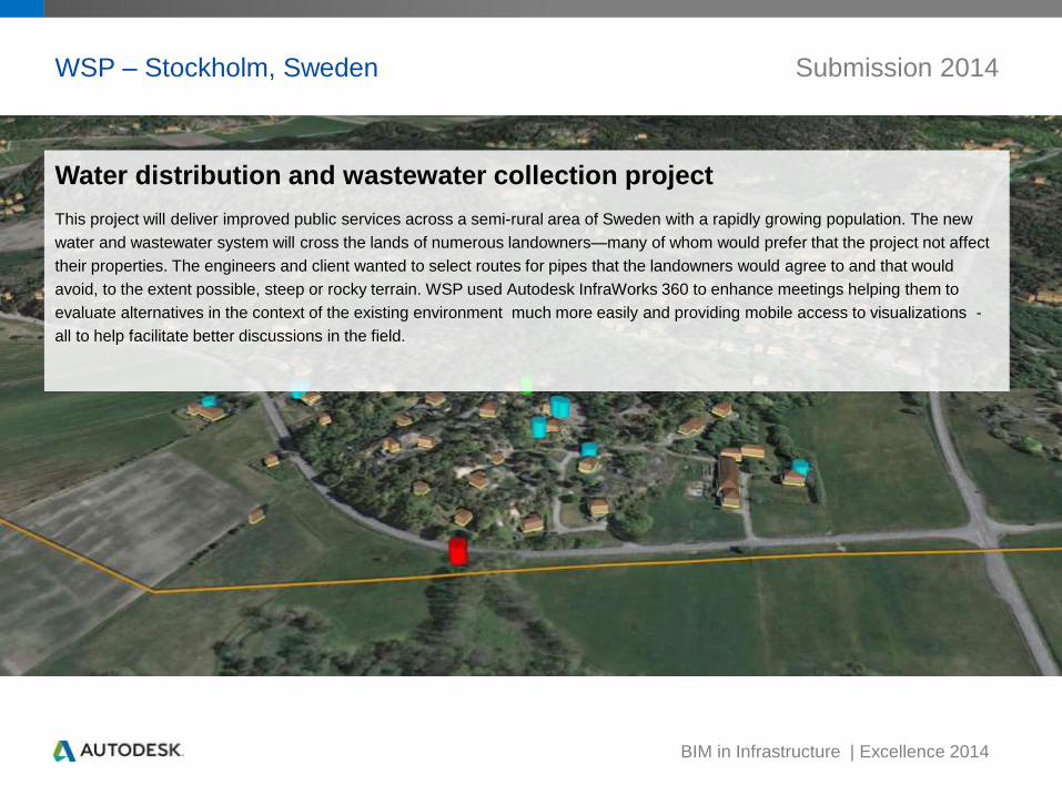
WSP – Stockholm, Sweden Submission 2014
Water distribution and wastewater collection project
This project will deliver improved public services across a semi-rural area of Sweden with a rapidly growing population. The new
water and wastewater system will cross the lands of numerous landowners—many of whom would prefer that the project not affect
their properties. The engineers and client wanted to select routes for pipes that the landowners would agree to and that would
avoid, to the extent possible, steep or rocky terrain. WSP used Autodesk InfraWorks 360 to enhance meetings helping them to
evaluate alternatives in the context of the existing environment much more easily and providing mobile access to visualizations -
all to help facilitate better discussions in the field.