europe mapping lab challenges 1 and 2 - mr. emmi's blogeurope and russia directions 1 challenge...
TRANSCRIPT
18 Europe and Russia Mapping Lab © Teachers’ Curriculum Institute
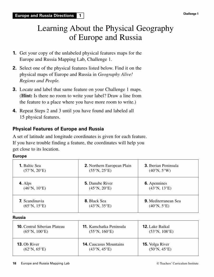
Europe and Russia Directions 1 Challenge 1
Learning About the Physical Geography of Europe and Russia
1. Get your copy of the unlabeled physical features maps for theEurope and Russia Mapping Lab, Challenge 1.
2. Select one of the physical features listed below. Find it on thephysical maps of Europe and Russia in Geography Alive!Regions and People.
3. Locate and label that same feature on your Challenge 1 maps. (Hint: Is there no room to write your label? Draw a line fromthe feature to a place where you have more room to write.)
4. Repeat Steps 2 and 3 until you have found and labeled all 15 physical features.
Physical Features of Europe and RussiaA set of latitude and longitude coordinates is given for each feature.If you have trouble finding a feature, the coordinates will help youget close to its location.
1. Baltic Sea(57°N, 20°E)
2. Northern European Plain(55°N, 25°E)
3. Iberian Peninsula (40°N, 5°W)
4. Alps(46°N, 10°E)
5. Danube River(45°N, 20°E)
6. Apennines(43°N, 13°E)
7. Scandinavia(65°N, 15°E)
8. Black Sea(43°N, 35°E)
9. Mediterranean Sea (40°N, 5°E)
10. Central Siberian Plateau(65°N, 100°E)
11. Kamchatka Peninsula(55°N, 160°E)
12. Lake Baikal (53°N, 108°E)
13. Ob River (62°N, 65°E)
14. Caucasus Mountains (43°N, 45°E)
15. Volga River(50°N, 45°E)
Russia
Europe

20 Europe and Russia Mapping Lab © Teachers’ Curriculum Institute
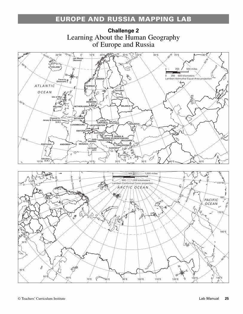
Europe and Russia Directions 2 Challenge 2
Learning About the Human Geography of Europe and Russia
1. Get your copy of the unlabeled political maps for the Europeand Russia Mapping Lab, Challenge 2.
2. Select one of the countries listed below. Find it on the politicalmaps of Europe and Russia in Geography Alive! Regions andPeople. Use the latitude and longitude coordinates to help you.
3. Label the country, and lightly shade the country on your maps.
4. Repeat Steps 2 and 3 until you have labeled and shaded all 15 countries.
Countries in Europe and Russia
1. Austria (48°N, 15°E)
2. Ukraine(50°N, 30°E)
3. Croatia (45°N, 15°E)
4. Romania(45°N, 25°E)
5. Russia (60°N, 90°E)
6. France (45°N, 3°E)
7. Germany(50°N, 10°E)
8. Greece(40°N, 22°E)
9. Hungary (47°N, 20°E)
10. Finland(65°N, 25°E)
11. Italy(45°N, 10°E)
12. Lithuania(56°N, 25°E)
13. Poland(52°N, 20°E)
14. Spain(40°N, 5°W)
15. United Kingdom(52°N, 2°W)

24 Europe and Russia © Teachers’ Curriculum Institute
EUROPE AND RUSSIA MAPPING LAB
Challenge 1Learning About the Physical Geography
of Europe and Russia
00 1,000 kilometers
00 1,000 miles1,000 miles
Lambert Conformal Conic projectionLambert Conformal Conic projection500500
500500
A R C T I C O C E A N
PACIFICOCEAN
40°E
30°E
70°N
Arctic C
ircle
60°N
50°N
40°N40
°N50
°N
60°N
Arc
tic C
ircle
70°N
80°N
80°N
20°E
10°E
0°
50°E 60°E70°E 80°E 90°E 100°E 110°E 120°E 130°E 140°E
160°E
170°E
180°
170°W
N
S
E
W
0 1,000 kilometers
0 1,000 miles
Lambert Conformal Conic projection500
500
TCI5 457Russia PhysicalGA_ML_LG_04-CH-1b.eps
00 500 kilometers
00 500 miles500 miles
Lambert AzimuthalEqual-Area projection250250
250250
AT L A N T I C
O C E A N
60°N
60°N
50°N
50°N
40°N
40°N
30°N
70°N 70°NArctic CircleArctic Circle
10°W 0°
0°20°W 10°E 20°E 40°E 50°E 60°E 70°E 80°E
10°E 20°E 30°E 40°E 50°E
N
S
EW
0 500 kilometers
0 500 miles
Lambert Azimuthal Equal-Area projection250
250
TCI5 449GA_ML_LG_04-CH-1a.epsEurope PhysicalSecond proof
© Teachers’ Curriculum Institute Lab Manual 25
EUROPE AND RUSSIA MAPPING LAB
Challenge 2Learning About the Human Geography
of Europe and Russia
00 500 kilometers
00 500 miles500 miles
Lambert AzimuthalEqual-Area projection250250
250250
ALBANIAALBANIA
ANDORRAANDORRA
BELARUSBELARUS
BOSNIA &BOSNIA &HERZEGOVINAHERZEGOVINA BULGARIABULGARIA
CZECHCZECHREPUBLICREPUBLIC
DENMARKDENMARK
ESTONIAESTONIA
ICELANDICELAND
MACEDONIAMACEDONIA
MALTAMALTA
NORWAYNORWAY
PORTUGALPORTUGAL
SERBIA &SERBIA &MONTENEGROMONTENEGRO
SLOVAKIASLOVAKIA
SWITZERLANDSWITZERLANDSLOVENIASLOVENIA
SWEDENSWEDEN
VATICANVATICANCITYCITY
MONACOMONACO
SANSANMARINOMARINO
LATVIALATVIA
LIECHTENSTEINLIECHTENSTEINLUXEMBOURGLUXEMBOURG MOLDOVAMOLDOVA
Faroe Is.Faroe Is.(Denmark)(Denmark)
Jan MayenJan Mayen(Norway)(Norway)
GibraltarGibraltar(U.K.)(U.K.)
BELGIUMBELGIUM
IRELANDIRELAND NETHERLANDSNETHERLANDS
Channel Is.:Channel Is.:Jersey & GuernseyJersey & Guernsey
(U.K.)(U.K.)
Isle of ManIsle of Man(U.K.)(U.K.)
ALBANIA
ANDORRA
BELARUS
BOSNIA &HERZEGOVINA BULGARIA
CZECHREPUBLIC
DENMARK
ESTONIA
ICELAND
MACEDONIA
NORWAY
PORTUGAL
SERBIA &MONTENEGRO
SLOVAKIA
SWITZERLANDSLOVENIA
SWEDEN
VATICANCITY
MONACO
SANMARINO
LATVIA
LIECHTENSTEINLUXEMBOURG MOLDOVA
Faroe Is.(Denmark)
Jan Mayen(Norway)
Gibraltar(U.K.)
BELGIUM
IRELAND NETHERLANDS
Channel Is.:Jersey & Guernsey
(U.K.)
Isle of Man(U.K.)
AT L A N T I C
O C E A N
60°N
60°N
50°N
50°N
40°N
40°N
30°N
70°N 70°NArctic CircleArctic Circle
10°W 0°
0°20°W 10°E 20°E 40°E 50°E 60°E 70°E 80°E
10°E 20°E 30°E 40°E 50°E
N
S
EW 0 500 kilometers
0 500 miles
Lambert Azimuthal Equal-Area projection250
250
TCI5 450GA_ML_LG_04-CH-2a.epsEurope PoliticalSecond proof
00 1,000 kilometers
00 1,000 miles1,000 miles
Lambert Conformal Conic projectionLambert Conformal Conic projection500500
500500
A R C T I C O C E A N
PACIFICOCEAN
40°E
30°E
70°N
Arctic C
ircle
60°N
50°N
40°N40
°N50
°N
60°N
Arc
tic C
ircle
70°N
80°N
80°N
20°E
10°E
0°
50°E 60°E70°E 80°E 90°E 100°E 110°E 120°E 130°E 140°E
160°E
170°E
180°
170°W
N
S
E
W
0 1,000 kilometers
0 1,000 miles
Lambert Conformal Conic projection500
500
TCI5 458Russia PoliticalGA_ML_LG_04-CH-2b.eps