escap/wmo - typhoon committeetyphooncommittee.org/docs/newsletterpdf/no_15_tc... · the...
TRANSCRIPT

Page 1Typhoon Committee Newsletter No. 15 August 2003
ESCAP/WMO
TYPHOON
COMMITTEENEWSLETTER
No. 15 August 2 003
THIRTY FIFTH SESSION OF THETYPHOON COMMITTEE INCHIANG MAI, THAILAND
The Typhoon Committee Newsletter ispublished in English by the TyphoonCommittee Secretariat .
Coordinator: Dr. Roman L. Kintanar
4/F PAGASA Bldg., Science GardenComplex, Agham Road, Diliman,Quezon City 1101PHILIPPINESTelefax: (632) 4349026E-mail: [email protected]
The newsletter is available on requestto the Editor at the above address.
Editor: Martin F. Rellin, Jr.Asst. Ed.: Hannibal B. MarayagLayout: Bella U. MendozaStaff: Rosemarie Z. Anillo
Roman O. Mendoza
Participants in the thirty-fifth session of the Typhoon Committee pose at the Grand Ballroom of Chiang MaiHill 2000 Hotel.
Officials and representatives ofnational meteorological services in Asia-Pacific pushed for the implementation ofseveral uncompleted action plans at theconclusion of the 35th Session of theESCAP/WMO Typhoon Committee, heldin Chiang Mai, Thailand, from 19 to 25November 2002.
The session, organized by theThailand Meteorological Department(TMD) and co-sponsored by the WorldMeteorological Organization (WMO) andthe Economic and Social Commission forAsia and the Pacific (ESCAP), wasattended by representatives from 12members of TC, as well as observers fromthe Russian Federation, International Civil
Governor Pisit Ketphasook ofChiang Mai said the work of the Committeewas of great interest to the province of ChiangMai. He stressed the need for the experts totake all possible measures in order to reducethe incidence of weather-related disastersaffecting the region.
Prapansak Buranaprapa, director-general of TMD, said the 2002 TC sessioncoincided with the 60th anniversary of TMDas a government department. He highlightedin his message the importance
Aviation Organization (ICAO), MekongRiver Commission and Thai Red CrossSociety.
of the close cooperation between membersto minimize loss of lives and damage toproperties caused by tropical cyclones.
Le-Huu Ti, ESCAP representative,said ESCAP has always accorded highpriority on the importance of mitigating
Contents
Ø Thirty-fifth Session of theTyphoon Committee inChiang Mai, Thailand
Ø Thai National WeatherService Wins 2002 TCNatural Disaster PreventionAward
Ø Meeting of Working Groupon Hydrology in Kyoto
Ø Flood Days of the 3rdWorld Water Forum
Ø T Changes
Ø TC Members’ News

Page 2 Typhoon Committee Newsletter No. 15 August 2003
cyclone and water-related disasters in theregion in view of its annual social impact withmore than 150,000 human loss, affectingnearly 1.5 billion people and annual economicloss exceeding US$110 billion during the lastdecade (1990s).
Ti also gave importance toestablishing effective regional, subregionaland national strategies, andscientific and technicalinstitutional support fordisaster management asrecommended in theaction plan of the WorldSummit on SustainableDevelopment inSeptember.
The ESCAPofficial lauded the TCmembers’ commitment inleading cooperative effortstowards achieving thevarious targets set out inthe new RCPIP. He alsogave assurance ofESCAP’s continuedsupport for the Committeein the enhancement of sub-regional cooperation incyclone-related disastermitigation and water resources management.
Eisa H. Al-Majed, WMOrepresentative, urged the Committee to assistits members in the common efforts to improveforecasting of floods which continued to beone of the most severe disasters in Asia. Headded that WMO would not cease on givingtop priority to issues related to the mitigationof natural disasters in line with theimplementation of the International Strategyfor Disaster Reduction (ISDR) and its relevantprograms.
Al-Majed also urged TC membersto strengthen the interaction between theirNational Meteorological and HydrologicalServices and the national agencies concernedwith disaster prevention and preparedness inorder to increase the effectiveness of thewarning system and national disastermitigation measures.
At the session, the Committee notedthe existing deficiencies in theimplementation of the ICAO tropical cyclonewarning system due to some designatedTropical Cyclone Advisory Centers (TCACs)and Meteorological Watch Offices (MWOs)which had not yet adopted the ICAO formatin the issuance of tropical cyclone advisories
and SIGMETS. Also noted was the problemwhich surfaced in the dissemination ofadvisories and SIGMETS through ICAOtelecommunication links due to incorrectWMO heading used by TCACs and MWOs.This has resulted in the automatic datahandling systems at aeronauticalmeteorological communication centers and
airlines unable to recognize the messagesrelated to tropical cyclones, and therefore notreaching aviation users.
In line with this, the Committeeagreed with the proposal to amend theTyphoon Committee Operational Manual(TOM) to reflect the current ICAO provisionsrelated to the TC advisories and warnings foraviation. Also, the Committee was informedthat the TCAC Tokyo would revise the formatof its tropical cyclone advisory for SIGMET,in accordance with the ICAO Annex 3/WMOTechnical Regulations, beginning January 1,2003.
A two-tiered strategy for thedevelopment of a unified best track data setwas proposed at the meeting of the WorkingGroup on a Unified North-West PacificTropical Cyclone Best Track Data Set. Inthe first stage, data which are useful fordisaster mitigation activities, particularly,during the land-falling period, should beappended to the Regional SpecializedMeteorological Center (RSMC) Tokyo BestTrack data set. The second stage was toconduct a feasibility study to examine if re-analysis and unification of best track data sets
of various centers are feasible and cost-effective before being implemented.
The Committee decided to carry outonly the first stage because the second stagewas deemed not feasible or effective for themembers and it would be more appropriatefor study themes of graduate students andresearch scientists. The Committee requested
the RSMC-Tokyo TyphoonCenter to work out details ofthe implementation plan ofthe first stage of the proposaland to circulate them amongthe members.
The workinggroup on RegionalCooperation ProgrammeImplementation Plan(RCPIP) noted thesignificant advances made bythe members in many areasof meteorology, hydrology,disaster prevention andpreparedness, training, andresearch. However, many ofthese advances were withinthe members’ respectiveareas, and elements ofregional cooperation neededfor many of the RCPIP
objectives were not evident.The working group on RCPIP added
that only a few members had accomplishedRegional Cooperation Objectives/ActionItems. All the members were to identifyadditional tropical cyclone forecastingguidance requirements. As documented, onlyChina and Hong Kong did while Malaysiasaid it was satisfied with the current guidance.RSMC Tokyo was to send a questionnaire onrequirements to members to be reportedduring the 35th session, and to implementidentified requirements from 2002 to 2006.
The working group noted severalsignificant actions in meteorology that shouldbe addressed which included theimplementation of a central server for dataexchange accessible by members withappropriate security measures; establishmentand training of human weather spotternetworks to report significant rainfall,flooding, storm surge and high surf; andprovision of members of their prioritized listof requirements to RSMC Tokyo.
In hydrology, the Committee notedthe improvements made by several memberson real-time meteorological/hydrologicalnetworks and exchange of data among
At the Session. (From left) Dr. R.L. Kintanar, TCS Coordinator; Mr. Le -Huu Ti, ESCAP Representative;Gov. Pisit Ketphasook, Governor of Chiang Mai; Mr. Sombut Uthaisang, Adviser to Ministry of ICT; Mr.J. Weyman, Director, RSMC Honolulu; Mr. E. H. Al-Majed, WMO Representative; and Dr. P. Buranaprapa,Director-General, TMD.

Page 3Typhoon Committee Newsletter No. 15 August 2003
members, and on workingtowards developing andextending activitiesbetween forecastingagencies and user groupsof flood information incooperation with disasterprevention andp r e p a r e d n e s sorganizations.
Japan hadprovided technicalsupport to interestedmembers in production offlood hazard maps and inestablishing sedimentdisaster forecasting andwarning system at pilotareas of each member. Itwas planned thatinterested members would make flood hazardmaps and implement public announcementof hazard maps in the pilot area by 2004.
The working group on RCPIPidentified the activities under hydrologywhich the members should fulfill, amongothers, to develop and implement plans whichincluded each member’s meteorological/hydrological data requirements from othermembers, and methods to receive the requireddata; to establish, evaluate and improve theaccuracy of flood forecasting and exchangeinformation among all members; and toimprove flood forecasting and warningsystems through exchange of experts.
The Committee endorsed therecommendations made at the pre-sessionmeeting of hydrologists, among others, toauthorize a TC delegation at the 3rd WorldWater Forum in Japan in March 2003; toadopt a new format for reporting of thehydrology component to be discussed andfinalized by the working group on RCPIP; torequest technical assistance from Japan toprovide training on flood hazard analysis andsediment-disaster forecasting and warning;to re-establish the working group onhydrology to continue its work in 2003; andto organize a Workshop on Implementationof the Hydrological Component of the NewRCPIP of the Committee, in Beijing, China,in September 2003.
In order to enhance effectiveness ofthe Beijing workshop, the Committee wouldalso request experts from Japan to preparefor the organization and program for follow-up actions based on the priority accorded inRCPIP; to request TCS to encourage focal
points on hydrology to prepare for theworkshop; and to request ESCAP to assistTCS and China in the preparation of thetechnical programme of the workshop.
The Committee thanked the JapanMeteorological Agency (JMA) for theexemplary work of the RSMC Tokyo-Typhoon Center on its continued provisionof numerical weather products to TCmembers. It noted JMA’s upgrading of theRSMC Data Serving System in April 2002to meet growing demand from users forenhancement of the data service.
China reported that its FY-1Dsatellite has been in full operation and wouldcollect meteorological and environmentaldata and transmit CHRPT to users aroundthe world. Japan informed the members onthe JMA-NOAA agreement to establish aGMS-5/GOES-9 back-up procedure for thecontinuous space observations over thewestern Pacific, including enhancement of theground facilities for data reception to beginin April 2003, and until the Multi-functionalTransport Satellite (MTSAT)-1R startsoperation by end of 2003. Japan would alsoprovide GMS-5 images via the Internetstarting 2 December 2002 prior to the GMS-5/GOES-9 backup to cope with possibledecrease of signal level of the MDUSbroadcast.
The Committee reviewed thedevelopments on the activities on disasterprevention and preparedness (DPP) coveringtwo categories, namely, public awareness, anddisaster management. It noted the urgentneed of some members for the preparationand improvement of hazard maps and
strengthening of related warningsystems. Several members haveexpressed interest in learningfrom the Japanese experience inflood map preparation.
China, Hong Kong,Singapore, and the USA werenoted to have made significantprogress in maintaining aneffective communication withthe media, emergencymanagement/ disaster responseagencies, and non-governmentalorganizations (NGOs); and inthe exchange of information oncommunications and significanttropical cyclone events.
The members were urgedto direct their efforts to provide
a list of Internet websites for disasterpreparedness and prevention information;exchange effective tropical cyclone resistantactions and members’ building codes; andinvestigate the availability of amateur radionetworks and implement procedures for theiruse to report significant weather events andas backup communications and disseminationsystems.
The Committee lauded ESCAP forits well-appreciated re-implementation of theannual survey on socio-economic impacts oftyphoons and requested for the members’active participation. The Committee alsopushed for the setting up of a data base onthe impact of typhoon-related disasters at thenational level and requested ESCAP, incooperation with TCS and WMO, to developa regional project on this subject.
The Committee was informed thatthe two WMO pilot websites, Severe WeatherInformation Center, and World WeatherInformation Center, were operating smoothly.For the purpose of facilitating the membersto present their city forecasts in the WorldWeather Information Center website, a varietyof communication methods utilizing GTS, E-mail, FTP and web-forms were implementedfor submission of forecasts.
At the session, the Asian DisasterReduction Center (ADRC) circulated a draftlist of Internet websites for the members’access on disaster prevention andpreparedness information and invited themembers of TC to provide additionalinformation before the list is finalized by endof February 2003.
The Committee also lauded themembers for making their national facilities
Mr. Sombut Uthaisang strikes the symbolic gong while officials look on during the openingof the 35th Typhoon Committee Session.
Page 4 Typhoon Committee Newsletter No. 15 August 2003
available for the training of meteorologicaland hydrological personnel of other members.It noted the important contribution to thetraining component of the Storm SurgeWorkshop in Hanoi, and the Workshop onIntegration of Risk Analysis andManagement of Water-related Disasters intothe Development Process in Manila.
The Committee requested theproduction of CD-ROMs in all TC-sponsoredworkshops and seminars for distribution tomembers, particularly, those who could notparticipate in such training opportunities inorder to maximize the use of its resources.
In training, there was an importantneed for members to prepare a separate,prioritized list of training requirements formeteorology and hydrology; and followingcompletion of finalized list, to conduct ameeting on these priorities and sources fortraining, if necessary.
The Committee noted severalimportant research activities undertaken bymembers on various aspects of tropicalcyclones, including those related tometeorological, hydrological and DPPcomponent. Actions needed included toorganize an International Intensive ObservingExperiment; conduct exchange ofmeteorological experts among membersthrough the Typhoon Committee ResearchFellowship Scheme; and organize workshopson typhoon forecasting research biennially.
recommended, among others, to re-establishthe working group on RCPIP to review andupdate the RCPIP based on the surveys frommembers; propose a new format and reportingsystem for the TC annual country reports; andconsolidate the members’ identified plannedtraining, prioritized training needs, andprioritized research needs; and to hold a 3-day meeting of the new RCPIP working groupin Japan.
The Typhoon ResearchCoordination Group (TRCG) recommendedseveral topics related to research activities,such as to continue the TRCG fellowshipscheme; to implement the visiting lecturerprogramme to promote research anddevelopment on tropical cyclone forecasting,hydrology component, and DPP component,while encouraging members to adoptcooperative activities to engage the interestof academic researchers; and to update thelist of resource persons in the region for betterinteraction, encourage members to take partin the development work, share researchresults, and to assist other members inadopting the use of information throughinternet.
The Committee urged its membersto implement these recommendations asmuch as possible and also requested TCS toprovide the necessary support to the workinggroup.
The Committee noted the studymade by TCS to produce the TyphoonCommittee Annual Review (TCAR) in CD-ROM format and thanked the USA for itsoffer to produce copies of the TCAR 2002 inCD-ROM.
The thirty fifth Committee sessionelected Dr. Prapansak Buranaprapa, Directorof Meteorological Department of Thailand,as Chairman of the Typhoon Committee untilits next session. It also accepted the offermade by the Government of Malaysia to hostthe next session scheduled from 15-20December 2003.
The working group on RCPIP
Thai National Weather Service wins 2002 TC Award
T h e T h a iM e t e o r o l o g i c a lDepartment has anotherreason to be proud as thenational weather servicewas awarded the TyphoonCommittee NaturalDisaster PreventionAward 2002 by theTyphoon CommitteeFoundation, Inc. (TCFI).
T h e T h a iDepartment joined 1996winnerSmith Tumsaroch,former director general ofTMD, as only the tworecipients of the covetedTC award from Thailand.
In session ceremony last November19, the award was presented to Prapansak
Buranaprapa, director general of TMD, onbehalf of the department, by TCFI chairman
Dr. P. Buranaprapa (right), Director-General of TMD, receives the TC Award Plaque, on behalfof the TMD, from Dr. Kintanar, Chairman of TCFI.
Roman L. Kintanar. The TC awardwas created by the TCFI in 1989 aimedat recognizing worthy endeavors in theimprovement of natural disasterprevention strategies.
The TMD was cited for teameffort emanating from the work of itsstaff; for its contributions as an entityfor sixty years in the promotion ofpublic safety; and for its valuableparticipation, as founding member, inthe work program of both the TyphoonCommittee and the Panel on TropicalCyclones for the Bay of Bengal andthe Arabian Sea, which has providedan important coordinating linkbetween the two geographical areascovered.
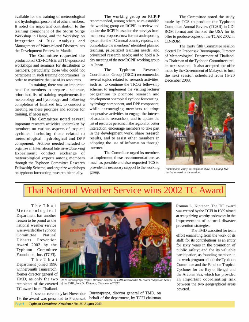
Participants enjoy an elephant show in Chiang Maiduring a break at the session.

Page 5Typhoon Committee Newsletter No. 15 August 2003
Lam succeeds Lam
C. Y. Lam was appointed directorof the Hong Kong Observatorysucceeding H. K. Lam in March 2003.Lam, who joined the Observatory in 1974,studied physics and mathematics at theUniversity of Hong Kong, andmeteorology at the Imperial College,University of London
Lam served as chairman of thesteering group for the Special ExperimentConcerning Typhoon Recurvature andUnusual Movement (SPECTRUM) 1990.He also served as the Chairman of theTyphoon Research Coordination Groupfrom 1996 to 2000, during which time thefellowship scheme and the new list oftyphoon names in the region wereintroduced.
Lam is currently involved inrunning the two WMO pilot websites onworld city forecasts and severe weatherinformation hosted by the Hong KongObservatory.
Kitade heads JMA
Takeo Kitade, 59, was appointednew director general of the JapanMeteorological Agency (JMA) last Aprilsucceeding Mr. Koji Yamamoto. Kitadewas the director of the ForecastDepartment, JMA, prior to hisappointment.
Kitade, who holds a PhD (ANumerical Study of Three-DimensionalBénard Convection), University of Tokyo(1978), and BSc, Faculty of Science, KyotoUniversity (1996), joined JMA asresearcher at the Typhoon ResearchDepartment in 1966 and gradually rosefrom the ranks. He served as director ofthe Sendai District MeteorologicalObservatory (1998-2000); AdministrationDivision (1995-1996) and NumericalPrediction Division (1992-1995) of theForecast Department; and TechnicalDepartment of the Sapporo DistrictMeteorological Observatory (1990-1992).
Kitade has worked extensively inthe development of synoptic forecastingmethods using numerical weatherprediction models, and in the planning ofmodernization of the forecasting system,observing system, and thetelecommunication and data processingsystem. He was a visiting scientist at theFlorida State University in 1981-83 andwas a member of the Commission forAtmospheric Sciences (CAS) in 1992-94and 2001-2003.
Kitade is a member of theCoordination Committee on Meteorologyof the Science Council of Japan, and the
Mannoji appointed NTC-JMA head
Nobutaka Mannoji, 46, wasappointed new head of the NationalTyphoon Center, Japan MeteorologicalAgency (RSMC Tokyo- Typhoon Center),
Dr. N. Mannoji
Dr.rT. Kitade
Dr. C. Y. Lam
T ChangesTokyo Environmental Council. He hasauthored several publications in J. Met. Soc.Japan, among others, On the Convectionin a Conditionally Unstable Atmospherewith Mean Vertical Motion (1972), ANumerical Study of Three-DimensionalBénard Convection, The Evaluation of theAmplitude (1974) Numerical Experimentsof Tropical Cyclones on a Plane withVariable Coriolis Parameter (1980), ANumerical Study of the Vortex Motion withBarotropic Models (1981), and NumericalWeather Prediction in JMA (1988).
Rellin named new TCS meteorologist
Martin F. Rellin, Jr. was appointednew Seconded Meteorologist of the TyphoonCommittee Secretariat (TCS), succeedingEfigenia C. Galang on 16 May 2003.
Rellin, 42, is a BSME graduate ofthe University of Mindanao. He holds a M.Sc.in Mgt. Eng’g. from the University of SantoTomas, and a Post graduate diploma Met.Eng’g. from the Meteorological OfficeCollege (U.K.).
Rellin, a Sr. Weather Specialist, alsoacts as chief of staff of the Office of theDirector of PAGASA. He received the ModelEmployee of the Year award in December2002.
M. Rellin, Jr.
succeeding Masashi Nagata on 1 April 2003.Mannoji holds a M.Sc and B.Sc
degree in Geophysics from the University ofTokyo. He joined JMA in 1984 as technicalstaff member of Sapporo District Observatory.He served as senior R/D staff member at theNumerical Prediction Division (1986-2001),mainly developing JMA’s Regional SpectralModel, including a 2-year stint as a visitingscientist at the Florida State University (1991-1993), USA.
Mannoji, who has worked withWMO (1998-2002), was the winner of theYamamoto Award of Japan MeteorologicalSociety in 1984. He held the position as SeniorCoordinator for Climate Modeling at theClimate Prediction Division, JMA (2001-2003) prior to his appointment as head ofNTC, JMA.

Page 6 Typhoon Committee Newsletter No. 15 August 2003
Vice-premier Hui Liangyu of the State Council of China,shares a light moment with Prof. G.O.P. Obasi, Secretary-General of WMO.
Opening ceremony of Beijing symposium
Int’l symposium on climate change in Beijing
An international symposium onclimate change was held in Beijing, China,from March 31 to April 3, 2003. Thesymposium attracted some 440 officials from46 countries including representatives ofvarious international scientific organizations.
Hui Liangyu, Vice-Premier of theState Council of China, graced the openingof the four-day meeting indicating the greatimportance the Chinese government attachedto climate change issue. WMO SecretaryGeneral G. O. P. Obasi and other prominentscientists also attended the symposium.
The symposium covered a broadarea on many aspects of science andsustainable development associated withclimate change, under the topic “ClimateChange: Science and SustainableDevelopment.” A total of 260 papers werepresented mostly on the latest world scientificfindings in the field of climate change. Inaddition, 15 papers, with Young ScientistAward, were presented as an encouragementto young scientists.
NOAA-KLM series AMSU warm coreobservations.’
Meteorological satellites have beenproved to be indispensable in improving theability in forecasting and understandingtropical cyclones’ track, structure andintensity change. The lectures provided agood opportunity for the STI members to gainmore knowledge that will be useful in theirwork in the future.
Workshop on landfalling tropical cyclone
The annual meeting of the nationalkey project “Monitoring on LandfallingTropical Cyclone Disasters of China and itsForecasting Techniques”was held on 2-4March in Guangdong Province. Forty sixexperts who were involved in the projectattended the meeting.
Chen Lianshou, the chief scientistof the project, gave a brief introduction onthe field experiment and reported on itsprogress which consisted of 5 sub-projectswith 30 topics covering several aspects onlandfalling tropical cyclone including
structure, motion, intensity, database andfield experiment.
The chiefs of each sub-projectintroduced new findings (in the past) as wellas problems and future plans. The fieldexperiment has chosen “Vongfong (2014)”as its target and has launched trackingmonitoring with data on wind field,turbulence and planetary boundary layerfeatures.
These valuable data filled in thegap in China’s monitoring of landfallingtropical cyclones. Based on these data, somepioneer achievements have been made inthe field of landfalling tropical cyclone PBLfeatures.
Lianshou named WGTMR chairman
Prof. Chen Lianshou, academicianof the Chinese Academy of Engineering(CAE), was designated chairman of theWorking Group on Tropical MeteorologyResearch (WGTMR) as well as a rapporteuron Interaction between Tropical and Mid-latitude Weather Systems of the WorkingGroup during the last session of the WMOCommission for Atmospheric Sciences(CAS) held in Oslo, on 12-20 February2002.
China contributes to globalmeteorology training
The China MeteorologicalAdministration Training Center (CMATC),the Beijing Component of the WMONanjing Regional Meteorological TrainingCenter (RMTC) was inaugurated on April1, 2003. The new training branch aims toprovide better education and trainingservices in the fields of meteorology andhydrology for developing countries in theAsia-Pacific region.
In 1994, China signed anagreement with WMO to set up RMTCNanjing at the Nanjing MeteorologicalInstitute in Jiangsu Province. In August2002, WMO formally designated the ChinaMeteorological Administration TrainingCenter (CMATC) as the Beijing componentof its RMTC in Nanjing.
In recent years, the CMATC hasmade great efforts in training high-levelprofessionals for China’s meteorologicaldevelopment. The training courses covernew weather radar principles and
Satellite data expert visits ShanghaiInstitute
Roger Edson of Quam Universityvisited the Shanghai Typhoon Institute (STI)for a one-week lecture-seminar on theutilization of satellite data in tropical cycloneforecasting and positioning on 17-23 March2003.
Edson introduced to the membersof STI the up-to-date advancement inmeteorological satellites and their utilizationin areas concerning tropical cyclones.Participants to the lectures were forecastersfrom the Shanghai Meteorological Center,Guangzhou Tropical Meteorology Institute,Zhejiang Observatory and JiangsuObservatory.
Edson’s topics included‘Introduction to meteorological satellites’,‘Operational evaluation of Quikscat overtropical cyclones’, ‘Evaluation of microwaveimagery over tropical cyclones’, and‘Tropical cyclone intensity estimation using
TC MEMBERS’ NEWS
CHINA
China

Page 7Typhoon Committee Newsletter No. 15 August 2003
operational applications, sandstormforecasting and warning services, techniquesfor urban environment prediction andmonitoring, latest findings of meteorologicalscience for water resources and civil aviationsectors, and other related subjects.
subjects.
The potential of the application ofTREC (Tracking Radar Echoes byCorrelation) winds in initializing tropicalcyclones was assessed using the case oftropical cyclone Kammuri (0212) in 2002.Numerical experiments on the assimilationof TREC winds were performed at the HongKong Observatory (HKO) using thehydrostatic Operational Regional SpectralModel (ORSM) and the non-hydrostaticAdvanced Regional Prediction System(ARPS).
The ORSM was configured to runat a 20-km inner domain one-way nestedinside a 60-km domain with 36 verticallevels. The ARPS was run at a 6-km innerdomain one-way nested inside a 30-km outerdomain with 40 levels. The boundaryconditions of both outer models wereprovided by the Global Spectral Model(GSM) of Japan Meteorological Agency(JMA). The ORSM employed 3-dimensional multivariate optimalinterpolation. The ARPS Data Assimilation
System (ADAS) used the Bratseth successivecorrection scheme. In the ADAS, radarvelocity and reflectivity data were assimilated.
The impact of TREC winds onmodel rainfall forecasts was evaluated withand without the presence of tropical cyclonebogus data. TREC winds at 1 km and 3 kmheights were assimilated in the models. Withthe assimilation of TREC winds, the ARPSpredicted generally higher rainfall intensitiesin the first few hours. The impact was stillobservable in later forecast hours. For theORSM, the impact of TREC winds was lessprominent than that of ARPS. The ORSMwas not very sensitive to the use of TRECwind data. Instead, the effect of TC bogusdata was significant.
Indications are that additional radarderived wind data like TREC winds with finervertical resolution may produce a moresubstantial impact on the rainfall forecasts oftropical cyclone upon landfall. Furtherexperimentation with TREC winds with finervertical resolution in addition to Dopplervelocity data will be carried out.
Dr. Qin Dahe (left), Administrator of CMA, and Prof.Obasi at the inauguration ceremony.
6-km ARPS T+ 3 h forecast for 3 hourly accumulated rainfall (mm) and surface winds with TREC wind data(left) and without TREC wind data (right). The model valid time is 21 UTC 4 August 2002.
Alerting service in ICAO journal
March 2003 issue of ICAO Journal
An article from HKO entitled“Ongoing research in Hong Kong has led toimproved wind shear and turbulence alerts”was recently featured in March issue of ICAOJournal. The article gives an overview of thewindshear and turbulence alerting service atthe airport and describes the improvementsthat the HKO has made in recent years. Itcan also be viewed on ICAO’s website at http://www.icao.int/ or on HKO’s website at http://www.weather.gov.hk/aviat/art icles/ShunNo2A3_Final.pdf.
HHH
One of the mainresponsibilities of HKO is toprovide alerts of windshearand turbulence to aircraftusing the Hong KongInternational Airport. TheHKO, in collaboration withthe International Federationof Air Line Pilots’Associations (IFALPA), hasrecently published a bookletentitled ‘Windshear and
Turbulence in Hong Kong –information for pilots.’
The booklet providespilots with basic information onwindshear and turbulence, theircauses and characteristics, and thewindshear and turbulence alertingservice in Hong Kong. It is availablein both English and Chinese and canbe viewed on HKO’s website (http://www.weather.gov.hk/education/edu04avimet_e.htm).
Hong Kong, China
Use of radar-derived TREC winds in model initialization of tropical cyclones assessed
Windshear and turbulence awareness in HK

Page 8 Typhoon Committee Newsletter No. 15 August 2003
LIDAR installed in HK Int’lAirport - a first of its kind
The Hong Kong Observatory hasinstalled a Doppler LIght Detection AndRanging (LIDAR) system at the Hong Kong
International Airport. The first of its kind inthe world for aviation weather alerting, theLIDAR detects movement of aerosols in theair to determine the wind flow under non-rainy weather.
The LIDAR has revealed the windstructure of a number of windshear-producingweather systems in rain-free conditions whichcannot be clearly depicted by TerminalDoppler Weather Radar, ranging from sea-breezes, gust fronts ahead of severethunderstorms, to complex flow behind hillyterrain.
A case in point occurred on 11September 2002 when severe tropical stormHAGUPIT, over the northern part of theSouth China Sea, brought high winds in HongKong. With winds crossing the hills onLantau Island south of the airport, alternatingstreaks of high and low wind speeds appearedover the airport. The LIDAR captured thesestreaks nicely and enabled early issuance ofthe windshear alert to aircraft. A total of 23aircraft had to go around that day due to thewindshear encounter.
Near real-time analysis of the windstructure of tropical cyclones
Under the Typhoon Committeeresearch fellowship scheme, Nathaniel T.Servando, a forecaster from the PhilippineAtmospheric, Geophysical and AstronomicalServices Administration (PAGASA),undertook a 2-month attachment programmeat HKO, from 2 May-29 June 2002 todevelop a rapidly updated analysis system
LIDAR image at 11 UTC on 11 September 2002 duringthe passage of HAGUPIT. Alternating streak of highand low winds speeds were discernible respectivelydownwind of the valleys and hills on Lantau Island tothe south of the airport.
and neighbouring areas. In the case ofUTOR, for instance, LAPS analysis indicatedthat the wind structure was highlyasymmetric throughout its passage, withhigh winds confined mostly to a band ofsouthwesterly running more or less parallelto the coastline. Just before landfall, windsto the south over the sea reached a maximumspeed of around 165 km/h while winds tothe north over land were only around 55 km/h. After landfall, winds weakened andapparently the radius of maximum wind ofUTOR increased. Gales remained quiteextensive within UTOR’s large circulation.Most of the damage was associated with thesouthwesterly gales sustained over aprolonged period in the wake of UTOR.
HKO plans to implement LAPSand to test the system operationally in afrequently updated manner. The ultimategoal is to enable forecasters to make timelyoperational decisions based on the locationof the wind maxima and the extent of violentwinds before and after TC making landfall.
using the Local Analysis and PredictionSystem (LAPS) of the Forecast SystemsLaboratory (FSL) in the US to produce 3-Dtropical cyclone circulation analyses.
LAPS was configured to useHKO’s Operational Regional Spectral Model(ORSM) output as the background field. Inaddition to conventional data, data from thelocal automatic weather station network,QuikSCAT, Doppler radar velocity andTREC (Tracking Radar Echoes byCorrelation) winds were also ingested.Hourly analyses were produced for a125x105 horizontal grid of 10, 5, and 2 kmresolutions centred over Hong Kong. Casestudies of tropical cyclones Sam (9910), Utor(0104) and Nari (0116) were carried outusing LAPS.
Results of the case studies wereencouraging. LAPS analysis was in generalagreement with observations in Hong Kong
72-Hour tropical cycloneposition forecast
The Hong Kong Observatory(HKO) commenced issuing 72-hour tropicalcyclone forecast positions in its warning forshipping for the area bounded by 10N to 25N,105E to 125E, last June 2003. This has beena major expansion of the HKO tropicalcyclone warning service since 1978 whichwas prompted by the progress in theperformance of numerical models as well asthe adoption of the multiple model ensembletechnique in forecasting the movement oftropical cyclones.
In the eighties, subjective skill wasclose to that of CLIPER (climatology andpersistence). The subjective skill gained overCLIPER gradually in the following decadeor so by some 30% as global operationalmodels (received by the HKO) improved inaccuracy.
As seen in Fig. 1, the annual averagetrack error of subjective 24- and 48-hourforecasts of HKO relative to CLIPER overthe years.
The recent jump (about another 20%)in the skill of subjective forecasting of tropicalcyclone track against CLIPER could beattributed to the use of the multiple modelensemble technique in which the average ofpredicted positions by the global models ofECMWF, JMA as well as UKMO was utilizedas the principal basis of the subjective track
The 900-hPa level LAPS wind field and isotach analysisat 00 UTC (top) and 12 UTC (above) on 6 July 2001,before and after the landfall of UTOR, respectively.Shaded areas correspond to wind speeds of 41-62 km/h(bluish green), 63-87 km/h (bright green), 88-117 km/h
(yellowish green) and 118 km/h or above (yellow).

Page 9Typhoon Committee Newsletter No. 15 August 2003
Macao, China
WMD 2003 marked
The Macao Meteorological andGeophysical Bureau (SMG) joined theworldwide celebration of WorldMeteorological Day 2003 with severalactivities promoting this year’s theme “OurFuture Climate.” A series of lectures on threetopics “El Niño and La Niña and its Impact,”“Air Pollution and Health” and the WMDtheme were conducted in 19 high schools,from 10-21 March and to the public on 23
forecast.Based on the performance of the
model ensemble prediction in 2002 (see Fig.2), the mean track error for the HKO 72-hour forecast is expected to be about 300kmto 350km, roughly equal to the 84-hourensemble error (taking into account the timelag in the availability of model data forformulating forecasts).
Macao, China
WMD Ceremony
March. A total of 5335 students attendedthe lectures.
A brand-new SMG website (http://www.smg.gov.mo) was introduced during theceremony. The website provides newarrangement of the main page and a wealthof new added information such as knowledgeon meteorology, meteorological instruments,weather information for cities around theworld, and aviation weather information.
W. M. Ma, a Hong KongObservatory official, was invited to introducetwo other websites developed by theObservatory under the auspices of WMO. TheWorld Weather InformationS e r v i c e s ( W W I S ) h t t p : /www.worldweather.org/ will provide themedia and the international community withan authoritative source (i.e., informationissued by the National Meteorological andHydrological Services (NMHSs) of up-to-dateweather forecast and climatologicalinformation around the world). While SevereWeather Information Center(SWIC)http://severe.worldweather.org to provide officialforecasts and warnings of tropical cyclonesin the western North Pacific region.
After a period of collection,arrangement and calculation of data recorded,a CD-ROM named “100-year of MacaoClimate data” was published by SMG on thesame day, making SMG one of the NMHSsin the world with 100-year record of climaticdata. The practice of meteorologicalobservations has a relatively long history inMacao and did not cease even during WorldWar II.
The CD-ROM, currently in Chineseversion, consists of 4 main data ontemperature, pressure, wind and precipitation.Observed weather and sunshine duration arealso included and more data information willbe added in the future. Also the CD-ROMcontains a paper introducing the mainclimatic feature of Macao.
Mr. W.M. Ma introduces the two website WWIS and WIC.
Lecture presentation
Main page of new SMG website
“100-year of Macao Climate data” CD-ROM
Fig. 1 Skill relative to CLIPER of the 24-and 48-hour HKOsubjective track forecast in 2002.
st.
0
100
200
300
400
0 24 48 72 96 120Hour
Mea
n Fo
reca
st E
rror
(km
)
Fig. 2. Mean track error of the ensemble of (ECMWF, JMA
and UKMO) forecast in 2002.

Page 10 Typhoon Committee Newsletter No. 15 August 2003
Philippines
Female meteorologist attends OJT intyphoon operation
Chongkolnee Yusabye, a seniormeteorologist of the Thai MeteorologicalDepartment, will attend an On-the-Jobtraining in Typhoon Operation at theRSMC-Tokyo Typhoon Center in Tokyo,Japan, from 23 July to 1 August 2003.Y u s a b y econducts studyresearches ontropical cyclonemovement andi n t e n s i f yf o r e c a s t i n g ,meteorologicals a t e l l i t eimageries, and severe weather forecasting.She works on how to apply the products fromnumerical weather prediction in dailyweather forecast.
The lady meteorologist alsoconducted a case study in “Typhoon Vamei”in 2001 as well as a case study in “Severeweather during the hot season inThailand”conducted during the period2000-2003.
C. Yusabye
Building inauguration highlightsWMD celebration
JMA extends 72-hour intensityforecast of tropical cyclone
The RSMC Tokyo Typhoon Centerof the Japan Meteorological Agency (JMA)has extended the forecast period for tropicalcyclone (TC) intensity from 48 hours to 72hours in June 2003.
The 72-hour intensity forecast (10-minute average maximum sustained windand central pressure of a TC) is provided inthe RSMC Tropical Cyclone Advisory(WTPQ20-25 RJTD) in addition to itsprevious contents.
The extension of the period is basedon the improvement of numerical weatherprediction (NWP) models and dataassimilation system of JMA after thereplacement of the computer system for NWPin March 2001. The forecast period of TCposition provided by the RSMC TokyoTyphoon Center was extended from 48 hoursto 72 hours in July 1997, while the forecastperiod of TC intensity was extended from 24hours to 48 hours in June 2001.
JMA starts GMS-5/GOES-9 back-up,postpones MTSAT-1R launch
JMA has started the back-up ofGMS-5 with GOES-9 in May 2003 incooperation with the US National Oceanicand Atmospheric Administration /NationalEnvironmental Satellite Data andInformation Service (NOAA/NESDIS) as ameasure for continuation of earthobservations over the western Pacific. GMS-5 has been in operation for over 8 years far
QuikSCAT/SeaWinds improvestyphoon track forecasts
The Japan Meteorological Agency(JMA) has been utilizing QuikSCAT/SeaWinds ocean surface wind data in theoperational global 3D-Var data assimilationsystem since May 2003. Observation systemexperiments (OSEs) conducted with theglobal data assimilation system prior to theimplementation showed remarkableimprovements in typhoon track forecasts.
The QuikSCAT satellite, whichcarries a scatterometer called SeaWinds, waslaunched by the US NASA in June 1999. Thescan range of QuikSCAT/SeaWinds is 3 timeswider than that of European ERS2/AMI andthe data obtained by QuikSCAT/SeaWindswas expected to give large impacts onnumerical weather predictions.
The OSEs were conducted withand without SeaWinds data for two monthsin July 2002 and December 2001. SeaWindsdata were assimilated every six hours. Positiveimpacts of the SeaWinds data wererecognized in the standard forecast scores(RMSEs of 500 hPa geopotential height andsea level pressure) in the northernhemisphere. However, the impacts wereneutral and slightly negative after four daysforecast in the southern hemisphere.
Thailand
PAGASA marked the celebrationof World Meteorological Day 2003 with theinauguration of its newly built four-storeymain office building located at the ScienceGarden Complex in Quezon City. A
New building of PAGASA
walkathon, led by PAGASA director LeoncioAmadore, kicked off the whole-day activitieswhich included an exhibit, open forum, videoshowing, games and poster-making contest.The theme for this year’s WMD celebration,“Our Future Climate”, was the focus of thelecture and open forum.
Guest officials, led by Philippinescience secretary, Estrella F. Alabastro, gracedthe inaugural ceremonies. The launching ofa new PAGASA homepage capped the WMDcommemoration.
Japan
beyond its designated life time (5 years).Earth observations were handed
over from GMS-5 to GOES-9 on 22 May afterGMS-5 made its final observation on that day.Since the take over, GVAR data from GOES-9 has been converted to S-VISSR data for theGMS-5 users; the broadcasting service ofWEFAX has been continuously performed byGMS-5, while S-VISSR data (IR-1 channel)has been made available only from the RSMCData Server of JMA via Internet for theNational Meteorological and HydrologicalServices (NMHSs) registered to JMA.
GMS-5 has also maintained itsfunction of data collection from the DataCollection Platforms (DCPs). During theback-up operation, GOES-9 is stationed at155E above the equator and GMS-5 isstationed at 140E above the equator.
The launch of MTSAT-1R, thesuccessor to GMS-5, will be postponed fromthe summer of 2003 to early 2004 due to thedelay in the manufacturing process of thespacecraft. The new plan for the launch andoperation of MTSAT-1R will be announcedas soon as it is finalized.
J a p a n

Page 11Typhoon Committee Newsletter No. 15 August 2003
The results of forecast tracks of typhoon T0207(HALONG). Initial time is 12 UTC 10 July 2002.Black line: the best track, gray line: without SeaWinds data and red line: with Sea Winds data.
The mean position distance error of forecasted trackof typhoons in July 2002. Black line: withoutSeawinds data, red line: with SeaWinds data and bar:number of samples.
Flood days of the 3rd WWF
Flood Days of the 3rd World WaterForum, a 2-day event with 10 parallelsessions, was held at the Kyoto InternationalConference Hall, on 18-19 March 2003,
Shown in Fig. 1, the example oftyphoon track forecasts for T0207(HALONG) by the JMA global model from12 UTC 10 July 2002 with and withoutSeaWinds data as compared to the best tracks.By using SeaWinds data, the position errorof forecasted typhoon track is reduced by asmuch as 100km.
Fig. 2 shows the mean positionerror of typhoon track forecasts with andwithout SeaWinds data in 36 cases for sixtropical cyclones during July 2002. Theposition error is significantly reduced after66 hour forecast.
In addition to the QuikSCAT/SeaWinds data, JMA is planning to useADEOS-II/SeaWinds data in order to extendthe data coverage in the near future.
Meeting of WG on hydrology in Kyoto
The Working Group (WG) onhydrological component, composed of Japan,China, Malaysia, Republic of Korea andThailand, held a meeting in Kyoto, Japan,on 20 March 2003. The meeting, organizedby ESCAP and TCS, in cooperation with theInfrastructure Development Institute (IDI) ofJapan, was attended by the members’representatives, headed by Junji Miwa,chairman of the WG, together with expertsfrom ESCAP and TCS. Discussions includedthe program of activities for theimplementation of RCPIP, and the provisionalschedule and preparatory activities for theworkshop on implementation of thehydrological component of the new RCPIPset in Beijing in September 2003.
Working Group on Hydrology meeting.
The participants gave an assessmenton the progress of their national activities onthe implementation of RCPIP. They wererequested to identify their goals and informESCAP on this matter. ESCAP wouldcirculate a questionnaire on RCPIP to all themembers before the Beijing workshop toknow the readiness of each member toimplement the plan.
The meeting also pushed formembers participating in the workshop todiscuss in detail their experiences on theirrespective activities; summarize theirprocedures on how to conduct the project atthe regional level, including the project’s timeframe; and to discuss the responses from otherparticipating countries.
On the agenda and preparatoryactivities for the workshop, the meetingagreed that the project on flood hazardmapping would be tackled on day one, whileday 2 would cover the project on sedimentdisaster forecasting and warning system.
Republic of Korea
New typhoon model developed
The Korea MeteorologicalAdministration (KMA) has implemented thenew Double Fourier Series BARotropictyphoon model (DBAR) jointly developed bythe Pukyoung National University andKongju National University in 2002. TheDBAR consisted of two major parts- dynamicframework and vortex utilization.
The dynamic framework of DBARis a global spectral frame employing the‘Double Fourier’ series as a spectraltransform method. For the algorithm ofvortex initialization in DBAR, the bogus
attended by experts in various fields of spaceand earth sciences. The opening plenary wasgraced by Dr. Askew, former chief of WMOHydrology and Water Resources Department,and Prof. G.O.P. Obasi, Secretary General ofWMO.
Roman L. Kintanar, coordinator ofTCS, and Liu Jinping, vice-chairman of theWorking Group of the Typhoon Committeehydrological component, represented TC inone of the sessions of Flood Days aimed atincreasing TC’s visibility in the fields of waterresources and disaster reduction.
In the flood mitigation session ofFlood Days, Kintanar spoke on the history ofTC and the continuing commitment on floodmitigation through regional cooperationamong TC members under its hydrologicalcomponent. Liu talked on the flood hazardmapping project, its role and objectives inflood mitigation in the region.
In the International Flood Network(IFNet) session of Flood Days, Junji Miwa,chairman of WG of TC HydrologicalComponent, presented a paper on the GlobalFlood Alert System of Japan. RyosukeKikuchi, director general of the Japan Waterin Rivers Secretariat, introduced the conceptof IFNet and its importance as a conduit forthe interaction between organizations,research institutes, GOs and NGOs in floodmitigation.
Finally, the outcome of theindividual sessions, particularly, key issuesidentified from the discussions, werepresented to the delegates during the wrap-up session of Flood Days.
Page 12 Typhoon Committee Newsletter No. 15 August 2003
rrr
An example of a 72-hour track prediction of DBAR isgiven for the typhoon “RUSA” initiated at 00 UTC Au-gust 29, 2002. The solid line with typhoon sysmbols in-dicates observed typhoon locations obtained from theRegional Specilaized Meteorological Centre in Tokyoevery 6 hours. The green, blue and brown lines indicateGDAPS, Regional Data Assimilation and Prediction Sys-tem (RDAPS), BATS, and DBAR, respectively.
Arrangement of meteorological instruments installedat the National Center for Intensive Observation ofSevere Weathers.
technique developed by the GeophysicalFluid Dynamics Laboratory is employed inthe analyzed vortex obtained from the GlobalData Assimilation and Prediction System(GDAPS) at KMA. DBAR produces 72-hourtrack predictions of typhoons over thenorthwestern Pacific at 00, 06, 12, and 18UTC.
Compared to the framework andvortex initializations of the currentlyoperational typhoon model at KMA, theBarotropic Adaptive-grid TyphoonSimulation model (BATS), those of DBARare more realistic. DBAR shows betterresults than BATS in the track predictions oftyphoons occurring in 2002 at all forecastingtimes.
KMA will conduct a trial run ofDBAR with BATS in 2003 to confirm ifDBAR can show better results in operationthan BATS.
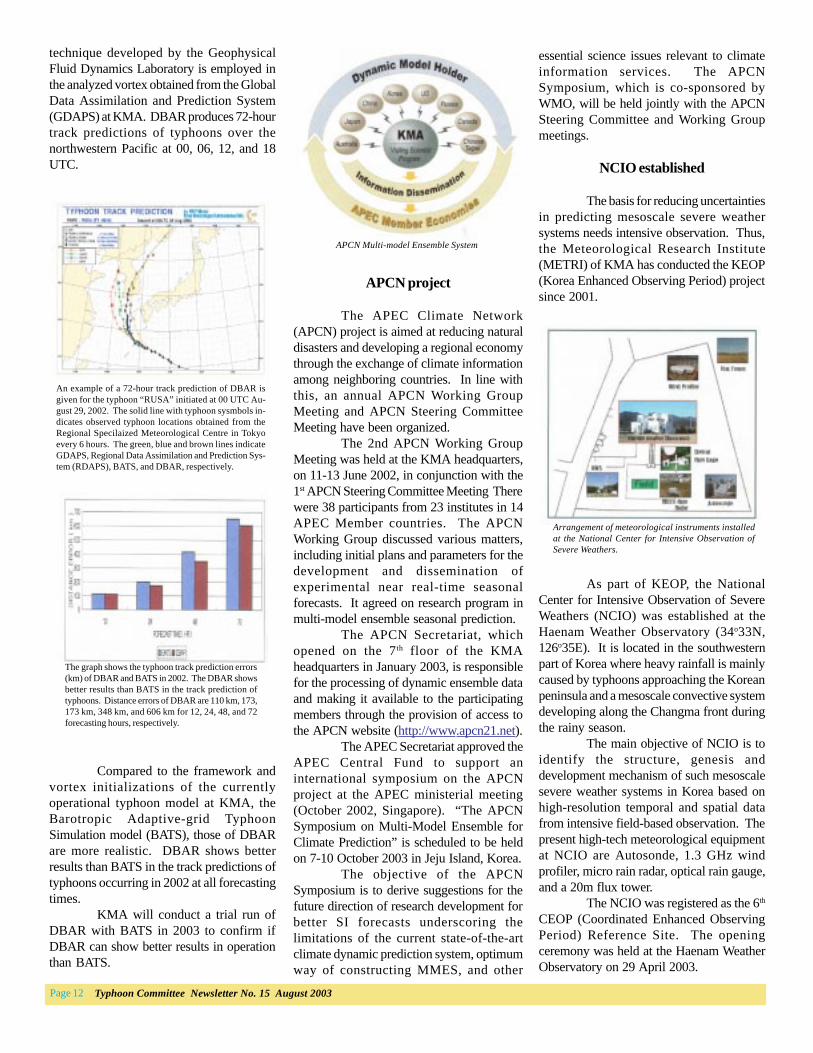
APCN project
The APEC Climate Network(APCN) project is aimed at reducing naturaldisasters and developing a regional economythrough the exchange of climate informationamong neighboring countries. In line withthis, an annual APCN Working GroupMeeting and APCN Steering CommitteeMeeting have been organized.
The 2nd APCN Working GroupMeeting was held at the KMA headquarters,on 11-13 June 2002, in conjunction with the1st APCN Steering Committee Meeting Therewere 38 participants from 23 institutes in 14APEC Member countries. The APCNWorking Group discussed various matters,including initial plans and parameters for thedevelopment and dissemination ofexperimental near real-time seasonalforecasts. It agreed on research program inmulti-model ensemble seasonal prediction.
The APCN Secretariat, whichopened on the 7th floor of the KMAheadquarters in January 2003, is responsiblefor the processing of dynamic ensemble dataand making it available to the participatingmembers through the provision of access tothe APCN website (http://www.apcn21.net).
The APEC Secretariat approved theAPEC Central Fund to support aninternational symposium on the APCNproject at the APEC ministerial meeting(October 2002, Singapore). “The APCNSymposium on Multi-Model Ensemble forClimate Prediction” is scheduled to be heldon 7-10 October 2003 in Jeju Island, Korea.
The objective of the APCNSymposium is to derive suggestions for thefuture direction of research development forbetter SI forecasts underscoring thelimitations of the current state-of-the-artclimate dynamic prediction system, optimumway of constructing MMES, and other
essential science issues relevant to climateinformation services. The APCNSymposium, which is co-sponsored byWMO, will be held jointly with the APCNSteering Committee and Working Groupmeetings.
NCIO established
The basis for reducing uncertaintiesin predicting mesoscale severe weathersystems needs intensive observation. Thus,the Meteorological Research Institute(METRI) of KMA has conducted the KEOP(Korea Enhanced Observing Period) projectsince 2001.
As part of KEOP, the NationalCenter for Intensive Observation of SevereWeathers (NCIO) was established at theHaenam Weather Observatory (34o33N,126o35E). It is located in the southwesternpart of Korea where heavy rainfall is mainlycaused by typhoons approaching the Koreanpeninsula and a mesoscale convective systemdeveloping along the Changma front duringthe rainy season.
The main objective of NCIO is toidentify the structure, genesis anddevelopment mechanism of such mesoscalesevere weather systems in Korea based onhigh-resolution temporal and spatial datafrom intensive field-based observation. Thepresent high-tech meteorological equipmentat NCIO are Autosonde, 1.3 GHz windprofiler, micro rain radar, optical rain gauge,and a 20m flux tower.
The NCIO was registered as the 6th
CEOP (Coordinated Enhanced ObservingPeriod) Reference Site. The openingceremony was held at the Haenam WeatherObservatory on 29 April 2003.
APCN Multi-model Ensemble System
The graph shows the typhoon track prediction errors(km) of DBAR and BATS in 2002. The DBAR showsbetter results than BATS in the track prediction oftyphoons. Distance errors of DBAR are 110 km, 173,173 km, 348 km, and 606 km for 12, 24, 48, and 72forecasting hours, respectively.

Page 13Typhoon Committee Newsletter No. 15 August 2003
Meeting of TC’s IWG onRCPIP slated
A meeting of the TyphoonCommittee’s Interim Working Group(IWG) on the Regional CooperationProgramme Implementation Plan (RCPIP)will be held on 16-18 September 2003 inTokyo, Japan at the very kind invitation ofthe Japanese Government and the JapanMeteorological Agency (JMA). The coremembers of the IWG on RCPIP are: JimWeyman (USA), Chairperson; TianCuiying (China), Focal Point forMeteorology; Junji Miwa (Japan),Chairperson, Working Group onHydrology; Surapol Pongtadsirikul(Thailand), Focal Point for DPP; JeanGalang (Philippines), Focal Point forTraining; Woo-Jin Lee (Republic of Korea),Chairperson, TRCG; and NobutakaMannoji (Japan), Director, RSMC Tokyo.
The Typhoon Committee’s Thirty-fifth Session Report (Appendix XVIII),provided the Terms of Reference of IWGon the RCPIP. As part of these Terms ofReference, the TC asked the IWG to deliverthe following items at the thirty-sixthsession:
♦ A document on options andproposals on changes to the
Roving seminar, workshop moved
The roving seminar oninterpretation of typhoon forecasts andanalysis, originally set in Seoul in May, hasbeen rescheduled on 20-21 October 2003,the organizing local committee announced.
Woo-Jin Lee, chairman of theTyphoon Research Coordination Group(TRCG), said the decision was prompted bythe outbreak of the Severe Acute RespiratorySyndrome (SARS) in Asia which severelyaffected two of the participating members,namely, China and Hong Kong.
The Seoul roving seminar, whichis intended to strengthen the exchange ofknowledge and expertise on typhoonforecasting centered on the utilization oftyphoon information from RSMC Tokyo, isone of three roving seminars lined up underthe visiting lecturer program of TRCG.
Installation of AWS for weathermonitoring of mountainous areas
In 2002, the KMA designed eightnew AWSs employing new wind sensors,solar electric power systems, and satellitetelecommunications for monitoring extreme
U S A
Meteorological instruments installed at the National Center for Intensive Observation of Severe Weathers.
environments such as high-altitudemountainous areas.
In general, KMA AWSs can detecttemperature, wind speed, wind direction,precipitation, and precipitation detection in10-minute intervals. KMA has introducedultrasonic wind sensors from the VaisalaWAS425 in eight sites. It has no movingparts (e.g. cup and vane) and is resistant tocontamination and corrosion.
In addition, the AWSs can eliminateon-demand and periodic maintenancerequirements while improving the accuracyand reliability of data in almost all windconditions and in all climates. The systemwill be applied to the real-time unmannedweather monitoring system in the future.
In a related development, the SecondWorkshop on South China Sea Storm Surge,Wave, and Ocean Circulation Forecasting,organized by TCP and JCOMM (Joint WMO/IOC Technical Commission forOceanography and Marine Meteorology, alsofell victim to the SARS scare as it was movedfrom 7-11 July to 15-19 September 2003 inKuantan, Malaysia.
The workshop aims to familiarizeparticipants with the Production Line (PL) ofoperational forecasting. The PL is a chain ofelements coming from field observation, viadata collection, acquisition of forcing fieldsand initial/boundary conditions, numericalmodel forecasting, forecast validation andfinal dissemination to users. It is designed tohold a hands-on exercise of numericalforecasting using a set of different cycloneforcing field and a set of wave/storm surgeforecasting models.

Page 14 Typhoon Committee Newsletter No. 15 August 2003
First phase of meteorologisttraining for Pacific Region
Weather Service Offices nearscompletion
The National Weather Service(NWS) Pacific Region program which aimsto educate and train meteorologists for theWeather Service Offices (WSO) in theRepublic of Palau, Federated States ofMicronesia and the Republic of theMarshall Islands (RMI) is reaching amilestone. Currently, there areMeteorologists-in-Charge (MIC) at theWSOs at Palau, Yap, Chuuk and Pohnpei.
Reginald White, who completedhis meteorology degree at the Universityof Hawaii, arrived at NWSFO (WFO)Guam. After successfully completing sixmonths of intern training in Guam, he willreturn to Majuro in the RMI for on-the-jobtraining before becoming their first MIC.At that time, the five Micronesian WSOswill all have MICs.
Meteorology Courses
Tom Yoshida, a former MIC forthe Guam office, conducted a BasicMeteorology Course and RefresherTropical Meteorology courses at the WFOGuam in April. Personnel from WSOKoror, Chuuk, Yap, Pohnpei and Majuroattended.
Tropical cyclone preparednessworkshops
The Warning CoordinationMeteorology from the WFO Guam heldtropical cyclone preparedness workshopsfor the Micronesian WSOs, localEmergency Managers, and othergovernment agencies at Chuuk, Pohnpeiand Kosrae, Federated States ofMicronesia, Majuro, Republic of theMarshall Islands, and Saipan and Tinianin the Commonwealth of the NorthernMariana Islands.
These workshops aim to provideattendees with an overview of the WFOGuam tropical cyclone program and thebasics of tropical cyclones, whileaddressing the issues of closercoordination, changes in tropical cyclonesupport and new products.
methodology and implementationof new technologies which maylead to efficiencies of the TyphoonCommittee, Typhoon CommitteeSecretariat (TCS) and TCSCoordinator.
♦ A document on overall options forthe framework of priorities foractivities the TC.
♦ A document on options forreporting formats for the fivecomponents of the RCPIP for theTC together with the mechanismsaimed at improving theimplementation of the RCPIP.
♦ A document on options forcollaborative activities among thefive components of the RCPIP andpriority options.
♦ A document, which describes theactions taken by the InterimWorking Group on the RCPIP toassist in mobilizing resources toachieve the goals and objectives,as determined by the TC at itsthirty-fifth session.
RSMC Honolulu expects below average Central Pacific
hurricane season
In May 2003, hurricane expertsfrom RSMC Honolulu, USA NationalWeather Service (NWS), forecasted belownormal hurricane activity within theCentral Pacific during the 2003 hurricaneseason.
James Weyman, director of RSMCHonolulu, said the 2002 moderate El Ninoepisode was nearly dissipated. The outlookfrom USA NWS’s Climate PredictionCenter indicated a cold event (La Nina)was much more likely to occur in seasurface temperatures in the tropical areasof the Pacific Oean by summer. This alongwit several other factors contributed to theforecast of below averge number of trpicalcyclones to affect the Central Pacific.
RSMC Honolulu also announcedthat they would provide a 96-hour and a120-hour tropical cyclone position andintensity forecast as part of their routineforecasts/advisories for the 2003 season.This was done in response to customers’requirements and the increase in hurricaneforecasting accuracy in the last 10 years.
Hurricane pr eparedness in Hawaii
The RSMC Honolulu personnelconducted extensive hurricanepreparedness activities in Hawaii prior tothe start of the Central Pacific hurricaneseason which extends from June 1 toNovember 30.
♦May 9-16, 2003, RSMC Honoluluand the State of Hawaii CivilDefense Agency (disaster preparedness/emergency management agency) heldtheir annual Makani Pahili (Hawaiianfor “strong wind”) statewide hurricaneexercise. All county civil defenseagencies, state departments, and USDepartment of Defense service branchesparticipated in this realistic exercise.♦ In the exercise scenario, a hurricanesouth of the Hawaiian Islands recurvesand strikes Maui County causingextensive damage. The various agenciesexercise the wide range of decisionsrequired during this type of disaster, suchas evacuation, closing schools andgovernment offices, pre-positioningequipment and supplies, and the manydecisions required after the disaster hasoccurred.♦ On May 19-23, 2003, RSMCHonolulu held a press conference to kickoff the USA and State of Hawaii NationalHurricane Awareness Week. Personnelfrom the American Red Cross, HawaiiState Civil Defense, and Oahu CivilDefense participated as partners in thepress conference.♦ The press conference was givenextensive local television, radio, andnewspaper coverage. Given the belowaverage forecast for the upcomingcentral Pacific, RSMC Honolulu madethe theme of the press conference, “ItOnly Takes One - Are You Prepared?”to emphasize that it could be a belowaverage year but if one hurricane hitsthe Hawaiian Islands, the results couldbe devastating.♦ During the end of May and thebeginning of June 2003, RSMCHonolulu personnel provided briefingson hurricane preparedness andawareness to all four counties in Hawaii.These were hosted by the county CivilDefense Administrators and attended byrepresentatives of the various county,state, and federal agencies in the county.
S A

Page 15Typhoon Committee Newsletter No. 15 August 2003