erdas apollo v2013 - intergraph · erdas apollo v2013 – top news new harmonized administration...
TRANSCRIPT

SMARTERDECISIONS
What’s New ….ERDAS APOLLO v2013
1
ERDAS APOLLO v2013
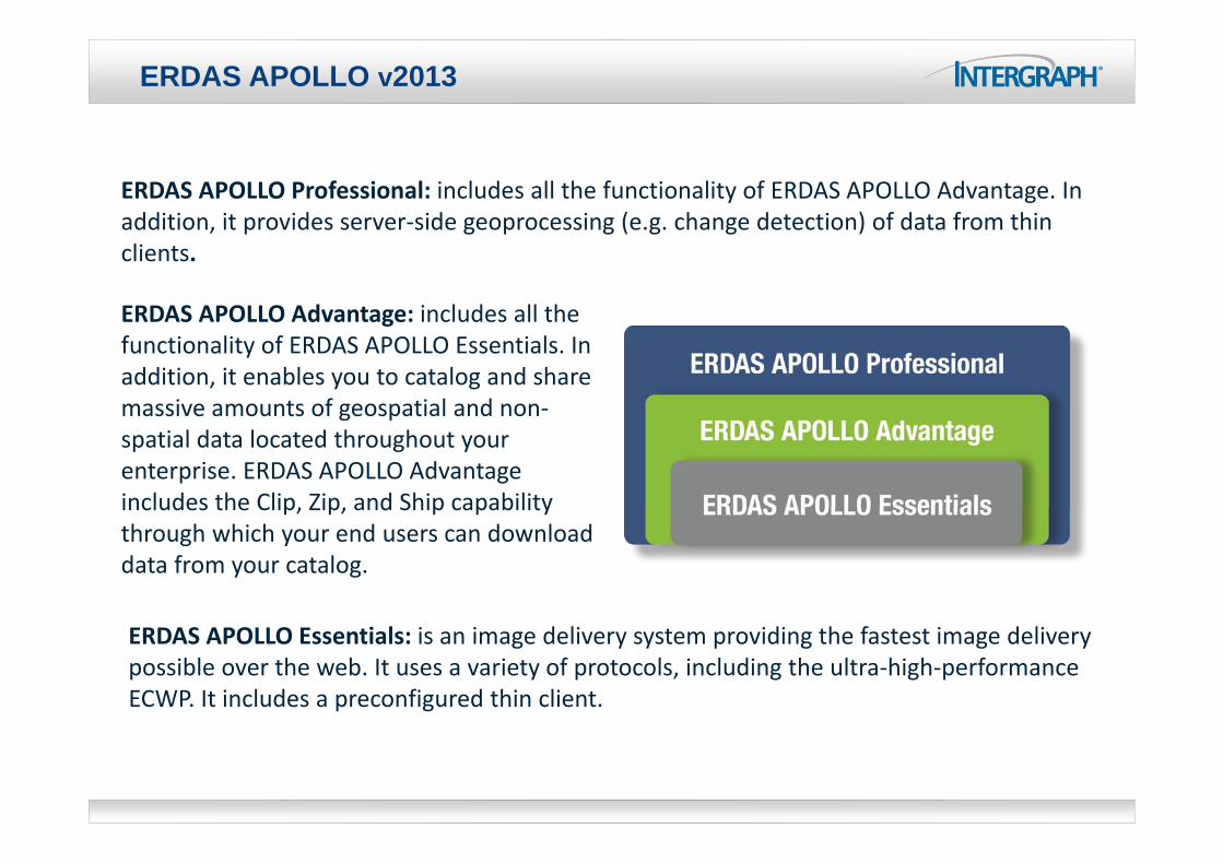
ERDAS APOLLO Essentials: is an image delivery system providing the fastest image delivery possible over the web. It uses a variety of protocols, including the ultra‐high‐performance ECWP. It includes a preconfigured thin client.
ERDAS APOLLO Advantage: includes all the functionality of ERDAS APOLLO Essentials. In addition, it enables you to catalog and share massive amounts of geospatial and non‐spatial data located throughout your enterprise. ERDAS APOLLO Advantage includes the Clip, Zip, and Ship capability through which your end users can download data from your catalog.
ERDAS APOLLO Professional: includes all the functionality of ERDAS APOLLO Advantage. In addition, it provides server‐side geoprocessing (e.g. change detection) of data from thin clients.

ERDAS APOLLO v2013 – Top News
New harmonized Administration Console:A new web‐based administration console enables you to create and configure all aspects of server‐side engines, web services and web applications in one place.
New and harmonized Web Client (Geospatial Portal):Geospatial Portal can now be used to view data and services, browse and search the catalog, download and clip datasets and create value‐added data products on‐demand.
Automatically Catalog Incoming Data:ERDAS APOLLO enables you to set up “listeners” on directories to automatically catalog incoming data of interest.
Virtual Mosaicking:You can now group datasets together, limit by scale, and portray potentially thousands of datasets as a single virtual mosaic layer.
Clip, Zip and Ship LAS‐Formatted Point Clouds:Clip, Zip and Ship for LAS‐formatted point cloud data (in whole or just a subset) using the out‐of‐the‐box web client.
OpenStreetMap in the Data Manager:OpenStreetMap is provided in the ERDAS APOLLO Data Manager, making it easier to see the global context of data and verify that it is correctly georeferenced.

APOLLO Essentials – Virtual mosaic
Group datasets together, limit by scale, and portray potentially thousands of datasets as a single virtual mosaic layer
Configure via the admin console
http://demo.erdas.com.au/virtualmosaic/

© 2012 Intergraph Corporation 5
APOLLO Essentials - Updated ECWP protocol
• Faster delivery, simpler deployment• ECWP has been completely redesigned in line with modern web
architecture developments.• ECWP v3 highlighted new features:
Now completely stateless. This makes complex clustered solutions deployed behind firewall and security systems a lot simpler to install
Uses HTTP pipelining to display data at faster speeds than ever before as data is downloaded in parallel streams, making better use of networking infrastructure
No longer has any concept of “polling mode” Is supported by any application that implements the ECW / JP2 SDK v5 Over connections with high latency, low bandwidth conditions, drawing
performance can be as much as 3x faster When serving the new v3 ECW file format, 10-20% less data needs to be
transferred for no quality loss
© 2012 Intergraph Corporation 6
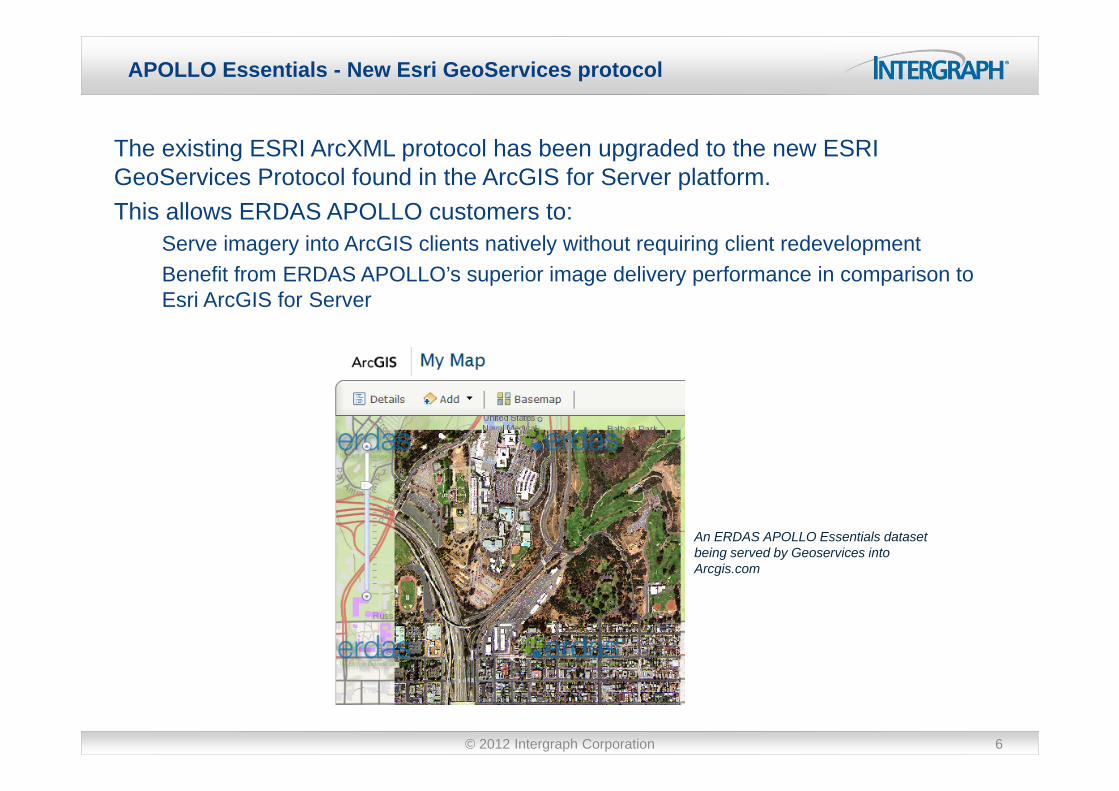
APOLLO Essentials - New Esri GeoServices protocol
The existing ESRI ArcXML protocol has been upgraded to the new ESRI GeoServices Protocol found in the ArcGIS for Server platform. This allows ERDAS APOLLO customers to:
Serve imagery into ArcGIS clients natively without requiring client redevelopment Benefit from ERDAS APOLLO’s superior image delivery performance in comparison to Esri ArcGIS for Server
An ERDAS APOLLO Essentials dataset being served by Geoservices into Arcgis.com

APOLLO Advantage – OpenStreetMap in Data Manager
OpenStreetMap is provided in the ERDAS APOLLO Data Manager, making it easier to see the global context of data and verify that it is correctly georeferenced

© 2012 Intergraph Corporation 8
APOLLO Advantage – L0&L1 data support
ERDAS APOLLO now supports cataloging and on-the-fly orientation to map for Leica ADS sensor L0 and L1 imagery in Socet Set .sup file format.
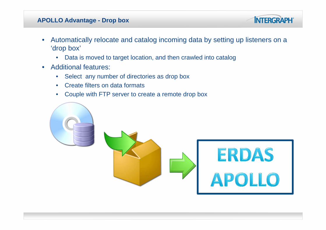
APOLLO Advantage - Drop box
• Automatically relocate and catalog incoming data by setting up listeners on a ‘drop box’
• Data is moved to target location, and then crawled into catalog• Additional features:
• Select any number of directories as drop box• Create filters on data formats• Couple with FTP server to create a remote drop box

APOLLO Advantage - Catalog hierarchy management
Reorganize the catalog hierarchy (i.e re-parenting of aggregates)Drag and drop

© 2012 Intergraph Corporation 11
APOLLO Professional – CZS LAS
Clip, Zip and Ship subsets of LAS-formatted point cloud data• Select clip area• Select classifications• Filter by return value
Client-side functionality in Geospatial Portal

12
Comprehensive Raster Delivery Options
OGC Web Map Service (WMS)
OGC Web Coverage Service (WCS)
OGC Web Map Tiling (WMTS 1.0)
ECWP Streaming – ECW + JPEG200
JPIP Streaming – JPEG2000
Optimized Tile Delivery Format (OTDF)
Algorithms – Dynamic On-the-fly Visualization

13
Web Map Tiling Service – Standards-based Tiling
OGC WMTS 1.0 Support
•Serve static image tiles•Publish OTDF, ECW, IMG and many other formats•Fast delivery•Standard interface•No plug-in required
Benefit: Simple, scalable and performantimage delivery via standard delivery interface

14
Positioning in existing ESRI- based Environment
Geo‐Database
ArcGIS Server
Clients
ERDAS APOLLO
Raster Images
Other OGC-compliant clientsOther OGC-compliant clients
FilesFiles OracleOraclePostGISPostGIS
Other OGC Web Services
Files OraclePostGIS
Other OGC Web Services
WMSWMS
ECWPECWP

Questions?
SMARTERDECISIONS4/30/2013 15
SMARTERDECISIONS
Thanks