environmental assessment for the proposed issuance · pdf file ·...
TRANSCRIPT

DOE/EA-1409
Environmental Assessment for theProposed Issuance of an Easement toPublic Service Company of New Mexicofor the Construction and Operation of a12-inch Natural Gas Pipeline withinLos Alamos National Laboratory,Los Alamos, New Mexico
July 24, 2002
Department of EnergyNational Nuclear Security AdministrationOffice of Los Alamos Site Operations
Proposed Pipeline Easement Environmental Assessment
DOE OLASO July 24, 2002iii
CONTENTS
ACRONYMS AND TERMS................................................................................................................vii
EXECUTIVE SUMMARY................................................................................................................... ix
1.0 PURPOSE AND NEED................................................................................................................11.1 Introduction ...................................................................................................................................11.2 Background....................................................................................................................................31.3 Statement of Purpose and Need for Agency Action.........................................................................51.4 Scope of This EA ...........................................................................................................................61.5 Public Involvement ........................................................................................................................6
2.0 DESCRIPTION OF PROPOSED ACTION AND ALTERNATIVES .......................................62.1 Proposed Action.............................................................................................................................6
2.1.1 Construction ......................................................................................................................82.1.2 Operation and Maintenance of New Pipeline.................................................................... 12
2.2 No Action Alternative .................................................................................................................. 132.3 Alternatives Considered but Dismissed from Further Consideration.............................................. 13
2.3.1 Replace Existing Pipeline Under SR 502.......................................................................... 132.3.2 Install Pipeline in Pueblo Canyon..................................................................................... 142.3.3 Install Pipeline Under Existing Gravel Roadway in Los Alamos Canyon.......................... 142.3.4 Install Pipeline in Sandia Canyon..................................................................................... 14
2.4 Related Actions ............................................................................................................................ 142.4.1 Site-Wide Environmental Impact Statement ..................................................................... 142.4.2 Land Conveyance and Transfer ........................................................................................ 15
3.0 AFFECTED ENVIRONMENT AND ENVIRONMENTAL CONSEQUENCES.................... 153.1 Regional Setting........................................................................................................................... 153.2 Potential Environmental Issues and Effects Discussions ............................................................... 16
3.2.1 Land Use ......................................................................................................................... 173.2.1.1 Affected Environment ...................................................................................... 173.2.1.2 Proposed Action............................................................................................... 173.2.1.3 No Action Alternative ...................................................................................... 17
3.2.2 Geologic Setting .............................................................................................................. 173.2.2.1 Affected Environment ...................................................................................... 173.2.2.2 Proposed Action............................................................................................... 193.2.2.3 No Action Alternative ...................................................................................... 19
3.2.3 Water Resources .............................................................................................................. 193.2.3.1 Affected Environment ...................................................................................... 193.2.3.2 Proposed Action............................................................................................... 223.2.3.3 No Action Alternative ...................................................................................... 23
3.2.4 Floodplains/Wetlands ...................................................................................................... 233.2.4.1 Affected Environment ...................................................................................... 233.2.4.2 Proposed Action............................................................................................... 233.2.4.3 No Action Alternative ...................................................................................... 24
3.2.5 Biological Resources ....................................................................................................... 243.2.5.1 Affected Environment ...................................................................................... 243.2.5.2 Proposed Action............................................................................................... 253.2.5.3 No Action Alternative ...................................................................................... 26
3.2.6 Air Quality ...................................................................................................................... 263.2.6.1 Affected Environment ...................................................................................... 263.2.6.2 Proposed Action............................................................................................... 27
Proposed Pipeline Easement Environmental Assessment
DOE OLASO July 24, 2002iv
3.2.6.3 No Action Alternative ...................................................................................... 273.2.7 Visual Resources ............................................................................................................. 27
3.2.7.1 Affected Environment ...................................................................................... 273.2.7.2 Proposed Action............................................................................................... 273.2.7.3 No Action Alternative ...................................................................................... 28
3.2.8 Cultural Resources........................................................................................................... 283.2.8.1 Affected Environment ...................................................................................... 283.2.8.2 Proposed Action............................................................................................... 283.2.8.3 No Action Alternative ...................................................................................... 29
3.2.9 Utilities and Infrastructure ............................................................................................... 293.2.9.1 Affected Environment ...................................................................................... 293.2.9.2 Proposed Action............................................................................................... 293.2.9.3 No Action Alternative ...................................................................................... 30
3.2.10 Noise............................................................................................................................... 303.2.10.1 Affected Environment ...................................................................................... 303.2.10.2 Proposed Action............................................................................................... 313.2.10.3 No Action Alternative ...................................................................................... 31
3.2.11 Human Health ................................................................................................................. 323.2.11.1 Affected Environment ...................................................................................... 323.2.11.2 Proposed Action............................................................................................... 333.2.11.3 No Action Alternative ...................................................................................... 33
3.2.12 Waste Management/Environmental Restoration ............................................................... 343.2.12.1 Affected Environment ...................................................................................... 343.2.12.2 Proposed Action............................................................................................... 343.2.12.3 No Action Alternative ...................................................................................... 353.2.12.4 Environmental Restoration ............................................................................... 35
3.2.13 Transportation and Traffic ............................................................................................... 353.2.13.1 Affected Environment ...................................................................................... 353.2.13.2 Proposed Action............................................................................................... 353.2.13.3 No Action Alternative ...................................................................................... 36
4.0 ACCIDENT ANALYSIS............................................................................................................ 36
5.0 CUMULATIVE EFFECTS........................................................................................................ 375.1 Activities in the Vicinity of the Proposed Gas Pipeline Easement ................................................. 37
5.1.1 Conveyance and Transfer................................................................................................. 375.1.2 Advanced Hydrotest Facility............................................................................................ 375.1.3 Omega West Demolition.................................................................................................. 385.1.4 Post Cerro Grande Fire Cleanup....................................................................................... 385.1.5 TA-21 PRS Cleanup ........................................................................................................ 38
6.0 AGENCIES CONSULTED........................................................................................................ 39
REFERENCES .................................................................................................................................... 41
APPENDIX: A FLOODPLAINS AND WETLANDS ASSESSMENT FOR THE POTENTIALEFFECTS OF THE LOS ALAMOS CANYON GAS LINE....................................... 45
FiguresFigure 1. Location of Los Alamos National Laboratory...........................................................................2Figure 2. Proposed location of new 12-in. (30-cm) gas line in Los Alamos Canyon. ................................7Figure 3. Existing aboveground 12-in. (30-cm) PNM gas mainline valve in Los Alamos Canyon. ...........8
Proposed Pipeline Easement Environmental Assessment
DOE OLASO July 24, 2002v
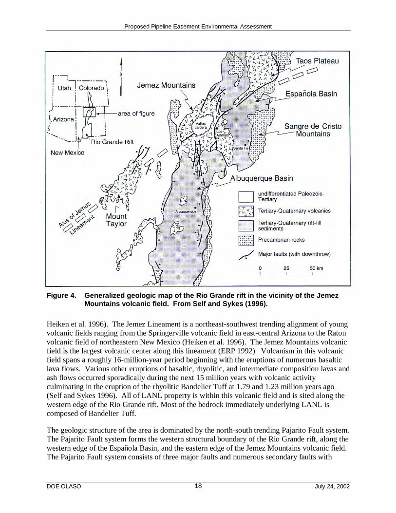
Figure 4. Generalized geologic map of the Rio Grande rift in the vicinity of the Jemez Mountainsvolcanic field ......................................................................................................................... 18
Figure 5. Stratigraphy of the Bandelier Tuff.......................................................................................... 20
TablesTable 1. Equipment to be Used to Construct and Test Natural Gas Pipeline in Los Alamos Canyon ..... 10Table 2. Potential Environmental Issues............................................................................................... 15Table 3. Environmental Issues Dismissed ............................................................................................16

Proposed Pipeline Easement Environmental Assessment
DOE OLASO July 24, 2002vi
This Page Intentionally Left Blank
Proposed Pipeline Easement Environmental Assessment
DOE OLASO July 24, 2002vii
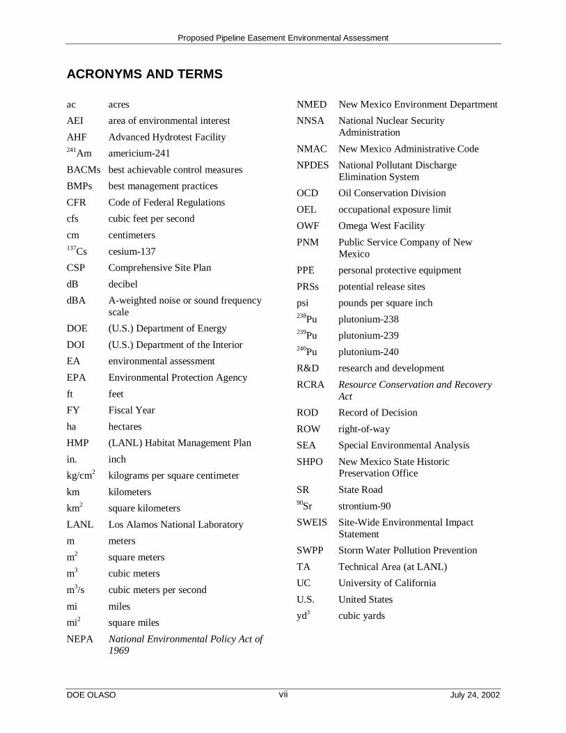
ACRONYMS AND TERMS
ac acres
AEI area of environmental interest
AHF Advanced Hydrotest Facility241Am americium-241
BACMs best achievable control measures
BMPs best management practices
CFR Code of Federal Regulations
cfs cubic feet per second
cm centimeters137Cs cesium-137
CSP Comprehensive Site Plan
dB decibel
dBA A-weighted noise or sound frequencyscale
DOE (U.S.) Department of Energy
DOI (U.S.) Department of the Interior
EA environmental assessment
EPA Environmental Protection Agency
ft feet
FY Fiscal Year
ha hectares
HMP (LANL) Habitat Management Plan
in. inch
kg/cm2 kilograms per square centimeter
km kilometers
km2 square kilometers
LANL Los Alamos National Laboratory
m meters
m2 square meters
m3 cubic meters
m3/s cubic meters per second
mi miles
mi2 square miles
NEPA National Environmental Policy Act of1969
NMED New Mexico Environment Department
NNSA National Nuclear SecurityAdministration
NMAC New Mexico Administrative Code
NPDES National Pollutant DischargeElimination System
OCD Oil Conservation Division
OEL occupational exposure limit
OWF Omega West Facility
PNM Public Service Company of NewMexico
PPE personal protective equipment
PRSs potential release sites
psi pounds per square inch238Pu plutonium-238239Pu plutonium-239240Pu plutonium-240
R&D research and development
RCRA Resource Conservation and RecoveryAct
ROD Record of Decision
ROW right-of-way
SEA Special Environmental Analysis
SHPO New Mexico State HistoricPreservation Office
SR State Road90Sr strontium-90
SWEIS Site-Wide Environmental ImpactStatement
SWPP Storm Water Pollution Prevention
TA Technical Area (at LANL)
UC University of California
U.S. United States
yd3 cubic yards
Proposed Pipeline Easement Environmental Assessment
DOE OLASO July 24, 2002viii
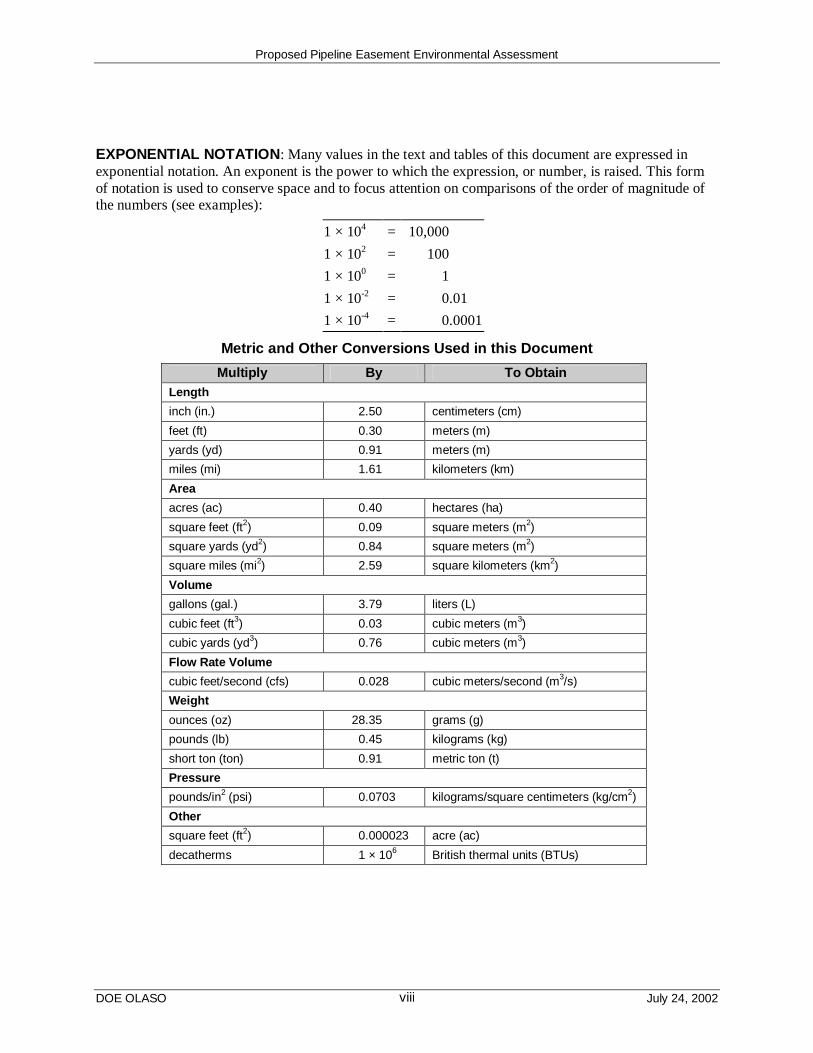
EXPONENTIAL NOTATION: Many values in the text and tables of this document are expressed inexponential notation. An exponent is the power to which the expression, or number, is raised. This formof notation is used to conserve space and to focus attention on comparisons of the order of magnitude ofthe numbers (see examples):
1 × 104 = 10,000
1 × 102 = 100
1 × 100 = 1
1 × 10-2 = 0.01
1 × 10-4 = 0.0001
Metric and Other Conversions Used in this Document
Multiply By To ObtainLength
inch (in.) 2.50 centimeters (cm)
feet (ft) 0.30 meters (m)
yards (yd) 0.91 meters (m)
miles (mi) 1.61 kilometers (km)
Area
acres (ac) 0.40 hectares (ha)
square feet (ft2) 0.09 square meters (m2)
square yards (yd2) 0.84 square meters (m2)
square miles (mi2) 2.59 square kilometers (km2)
Volume
gallons (gal.) 3.79 liters (L)
cubic feet (ft3) 0.03 cubic meters (m3)
cubic yards (yd3) 0.76 cubic meters (m3)
Flow Rate Volume
cubic feet/second (cfs) 0.028 cubic meters/second (m3/s)
Weight
ounces (oz) 28.35 grams (g)
pounds (lb) 0.45 kilograms (kg)
short ton (ton) 0.91 metric ton (t)
Pressure
pounds/in2 (psi) 0.0703 kilograms/square centimeters (kg/cm2)
Other
square feet (ft2) 0.000023 acre (ac)
decatherms 1 × 10⁶ British thermal units (BTUs)

Proposed Pipeline Easement Environmental Assessment
DOE OLASO July 24, 2002ix
EXECUTIVE SUMMARY
The National Nuclear Security Administration (NNSA)1 has assigned a continuing role to LosAlamos National Laboratory (LANL) in carrying out NNSA’s national security mission. Toenable LANL to continue this enduring responsibility requires that NNSA maintain thecapabilities and capacities required in support of its national mission assignments at LANL. Tocarry out its Congressionally assigned mission requirements, NNSA must maintain a safe andreliable infrastructure at LANL. Upgrades to the various utility services at LANL have beenongoing together with routine maintenance activities over the years. However, the replacementof a certain portion of natural gas service transmission pipeline is now necessary as this deliverysystem element has been operating well beyond its original design life for the past 20 to 30 yearsand components of the line are suffering from normal stresses, strains, and general failures.
The Proposed Action is to grant an easement to the Public Service Company of New Mexico(PNM) to construct, operate, and maintain approximately 15,000 feet (4,500 meters) of 12-inch(in.) (30-centimeter [cm]) coated steel natural gas transmission mainline on NNSA-administeredland within LANL along Los Alamos Canyon. The new gas line would begin at the existingvalve setting located at the bottom of Los Alamos Canyon near the Los Alamos County waterwell pump house and adjacent to the existing 12-in. (30-cm) PNM gas transmission mainline.The new gas line (owned by PNM) would then cross the streambed and continue east in a neweasement obtained by PNM from the NNSA, paralleling the existing electrical power line alongthe bottom of the canyon. The gas line would then turn northeast near State Road (SR) 4 and beconnected to the existing 12-in. (30-cm) coated steel gas transmission mainline, located withinthe right-of-way (ROW) of SR 502.
The Proposed Action would also involve crossing a streambed twice. PNM would bore underthe streambed for pipe installation. PNM would also construct and maintain a service road alongthe pipeline easement. In addition, when construction is complete, the easement would bereseeded. Portions of the Proposed Action are located within potential roosting and nestinghabitat for the Mexican spotted owl (Strix occidentalis lucida), a Federally protected threatenedspecies. Surveys over the last seven years have identified no owls within this area. TheProposed Action would be conducted according to the provisions of the LANL Threatened andEndangered Species Habitat Management Plan. Effects would not be adverse to eitherindividuals or potential critical habitat for protected species. Cultural resources within thevicinity of the proposed easement would be avoided with the exception of an historic trail.However, the original trail has been affected by previous activities and no longer has sufficienthistorical value to be eligible for listing on the National Register of Historic Places. Minimalundisturbed areas would be involved in the Proposed Action. Most of the proposed easementfollows an established ROW for the existing electrical power line. There are several potentiallycontaminated areas within Los Alamos Canyon; however, these areas would be avoided, wherepossible, or, if avoidance isn’t possible or practicable under the Proposed Action, thecontaminated areas would be sampled and remediated in accordance with New MexicoEnvironment Department requirements before construction.
1 The NNSA is a separately organized agency within the Department of Energy (DOE) established by the 1999National Nuclear Security Administration Act [Title 32 of the Defense Authorization Act for Fiscal Year 2000(Public Law 106-65)].
Proposed Pipeline Easement Environmental Assessment
DOE OLASO July 24, 2002x
Construction wastes would be trucked to a licensed commercial landfill or, in the case ofexcavated soils, could be reused for backfilling. Vegetation removed from the easement wouldbe chipped and placed on site in such a way that it would not re-enter the floodplain.Construction activities for the proposed gas pipeline would be expected to produce onlytemporary and localized air emissions. Once construction is complete, operational emissionswould return to background levels. Construction, operation, and maintenance of the new gaspipeline under the Proposed Action would have no effects on utilities and infrastructure, landuse, transportation and traffic, and would have no adverse health effects on LANL employees orconstruction workers. There would be slight temporary effects to wetlands and floodplains.
Effects, if any, on the local geology as a result of the Proposed Action are expected to be minorand would consist of possible slope instability and increased erosion and sediment load. TheProposed Action may have slight short-term effects on water quality. Water used for leak testingthe pipeline would be analyzed and found to be free of contaminants before being released on theeasement. Best Management practices derived from the Storm Water Pollution Prevention Planwould be implemented to prevent erosion and to prevent fill material from entering the streamchannel. Effects on visual resources would be minor and temporary. The Proposed action wouldresult in limited short-term noise levels. Following completion of construction activities, thenoise levels would return to preconstruction levels. LANL waste management would be slightlyaffected by the Proposed Action. PNM or their subcontractors would be responsible for sitewaste removal and disposition. LANL would accept only radioactive waste, if any.
Cumulative effects of the Proposed Action on LANL and surrounding lands, along with past,present, and reasonably foreseeable actions, are anticipated to be negligible. Portions of theeasement that are located within tracts of land designated for Conveyance and Transfer wouldeither be used for cultural preservation were they to be transferred to San Ildefonso Pueblo; orkept as natural areas or used for transportation and utility improvements were they to betransferred to Los Alamos County. The feasibility and definition of an Advanced HydrotestFacility is still insufficiently determined for NNSA DOE to propose such a facility. Hence therewould not be any cumulative effects. Likewise, no cumulative effects are expected from thedemolition and disposition of the Omega West Facility located approximately 2 miles (3kilometers) upstream from the Proposed Action. Post Cerro Grande Fire and Technical Area 21cleanup activities are expected to have long-term beneficial effects by reducing the likelihood ofcontaminant transport downstream. No increases in LANL operations are anticipated as a resultof this action.
The No Action Alternative was also considered. Under this alternative PNM would not begranted an easement and would not construct and operate a new gas pipeline at LANL.

Proposed Pipeline Easement Environmental Assessment
DOE OLASO July 24, 20021
1.0 PURPOSE AND NEED
Chapter 1 presents the Department of Energy (DOE), National Nuclear SecurityAdministration’s (NNSA2) requirements under the National Environmental Policy Act of 1969(NEPA), background information on the proposal, the purpose and need for agency action, and asummary of public involvement activities.
1.1 Introduction
NEPA requires Federal agency officials to consider the environmental consequences of theirproposed actions before decisions are made. In complying with NEPA, NNSA follows theCouncil on Environmental Quality regulations (40 Code of Federal Regulations [CFR] 1500–1508) and DOE’s NEPA implementing procedures (10 CFR 1021). The purpose of anenvironmental assessment (EA) is to provide Federal decision makers with sufficient evidenceand analysis to determine whether to prepare an environmental impact statement or issue aFinding of No Significant Impact.
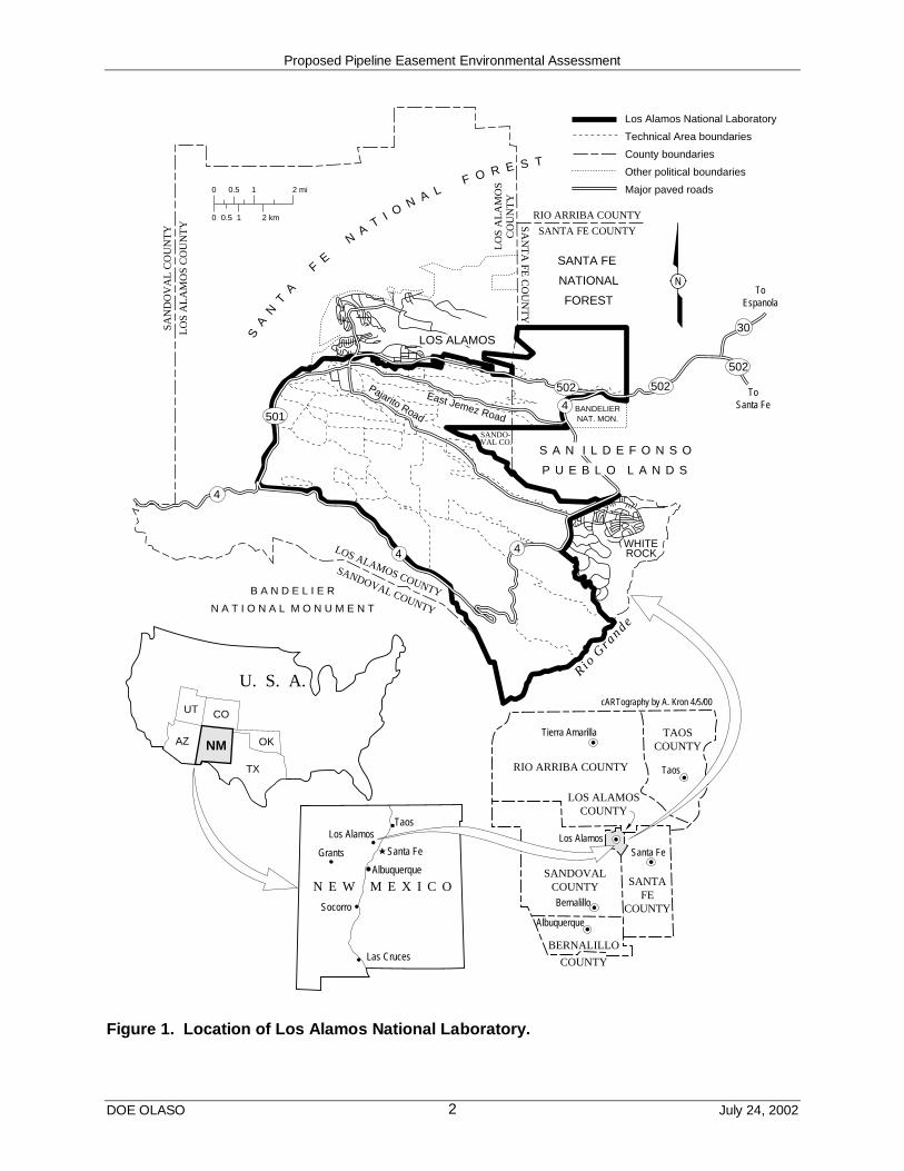
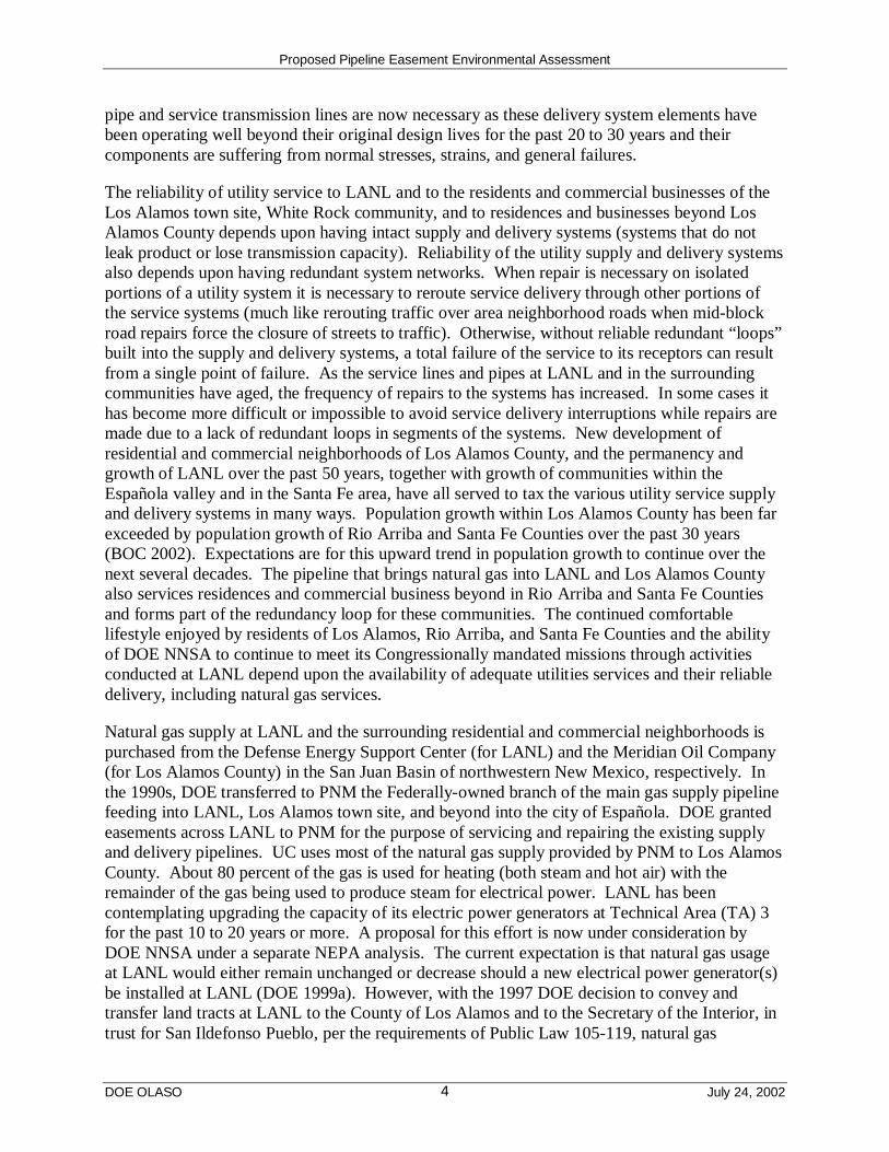
At this time, the NNSA must make a decision regarding the issuance of an easement to thePublic Service Company of New Mexico (PNM) for the purpose of installing, operating, andmaintaining a natural gas service pipeline at Los Alamos National Laboratory (LANL). LANLis a Federal facility located at Los Alamos, New Mexico, that comprises 43 square miles (mi2)(111 km2) of buildings, structures, and forested land (Figure 1). It is administered by NNSA, forthe Federal government, and managed and operated under contract by the University ofCalifornia (UC). This EA has been prepared to assess the potential environmental consequencesof the issuance of this proposed easement for the purpose of installing and operating a newnatural gas pipeline, together with the No Action Alternative.
The objectives of this EA are to (1) describe the underlying purpose and need for DOE action;(2) describe the Proposed Action and identify and describe any reasonable alternatives thatsatisfy the purpose and need for Agency Action; (3) describe baseline environmental conditionsat LANL; (4) analyze the potential indirect, direct, and cumulative effects to the existingenvironment from implementation of the Proposed Action, and (5) compare the effects of theProposed Action with the No Action Alternative and other reasonable alternatives. For thepurposes of compliance with NEPA, reasonable alternatives are identified as being those thatmeet DOE’s purpose and need for action by virtue of timeliness, appropriate technology, andapplicability to LANL. The EA process provides DOE with environmental information that canbe used in developing mitigative actions, if necessary, to minimize or avoid adverse effects to thequality of the human environment and natural ecosystems should DOE decide to proceed withimplementing the construction and operation of a new gas pipeline at LANL.
Ultimately, the goal of NEPA, and this EA, is to aid DOE officials in making decisions based onan understanding of environmental consequences and taking actions that protect, restore, andenhance the environment.
2 The NNSA is a separately organized agency within the DOE established by the 1999 National Nuclear SecurityAdministration Act [Title 32 of the Defense Authorization Act for Fiscal Year 2000 (Public Law 106-65)].
Proposed Pipeline Easement Environmental Assessment
DOE OLASO July 24, 20022
RIO ARRIBA COUNTY
SANTA FE COUNTY
0 0.5 1 2 mi
0 0.5 1 2 km
SAN
TA
FE C
OU
NT
Y
SANDO-VAL CO.
SAN
DO
VA
L C
OU
NT
Y
LO
S A
LA
MO
S C
OU
NT
Y
SANDOVAL COUNTY
WHITE
SANTA FE
NATIONAL
FOREST
SA
NT
A
FE
NA
TI O
N A LF O R E S T
BANDELIERNAT. MON.
S A N I L D E F O N S O
P U E B L O L A N D S
Rio G
rande
★
TaosLos Alamos
Grants
Albuquerque
Socorro
Las Cruces
Santa Fe
N E W M E X I C O
ToEspanola
ToSanta Fe
LO
S A
LA
MO
SC
OU
NT
Y
LOS ALAMOS COUNTY
RIO ARRIBA COUNTY
TAOSCOUNTY
SANDOVALCOUNTY SANTA
FECOUNTY
BERNALILLO
COUNTY
Tierra Amarilla
Taos
Los AlamosSanta Fe
Bernalillo
Albuquerque
LOS ALAMOSCOUNTY
Pajarito Road
East Jemez Road
Los Alamos National Laboratory
Technical Area boundaries
County boundaries
Other political boundaries
Major paved roads
ROCK
NM
COUT
AZ
TX
OK
cARTography by A. Kron 4/5/00
B A N D E L I E R
N A T I O N A L M O N U M E N T
N
4 4
30
4
502
502 502
501
4
U. S. A.
LOS ALAMOS
Figure 1. Location of Los Alamos National Laboratory.
Proposed Pipeline Easement Environmental Assessment
DOE OLASO July 24, 20023
1.2 Background
The United States (U.S.) National Security Policy requires the DOE NNSA to maintain coreintellectual and technical competencies in nuclear weapons and to maintain a safe, and reliable,national nuclear weapons stockpile. NNSA fulfills its national security nuclear weaponsresponsibilities, in part, through activities performed at LANL. LANL is one of three nationalsecurity laboratories that support DOE’s responsibilities for national security, energy resources,environmental quality, and science. The DOE NNSA’s national security mission includes thesafety and reliability of the nuclear weapons in the stockpile; maintenance of the nuclearweapons stockpile in accordance with Executive directives; stemming the international spread ofnuclear weapons materials and technologies; developing technical solutions to reduce the threatof weapons of mass destruction; and production of nuclear propulsion plants for the U.S. Navy.The energy resources mission of DOE includes research and development (R&D) for energyefficiency, renewable energy, fossil energy, and nuclear energy. The DOE’s environmentalquality mission includes treatment, storage, and disposal of DOE wastes; cleanup of nuclearweapons sites; pollution prevention; storage and disposal of civilian radioactive waste; anddevelopment of technologies to reduce risks and reduce cleanup costs. DOE’s science missionincludes fundamental research in physics, materials science, chemistry, nuclear medicine, basicenergy sciences, computational sciences, environmental sciences, and biological sciences, andoften contributes to the other three DOE missions. LANL provides support to each of thesedepartmental missions, with a special focus on national security.
To carry out its Congressionally assigned mission requirements, DOE NNSA must maintain asafe and reliable infrastructure at each of the national security laboratories. The 1999 Final Site-Wide Environmental Impact Statement for Continued Operations of the Los Alamos NationalLaboratory (SWEIS) (DOE 1999a) discusses each of the previously identified DOE missions ingreater detail and analyzes four different levels of operations at LANL that support thesemissions. The SWEIS identified the various technical areas at LANL and their associatedactivities and buildings. The SWEIS also identified the existing circumstances of the natural andhuman-created environment at LANL. Part of the discussion of infrastructure at LANL includesthe following statement (Chapter 3, page 3-58, Section 3.6.2.9): “Natural gas demand is notprojected to change across the [SWEIS] alternatives, and this demand is within the existingsupply of natural gas to the area; however, the age and condition of the existing supply anddistribution system would continue to be a reliability issue for LANL and for residents and otherbusinesses in the area.”
Many of the buildings, structures, and infrastructure at LANL were built in the mid-1900s duringand after World War II. The original installation for the R&D of the world’s first nuclearweapon was established at Los Alamos, New Mexico, in 1943 by the Manhattan District of theU.S. Army Corps of Engineers. At that time it was constructed and equipped as a temporaryshort-term use facility. This installation has evolved over the past nearly 60 years into the LANLfacility of today currently under the administration of the DOE NNSA. LANL was designated asa national security laboratory in 1999 when the NNSA was established by the 1999 NationalNuclear Security Administration Act.
Upgrades to the various utility services at LANL have been ongoing together with routinemaintenance activities over the years. However, the replacement of large portions of various
Proposed Pipeline Easement Environmental Assessment
DOE OLASO July 24, 20024
pipe and service transmission lines are now necessary as these delivery system elements havebeen operating well beyond their original design lives for the past 20 to 30 years and theircomponents are suffering from normal stresses, strains, and general failures.
The reliability of utility service to LANL and to the residents and commercial businesses of theLos Alamos town site, White Rock community, and to residences and businesses beyond LosAlamos County depends upon having intact supply and delivery systems (systems that do notleak product or lose transmission capacity). Reliability of the utility supply and delivery systemsalso depends upon having redundant system networks. When repair is necessary on isolatedportions of a utility system it is necessary to reroute service delivery through other portions ofthe service systems (much like rerouting traffic over area neighborhood roads when mid-blockroad repairs force the closure of streets to traffic). Otherwise, without reliable redundant “loops”built into the supply and delivery systems, a total failure of the service to its receptors can resultfrom a single point of failure. As the service lines and pipes at LANL and in the surroundingcommunities have aged, the frequency of repairs to the systems has increased. In some cases ithas become more difficult or impossible to avoid service delivery interruptions while repairs aremade due to a lack of redundant loops in segments of the systems. New development ofresidential and commercial neighborhoods of Los Alamos County, and the permanency andgrowth of LANL over the past 50 years, together with growth of communities within theEspañola valley and in the Santa Fe area, have all served to tax the various utility service supplyand delivery systems in many ways. Population growth within Los Alamos County has been farexceeded by population growth of Rio Arriba and Santa Fe Counties over the past 30 years(BOC 2002). Expectations are for this upward trend in population growth to continue over thenext several decades. The pipeline that brings natural gas into LANL and Los Alamos Countyalso services residences and commercial business beyond in Rio Arriba and Santa Fe Countiesand forms part of the redundancy loop for these communities. The continued comfortablelifestyle enjoyed by residents of Los Alamos, Rio Arriba, and Santa Fe Counties and the abilityof DOE NNSA to continue to meet its Congressionally mandated missions through activitiesconducted at LANL depend upon the availability of adequate utilities services and their reliabledelivery, including natural gas services.
Natural gas supply at LANL and the surrounding residential and commercial neighborhoods ispurchased from the Defense Energy Support Center (for LANL) and the Meridian Oil Company(for Los Alamos County) in the San Juan Basin of northwestern New Mexico, respectively. Inthe 1990s, DOE transferred to PNM the Federally-owned branch of the main gas supply pipelinefeeding into LANL, Los Alamos town site, and beyond into the city of Española. DOE grantedeasements across LANL to PNM for the purpose of servicing and repairing the existing supplyand delivery pipelines. UC uses most of the natural gas supply provided by PNM to Los AlamosCounty. About 80 percent of the gas is used for heating (both steam and hot air) with theremainder of the gas being used to produce steam for electrical power. LANL has beencontemplating upgrading the capacity of its electric power generators at Technical Area (TA) 3for the past 10 to 20 years or more. A proposal for this effort is now under consideration byDOE NNSA under a separate NEPA analysis. The current expectation is that natural gas usageat LANL would either remain unchanged or decrease should a new electrical power generator(s)be installed at LANL (DOE 1999a). However, with the 1997 DOE decision to convey andtransfer land tracts at LANL to the County of Los Alamos and to the Secretary of the Interior, intrust for San Ildefonso Pueblo, per the requirements of Public Law 105-119, natural gas

Proposed Pipeline Easement Environmental Assessment
DOE OLASO July 24, 20025
consumption of Los Alamos County may increase slightly over the next several decades. Futureincreases in natural gas service requirements by communities within Rio Arriba and Santa FeCounties are also partially dependent upon the service transmission line that brings natural gas toLANL and Los Alamos County.
Several segments of natural gas transmission and delivery pipelines have been upgraded andredundant loops of pipeline have been installed across LANL and across New Mexico in generalover the past two decades. The most recent major upgrades to the natural gas transmission lineto LANL and Los Alamos County, which included the installation of relocated segments ofredundant loops, occurred in the early to mid-1990s. Within that time frame, several additionalsegments of the aged supply pipeline, without redundant portions, were identified acrossnorthern New Mexico. Plans to provide redundant service supply were undertaken by PNM tocorrect this multi-community supply system deficiency.
PNM has identified a certain segment of 8.1-inch (in.) (20.3-centimeter [cm]) pipeline in LosAlamos County and within LANL’s boundaries as being one that is of high carbon content steel.This approximately 3-mile (mi) (5-kilometer [km]) -long pipeline segment located under StateRoad (SR) 502 is of a non-standard size and is constructed of high carbon content pipe which hasa reduced impact strength compared to modern pipes. This existing line segment is a criticalportion of pipeline that forms part of the northern New Mexico redundancy loop to ensurecontinued adequate supply to many communities and businesses in the northern part of the stateand is a limiting factor for increasing the total system’s pressure. The size of the line, 8.1 in.(20.3 cm), and the impact-withstanding properties of its composition, make this pipeline segmenta choke point for service delivery to LANL and to communities in northwestern New Mexico ifrepairs are needed on other, larger diameter portions of the pipeline delivery system and serviceis rerouted through this smaller diameter segment. By virtue of the pipeline’s location beneathSR 502, which is a two-lane road also known locally as the “Main Hill Road,” necessary repairsresult in the need to close the road or restrict traffic to a single lane. Road closure may last for afew hours or several days. In the event of an emergency such as the Cerro Grande Fire (May2000) when the population of Los Alamos town site was evacuated, having SR 502 closed totraffic would greatly hinder emergency evacuation efforts and could also hinder emergencyresponse efforts as well. Several LANL facilities share a mesa-top location with a heavilypopulated portion the Los Alamos town site; SR 502 is the main transportation artery for thetown site and these LANL facilities.
1.3 Statement of Purpose and Need for Agency Action
The DOE NNSA has assigned a continuing role for LANL in carrying out its national securitymission. To enable LANL to continue this enduring responsibility requires that NNSA maintainthe capabilities and capacities required in support of its national mission assignments at LANL.To accomplish its mission support activities, a reliable natural gas service supply system isnecessary. Additionally, NNSA must provide adequate emergency response actions necessary atLANL facilities. NNSA needs to ensure that adequate maintenance is performed and theredundancy of the natural gas supply line is assured so that natural gas delivery to LANL doesnot suffer interruption and that emergency response actions can be conducted at LANL facilitiesin a reasonable fashion.
Proposed Pipeline Easement Environmental Assessment
DOE OLASO July 24, 20026
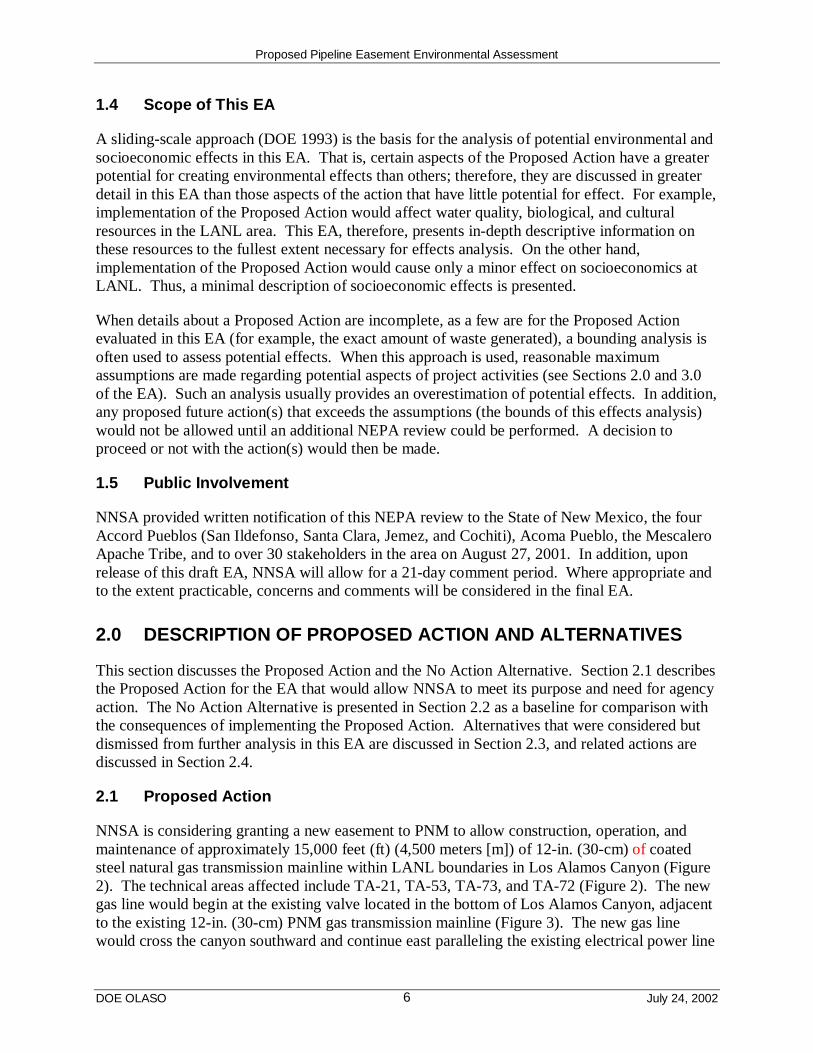
1.4 Scope of This EA
A sliding-scale approach (DOE 1993) is the basis for the analysis of potential environmental andsocioeconomic effects in this EA. That is, certain aspects of the Proposed Action have a greaterpotential for creating environmental effects than others; therefore, they are discussed in greaterdetail in this EA than those aspects of the action that have little potential for effect. For example,implementation of the Proposed Action would affect water quality, biological, and culturalresources in the LANL area. This EA, therefore, presents in-depth descriptive information onthese resources to the fullest extent necessary for effects analysis. On the other hand,implementation of the Proposed Action would cause only a minor effect on socioeconomics atLANL. Thus, a minimal description of socioeconomic effects is presented.
When details about a Proposed Action are incomplete, as a few are for the Proposed Actionevaluated in this EA (for example, the exact amount of waste generated), a bounding analysis isoften used to assess potential effects. When this approach is used, reasonable maximumassumptions are made regarding potential aspects of project activities (see Sections 2.0 and 3.0of the EA). Such an analysis usually provides an overestimation of potential effects. In addition,any proposed future action(s) that exceeds the assumptions (the bounds of this effects analysis)would not be allowed until an additional NEPA review could be performed. A decision toproceed or not with the action(s) would then be made.
1.5 Public Involvement
NNSA provided written notification of this NEPA review to the State of New Mexico, the fourAccord Pueblos (San Ildefonso, Santa Clara, Jemez, and Cochiti), Acoma Pueblo, the MescaleroApache Tribe, and to over 30 stakeholders in the area on August 27, 2001. In addition, uponrelease of this draft EA, NNSA will allow for a 21-day comment period. Where appropriate andto the extent practicable, concerns and comments will be considered in the final EA.
2.0 DESCRIPTION OF PROPOSED ACTION AND ALTERNATIVES
This section discusses the Proposed Action and the No Action Alternative. Section 2.1 describesthe Proposed Action for the EA that would allow NNSA to meet its purpose and need for agencyaction. The No Action Alternative is presented in Section 2.2 as a baseline for comparison withthe consequences of implementing the Proposed Action. Alternatives that were considered butdismissed from further analysis in this EA are discussed in Section 2.3, and related actions arediscussed in Section 2.4.
2.1 Proposed Action
NNSA is considering granting a new easement to PNM to allow construction, operation, andmaintenance of approximately 15,000 feet (ft) (4,500 meters [m]) of 12-in. (30-cm) of coatedsteel natural gas transmission mainline within LANL boundaries in Los Alamos Canyon (Figure2). The technical areas affected include TA-21, TA-53, TA-73, and TA-72 (Figure 2). The newgas line would begin at the existing valve located in the bottom of Los Alamos Canyon, adjacentto the existing 12-in. (30-cm) PNM gas transmission mainline (Figure 3). The new gas linewould cross the canyon southward and continue east paralleling the existing electrical power line

Proposed Pipeline Easement Environmental Assessment
DOE OLASO July 24, 20026
1.4 Scope of This EA
A sliding-scale approach (DOE 1993) is the basis for the analysis of potential environmental andsocioeconomic effects in this EA. That is, certain aspects of the Proposed Action have a greaterpotential for creating environmental effects than others; therefore, they are discussed in greaterdetail in this EA than those aspects of the action that have little potential for effect. For example,implementation of the Proposed Action would affect water quality, biological, and culturalresources in the LANL area. This EA, therefore, presents in-depth descriptive information onthese resources to the fullest extent necessary for effects analysis. On the other hand,implementation of the Proposed Action would cause only a minor effect on socioeconomics atLANL. Thus, a minimal description of socioeconomic effects is presented.
When details about a Proposed Action are incomplete, as a few are for the Proposed Actionevaluated in this EA (for example, the exact amount of waste generated), a bounding analysis isoften used to assess potential effects. When this approach is used, reasonable maximumassumptions are made regarding potential aspects of project activities (see Sections 2.0 and 3.0of the EA). Such an analysis usually provides an overestimation of potential effects. In addition,any proposed future action(s) that exceeds the assumptions (the bounds of this effects analysis)would not be allowed until an additional NEPA review could be performed. A decision toproceed or not with the action(s) would then be made.
1.5 Public Involvement
NNSA provided written notification of this NEPA review to the State of New Mexico, the fourAccord Pueblos (San Ildefonso, Santa Clara, Jemez, and Cochiti), Acoma Pueblo, the MescaleroApache Tribe, and to over 30 stakeholders in the area on August 27, 2001. In addition, uponrelease of this draft EA, NNSA will allow for a 21-day comment period. Where appropriate andto the extent practicable, concerns and comments will be considered in the final EA.
2.0 DESCRIPTION OF PROPOSED ACTION AND ALTERNATIVES
This section discusses the Proposed Action and the No Action Alternative. Section 2.1 describesthe Proposed Action for the EA that would allow NNSA to meet its purpose and need for agencyaction. The No Action Alternative is presented in Section 2.2 as a baseline for comparison withthe consequences of implementing the Proposed Action. Alternatives that were considered butdismissed from further analysis in this EA are discussed in Section 2.3, and related actions arediscussed in Section 2.4.
2.1 Proposed Action
NNSA is considering granting a new easement to PNM to allow construction, operation, andmaintenance of approximately 15,000 feet (ft) (4,500 meters [m]) of 12-in. (30-cm) of coatedsteel natural gas transmission mainline within LANL boundaries in Los Alamos Canyon (Figure2). The technical areas affected include TA-21, TA-53, TA-73, and TA-72 (Figure 2). The newgas line would begin at the existing valve located in the bottom of Los Alamos Canyon, adjacentto the existing 12-in. (30-cm) PNM gas transmission mainline (Figure 3). The new gas linewould cross the canyon southward and continue east paralleling the existing electrical power line

Proposed Pipeline Easement Environmental Assessment
DOE OLASO July 24, 20027
Figure 2. Proposed location of new 12-in. (30-cm) gas line in Los Alamos Canyon.

Proposed Pipeline Easement Environmental Assessment
DOE OLASO July 24, 20028
Figure 3. Existing aboveground 12-in. (30-cm) PNM gas mainline valve in Los AlamosCanyon.
along the bottom of the canyon (see Figure 2). The gas line would turn northeast near SR 4 andthen be connected to the existing 12-in. (30-cm) coated steel gas transmission mainline, locatedwithin the right-of-way (ROW) of SR 502.
Los Alamos Canyon runs east-west and is roughly 300 ft (90 m) deep with steep canyon walls.The canyon is heavily wooded with piñon (Pinus edulis Engelm.)-juniper (Juniperus L.) on thesouth-facing slopes and ponderosa-mixed conifer on the valley floor and north-facing slopes.Cottonwood (Populus fremontii S. Wats.) and other scattered deciduous trees occur along afloodplain and streambed located at the bottom of the canyon. The access road leading into LosAlamos Canyon from the east end of the canyon is gated and closed to non-LANL vehiculartraffic.
2.1.1 Construction
Construction work would be planned, managed, and performed to ensure that standard workersafety goals are met and that work would be performed in accordance with good managementpractices, regulations promulgated by the Occupational Safety and Health Administration, andLANL resource management plans, including the Wildfire Hazard Reduction Program. Toprevent serious injuries, all site workers (including contractors, subcontractors, lessees and
Proposed Pipeline Easement Environmental Assessment
DOE OLASO July 24, 20029
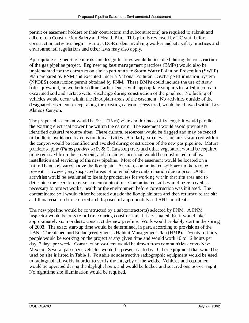
permit or easement holders or their contractors and subcontractors) are required to submit andadhere to a Construction Safety and Health Plan. This plan is reviewed by UC staff beforeconstruction activities begin. Various DOE orders involving worker and site safety practices andenvironmental regulations and other laws may also apply.
Appropriate engineering controls and design features would be installed during the constructionof the gas pipeline project. Engineering best management practices (BMPs) would also beimplemented for the construction site as part of a site Storm Water Pollution Prevention (SWPP)Plan prepared by PNM and executed under a National Pollutant Discharge Elimination System(NPDES) construction permit obtained by PNM. These BMPs could include the use of strawbales, plywood, or synthetic sedimentation fences with appropriate supports installed to containexcavated soil and surface water discharge during construction of the pipeline. No fueling ofvehicles would occur within the floodplain areas of the easement. No activities outside of thedesignated easement, except along the existing canyon access road, would be allowed within LosAlamos Canyon.
The proposed easement would be 50 ft (15 m) wide and for most of its length it would parallelthe existing electrical power line within the canyon. The easement would avoid previouslyidentified cultural resource sites. These cultural resources would be flagged and may be fencedto facilitate avoidance by construction activities. Similarly, small wetland areas scattered withinthe canyon would be identified and avoided during construction of the new gas pipeline. Matureponderosa pine (Pinus ponderosa P. & C. Lawson) trees and other vegetation would be requiredto be removed from the easement, and a maintenance road would be constructed to allowinstallation and servicing of the new pipeline. Most of the easement would be located on anatural bench elevated above the floodplain. As such, contaminated soils are unlikely to bepresent. However, any suspected areas of potential site contamination due to prior LANLactivities would be evaluated to identify procedures for working within that site area and todetermine the need to remove site contamination. Contaminated soils would be removed asnecessary to protect worker health or the environment before construction was initiated. Thecontaminated soil would either be stored outside the floodplain area and then returned to the siteas fill material or characterized and disposed of appropriately at LANL or off site.
The new pipeline would be constructed by a subcontractor(s) selected by PNM. A PNMinspector would be on-site full time during construction. It is estimated that it would takeapproximately six months to construct the new pipeline. Work would probably start in the springof 2003. The exact start-up time would be determined, in part, according to provisions of theLANL Threatened and Endangered Species Habitat Management Plan (HMP). Twenty to thirtypeople would be working on the project at any given time and would work 10 to 12 hours perday, 7 days per week. Construction workers would be drawn from communities across NewMexico. Several passenger vehicles would be present each day. Other equipment that would beused on site is listed in Table 1. Portable nondestructive radiographic equipment would be usedto radiograph all welds in order to verify the integrity of the welds. Vehicles and equipmentwould be operated during the daylight hours and would be locked and secured onsite over night.No nighttime site illumination would be required.

Proposed Pipeline Easement Environmental Assessment
DOE OLASO July 24, 200210
Table 1. Equipment to be Used to Construct and Test Natural Gas Pipeline in LosAlamos Canyon
Equipment Number of Units Fuel Type
Bull Dozer 3 Diesel
Excavator 3 Diesel
Backhoe 1 Diesel
Side Boom 1–3 Diesel
Tamper Compactor 2 Gasoline
Trencher 1 Diesel
Three-quarter ton Pickup 6-8 Gasoline
1 ton Welding Truck 5 Diesel
Arc Welder 5 Diesel
Water Truck 1–2 Diesel
Graders 2 Diesel
Boring Machine 1 Diesel
Wood Chippers 3 Gasoline
Dump Trucks 2 Diesel
Not all equipment to install the pipeline would be operating at the same time. Typically, thebulldozer would clear the easement and would not be used again until it was needed to backfillthe trench. The trencher or excavator and backhoe could be operating at the same or at differenttimes from the operation of the track-mounted side boom and the welding trucks. The arcwelders would only be operating during the welding process. The three-quarter ton pickupswould be used for workers commuting to and from the construction site.
Construction materials would be procured primarily from New Mexico suppliers. Pipe and othersupplies would be delivered to, and stored in, a fenced staging area within Los Alamos Canyon.PNM would use an existing 1.2-acre (ac) (0.5-hectare [ha]) staging area approximately 1,500 ft(450 m) southwest along SR 4 from the locked gate at the eastern end of the easement. About 20trucks would be required to deliver pipe to the job site. The delivery and off loading of the pipewould take approximately one week. The exact material, supplies, and equipment that would bestored in the fenced staging area would be left to the discretion of the contractor but wouldminimally include lengths of pipe and various construction equipment. No ResourceConservation and Recovery Act- (RCRA-) regulated materials would be stored onsite.
Chain saws and chippers would be used to clear the 50-ft-wide easement of woody vegetation.Trees would be chipped and then spread on the ground within the easement. Dozers, backhoes,or graders may be used to remove tree stumps and rocks and to smooth the surface of theeasement. Tree stumps would be chipped and then spread on the ground within the easement.Rocks would remain on site, although they would likely be moved around the easement so thatthey would not impede the proposed pipeline installation. The length of time required to clearthe 17.5 ac (7.0 ha) of easement would likely be accomplished over a one-week period. Clearingor excavation activities during site construction have the potential to generate dust and toencounter previously buried materials. If buried material or cultural remains are encounteredduring construction, activities would cease until their significance was determined and
Proposed Pipeline Easement Environmental Assessment
DOE OLASO July 24, 200211
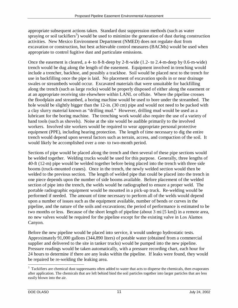
appropriate subsequent actions taken. Standard dust suppression methods (such as waterspraying or soil tackifiers3) would be used to minimize the generation of dust during constructionactivities. New Mexico Environment Department (NMED) does not regulate dust fromexcavation or construction, but best achievable control measures (BACMs) would be used whenappropriate to control fugitive dust and particulate emissions.
Once the easement is cleared, a 4- to 8-ft-deep by 2-ft-wide (1.2- to 2.4-m-deep by 0.6-m-wide)trench would be dug along the length of the easement. Equipment involved in trenching wouldinclude a trencher, backhoe, and possibly a trackhoe. Soil would be placed next to the trench foruse in backfilling once the pipe is laid. No placement of excavation spoils in or near drainageswales or streambeds would occur. Excavated materials that were unsuitable for backfillingalong the trench (such as large rocks) would be properly disposed of either along the easement orat an appropriate receiving site elsewhere within LANL or offsite. Where the pipeline crossesthe floodplain and streambed, a boring machine would be used to bore under the streambed. Thehole would be slightly bigger than the 12-in. (30 cm) pipe and would not need to be packed witha clay slurry material known as “drilling mud.” However, drilling mud would be used as alubricant for the boring machine. The trenching work would also require the use of a variety ofhand tools (such as shovels). Noise at the site would be audible primarily to the involvedworkers. Involved site workers would be required to wear appropriate personal protectiveequipment (PPE), including hearing protection. The length of time necessary to dig the entiretrench would depend upon several factors such as terrain, access, and compaction of the soil. Itwould likely be accomplished over a one- to two-month period.
Sections of pipe would be placed along the trench and then several of these pipe sections wouldbe welded together. Welding trucks would be used for this purpose. Generally, three lengths of40-ft (12-m) pipe would be welded together before being placed into the trench with three sidebooms (truck-mounted cranes). Once in the trench, the newly welded section would then bewelded to the previous section. The length of welded pipe that could be placed into the trench inone piece depends upon the number of side booms available. Before placement of the weldedsection of pipe into the trench, the welds would be radiographed to ensure a proper weld. Theportable radiographic equipment would be mounted in a pick-up truck. Re-welding would beperformed if needed. The amount of time necessary to perform all of the welds would dependupon a number of issues such as the equipment available, number of bends or curves in thepipeline, and the nature of the soils and excavations; the period of performance is estimated to betwo months or less. Because of the short length of pipeline (about 3 mi [5 km]) in a remote area,no new valves would be required for the pipeline except for the existing valve in Los AlamosCanyon.
Before the new pipeline would be placed into service, it would undergo hydrostatic tests.Approximately 91,000 gallons (344,890 liters) of potable water (obtained from a commercialsupplier and delivered to the site in tanker trucks) would be pumped into the new pipeline.Pressure readings would be taken automatically, with a pressure recording chart, each hour for24 hours to determine if there are any leaks within the pipeline. If leaks were found, they wouldbe repaired be re-welding the leaking area.
3 Tackifiers are chemical dust suppressants often added to water that acts to disperse the chemicals, then evaporatesafter application. The chemicals that are left behind bind the soil particles together into larger particles that are lesseasily blown into the air.
Proposed Pipeline Easement Environmental Assessment
DOE OLASO July 24, 200212
The hydrostatic test will be conducted in accordance with PNM’s 5-Year Renewable HydrostaticTest Waters Discharge Permit HBP-NM-007 from the New Mexico Energy, Minerals, andNatural Resources Department Oil Conservation Division (OCD). PNM is required to notify theOCD annually of any discharges under this permit. Testing the water quality prior to dischargeis not required by the OCD as a fresh water supply system or other potable source shall be used.No test waters will be discharged to any lakes, perennial streams, rivers, or any surface bodies ofwater or their respective tributaries. The test water will be released upon the ground within theeasement using BMPs in such a way that there would be no erosion.
Connecting the new pipeline to the existing pipelines would require the excavation of theexisting line at the connection points. Backhoes would be used for excavation. Gas servicewould be stopped in the existing line at the point of connection using specialized “stopple”equipment. Basically, plugs (also known as “stops’) would be placed within the existing line tostop the flow of gas at the connection point. The existing line would then be cut with a welderand the new pipeline welded to the existing line. The welds would be radiographed and, ifacceptable, the plugs would be removed from the gas line resuming the flow of gas. It isestimated to take approximately eight hours to make this type of connection.
Upon completion of the new pipeline installation and successful testing, the trench would bebackfilled using backhoes. The soil would be roller compacted and the easement would begraded and reseeded with native grasses. A maintenance service road would remain on theeasement to facilitate future servicing of the pipeline. The width of the service road would notexceed 10 ft (3 m). Signs designating a buried gas pipeline would be placed along the easement,directly above the pipeline at a frequency determined by line-of-sight (each sign must be visiblefrom the next one). Cathodic protection4 test stations would also be placed above the pipelineapproximately every 1,000 ft (300 m). These test stations would have sacrificial magnesiumcathodic protection anodes, which would be replaced over the years of pipeline operation asnecessary.
The existing 8.1-in. (20.3-cm) high carbon steel gas line under SR 502 would be capped and leftin place. This gas pipeline would be exposed at each end by excavation with a backhoe. The gasline would be cut with welders and then would be purged with air. Once all of the gas has beenremoved from the pipeline, steel end caps would be welded on each end and the trenchesbackfilled. No concrete grout material would be placed within the pipeline. It is anticipated thatthis work could be accomplished without damage to the existing road surface but traffic mayneed to be temporarily re-routed for a period of a few hours while this action is performed. PNMwould also legally abandon the ROW along this pipeline.
2.1.2 Operation and Maintenance of New Pipeline
The new pipeline easement would be monitored by PNM to ensure seed germination and wouldbe reseeded as necessary. The 10-ft- (3-m-) wide service road would be maintained for theuseful life of the pipeline within the easement for access to the pipeline for maintenanceactivities. PNM would repair soil erosion and would remove trees and brush within the easement
4 Cathodic protection is the elimination or reduction of corrosion on pipe by attachment of an anode. An anode isthe negatively charged terminal of a primary cell or of a storage battery that is supplying current.

Proposed Pipeline Easement Environmental Assessment
DOE OLASO July 24, 200213
as part of their continuing maintenance of the pipeline. Equipment used for these purposeswould likely include backhoes, shovels, chain saws, and handheld pruners and trimmers.
The pipeline would be operated at a maximum allowable operating pressure of 600 pounds persquare inch (psi) (42 kilograms per square centimeters [kg/cm2]). The pipeline would be leaksurveyed once every year by personnel walking the length of the pipeline. These personnelwould survey the pipeline trench area with hand-held natural gas detectors. The pipeline wouldalso be monitored for corrosion and vegetation regrowth. The pipeline would be maintainedcathodically and the magnesium anodes serviced once a year or sooner if needed.
No utility service would be required for the operation and maintenance of the new gas pipeline.Any power generators, welding trucks, water trucks, or other equipment needed for requiredmaintenance activities would be brought in by PNM on an “as needed” basis.
The expected operational lifetime of the new pipeline would be at least 50 years. At the end ofthe pipeline’s useful life, it would be purged and capped (as described previously for the existinggas line present underneath SR 502), and may be abandoned in place or removed. AdditionalNEPA compliance review may be necessary at that time.
2.2 No Action Alternative
The No Action Alternative provides a description of the potential effects of taking no action tocompare to the potential effects of the Proposed Action. This alternative must be consideredeven if DOE is under a court order or legislative command to act [10 CFR 1021.32 (c)]. Underthe No Action Alternative, NNSA would not grant an easement in Los Alamos Canyon and PNMwould not construct a new 12-in. (30-cm) natural gas pipeline as described in the ProposedAction. No disturbance of the canyon floor in Los Alamos Canyon would occur. The existing8.1-in. (20.3-cm) gas line under SR 502 would continue to be used and maintained. Maintenanceand repairs of the existing gas line would remain problematic. Traffic disruption would berequired to maintain the gas line. Natural gas service to LANL, Los Alamos County, andsurrounding communities would continue to be limited by the diameter of this pipe and servicecould not be increased through this pipeline. If any of the pipeline beneath SR 502 failed, majordisruption of gas service could occur for a period of time over days or weeks before a repaircould occur. Traffic would have to be routed to the other three roads that lead out of Los AlamosCounty.
2.3 Alternatives Considered but Dismissed from Further Consideration
2.3.1 Replace Existing Pipeline Under SR 502
Replacement of the existing 8.1-in. (20.3 cm) pipeline under SR 502 with a new 12-in. (30 cm)pipeline would disrupt traffic along this main artery into Los Alamos for a period of more thansix months. There is no room outside of the narrow road for the pipeline. Replacing the pipelineunder the road would require that the existing road surface be partially or wholly removed. Afterplacement of the new pipe, a new road surface would have to be installed. Future maintenanceand repairs would also disrupt the traffic flow at both scheduled and at unpredictable times. Thisalternative was considered to be unreasonable and was not analyzed further in this EA.
Proposed Pipeline Easement Environmental Assessment
DOE OLASO July 24, 200214
2.3.2 Install Pipeline in Pueblo Canyon
Under this alternative, a new pipeline would be installed in the canyon floor along the south sideof Pueblo Canyon from the intersection of SR 4 and SR 502 to approximately 6,000 ft (1,800 m)to the west. From here the pipeline would traverse the canyon wall to the south and thencontinue west along the mesa top to the existing 12-in. (30 cm) mainline tie-in at East Gate.Building a pipeline up the steep canyon wall would significantly increase costs, would requirethat the pipeline traverses the canyon wall, and be exposed (not buried). Exposed pipelinesincrease the risk of vandalism and reliability issues. This alternative was considered to beunreasonable due to pipeline exposure and costs and was not analyzed further in this EA.
2.3.3 Install Pipeline Under Existing Gravel Roadway in Los Alamos Canyon
Another alternative would be to install the new pipeline under the existing gravel road in LosAlamos Canyon. This road has numerous turns that would require bending the pipeline or theinstallation of fittings to allow for curves in the pipeline. Additionally, the road would have tobe improved and widened and vegetation would need to be removed at some locations. Thisroad also crosses the streambed more than six times, thus adverse effects to the streambed andfloodplain would be greater than if the pipeline were constructed as described in the ProposedAction. The numerous curves in the pipeline would also increase the duration of constructionand costs. This alternative was considered to be unreasonable and was not analyzed further inthis EA.
2.3.4 Install Pipeline in Sandia Canyon
Installing the new pipeline in Sandia Canyon instead of Los Alamos Canyon would result in amuch longer pipeline being required thereby increasing installation and maintenance costs.Much of the pipeline would need to be installed under East Jemez Road. This would increasecosts and disrupt traffic along this road, which is one of the four roads to LANL and the LosAlamos town site. Truck traffic is routed along this road and inspections of delivery trucks areperformed. Closing this road for an extended period of time could potentially delay shipments ofgoods into LANL. There are also potential release sites (PRSs) and a radioactive waste linenearby which would have to be avoided, thus increasing the length of the pipeline and thenumber of curves it would require. This alternative was also considered to be unreasonable andwas not analyzed further in this EA.
2.4 Related Actions
2.4.1 Site-Wide Environmental Impact Statement
The SWEIS (DOE 1999a), dated January 1999, was issued in February of that year. A Record ofDecision (ROD) was issued in September 1999, and a Mitigation Action Plan was issued inOctober 1999. In the ROD, DOE decided to continue operating LANL at the level of ExpandedOperations analyzed in the SWEIS. The SWEIS included the information that portions of theexisting gas distribution system are over 50 years old and would require modification andupgrades in the future.
Proposed Pipeline Easement Environmental Assessment
DOE OLASO July 24, 200215
2.4.2 Land Conveyance and Transfer
A portion of the proposed alignment of the 12-in. (30-cm) gas pipeline is located within theWhite Rock Y Tract identified in the ROD for the Conveyance and Transfer of Certain LandsAdministered by the DOE and Located at Los Alamos National Laboratory, Los Alamos andSanta Fe Counties, New Mexico (DOE 1999b). To be conveyed or transferred, these tracts mustnot be necessary for required DOE mission-related use and must have undergone any necessaryenvironmental restoration or remediation activities. If transferred, it is anticipated that theselands would be used for natural areas or used for transportation and utility improvements by LosAlamos County. However, DOE determined that part of the White Rock Y Tract considered forthe proposed easement to PNM should be retained by the DOE. This part of the White Rock YTract would serve as a health and safety buffer area for the proposed Advanced HydrotestFacility (AHF) if NNSA decides to build the facility at LANL’s TA-53. Should this conveyancedecision change, any utility easements would be transferred with the land. The proposed gaspipeline would be buried from 4 ft to 8 ft (1.2 m to 2.4 m) deep and would not be expected toaffect or be affected by the AHF project if it were constructed at LANL.
3.0 AFFECTED ENVIRONMENT AND ENVIRONMENTALCONSEQUENCES
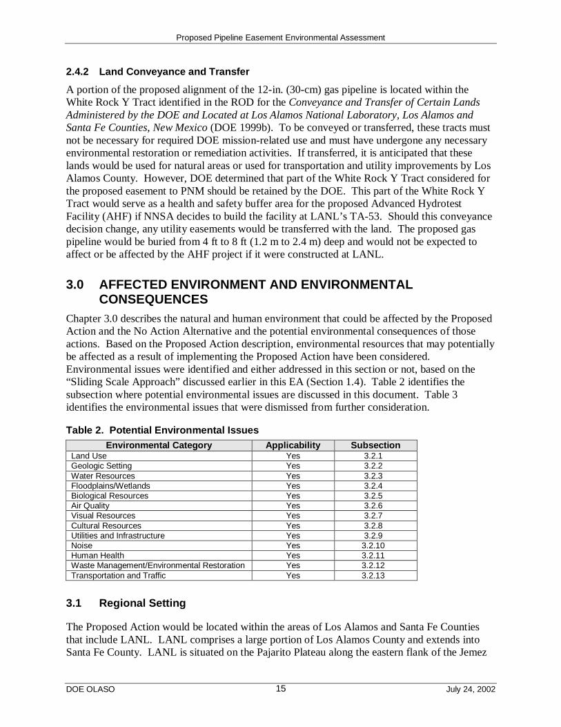
Chapter 3.0 describes the natural and human environment that could be affected by the ProposedAction and the No Action Alternative and the potential environmental consequences of thoseactions. Based on the Proposed Action description, environmental resources that may potentiallybe affected as a result of implementing the Proposed Action have been considered.Environmental issues were identified and either addressed in this section or not, based on the“Sliding Scale Approach” discussed earlier in this EA (Section 1.4). Table 2 identifies thesubsection where potential environmental issues are discussed in this document. Table 3identifies the environmental issues that were dismissed from further consideration.
Table 2. Potential Environmental IssuesEnvironmental Category Applicability Subsection
Land Use Yes 3.2.1Geologic Setting Yes 3.2.2Water Resources Yes 3.2.3Floodplains/Wetlands Yes 3.2.4Biological Resources Yes 3.2.5Air Quality Yes 3.2.6Visual Resources Yes 3.2.7Cultural Resources Yes 3.2.8Utilities and Infrastructure Yes 3.2.9Noise Yes 3.2.10Human Health Yes 3.2.11Waste Management/Environmental Restoration Yes 3.2.12Transportation and Traffic Yes 3.2.13
3.1 Regional Setting
The Proposed Action would be located within the areas of Los Alamos and Santa Fe Countiesthat include LANL. LANL comprises a large portion of Los Alamos County and extends intoSanta Fe County. LANL is situated on the Pajarito Plateau along the eastern flank of the Jemez
Proposed Pipeline Easement Environmental Assessment
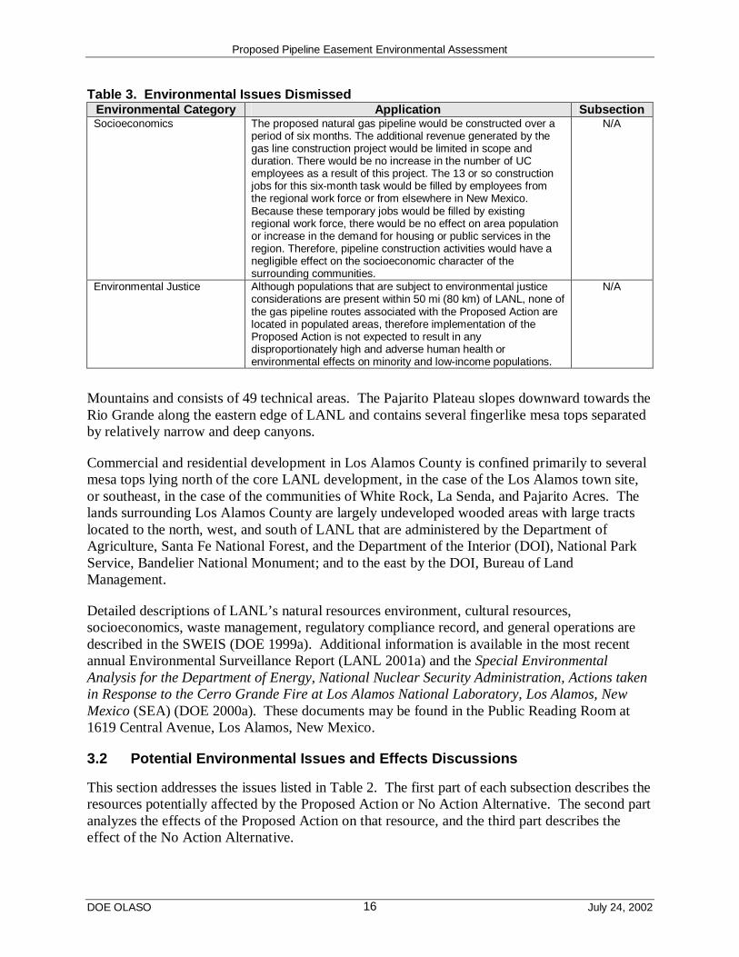
DOE OLASO July 24, 200216
Table 3. Environmental Issues DismissedEnvironmental Category Application SubsectionSocioeconomics The proposed natural gas pipeline would be constructed over a
period of six months. The additional revenue generated by thegas line construction project would be limited in scope andduration. There would be no increase in the number of UCemployees as a result of this project. The 13 or so constructionjobs for this six-month task would be filled by employees fromthe regional work force or from elsewhere in New Mexico.Because these temporary jobs would be filled by existingregional work force, there would be no effect on area populationor increase in the demand for housing or public services in theregion. Therefore, pipeline construction activities would have anegligible effect on the socioeconomic character of thesurrounding communities.
N/A
Environmental Justice Although populations that are subject to environmental justiceconsiderations are present within 50 mi (80 km) of LANL, none ofthe gas pipeline routes associated with the Proposed Action arelocated in populated areas, therefore implementation of theProposed Action is not expected to result in anydisproportionately high and adverse human health orenvironmental effects on minority and low-income populations.
N/A
Mountains and consists of 49 technical areas. The Pajarito Plateau slopes downward towards theRio Grande along the eastern edge of LANL and contains several fingerlike mesa tops separatedby relatively narrow and deep canyons.
Commercial and residential development in Los Alamos County is confined primarily to severalmesa tops lying north of the core LANL development, in the case of the Los Alamos town site,or southeast, in the case of the communities of White Rock, La Senda, and Pajarito Acres. Thelands surrounding Los Alamos County are largely undeveloped wooded areas with large tractslocated to the north, west, and south of LANL that are administered by the Department ofAgriculture, Santa Fe National Forest, and the Department of the Interior (DOI), National ParkService, Bandelier National Monument; and to the east by the DOI, Bureau of LandManagement.
Detailed descriptions of LANL’s natural resources environment, cultural resources,socioeconomics, waste management, regulatory compliance record, and general operations aredescribed in the SWEIS (DOE 1999a). Additional information is available in the most recentannual Environmental Surveillance Report (LANL 2001a) and the Special EnvironmentalAnalysis for the Department of Energy, National Nuclear Security Administration, Actions takenin Response to the Cerro Grande Fire at Los Alamos National Laboratory, Los Alamos, NewMexico (SEA) (DOE 2000a). These documents may be found in the Public Reading Room at1619 Central Avenue, Los Alamos, New Mexico.
3.2 Potential Environmental Issues and Effects Discussions
This section addresses the issues listed in Table 2. The first part of each subsection describes theresources potentially affected by the Proposed Action or No Action Alternative. The second partanalyzes the effects of the Proposed Action on that resource, and the third part describes theeffect of the No Action Alternative.

Proposed Pipeline Easement Environmental Assessment
DOE OLASO July 24, 200217
3.2.1 Land Use
3.2.1.1 Affected Environment
The LANL SWEIS (DOE 1999a Volume 1 Section 4.1.1.2) notes that, “Over the years, land onLANL has been developed in response to the specific needs of a variety of users…This has led toa pattern of mixed land uses throughout the property…This makes ‘absolute’ classification ofland use on LANL difficult.” The SWEIS characterized land use into six categories based on themost hazardous activities occurring in each of the 49 LANL technical areas as support, R&D,R&D/waste disposal, explosives, explosives/waste disposal, or buffer. The LANLComprehensive Site Plan 2000 (CSP) (LANL 2000) incorporated this hazard-based land useapproach and augmented it by describing and mapping 10 land use categories. The entire LANLsite is designated as being in one of the following land uses: administration, experimentalscience, high-explosives R&D, high-explosives testing, nuclear materials R&D,physical/technical support, public/corporate interface, reserve, theoretical/computational science,and waste management.
Los Alamos Canyon falls partially within the “Omega West” Planning Area described in the CSP(LANL 2000). The plan designates this planning area as primarily reserve land. East of theLANL boundary, Los Alamos Canyon crosses the Tsankawi Unit of Bandelier NationalMonument, which is adjacent to, and southeast of, SR 4, and then enters San Ildefonso Puebloland beyond. The general public uses SR 4 and the Tsankawi Unit of Bandelier NationalMonument.
Los Alamos Canyon is currently designated as a “reserve” in the CSP. These “reserves” areundeveloped lands that may be environmental core and buffer areas, or have other uniquephysical constraints such as steep slopes, wetlands, floodplains, or faults. The Los AlamosCanyon bottom is used for environmental monitoring and research and there is a Los AlamosCounty water well pump house building in this part of the canyon. Utility lines can be located inreserve areas. The SWEIS designates this area for support because it is undeveloped and free ofhazardous activities.
3.2.1.2 Proposed Action
Land use in Los Alamos Canyon would not change if the Proposed Action were implemented.Los Alamos Canyon would continue to be used as a “reserve” for LANL. Placing a 12-in (30-cm) gas line along the floor of Los Alamos Canyon would not interfere with other existing landuses.
3.2.1.3 No Action Alternative
The No Action Alternative would result in the 12-in. (30-cm) gas line not being constructed andoperated within Los Alamos Canyon. No change in land use would occur within Los AlamosCanyon or along SR 502.
3.2.2 Geologic Setting
3.2.2.1 Affected Environment
The Jemez Mountains volcanic field is located in northern New Mexico at the intersection of thewestern margin of the Rio Grande rift and the Jemez Lineament (Figure 4) (Gardner et al. 1986,
Proposed Pipeline Easement Environmental Assessment
DOE OLASO July 24, 200218
Figure 4. Generalized geologic map of the Rio Grande rift in the vicinity of the JemezMountains volcanic field. From Self and Sykes (1996).
Heiken et al. 1996). The Jemez Lineament is a northeast-southwest trending alignment of youngvolcanic fields ranging from the Springerville volcanic field in east-central Arizona to the Ratonvolcanic field of northeastern New Mexico (Heiken et al. 1996). The Jemez Mountains volcanicfield is the largest volcanic center along this lineament (ERP 1992). Volcanism in this volcanicfield spans a roughly 16-million-year period beginning with the eruptions of numerous basalticlava flows. Various other eruptions of basaltic, rhyolitic, and intermediate composition lavas andash flows occurred sporadically during the next 15 million years with volcanic activityculminating in the eruption of the rhyolitic Bandelier Tuff at 1.79 and 1.23 million years ago(Self and Sykes 1996). All of LANL property is within this volcanic field and is sited along thewestern edge of the Rio Grande rift. Most of the bedrock immediately underlying LANL iscomposed of Bandelier Tuff.
The geologic structure of the area is dominated by the north-south trending Pajarito Fault system.The Pajarito Fault system forms the western structural boundary of the Rio Grande rift, along thewestern edge of the Española Basin, and the eastern edge of the Jemez Mountains volcanic field.The Pajarito Fault system consists of three major faults and numerous secondary faults with

Proposed Pipeline Easement Environmental Assessment
DOE OLASO July 24, 200219
vertical displacements ranging from 80 ft to 400 ft (24 m to 120 m). Estimates of the timing ofthe most recent surface rupturing paleoearthquakes along this fault range from 3,000 to 24,000years ago (Gardner et al. 2001).
Los Alamos Canyon cuts through the upper Tshirege Member of the Bandelier Tuff, the CerroToledo Interval, and into the lower Otowi Member of the Bandelier Tuff (Figure 5). Near SR 4,the canyon cuts down through the base of the Otowi Member and into the underlying Cerros delRio basalts. The Otowi Member tends to be a slope former and the upper Tshirege Membercomposes the near-vertical cliffs of the canyon walls.
Rockfalls, landslides, and slope instability are triggered by any process that might destabilizesupporting rocks. These are the most likely geo-hazards that could affect the Proposed Action.The natural jointing (cooling cracks) within the tuff provides pathways for water, increasing thelikelihood of freeze-thaw cycles or excessive rainfalls contributing to rockfalls. Preferentialerosion of weaker portions of the tuffs (by streams or rainfall) could undermine the overlying,more densely welded layers (Figure 5) resulting in rockfalls or landslides. Construction activityalong the canyon sides (such as creating roads and trenches) could also contribute to slopeinstability. A study on potential mesa-edge stability at Pajarito Mesa (Reneau 1995) indicatesthat north rims display large-scale mass movement features in a zone typically 100 to 200 ft (30to 60 m) wide. In contrast, mass wasting on south rims is dominated by infrequent failure ofnarrow fracture-bounded tuff blocks. The same conditions exist in Los Alamos Canyon. Thefrequency of failure is unknown but seismic shaking may provide a triggering mechanism.
3.2.2.2 Proposed Action
Construction, maintenance, grading, and other activities related to access roads and pipelineconstruction in and out of Los Alamos Canyon may have a slight effect on local geology. Thecurrent access road would need to be upgraded to support heavy truck traffic associated with theconstruction of the pipeline. An additional service road would also be constructed along theeasement for service and maintenance of the pipeline. These activities could have a slight effecton the overall stability of the south side of the canyon. However, in general, the southern partsof the canyons tend to have more gentle slopes than north canyon walls and also have morevegetation, which acts to stabilize these southern canyon slopes. While upgrades to these roadsand pipeline construction would not likely affect slope stability of the canyon walls, it is possiblethat road maintenance and improvements could increase the potential for soil erosion.Appropriate engineering controls and design features, as well as BMPs, installed as part of thepipeline project would contribute to slope stability and minimize erosion.
3.2.2.3 No Action Alternative
Under the No Action Alternative, roads would not be upgraded and the pipeline would not beinstalled. Thus, there would be no effects to local geology in Los Alamos Canyon other than thenaturally occurring erosion processes.
3.2.3 Water Resources
3.2.3.1 Affected Environment
Surface water at LANL occurs primarily as short-lived or intermittent reaches of streams.Perennial springs on the flanks of the Jemez Mountains supply base flow into the upper reaches
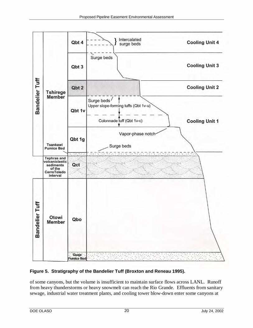
Proposed Pipeline Easement Environmental Assessment
DOE OLASO July 24, 200220
Figure 5. Stratigraphy of the Bandelier Tuff (Broxton and Reneau 1995).
of some canyons, but the volume is insufficient to maintain surface flows across LANL. Runofffrom heavy thunderstorms or heavy snowmelt can reach the Rio Grande. Effluents from sanitarysewage, industrial water treatment plants, and cooling tower blow-down enter some canyons at

Proposed Pipeline Easement Environmental Assessment
DOE OLASO July 24, 200221
rates sufficient to maintain surface flows for varying distances (DOE 1999a). Surface waters atLANL are monitored by LANL and the NMED to survey the environmental effects of LANLoperations. Planned releases from industrial and sanitary wastewater facilities within LANLboundaries are controlled by NPDES permits. Construction, maintenance, and environmentalactivities conducted within water courses are carried out under permits pursuant to sections 404and 401 of the Clean Water Act (Public Law 92-500, October 18, 1972) as administered by theSurface Water Bureau of the NMED. The NMED also requires the application of BMPs toensure compliance with New Mexico stream standards.
The nature and extent of groundwater within the LANL region have not been fully characterized.Current data indicate that groundwater bodies occur near the surface in the canyon bottomalluvium, perched at deeper levels within the alluvium, and at still deeper levels in the regionalaquifer (Purtymun 1995). Alluvial groundwater bodies have been identified primarily by drillingwells in locations where impacts from LANL operations are most likely to occur (DOE 1999a).On LANL property, continually saturated alluvial groundwater bodies occur in Mortandad, LosAlamos, Pueblo, Sandia, and Pajarito Canyons. The depth to these alluvial groundwater bodiesvaries from approximately 90 ft (27 m) in the middle of Pueblo Canyon to 450 ft (135 m) inlower Sandia Canyon (LANL 1993). The main aquifer is separated from the alluvialgroundwater bodies by 350 to 620 ft (105 to 186 m) of unsaturated volcanic tuff and sediments(Purtymun 1995). Recharge of the aquifer is not fully understood nor characterized and it is notstrongly interconnected across its extent. Groundwater within the LANL area is monitored toprovide indications of the potential for human and environmental exposure from contaminants(DOE 1999a). Groundwater protection and monitoring requirements are included in DOE Order5400.1, General Environmental Protection Program.
Data and analysis of LANL surface and groundwater quality samples taken from test wellsindicate that past LANL operations and activities have affected the surface water within LANLboundaries and some of the alluvial groundwater zones in the LANL region as well. Details onthe surface and groundwater quality can be found in the annual LANL EnvironmentalSurveillance and Compliance Report (LANL 2001a).
The LANL Environmental Restoration Program has produced detailed reports on the amount ofcontamination in Los Alamos Canyon (LANL 1998) and DP Canyon (LANL 1999), a tributaryof Los Alamos Canyon. The following summary, contained in the next paragraph, is derivedfrom these reports.
Several former LANL sites within the DP Canyon and Los Alamos Canyon watershedscontributed or may have contributed contaminants to these canyons beginning in 1943.Contaminants include americium-241 (241Am), plutonium-238 (238Pu), plutonium-239 (239Pu),plutonium-240 (240Pu), cesium-137 (137Cs), strontium-90 (90Sr), tritium, uranium isotopes,metals, various organic compounds, diesel range organic hydrocarbon contamination, septic tankoutfalls, and surface water runoff from the Los Alamos town site. The most significantcontaminant from a human health perspective is 137Cs in the sediments of upper Los AlamosCanyon. These contaminants have been distributed by floods along the full length of upper LosAlamos Canyon and have been dispersed laterally away from the stream channel from 16 to 83 ft(5 to 25 m). Radionuclide concentrations are generally higher in fine-grained sediments. In LosAlamos Canyon, the highest concentrations of 241Am, 238Pu, 137Cs, 90Sr, and tritium are found
Proposed Pipeline Easement Environmental Assessment
DOE OLASO July 24, 200222
close to DP Canyon with much lower concentrations downstream near the White Rock Y (LANL1998). Soils within the canyon bench areas are not expected to be contaminated to the samedegree as floodplain sediments (if at all).
High- and moderate-severity fire increases the potential for surface runoff and soil erosion byremoving vegetation and surface organic layers and increasing soil hydrophobicity. The CerroGrande Fire increased the potential for storm water runoff through the canyons. For example, inPueblo Canyon (one of the most severely burned areas), peak flows increased 16 times over pre-fire conditions. Details of flow rate increases can be found in the SEA (DOE 2000a). Studiesare currently underway using data obtained from gauging stations, rainfall, vegetation regrowth,and other sources to model how water flows and sedimentation rates would change over theyears as the forests recover from the fire. Currently, only one year’s worth of data have beencollected and thus there is insufficient information to perform predictive modeling. The datacollected so far show little recovery. Peak observed flows before the Cerro Grande Fire wereusually less than 20 to 30 cubic feet per second (cfs) (0.6 to 0.8 cubic meters per second [m3/s]).Peak flows after the fire can be as high as 1,300 cfs (36 m3/s) as determined by modeling of a100-year design event (Springer 2002) but a stabilization of the watershed ecology along theburned area of the Pajarito Plateau will likely occur within the next decade. An absolute returnto “pre-fire” conditions could take decades (Springer 2002). With increased runoff and erosion,the potential for the migration of contaminants throughout the canyons has increased. The mostrecent floodplain modeling efforts (LANL 2002) indicate that the post-fire floodplain in thevicinity of the pipeline is no longer estimated as being from canyon-wall-to-canyon-wall. A mapof the current floodplain can be found in the appendix.
3.2.3.2 Proposed Action
Construction of the natural gas pipeline may have a slight temporary, short-term effect onsurface water quality in Los Alamos Canyon. The Proposed Action would involve heavymachinery to improve access roads, trenching, and leak testing of the newly constructed pipeline.Leak testing the pipeline with water could result in the release of thousands of gallons of wateronto the easement. This water would be tested for contaminants and hazardous constituentsbefore release. Where the proposed pipeline route crosses the streambed, PNM (or theirsubcontractor) would bore under the streambed in order to place pipe without disturbing thestreambed and floodplain sediments. The stream channel could be affected by equipmentcrossing the channel or by the introduction of fill into the channel. When setting up theequipment to bore under the streambed, PNM or their subcontractor would use BMPs to keepany fill from being introduced into the channel.
BMPs derived from the SWPP Plan would also be implemented to prevent erosion and migrationof disturbed soil from along the pipeline caused by storm water or other water discharges. If soiland sediment contamination levels in the proposed easement within Los Alamos Canyon arerelatively low, as expected, erosion and transportation of these sediments may have ainconsequential effect, if any, on water quality.

Proposed Pipeline Easement Environmental Assessment
DOE OLASO July 24, 200223
3.2.3.3 No Action Alternative
There would be no effects to water quality under the No Action Alternative. No constructionactivities would be undertaken. BMPs to prevent erosion effects are already in place alongSR 502.
3.2.4 Floodplains/Wetlands
3.2.4.1 Affected Environment
Los Alamos Canyon is approximately 20 mi (32 km) long (from its headwaters to the RioGrande), and from 1,387 ft (416 m) (minimum) to 2,434 ft (730 m) (maximum) wide (within thearea of the gas line route). There are scattered wetlands, potential wetlands, and riparianvegetation in the streambed and along the stream sides throughout the canyon. The stream isintermittent in nature and usually flows only during spring runoff and storm events. The wetlandand riparian vegetation, although scant, helps retain soil and serves to slow streambed erosion.There is a small (0.5 ac [0.2 ha]) potential wetland area that may be developing at the low-headweir detention basin located near the intersection of SR 502 and SR 4 (see appendix). The low-head weir was constructed in 2000 after the Cerro Grande Fire. The vegetation in this area isprimarily piñon-juniper (Pinus edulus Englem.)-(Juniperus monosperma L.); however, thesettling basin was planted with cottonwood (Populus fremontii S. Wats.) and willow (Salixexigua Nutt.) seedlings. The new vegetation may or may not become established over time; asthe upper portions of the watershed recover and stabilize, the amount of storm water runoff downthe canyons is expected to decrease. There likely will not be enough water to sustain wetlandspecies this far downstream within Los Alamos Canyon.
The SEA (DOE 2000a) describes all the actions taken by NNSA in response to the Cerro GrandeFire, particularly for floodwater control. As a result of the fire, the potential for soil erosion,debris, water, ash, and silt has increased exponentially compared to pre-fire ratios. Mitigationmeasures for these conditions include revegetation, channel work, and debris clean up infloodplains, all of which are being conducted at LANL.
DOE’s 10 CFR Part 1022.4 defines a flood or flooding as “. . . a temporary condition of partialor complete inundation of normally dry land areas from . . . the unusual and rapid accumulationof runoff of surface waters. . . .” The base floodplain is the area inundated by a flood having a1.0 percent chance of occurrence in any given year (referred to as the 100-year floodplain[LANL 2002]). The critical-action floodplain is the area inundated by a flood having a 0.2percent chance of occurrence in any given year (referred to as the 500-year floodplain).
3.2.4.2 Proposed Action
No long-term effects to the floodplain or the wetland areas (or potential wetland areas) in LosAlamos Canyon would be likely. The gas pipeline easement would be adjacent to, and south of,the Los Alamos Canyon floodplain (the floodplain extends for the entire length of the canyonwith variable widths [LANL 2002]) and the streambed areas. A floodplain/wetland assessmentis included as an appendix in this EA. The proposed construction would consist of trenching inLos Alamos Canyon mostly along a natural bench above the floodplain area. Duringconstruction, a loss of approximately 17.5 ac (7.0 ha) of vegetated area, along with an expectedaverage of a 50-ft- (15-m-) wide corridor is expected. Part of the pipeline construction wouldbore under the streambed so that the streambed would not be directly disturbed. BMPs and

Proposed Pipeline Easement Environmental Assessment
DOE OLASO July 24, 200224
mitigation actions would be implemented during and after the construction phase to reduce oreliminate erosion. Removal of canyon slope habitat would not occur.
Vegetation removal and trenching would expose mineral soils because of excavation and the useof heavy equipment. BMPs for runoff control, such as silt barriers, would be used during thisproject. Siltation into the stream would be minor and temporary in nature. Wetland areas wouldbe avoided and the pipeline would be bored under the streambed thereby avoiding disturbance toriparian vegetation. Downstream floodplain and wetland values potentially effected by theproposed gas line project could include a slight alteration of flood-flow retention times; a slightalteration of wildlife nesting, foraging, or resting habitat; a slight redistribution of sediments andsediment retention-time changes. However, with the use of BMPs, no adverse effects towetlands functions downstream of the pipeline would be likely.
3.2.4.3 No Action Alternative
Under the No Action Alternative, the new gas line would not be installed in Los Alamos Canyon.There would be no effect on floodplains or wetlands under the No Action Alternative.
3.2.5 Biological Resources
3.2.5.1 Affected Environment
A number of regionally protected and sensitive (rare or declining) species have been documentedin the LANL region. These include three Federally-listed endangered species (the whoopingcrane [Grus americana], the southwestern willow flycatcher, and the black-footed ferret[Mustela nigripes]) and two Federally-listed threatened species (the bald eagle [Haliaeetusleucocephalus] and the Mexican spotted owl). Under the Endangered Species Act of 1973 (16U.S.C. 1531 et seq.) as amended, government agencies are required to consider the potentialeffects of all its activities on Federally-listed threatened and endangered species and their criticalhabitat.
The LANL Threatened and Endangered Species HMP establishes areas of environmental interest(AEIs) that are being managed and protected because of their significance to biological or otherresources. Potential or known occupied habitats of threatened or endangered species that occuror may occur at LANL are designated as AEIs. In general, an AEI consists of a core area thatcontains important breeding or necessary survival habitat for a specific species and buffer areaaround the core area. The core and buffer areas are protected from disturbances for certainactivities, including construction. For instance, activities are restricted in a core and buffer areaduring breeding season until it is determined that the habitat is not occupied by individuals of alisted species for that year. LANL UC personnel perform annual surveys of the AEI early in thebreeding season to determine the presence of listed species breeding pairs. If the habitat isoccupied, the restrictions remain in place until the completion of the breeding season. Anyactivities that cannot be conducted within the guidelines of the HMP require further consultationwith the U.S. Fish and Wildlife Service.
Seven years of Mexican spotted owl surveys have been conducted within Los Alamos Canyon(Keller 2002). These surveys did not locate Mexican spotted owls, but potential habitatnecessary for this species exists within the project area.
Proposed Pipeline Easement Environmental Assessment
DOE OLASO July 24, 200225
The proposed pipeline route transects areas of ponderosa pine forest on the western end andpiñon/one-seed juniper woodland in the eastern end of the canyon; native understory species arepresent along the entire route. There has been previous disturbance along the south side of thecanyon bottom where electric power lines were installed many years ago. Ponderosa pines havegrown up around and under most of the existing power line easement. Although these pines arenot as large as other pines found on the south side of the canyon bottom, this area is heavilyforested and will be subjected to tree thinning procedures under LANL’s Wildfire HazardReduction Program. Most of the north-facing slope (south side of the canyon) is heavilyvegetated all the way up the canyon wall.
Larger wildlife species, such as elk and deer, move through Los Alamos Canyon including theproposed gas line construction area and the existing utility easement. A variety of smallmammals, birds, reptiles, and insects occupy Los Alamos Canyon including the area around theproposed pipeline easement.
3.2.5.2 Proposed Action
Implementation of the Proposed Action is not expected to result in any adverse effects toindividuals of Federally-protected threatened or endangered species or their critical habitat.Minimal short-term and long-term effects to vegetation and biota are expected from constructionand operation of the proposed gas pipeline.
Under the Proposed Action, vegetation within the canyon bottom would be disturbed and clearedwithin a 50-ft- (15-m-) wide corridor for the length of the proposed gas line. The land proposedfor the construction activity is approximately five percent unvegetated with the remainder of theproposed easement corridor covered with native vegetation. A 10-ft (3-m) -wide access roadwould be constructed within the easement along the length of the pipeline for maintenance afterthe pipeline is installed. Once the project is completed, native species of grasses would bereseeded along the easement. Effects to non-woody vegetation would be short term.
Trees would be removed within the existing electric utility easement along the proposed gas lineeasement. Reforestation of the area would likely occur over the next several decades but treeswould be removed and the area would be maintained in a fashion that is conducive to effectivewildfire hazard management. PNM personnel conducting annual leak surveys of the new gaspipeline would monitor vegetation regrowth along the easement during these surveys. The longterm maintenance of the proposed gas line would be expected to have minimal long-term effectson woody vegetation.
Large mammal migration would be temporarily disturbed during the construction activities.Most of these species, however, would likely continue using the canyon corridor for foraging andmigration purposes after the construction of the gas line was finished. Similarly, small mammalsin the project area would avoid the site during the construction phase, but would return to thepipeline area after construction was completed. This avoidance of the area by large and smallmammals would be a short-term, temporary effect.
Of the Federally-listed threatened or endangered species potentially present at LANL, the projectarea falls within an AEI for the Mexican spotted owl. Tree removal would decrease the potentialMexican spotted owl habitat within Los Alamos Canyon. Removal of overstory trees would also

Proposed Pipeline Easement Environmental Assessment
DOE OLASO July 24, 200226
open the canopy and increase light and heat penetration. The area of sensitive habitat disturbedwould be less than approximately 1.75 ac (0.7 ha) if an expected 50-ft (15-m) -wide corridor ismaintained. This is less than one percent of the total available foraging and roosting habitat atthis LANL AEI. Site-specific surveys would be preformed before the beginning of constructionactivities to determine if owls are using the Los Alamos Canyon AEI. If owls are not present inthe construction zone, the work would be allowed to commence and continue until completed. Ifowls are present in the project area, time restrictions on initiation of work activities would beimposed and construction would not be allowed to occur between March 15th and May 30th, andmay be restricted further until September 1st depending on owl activity within the AEI. Allprovisions of the LANL Threatened and Endangered Species HMP would be followed so that noadverse effects to individual Mexican spotted owls or their critical habitat would be expected.
The Proposed Action area has also been designated as a potential bald eagle foraging habitat.However, the Proposed Action represents a small fraction of the total foraging habitat availableto this species throughout LANL. Disturbance to the bald eagle foraging habitat would betemporary in nature and would only occur during the gas line construction so that the overalleffect to the foraging area available to this species would be minor and is not expected to beadverse.
3.2.5.3 No Action Alternative
Under the No Action Alternative, a new gas line would not be installed in Los Alamos Canyon.There would be no habitat disturbances and, therefore, no effects on biological resources.
3.2.6 Air Quality
3.2.6.1 Affected Environment
Air quality is a measure of the amount and distribution of potentially harmful pollutants inambient air5. Air surveillance at Los Alamos includes monitoring emissions to determine the airquality effects of LANL operations. UC staff calculate annual actual LANL emissions ofregulated air pollutants and report the results annually to the NMED. The ambient air quality inand around LANL meets all Environmental Protection Agency (EPA) and DOE standards forprotecting the public and workers (LANL 2001a).
Both EPA and NMED regulate nonradioactive air emissions. NMED does not regulate dustfrom excavation or construction, but BACMs must be used when appropriate to control fugitivedust and particulate emissions. Annual dust emissions from daily windblown dust are generallyhigher than short-term construction-related dust emissions.
Excavation and construction activities are not considered stationary sources of regulated airpollutants under the New Mexico air quality requirements. Mechanical equipment associatedwith the construction phase of this project, including bulldozers, trenchers (trackhoes),excavators, side booms, tamper compactors, forklifts, and backhoes are exempt from permitting.
5 Ambient air is defined in 40 CFR 50.1 as “that portion of the atmosphere external to buildings, to which the publichas access.” It is defined in the New Mexico Administrative Code (NMAC) Title 20, chapter 2, part 72, as “theoutdoor atmosphere, but does not include the area entirely within the boundaries of the industrial or manufacturingproperty within which the air contaminants are or may be emitted and public access is restricted within suchboundaries.”
Proposed Pipeline Easement Environmental Assessment
DOE OLASO July 24, 200227
Mobile sources, such as automobiles and construction vehicles, are additional sources of airemissions; however, mobile sources and diesel emissions from conveyance vehicles are notregulated by NMED.
3.2.6.2 Proposed Action
Construction of the Los Alamos Canyon gas line would result in short-term, temporary, localizedemissions associated with vehicle and equipment exhaust as well as particulate (dust) emissionsfrom excavation and construction activities. The air emissions would not be expected to exceedeither the National Ambient Air Quality Standards or the New Mexico Ambient Air QualityStandards. The new gas line would not result in additional air emissions from existing gas-firedequipment at LANL. Effects of the Proposed Action on air quality would be negligiblecompared to annual air emissions from LANL as a whole.
3.2.6.3 No Action Alternative
No construction activities would occur under the No Action Alternative. There would be nochange from ambient air quality effects associated with implementing the No Action Alternative.
3.2.7 Visual Resources
3.2.7.1 Affected Environment
Los Alamos Canyon is relatively undeveloped. Although there are no vistas from the bottom ofthe canyon, the area possesses desirable aesthetic qualities. The vegetation within the canyon ismixed. The canopy cover on the south side of the canyon along the existing electric distributionline contains sparse to moderately dense small-diameter ponderosa pine trees. The north side ofthe canyon contains more mature piñon-juniper woodland.
The principal humanmade features that contrast with the existing natural environment are anelectric distribution line along the south side of the canyon, a dirt road that meanders along thecanyon bottom, and a scar on the north face of the canyon where the existing gas pipeline crossesthe canyon at the western end of the proposed gas pipeline easement.
Vehicles traveling on SR 4 cross an open area of Los Alamos Canyon at the eastern LANLboundary. Most of the area in which the proposed pipeline would be constructed is largelyscreened from vehicular traffic but is visible by hikers using nearby trails along the mesa top andcanyon side as well as people passing along the road through the canyon bottom.
3.2.7.2 Proposed Action
Heavy equipment, hauling operations, staging areas, and site preparation activities would createlocal temporary adverse visual effects, particularly near the intersection of Los Alamos Canyonwith SR 4. Over the long term, the aesthetic qualities of the canyon would be restored to a largeextent by reseeding of the areas affected by construction. Short term, clearing the trees withinthe easement could cause an adverse effect on area aesthetic qualities. Along segments ofpipeline constructed in forest areas, this effect would be less noticeable after tree thinningoccurred in the canyon area as part of the LANL Wildfire Hazard Reduction Program. Longterm, this visual quality effect would not likely be adverse.

Proposed Pipeline Easement Environmental Assessment
DOE OLASO July 24, 200228
Construction could temporarily create a linear area of cleared vegetation that would expose moreof the canyon to the view of travelers driving on SR 4. This lineal feature could disrupt thevisual quality of the canyon to both travelers on SR 4 and to hikers on the Breakneck Trail,particularly in the short term. As vegetation is reestablished, the aesthetic qualities of the canyonwould be largely restored. Views of Los Alamos Canyon from the mesa top Anniversary Trailwould be more affected because the south side of Los Alamos Canyon is more visible from theAnniversary Trail than is the north side of the canyon.
3.2.7.3 No Action Alternative
There would be no effects to visual resources under the No Action Alternative. No changes inthe vegetation or constructed features in the canyon bottom would occur under this alternative.
3.2.8 Cultural Resources
3.2.8.1 Affected Environment
Cultural resources include any prehistoric sites, buildings, structures, districts, or other places orobjects considered to be important to a culture or community for scientific, traditional, religious,or any other reason. They combine to form the human legacy for a particular place (DOE1999a). To date, over 1,950 archaeological sites and historic properties have been recorded atLANL.
The criteria used for evaluating cultural resources depend upon their significance as sites eligiblefor listing to the National Register of Historic Places as described in the National HistoricPreservation Act (16 United States Code 470). These determinations of significance are met byevaluating each cultural resource based on it meeting any one or more of the following criteria:
• association with events that have made a significant contribution to the broad pattern ofour history,
• association with the lives of persons significant in our past,
• illustration of a type, period, or method of construction; for its aesthetic values or for itsrepresentation of the work of a master; or if it represents a significant and distinguishedentity whose components may lack individual distinction, and
• it has yielded, or may be likely to yield, information important in prehistory or history.
3.2.8.2 Proposed Action
There are 13 prehistoric sites and one historic trail located within 250 ft (75 m) of the proposedgas pipeline easement. The prehistoric sites consist of one garden plot, two pueblo room blocks,eight one- to three-room structures, one lithic scatter, and one rock and wood enclosure. Theseprehistoric sites are predominantly from the Coalition or Classic Periods (Ancestral Pueblo). AHomestead Period historic trail traverses the floor of Los Alamos Canyon in an east-westdirection. The pipeline easement would be sited so that it would avoid prehistoric culturalresources. Therefore, the construction, operation, and maintenance of the new gas mainline inLos Alamos Canyon would not affect the recorded prehistoric archaeological sites in the area.
At two locations the proposed gas line would cross the original location of the Los AlamosCanyon Trail, which was one of the original routes from the Rio Grande to Los Alamos Mesa.
Proposed Pipeline Easement Environmental Assessment
DOE OLASO July 24, 200229
However, in previous years the trail location has been bladed and it currently serves as the LosAlamos Canyon access road. As a result, the original trail has been destroyed and the trail is nolonger of historic value.
All of the significant and potentially significant cultural resources in the vicinity of the proposedeasement would be protected by avoidance. Under the Programmatic Agreement (DOE 2000b)between NNSA and the New Mexico State Historic Preservation Office (SHPO), the SHPOwould be notified that there would be no effect to cultural resources by the Proposed Action ifNNSA decides to proceed with the granting of the easement to PNM.
3.2.8.3 No Action Alternative
Implementing the No Action Alternative would result in no affect to cultural resources withinLos Alamos Canyon. No construction activity would occur under this alternative.
3.2.9 Utilities and Infrastructure
3.2.9.1 Affected Environment
Section 4.9.2 of the 1999 LANL SWEIS (DOE 1999a) describes utility and infrastructureservices at LANL. The utilities and infrastructure in and around LANL under the PreferredAlternative selected in the SWEIS ROD are described in detail in Section 5.5.9.2 of the SWEIS.Utility systems at LANL include electrical service, natural gas pipeline, communications lines,steam lines, potable water lines, sanitary wastewater and storm water lines, and refuse collection.The CSP (LANL 2000) documents that portions of the existing 62 mi (100 km) of gasdistribution lines at LANL are about 50 years old or older, and that building redundancy into thesystem is necessary to avoid potential curtailment of a large percentage of LANL operations inthe event of a disruption.
The SWEIS Yearbook–2000 (LANL 2001d) notes that total gas consumption in FY 2000 wasless than projected by the SWEIS ROD (1.84 million decatherms) because of warmer thannormal weather; however, more gas than anticipated was used for electric generation at the TA-3power plant. According to the Yearbook, LANL used about 1.43 million decatherms of naturalgas in FY 2000 and approximately 90 percent of this was used for heating (both steam and hotair). The remainder was used for electrical production to provide the difference between peakload demands and electric contractual import rights.
The SWEIS ROD issued by the DOE in 1999 required the preparation of a Mitigation ActionPlan for assuring electrical power availability to carry out the mission requirements of theexpanded operations alternative. NNSA is considering the installation of a third electrictransmission line and a 20-megawatt natural gas combustion turbine within the TA-3 South Mesa22 Power Plant complex to provide reliable, onsite electricity to LANL. A separate EA for theproposed electric line was issued together with a Finding of No Significant Impact on March 9,2000. The EA for the proposal to install a new gas combustion turbine is under preparation.
3.2.9.2 Proposed Action
There is an existing electrical distribution power line easement alongside the proposed alignmentof the new 12-in. (30-cm) gas transmission line up Los Alamos Canyon. There is also a watersupply well that is located along the south wall of the canyon near the proposed tie-in with the
Proposed Pipeline Easement Environmental Assessment
DOE OLASO July 24, 200230
existing gas transmission mainline. The proposed gas transmission line would not affect eitherthe electrical distribution line or the water supply well located in Los Alamos Canyon. Theproposed gas transmission line would enhance the reliability of gas supply at LANL byproviding system redundancy in the event of service disruptions. Since natural gas is used togenerate some onsite electricity at LANL, the new gas line would also ensure the reliability ofadequate electric power production and supply at LANL.
3.2.9.3 No Action Alternative
Under the No Action Alternative, the proposed 12-in. (30-cm) gas transmission line would not bebuilt and therefore the existing electrical distribution line or the water supply well located in LosAlamos Canyon would not be affected. The No Action Alternative would also mean that LANLwould not have the desired redundancy in gas supply. This could affect the reliability of naturalgas supplies to LANL and the Los Alamos town site in the event of a service disruption. Thiscould, in turn, affect the ability to heat buildings and generate onsite electricity using gas-firedsteam generators and turbines.
3.2.10 Noise
3.2.10.1 Affected Environment
Noise is defined as unwanted sound. Noise is categorized into two types: steady-state noise,which is characterized as longer duration and lower intensity, such as a running motor, andimpulse or effect noise, which is characterized by short duration and high intensity, such as thedetonation of high explosives. The intensity of sound is measured in decibel (dB) units. Insound measurements relative to human auditory limits, the dB scale is modified into an A-weighted frequency scale (dBA).
Noise measured at LANL is primarily from occupational exposures. Occupational exposure dataare compared against an established occupational exposure limit (OEL). At LANL, the OEL isadministratively defined as noise to which a worker may be exposed for a specific work periodwithout probable adverse effects on hearing acuity. The maximum permissible OEL for steady-state noise is 84 dBA for each 8-hour work period. The OEL for impulse and effect noise is notfixed because the number of effects allowed per day varies depending on the dBA of each effect.DOE also requires that Action Levels (levels of exposure to workplace hazards that are belowthe OEL but require monitoring or the use of PPE) be established for noise in the workplace.Action levels at LANL for steady-state noise and impulse and effect noise are 80 dBA and 140dBA for each 8-hour day, respectively.
Environmental noise levels at LANL are measured outside of buildings and away from routineoperations. The following are typical examples of sound levels (dBA) generated by barkingdogs (58), sport events (74), nearby vehicle traffic (63), aircraft overhead (66), children playing(65), and birds chirping (54). Sources of environmental noise at LANL consist of backgroundsound, vehicular traffic, routine operations, and periodic high explosives testing. Measurementsof environmental noise in and around LANL facilities and operations average below 80 dBA.
The averages of measured values from limited ambient environmental sampling in Los AlamosCounty were found to be consistent with expected sound levels (55 dBA) for outdoors inresidential areas. Background sound levels at the White Rock community ranged from 38 to 51
Proposed Pipeline Easement Environmental Assessment
DOE OLASO July 24, 200231
dBA (Burns 1995) and from 31 to 35 dBA at the entrance of Bandelier National Monument(Vigil 1995). The minimum and maximum values for Los Alamos County ranged between 38dBA and 96 dBA, respectively. Because of the isolated location of the proposed gas line in LosAlamos Canyon, ambient noise levels in the vicinity of the line are typical of undevelopedoutdoor areas.
3.2.10.2 Proposed Action
The Proposed Action would result in limited short-term increases in noise levels associated withpipeline construction activities. Following the completion of these activities, noise levels wouldreturn to preconstruction levels. Noise generated by the Proposed Action is not expected to havean adverse effect on either UC and non-UC construction workers or on PNM maintenanceworkers.
The construction of the gas pipeline would require the use of heavy equipment for clearing of theeasement, removal of dirt, rock, and vegetation, and for hauling and placing pipe. Heavyequipment such as front-end loaders and backhoes would produce intermittent noise levels ataround 73 to 94 dBA at 50 ft (15 m) from the work site under normal working conditions (Canter1996, Magrab 1975). Truck traffic would occur frequently but would generally produce noiselevels below that of the heavy equipment. No high explosives or other noise generatingoperations or equipment would be used during construction or to perform routine maintenance.Workers would be required to have hearing protection if site-specific work produced noise levelsabove the LANL action level of 80 dBA for steady-state noise. Based upon a number of physicalfeatures, such as attenuation factors, noise levels should return to background levels within about200 ft (66 m) of the noise source (Canter 1996). Since sound levels would be expected todissipate to background levels before reaching publicly accessible areas or undisturbed wildlifehabitats, they should not be noticeable to nearby workers or members of the public, nor shouldthey disturb local wildlife. In addition, any elevated noise levels would occur for a shortduration only (six months at the most). Traffic noise from pipeline construction workers (about13 workers) would not increase the present traffic noise level on roads at LANL. Therefore,noise levels are not expected to exceed the established OEL.
No adverse effects on either UC or PNM maintenance workers, the public, or the environmentwould be expected from noise levels generated by routine maintenance operations under theProposed Action. Noise generated by these activities would be very short term in duration, oflow intensity, and highly localized in remote and unoccupied areas at LANL.
3.2.10.3 No Action Alternative
Under the No Action Alternative, ambient noise levels would remain unchanged in the vicinityof the proposed pipeline corridor in Los Alamos Canyon. Noise from construction activitiesassociated with the Proposed Action would not occur. Environmental noise levels in and aroundLos Alamos Canyon and the existing gas pipeline under SR 502 would be expected to remainbelow 80 dBA on average.
Proposed Pipeline Easement Environmental Assessment
DOE OLASO July 24, 200232
3.2.11 Human Health
3.2.11.1 Affected Environment
This section considers the health of UC workers, non-UC workers, and PNM construction andmaintenance workers. These two categories are considered in this EA because each category ofworker would either be involved in the site inspections or the construction and maintenance ofthe new gas line under the Proposed Action. Members of the public are not considered becausethey are not likely to be affected by construction activities, routine maintenance, or any credibleaccident scenarios that could result from the Proposed Action.
The health of LANL workers is routinely monitored depending upon the type of workperformed. Health monitoring programs for LANL workers consider a wide range of potentialconcerns including exposures to radioactive materials, hazardous chemicals, and routineworkplace hazards. In addition, LANL workers involved in hazardous operations are protectedby engineering controls and required to wear appropriate PPE. Training is also required toidentify and avoid or correct potential hazards typically found in the work environment and torespond to emergency situations. Because of the various health monitoring programs and therequirements for PPE and routine health and safety training, LANL workers are generallyconsidered to be a healthy workforce with a below average incidence of work-related injuriesand illnesses.
UC staff monitor environmental media for contaminants that could affect non-UC workers ormembers of the public. This information is reported to regulatory agencies, such as the NMEDand to the public through various permit requirements and reporting mechanisms and it is used toassess the effects of routine operations at LANL on the general public. For detailed informationabout environmental media monitoring and doses to the public, see LANL’s EnvironmentalSurveillance Report for 2000 (LANL 2001a). For those persons who work within the boundariesof LANL as subcontractors or utility workers and could be exposed to radioactive or otherhazardous materials, their exposures are monitored in the same manner as UC workers. Inaddition, site-specific training and PPE requirements would also apply to these workers.
The preliminary assessments of potential human health (including risks for constructionworkers6) and ecological risk presented in the LANL Environmental Restoration Program reportsregarding Los Alamos Canyon and DP Canyon (LANL 1998 and 1999, respectively) indicatethat levels of contamination in the floodplain sediments of upper Los Alamos Canyon and DPCanyon do not pose an unacceptable human health or environmental risk or require immediateremedial actions with regard to present-day land use (including “construction worker”).
6 The construction worker scenario in the human health risk assessment is based upon a 250-day work year witheight-hour days. The duration of the scenario is one year, and all activities occur within sediment layers that containcontaminants above background values. The involved individual worker ingests soil at a rate of 480 mg/day andinhales soil as airborne dust at a rate of 2 mg/day. Possible construction activities in upper Los Alamos Canyonunder present-day land use conditions include the construction or maintenance of roads and the excavation oftrenches for sewer lines or other purposes. These activities would likely involve uncontaminated parts of the canyonfloor as well as contaminated areas and would likely have actual durations of less than one year; therefore, thisassessment provides conservative estimates of risk (LANL 1998).
Proposed Pipeline Easement Environmental Assessment
DOE OLASO July 24, 200233
3.2.11.2 Proposed Action
Pipeline construction and maintenance work planned under the Proposed Action would not beexpected to have any adverse health effects on UC workers. UC workers would not be directlyinvolved in the construction of the proposed gas pipeline. Non-UC support and maintenancecontractors would be actively involved in the construction activities, routine site inspections, andtesting of the pipeline. Approximately five UC workers would perform site inspections ormonitor construction activities during periods of peak activity. Applicable safety and healthtraining and monitoring, PPE, and work-site hazard controls would be required for all siteworkers.
The Proposed Action is not expected to result in adverse effects on the health of non-UCconstruction or maintenance workers. Approximately 20 to 30 construction workers would beactively involved in potentially hazardous activities such as heavy equipment operations,including several heavy debris removal vehicles, and removal of excess dirt and vegetation frompipeline construction activities. Construction activities could begin in early 2003 and would lastfor about six months. Potentially serious exposures to various hazards or injuries are possibleduring the pipeline construction and testing under the Proposed Action. Risks of incidents andinjuries that could occur range from relatively minor incidents (e.g., respiratory irritation, cuts, orsprains) to major injuries (e.g., broken bones or asphyxiation). To prevent serious injuries, allsite workers are required to submit and adhere to a Construction Safety and Health Plan. Thisplan is reviewed by UC staff before construction activities can begin. Following review of thisplan, UC site inspectors would routinely verify that site workers are adhering to the plan,including applicable Federal and state health and safety standards. In addition, UC staff wouldprovide site-specific hazard training to construction contractors as needed. Adherence to areviewed plan, use of PPE and engineered controls, and completion of appropriate hazardstraining are expected to help prevent adverse health effects on construction workers.
Routine maintenance of the new gas pipeline would be performed primarily through site visitsthat include driving or walking the length of the line, and cathodic and leak testing of thepipeline itself. For maintenance that requires the repair or removal of any portion of the pipeline,soil and pipe excavation could be required and some heavy equipment may be needed. Hazardsassociated with the routine maintenance of the pipeline would pose no hazard to UC workers andonly a minimal health risk to non-UC maintenance workers employed by PNM or theirsubcontractors. Adherence to required and applicable hazard control plans, monitoring ofpotential hazards, and completion of appropriate worker training would help to prevent adversehealth effects on these workers.
3.2.11.3 No Action Alternative
Under the No Action Alternative, there would be no potential for injuries to UC or non-UCconstruction or maintenance workers. There would also not be any potential for injuries tomembers of the public from construction and operation of the proposed gas pipeline. Noexposures to hazardous working conditions would occur on DOE-administered lands because noconstruction activities would take place. However, routine maintenance of the existing gaspipeline under SR 502 would continue and would probably increase over time because of thecondition of the pipeline. An increase in maintenance activities would increase the potential foradverse health effects to maintenance workers. With the use of appropriate worksite controls
Proposed Pipeline Easement Environmental Assessment
DOE OLASO July 24, 200234
and monitoring, PPE, and worker training programs, an increase in actual PNM maintenanceworker injuries would be unlikely.
3.2.12 Waste Management/Environmental Restoration
3.2.12.1 Affected Environment
LANL generates solid waste7 from construction, demolition, and facility operations. Thesewastes are managed and disposed of at appropriate solid waste facilities. Both UC-LANL andLos Alamos County use the same solid waste sanitary landfill located within LANL boundaries.The Los Alamos County Landfill also accepts solid waste from other neighboring communities.The Los Alamos County Landfill receives about 52 tons per day (47 metric tons per day), withLANL contributing about 8 tons per day (7 metric tons per day), or about 15 percent of the total.Current plans (as of May 8, 2002) are to close the Los Alamos County Landfill by June 30, 2004.Several possible landfills located within New Mexico could be used by UC-LANL and LosAlamos County after 2004.
Building debris storage yards on Sigma Mesa (TA-60) or other approved areas are used byLANL to store concrete, soil, and asphalt debris for future use at LANL. Low-level radioactivewaste is disposed of at LANL, in Area G at TA-54, or may be shipped to appropriate permittedfacilities. Hazardous waste8 regulated under RCRA is transported to TA-54 at LANL for propermanagement, which is carried out in accordance with applicable laws, regulations, and DOE
Orders. Hazardous waste and mixed wastes are treated and disposed of offsite because LANLhas no onsite disposal capability for these waste types. The offsite disposal locations are locatedacross the U.S. and are audited for appropriate regulatory compliance before UC-LANL sendswaste to these disposal site locations.
3.2.12.2 Proposed Action
LANL waste management would be slightly affected by implementing the Proposed Action.PNM or their subcontractors would be responsible for site waste removal and disposition.LANL waste management would accept waste generated by the project only in the case ofradioactive waste. The Proposed Action would generate solid waste such as spent welding rodsand waste paper products. This material would be removed from the construction site anddisposed of at the Los Alamos County Landfill or another permitted facility. Excess pipe wouldbe removed by PNM for future use elsewhere. Any brush, trees, or vegetation waste resultingfrom the Proposed Action would be chipped onsite and spread on the easement. Chippedmaterial would not be spread in or near any waterway. Since the bulk of the proposed pipelineroute is not located within the floodplain, it would be possible to arrange for none of the chippedmaterial to be placed within the floodplain. Chipped material would be placed on the easement
7 Solid waste, as defined in CFR 40 CFR 261.2 and in 20 NMAC 9.1, is any garbage, refuse, sludge from a wastetreatment plant, water supply treatment plant, or air pollution control facility, and other discarded material, includingsolid, liquid, semisolid, or contained gaseous material resulting from industrial, commercial, mining, andagricultural operations, and from community activities.8 Hazardous waste, as defined in 40 CFR 261.3, which addresses RCRA regulations, and by reference in 20 NMAC4.1, is waste that meets any of the following criteria: a) waste exhibits any of the four characteristics of a hazardouswaste: ignitability, corrosivity, reactivity, or toxicity; b) waste is specifically listed as being hazardous in one of thefour tables in Subpart D of the CFR; c) waste is a mixture of a listed hazardous waste item and a nonhazardouswaste; d) waste has been declared to be hazardous by the generator.

Proposed Pipeline Easement Environmental Assessment
DOE OLASO July 24, 200235
just south of the floodplain and stabilized to prevent it from entering the floodplain. Excavatedsoil and rock material would be returned to the trench whenever practicable. Excess excavatedmaterial generated in the floodplain would be analyzed for suspected radioactive contamination.Material determined to be low-level radioactive waste would be removed and disposed of at AreaG, TA-54. Material that was not radioactively contaminated could remain on site.
3.2.12.3 No Action Alternative
There would be no change in waste management associated with implementing the No ActionAlternative. No waste would be generated under this alternative.
3.2.12.4 Environmental Restoration
Los Alamos Canyon has received contaminants from PRSs within the watershed (see Section3.2.3). The area of the highest elevated constituents in the construction area is expected to be atthe western end of the easement at the confluence of Los Alamos and DP Canyons. Evaluationof these sediments has found increased concentrations of 241Am, 238Pu, 90Sr, and 137Cs.However, much of this sediment was removed during revegetation activities after the CerroGrande Fire. The levels of contamination in Los Alamos Canyon sediments do not present anunacceptable human health risk under the conditions of present-day land use, including ascenario for “construction worker” (LANL 1998) as described in Section 3.2.11.1. However,data are not sufficient to rule out the possibility of a higher potential health risk fromcontamination encountered in an unsampled area. Since most of the pipeline route is south of thefloodplain on an elevated natural bench, radioactive contamination of the easement area isexpected to be minimal (LANL 1998). Radiation surveys would be conducted by LANLworkers prior to and during construction to evaluate areas of concern.
3.2.13 Transportation and Traffic
3.2.13.1 Affected Environment
Section 4.10 of the 1999 LANL SWEIS (DOE 1999a) describes transportation services atLANL. The impacts on transportation in and around LANL under the Preferred Alternativeselected in the SWEIS ROD are described in detail in Section 5.3.10 of the SWEIS. Regionaland site transportation routes are the primary methods used to transport LANL-affiliatedemployees, commercial shipments, and hazardous and radioactive material shipments. Bladed(unpaved) fire roads are located in many areas of LANL and are often used as access roads formaintaining utility services. The existing gas transmission line is buried beneath SR 502, whichserves as the most direct access to Los Alamos town site from Santa Fe and the Española Valley.It is not subject to closure by the NNSA; it is under the control of the County HighwayDepartment.
3.2.13.2 Proposed Action
Traffic along SR 502 would not be affected by the Proposed Action. The existing gastransmission line buried under SR 502 would be taken out of service and abandoned in place. Avery short period (hours) of traffic control would be required for this activity but the road surfacewould not be disturbed and all traffic into and out of the area would be stopped for a very shortperiod of time. Construction of the new gas transmission line in Los Alamos Canyon would notappreciably affect traffic along SR 4 because the project would only involve 20 to 30 people

Proposed Pipeline Easement Environmental Assessment
DOE OLASO July 24, 200236
working up to six months duration. Construction equipment would be confined to working inLos Alamos Canyon and not interfere with traffic on SR 4 or SR 502. The existing unpavedaccess road into Los Alamos Canyon may require some grading to enhance its functioning as afire and maintenance road once the gas line project was completed.
3.2.13.3 No Action Alternative
Under this alternative, the existing gas transmission line buried under SR 502 would not beabandoned and implementing the No Action Alternative would result in the existing gas linecontinuing to be used. SR 502 could be damaged and possibly closed to traffic for anindeterminate length of time in the event of a gas line failure. Loss of the use of SR 502 toaccess the Los Alamos town site would cause all traffic coming into and out of Los Alamos andLANL to divert to SR 4, East Jemez Road, or Pajarito Road. If NNSA restricted traffic alongEast Jemez or Pajarito Roads then traffic would encounter a considerable diversion in miles andtime traveling past White Rock and Bandelier National Monument. There would be morecongestion along West Jemez Road especially through TA-3 and at the Diamond Drive andJemez Road intersection and northbound across the Los Alamos Canyon bridge during peakcommute periods. These delays would present safety problems of various magnitudes duringemergencies.
4.0 ACCIDENT ANALYSIS
The Proposed Action of constructing approximately 3 mi (5 km) of new 12-in. (30-cm) naturalgas transmission line from the White Rock intersection to Los Alamos Canyon consists ofactivities that are performed on a routine basis in utility line installation and, thus, are a commonpractice in this standardized public utility industry. Therefore, specialized accident types that areconsidered at DOE nuclear facilities are not a consideration. The most serious potential accidentconsidered for the Proposed Action would be a fatality during installation of the transmissionline. The activities are considered a form of construction and, so, potential fatalities can beconsidered by comparing national statistics on construction with project worker information forthe Proposed Action. No fatalities are likely to result from the proposed construction.
The estimated number of workers was compared to recent risk rates of occupational fatalities forconstruction. Up to 30 full-time workers could be employed, working up to 12 hours per dayand up to 7 days per week for about a 6-month duration. This equates to about 110 percent of anormal work year. The average fatality rate in the U.S. for industries that include causes of falls,exposure to harmful substances, fires and explosions, and being struck by objects, equipment, orprojectiles is 1.9 per 100,000 workers per year (Saltzman 2001). No deaths (0.00062) from thesecauses are expected from implementing the Proposed Action.
Transportation activities are expected to include the transport of materials (such as pipes andwelding materials) to the site and waste and debris away from the site. Of the different types oftransportation occupations nationwide, truck drivers of all types of trucks experience the highestfatality rate (26 deaths per 100,000 full-time workers per year) (Saltzman 2001). Thetransportation activities for the Proposed Action are expected to constitute a minor fraction of theamount of travel on which transportation fatality rates for industry are based. No statistics werefound for trucks hauling materials on special roads such as the pipeline access road; however, the
Proposed Pipeline Easement Environmental Assessment
DOE OLASO July 24, 200237
long distances and higher speeds that are included in the national statistics would be uncommonin this project and the number of driver-years would be very low, therefore no transportationfatalities are expected for this project.
The nonfatal occupational injury and illness rate in the U.S. for the occupational categoryincluding public utilities is 8.7 per 100 workers per year. At this rate and assuming the workerstatistics previously mentioned for the Proposed Action, about three nonfatal injuries/illnessescan be expected for the project.
5.0 CUMULATIVE EFFECTS
Cumulative effects are caused by the aggregate of past, present, and reasonably foreseeablefuture actions, regardless of what agency or person undertakes them. These effects can resultfrom individually minor, but collectively significant, actions taking place over a period of time(40 CFR 1508.7).
This section considers the Proposed Action and possible effects on resources in context to anyongoing or reasonably foreseeable future actions. The cumulative effects on resources arediscussed further in this section. This analysis concludes that there could be cumulative effectson land use, transportation, infrastructure, visual, noise, health effects, cultural resources, waterquality, air quality, and PRSs or other aspects of the environment.
5.1 Activities in the Vicinity of the Proposed Gas Pipeline Easement
5.1.1 Conveyance and Transfer
A portion of the proposed easement of the 12-in. (30-cm) gas pipeline is located within theWhite Rock Y Tract identified in the Record of Decision for the Conveyance and Transfer ofCertain Lands Administered by the Department of Energy and Located at Los Alamos NationalLaboratory, Los Alamos and Santa Fe Counties, New Mexico (DOE 1999b). It is anticipated thatthese lands would be used for either cultural preservation were they to be transferred to SanIldefonso Pueblo; or kept as natural areas or used for transportation and utility improvementswere they to be transferred to Los Alamos County. Consequently, there could be other futureconstruction or operational activities that would contribute to cumulative effects on land use,transportation, infrastructure, visual, noise, health effects, water quality, air quality, and PRSs inLos Alamos Canyon or adjacent areas if DOE modified its original Record of Decision to allowthe transfer or conveyance of this land tract.
5.1.2 Advanced Hydrotest Facility
The conceptualized AHF would be the next generation hydrodynamic test facility following theDual-Axis Radiographic Hydrodynamic Test Facility at LANL. AHF would be an improvedradiographic facility that would provide for imaging on more than two axes, each with multipletime frames, though the number of axes and time frames needed for such imaging is still subjectto requirements definition and design evolution. The facility would be used to better reveal theevolution of weapon primary implosion symmetry and boost-cavity shape under normalconditions and in accident scenarios (DOE 1996).
Proposed Pipeline Easement Environmental Assessment
DOE OLASO July 24, 200239
6.0 AGENCIES CONSULTED
Since all of the significant and potentially significant cultural resources will be protected byavoidance, there is no need for consultation with the SHPO. However, the SHPO will benotified that the proposed pipeline would cross the Los Alamos Trail and will be given theopportunity to comment.
NNSA has determined that informal consultation with the U.S. Fish and Wildlife Serviceregarding the potential affect of the Proposed Action on Federally protected threatened orendangered species or their critical habitat is necessary. No adverse affect to these individualMexican spotted owls or bald eagles, or to their critical habitat is expected from the ProposedAction. The U.S. Fish and Wildlife Service, in a letter dated May 23, 2002, concurred with thisdetermination that the Proposed Action “may affect, not likely to adversely affect” Mexicanspotted owls or bald eagles.

Proposed Pipeline Easement Environmental Assessment
DOE OLASO July 24, 200240
This Page Intentionally Left Blank
Proposed Pipeline Easement Environmental Assessment
DOE OLASO July 24, 200241
REFERENCES
10 CFR 1021 U.S. Department of Energy, National Environmental Policy Act ImplementingProcedures, Code of Federal Regulations, Office of the Federal Register, NationalArchives and Records Administration, U.S. Government Printing Office,Washington, D.C. (revised as of January 1, 1999).
10 CFR 1022 U.S. Department of Energy, Compliance with Floodplain/WetlandsEnvironmental Review Requirements, Code of Federal Regulations, Office of theFederal Register, National Archives and Records Administration, U.S.Government Printing Office, Washington, D.C. (revised as of January 1, 2000).
20 NMAC 2.72 Environmental Protection Regulations, New Mexico Administrative Code, AirQuality, Construction Permits, New Mexico Environment Department.
20 NMAC 9.1 Environmental Protection Regulations, New Mexico Administrative Code, SolidWaste Management, New Mexico Environment Department.
40 CFR 50 Environmental Protection Agency, Protection of the Environment, NationalPrimary and Secondary Ambient Air Quality Standards, Code of FederalRegulations, Office of the Federal Register, National Archives and RecordsAdministration, U.S. Government Printing Office, Washington DC (revised as ofJuly 1, 2001)
40 CFR 261 Environmental Protection Agency, Protection of the Environment, Identificationand Listing of Hazardous Waste, Code of Federal Regulations, Office of theFederal Register, National Archives and Records Administration, U.S.Government Printing Office, Washington D.C. (revised as of July 1, 2001).
40 CFR 1500–1508 Environmental Protection Agency, Protection of the Environment,Identification and Listing of Hazardous Waste, Code of Federal Regulations,Office of the Federal Register, National Archives and Records Administration,U.S. Government Printing Office, Washington D.C. (revised as of July 1, 2001).
BOC 2002 U.S Bureau of the Census, “Quickfacts” ONLINE, May 8, 2002, Census Bureau,available: http://quickfacts.census.gov/qfd/states (May 13, 2002).
Broxton and Reneau 1995 D.E. Broxton and S.L. Reneau, Stratigraphic Nomenclature of theBandelier Tuff for the Environmental Restoration Project at Los Alamos NationalLaboratory, Los Alamos National Laboratory report LA-13010-MS (1995).
Burns 1995 M.J. Burns, White Rock Noise Measurements During PHERMEX Tests, 11 March1995, Los Alamos National Laboratory memorandum no. DX-DO:DARHT-95-31(March 13, 1995).
Proposed Pipeline Easement Environmental Assessment
DOE OLASO July 24, 200242
Canter 1996 L. Canter, Environmental Impact Assessment, McGraw-Hill, Inc., second edition,New York (1996).
DOE 1993 U.S. Department of Energy, Recommendations for the Preparation ofEnvironmental Assessments and Environmental Impact Statements, U.S.Department of Energy, Office of NEPA Oversight (May 1993).
DOE 1996 U.S. Department of Energy, Final Programmatic Environmental ImpactStatement for Stockpile Stewardship and Management, DOE/EIS-0236, 4 volumes(September 1996).
DOE 1999a U.S. Department of Energy, Site-Wide Environmental Impact Statement for theContinued Operation of Los Alamos National Laboratory, DOE/EIS-0238, 4volumes (January 1999).
DOE1999b U.S. Department of Energy, Environmental Impact Statement for the Conveyanceand Transfer of Certain Land Tracts Administered by the U.S. Department ofEnergy and Located at Los Alamos National Laboratory, Los Alamos and SantaFe Counties, New Mexico, DOE/EIS-0293 (October 1999).
DOE 2000a U.S. Department of Energy, Special Environmental Analysis for the Departmentof Energy, National Nuclear Security Administration, Actions Taken in Responseto the Cerro Grande Fire at Los Alamos National Laboratory, Los Alamos, NM,DOE/SEA-03 (September, 2000).
DOE 2000b U.S. Department of Energy, Programmatic Agreement MOU DE-GM32-00AL77152 Between the U.S. Department of Energy Los Alamos Area Office, andthe New Mexico State Historic Preservation Office Concerning Management ofthe Historic Properties of Los Alamos National Laboratory, New Mexico (April26, 2000).
ERP 1992 Environmental Restoration Program, RFI Work Plan for Operable Unit 1129.Los Alamos National Laboratory report LA-UR-92-800, Los Alamos, NM (1992).
EO 11990 Office of the Federal Register, National Archives and Records Administration,Executive Order 11990 Protection of Wetlands, 42 FR 26961, GovernmentPrinting Office, Washington, D.C. (May 24, 1977).
EO 11988 Office of the Federal Register, National Archives and Records Administration,Executive Order 11988 Floodplain Management, 42 FR 26951, GovernmentPrinting Office, Washington, D.C. (May 24, 1977).
EO 12898 Office of the Federal Register, National Archives and Records Administration,Executive Order 12898 Federal Actions to Address Environmental Justice inMinority Populations and Low-Income Populations, 59 Fed. Reg. at 7630,Government Printing Office, Washington, D.C.
Proposed Pipeline Easement Environmental Assessment
DOE OLASO July 24, 200243
16 U.S.C. 1531 Endangered Species Act of 1973, 16 United States Code, Section 1531.
Gardner et al. 1986 J.N. Gardner, F. Goff, S. Garcia, and R.C. Hagan, Stratigraphic Relationsand Lithologic Variations in the Jemez Volcanic Field, New Mexico, Journal ofGeophysical Research, 91(B2):1763–1778 (1986).
Gardner et al. 2001 J.N. Gardner, S.L. Reneau, C.J. Lewis, A. Lavine, D.J. Krier, G.WoldeGabriel, and G. Guthrie, Geology of the Pajarito Fault Zone in the Vicinityof S-Site (TA-16), Los Alamos National Laboratory, Rio Grande Rift, NewMexico, Los Alamos National Laboratory report LA-13831-MS (2001).
Heiken et al. 1996 G. Heiken, K. Wohletz, R.V. Fisher, and D.P. Dethier Part II: FieldGuide to the Maar Volcanoes of White Rock Canyon, in Self, S., Heiken, G.,Sykes, M.L., Wohletz, K, Fisher, R.V., and Dethier, D.P., 1996, Field Excursionsto the Jemez Mountains, New Mexico, Bulletin 134, New Mexico Bureau ofMines and Mineral Resources. 72 pp. (1996).
Keller 2002 Keller, D., Personal communication (meeting) between David Keller and EvelynRainey regarding “Spotted Owl Surveys,” Los Alamos, NM (May 2, 2002).
LANL 1998 Los Alamos National Laboratory, Evaluation of Sediment Contamination inUpper Los Alamos Canyon, LA-UR-98-3974, Los Alamos, NM (September1998).
LANL 2000 Los Alamos National Laboratory, Comprehensive Site Plan 2000, LA-UR-99-6704 (January 2000).
LANL 2001a Los Alamos National Laboratory, Environmental Surveillance at Los Alamosduring 2000, LA-13861-ENV. Los Alamos, NM (October 2001).
LANL 2001b Los Alamos National Laboratory, FY01 Ten-Year Comprehensive Site Plan, LA-CP-01-374, CD-ROM (September 2001).
LANL 2001c Los Alamos National Laboratory, Cerro Grande Recovery Subtask 2 for HabitatManagement Plan Task: Endangered Species and Wetlands Consultations: AFinal Report, LA-UR-01-5574, Los Alamos, NM (September 2001).
LANL 2001d Los Alamos National Laboratory, SWEIS Yearbook-2000, LA-UR-01-2965, LosAlamos, NM (July 2001).
LANL 2002 Los Alamos National Laboratory, Mapping 100-Year Floodplain BoundariesFollowing the Cerro Grande Wildfire, LA-UR-02-1377, Los Alamos, NM (2002).
Magrab 1975 E.B. Magrab, Environmental Noise Control, Wiley-Interscience Publication, JohnWiley & Sons, New York, NY (1975).

Proposed Pipeline Easement Environmental Assessment
DOE OLASO July 24, 200244
Purtymun 1995 W.D. Purtymun, Geologic and Hydrologic Records of Observation Wells,Test Holes, Test Wells, Supply Wells, Springs, and Surface Water Stations in theLos Alamos Area, Los Alamos National Laboratory report LA-12883-MS, LosAlamos, NM (1995).
Reneau 1995 S.L. Reneau Potential Mesa-Edge Instability at Pajarito Mesa, in Los AlamosNational Laboratory Geological Site Characterization for the Proposed MixedWaste Disposal Facility, Los Alamos National Laboratory, Los Alamos NationalLaboratory report LA-13089-MS (1995).
Saltzman 2001 Saltzman, B.E., “Recent Risk Rates of Occupational Fatalities, Injuries, andIllnesses in U.S. Industries and Their Use in Planning Environmental Controls,”Appl. Occup. Environ. Hyg. 16(7)742–744 (2001).
Self and Sykes 1996 S. Self and M.L. Sykes Part I: Field Guide to the Bandelier Tuff andValles Caldera, in Self, S., Heiken, G., Sykes, M.L., Wohletz, K, Fisher, R.V.,and Dethier, D.P., 1996, Field Excursions to the Jemez Mountains, New Mexico,Bulletin 134, New Mexico Bureau of Mines and Mineral Resources. 72 pp.(1996).
Springer 2002 Personal Communication, Meeting between Everett Springer, Ellen Taylor,Phillip Noll, Danny Katzman, Mike Alexander, Susan Radzinski, Dan Pava,January 23rd, 2002, Los Alamos, NM (2002).
Vigil 1995 E.A. Vigil, Noise Measurement at State Road 4 and Bandelier Turn-Off at StateRoad 4 During PHERMEX Test on March 11, 1995, Los Alamos NationalLaboratory memorandum no. ESH-5:95-11825 (March 17, 1995).

Proposed Pipeline Easement Environmental Assessment
DOE OLASO July 24, 200245
APPENDIX: A FLOODPLAINS AND WETLANDS ASSESSMENT FORTHE POTENTIAL EFFECTS OF THE LOS ALAMOS CANYON GAS LINE

Proposed Pipeline Easement Environmental Assessment
DOE OLASO July 24, 200246
This Page Intentionally Left Blank
LA-UR-02-1204Approved for public release;distribution is unlimited.
Title A Floodplains and Wetlands Assessment for the
Potential Effects of the Los Alamos Canyon Gas Line
Compiled by Laura K. Marsh, Biology Team, RRES-ECO
July 24, 2002

iii
CONTENTS
Summary ...................................................................................................................................1
1.0 Proposed Action ...............................................................................................................1
2.0 Environmental Baseline ...................................................................................................22.1 Regional Description..........................................................................................................2
2.1.1 Location within the State .......................................................................................22.1.1 Geologic Setting....................................................................................................22.1.3 Topographic Setting ..............................................................................................62.1.4 Weather and Climate .............................................................................................72.1.5 Plant Communities ................................................................................................82.1.6 Post-Fire Plant Communities .................................................................................92.1.7 Pre- and Post-Fire Hydrology ................................................................................9
3.0 Project Description ..........................................................................................................93.1 Project Area .......................................................................................................................9
3.1.1 Location ..............................................................................................................113.1.2 Elevation .............................................................................................................113.1.3 Plant Communities ..............................................................................................113.1.4 Levels of Disturbance..........................................................................................12
4.0 Description and Effects on Floodplains and Wetlands .................................................124.1 General ............................................................................................................................134.2 Canyon Area Issues and Concerns....................................................................................15
5.0 Canyon Specific Assessment ..........................................................................................155.1 Los Alamos Canyon.........................................................................................................15
5.1.1 Description..........................................................................................................155.1.2 Floodplains and Wetlands Description and Potential Impacts from Proposed Los
Alamos Gas Line.................................................................................................16
6.0 Alternatives and Mitigations for the Proposed Project ................................................176.1 Alternatives .....................................................................................................................176.2 Mitigations.......................................................................................................................17
7.0 Conclusion......................................................................................................................18
8.0 References ......................................................................................................................19
Figures
Figure 1. Location of Los Alamos National Laboratory and the area of the LAGL project. ..........3Figure 2. Extent of floodplains and wetlands within the project area. ........................................10

iv
1
A Floodplains and Wetlands Assessment for the Potential Effectsof the Los Alamos Canyon Gas Line
Summary
The Department of Energy proposes to construct the Los Alamos CanyonGas Line (LAGL) on Los Alamos National Laboratory property startingduring the 2002-2003 fiscal years. The Public Service Company of NewMexico will conduct the actual construction of this line. This assessmentdocuments potential impacts of the floodplains and wetlands associatedwith the area. Site-specific best management practices are included toensure that impacts do not occur to floodplains and wetlands that may existin the area of the proposed construction site. No potential loss of life orproperty has been identified with respect to the floodplains and wetlandsfor the proposed project. Concerns about siltation, erosion, and excessivestorm water runoff will be addressed with specific mitigation implementedas part of careful project planning. Although there may be some effect tofloodplains and wetlands, the potential impacts from the LAGL project areexpected to be minor.
1.0 Proposed Action
The NNSA U.S. Department of Energy (DOE) proposes to grant an easement to
the Public Service Company of New Mexico (PNM) for the construction and operation of
a new 30-cm (12-in.) gas line on Los Alamos National Laboratory (LANL). PNM will
conduct the actual construction of the Los Alamos Canyon Gas Line (LAGL). PNM will
follow LANL/DOE regulations and requirements during the LAGL construction on
LANL/DOE property. This project is located in Technical Areas (TA) 53, TA-21, TA-73,
and TA-72 in the central portion of LANL in Los Alamos Canyon. The construction of
this line is scheduled to begin in fiscal years 2002-2003. The proposed construction will
consist of trenching along the canyon bottom, mostly along an existing electric utility
corridor. The project area will be approximately 4.5 km (3.0 mi) long and 15 m (50 ft)
wide. The project area, in sensitive spotted owl habitat, will be approximately 1.43 km
(0.90 mi). The average width of the disturbance will be approximately 15 m (50 ft). There
will be no removal of vegetation or rock features on the slopes of Los Alamos Canyon as
a result of this project. The proposed line will be placed under the canyon streambed
2
through directional drilling rather than being placed on the surface. The LAGL will
provide additional capacity for future regional growth, add redundancy to existing gas
supplies, and replace the existing 20.6-cm (8.1-in.) high-carbon steel pipeline that is
located under State Highway 502. The existing pipeline is over 50 years old, is a
nonstandard size, is difficult to weld and work on, and has reduced impact strength
compared to modern pipe because of the high carbon content.
2.0 Environmental Baseline
2.1 Regional Description
2.1.1 Location within the State
LANL and the associated residential areas of Los Alamos and White Rock are
located in Los Alamos County, north-central New Mexico, approximately 100 km (60
mi) north-northeast of Albuquerque and 40 km (25 mi) northwest of Santa Fe (Figure 1).
The 11,596-ha (28,654-ac) LANL site is situated on the Pajarito Plateau. This plateau is a
series of finger-like mesas separated by deep east-to-west-oriented canyons cut by
intermittent streams. Mesa tops range in elevation from approximately 2,400 m (7,800 ft)
on the flanks of the Jemez Mountains to about 1,900 m (6,200 ft) at their eastern
termination above the Rio Grande.
Most LANL and community developments are confined to mesa tops. The
surrounding land is largely undeveloped. Large tracts of land north, west, and south of
the LANL site are held by the Santa Fe National Forest, Bureau of Land Management,
Bandelier National Monument, General Services Administration, and Los Alamos
County. The Pueblo of San Ildefonso borders LANL to the east.
2.1.2 Geologic Setting
Most of the finger-like mesas in the Los Alamos area are composed of Bandelier Tuff,
which consists of ash fall, ash fall pumice, and rhyolite tuff. The tuff, ranging from
nonwelded to welded, is more than 300 m (1,000 ft) thick in the western part of the
plateau and thins to about 80 m (260 ft) eastward above the Rio Grande (Broxton et al.,
1995). It was deposited after major eruptions in the Jemez Mountains Volcanic Field
about 1.2 to 1.6 million years ago (Self and Sykes 1996).

3
Figure 1. Location of Los Alamos National Laboratory and the area of the LAGLproject.

4
On the western part of the Pajarito Plateau, the Bandelier Tuff overlaps onto the
Tschicoma Formation, which consists of older volcanics that form the Jemez Mountains
(Self and Sykes 1996). The conglomerate of the Puye Formation underlies the tuff in the
central plateau and near the Rio Grande. Chino Mesa basalts interfinger with the
conglomerate along the river. These formations overlay the sediments of the Santa Fe
Group, which extend across the Rio Grande valley and are more than 1,000 m (3,300 ft)
thick. LANL is bordered on the east by the Rio Grande, within the Rio Grande rift.
Because of the faulting associated with the rift, the area experiences frequent minor
seismic disturbances.
Surface water in the Los Alamos area occurs primarily as short-lived or
intermittent reaches of streams. Perennial springs on the flanks of the Jemez Mountains
supply base flow into the upper reaches of some canyons, but the volume is insufficient
to maintain surface flows across the LANL site before they are depleted by evaporation,
transpiration, and infiltration (DOE 1999). Runoff from heavy thunderstorms or heavy
snowmelt reaches the Rio Grande several times a year in some drainages. Effluents from
sanitary sewage, industrial waste treatment plants, and cooling-tower blowdown enter
some canyons at rates sufficient to maintain surface flows for varying distances.
Groundwater in the Los Alamos area occurs in three forms: (1) water in shallow
alluvium in canyons, (2) perched water (a body of groundwater above a less permeable
layer that is separated from the underlying main body of groundwater by an unsaturated
zone), and (3) the main aquifer of the Los Alamos area. Ephemeral and intermittent
streams have filled some parts of canyon bottoms with alluvium that ranges from less
than 1 m (3 ft) to as much as 30 m (100 ft) in thickness. Runoff in canyon streams
percolates through the alluvium until its downward movement is impeded by layers of
weathered tuff and volcanic sediment that are less permeable than the alluvium. This
process creates shallow bodies of perched groundwater that move downgradient within
the alluvium. As water in the alluvium moves down the canyon, it is depleted by
evapotranspiration and movement into underlying volcanics (Purtymun et al., 1977). The
chemical quality of the perched alluvial groundwaters shows the effects of discharges
from LANL.

5
In portions of Pueblo, Los Alamos, and Sandia canyons, perched groundwater
occurs beneath the alluvium at intermediate depths within the lower part of the Bandelier
Tuff and within the underlying conglomerates and basalts. Perched groundwater has been
found at depths of about 37 m (120 ft) in the midreach of Pueblo Canyon to about 137 m
(450 ft) in Sandia Canyon near the eastern boundary of LANL (Purtymun 1995a). This
intermediate-depth perched water discharges at several springs in the area of Basalt
Spring in Los Alamos Canyon. These intermediate-depth groundwaters are formed in part
by recharge from the overlying perched alluvial groundwaters and show evidence of
radioactive and inorganic contamination from LANL operations (Purtymun 1995a).
Perched water may also occur within the Bandelier Tuff in the western portion of
LANL, just east of the Jemez Mountains. The source of this perched water might be
infiltration from streams discharging from the mouths of canyons along the mountain
front and underflow of recharge from the Jemez Mountains. Industrial discharges from
LANL operations may also contribute to perched groundwater in the western portion of
LANL. Perched groundwater in the Tschicoma Formation is the source of water supply
for the ski area located just west of the LANL boundary in the Jemez Mountains.
The main aquifer of the Los Alamos area is the only aquifer in the area capable of
serving as a municipal water supply (Griggs 1964). The surface of the aquifer rises
westward from the Rio Grande within the Tesuque Formation (part of the Santa Fe
Group) into the lower part of the Puye Formation beneath the central and western part of
the plateau. Depth to the main aquifer is about 300 m (1,000 ft) beneath the mesa tops in
the central part of the plateau. The main aquifer is separated from alluvial and perched
waters by about 110 to 190 m (350 to 620 ft) of tuff and volcanic sediments with low
(less than 10 percent) moisture content (Griggs 1964).
Water in the main aquifer is under artesian conditions under the eastern part of the
Pajarito Plateau near the Rio Grande (Purtymun and Johnson 1974). The source of
recharge to the aquifer is presently uncertain. Early research studies concluded that major
recharge to the main aquifer is probably from the Jemez Mountains to the west because
the piezometric surface slopes downward to the east, suggesting easterly groundwater
flow beneath the Pajarito Plateau (Purtymun 1995b). However, the small amount of
recharge available from the Jemez Mountains relative to water supply pumping

6
quantities, along with differences in isotopic and trace element composition, appear to
rule this out. Further, isotopic and chemical composition of some waters from wells near
the Rio Grande suggest that the source of water underlying the eastern part of the Pajarito
Plateau may be the Sangre de Cristo Mountains (Blake et al., 1995).
Groundwater flow along the Rio Grande rift from the north is another possible
recharge source. The main aquifer discharges into the Rio Grande through springs in
White Rock Canyon. The 18.5-km (11.5-mi) reach of the river in White Rock Canyon
between Otowi Bridge and the mouth of Rio de los Frijoles receives an estimated 5.3 to
6.8 × 10⁶ m3 (4,300 to 5,500 acre-ft) annually from the aquifer (Griggs 1964).
2.1.3 Topographic Setting
LANL and its surrounding environments encompass a wide range of
environmental conditions. This is due in part to the prominent elevational gradient in the
east-west direction. This is also attributable to the complex, local topography that is
found throughout much of the region.
The spectacular scenery that is a trademark of the Los Alamos area is largely a
result of this regional gradient. The difference between its lowest elevation in the eastern
extremities and its highest elevation on the western boundaries represents a change of
approximately 1,568 m (5,146 vertical feet). At the lowest point along the Rio Grande,
the elevation is approximately 1,631 m (5,350 ft) above mean sea level. At the opposite
elevational extreme, the Sierra de los Valles, which is part of the more extensive Jemez
Mountains, forms a continuous backdrop to the landscapes of the region being studied.
The tallest mountain peaks in the Sierra include Pajarito Mountain at 10,441 ft (3,182 m),
Cerro Rubio at 10,449 ft (3,185 m), and Caballo Mountain at 10,496 ft (3,199 m).
In addition to the prominent elevational gradient, the Los Alamos region is also
topographically complex. Within Los Alamos County, there are three main physiographic
systems (Nyhan et al., 1978). From east to west, these systems are the White Rock
Canyon, the Pajarito Plateau, and the Sierra de los Valles. White Rock Canyon is 1,890 m
(6,200 ft) above mean sea level. This rugged canyon is approximately 1.6 km (1 mi) wide
and extends to a depth of nearly 275 m (900 ft). White Rock Canyon occupies about 5
percent of Los Alamos County. The Pajarito Plateau is the largest of the three
physiographic systems, occupying nearly 65 percent of Los Alamos County. The Pajarito
7
Plateau is a broad piedmont that slopes gently to the east and southeast. At a more
localized scale, the Pajarito Plateau is also topographically complex. The surface of the
plateau is dissected into narrow mesas by a series of east-west-trending canyons. Above
2,377 m (7,800 ft), the Sierra de los Valles rises to the western extremity of the study
region. These mountains occupy approximately 30 percent of Los Alamos County. The
Sierra is also dissected into regularly spaced erosional features, although these canyons in
the mountains are not so prominent as the canyons on the Pajarito Plateau.
2.1.4 Weather and Climate
Los Alamos has a temperate, semiarid mountain climate. However, its climate is
strongly influenced by elevation, and large temperature and precipitation differences are
observed in the area because of the topography.
Los Alamos has four distinct seasons. Winters are generally mild, but
occasionally winter storms produce large amounts of snow and below-freezing
temperatures. Spring is the windiest season of the year. Summer is the rainy season in
Los Alamos, when afternoon thunderstorms and associated hail and lightning are
common. Fall marks the end of the rainy season and a return to drier, cooler, and calmer
weather. The climate statistics discussed below summarize analyses given in Bowen
(1990 and 1992).
Several factors influence the temperature in Los Alamos. An elevation of 2,256 m
(7,400 ft) helps to counter its southerly location, making for milder summers than nearby
locations with lower elevations. The sloping nature of the Pajarito Plateau causes cold-air
drainage, making the coolest air settle into the valley. The Sangre de Cristo Mountains to
the east act as a barrier to arctic air masses affecting the central and eastern United States.
The temperature does occasionally drop well below freezing, however. Another factor
affecting the temperature in Los Alamos is the lack of moisture in the atmosphere. With
less moisture, there is less cloud cover, which allows a significant amount of solar
heating during the daytime and radiative cooling during the nighttime. This heating and
cooling often causes a wide range of daily temperature.
Winter temperatures range from 30°F to 50°F (-1°C to 10°C) during the daytime
to 15°F to 25°F (-9°C to -4°C) during the nighttime. The record low temperature
recorded in Los Alamos (as of 1992) is -18°F (-28°C). Winter is usually not particularly

8
windy, so extreme wind chills are uncommon at Los Alamos. Summer temperatures
range from 70°F to 88°F (21°C to 31°C) during the daytime to 50°F to 59°F (10°C to
15°C) during the nighttime. Temperatures occasionally will break 90°F (32°C). The
highest temperature ever recorded (as of 1992) in Los Alamos is 95°F (35°C).
The average annual precipitation in Los Alamos is 47.57 cm (18.73 in.). The
average snowfall for a year is 149.6 cm (58.9 in.). Freezing rain and sleet are rare at Los
Alamos. Winter precipitation in Los Alamos is often caused by storms entering the
United States from the Pacific Ocean, or by cyclones forming or intensifying in the lee of
the Rocky Mountains. When these storms cause upslope flow over Los Alamos, large
snowfalls can occur. The snow is usually a dry, fluffy powder, with an average equivalent
water-to-snowfall ratio of 1:20.
The summer rainy season accounts for 48 percent of the annual precipitation.
During the July–September period, orographic thunderstorms form when moist air from
the Gulf of Mexico and the Pacific Ocean moves up the sides of the Jemez Mountains.
These thunderstorms can bring large downpours, but sometimes they only cause strong
winds and lightning. Hail frequently occurs from these rainy-season thunderstorms.
Winds in Los Alamos are also affected by the complex topography, particularly in
the absence of a large-scale disturbance. There is often a distinct daily cycle of the winds
around Los Alamos. During the daytime, upslope flow can produce a southeasterly wind
on the plateau. In the evening, as the mountain slopes and plateau cool, the flow moves
downslope, causing light westerly and northwesterly flow. Cyclones moving through the
area disturb and override the cycle. Flow within the canyons of the Pajarito Plateau can
be quite varied and complex.
2.1.5 Plant Communities
The Pajarito Plateau, including the Los Alamos area, is biologically diverse. This
diversity of ecosystems is due partly to the dramatic 5,000-ft (1,500-m) elevation gradient
from the Rio Grande on the east to the Jemez Mountains 20 km (12 mi) to the west, and
partly to the many steep canyons that dissect the area. Five major vegetative cover types
are found in Los Alamos County: juniper (Juniperus monosperma)-savanna, piñon (Pinus
edulis)-juniper, ponderosa pine (Pinus ponderosa), mixed conifer, and spruce-fir All of
the communities and their distribution are cited in Balice (1998). The juniper-savanna

9
community is found along the Rio Grande on the eastern border of the plateau and
extends upward on the south-facing sides of canyons at elevations between 1,700 to
1,900 m (5,600 to 6,200 ft). The piñon-juniper cover type, generally in the 1,900- to
2,100-m (6,200- to 6,900-ft) elevation range, covers large portions of the mesa tops and
north-facing slopes at the lower elevations. Ponderosa pines are found in the western
portion of the plateau in the 2,100- to 2,300-m (6,900- to 7,500-ft) elevation range. These
three cover types predominate, each occupying roughly one-third of the LANL site. The
mixed conifer cover type, at an elevation of 2,300 to 2,900 m (7,500 to 9,500 ft), overlaps
the ponderosa pine community in the deeper canyons and on north-facing slopes and
extends from the higher mesas onto the slopes of the Jemez Mountains. Spruce-fir is at
higher elevations of 2,900 to 3,200 m (9,500 to 10,500 ft). Twenty-seven wetlands and
several riparian areas enrich the diversity of plants and animals found on LANL lands.
2.1.6 Post-Fire Plant Communities
In May 2000, the Cerro Grande Fire burned over 43,000 acres of forest on and
around LANL. Most of the habitat damage occurred on Forest Service property to the
west and north of LANL. An assessment of fire-induced vegetation mortality was made
by the Burned Area Emergency Rehabilitation Team (BAER 2000) and is discussed for
threatened and endangered species in the Los Alamos Canyon Gas Line Biological
Assessment (Keller 2002). Some vegetation was burned in floodplains, but not in
wetlands.
2.1.7 Pre- and Post-Fire Hydrology
McLin (1992) modeled all major 100-year floodplains for LANL using U.S.
Army Corps of Engineers Hydrologic Engineering Center HEC-1 and HEC-2 computer-
based models. These data represent pre-fire flow rates for all of the floodplains on LANL.
Post-fire analyses have been completed (McLin et al., 2001). Figure 2 shows the extent of
the current floodplain in Los Alamos Canyon.
3.0 Project Description
3.1 Project Area
All activities associated with this project will occur on LANL property (see Figure 1).
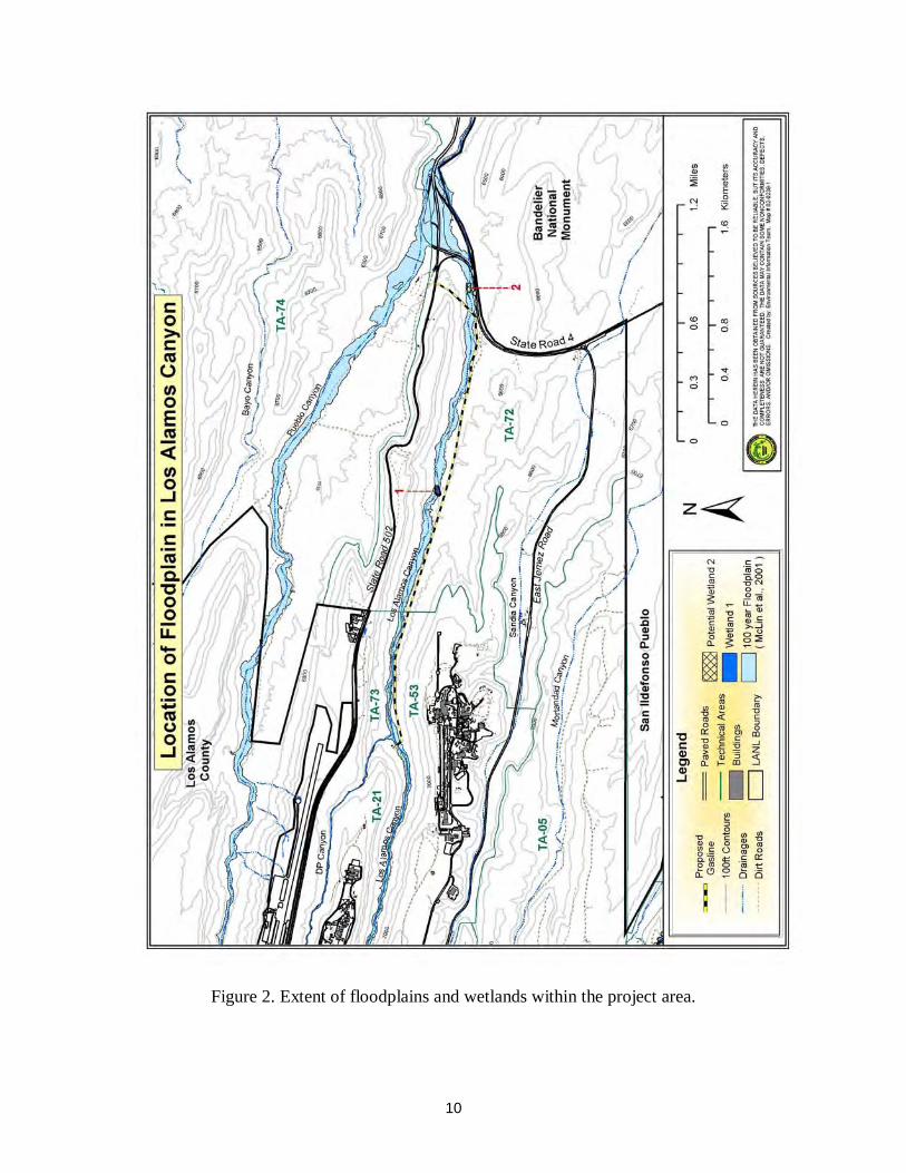
10
Figure 2. Extent of floodplains and wetlands within the project area.
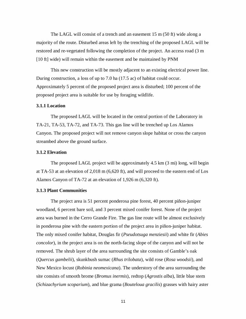
11
The LAGL will consist of a trench and an easement 15 m (50 ft) wide along a
majority of the route. Disturbed areas left by the trenching of the proposed LAGL will be
restored and re-vegetated following the completion of the project. An access road (3 m
[10 ft] wide) will remain within the easement and be maintained by PNM
This new construction will be mostly adjacent to an existing electrical power line.
During construction, a loss of up to 7.0 ha (17.5 ac) of habitat could occur.
Approximately 5 percent of the proposed project area is disturbed; 100 percent of the
proposed project area is suitable for use by foraging wildlife.
3.1.1 Location
The proposed LAGL will be located in the central portion of the Laboratory in
TA-21, TA-53, TA-72, and TA-73. This gas line will be trenched up Los Alamos
Canyon. The proposed project will not remove canyon slope habitat or cross the canyon
streambed above the ground surface.
3.1.2 Elevation
The proposed LAGL project will be approximately 4.5 km (3 mi) long, will begin
at TA-53 at an elevation of 2,018 m (6,620 ft), and will proceed to the eastern end of Los
Alamos Canyon of TA-72 at an elevation of 1,926 m (6,320 ft).
3.1.3 Plant Communities
The project area is 51 percent ponderosa pine forest, 40 percent piñon-juniper
woodland, 6 percent bare soil, and 3 percent mixed conifer forest. None of the project
area was burned in the Cerro Grande Fire. The gas line route will be almost exclusively
in ponderosa pine with the eastern portion of the project area in piñon-juniper habitat.
The only mixed conifer habitat, Douglas fir (Pseudotsuga menziesii) and white fir (Abies
concolor), in the project area is on the north-facing slope of the canyon and will not be
removed. The shrub layer of the area surrounding the site consists of Gamble’s oak
(Quercus gambelii), skunkbush sumac (Rhus trilobata), wild rose (Rosa woodsii), and
New Mexico locust (Robinia neomexicana). The understory of the area surrounding the
site consists of smooth brome (Bromus inermis), redtop (Agrostis alba), little blue stem
(Schizachyrium scoparium), and blue grama (Bouteloua gracilis) grasses with hairy aster
12
(Heterotheca villosa), broom snakeweed (Gutierrezia sarothrae), and New Mexico
lupine (Lupinus neomexicanus). Along the primary waterway through the bottom of the
canyon are willow (Salix exigna), narrow leaf cottonwood (Populus angustifolia), and
patchy areas of rush (Juncus sp.) and grasses.
3.1.4 Levels of Disturbance
The proposed LAGL project location is approximately 5 percent disturbed along
the existing electrical line with the remainder of the location having a cover of native
vegetation. Currently, the site consists of an electric power line at the edge of the
proposed gas line route along most of its length with the remainder of the site having a
scattered ponderosa pine woodland and native understory species. The site is mostly
within the existing utility corridor for the high-power electric utility line, but the
vegetation in this corridor is well developed with ponderosa pine up to about 20 cm
(8 in.) in diameter.
4.0 Description and Effects on Floodplains and Wetlands
Pursuant to Executive Order 11988, Floodplain Management, each Federal
agency is required, when conducting activities in a floodplain, to take actions to reduce
the risk of flood damage; minimize the impact of floods on human safety, health, and
welfare; and restore and preserve the natural and beneficial values served by floodplains.
DOE’s 10 CFR Part 1022.4 defines a flood or flooding as “. . . a temporary condition of
partial or complete inundation of normally dry land areas from . . . the unusual and rapid
accumulation of runoff of surface waters . . . .” DOE’s 10 CFR Part 1022.4 identifies
floodplains that must be considered in a floodplain assessment as the base floodplain and
the critical-action floodplain. The base floodplain is the area inundated by a flood having
a 1.0 percent chance of occurrence in any given year (referred to as the 100-year
floodplain). The critical-action floodplain is the area inundated by a flood having a 0.2
percent chance of occurrence in any given year (referred to as the 500-year floodplain).
Critical action is defined as any activity for which even a slight chance of flooding would
be too great. Such actions could include the storage of highly volatile, toxic, or water-
reactive materials.

13
Pursuant to Executive Order 11990, Protection of Wetlands, each Federal agency
is to avoid, to the extent practicable, the destruction or modification of wetlands, and to
avoid direct or indirect support of new construction in wetlands if a practicable
alternative exists. DOE 10 CFR Section 1022.4(v): Wetlands means those areas that are
inundated by surface or groundwater with a frequency sufficient to support and under
normal circumstances does or would support a prevalence of vegetative or aquatic life
that requires saturated or seasonally saturated soil conditions for growth and
reproduction. Wetlands generally include swamps, marshes, bogs, and similar areas such
as sloughs, potholes, wet meadows, river overflow, mudflats, and natural ponds.
According to 10 CFR 1022.12(a)(2), a floodplain/wetland assessment is required
to discuss the positive and negative, direct and indirect, and long- and short-term effects
of the proposed action on the floodplain and/or wetlands. In addition, the effects on lives
and property and on natural and beneficial values of floodplains must be evaluated. For
actions taken in wetlands, the assessment should evaluate the effects of the proposed
action on the survival, quality, and natural and beneficial values of the wetlands. If DOE
finds no practicable alternative to locating activities in floodplains or wetlands, DOE will
design or modify its actions to minimize potential harm to or in the floodplains and
wetlands. The floodplains and wetlands that are assessed herein are those areas in
canyons or drainages that are seasonally inundated with perennial or intermittent streams
from runoff during 100-year floods.
4.1 General
Wetland functions are naturally occurring characteristics of wetlands such as food
web production; general, nesting, resting, or spawning habitat; sediment retention;
erosion prevention; flood and runoff storage; retention and future release; groundwater
discharge or recharge; and land-nutrient retention and removal. Wetland values are
ascribed by society based on the perception of significance and include water-quality
improvement, aesthetic or scenic value, experiential value, and educational or training
value. These values often reflect concerns regarding economic values; strategic locations;
and in arid regions, the location relative to other landscape features. Thus, two wetlands
with similar size and shape could serve the same function but have different values to
society. For example, a wetland that retains or changes flood flow timing of a flood high
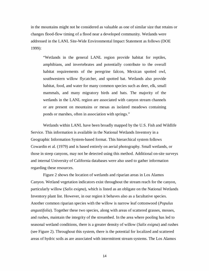
14
in the mountains might not be considered as valuable as one of similar size that retains or
changes flood-flow timing of a flood near a developed community. Wetlands were
addressed in the LANL Site-Wide Environmental Impact Statement as follows (DOE
1999):
“Wetlands in the general LANL region provide habitat for reptiles,
amphibians, and invertebrates and potentially contribute to the overall
habitat requirements of the peregrine falcon, Mexican spotted owl,
southwestern willow flycatcher, and spotted bat. Wetlands also provide
habitat, food, and water for many common species such as deer, elk, small
mammals, and many migratory birds and bats. The majority of the
wetlands in the LANL region are associated with canyon stream channels
or are present on mountains or mesas as isolated meadows containing
ponds or marshes, often in association with springs.”
Wetlands within LANL have been broadly mapped by the U.S. Fish and Wildlife
Service. This information is available in the National Wetlands Inventory in a
Geographic Information System-based format. This hierarchical system follows
Cowardin et al. (1979) and is based entirely on aerial photography. Small wetlands, or
those in steep canyons, may not be detected using this method. Additional on-site surveys
and internal University of California databases were also used to gather information
regarding these resources.
Figure 2 shows the location of wetlands and riparian areas in Los Alamos
Canyon. Wetland vegetation indicators exist throughout the stream reach for the canyon,
particularly willow (Salix exigna), which is listed as an obligate on the National Wetlands
Inventory plant list. However, in our region it behaves also as a facultative species.
Another common riparian species with the willow is narrow leaf cottonwood (Populus
angustifolia). Together these two species, along with areas of scattered grasses, mosses,
and rushes, maintain the integrity of the streambed. In the area where pooling has led to
seasonal wetland conditions, there is a greater density of willow (Salix exigna) and rushes
(see Figure 2). Throughout this system, there is the potential for localized and scattered
areas of hydric soils as are associated with intermittent stream systems. The Los Alamos
15
Canyon weir area is being monitored for the formation of a wetland. Signs of natural
wetland formation are present, including hydric vegetation such as cattails and rushes.
Willow (Salix exigna) and cottonwood (Populus sp.) have been planted by LANL staff to
decrease soil erosion. The formation of a wetland in this area will depend upon future
presence of wetland indicators.
Within the Los Alamos Canyon section there is discussion of the direct and
indirect (both primary and secondary) effects of the proposed project on floodplain and
wetlands resources located in the canyon. The effect of proposed floodplain actions on
lives and property and on natural and beneficial floodplain values is evaluated.
4.2 Canyon Area Issues and Concerns
The canyon areas on LANL land are comprised primarily of mixed conifer and
ponderosa pine. The majority of these canyons, especially in the northern region of
LANL property, have been identified as core habitat for the Mexican spotted owl (Keller
2002).
Treatments in floodplains within habitat areas, such as potential habitat for the
Mexican spotted owl, will follow the LAGL Biological Assessment (Keller 2002) and the
actions agreed upon within the Threatened and Endangered Species Habitat Management
Plan (HMP) (LANL 1998). In all cases, erosion, sediment transfer, and movement of
contaminants are a concern, for work on mesa tops as well as within floodplains,
particularly during rain events and the monsoon season.
Cumulative erosion of ash and soils from severely burned headlands above the
project site is also a potential concern. The potential for downstream floodplain/wetland
values to be impacted by the proposed project exists for the canyon. Potential
downstream impacts are discussed for Los Alamos Canyon.
5.0 Canyon Specific Assessment
5.1 Los Alamos Canyon
5.1.1 Description
The primary tree cover for Los Alamos Canyon is mixed conifer in the upper
sections and ponderosa pine for much of the length down to the lower elevations where it

16
blends with piñon-juniper. There are wetlands associated with the canyon streambed, and
the floodplain extends for the entire length. The headlands were severely burned, which
may increase runoff during the monsoons. There is an established road running the entire
length of the canyon.
5.1.2 Floodplains and Wetlands Description and Potential Impacts from Proposed
Los Alamos Gas Line
Floodplains
The 100-year floodplain is illustrated in Figure 2.
Wetlands
There are scattered wetlands associated with this canyon (Figure 2). Wetland 1
(Fig. 2) shows signs of seasonal pooling associated with clustered dominant vegetation of
willow (Salix exigna) and rush (Juncus sp.). Wetland 2 (Fig. 2) is a naturally developing
potential wetland due to water pooling at the Los Alamos weir.
Summary of Impacts
No potential for loss of life or property has been identified with respect to
floodplains or wetlands in this canyon, as long as previously approved best management
practices are considered. Possible primary direct effects of the gas line project are a
reduction in vegetation cover, exposure, and compaction of mineral soils due to
excavation and heavy equipment. Possible secondary direct effects are the potential for
the increase of erosion and storm water runoff.
Primary indirect impacts (within the canyon) to floodplains and wetlands resulting
from the gas line project have not been identified. If work conducted in Los Alamos
Canyon contributed to increased sediment movement, there may be some retention of
those sediments by the wetlands. Best management practices for runoff control would be
installed to minimize these impacts.
Secondary indirect impacts (outside of the project area) resulting from the gas line
project would result in possible impacts to floodplains and wetlands not associated with
the project area (e.g., downstream to the Rio Grande). Downstream floodplain and
wetland values potentially effected by the proposed gas line project could include a slight

17
alteration of flood-flow retention times; a slight alteration of wildlife nesting, foraging, or
resting habitat; a slight redistribution of sediments and sediment retention-time changes.
At a minimum, best management practices for runoff control, such as silt barriers,
should be in place to mitigate runoff effects during the project. These best management
practices would incorporate considerations of the National Pollutant Discharge
Elimination System permit program and Environmental Protection Agency requirements
for a Storm Water Pollution Prevention Plan and under sections 401 and 404 of the Clean
Water Act.
6.0 Alternatives and Mitigations for the Proposed Project
6.1 Alternatives
There were a number of alternatives considered for the LAGL project. These
include replacing the existing pipeline under SR 502, installing a pipeline in Pueblo
Canyon, installing a pipeline under the existing gravel roadway in Los Alamos Canyon,
and installing a pipeline in Sandia Canyon. All of these alternatives were dismissed for
the following reasons: traffic disruption, floodplains and/or wetlands issues, increased
costs, and no discernable improvements to the Proposed Action (for further details see
DOE 2002).
The No Action Alternative, where the LAGL would not be constructed was also
considered. Although no activity would be taken within the Los Alamos Canyon
floodplain under this alternative, this action was dismissed on the grounds that natural gas
service expansion is necessary for LANL, Los Alamos County, and surrounding
communities.
6.2. Mitigations
In all cases, best management practices would be followed according to any and
all DOE and LANL best management practices for wetlands and floodplains including
the “Special Environmental Analysis for the Department of Energy, National Nuclear
Security Administration, Actions Taken in Response to the Cerro Grande Fire at Los
Alamos National Laboratory, Los Alamos, NM” (CSFS 1998, DOE 2000). All disturbed
18
areas will be evaluated and improvements installed as needed. There may be some
additional useful mitigation that is discussed below.
All work conducted for the proposed gas line project that involves the disturbance
of soils through road building, the continuous use of roads, off-road vehicle use, dragging
of debris, or trenching potentially contributes to an increase in sediment movement
during a 100-year storm event. This in turn can possibly increase the amount of
contaminants being relocated to downstream areas. Mitigation actions associated with
activities in floodplains will in part depend upon best management practices already in
place for potential release sites, erosion control, and post-gas line project mitigation.
In general, no debris would be left in the floodplains. This includes all downed
vegetation. Care would be taken to keep all vegetation or soil from going into the
watercourse. Leaving debris of any kind in a drainage, stream channel, or watercourse,
even if it only runs seasonally, may invoke a penalty under Sections 401 and/or 404 of
the Clean Water Act. Enough trees should remain along channel edges to stabilize the
banks. Best management practices’ suggestions from the Colorado Forest Stewardship
Guidelines (CSFS 1998) include maintaining streamside management zones that are 15-
m (50-ft) buffers on all sides of a perennial streambed, spring, seep, wetland, or any
riparian-like area where no disturbance would occur. This enhances stability of any
potential watercourse. If the gas line passes under the streambed, depending on the
degree of disturbance, stabilization and revegetation of the streambed may be necessary.
Best management practices would be employed when working in canyon bottoms
as a planned part of the project since these areas are considered potentially contaminated
until proven otherwise through extensive further contaminant testing. Minimizing soil
disturbance and contaminant movement is desired. Following the already prescribed
method (CSFS 1998, Marsh 2001, DOE 2000) of using established roads only in canyon
bottoms will help with this issue.
7.0 Conclusion
No potential loss of life or property have been identified with respect to the
floodplains and wetlands for the proposed gas line project. Concerns about siltation,
erosion, and excessive storm water runoff will be addressed with specific mitigation
19
implemented as part of careful project planning. Although there may be some effect to
floodplains and wetlands, the potential impacts from the LAGL project are expected to be
minor.
8.0 References
BAER. 2000. “Cerro Grande Fire Burned Area Emergency Rehabilitation Plan,”Interagency Burned Area Emergency Rehabilitation Team, Los Alamos, NM.
Balice, R.G. 1998. “A Preliminary Survey of Terrestrial Plant Communities in the Sierrade los Valles.” Los Alamos National Laboratory report LA-13523-MS.
Blake, W.D., F. Goff, A. Adams, and D. Counce. 1995. “Environmental Geochemistryfor Surface and Subsurface Waters in the Los Alamos Canyon Plateau and OutlyingAreas, New Mexico,” Los Alamos National Laboratory report LA-12912-MS.
Bowen, B.M. 1990. “Los Alamos Climatology,” Los Alamos National Laboratory reportLA-11735-MS.
Bowen, B.M. 1992. “Los Alamos Climatology Summary,” Los Alamos NationalLaboratory report LA-12232-MS.
Broxton, D.E., G.H. Heiken, S.J. Chipera, And F.M. Byers, Jr., 1995, “Stratigraphy,Petrography, And Mineralogy Of Bandelier Tuff And Cerro Toledo Deposits,” inEarth Science Investigations for Environmental Restoration— Los Alamos NationalLaboratory Technical Area 21 Edited by D.E. Broxton P.G. Eller LA-12934-MS
Cowardin, L.M., V. Carter, F.C. Golet, and E.T. LaRoe. 1979. “Classification ofWetlands and Deep Water Habitats of the United States.” Performed for the U.S.Department of the Interior, Fish and Wildlife Service, Washington, D. C.USFWS/OBS-79-31. U.S. Government Printing Office.
Colorado State Forest Service 1998. “Colorado Forest Stewardship Guidelines: BestManagement Practices for Colorado,” Pp. 1–33.
Department of Energy. 1999. “Site-wide Environmental Impact Statement for theContinued Operation of Los Alamos National Laboratory,” U.S. Department ofEnergy report DOE-EIS-0238.
Department of Energy. 2000. “Special Environmental Analysis for the Department ofEnergy, National Nuclear Security Administration, Actions Taken in Response to theCerro Grande Fire at Los Alamos National Laboratory, Los Alamos, NM,” U.S.Department of Energy report, DOE/SEA-03.
20
Department of Energy. 2002. “Environmental Assessment for the Proposed Issuance ofan Easement to Public Service Company of New Mexico for the Construction andOperation of a 12-inch Natural Gas Pipeline within Los Alamos National Laboratory,Los Alamos, New Mexico.” U.S. Department of Energy report, DOE/EA-1409.
Griggs, R.L. 1964. “Geology and ground-water resources of the Los Alamos area NewMexico,” U.S. Geological Survey Water-Supply Paper 1753, 107 p.
Keller, D.C. 2002. “Biological Assessment: The Potential Effects of the Los AlamosCanyon Gas Line Construction on Federally Listed Threatened, Endangered, andSensitive Species,” Los Alamos National Laboratory report LA-UR-02-914.
Keller, D.C., L.K. Marsh. 2001. “A Floodplain and Wetland Assessment for the PotentialEffects of the Decontamination and Demolition of Omega West Reactor,” LosAlamos National Laboratory report LA-UR-01-5823.
Los Alamos National Laboratory. 1998. “Threatened and Endangered Species HabitatManagement Plan,” Los Alamos National Laboratory report LALP-98-112.
Marsh, L.K. 2001. “A Floodplain and Wetlands Assessment for the Potential Effects ofthe Wildfire Hazard Reduction Project,” Los Alamos National Laboratory report LA-UR-01-3643.
McLin, S.G. 1992. “Determination of 100-Year Floodplain Elevations at Los AlamosNational Laboratory,” Los Alamos National Laboratory report LA-12195-MS.
McLin, S.G., M.E. van Eeckhout, A. Earles. 2001. “Mapping 100-year FloodplainBoundaries following the Cerro Grande Wildfire,” Los Alamos National Laboratoryreport LA-UR-01-5218.
Nyhan, J.W., L.W. Hacker, T.E. Calhoun, and D.L. Young. 1978. “Soil Survey of LosAlamos County, New Mexico,” Los Alamos Scientific Laboratory report LA-6779-MS.
Purtymun, W.D. 1995a. “Geologic and Hydrologic Records of Observation Wells, TestHoles, Test Wells, Supply Wells, Springs, and Surface Water Stations in the LosAlamos Area.” Los Alamos National Laboratory report LA-12883-MS, Los Alamos,NM.
Purtymun, W.D. 1995b. Source document compilation: “Los Alamos InvestigationsRelated to the Environment, Engineering, Geology, and Hydrology: 1961–1990.” LosAlamos National Laboratory report LA-12733-MS, Los Alamos, NM.
Purtymun, W.D., and S. Johnson. 1974. “General Geohydrology of the Pajarito Plateau,”New Mexico Geological Society Guidebook, 25th Field Conference, Ghost Ranch,NM.

21
Self, S. and Sykes, M.L., 1996, “Part I: Field Guide to the Bandelier Tuff and VallesCaldera,” in Self, S., Heiken, G., Sykes, M.L., Wohletz, K, Fisher, R.V., and Dethier,D.P., 1996, Field Excursions to the Jemez Mountains, New Mexico, Bulletin 134,New Mexico Bureau of Mines and Mineral Resources. 72 pp.