enhancedview program - amazon web services · enhancedview program under the enhancedview program,...
TRANSCRIPT
EnhancedView ProgramUnder the EnhancedView program, the National Geospatial-Intelligence Agency (NGA) acquires imagery and imagery-derived products on behalf of its customers within the U.S. government. This program provides the US government with cost-effective, preemptive access to unclassified high-resolution satellite imagery. EnhancedView is designed to promote collaboration within the U.S. government for national security, homeland defense, and disaster and emergency response situations. USG users can readily share the imagery with partners such as military coalitions and non-government support and relief organizations.
See a better world.®ENHANCEDVIEW PROGRAM
DATA SHEET
° Broad constellation
° Worldwide network of ground stations
° Online web dissemination
° Secure tasking
° Guaranteed and predicable preemptive tasking across the DG WorldView constellation.
° Availability of complete DigitalGlobe EnhancedView imagery archive
° Ready to use imagery rapidly available to end-users.
° Shareable unclassified high-resolution imagery
° EnhancedView Web Hosting enables online web dissemination to the intelligence community, military, and federal agencies and allies on internet and SIPRNET.
Features & Benefits
Archive Imagery Access: DigitalGlobe’s 80+ petabyte, 16-year time-lapse library of high-resolution imagery and information makes up the largest knowledge base of location-based information about our changing planet.
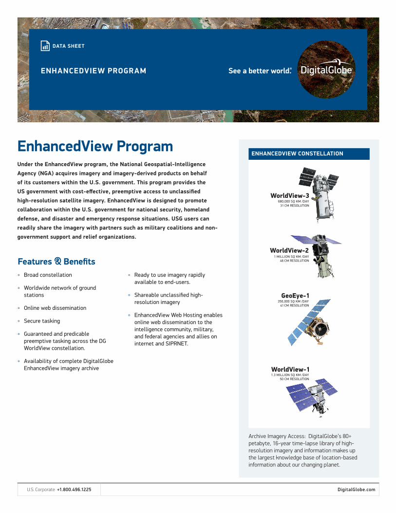
ENHANCEDVIEW CONSTELLATION
31
46
41
U.S. Corporate +1.800.496.1225 DigitalGlobe.com
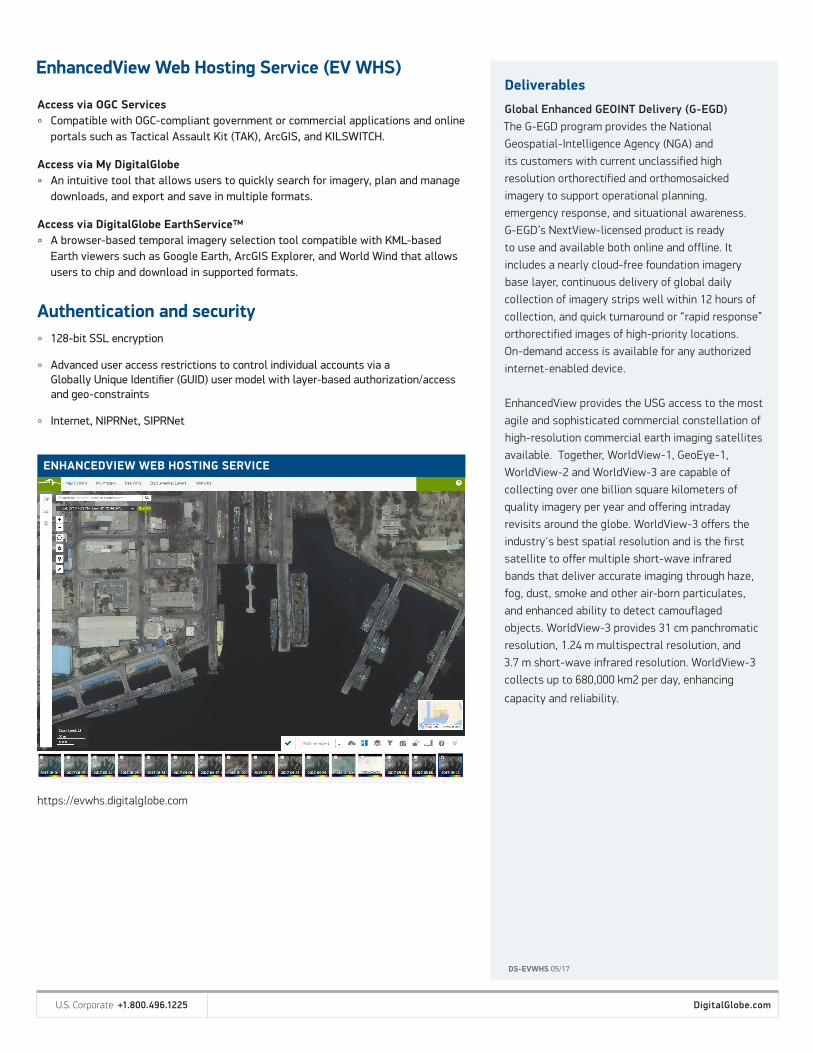
ENHANCEDVIEW WEB HOSTING SERVICE
EnhancedView Web Hosting Service (EV WHS)
DS-EVWHS 05/17
Deliverables
Global Enhanced GEOINT Delivery (G-EGD)The G-EGD program provides the NationalGeospatial-Intelligence Agency (NGA) andits customers with current unclassified high resolution orthorectified and orthomosaickedimagery to support operational planning,emergency response, and situational awareness. G-EGD’s NextView-licensed product is ready to use and available both online and offline. It includes a nearly cloud-free foundation imagery base layer, continuous delivery of global daily collection of imagery strips well within 12 hours of collection, and quick turnaround or “rapid response” orthorectified images of high-priority locations. On-demand access is available for any authorized internet-enabled device.
EnhancedView provides the USG access to the most agile and sophisticated commercial constellation of high-resolution commercial earth imaging satellites available. Together, WorldView-1, GeoEye-1, WorldView-2 and WorldView-3 are capable of collecting over one billion square kilometers of quality imagery per year and offering intraday revisits around the globe. WorldView-3 offers the industry's best spatial resolution and is the first satellite to offer multiple short-wave infrared bands that deliver accurate imaging through haze, fog, dust, smoke and other air-born particulates, and enhanced ability to detect camouflaged objects. WorldView-3 provides 31 cm panchromatic resolution, 1.24 m multispectral resolution, and 3.7 m short-wave infrared resolution. WorldView-3 collects up to 680,000 km2 per day, enhancing
capacity and reliability.
Access via OGC Services
° Compatible with OGC-compliant government or commercial applications and online portals such as Tactical Assault Kit (TAK), ArcGIS, and KILSWITCH.
Access via My DigitalGlobe
° An intuitive tool that allows users to quickly search for imagery, plan and manage downloads, and export and save in multiple formats.
Access via DigitalGlobe EarthService™
° A browser-based temporal imagery selection tool compatible with KML-based Earth viewers such as Google Earth, ArcGIS Explorer, and World Wind that allows users to chip and download in supported formats.
° 128-bit SSL encryption
° Advanced user access restrictions to control individual accounts via a Globally Unique Identifier (GUID) user model with layer-based authorization/access and geo-constraints
° Internet, NIPRNet, SIPRNet
Authentication and security
https://evwhs.digitalglobe.com
U.S. Corporate +1.800.496.1225 DigitalGlobe.com