engineering surveying -1 ce212 compass surveying · 9/6/2016 · engineering surveying -1 ce212...
TRANSCRIPT
Engineering Surveying -1 CE212 Plane Table Surveying
Lecture
2016, September 18
Muhammad Noman
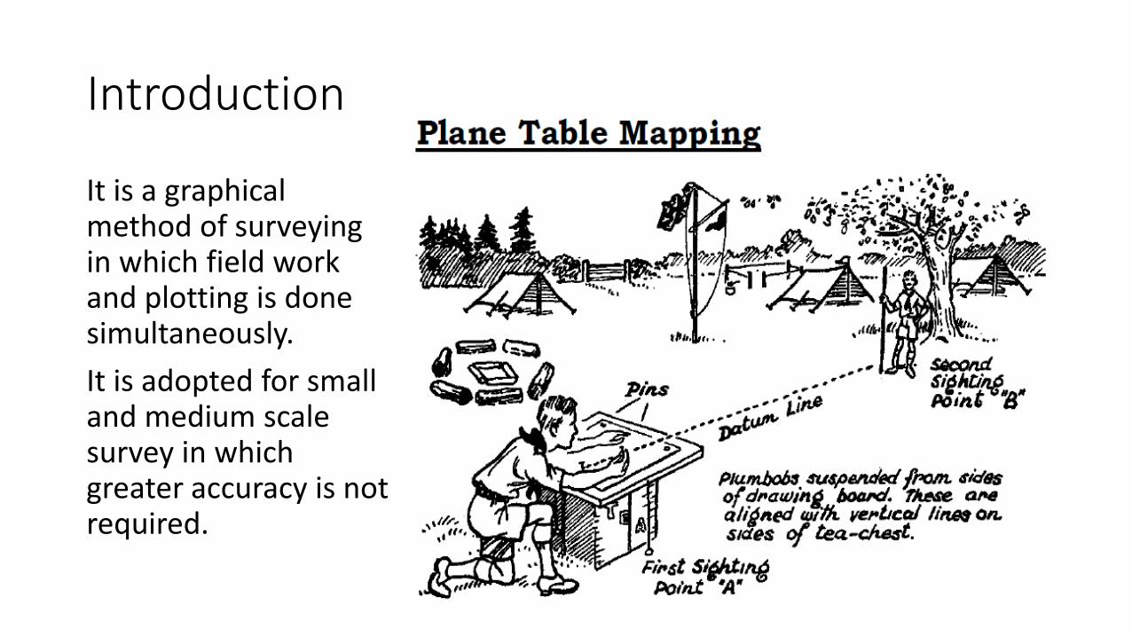
Introduction
It is a graphical method of surveying in which field work and plotting is done simultaneously.
It is adopted for small and medium scale survey in which greater accuracy is not required.
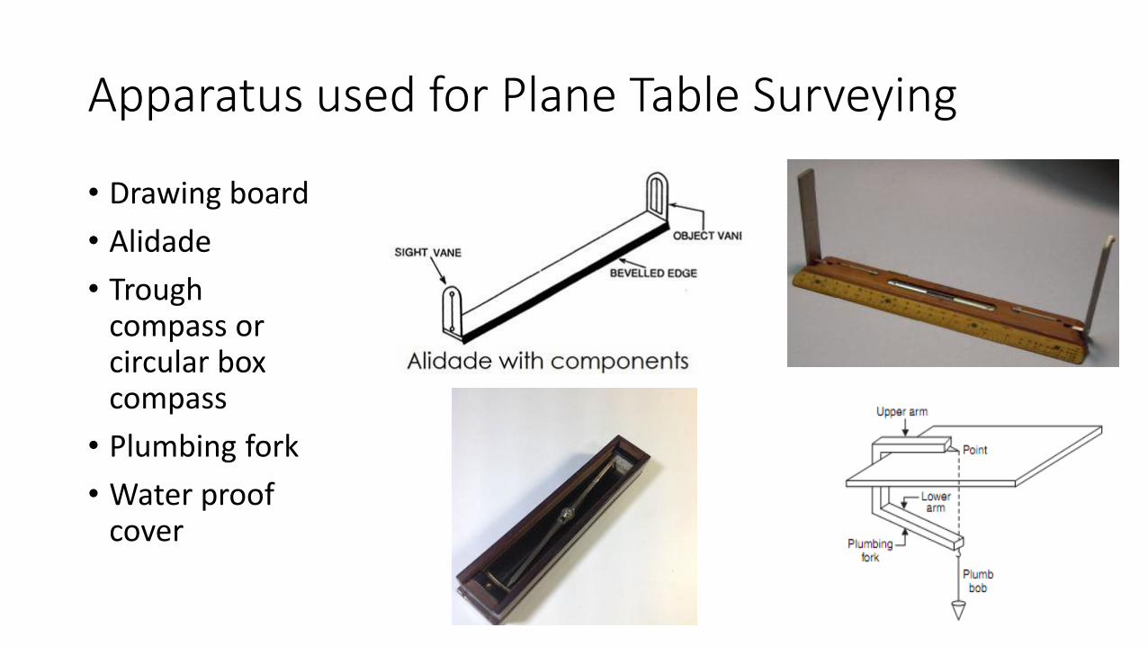
Apparatus used for Plane Table Surveying
• Drawing board
• Alidade
• Trough compass or circular box compass
• Plumbing fork
• Water proof cover
Advantages of plane tabling
• Used for preparing small scale maps.
• It is most rapid method.
• Field book is not necessary as field work and plotting is done simultaneously.
• The surveyor can compare the plotted work with the actual features of the area.
• Irregular objects may be represented accurately.
• It is advantageous in magnetic area where compass survey is not reliable.
• It is less costly than a theodolite survey.
Disadvantages of plane tabling
• It is not suitable for work in a wet climate.
• It is heavy.
• It is not intended for accurate work.
• Replotting is difficult due to the absence of field notes.
Setting up the plane table
The table should be at convenient height for working.
The legs of the table should be well apart and firmly fixed in the ground.
The point plotted on the sheet representing the ground station should be exactly above the station on the ground. This operation is known as centering of the table. This is done with the help of plumbing fork or U frame.
Level the table by means of a level tube or circular level placed on the table. This is done by adjusting legs or ball and socket joint.
Orientation of the table
Orientation is done to keep the table at each successive station parallel to previous station.
When the table is oriented the lines on the ground becomes parallel to the lines on the sheet.
Table is oriented by two methods.
1. Orientation by back sighting
2. Orientation by magnetic needle
Methods of Plane Tabling
There are Four methods of Plane Tabling:
• Radiation
• Intersection
• Traversing
• Resection
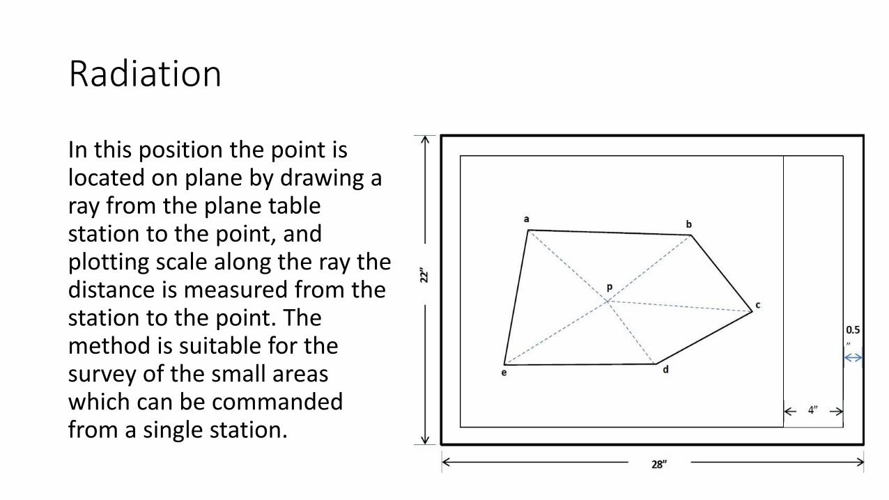
Radiation
In this position the point is located on plane by drawing a ray from the plane table station to the point, and plotting scale along the ray the distance is measured from the station to the point. The method is suitable for the survey of the small areas which can be commanded from a single station.
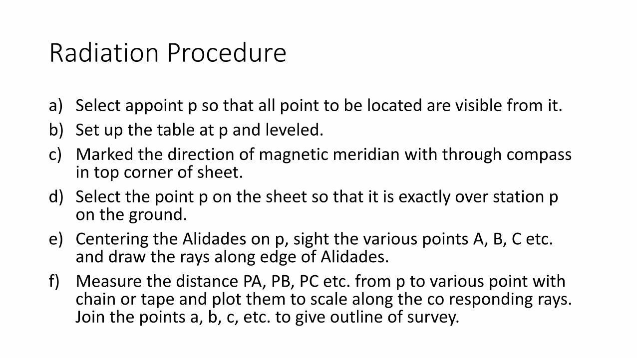
Radiation Procedure
a) Select appoint p so that all point to be located are visible from it.
b) Set up the table at p and leveled.
c) Marked the direction of magnetic meridian with through compass in top corner of sheet.
d) Select the point p on the sheet so that it is exactly over station p on the ground.
e) Centering the Alidades on p, sight the various points A, B, C etc. and draw the rays along edge of Alidades.
f) Measure the distance PA, PB, PC etc. from p to various point with chain or tape and plot them to scale along the co responding rays. Join the points a, b, c, etc. to give outline of survey.
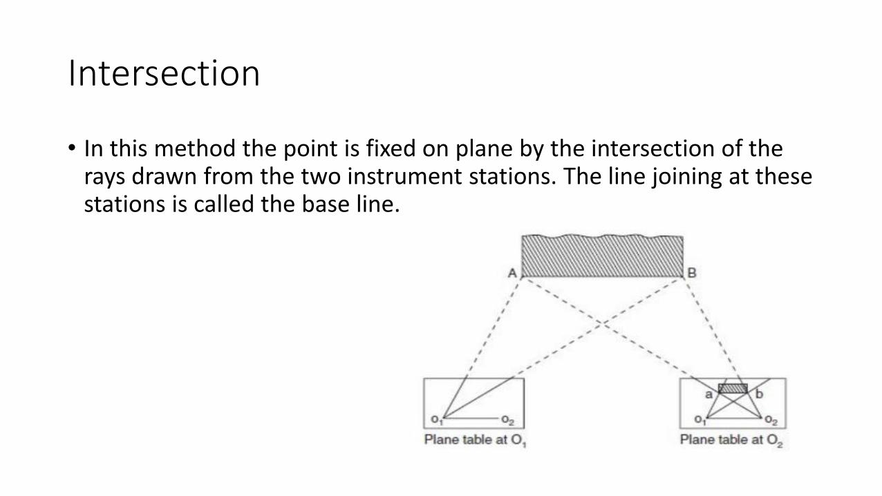
Intersection
• In this method the point is fixed on plane by the intersection of the rays drawn from the two instrument stations. The line joining at these stations is called the base line.
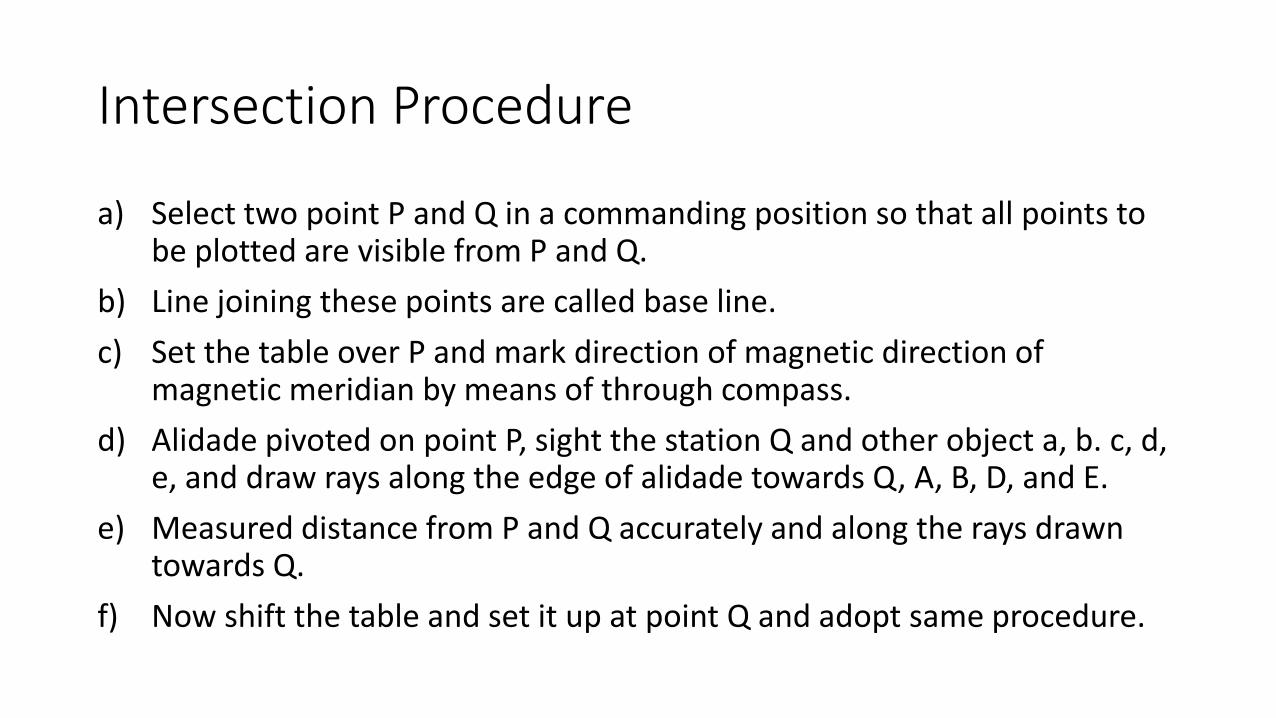
Intersection Procedure
a) Select two point P and Q in a commanding position so that all points to be plotted are visible from P and Q.
b) Line joining these points are called base line.
c) Set the table over P and mark direction of magnetic direction of magnetic meridian by means of through compass.
d) Alidade pivoted on point P, sight the station Q and other object a, b. c, d, e, and draw rays along the edge of alidade towards Q, A, B, D, and E.
e) Measured distance from P and Q accurately and along the rays drawn towards Q.
f) Now shift the table and set it up at point Q and adopt same procedure.
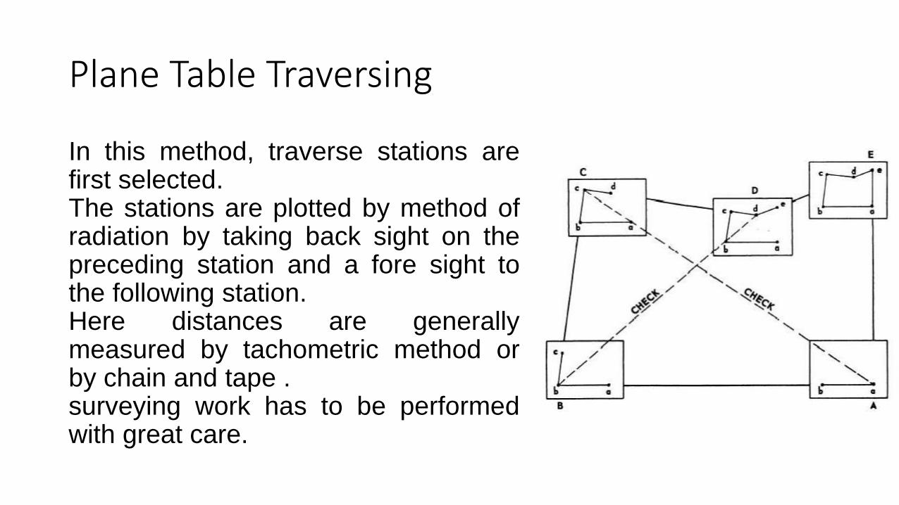
Plane Table Traversing
In this method, traverse stations arefirst selected.The stations are plotted by method ofradiation by taking back sight on thepreceding station and a fore sight tothe following station.Here distances are generallymeasured by tachometric method orby chain and tape .surveying work has to be performedwith great care.
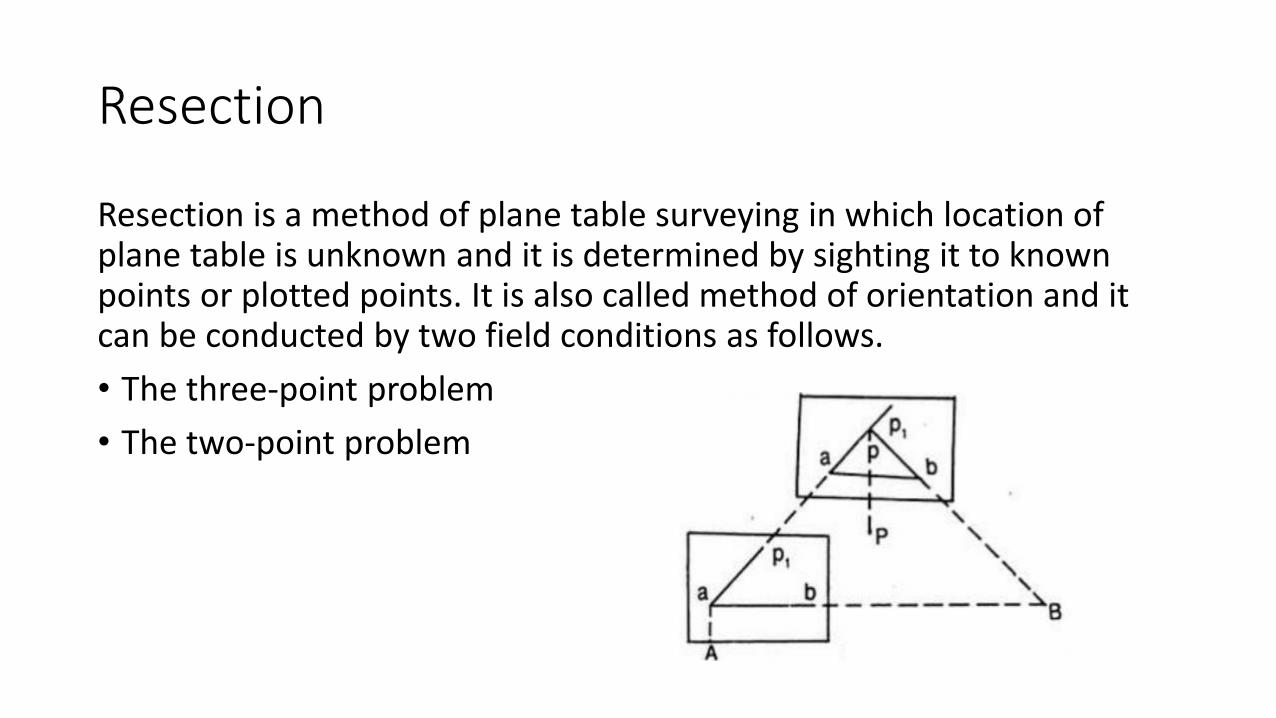
Resection
Resection is a method of plane table surveying in which location of plane table is unknown and it is determined by sighting it to known points or plotted points. It is also called method of orientation and it can be conducted by two field conditions as follows.
• The three-point problem
• The two-point problem

• Thankyou