drainage patterns - mrs. connor's website st. james...
TRANSCRIPT

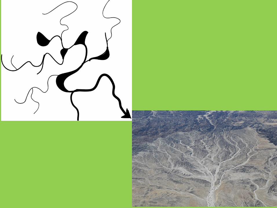
Drainage Patterns

Patterns of Water• All water will eventually drain to another
water source. • Most of the time it is to a larger water source,
such as an ocean.• How different flowing water types drain
creates a pattern.

Drainage System • In geomorphology (the study of the Earth’s
processes), a drainage system is the pattern formed by the streams, rivers, and lakes in a particular drainage basin.

What are some natural processes you can think of that happen on the Earth?

Why water drains…
• http://www.youtube.com/watch?v=DPlkw5L5Yg8
• Water drains due to the topography of the land.
• Topography refers to the shape and features of the Earth’s surface.

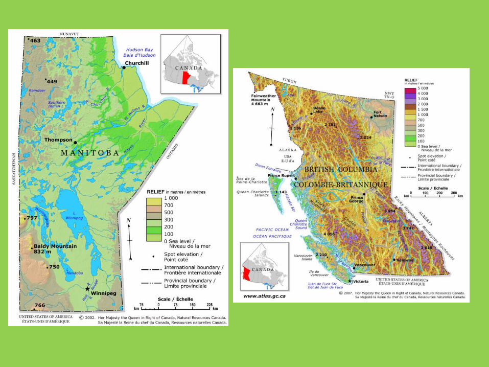
Relief
• These features typically form a pattern depending on what makes up the topography, which can be called the ‘relief’ of a region.
• Relief can refer to how flat an area is in relationship to the area around it.
• Example: Manitoba is mostly flat so would have less relief, while Alberta would have more relief closed to the Rocky Mountain range.
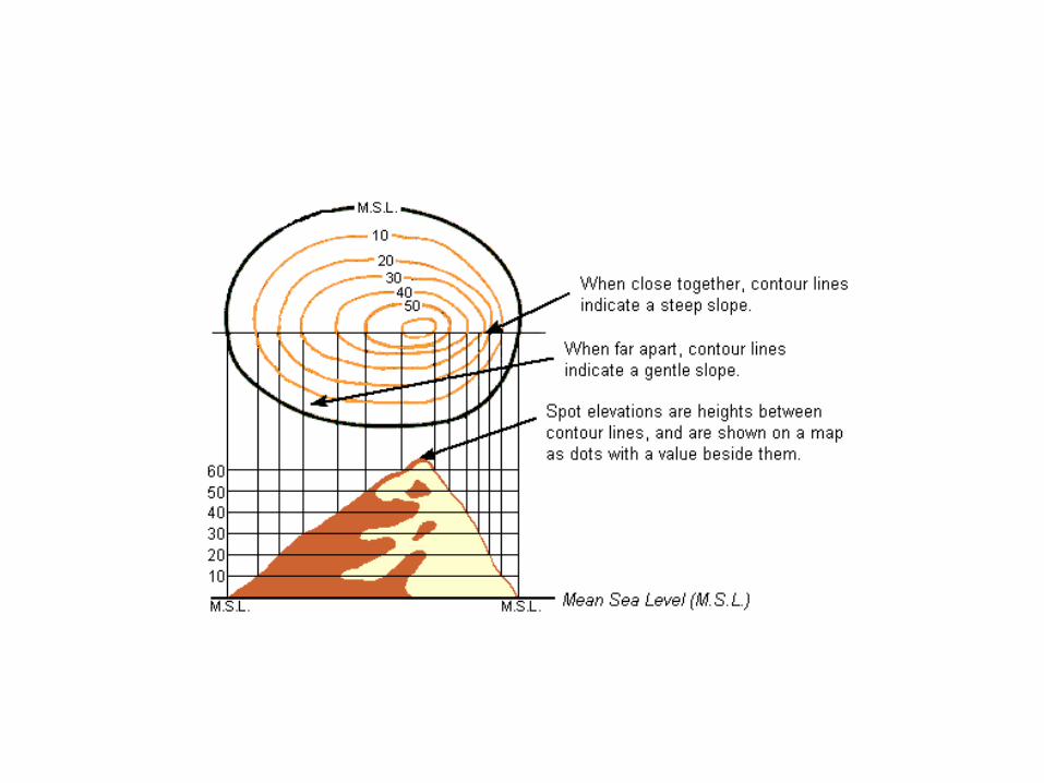

• Topography can also be described as whether a particular region is dominated by hard or soft rocks, and the gradient of the land.
• The harder the rocks, the less the water will seep or absorb into them. Softer rocks work like a sponge and take in much more water, allowing for more drainage.
• The gradient refers also to the height of the land but also how much difference between the different heights there is.

Drainage Basin • A drainage basin is the topographic region
from which a stream receives runoff, throughflow, and groundwater flow.

Runoff• When the ground (specifically the soil) cannot
absorb any more water from precipitation sources, it flows over the land until it comes in contact with a drainage source. This can cause erosion of the land.

Throughflow
• When water flows in horizontal manner, mostly below ground. It must emerge onto land before it enters a larger body of water, such as a lake. The reason why it flows underground is that when water enters the soil, the force of gravity pulls it down below the soil. This typically happens when the soil gets super saturated with water and cannot absorb anymore water.

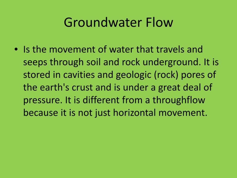
Groundwater Flow
• Is the movement of water that travels and seeps through soil and rock underground. It is stored in cavities and geologic (rock) pores of the earth's crust and is under a great deal of pressure. It is different from a throughflowbecause it is not just horizontal movement.


Watershed
• Drainage basins are divided from each other by topographic barriers called a watershed.
• It is represented by tributaries. These are parts of a steam that will flow into fresh water sources, such as rivers and not salt water sources, such as oceans.


• A watershed represents all of the stream tributaries that flow to some location along the stream channel.
• The number, size, and shape of the drainage basins found in an area can vary.

Types of Drainage Systems • Types of drainage system• Drainage systems can fall into one of several
categories, depending on the topography and geology of the land:
• Dendritic drainage pattern.• Parallel drainage pattern.• Trellis drainage pattern.• Rectanglar drainage system • Radial drainage system• Deranged drainage system• Annular drainage pattern

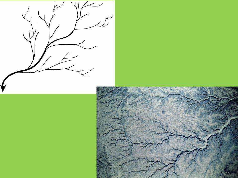
Dendritic drainage system
• Comes from the Greek word meaning tree.• Most common types• Many contributing streams (like twigs on a
tree)• They then join into the main stream or river.• They form following the slope or gradient of
the terrain they are in.

Parallel drainage system
• Pattern of rivers caused by steep slopes with some relief (flat parts)
• Due to the steep slopes, the streams are swift and straight, with very few tributaries (branches), and all flow in the same direction.
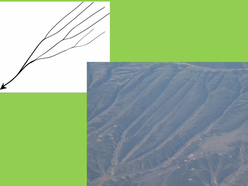
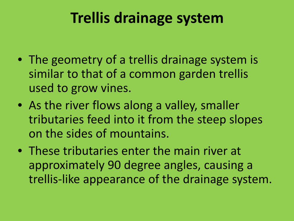
Trellis drainage system
• The geometry of a trellis drainage system is similar to that of a common garden trellis used to grow vines.
• As the river flows along a valley, smaller tributaries feed into it from the steep slopes on the sides of mountains.
• These tributaries enter the main river at approximately 90 degree angles, causing a trellis-like appearance of the drainage system.

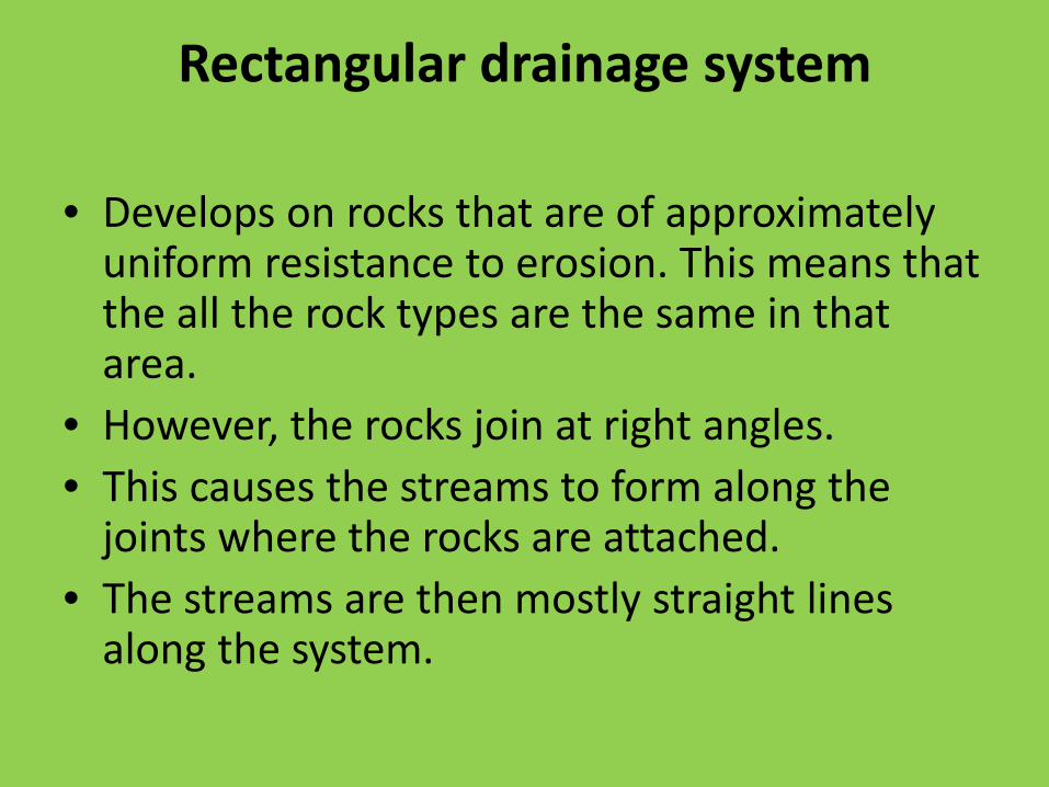
Rectangular drainage system
• Develops on rocks that are of approximately uniform resistance to erosion. This means that the all the rock types are the same in that area.
• However, the rocks join at right angles.• This causes the streams to form along the
joints where the rocks are attached. • The streams are then mostly straight lines
along the system.

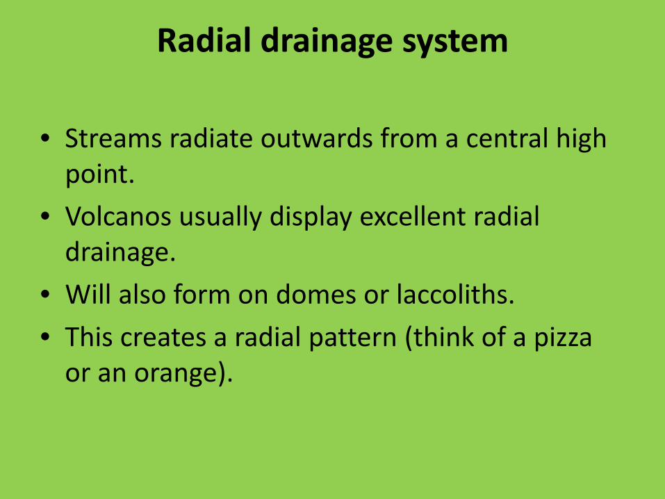
Radial drainage system
• Streams radiate outwards from a central high point.
• Volcanos usually display excellent radial drainage.
• Will also form on domes or laccoliths.• This creates a radial pattern (think of a pizza
or an orange).


Deranged drainage system
• A deranged drainage system is a drainage system in drainage basins where there is no set pattern to the rivers and lakes.
• It happens in areas where there has been much geological disruption, such as earthquakes and mountains forming.

Annular drainage pattern
• In an annular drainage pattern streams follow a roughly circular path, creating a ring like pattern.
• This is because the rock is weak, which means that it is very porous, allowing a lot fo water to flow into it.
