Download - Introduction to LiDAR presentation
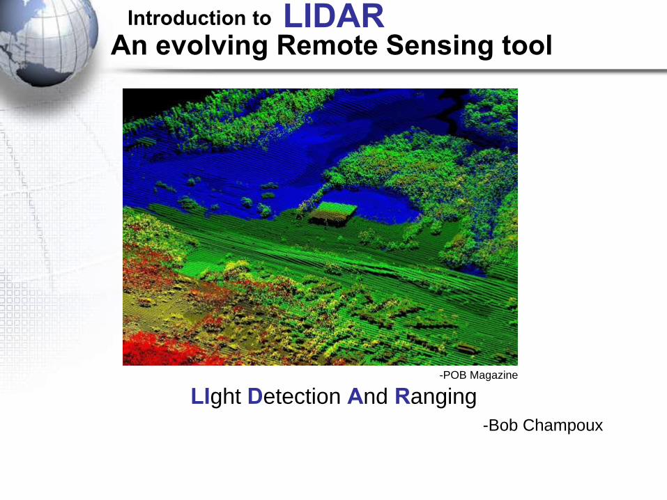
An evolving Remote Sensing tool
-Bob Champoux
-ICESAT, NASA
LIght Detection And Ranging
Introduction to LIDAR
-POB Magazine
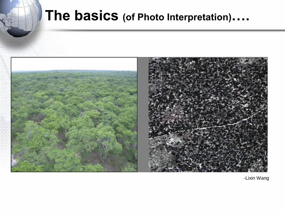
The basics (of Photo Interpretation)….
-Lixin Wang
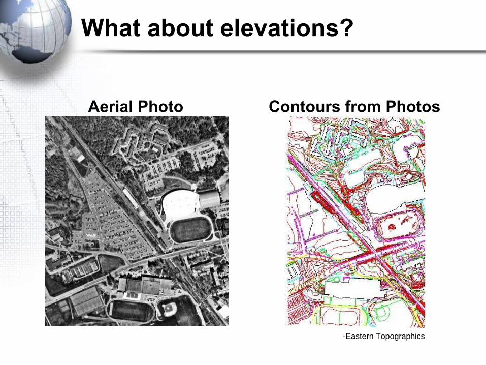
What about elevations?
Aerial Photo Contours from Photos
-Eastern Topographics
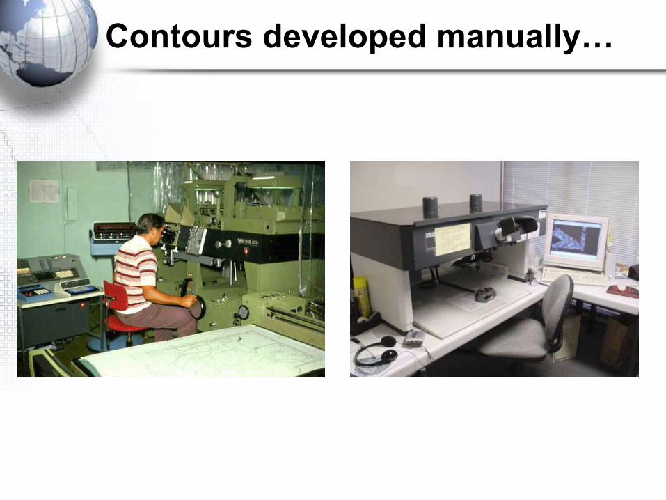
Contours developed manually…
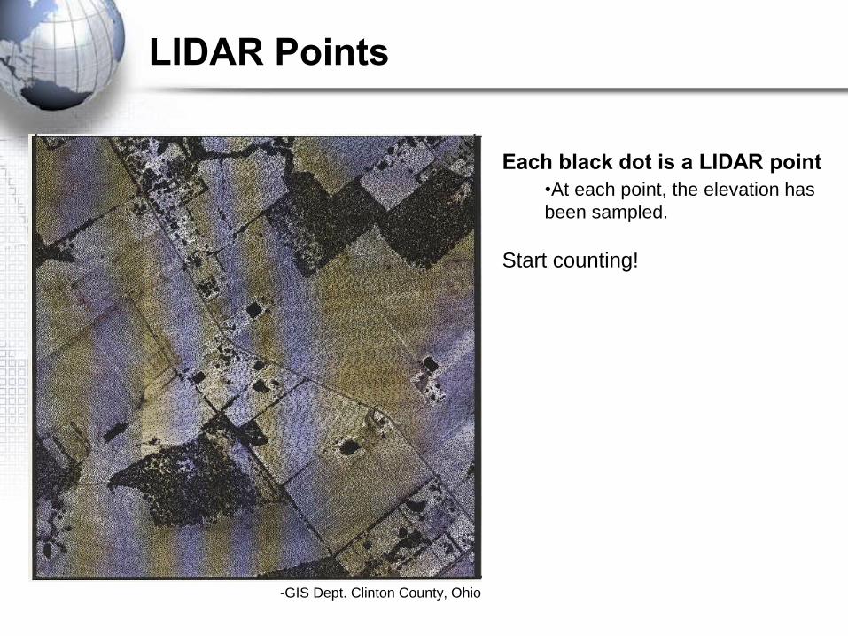
LIDAR Points
Each black dot is a LIDAR point
•At each point, the elevation has
been sampled.
Start counting!
-GIS Dept. Clinton County, Ohio
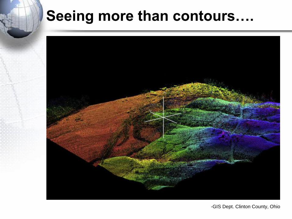
Seeing more than contours….
-GIS Dept. Clinton County, Ohio
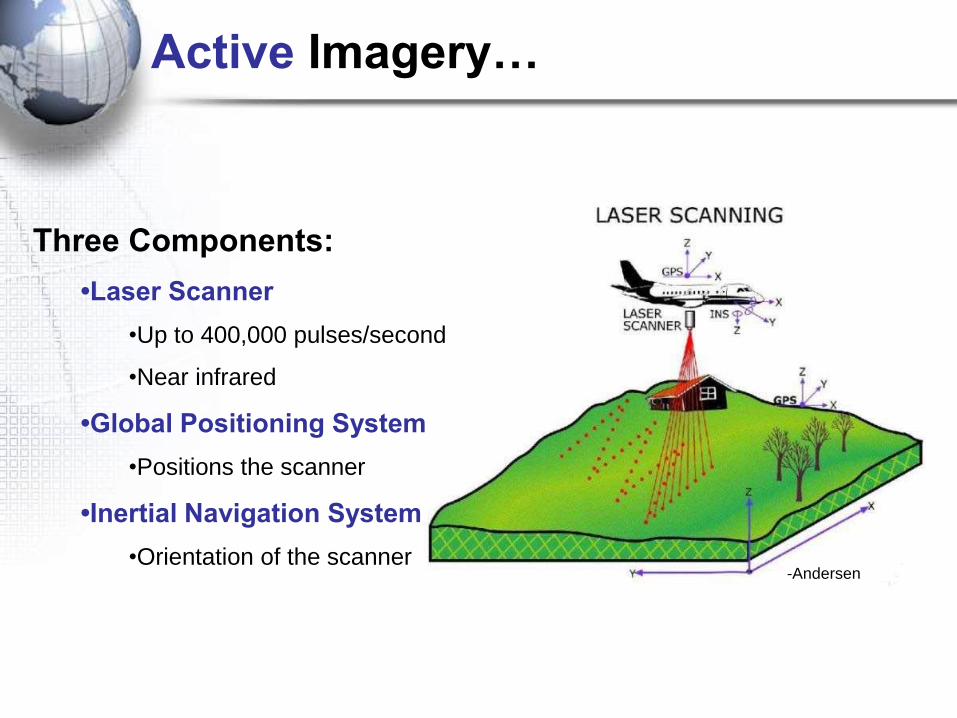
Active Imagery…
Three Components:
•Laser Scanner
•Up to 400,000 pulses/second
•Near infrared
•Global Positioning System
•Positions the scanner
•Inertial Navigation System
•Orientation of the scanner-Andersen
-Andersen
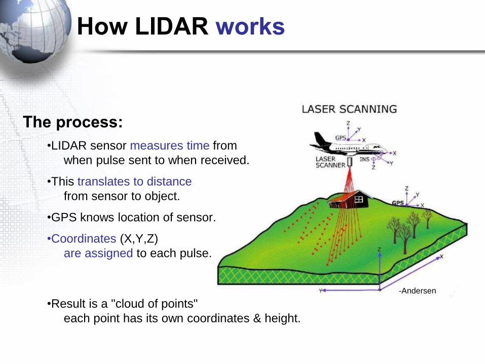
How LIDAR works
The process:
•LIDAR sensor measures time from
when pulse sent to when received.
•This translates to distance
from sensor to object.
•GPS knows location of sensor.
•Coordinates (X,Y,Z)
are assigned to each pulse.
•Result is a "cloud of points"
each point has its own coordinates & height.
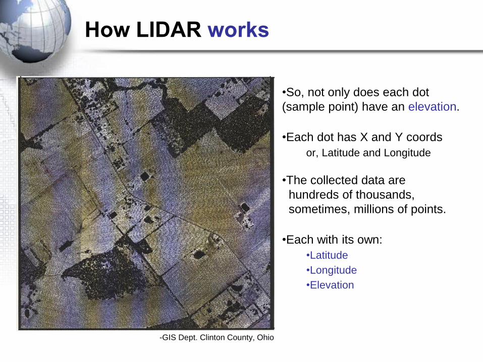
How LIDAR works
•So, not only does each dot
(sample point) have an elevation.
•Each dot has X and Y coords
or, Latitude and Longitude
•The collected data are
hundreds of thousands,
sometimes, millions of points.
•Each with its own:
•Latitude
•Longitude
•Elevation
-GIS Dept. Clinton County, Ohio

How many points?
• Points equals resolution.
• Dependent on these variables:
• Number of pulses.
• Flying height.
• Flying speed.
• Scan angle.
-N. Carolina State University
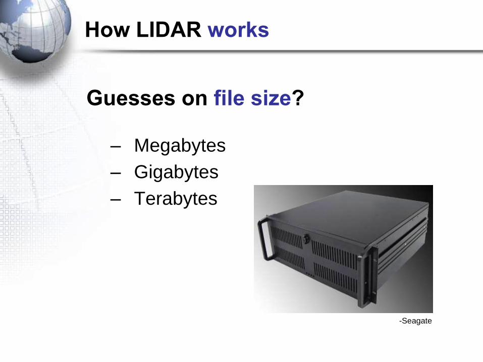
Guesses on file size?
– Megabytes
– Gigabytes
– Terabytes
-Seagate
How LIDAR works
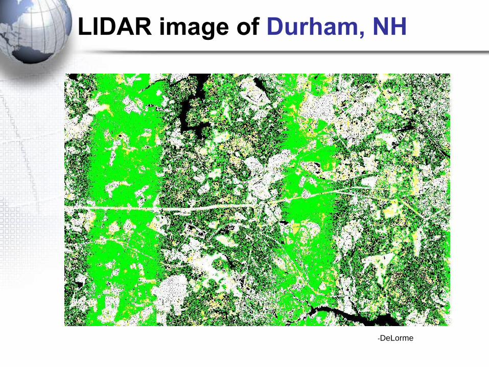
LIDAR image of Durham, NH
-DeLorme
-GIS Dept. Clinton County, Ohio
-Natural Hazards Centre, NZ
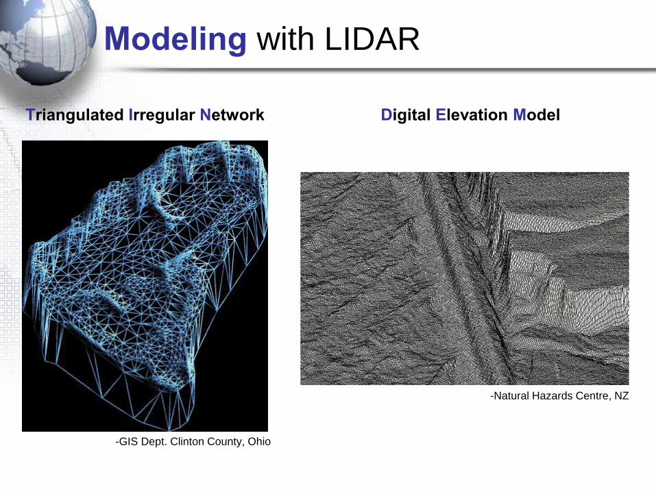
Triangulated Irregular Network Digital Elevation Model
Modeling with LIDAR
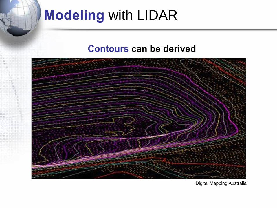
Modeling with LIDAR
Contours can be derived
-Digital Mapping Australia
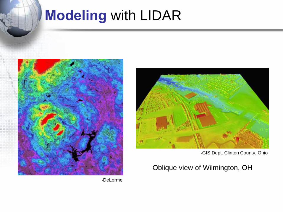
Modeling with LIDAR
Oblique view of Wilmington, OH
-GIS Dept. Clinton County, Ohio
-DeLorme
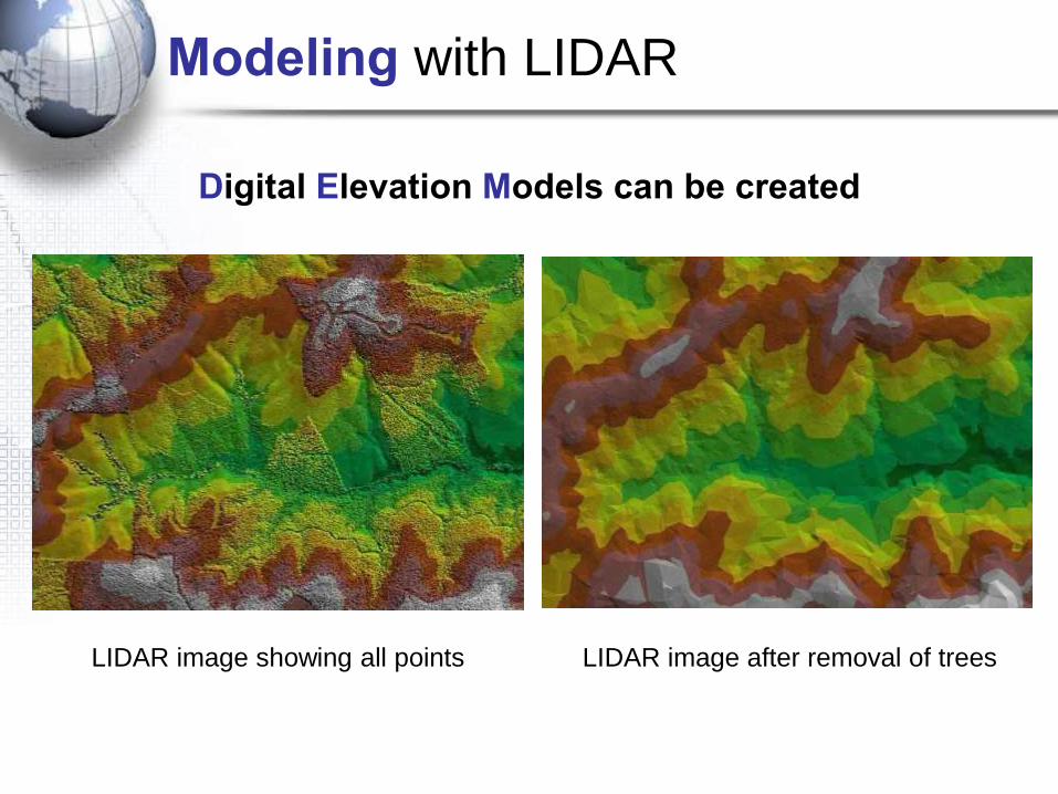
Modeling with LIDAR
LIDAR image showing all points LIDAR image after removal of trees
Digital Elevation Models can be created
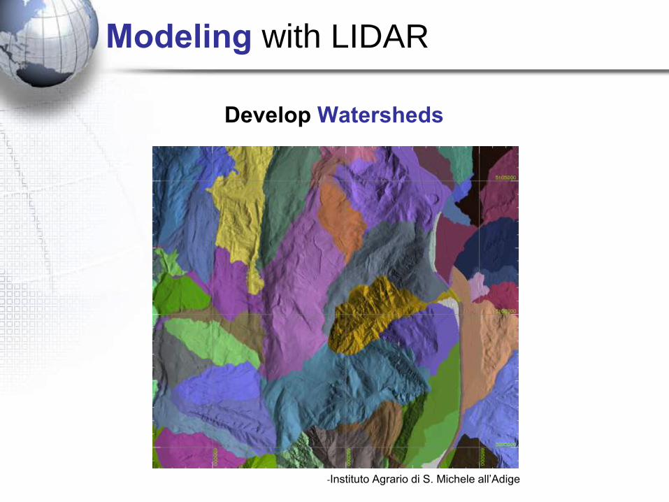
Modeling with LIDAR
Develop Watersheds
-Instituto Agrario di S. Michele all’Adige
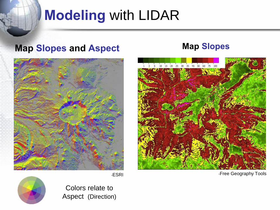
Map Slopes and Aspect
-Free Geography Tools-ESRI
Map Slopes
Colors relate to
Aspect (Direction)
Modeling with LIDAR
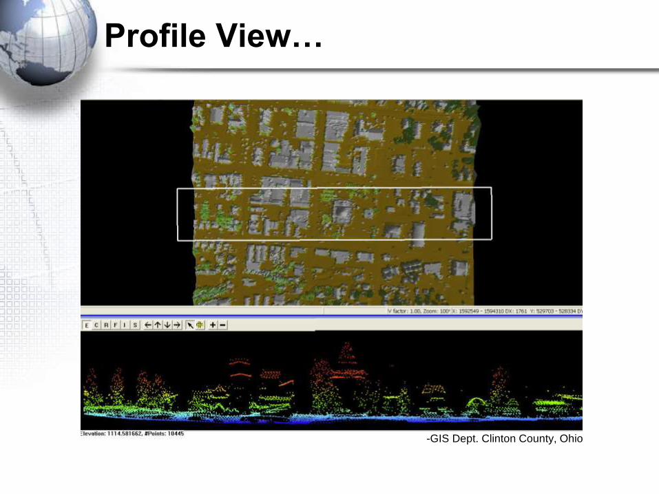
Profile View…
-GIS Dept. Clinton County, Ohio
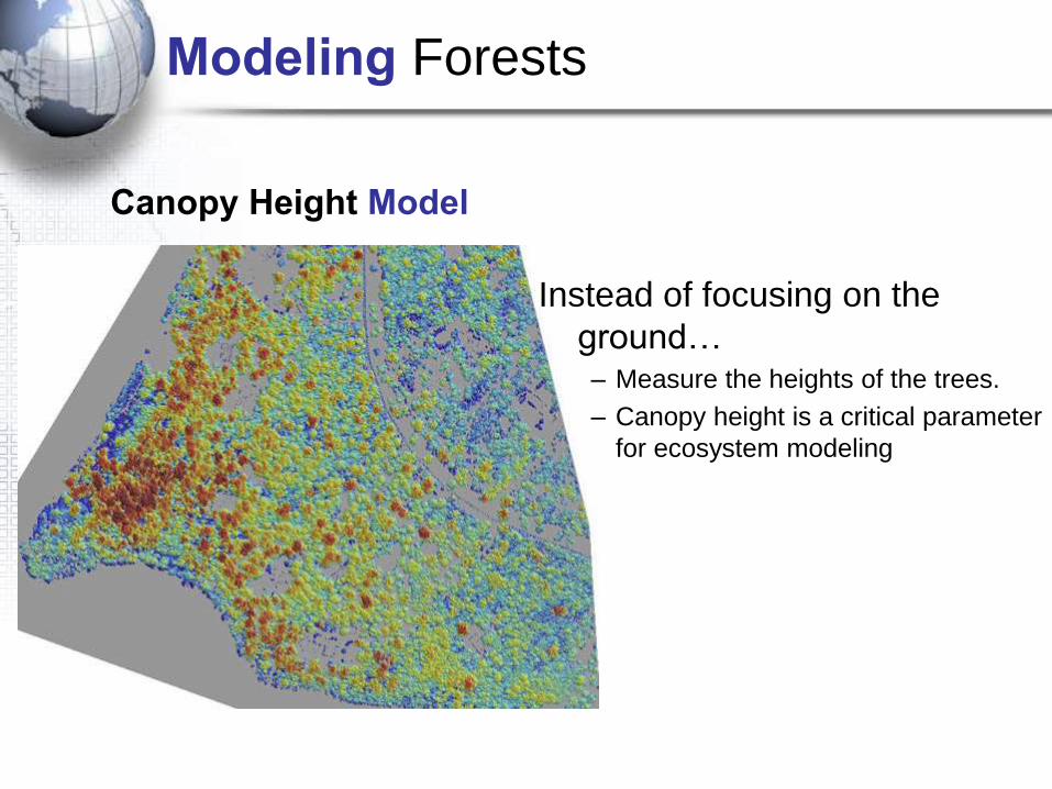
Modeling Forests
Canopy Height Model
Instead of focusing on the
ground…– Measure the heights of the trees.
– Canopy height is a critical parameter
for ecosystem modeling
-Digital Mapping Australia
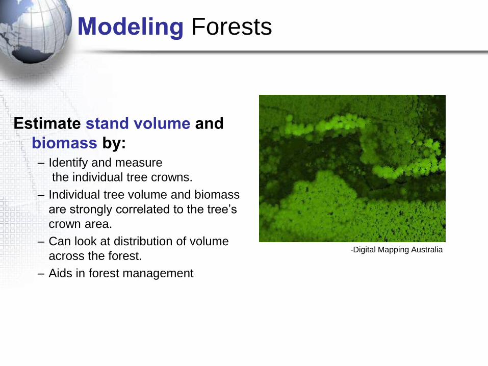
Modeling Forests
Estimate stand volume and
biomass by:– Identify and measure
the individual tree crowns.
– Individual tree volume and biomass
are strongly correlated to the tree’s
crown area.
– Can look at distribution of volume
across the forest.
– Aids in forest management
-Lefsky
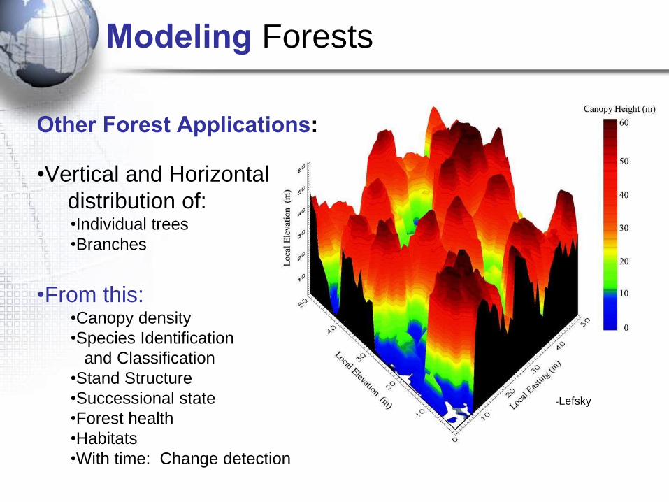
Other Forest Applications:
•Vertical and Horizontal
distribution of:•Individual trees
•Branches
•From this:•Canopy density
•Species Identification
and Classification
•Stand Structure
•Successional state
•Forest health
•Habitats
•With time: Change detection
Modeling Forests
-Spencer B. Gross
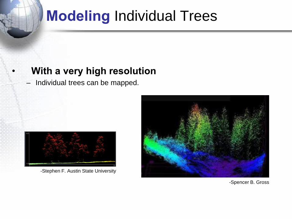
Modeling Individual Trees
-Stephen F. Austin State University
• With a very high resolution– Individual trees can be mapped.
-Lefsky
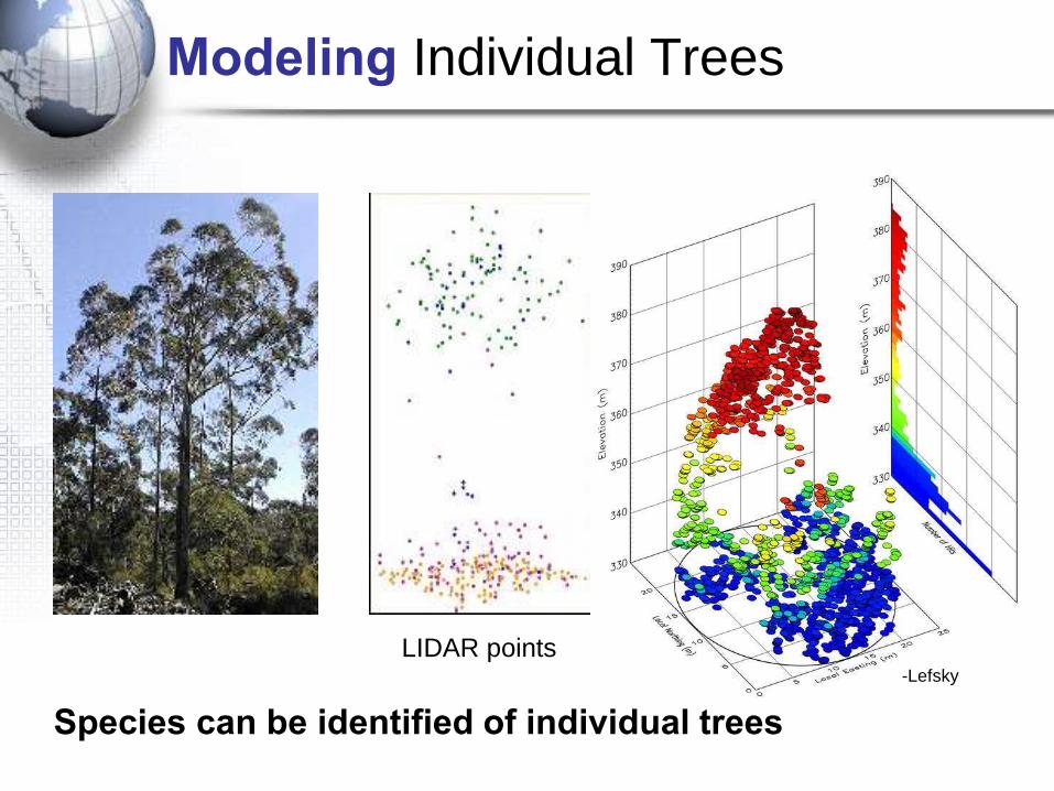
LIDAR points
Modeling Individual Trees
Species can be identified of individual trees
Modeling Individual Trees
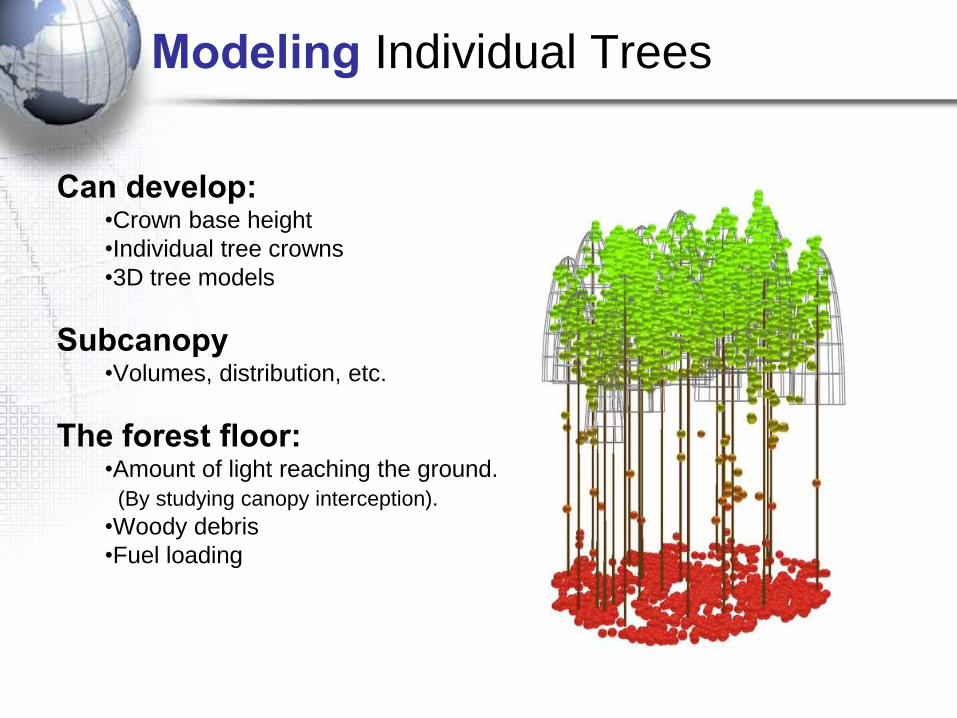
Can develop:•Crown base height
•Individual tree crowns
•3D tree models
Subcanopy•Volumes, distribution, etc.
The forest floor:•Amount of light reaching the ground.
(By studying canopy interception).
•Woody debris
•Fuel loading

Modeling urban areas
-TerrascanHouston, TX

-OpenTopography
Modeling urban areas
Uses:•Urban Planning
•Transportation
•Emergency Response
•Drainage Patterns
•Flooding
•Flooding Response
•Amount of Impervious
Surface
•Vegetation
Image above:
New Orleans, LA-Terrascan
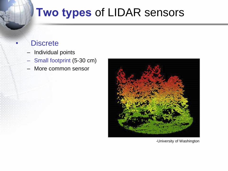
Two types of LIDAR sensors
• Discrete– Individual points
– Small footprint (5-30 cm)
– More common sensor
-University of Washington
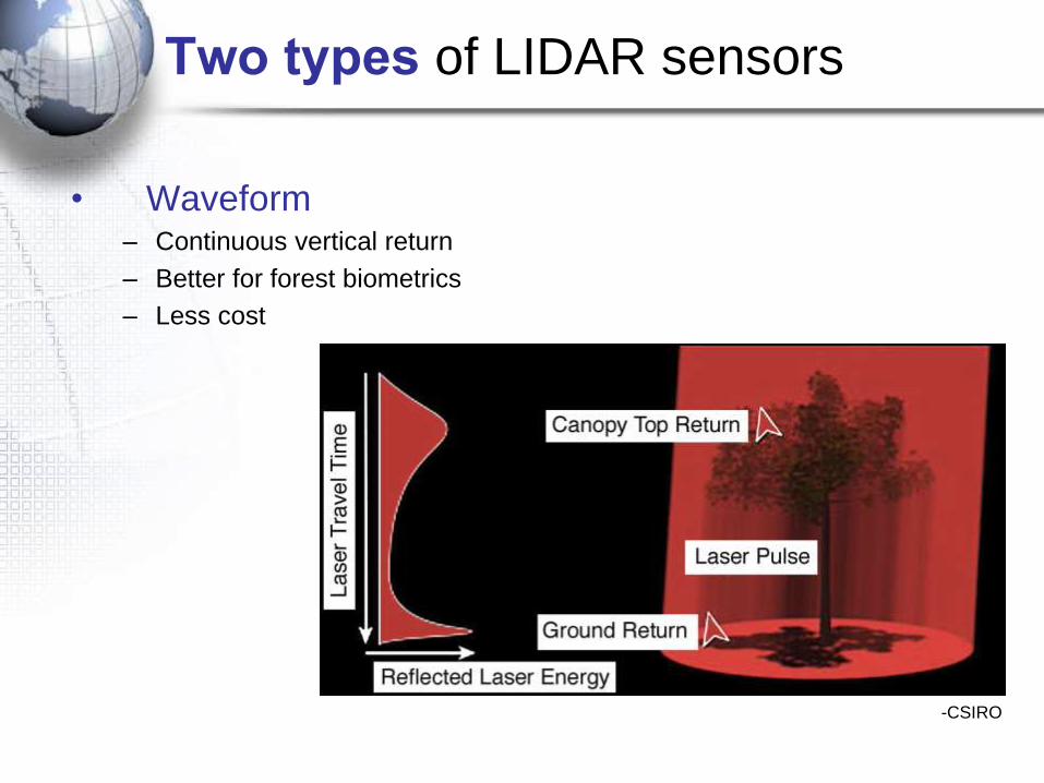
Two types of LIDAR sensors
-CSIRO
• Waveform– Continuous vertical return
– Better for forest biometrics
– Less cost
-ASPRS
Two types of LIDAR sensors
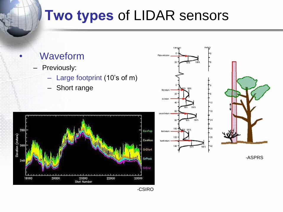
• Waveform– Previously:
– Large footprint (10’s of m)
– Short range
-CSIRO
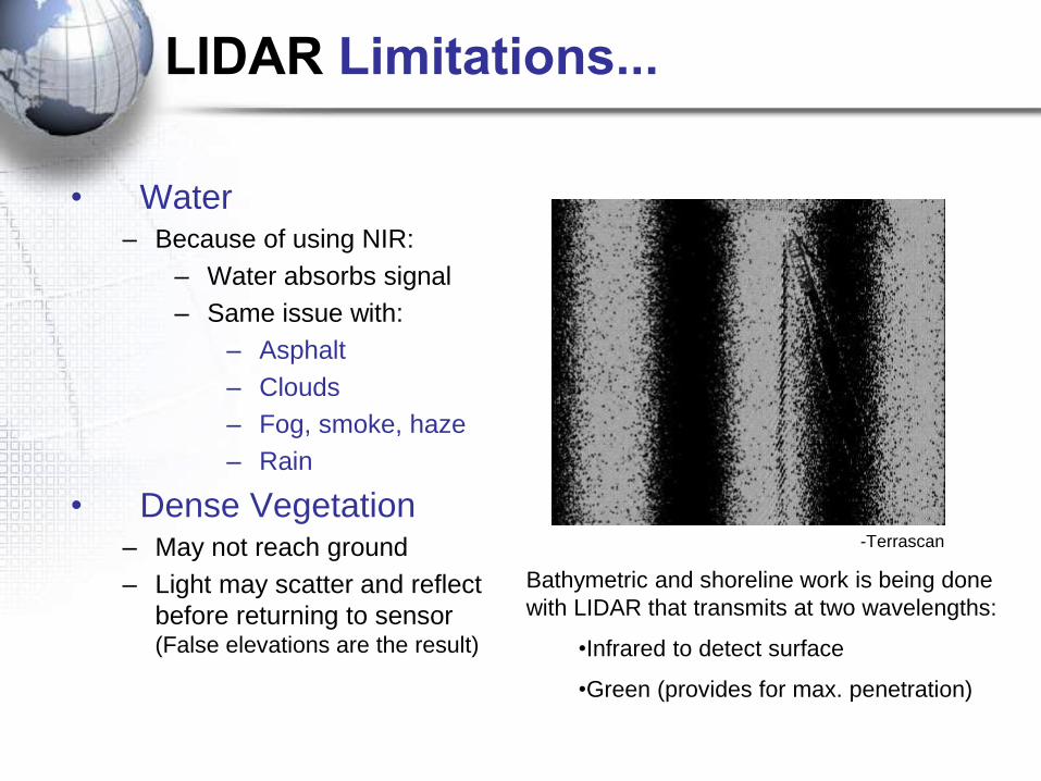
LIDAR Limitations...
Bathymetric and shoreline work is being done
with LIDAR that transmits at two wavelengths:
•Infrared to detect surface
•Green (provides for max. penetration)
-Terrascan
• Water– Because of using NIR:
– Water absorbs signal
– Same issue with:
– Asphalt
– Clouds
– Fog, smoke, haze
– Rain
• Dense Vegetation– May not reach ground
– Light may scatter and reflect
before returning to sensor (False elevations are the result)
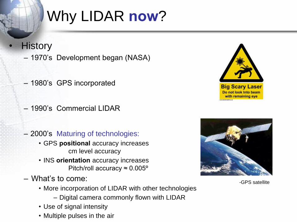
Why LIDAR now?
• History– 1970’s Development began (NASA)
– 1980’s GPS incorporated
– 1990’s Commercial LIDAR
– 2000’s Maturing of technologies:
• GPS positional accuracy increases
cm level accuracy
• INS orientation accuracy increases
Pitch/roll accuracy ≈ 0.005º
– What’s to come:
• More incorporation of LIDAR with other technologies
– Digital camera commonly flown with LIDAR
• Use of signal intensity
• Multiple pulses in the air
-GPS satellite
-Fugro EarthData
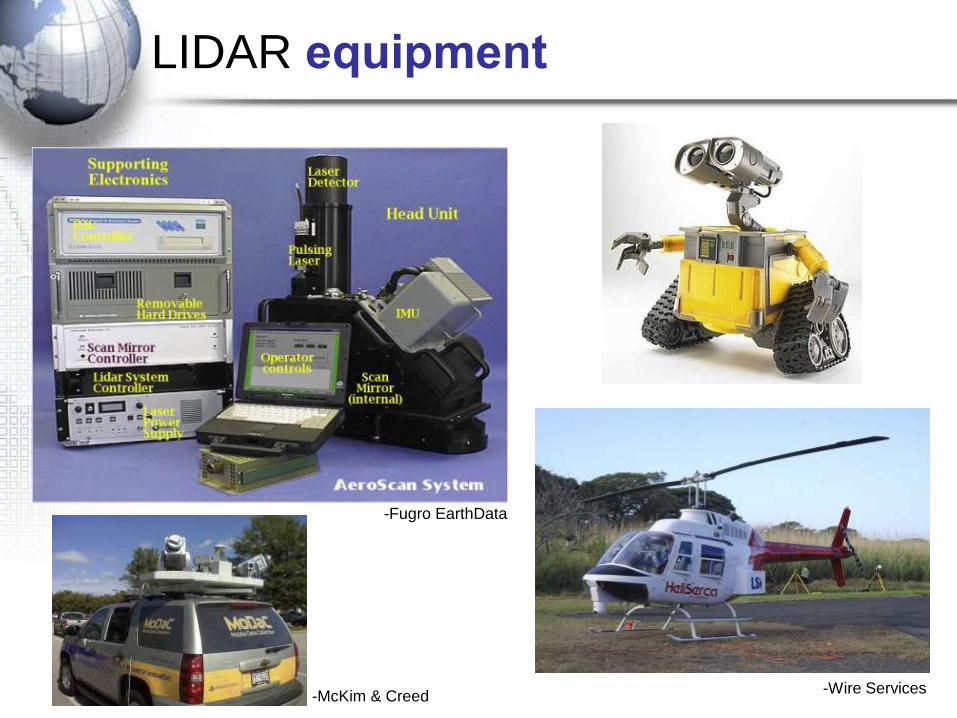
LIDAR equipment
-Wire Services-McKim & Creed
LIDAR unit in action
-ICESAT, NASA
Pretty exciting, huh?
LIDAR:
-Provides the Elevation
-Intensity can be measured
-DN values
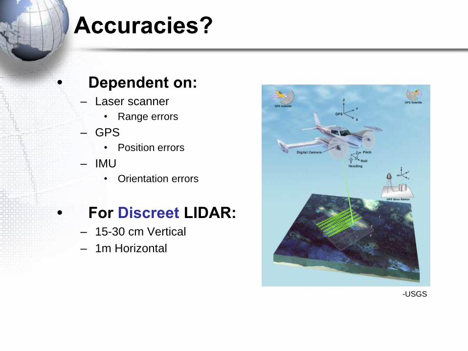
Accuracies?
• Dependent on:– Laser scanner
• Range errors
– GPS
• Position errors
– IMU
• Orientation errors
• For Discreet LIDAR:– 15-30 cm Vertical
– 1m Horizontal
-USGS
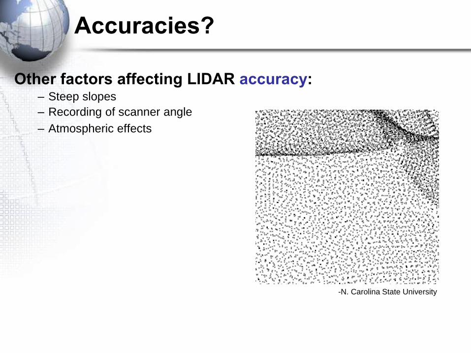
Accuracies?
Other factors affecting LIDAR accuracy:– Steep slopes
– Recording of scanner angle
– Atmospheric effects
-N. Carolina State University
References
• Baltsavais, E.P. (1999). Airborne Laser Scanning: Basic Relations and
Formulas. ISPRS Journal of Photogrammetry and Remote Sensing 54
(2/3), 199-214.
• Flood, M. and Satalich, J. (3/28/01) LIDAR 101. POB.
• Dubayah, R. and Drake, J. LIDAR Remote Sensing for Forestry
Applications, College Park, MD, University of Maryland, Department of
Geography.
• Kraus, K. and Pfeifer, N. (1998) Determination of Terrain Models in
Wooded Areas with Airborne Laser Scanning Data. ISPRS Journal of
Photogrammetry and Remote Sensing 53 (4), 193-203.
• Lefsky, M., Cohen, W., Parker, G. and Harding, D. (2002) LIDAR Remote
Sensing for Ecosystem Studies. BioScience 52 (1), 19-30
• CLICK—USGS Center for LIDAR Information Coordination


