
GOES-16 & GOES-S:Preparing Users for New Generation Satellites
Natalia DonohoSatellite Products and Services Division (NOAA/NESDIS)
WMO IPET-SUP-4Geneva, Switzerland26 February, 2018

2
Outline• GOES-R series• GOES-16 Status and Update;
– Mesoscale Domain Sector (MDS) Request Process
• User Readiness Activities and Training• GOES-S Launch and Updates
– GOES-S Product Validation Schedule and Data Release Strategy
3
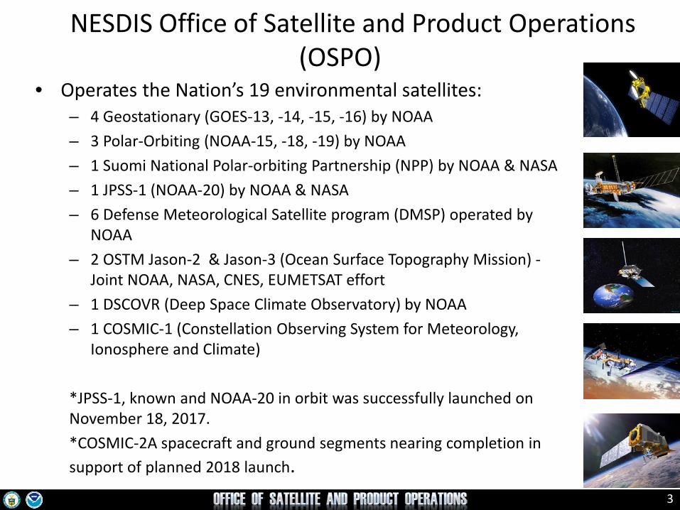
• Operates the Nation’s 19 environmental satellites:– 4 Geostationary (GOES-13, -14, -15, -16) by NOAA– 3 Polar-Orbiting (NOAA-15, -18, -19) by NOAA– 1 Suomi National Polar-orbiting Partnership (NPP) by NOAA & NASA– 1 JPSS-1 (NOAA-20) by NOAA & NASA– 6 Defense Meteorological Satellite program (DMSP) operated by
NOAA– 2 OSTM Jason-2 & Jason-3 (Ocean Surface Topography Mission) -
Joint NOAA, NASA, CNES, EUMETSAT effort– 1 DSCOVR (Deep Space Climate Observatory) by NOAA– 1 COSMIC-1 (Constellation Observing System for Meteorology,
Ionosphere and Climate)
*JPSS-1, known and NOAA-20 in orbit was successfully launched on November 18, 2017.*COSMIC-2A spacecraft and ground segments nearing completion in support of planned 2018 launch.
NESDIS Office of Satellite and Product Operations (OSPO)

4
GOES-R Series
– Geostationary Lightning Mapper (GLM)– Advanced Baseline Imager (ABI)
• 3x more spectral bands• 4x spatial resolution • 5x temporal coverage
• Space weather and solar imaging instruments– Space Environment in-Situ Suite (SEISS)– Magnetometer– Solar Ultraviolet Imager (SUVI)– Extreme Ultraviolet and X-ray Irradiance Sensor (EXIS)
• Next generation of NOAA/NASA geo weather satellites– R-Series includes 4 satellites (16, S, T, U)– First launched in Nov 2016– Represents first major upgrade in over 20 years
• Earth-pointing instruments
55
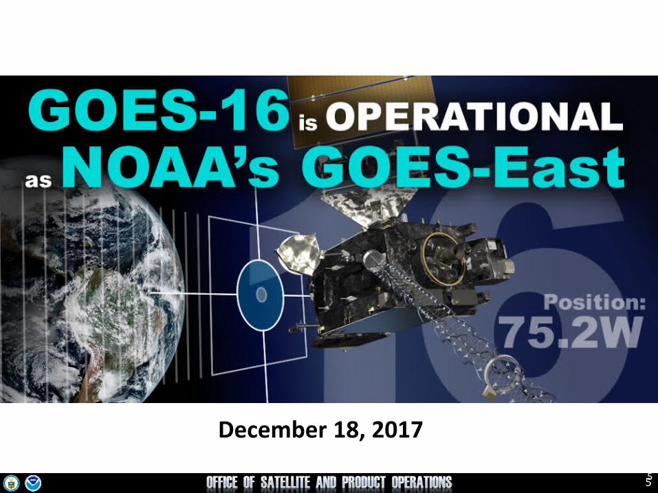
December 18, 2017
6
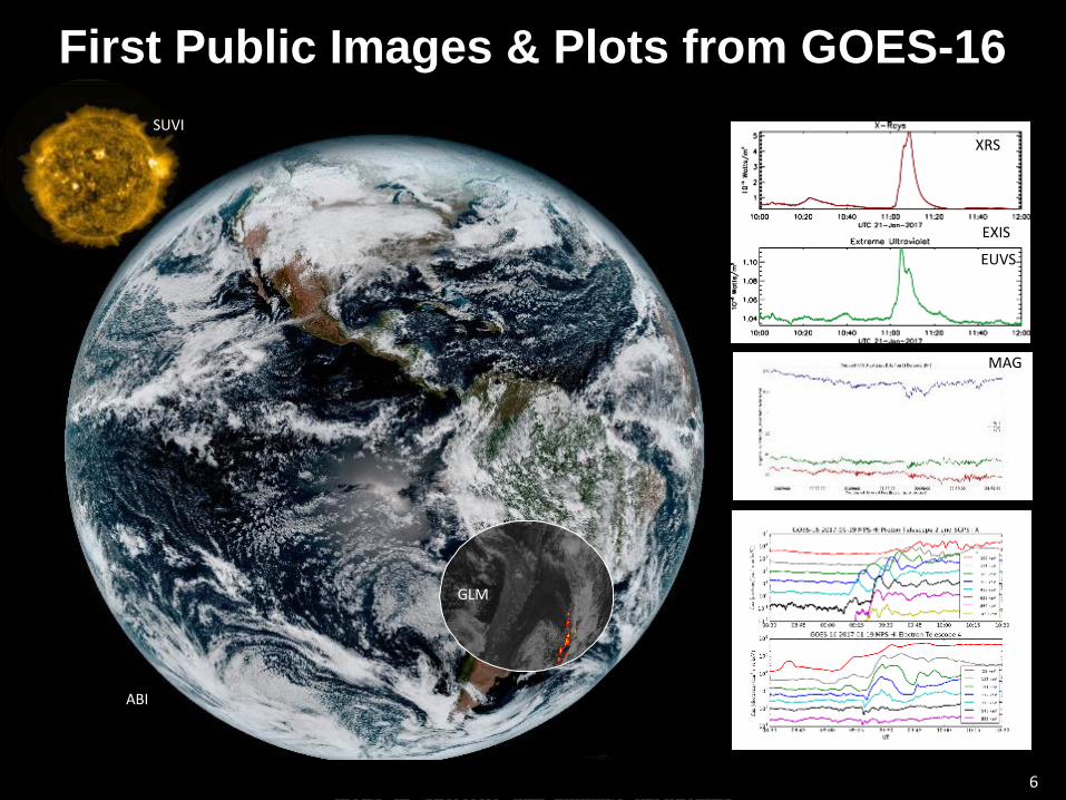
First Public Images & Plots from GOES-16
3-6 6
EUVS
MAG
SUVI
ABI
XRS
EXIS
GLM

77
Full Disk Imagery IncreasedFrom 8X to 96X per Day
GOES-16 every 15 minutes GOES-13 every 3 hours
8
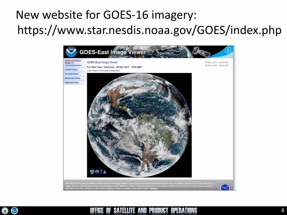
New website for GOES-16 imagery: https://www.star.nesdis.noaa.gov/GOES/index.php

9
What GVAR Users Need to Know
A GRB-compatible receiver is required. The GRB frequency is 1686.6 MHz and dual circular polarized signals are used. GVAR users might be able to repurpose their GVAR antenna. GRB requires a processing system that can handle the new data volumes and software that can
display the products
A manufacturers list is available at:http://www.noaasis.noaa.gov/NOAASIS/ml/manulst.html
GOES-16 GRB has replaced GOES-13 GVAR and GOES-16 is at 75.2⁰ W. GOES-17 GRB will replace GOES-15 GVAR and GOES-17 will be at 137⁰ W.
The Community Satellite Processing Package for Geostationary Data (CSPP Geo) software is available from the University of Wisconsin – Madison
Alternatives for GOES East for users without GRB include GNC-A and the GOES-East Image Viewer. HRIT/EMWIN is available as well

10
Mesoscale Domain Sector (MDS) Request
Process for International Users
See Documents for Information

11Courtesy of Tim Schmit and Mat Gunshor
Routine ABI Operating Mode
11
15 min
5 min
1 min
1 min
GOES-R Series: “Flex” Mode
Image FrequencyFull Disk: 15 min CONUS: 5 min Mesoscale: 30-sec
or, 2 x 1-min
Mesoscale Domain Sector (MDS) coverage approximately
1,000 km x 1,000 km

12
GOES-WestGOES-15
135° West
GOES-EastGOES-16
75.2° West
StandbyGOES-14
105° West
StorageGOES-1360° West
GOES Constellation
• Primary source of data for short term forecasting, especially of severe weather such as tropical storms
• Continuity of Operations since 1974

13
GOES ConstellationGOES-West
GOES-15135° West
GOES-EastGOES-16
75.2° West
StandbyGOES-14
105° West
StorageGOES-1360° West
CheckoutGOES-S
89.5° West

14
GOES ConstellationGOES-West
GOES-15135° West
GOES-EastGOES-16
75.2° West
StandbyGOES-14
105° West
StorageGOES-1360° West
CheckoutGOES-S
89.5° West
GOES-WestGOES-S
137° West


GOES-S Arrival at Kennedy Space Center, Dec. 4, 2017

GOES-S Launch and Activities• GOES-S road to launch:
http://goes-r.noaa.gov/multimedia/images/launches.html• The launch, scheduled for 1 March at 5:02 p.m. EST from
Cape Canaveral, Florida, will be shown on NASA-TV.• ~6 months post-launch testing at 89.5°W• Move to 137°W after post-launch testing


19
User Readiness and Training• NOAA hosted 1 workshop and provided trainers
and organizational support to 3 other workshops this past year for the international community:– Two-day train the trainer workshop at the NOAA Satellite
Conference on “Satellite Data Usage: Access through GEONETCastAmericas, Display, Interpretation, and Usage in Training”; 15-16 July 2017 in New York City
– AmeriGEOSS "Training on Satellite Data: Access through GEONETCast Americas, Display, Interpretation, and Usage" occurring on 31 July - 4 August 2017 in San José, Costa Rica
– GOES-16 Workshop at Servicio Meteorológico Nacional (SMN) occurring 21-24 November 2017 in Buenos Aires, Argentina
– GOES-16 Workshop at Dirección Meteorológica de Chile (DMC) / Chile Weather Service main office, occurring 27 November to 1 December 2017 in Santiago de Chile, Chile

20
User Readiness and Training (cont.)
• NOAA continues to support training development and translation efforts at COMET, training at the National Centers for Environmental Prediction (NCEP)/ Weather Prediction Center (WPC) / International Desks, and the Regional Focus Group (RFG) Monthly Weather and Climate Virtual Discussions
• NOAA has also created a GOES International Training Working Group (GITWG) to assess, coordinate, and plan for training activities in response to increasing user requests. Because of the newness of the satellite capabilities, continued training activities targeted at different levels of users (intern, advanced, expert) are ongoing

21
GOES-R Funded Training: Online Resources in Spanish & Portuguese
http://www.meted.ucar.edu/satmet/goes_resources/index.html

22
User Readiness and Training (cont.)Proposed training:
• RA IV: Mexico City for Mexico, Central America and Caribbean, in Spanish, July 23 – 27, 2018
• RA III: AmeriGEOSS Week, São José dos Campos, Brazil, for South America, in “Portuñol”, August 6-10, 2018

23
2019 (Jointly Organized) Satellite Conference
• EUMETSAT Meteorological Satellite Conference, the NOAA Satellite Conference, and the AMS Satellite Conference
• It is scheduled for 30 Sep - 4 October, 2019 at the Westin Water Front in Boston.

Thank youFor more information visit www.goes-r.gov
www.facebook.com/GOESRsatellite
www.youtube.com/user/NOAASatellites
twitter.com/NOAASatellites
www.flickr.com/photos/noaasatellites


