In the Matter of the Application of FINDINGS OF FACT AND
Ridgewind Power Partners, LLC for CONCLUSIONS
a Site Permit for a Large Wind Energy PUC DOCKET NO. IP-6603/WS-06-1327
Conversion System in Pipestone and Murray
counties, Minnesota
The above-entitled matter came before the Minnesota Public Utilities Commission (PUC),
pursuant to an application by Ridgewind Power Partners, LLC, for a Large Wind Energy
Conversion Site (LWECS) permit to construct, operate, maintain and manage up to a 27
Megawatt (MW) combined nameplate capacity wind farm and associated facilities in the
township of Burke in Pipestone County and the township of Cameron in Murray County,
Minnesota. The LWECS site permit is to be issued to Ridgewind Power Partners, LLC.
The project will be constructed to collect and deliver electricity generated to the Xcel Energy
Chanarambie Substation in Cameron Township, Section 6, Murray County.
STATEMENT OF ISSUE
Should Ridgewind Power Partners, LLC, be granted a site permit under Minnesota Statutes
Chapter 216F to construct an up to 27 MW Large Wind Energy Conversion System (LWECS) in
Pipestone and Murray counties, Minnesota?
Based upon the record and proceedings created in this proceeding, the Minnesota Public Utilities
Commission makes the following:
FINDINGS OF FACT
Background and Procedure
1. On October 13,2006, Project Resources Corporation filed an application on behalf of
Ridgewind Power Partners, LLC, for a LWECS site permit to construct, operate, maintain
and manage up to a 27 Megawatt (MW) combined nameplate capacity wind facility and
associated infrastructure in the township of Burke in Pipestone County and the township
of Cameron in Murray County, Minnesota. (Exhibit 1)
2. Department of Commerce (DOC) Energy Facility Permitting (EFP) staff determined that
the October 13, 2006, application complied with the application requirements of
Minnesota Rules, part 4401.0450. In Comments and Recommendations to the PUC,
dated November 2,2006, DOC EFP staff recommended that the PUC accept the
application as complete, appoint a public advisor, make a preliminary determination to
issue a draft site permit, and authorize a proposed draft site permit. (Exhibit 2)

3. On November 2,2006, the DOC EFP staff mailed notice of the Public Information
Meeting and Public Comment Period, to the project mailing list to solicit comments on
the site permit application, draft site permit, and to review the permitting process for
LWECS. (Exhibit 3)
4. On November 2, 2006, EFP staff posted on the PUC Energy Facilities Permitting web
page the notice of public information meeting and the availability of the draft site permit.
5. On November 3, 2006, the PUC issued an order accepting the application as complete,
appointing a public advisor, made a preliminary determination to issue a draft site permit,
and authorized the proposed draft site permit for the project. (Exhibit 4)
6. Ridgewind Power Partners, LLC, distributed a permit application and Notice of Public
Information Meeting and Public Comment Period by U.S. Mail to each landowner and
township clerk within the site boundary, county governmental and other required officials
during the week of November 3,2006. (Exhibit 5)
7. On November 6,2006, the EFP staff published the Notice of Public Information Meeting
and Public Comment Period in the EQB Monitor, Volume 30, No. 23. The published
notice contained all of the information required by Minnesota Rules, part 4401.0550 subp. 1. (Exhibit 6)
8. The Department of Commerce published a Notice of Application Acceptance and Public
Information Meeting in the Murray County Wheel-Herald and Pipestone Star newspapers
on November 6,2006 and November 9,2006, respectively. (Exhibits 7-8)
9. The DOC EFP staff held a public information meeting on November 21,2006, in Lake
Wilson, Minnesota, to receive comments on the site permit application and draft site
permit. Approximately 20 people attended the meeting. Representatives from
Ridgewind Power Partners, LLC, attended. DOC EFP staff provided an overview of the
permitting process and draft site permit and responded to questions about the permitting
process. Representatives from Ridgewind Power Partners, LLC, reviewed the proposed project and responded to questions.
10. No additional issues or concerns were raised about the permitting process, the proposed project, or conditions in the draft site permit at the public meeting.
11. The public comment period on the project closed on December 20,2006.
The Permittee
12. Ridgewind Power Partners is an affiliate of Project Resources Corporation.
13. Ridgewind Power Partners, LLC, will be responsible for development, project
management, procurement, construction, commissioning, operation, and long-term
ownership of the project.
14. Ridgewind Power Partners, LLC, will own the project including all equipment up the
project's interconnection to the Xcel Energy Chanarambie Substation.
Project Description
15. The proposed project will use utility scale 1.5 MW wind turbines (or comparable utility
grade wind turbines) for a combined nameplate capacity of up to 27 MW.
16. The Ridgewind Power Partners, LLC, Application provides a preliminary layout and site
plan utilizing 1.5 MW (or comparable utility grade wind turbines) turbines with a hub
height of approximately 80 meters (262 feet) and a rotor diameter between 65 and 77
meters.
17. All turbines, towers and blades under consideration will be in a neutral color.
18. The project will also include an underground-automated supervisory control and data
acquisition system (SCADA) for communication purposes. One permanent
meteorological tower will be used as part of the communication system. Other
components of the project include a concrete and steel foundation for each tower, pad-
mounted step-up transformers, all weather class 5 roads of gravel or similar material, and
an underground and overhead electric energy feeder and collection system.
19. Each tower will be secured by a concrete foundation that will vary in size and design
depending on site soil conditions. A control panel that houses communication and
electronic circuitry is placed in each tower. A step-up, pad-mounted transformer will be
located adjacent to each turbine to collect the power from the turbine and transfer it to a
34.5 kV collection system via underground or overhead cables.
20. Each turbine will be interconnected through an underground electrical collection and
feeder system at 34.5 kV. The Applicant will place the 34.5 kV collection and feeder
lines primarily on private rights-of-way and limit use of public rights-of-way. Feeder
lines may be underground or overhead depending on local conditions. All of the
proposed collection and feeder lines would connect to the proposed project substation at
or adjacent to the Xcel Energy Chanarambie Substation in Section 6 of Cameron
Township, Murray County.
21. The project substation will connect to the Xcel Energy Chanarambie Substation, where
voltage from the Ridgewind Power Partners, LLC, 34.5 kV collection system will be
stepped up to the transmission system level of 115 kV.
22. All meteorological tower systems will be interconnected with fiber optic communication
cables that will be installed underground. The communication cables will run to a central
host computer which will be located either at the project substation or at the operations
and maintenance facility where a supervisory control and data acquisition (SCADA)
system will be located. Signals from the current and potential transformers at each of the
delivery points will also be fed to the central SCADA host computer. The SCADA
system will be able to give status indications of the individual wind turbines and the
substation and allow for remote control of the wind turbines locally or from a remote
computer. This computerized supervisory control and data acquisition network will
provide detailed operating and performance information for each wind turbine.
Ridgewind Power Partners, LLC, will maintain a computer program and database for
tracking each wind turbine's maintenance history and energy production. The PUC may
have viewer access to the SCADA system.
Wind Resource Considerations
23. The Ridgewind Power Partners, LLC, project will be located in Pipestone and Murray
counties approximately 1,800 feet or more above sea level. Land use in the project area
is agricultural with intensive farming and some grazing activities and, as a result, there
are few trees or structures in the proposed project site to inhibit the wind as it passes over
the site. The wind resource in the project area is considered to be among the best in the
nation and is well documented by the Department of Commerce. Wind Resource Maps
produced by WindLogics for the Department of Commerce indicate that the resource in
the vicinity of the project area at 80 meters (-263 feet) is between 18.1 and 19.9 miles
per hour.
24. For this project wind turbines are sited so as to have good exposure to winds from all
directions with emphasis on exposure to the prevailing southerly and northwesterly
winds. The turbine spacing, according to site permit application, maximizes use of the
available wind and minimizes wake and array losses within the topographical context of
the site. Turbine placement has been designed to provide a minimum of 3 rotor diameter
spacing in the east-west direction and 5 rotor diameter spacing in the north-south
direction, with respect to the predominant energy production directions. Given the
prevalence of southerly and northwest winds, the spacing is widest in the north-south
direction. Greater or lesser spacing between the turbine strings may be used in areas
where the terrain dictates the spacing. This is addressed in the permit at III.E.5.
Individual, isolated turbine sites are avoided to minimize interconnection and access
costs. Sufficient spacing between the turbines is utilized to minimize wake losses when
the winds are blowing parallel to the turbine rows.
25. The project projected average annual output will be approximately 90,000 megawatt
hours per year (MWh). Final project output is subject to final layout, design, and
equipment selected.
26. Most of the land within the project site is actively farmed. Cultivated lands comprise
nearly all of the project area with corn, soybeans, and small grains as the dominant crops.
Some pasture land is present within the project area.
27. The project site as proposed includes approximately 1,100 acres in the townships of
Burke in Pipestone County and Cameron in Murray County. The land is predominately
agricultural. The proposed wind turbine site layout found in Figure 3 of the site permit

application shows where the proposed towers may be located. These locations are
subject to change. It is estimated that the proposed facilities will result in the permanent,
direct disturbance of approximately 60 acres of land depending on turbine model, size
and final site layout.
Land Rights and Easement Agreements
28. In order to build a large wind energy conversion system, a developer needs to secure
wind rights, site leases and easement option agreements to ensure access to the site for
construction and operation of a proposed project. These lease or easement agreements
also prohibit landowners from any activities that might interfere with execution of the
proposed project.
29. Ridgewind Power Partners, LLC, has obtained lease and easement option agreements
and/or rights to such agreements with landowners for land within the project site
boundary necessary for installation of the components of the wind farm. These rights and
easements will be able to support the proposed project.
30. The project boundary set-back of 3 RD on the east-west (cross-wind) axis and set-back of
5 RD on the north-south (down-wind) axis have been established to protect the wind
rights of adjacent landowners or owners not participating in the Ridgewind Power Partners, LLC, project.
31. The Applicant will be required to meet the 3 RD east-west and 5 RD north-south wind
turbine set-backs from properties outside of the project boundary described in the
application and from properties within the project boundary for which Ridgewind Power
Partners, LLC, does not hold wind development easements or rights.
Public Comments and Letters Received
32. At the close of the comment period on December 20,2006, the DOC had received one
comment letter on the proposed Ridgewind Power Partners, LLC, project.
33. On December 19,2006, a letter from the United States Fish and Wildlife Service (FWS)
commented on the site permit application and indicated that no known threatened or
endangered species are present within the proposed project site. The FWS also
recommended that the applicant follow federal guidelines in siting the project to protect migratory bird species. (Exhibit 9)
34. The public comment period closed on December 20, 2006.
Site Criteria
Minnesota Statutes Chapter 216F and Minnesota Rules Chapter 4401 apply to the siting of Wind
Energy Conversion Systems. The rules require applicants to provide a substantial amount of
information to allow the PUC to determine the potential environmental and human impacts of the

proposed project and whether the project is compatible with environmental preservation,
sustainable development, and the efficient use of resources. Minnesota Rules parts 4401.0450
through 4401.0600. The following analysis addresses the relevant criteria that are to be applied
to a LWECS project.
Human Settlement, Public Health and Safety
35. The site is in an area of low population density, with little residential, commercial or
industrial development on or near the site. As a result, the impact of the proposed
LWECS on human settlement, public health and safety will be minimal. The site permit
condition III. C. specifies conditions for setbacks from residences and roads. The
proposed wind turbine layout meets or exceeds those requirements.
36. There will be no displacement of existing residences or structures in siting the wind
turbines and associated facilities.
37. The project will comply with the Federal Aviation Administration requirements with
respect to lighting. See site permit condition III.E.4.
38. Ridgewind Power Partners, LLC, will provide security during construction and operation
of the project, including fencing, warning signs, and locks on equipment and facilities
Ridgewind Power Partners, LLC, will also provide landowners and interested persons
with safety information about the project and its facilities. See site permit condition
III.B.15.
39. Each turbine will be clearly marked to identify each unit and a map of the site shall be
provided to local public safety authorities.
Noise
40. Wind turbines generate noise. According to estimates provided by Ridgewind Power
Partners, LLC, in its application, the sound pressure level is expected to be lower than the
Minnesota Pollution Control Agency noise standard of 50 dBA measured at the closest
residences. The MPCA noise standard is found in Minnesota Rules part 7030.0040. The
Applicant will be required to meet the Minnesota Pollution Control Agency's (MPCA)
noise standard. See site permit condition III.B.15.
41. For this project, the wind turbine generators will sited no less than 500 feet and at a
sufficient distance from occupied residences to ensure that the noise measured at a all
existing residential receptors will meet the requirements of the Nightime L50 standard of
50 dB(A). The final minimum setback from occupied residences for noise standard
compliance may vary by the turbine model ultimately selected. See site permit condition
III.E.3.

Visual Values
42. Wind turbines, towers and rotor blades are prominent features on the landscape adjacent
to the proposed project site and on the Buffalo Ridge generally. There are currently
expansive views of the turbines to passing motorists on local, county and state highways.
43. The visual impact of the proposed Ridgewind Power Partners, LLC, wind turbines will be
reduced by the use of a neutral paint color. The only lights will be those required by the
Federal Aviation Administration. All site permits issued by the PUC require the use of
tubular towers; therefore, the turbine towers will be uniform in appearance. Wind
turbines are and will continue to be a dominant visual feature on the landscape on and
near the Buffalo Ridge. The wind turbines in this project, while prominent on the
landscape, will also blend in with the surrounding area. The project site will retain its
rural character. The turbines and associated facilities necessary to convert the wind for
energy are consistent with existing land use, wind energy production, and agricultural
practices.
44. The numerous wind farms on the Buffalo Ridge have altered the landscape from
agricultural to wind plant/agricultural. This project will incrementally increase the visual
impact to the area. The cumulative effect of the proposed project will increase both the
industrial appearances of the wind plants in the area and the areas from which they will
be seen. Because wind generation development is likely to continue in Pipestone and
Murray counties, this visual impact will continue to increase the size of the wind
plant/farm footprint as the turbines harvest the wind resources of the area for energy. To
date the presence of numerous wind turbines on Buffalo Ridge has been well accepted by the people who live and work in the area.
45. Ridgewind Power Partners, LLC, use of larger turbine rotor sizes and rotor diameters will
result in greater turbine spacing to minimize wake loss. Therefore the Ridgewind Power
Partners, LLC, turbines will be spaced further from one another and existing turbines
than in several older, existing projects on Buffalo Ridge which used smaller turbine
rotors and rotor diameters. See site permit conditions III.C.
Recreational Resources
46. Recreational opportunities in Pipestone and Murray counties include: hunting, fishing,
snowmobiling, bird and wildlife watching, campgrounds and trails. Hunting, fishing and
wildlife observation is permitted in designated Minnesota Department of Natural
Resources Wildlife Management Areas (WMA's), Fish and Wildlife Service lands and
other lands inside and outside of the project boundary, in public waters, and on private
property in the area unless otherwise posted. There are no designated states or federal
wildlife areas located within the project boundary; however one state WMA is present
within two miles. The proposed project will not impact public access to public waters in the area.

47. The proposed turbines will be visible to persons using the lands inside and close to the
project area. Turbines will not be located on public lands, WMA's, Scientific and Natural
Areas or in any local parks. There are no designated WMAs, SNAs, or public parklands
within the project boundary. Wind turbine operations are not expected to affect the
natural areas in any material way and no adverse impact on wildlife areas is expected.
Infrastructure
48. The Ridgewind Power Partners, LLC, project is expected to have a minimal effect on the
existing infrastructure. The proposed project will use underground cables for the
collector lines on private property within the wind farm. The feeder lines associated with
the project may be overhead or underground, dependant on site conditions. Any above
ground feeder lines, if used, would be wood or steel poles, 34.5 kV typical of wind
project feeder lines in the Buffalo Ridge area. The feeder lines will deliver the energy
from the wind farm to the project substation. Placement of collector and feeder lines is
addressed in the site permit at III.E.7. and 8.
49. The project will require the use of public roads to deliver construction supplies and
materials to the work site. Site permit condition III.B.8. addresses this topic.
Construction of the project requires the construction of access roads that will be located
on private property. The access roads will be routed in a manner that minimizes
disturbance of agricultural activities while maintaining a short, direct route. The typical
permanent access road will be 16 feet in width and covered in Class 5 gravel (or similar
material). The access roads will be low profile roads to allow for the movement of
agricultural equipment. The site permit at III.B. 8 (b) addresses this topic. During
operation and maintenance of the wind plant, operation and maintenance crews, while
inspecting and servicing the wind turbines, will use the access roads. Periodic grading or
other methods are necessary to maintain road integrity. The Permittee may do this work
or contract it out.
50. If access roads must be installed across waterways that are considered public waters, the
Permittee in consultation with the Minnesota Department of Natural Resources will
design, shape and locate the road so as not to alter the original water flow or drainage
patterns. Any work required below the ordinary high water line, such as road crossings
or culvert installation, will require a permit from the Minnesota Department of Natural
Resources.
51. The proposed wind farm will not affect water supplies, railroads, telecommunication
facilities, and radio reception. The presence or operation of the wind plant could
potentially impact the quality of television reception in the area. Previous work on
television reception issues indicates that in some cases new antennas or relocation of
existing antennas can restore television signal strength reception. Ridgewind Power
Partners, LLC, will address the concerns of residents in the area of the project site before
and after the project construction to document and mitigate any television reception
impacts that might occur. This is addressed in the site permit at III.D.3.

52. Construction, operation, and maintenance of the proposed wind plant will comply with all
of the required federal and state permit requirements.
Community Benefits
53. The project will provide local tax revenues from a production tax on the wind energy
produced by the turbines. No significant adverse impact on public services is expected.
Wear and tear on roads will occur as a result of the transport of heavy equipment and
other materials. The site permit at III.B.8. addresses road damages. Landowners with
turbine(s) or associated infrastructure on their property will receive payments from
Ridgewind Power Partners, LLC, for wind rights and land easements.
54. To the extent that local workers and local contractors are capable, qualified, and
available, Ridgewind Power Partners, LLC, will seek to hire them to construct the
proposed project. The hiring of local people will expand employment opportunities in
this area of the state and keep money in the local economy. Once constructed, the project
will be staffed with site technicians and a wind plant supervisor. Short term construction
spending will provide local economic benefits. Long term operations, maintenance,
production taxes, and lease payments will also have positive local economic benefits.
Effects on Land-Based Economies
55. The project will permanently displace approximately 60 acres of agricultural land. The
site permit at III.B. 2., 3., 4., 5., 6., 7., 8(c)., 9., and 10. addresses mitigation measures for
agricultural lands. The proposed project does not affect any sand or gravel operations.
Archaeological and Historical Resources
56. The Ridgewind Power Partners, LLC, site permit application indicates that the Applicant
has consulted with and reviewed the Minnesota State Historic Preservation Office
(SHPO) computer database for the project area, which indicates that 1 (one) known
historic structure and 2 archaeological resources have been documented inside the
boundaries of or within 1 mile of the project. A Phase I archeological resources survey
has been recommended for all the proposed turbine locations, access roads, and other
construction elements to document any previously unrecorded archaeological sites within
the project site. The site permit at III.D.2. requires Ridgewind Power Partners, LLC, to
consult with the SHPO upon completion of cultural resources surveys.
57. If any archaeological sites are found during the Phase I survey, their integrity and
significance should be addressed in terms of the site's potential eligibility for placement
on the National Register of Historic Places (NRHP). If such sites are found to be eligible
for the NRHP, appropriate mitigation measures will need to be developed in consultation
with SHPO, the State Archaeologist, and consulting American Indian communities. The
site permit also requires the Permittee to stop work and notify the Minnesota Historical
Society and PUC if any unrecorded cultural resources are found during construction. See the site permit at III.D.2.

Air and Water Emissions
58. No harmful air or water emissions are expected from the construction and operation of
theLWECS.
Animals and Wildlife
59. Ridgewind Power Partners, LLC, has consulted with the Minnesota Department of
Natural Resources and the U.S. Fish and Wildlife Service about the project's design and
mitigation measures on natural communities, fish and wildlife.
60. The Topeka Shiner, a species of endangered fish, may be present in streams within the
project boundary. Best management practices shall be implemented to minimize impacts
to Topeka Shiner habitat and are attached to the site permit.
61. Neither construction nor operation of the project is expected to significantly impact
wildlife. Based on studies of existing wind power projects in the United States and
Europe, the only impact of concern to wildlife would primarily be to avian and bat
populations. The final report on avian monitoring studies at Buffalo Ridge, Minnesota
"Final Report-Avian Monitoring Studies at the Buffalo Ridge, Minnesota Resource Area:
Results of a 4-Year Study" (September 2000) identified the following impacts:
a) Following construction of the wind turbines, there is a reduction in the use of the
area within 100 meters of the turbines by seven of 22 species of grassland breeding
birds. It was hypothesized that lower avian use may be associated with avoidance
of turbine noise, maintenance activities, and less available habitat. The researchers
stated "on a large scale basis, reduced use by birds associated with wind power
development appears to be relatively minor and would not likely have any
population consequences on a regional level."(p. 44)
b) Avian mortality appears to be low on Buffalo Ridge, compared to other wind
facilities in the United States, and is primarily related to nocturnal migrants.
Resident bird mortality is very low and involves common species. The researchers
stated that "based on the estimated number of birds that migrate through Buffalo
Ridge each year, the number of wind plant related avian fatalities at Buffalo Ridge
is likely inconsequential from a population standpoint." (p. iv)
62. Bat mortality was also studied at Buffalo Ridge, instigated by bat collision victims found
during the avian monitoring studies. The bat study was conducted in 2001 and 2002.
("Bat Interactions with Wind Turbines at the Buffalo Ridge, Minnesota Wind Resource
Area," November 2003). The overall conclusion is that bat activity at turbines and the
numbers of bat fatalities do not share a statistical relationship. Bat collisions were found
to be very rare, given the amount of bat activity documented at the turbines. Most
fatalities involved migrating bats, a wind-plant related mortality "is possibly not
sufficient to cause significant, large-scale population declines." (p. 61)
10
63. Mitigation measures are also prescribed in the site permit and include but are not limited
to: a) a pre-construction inventory of existing biological resources, native prairie, state
listed and threatened species and wetlands in the project area; b) turbines and associated
facilities will not be constructed in wildlife management areas, recreation and state and
scientific natural areas; c) landowner approval will be negotiated prior to any removal of
trees during construction; d) sound water and soil conservation practices will be
implemented during construction and operation of the project to protect topsoil and
adjacent resources and to minimize soil erosion. This also applies to any work in
proximity to watercourses.
Vegetation
64. Removal of groves of trees or shelterbelts will be minimized. Native prairie will also be
avoided. If native prairie cannot be avoided, the site permit, at III. C.6. provides for
preparation of a prairie protection and management plan.
Soils
65. Construction of the wind turbines and access roads increases the potential for erosion
during construction and converts prime farmland to industrial use. The site permit at III.
B. 9. requires a soil erosion and sediment control plan. The project will also require a
storm water run-off permit from the Minnesota Pollution Control Agency.
Surface Water and Wetlands
66. No towers, access roads or utility lines will be located in or will cross Public Waters or
wetlands, unless licensed or permitted by the DNR. See site permit at III.C.5.
Future Development and Expansion
67. While large-scale projects have occurred elsewhere (California and Iowa), little
systematic study of the cumulative impact has occurred. Research on the total impact of
many different projects in one area has not occurred. DOC EFP staff continues to
monitor for cumulative impacts and issues related to wind energy development.
68. The PUC and DOC anticipate more site permit applications under Minnesota Statutes
Chapter 216F. The PUC is responsible for siting of LWECS "in an orderly manner
compatible with environmental preservation, sustainable development, and the efficient
use of resources." Minnesota Statutes section 216F.03.
69. Minnesota Statutes section 116C.57, subd. 4 requires consideration of design options that
might minimize adverse environmental impacts. By using larger turbines, fewer turbines
are required, reducing siting needs for turbines and related facilities. Turbines must also
be designed to minimize noise and aesthetic impacts. Buffers between strings of turbines
are designed to protect the turbines' production potential. The site permit also provides
11
for buffers between adjacent wind energy projects to protect production potential. See
site permit at 111.C.I.
70. The location and spacing of the turbines are critical to the issues of orderly development
and the efficient use of wind resources. Turbines are likely to be located in the best
winds, and the spacing dictates, among other factors, how much land area the project
occupies.
71. One efficiency issue is the loss of wind in the wake of turbines. Wind flow behind the
turbine is not as fast and is more turbulent than the free-flowing wind. This condition
persists for some distance behind the turbine as normal wind flow is gradually restored.
If a turbine is spaced too close downwind of another, it produces less energy and is less
cost-effective. This is the wake loss effect. If the spacing is too far, wind resources are
wasted and the projects' footprint on the land is unnecessarily large.
72. For this project, turbine spacing maximizes use of the available wind resources and
minimizes wake and array losses within the topographical context of the site. Site
topography and wind resources resulted in a layout involving long strips of turbines
running parallel to each other and perpendicular to the prevailing wind. The objective is
to capture the most net energy possible from the best available wind resource. Allowing
for setback from roads and residences and avoiding sensitive areas, Ridgewind Power
Partners, LLC, proposes an average internal turbine spacing of approximately 4 rotor
diameters in the east-west direction and approximately 7 to 8 rotor diameter spacing in
the north-south direction, with respect to the predominant energy production directions.
Given the prevalence for southerly and northerly winds at this site, the spacing between
turbines is greatest in the north-south direction for this project.
Maintenance
73. Maintenance of the turbines will be on a scheduled, rotating basis. Additional
unscheduled maintenance will be conducted on an as needed basis. Maintenance on the
interconnection points will be coordinated with Xcel Energy. The Ridgewind Power
Partners, LLC, project will be staffed with site technicians and a wind plant supervisor.
Ridgewind Power Partners, LLC, does not anticipate building a facility to house the
operation and maintenance efforts for the project.
Site Restoration
74. Decommissioning and site restoration activities will include (1) removal of all turbines
and towers; (2) removal of all pad mounted transformers; (3) removal of all above-
ground distribution facilities; (4) removal of foundations to a depth of three feet below
grade; and (5) removal of surface road material and restoration of the roads and turbine
sites to previous conditions to the extent feasible.
Decommissioning Economics
12

75. Ridgewind Power Partners, LLC, will be responsible for all costs to decommission the
project and associated facilities and will begin decommissioning the facility within 8
months from the time the facility ceases to operate. Decommissioning will be completed
within 15 months from the time the facility ceases to operate. See site permit at III.G.
76. The estimated decommissioning cost for the Ridgewind Power Partners, LLC, project is
approximately $250,000 current dollars. The Permit requires Ridgewind Power Partners,
LLC, to submit a Decommissioning Plan to the PUC that describes how the Permittee
will ensure that the resources are available to pay for decommissioning the project at the
appropriate time. See site permit at III.G.
Site Permit Conditions
77. Nearly all of the conditions contained in this site permit were established as part of the
site permit proceedings of other wind turbine projects permitted by the Environmental
Quality Board and the Public Utilities Commission. Minor changes that provide for
clarifications of the draft site permit conditions have been made.
78. The proposed Ridgewind Power Partners, LLC, project meets the site permit setback
requirements from existing wind turbines and lands which Ridgewind Power Partners,
LLC, does not hold wind rights.
79. The site permit contains conditions that apply to site preparation, construction, cleanup,
restoration, operation, maintenance, abandonment, decommissioning and all other aspects
of the project.
Based on the foregoing findings, the Minnesota Public Utilities Commission makes the
following:
CONCLUSIONS OF LAW
1. Any of the foregoing findings, which more properly should be designated as conclusions,
are hereby adopted as such.
2. The Ridgewind Power Partners, LLC, application for a site permit was properly filed and
noticed as required by Minnesota Statutes section 216F.04 and Minnesota Rules parts
4401.0460 subp. 2 and 4401.0550 subp. 2.
3. The Minnesota Public Utilities Commission has afforded all interested persons an
opportunity to participate in the development of the site permit and has complied with all
applicable procedural requirements of Minnesota Statutes section 216F.04 and Minnesota Rules Chapter 4401.
4. No objections were filed with the Minnesota Public Utilities Commission by any
governmental unit, affected landowner or any other interested person during the 30-day
comment period and no contested case hearing was requested.
13
5. The Commission concludes that the 3 RD east-west and 5 RD north-south project
boundary set back adequately protects the wind and property rights of persons outside the
project boundary and/or persons within the project boundary but not participating the
Ridgewind Power Partners, LLC, project.
6. The Minnesota Public Utilities Commission has jurisdiction under Minnesota Statutes
section 216F.04 over the site permit applied for by Ridgewind Power Partners, LLC.
7. The Ridgewind Power Partners, LLC, LWECS project will not create significant human
or environmental impacts and is compatible with environmental preservation, sustainable
development, and the efficient use of resources.
8. The Minnesota Public Utilities Commission has the authority under Minnesota Statutes
section 216F.04 and Minnesota Rules Chapter 4401 to establish conditions in site permits
relating to site layout, construction, operation and maintenance of an LWECS. The
conditions contained in the site permit issued to Ridgewind Power Partners, LLC, are
appropriate, necessary and within the Minnesota Public Utilities Commission's authority.
Based on the foregoing Findings of Fact and Conclusions of Law, the Minnesota Public Utilities
Commission issues the following:
ORDER
The attached site permit is hereby issued to Ridgewind Power Partners, LLC, for up to a 27-MW
LWECS in Pipestone and Murray counties, Minnesota. The site permit issued by the PUC
authorizes Ridgewind Power Partners, LLC, to construct and operate the proposed large wind
energy conversion system and associated facilities in accordance with the conditions contained in
the site permit and in compliance with Minnesota Statutes, section 216F.04 and with Minnesota
Rules Chapter 4401.
Approved and adopted this ^M/day of February, 2007.
BY ORDER OF THE COMMISSION
Burl W. Haar,
Executive Secretary
14

SITE PERMIT FOR
RIDGEWIND POWER PARTNERS, LLC
LARGE WIND ENERGY CONVERSION SYSTEM
IN
PIPESTONE AND MURRAY COUNTIES
ISSUED TO
RIDGEWIND POWER PARTNERS, LLC
PUC DOCKET NO. IP 6603/WS-06-1327
In accordance with Minnesota Statutes Section 216F.04 this Site Permit is hereby issued to:
RIDGEWIND POWER PARTNERS, LLC
Ridgewind Power Partners, LLC, is authorized to construct and operate up to a 27-Megawatt
Large Wind Energy Conversion System on the site identified in this Site Permit and in
compliance with the conditions contained in this Permit.
This Permit shall expire on December 31,2039
BYJ9KDER OF THE COMMISSION
BURL W. HAAR
Executive Secretary
(SEAL)
This document can be made available in alternative formats (i.e., large print or audio tape) by calling 651-201-2202
(Voice), 651-297-1200 (TTY).
www.puc.state.mn.us
PHONE(65I)296-7I24 • FAX (651)297-7073 • TDD (651)297-1200 • 121 7™ PLACE EAST • SUITE 350 • SAINTPAUL, MINNESOTA 55101-2147

Table of Contents
I. SITE PERMIT 3
II. PROJECT DESCRIPTION 3
III. CONDITIONS 3 A. GENERAL CONSTRUCTION CONDITIONS 3
1. SITE PLAN 3
2. FIELD REPRESENTATIVE 4
3. PRECONSTRUCTION MEETING 4
4. NOTICE OF PERMIT CONDITIONS 4
B. MITIGATION MEASURES 4
1. SITE CLEARANCE 4
2. TOPSOIL PROTECTION 4
3. COMPACTION 4
4. LIVESTOCK PROTECTION 4
5. FENCES 5
6. DRAINAGE TILE 5
7. EQUIPMENT STORAGE 5
8. ROADS 5
9. SOIL EROSION AND SEDIMENT CONTROL 6
10. CLEANUP 6
11. TREE REMOVAL 6
12. RESTORATION 7
13. HAZARDOUS WASTE 7
14. APPLICATION OF HERBICIDES 7
15. PUBLIC SAFETY 7
16. FIRE PROTECTION 7
17. TOWER IDENTIFICATION 7
C. SETBACKS 8
1. WIND ACCESS BUFFER 8
2. RESIDENCES 8
3. ROADS 8
4. WILDLIFE MANAGEMENT AREAS 8
6. NATIVE PRAIRIE 8
7. OTHER 9
D. PRECONSTRUCTION SURVEYS 9
1. BIOLOGICAL PRESERVATION SURVEY 9
2. ARCHAEOLOGICAL RESOURCES 9
3. ELECTROMAGNETIC INTERFERENCE 10
1. WIND TURBINE TOWERS 10
2. METEOROLOGICAL TOWERS 10
3. NOISE 11
4. FEDERAL AVIATION ADMINISTRATION 11
5. TURBINE SPACING 11
6. FOOTPRINT MINIMIZATION 11
7. ELECTRICAL CABLES 11
8. FEEDER LINES 11
1
F. STUDIES 12
1. WAKE LOSS STUDIES 12
2. NOISE 12
G. DECOMMISSIONING/RESTORATION/ABANDONMENT 12
1. DECOMMISSIONING PLAN 12
2. SITE RESTORATION 13
3. ABANDONED TURBINES 13
H. REPORTING 13
1. PROJECT ENERGY PRODUCTION 13
2. WIND RESOURCE USE 13
3. EXTRAORDINARY EVENTS 14
4. COMPLAINTS 14
I. FINAL CONSTRUCTION 14
1. AS-BUILT PLANS AND SPECIFICATIONS 14
2. FINAL BOUNDARIES 15
3. EXPANSION OF SITE BOUNDARIES 15
J. AUTHORITY TO CONSTRUCT LWECS 15
1. WIND RIGHTS 15
2. OTHER PERMIT APPLICATIONS 15
3. PREEMPTION OF OTHER LAWS 15
4. POWER PURCHASE AGREEMENT 15
K. MISCELLANEOUS 16
1. PERIODIC REVIEW 16
2. FAILURE TO COMMENCE CONSTRUCTION 16
3. MODIFICATION OF CONDITIONS 16
4. REVOCATION OR SUSPENSION OF THE PERMIT 16
5. PROPRIETARY INFORMATION 17
6. TRANSFER OF PERMIT 17
7. OTHER PERMITS 17
8. SITE MANAGER 17
9. NOTICE TO LOCAL RESIDENTS 18
10. RIGHT OF ENTRY 18
11. MORE STRINGENT RULES 18
L. EXPIRATION DATE 18
M. SPECIAL CONDITIONS 19
1. EFFECT 19
2. FEDERALLY-ENDANGERED TOPEKA SHINER 19

I. SITE PERMIT
This Site Permit for a Large Wind Energy Conversion System authorizes Ridgewind
Power Partners, LLC (hereinafter "Permittee") to construct up to a 27-Megawatt LWECS
and associated facilities in Pipestone and Murray Counties, on a site of approximately
1,100 acres in accordance with the conditions contained in this Permit. The site boundary
is shown on the map that is attached hereto as Exhibit 1.
II. PROJECT DESCRIPTION
The 27-Megawatt LWECS authorized to be constructed in this Permit will be owned and
operated by Ridgewind Power Partners, LLC. The project will consist of 1.5 MW wind
turbines (or comparable utility grade wind turbines) with a combined nominal nameplate
capacity of no more than 27 Megawatts. Turbines are interconnected by communication
and electrical power collection facilities within the wind farm. These facilities will
include transformers and underground collector lines, and feeder lines that will deliver
wind-generated power to the project substation located in Section 6 of Chanarambie
Township in Murray County.
in. CONDITIONS
The following conditions shall apply to site preparation, construction, cleanup,
restoration, operation, maintenance, abandonment, decommissioning and all other phases
of the LWECS. The PUC preserves all available remedies for violation of any of these
Permit conditions, including revocation or modification of the Permit.
A. GENERAL CONSTRUCTION CONDITIONS
1. SITE PLAN
Prior to commencing construction, the Permittee shall submit to the PUC or Commission
a site plan for all turbines, roads, electrical equipment, collector and feeder lines and
other associated facilities to be constructed and engineering drawings for site preparation,
construction of the facilities, and a plan for restoration of the site due to construction. The
Permittee may submit a site plan and engineering drawings for only a portion of the
LWECS if the Permittee is prepared to commence construction on certain parts of the
project before completing the site plan and engineering drawings for other parts of the
LWECS. The Permittee shall have the right to move or relocate turbine sites due to the
discovery of environmental conditions during construction, not previously identified,
which by law or pursuant to this Permit would prevent such use. The Permittee shall
notify the PUC of any turbines that are to be relocated before the turbine is constructed
on the new site.

2. FIELD REPRESENTATIVE
Prior to the start of construction and continuously throughout construction and site
restoration, the Permittee shall designate a field representative responsible for overseeing
compliance with the conditions of this Permit. This person (or a designee) shall be
accessible by telephone during normal business hours. This person's address, phone
number and emergency phone number shall be provided to the PUC, who may make the
number available to local residents and officials and other interested persons. The
Permittee may change the field representative by notification to the PUC.
3. PRECONSTRUCTION MEETING
Prior to the start of any construction, the Permittee shall conduct a preconstruction
meeting with the person designated by the PUC to coordinate field monitoring of
construction activities.
4. NOTICE OF PERMIT CONDITIONS
The Permittee shall inform all employees, contractors, and other persons involved in the
construction and ongoing operation of the LWECS of the terms and conditions of this
Permit.
B. MITIGATION MEASURES
1. SITE CLEARANCE
The Permittee shall disturb or clear the site only to the extent necessary to assure suitable
access for construction, safe operation, and maintenance of the LWECS.
2. TOPSOIL PROTECTION
The Permittee shall implement measures to protect and segregate topsoil from subsoil in
cultivated lands unless otherwise negotiated with the affected landowner.
3. COMPACTION
The Permittee shall implement measures to minimize compaction of all lands during all
phases of the project's life and shall confine compaction to as small an area as practicable.
4. LIVESTOCK PROTECTION
The Permittee shall take precautions to protect livestock during all phases of the project's
life.

5. FENCES
The Permittee shall promptly replace or repair all fences and gates removed or damaged
during all phases of the project's life unless otherwise negotiated with the affected
landowner. When the Permittee installs a gate where electric fences are present, the
Permittee shall provide for continuity in the electric fence circuit.
6. DRAINAGE TILE
The Permittee shall promptly repair or replace all drainage tiles broken or damaged by
activities of Permittee during all phases of the project's life unless otherwise negotiated
with the affected landowner.
7. EQUIPMENT STORAGE
The Permittee shall not locate temporary equipment staging areas for site construction
and restoration on cultivated land unless otherwise negotiated with the affected
landowner. Temporary staging areas shall not be located in wetlands or native prairie.
8. ROADS
(a) Public Roads
Prior to commencement of construction, the Permittee shall identify all state, county or
township roads that will be used for the LWECS project and shall notify the PUC and the
state, county or township governing body having jurisdiction over the roads to determine
if the governmental body needs to inspect the roads prior to use of these roads. Where
practical, existing roadways shall be used for all activities associated with the LWECS.
Where practical, all-weather roads shall be used to deliver cement, turbines, towers,
assembled nacelles and all other heavy components to and from the turbine sites.
The Permittee shall, prior to the use of such roads, make satisfactory arrangements with
the appropriate state, county or township governmental body having jurisdiction over
roads to be used for construction of the LWECS for maintenance and repair of roads that
will be subject to extra wear and tear due to transportation of equipment and LWECS
components. The Permittee shall notify the PUC of such arrangements upon request of
the PUC.
(b) Turbine Access Roads
The Permittee shall construct the smallest number of turbine access roads it can. Access
roads shall be low profile roads so that farming equipment can cross them and shall be
covered with Class 5 gravel or similar material. When access roads are constructed across
streams and drainage ways, the access roads shall be designed in a manner so runoff from

the upper portions of the watershed can readily flow to the lower portion of the
watershed.
(c) Private Roads
The Permittee shall promptly repair private roads or lanes damaged when moving
equipment or when obtaining access to the site, unless otherwise negotiated with the
affected landowner.
9. SOIL EROSION AND SEDIMENT CONTROL
The Permittee shall develop a Soil Erosion and Sediment Control Plan prior to
construction and submit the Plan to the PUC. This Plan may be the same plan submitted
to the Minnesota Pollution Control Agency as part of a storm water runoff permit
application. A goal of the Soil Erosion and Sediment Control Plan is to minimize soil
erosion, to revegetate non-cropland and range areas disturbed by construction with
wildlife conservation species, and wherever possible, to plant appropriate native species
in cooperation with landowners.
The Soil Erosion and Sediment Control Plan shall address what types of erosion control
measures will be implemented during each project phase, and shall at a minimum identify
plans for grading, construction and drainage of roads and turbine pads; necessary soil
information; detailed design features to maintain downstream water quality; a
comprehensive re-vegetation plan to maintain and ensure adequate erosion control and
slope stability and to restore the site after temporary project activities; and measures to
minimize the area of surface disturbance. Other practices shall include containing
excavated material, protecting exposed soil, and stabilizing restored material and removal
of silt fences or barriers when the area is stabilized. The plan shall identify methods for
disposal or storage of excavated material. Erosion and sedimentation control measures
shall be installed prior to construction and maintained throughout the project's life.
10. CLEANUP
The Permittee shall remove all waste and scrap that is the product of construction,
operation, restoration and maintenance from the site and properly dispose of it upon
completion of each task. Personal litter, bottles, and paper deposited by site personnel
shall be removed on a daily basis.
11. TREE REMOVAL
The Permittee shall minimize the removal of trees and the Permittee shall not remove
groves of trees or shelter belts without notification to the PUC and the approval of the affected landowner.

12. RESTORATION
The Permittee shall, as soon as practical following construction of each turbine,
considering the weather and preferences of the landowner, restore the area affected by
any LWECS activities to the condition that existed immediately before construction
began, to the extent possible. The time period may be no longer than eight months after
completion of construction of the turbine. Restoration shall be compatible with the safe
operation, maintenance, and inspection of the LWECS.
13. HAZARDOUS WASTE
The Permittee shall be responsible for compliance with all laws applicable to the
generation, storage, transportation, clean up and disposal of hazardous wastes generated
during any phase of the project's life.
14. APPLICATION OF HERBICIDES
The Permittee shall restrict herbicide use to those herbicides and methods of application
approved by the Minnesota Department of Agriculture and the U.S. Environmental
Protection Agency. Selective foliage or basal application shall be used when practicable.
The Permittee shall contact the landowner or his designee to obtain approval for the use
of herbicide prior to any application on their property. The landowner may request that
there be no application of herbicides on any part of the site within the landowner's
property. All herbicides shall be applied in a safe and cautious manner so as to not
damage crops, orchards, tree farms, or gardens. The Permittee shall also, at least ten days
prior to the application, notify beekeepers with an active apiary within one mile of the
proposed application site of the day the company intends to apply herbicide so that
precautionary measures may be taken by the beekeeper.
15. PUBLIC SAFETY
The Permittee shall provide educational materials to landowners within the site
boundaries and, upon request, to interested persons, about the project and any restrictions
or dangers associated with the LWECS project. The Permittee shall also provide any
necessary safety measures, such as warning signs and gates for traffic control or to
restrict public access.
16. FIRE PROTECTION
The Permittee shall prepare a fire protection and medical emergency plan in consultation
with the fire department having jurisdiction over the area prior to LWECS construction.
The Permittee shall submit a copy of the plan to the PUC upon request.
17. TOWER IDENTIFICATION
All turbine towers shall be marked with a visible identification number.

C. SETBACKS
1. WIND ACCESS BUFFER
Wind turbine towers shall not be placed less than 5 rotor diameters from the perimeter of
the site on the north-south axis and 3 rotor diameters on the east-west axis where the
Permittee does not hold the wind rights, without the approval of the PUC. Permittee
acknowledges that properties within the project boundaries for which Permittee does not
hold the wind rights will not be foreclosed from installing wind turbine generators on
such property at a later date as a result of the issuance of this Permit, even if such turbine
generators cannot be installed on such property in compliance with the setbacks set forth
in the first sentence of this section.
2. RESIDENCES
Wind turbine towers shall not be located closer than 500 feet from the nearest occupied
dwelling.
3. ROADS
Wind turbine towers shall not be located closer than 250 feet from the edge of the nearest
public road right-of-way.
4. WILDLIFE MANAGEMENT AREAS
Wind turbines and associated facilities including foundations, access roads, underground
cable, and transformers, shall not be located in Waterfowl Protection Areas, State
Wildlife Management Areas or Scientific and Natural Areas or in county parks. These
areas may be used in establishing the wind access buffer required by paragraph III.C.1.
5. WETLANDS
Wind turbines and all associated facilities, including foundations, access roads,
underground cable, and transformers, shall not be placed in public waters wetlands, as
defined in Minnesota Statutes section 103G.005, subp. 15a.
6. NATIVE PRAIRIE
Upon request of the PUC, the Permittee shall, with the advice of the DNR and any others
selected by the Permittee, prepare a prairie protection and management plan and submit it
to the PUC and DNR Commissioner 60 days prior to the start of project construction. The
plan shall address steps to be taken to identify native prairie within the project area,
measures to avoid impacts to native prairie, and measures to mitigate for impacts if
unavoidable. Wind turbines and all associated facilities, including foundations, access
roads, underground cable and transformers, shall not be placed in native prairie unless

addressed in the prairie protection and management plan. Unavoidable impacts to native
prairie shall be mitigated by restoration or management of other native prairie areas that
are in degraded condition, or by conveyance of conservation easements, or by other
means agreed to by the Permittee and PUC.
7. OTHER
Wind turbines and all associated facilities, including foundations, access roads,
underground cable, and transformers shall not be located within active sand and gravel
operations, unless otherwise negotiated with the landowner with notice given to the
owner of the sand and gravel operation.
D. PRECONSTRUCTION SURVEYS
1. BIOLOGICAL PRESERVATION SURVEY
The Permittee, in consultation with DNR and other interested parties, shall conduct a pre-
construction inventory of existing wildlife management areas, scientific and natural areas,
recreation areas, native prairies and forests, wetlands, and any other biologically sensitive
areas within the site and assess the presence of state- or federally-listed or threatened
species. The results of the survey shall be submitted to the PUC and DNR prior to the
commencement of construction.
2. ARCHAEOLOGICAL RESOURCES
The Permitee shall work with the State Historic Preservation Office (SHPO) at the
Minnesota Historical Society and the State Archaeologist as early as possible in the
planning process to determine whether an archaeological survey is recommended for any
part of the proposed project. The Permitee will contract with a qualified archaeologist to
complete such surveys, and will submit the results to the PUC, the SHPO and the State
Archaeologist. The SHPO and the State Archaeologist will make recommendations for
the treatment of any significant archaeological sites which are identified. Any issues in
the implementation of these recommendations will be resolved by PUC in consultation
with SHPO and the State Archaeologist. In addition, the Permitee shall mark and
preserve any previously unrecorded archaeological sites that are found during
construction and shall promptly notify the SHPO, the State Archaeologist, and the PUC
of such discovery. The Permitee shall not excavate at such locations until so authorized
by the PUC in consultation with the SHPO and the State Archaeologist.
If human remains are encountered during construction, the Permitee shall immediately
halt construction at that location and promptly notify local law enforcement authorities
and the State Archaeologist. Construction at the human remains location shall not
proceed until authorized by local law enforcement authorities or the State Archaeologist.
If any federal funding, permit or license is involved or required, the Permittee shall notify
the MHS as soon as possible in the planning process to coordinate section 106 (36 C.F.R
800) review.

Prior to construction, construction workers shall be trained about the need to avoid
cultural properties, how to identify cultural properties, and procedures to follow if
undocumented cultural properties, including gravesites, are found during construction. If
any archaeological sites are found during construction, the Permittee shall immediately
stop work at the site and shall mark and preserve the site and notify the PUC and the
MHS about the discovery. The PUC and the MHS shall have three working days from the
time the agency is notified to conduct an inspection of the site if either agency shall
choose to do so. On the fourth day after notification, the Permittee may begin work on the
site unless the MHS has directed that work shall cease. In such event, work shall not
continue until the MHS determines that construction can proceed.
3. ELECTROMAGNETIC INTERFERENCE
At least 60 days prior to beginning construction, the Permittee shall submit a plan to the
PUC for conducting an assessment of television signal reception and microwave signal
patterns in the project area prior to commencement of construction of the project. The
assessment shall be designed to provide data that can be used in the future to determine
whether the turbines and associated facilities are the cause of disruption or interference of
television reception or microwave patterns in the event residents should complain about
such disruption or interference after the turbines are placed in operation. The assessment
shall be completed prior to operation of the turbines. The Permittee shall be responsible
for alleviating any disruption or interference of these services caused by the turbines or
any associated facilities.
The Permittee shall not operate the LWECS and associated facilities so as to cause
microwave, television, radio, telecommunications or navigation interference contrary to
Federal Communications Commission (FCC) regulations or other law. In the event the
LWECS and its associated facilities or its operations cause such interference, the
Permittee shall take timely measures necessary to correct the problem.
E. SITE LAYOUT RESTRICTIONS
1. WIND TURBINE TOWERS
Structures for wind turbines shall be self-supporting tubular towers. The towers shall not
be more than approximately 262 feet (80 meters) above grade.
2. METEOROLOGICAL TOWERS
Permanent towers up to 100 feet high for meteorological equipment shall be free
standing. Temporary meteorological towers, which are those that will be removed after
completion of construction, and all meteorological towers over 100 feet high may be
guyed if the landowner has given written permission and the guys are properly marked with safety shields.
10

3. NOISE
The wind turbine towers shall be placed such that the Permittee shall comply with noise standards established as of the date of this permit by the Minnesota Pollution Control
Agency at all times at all appropriate locations. Turbines shall be moved or modified or
removed from service if necessary to comply with this condition. The Permittee or its
contractor may install and operate turbines, as close as the minimum setback required in
this Permit but in all cases shall comply with PCA standards. The Permittee shall be
required to comply with this condition with respect to all homes or other receptors in
place as of the time of construction, but not with respect to such receptors built after
construction of the towers.
4. FEDERAL AVIATION ADMINISTRATION
Towers shall be marked as required by the Federal Aviation Administration (FAA).
There shall be no lights on the towers other than what is required by the FAA. This
restriction shall not apply to infrared heating devices used to protect the wind monitoring
equipment.
5. TURBINE SPACING
The turbine towers shall be constructed within the site as shown on the map attached as
Exhibit 1. The turbine towers shall be spaced no closer than 3 rotor diameters (RD) for
crosswind spacing (distance between towers) and 5 RD downwind spacing (distance
between strings of towers). If required during final micro siting of the turbine towers to
account for topographic conditions, up to 20 percent of the towers may be sited closer
than the above spacing but the Permittee shall minimize the need to site the turbine
towers closer.
6. FOOTPRINT MINIMIZATION
The Permittee shall design and construct the LWECS so as to minimize the amount of
land that is impacted by the LWECS. Associated facilities in the vicinity of turbines such
as electrical/electronic boxes, transformers and monitoring systems shall, to the greatest
extent feasible, be mounted on the foundations used for turbine towers or inside the
towers unless otherwise negotiated with the affected landowner.
7. ELECTRICAL CABLES
The Permittee shall place electrical lines, known as collectors, and communication cables
underground when located on private property. Collectors and cables shall also be placed
within or adjacent to the land necessary for turbine access roads unless otherwise
negotiated with the affected landowner. This paragraph does not apply to feeder lines.
8. FEEDER LINES
11

The Permittee shall place overhead 34.5 kV electric lines, known as feeders, on public
rights-of-way if a public right-of-way exists or the Permittee may place feeders on private
property. A change in feeder line locations may be made as long as feeders remain on
public rights-of-way and approval has been obtained from the governmental unit
responsible for the affected right-of-way. When placing feeders on private property, the
Permittee shall place the feeder in accordance with the easement negotiated with the
affected landowner. Not withstanding any of the requirements in paragraph III.D. to
conduct surveys before any construction can commence, the Permittee may begin
immediately upon issuance of this permit to construct the 34.5 kV feeder lines that will
be required as part of this project. The Permittee shall submit the site plan and
engineering drawings required under paragraph I11.A.1. for the feeder lines before
commencing construction. Any guy wires on the structures for feeder lines shall be
marked with safety shields.
The Permittee must fulfill, comply with, and satisfy all Institute of Electrical and
Electronics Engineers, Inc. (IEEE) standards applicable to this project, including but not
limited to IEEE 776, IEEE 519, and IEEE 367, provided the telephone service provider(s)
have complied with any obligations imposed on it pursuant to these standards. Upon
request by the PUC, the Permittee shall report to the PUC on compliance with these
standards.
F. STUDIES
1. WAKE LOSS STUDIES
The Permittee shall provide to the PUC with the site plan required by paragraph III.A.1.,
the preconstruction micro siting analysis leading to the final tower locations and an
estimate of total project wake losses. The Permittee shall provide to the PUC any
operational wake loss studies conducted on this project.
2. NOISE
On request of the PUC, the Permittee shall submit a proposal to the PUC for the conduct
of a noise study. Upon the approval of the PUC the Permittee shall carryout the study.
The study shall be designed to determine the noise levels at various distances from the
turbines at various wind directions and speeds.
G. DECOMMISSIONING/RESTORATION/ABA1NDONMENT
1. DECOMMISSIONING PLAN
Prior to commencement of construction, the Permittee shall submit to the PUC a
Decommissioning Plan describing the manner in which the Permittee anticipates
decommissioning the project in accordance with the requirements of Minn. Rules part
4401.0450, subp.13. The Permittee shall ensure that it carries out its obligations to
provide for the resources necessary to fulfill its requirements to properly decommission
12

the project at the appropriate time. The PUC may at any time request the Permittee to file
a report with the PUC describing how the Permittee is fulfilling this obligation.
2. SITE RESTORATION
Upon expiration of this Permit, or upon earlier termination of operation of the LWECS,
the Permittee shall have the obligation to dismantle and remove from the site all towers,
turbine generators, transformers, overhead and underground cables, foundations,
buildings and ancillary equipment to a depth of four feet. To the extent possible the
Permittee shall restore and reclaim the site to its pre-project topography and topsoil
quality. All access roads shall be removed unless written approval is given by the
affected landowner requesting that one or more roads, or portions thereof, be retained.
Any agreement for removal to a lesser depth or for no removal shall be recorded with the
county and shall show the locations of all such foundations. All such agreements between
the Permittee and the affected landowner shall be submitted to the PUC prior to
completion of restoration activities. The site shall be restored in accordance with the
requirements of this condition within 18 months after expiration.
3. ABANDONED TURBINES
The Permittee shall advise the PUC of any turbines that are abandoned prior to
termination of operation of the LWECS. The PUC may require the Permittee to
decommission any abandoned turbine.
H. REPORTING
1. PROJECT ENERGY PRODUCTION
The Permittee shall, by July 15 of each year, report to the PUC on the monthly energy
production of the project and the average monthly wind speed collected at one permanent
meteorological tower selected by the PUC during the preceding year or partial year of
operation. The report shall include copies of any project production reports filed with the
Midwest Area Power Pool (MAPP), the Federal Energy Regulatory Commission (FERC),
or any other public regulatory agency. The Permittee shall describe the operational status
and availability of the project and any major outages, major repairs, or turbine performance
improvements occurring in the previous year.
2. WIND RESOURCE USE
Within three months after commercial operation begins, the Permittee shall provide the
PUC with viewer access to its supervisory control and data acquisition (SCADA) system
to allow the PUC convenient review of the following average hourly data for each hour
of commercial operation in printed format or electronic format capable of computerized
analysis as specified by the PUC:
(a) The power output of each turbine;
13

(b) The wind speed and direction measured at all monitored
heights at any temporary and permanent meteorological towers, connected
to the SCADA system, owned or operated by the Permittee, in or within
three miles of the project site boundary; and
(c) Temperature and any other meteorological parameters recorded
at one permanent meteorological tower selected by the PUC.
Once the Permittee provides the initial access, the PUC shall be responsible for
maintaining the remote viewer connection. The Permittee shall not be in violation of this
Permit if remote connection is lost or the SCADA system goes down. In the event the
PUC is not provided access to the SCADA system, the Permittee shall file a quarterly
report (due January 15, April 15, July 15, and October 15) with the PUC with the same
data specified above. After two years of commercial operation, the PUC may reduce or
eliminate the requirements of this condition. The provisions of paragraph III.K.5. shall
apply to the PUC's review of this data.
3. EXTRAORDINARY EVENTS
Within 24 hours of an occurrence, the Permittee shall notify the PUC of any
extraordinary event. Extraordinary events include but shall not be limited to: fires, tower
collapse, thrown blade, collector or feeder line failure, injured LWECS worker or private
person, kills of threatened or endangered species, or discovery of an unexpectedly large
number of dead birds or bats of any variety on site. In the event of extraordinary avian
mortality the DNR shall also be notified within 24 hours. The Permittee shall, within 30
days of the occurrence, submit a report to the PUC describing the cause of the occurrence
and the steps taken to avoid future occurrences.
4. COMPLAINTS
Prior to the start of construction, the Permittee shall submit to the PUC the company's
procedures to be used to receive and respond to complaints. The Permittee shall report to
the PUC all complaints received concerning any part of the LWECS in accordance with
the procedures provided in Exhibit 2 attached to this Permit.
I. FINAL CONSTRUCTION
1. AS-BUILT PLANS AND SPECIFICATIONS
Within 60 days after completion of construction, the Permittee shall submit to the PUC a
copy of the as-built plans and specifications. The Permittee must also submit this data in
a geographic information system (GIS) compatible format so that the PUC can place it
into the Land Management Information Center's geographic date clearinghouse located in the Office of Geographic and Demographic Analysis.
14

2. FINAL BOUNDARIES
After completion of construction, the PUC may determine a need to adjust the final
boundaries of the site required for this project. If done, this Permit may be modified, after
notice and opportunity for public hearing, to represent the actual site required by the
Permittee to operate the project authorized by this Permit.
3. EXPANSION OF SITE BOUNDARIES
No expansion of the site boundaries described in this Permit shall be authorized without
the approval of the PUC. The Permittee may submit to the PUC a request for a change in
the boundaries of the site for the LWECS. The PUC will respond to the requested change
in accordance with applicable statutes and rules.
J. AUTHORITY TO CONSTRUCT LWECS
1. WIND RIGHTS.
The Permittee shall advise the PUC of the obtaining of exclusive wind rights within the
boundaries of the LWECS authorized by this Permit within 30 days of receiving such
wind rights. The Permittee shall submit documentation of such exclusive wind rights if
requested by the PUC.
2. OTHER PERMIT APPLICATIONS.
Nothing in this Permit shall be construed to preclude any other person from seeking a site
permit to construct a large wind energy conversion system in any area within the
boundaries of the project covered by this Permit if the Permittee does not hold exclusive
wind rights for such areas.
3. PREEMPTION OF OTHER LAWS
Pursuant to Minn. Stat. § 216F.07, this Site Permit shall be the only site approval
required for the location of this project, and this Permit shall supersede and preempt all
zoning, building, and land use rules, regulations, and ordinances adopted by regional,
county, local, and special purpose governments. Nothing in this Permit shall release the
Permittee from any obligation imposed by law that is not superseded or preempted by law.
4. POWER PURCHASE AGREEMENT
This Permit does not authorize construction of the project until the Permittee has obtained
a power purchase agreement or some other enforceable mechanism for sale of the
electricity to be generated by the project. In the event the Permittee does not obtain a
power purchase agreement or some other enforceable mechanism for sale of the
electricity to be generated by the project within three years of the issuance of this Permit,
15

the Permittee must advise the PUC of the reason for not having such power purchase
agreement or enforceable mechanism. In such event, the PUC may determine whether
this Permit should be amended or revoked. No amendment or revocation of this Permit
may be undertaken except in accordance with applicable statutes and rules, including
Minn. Stat. § 216F.05 and Minnesota Rules 4401.0700.
K. MISCELLANEOUS
1. PERIODIC REVIEW
The PUC shall initiate a review of this Permit and the applicable conditions at least once
every five years. The purpose of the periodic review is to allow the PUC, the Permittee,
and other interested persons an opportunity to consider modifications in the conditions of
the Permit. No modification may be made except in accordance with applicable statutes
and rules.
2. FAILURE TO COMMENCE CONSTRUCTION
If the Permittee has not completed the pre-construction surveys required in paragraph
IIl.D. and commenced construction of the LWECS within three years of the issuance of
this Permit, the Permittee must advise the PUC of the reason construction has not
commenced. In such event, the PUC may determine whether this Permit should be
amended or revoked. No revocation of this Permit may be undertaken except in
accordance with applicable statutes and rules, including Minn. Stat. § 2I6F.05 and
Minnesota Rules 4401.0700.
3. MODIFICATION OF CONDITIONS
After notice and opportunity for hearing, this Permit may be modified or amended for
cause including but not limited to the following:
(a) Violation of any condition in this Permit;
(b) Endangerment of human health or the environment by
operation of the facility: or
(c) Existence of other grounds established by rule.
4. REVOCATION OR SUSPENSION OF THE PERMIT
The PUC may take action to suspend or revoke this Permit upon the grounds that:
(a) A false statement was knowingly made in the application or in
accompanying statements or studies required of the applicant, and a true
statement would have warranted a change in the PUC's findings;
16

(b) There has been a failure to comply with material conditions of
this Permit, or there has been a failure to maintain health and safety
standards; or
(c) There has been a material violation of a provision of an
applicable statute or rule or an order of the PUC.
In the event the PUC shall determine that it is appropriate to consider revocation or
suspension of this Permit, the PUC shall proceed in accordance with the requirements of
Minn. Stat. § 216F.05 to determine the appropriate action. Upon a finding of any of the
above, the PUC may require the Permittee to undertake corrective measures in lieu of
having the Permit suspended or revoked.
5. PROPRIETARY INFORMATION
Certain information required to be submitted to the PUC under this Permit, including
energy production and wake loss data, may constitute trade secret information or other
type of proprietary information under the Data Practices Act or other law and is not to be
made available by the PUC. The Permittee must satisfy requirements of applicable law to
obtain the protection afforded by the law.
6. TRANSFER OF PERMIT
The Permittee may not transfer this Permit without the approval of the PUC. If the
Permittee desires to transfer this Permit, the holder shall advise the PUC in writing of
such desire. The Permittee shall provide the PUC with such information about the
transfer as the PUC requires to reach a decision. The PUC may impose additional
conditions on any new Permittee as part of the approval of the transfer.
7. OTHER PERMITS
The Permittee shall be responsible for acquiring any other federal, state, or local permits
or authorizations that may be required to construct and operate a LWECS within the
authorized site. The Permittee shall submit a copy of such permits and authorizations to the PUC upon request.
8. SITE MANAGER
The Permittee shall designate a Site Manager who shall be the contact person for the
PUC to contact with questions about the LWECS. The Permittee shall provide the PUC
with the name, address, and phone numbers of the project site manager prior to placing
any turbine into operation. This information shall be maintained current by informing the
PUC of any changes, as they become effective.
17

9. NOTICE TO LOCAL RESIDENTS
The Permittee shall, within ten working days of receipt of this Permit, send a copy of the
Permit to the office of the auditor of each county in which the site is located and to the
clerk of each city and township within the site boundaries. If applicable, the Permittee
shall also, within 10 working days of issuance, send a copy of this Permit to each regional
development commission, local fire district, soil and water conservation district,
watershed district, and watershed management district office with jurisdiction in the
county where the site is located. Within 30 days of issuance of this Permit, the Permittee
shall send a copy of the Permit to each affected landowner within the site. In no case shall
the affected landowner receive the site permit less than five days prior to the start of
construction on their property.
10. RIGHT OF ENTRY
The Permittee shall allow representatives of the PUC to perform the following, upon
reasonable notice, upon presentation of credentials and at all times in compliance with the
Permittee's site safety standards:
(a) To enter upon the facilities easement of the site property for the
purpose of obtaining information, examining records, and conducting surveys or
investigations.
(b) To bring such equipment upon the facilities easement of the property
as is necessary to conduct such surveys and investigations.
(c) To sample and monitor upon the facilities easement of the property;
and
(d) To examine and copy any documents pertaining to compliance with the conditions of this Permit.
11. MORE STRINGENT RULES
The PUC's issuance of this Site Permit does not prevent the future adoption by the PUC
of rules or orders more stringent than those now in existence and does not prevent the
enforcement of these more stringent rules and orders against the Permittee.
L. EXPIRATION DATE
This Permit shall expire on December 31, 2039.
18

M. SPECIAL CONDITIONS
1. EFFECT
These Special Conditions shall take precedence over any of the other conditions of this
Permit if there should be a conflict between the two.
2. FEDERALLY-ENDANGERED TOPEKA SHINER
To prevent sedimentation in streams inhabited by the federally-endangered (state special
concern) Topeka shiner {Notropis topeka), the Permittee shall employ best management
practices as described in Exhibit 3, when working in project area waters.
19

EXHIBIT 1
Ridgewind
Power Partners, LLC
MOTE;
GENERAL PROJECT DESIGN
SUBJECT TO CHANGE.
CWW B XW 0EKCW1.10CIKM OM Me o not pttnois rok
PROJECT SITE MAP
RIOGEWIND WIND POWER PLANT
P|f*3TCKE.' UUSKAT COUHtltS. UN
JIM Iferracon
VUlto Ecit Utt, UK 5S110
410S7744
NO SCALE
UTO(4t)
I £1*7*1.
20

EXHIBIT 2
MINNESOTA PUBLIC UTILITIES COMMISSION
COMPLAINT REPORT PROCEDURES FOR
LARGE WIND ENERGY CONVERSION SYSTEMS
1. Purpose
To establish a uniform and timely method of reporting complaints received by the
Permittee concerning the Permit conditions for site preparation, construction,
cleanup and restoration, and resolution of such complaints.
2. Scope
This reporting plan encompasses complaint report procedures and frequency.
3. Applicability
The procedures shall be used for all complaints received by the Permittee.
4. Definitions
Complaint - A statement presented by a person expressing dissatisfaction,
resentment, or discontent as a direct result of the LWECS and associated
facilities. Complaints do not include requests, inquiries, questions or general
comments.
Substantial Complaint - Any complaints submitted to the Permittee in writing
that, if substantiated, could result in Permit modification or suspension pursuant
to the applicable regulations.
Person - An individual, partnership, joint venture, private or public corporation,
association, firm, public service company, cooperative, political subdivision,
municipal corporation, government agency, public utility district, or any other
entity, public or private, however organized.
5. Responsibilities
Everyone involved with any phase of the LWECS is responsible to ensure
expeditious and equitable resolution of all complaints. It is therefore necessary to
establish a uniform method for documenting and handling complaints related to
this LWECS project. The following procedures will satisfy this requirement:
21

A. The Permittee shall document all complaints by maintaining a record of all
applicable information concerning the complaint, including the following:
1. Name of the Permittee and project.
2. Name of complainant, address and phone number.
3. Precise property description or tract numbers (where applicable).
4. Nature of complaint.
5. Response given.
6. Name of person receiving complaint and date of receipt.
7. Name of person reporting complaint to the PUC and phone
number.
8. Final disposition and date.
B. The Permittee shall assign an individual to summarize complaints for
transmittal to the PUC.
6. Requirements
The Permittee shall report all complaints to the PUC according to the following
schedule:
Immediate Reports - All substantial complaints shall be reported to the PUC by
phone the same day received or on the following working day for complaints
received after working hours. Such reports are to be directed to Wind Permit
Compliance at the following: 651-296-5089 or 1-800-657-3794. Voice messages
are acceptable.
Monthly Reports - By the 15th of each month, a summary of all complaints,
including substantial complaints received or resolved during the proceeding
month, and a copy of each complaint shall be sent to Wind Permit Compliance,
Minnesota Department of Commerce, 85 7th Place East, Suite 500, St. Paul, MN 55101-2198.
7. Complaints Received by the PUC
Copies of complaints received directly by the PUC from aggrieved persons
regarding site preparation, construction, cleanup, restoration, operation and
maintenance shall be promptly sent to the Permittee.
22
EXHIBIT 3
Recommendations for Construction Projects Affecting Waters Inhabited by
Topeka Shiners (Notropis topeka) in Minnesota
U.S. Fish and Wildlife Service
Twin Cities Field Office
(612)725-3548
Background
Topeka shiner (Notropis topeka) occurs throughout the Big Sioux and Rock River Watersheds in five
counties in southwestern Minnesota (Figure 1). The U.S. Fish and Wildlife Service (Service) listed Topeka
shiner as an endangered species in 1998 and designated critical habitat I' for it in 2004. The Endangered
Species Act (ESA) prohibits the taking2 of this species.
Endangered Species Act Requirements for Actions in Topeka Shiner Habitat
Federal Agency Actions
Federal agencies or their designated non-federal representatives must consult with the Service on any
action that they fund, authorize, or carry out that may affect Topeka shiner or its critical habitat. If an
agency proposes to implement an action that is likely to result in adverse effects to Topeka shiner, it must
undergo formal consultation with the Service. If the agency determines that an action may affect Topeka
shiners, but that those effects are not likely to be adverse, it may avoid formal consultation by receiving
written concurrence on this determination from the Service.
Private or Local (Non-federal) Actions
Private landowners, corporations, state or local governments, and other non-federal entities or individuals
who wish to conduct activities that might incidentally harm (or "take") Topeka shiners must first obtain an
incidental take permit from the U.S. Fish and Wildlife Service (Service). To determine whether an action
may require an incidental take permit, coordinate with the Service when planning actions that may affect
streams or off-channel habitats in the Rock River or Big Sioux River watersheds in Minnesota. Contact the
Service's Twin Cities Field Office (612/725-3548) for further information or see the following website for
information regarding Endangered Species permits - http://endangered.rws.gov/permits/index.html?#forms.
Project Recommendations
The following recommendations are provided to help design actions that would avoid or minimize adverse
effects to Topeka shiner. These recommendations may not address every way in which proposed actions
may affect this species and may not preclude the need for formal consultation for federal actions or for an
incidental take permit for non-federal actions. Therefore, we highly recommend that you coordinate early
in the planning process with the Service's Twin Cities Field Office (612/725-3548) when contemplating
1 1 See 69 Federal Register 44,736 (July 27,2004) or
http://www.fws.gov/midwest/endangered/fishes/index.html for further information about Topeka shiner
critical habitat. 1 Revised 5/12/2005 USFWS Ecological Services
2 2 The term "take" means to harass, harm, pursue, hunt, shoot, wound, kill, trap, capture, or collect, or to
attempt to engage in any such conduct.
23

any action that may affect streams or associated off-channel habitats (oxbows, abandoned channels, etc.) in
the Big Sioux River or Rock River watersheds in Minnesota (Fig. t).
1. Ensure that contractors and subcontractors understand all permit provisions that are necessary to
avoid or minimize adverse effects to Topeka shiners.
2. Do not dewater stream reaches or temporarily divert streams for construction.
3. Do not conduct in-stream work before August 15 to avoid disrupting Topeka shiner spawning.
4. Follow all applicable requirements and best management practices for stormwater and erosion
control - for example, requirements contained within stormwater permits from Minnesota Pollution
Control Agency (MPCA). Useful resources for designing effective stormwater and erosion control
include the MPCA Stormwater Best Management Practices Manual (see
http://www.pca.state.mn.us/water/pubs/sw-bmpmanual.htmn and the Minnesota Department of
Transportation Erosion Control Handbook for Local Roads (see
http://www.lrrb.gen.mn.us/PDF/200308.pdf). Other resources are available at
http://www.pca.state.mn.us/water/stormwater/stormwater-c.html#factsheets. General suggestions for
minimizing effects of erosion on Topeka shiners are shown below.
5. Minimize removal of riparian (streamside) vegetation; such removal should occur sequentially as
needed over the length of the project.
6 Mulch areas of disturbed soils and reseed promptly.
7. Implement appropriate erosion and sediment prevention measures to the maximum extent
practicable. Inspect devices frequently to ensure that they are effective and in good
8. Leave existing features, such as bridge abutments, retaining walls, and riprap, in place as much as is
feasible.
9. Ensure that erosion prevention measures are in place and in adequate condition when leaving work
site.
10. Design and install instream structures (e.g., box culverts) in a manner that will not impair passage of
Topeka shiners and other fish species after construction is completed.
11. Do not operate motorized vehicles instream. Excavation, culvert placement, etc. should be conducted
from streambanks outside of standing or flowing water.
12. Backfill placed in the stream shall consist of rock or granular material free of fines, silts, and mud.
Machinery parts (i.e., backhoe buckets, etc.) shall be cleaned of all such material and free of grease,
oil, etc. before their instream use.
13. Prevent materials and debris from falling into the water during construction. If materials or debris
fall into the water or into riparian areas retrieve them promptly by hand or with equipment working
from the banks.
14. If the project is modified, or if field conditions change, the applicant or agency representative should
contact U.S. Fish and Wildlife Service before proceeding.
24
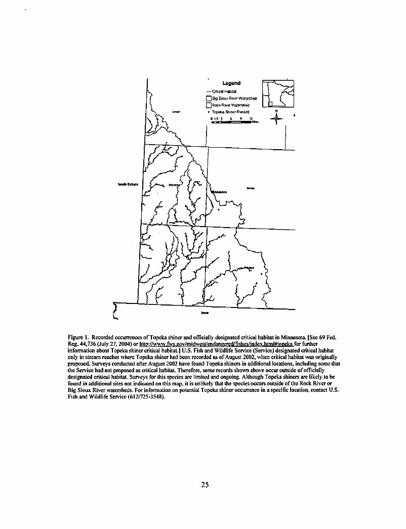
Legend
— Cntica! Habitat
□ Bg Stoux Swer watrsneci
Q RocK R»er Watervt«c
• Tooeka 9>mer Record
Figure I. Recorded occurrences of Topeka shiner and officially designated critical habitat in Minnesota. (See 69 Fed.
Reg. 44,736 (July 27,2004) or http://www.fws.pov/midwest/endanpered/rishes/index.htmWtopekafor further
information about Topeka shiner critical habitat.] U.S. Fish and Wildlife Service (Service) designated critical habitat
only in stream reaches where Topeka shiner had been recorded as of August 2002, when critical habitat was originally
proposed. Surveys conducted after August 2002 have found Topeka shiners in additional locations, including some that
the Service had not proposed as critical habitat. Therefore, some records shown above occur outside of officially
designated critical habitat. Surveys for this species are limited and ongoing. Although Topeka shiners are likely to be
found in additional sites not indicated on this map, it is unlikely that the species occurs outside of the Rock River or
Big Sioux River watersheds. For information on potential Topeka shiner occurrence in a specific location, contact U.S.
Fish and Wildlife Service (612/725-3548).
25


