digital leveling section 8 preparing descriptions for passive marks
TRANSCRIPT

Digital LevelingSection 8
Preparing Descriptions for Passive Marks
Purpose of Writing Descriptions
• To make geodetic data available to surveyors, engineers, cartographers and general public
• To facilitate finding the mark• To correctly identify the mark• To use the mark for new surveys• To preserve the mark for future generations

History
• Hand-written/typed-different formats for horizontal and vertical control points
• WDDProc-DOS-unified format-printed
• WinDesc-Windows-D-File format-web

The Description Header
• Key fields: SSN, DNR code, Rec code• Enter from left to right from the top down• Some boxes populate subsequent boxes• Contains most mark attributes• Data must meet stringent NGS standards• Data will be loaded and stored in separate
tables/fields in the NGS IDB• Used to generate the official NGS Datasheet

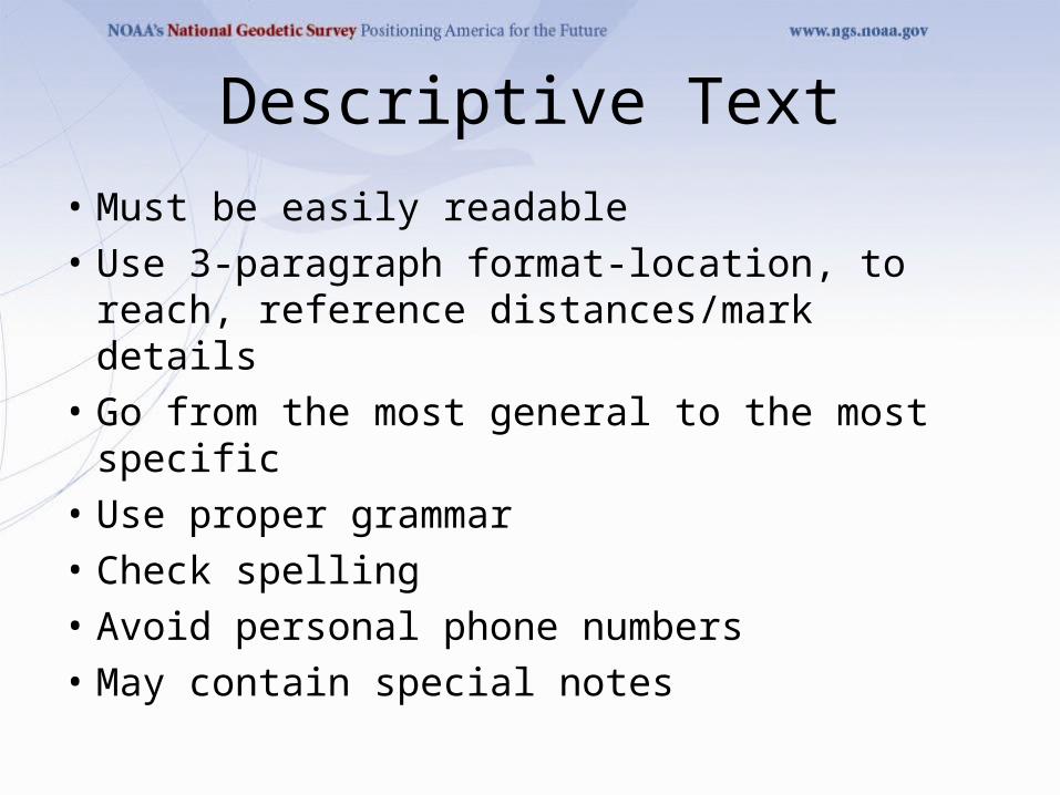
Descriptive Text
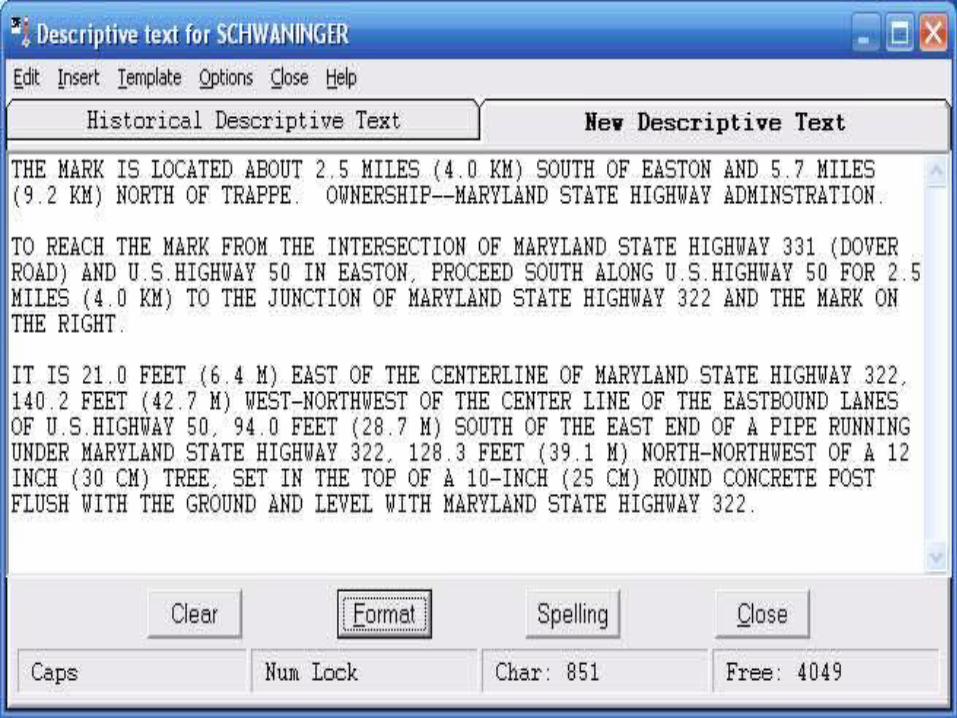
• Must be easily readable• Use 3-paragraph format-location, to reach,
reference distances/mark details• Go from the most general to the most specific• Use proper grammar• Check spelling• Avoid personal phone numbers• May contain special notes

Descriptive Text - Do
• Use 3-paragraph format-Approximate location, to-
reach, and objects
• Get at least 5 reference distances
• Format all descriptions
• Spell check all descriptions
• Use Windesc tools to help create descriptive text

Descriptive Text – Don’t
• Don’t use slang
• Don’t omit articles (a, an, the, etc.)
• Don’t duplicate text
• Don’t use the term ‘standard disk’
• Don’t use bearings in descriptive text
• Don’t put positions in descriptive text

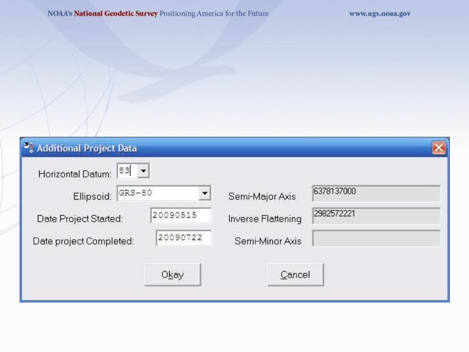
Positional Information
• Latitude and Longitude to 0.1 seconds for bench marks via hand-held GPS measurement
• Include horizontal datum• Include source, order and technique• May include other information for use with other
geodetic software such as Translev• Used for geodetic computations and corrections• Used to plot mark in Google Earth and other
plotting software

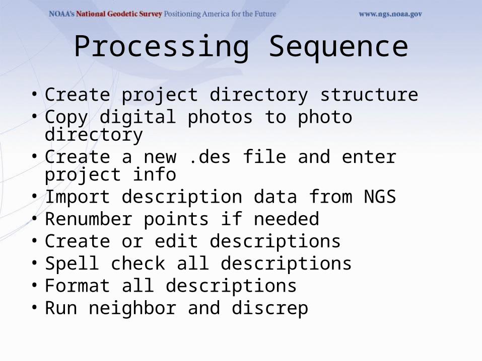
Processing Sequence
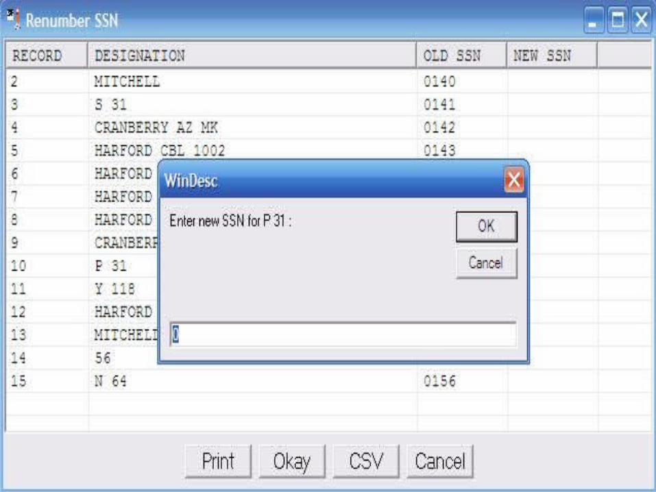
• Create project directory structure• Copy digital photos to photo directory• Create a new .des file and enter project info• Import description data from NGS• Renumber points if needed• Create or edit descriptions• Spell check all descriptions• Format all descriptions• Run neighbor and discrep

Recommended Directory Structure
• C:\L12345\• Adj\• Desc\• Obs\• Photos\


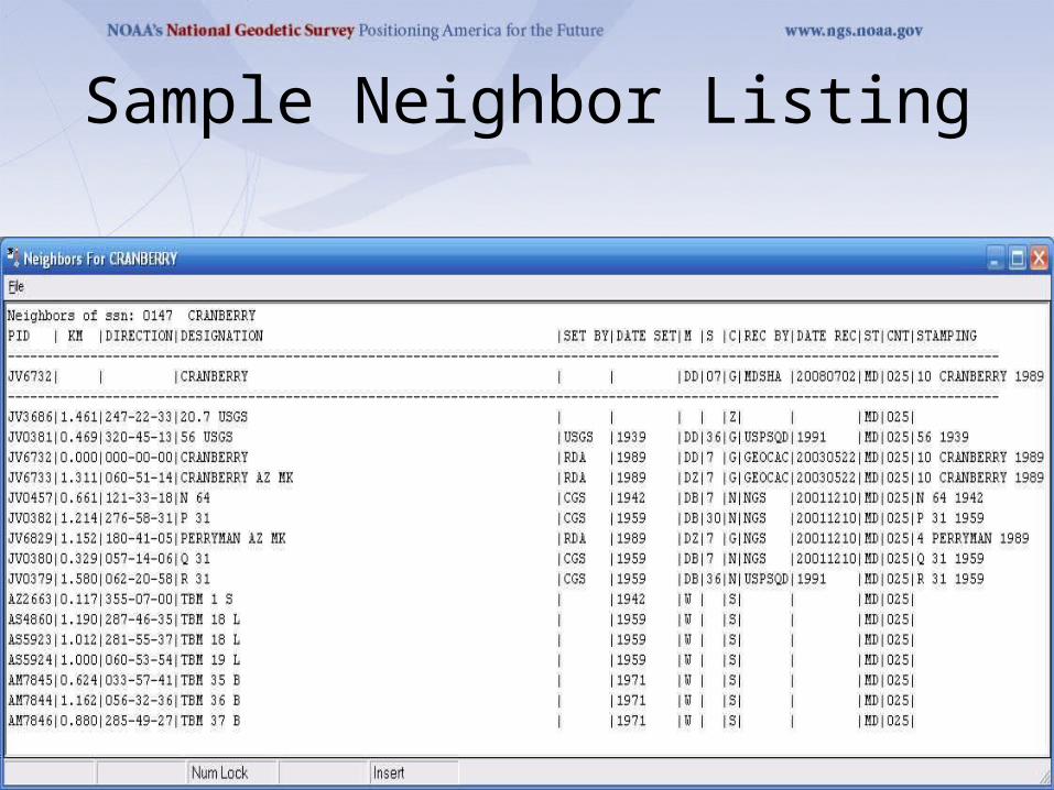
Sample Neighbor Listing
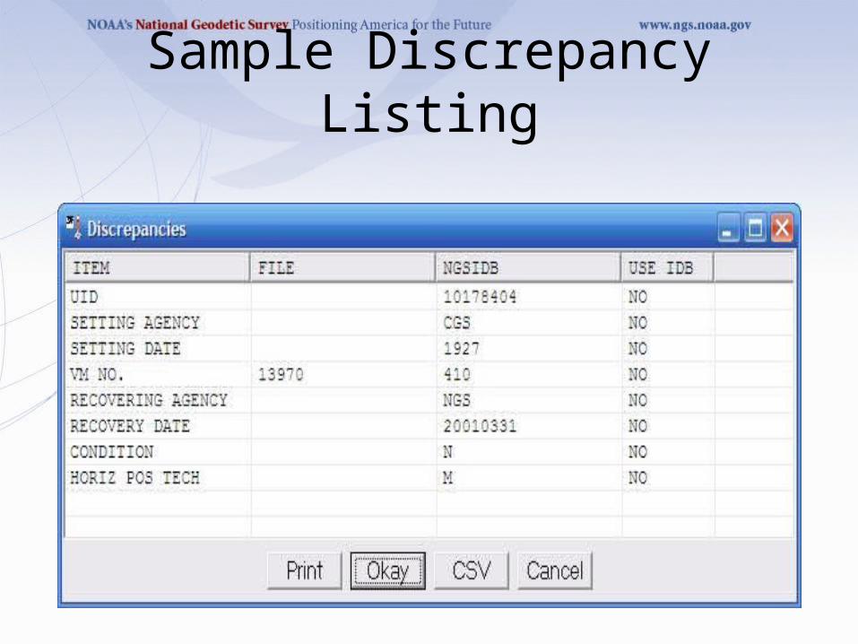
Sample Discrepancy Listing

Processing Sequence (cont.)
• Export to .dsc file• Check .dsc file• Fix errors in .des file and re-export• Rename photos• Resize photos if required• Insert labels to photos• Create .dsc file CD• Create photo CD


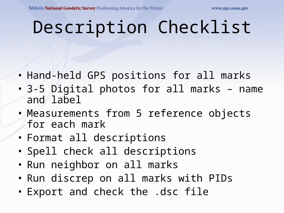
Description Checklist
• Hand-held GPS positions for all marks• 3-5 Digital photos for all marks – name and label• Measurements from 5 reference objects for each
mark• Format all descriptions• Spell check all descriptions• Run neighbor on all marks• Run discrep on all marks with PIDs• Export and check the .dsc file