different maps of europe with qc
TRANSCRIPT

*Types of Maps

*Parts of a map*In order to know what a map is about and what the symbols on each map mean we must look at 4 things found on every map.
TITLE
MAP SCALE
COMPASSROSE

*Locations: Absolute and Relative
*Absolute location can get a person, goods, or ideas right where they need to be by using 2 main methods.
*Street address
*Global coordinates (longitude and latitude)
Relative location is more casual and uses a location that is familiar to the user to get to another location with simple direction.
Amazon is on Leestown Road across the
street from Leestown Middle School.
BCTC college is right behind Lestown
Middle School

*Types of maps*Geographers use many different maps that are useful for many different jobs and purposes.
*Climate- the recorded average of the weather over a period of time.
*This climate map of Europe shows which type of climate is in each part of Europe

*Population density mapPopulation
density refers to the number of people living in an area. The more people per square mile the higher the “population density”
*Quick check!
*What type of information is found on a population density map?
*A) the size of each country
*B) the number of people living in an area in relation to another area the same size (per square mile or kilometer)

*Political maps*Political maps show where humans have agreed that the borders of their countries, cities, and state’s are.

*Physical maps*Physical maps show the natural landforms like mountains, oceans, rivers, etc…
Some of the physical features of a place can limit (stop or slow) human activity, others can promote it (help).

*Quick check!
*What type of map would show you countries’ borders?
*What type of map would show you mountains?
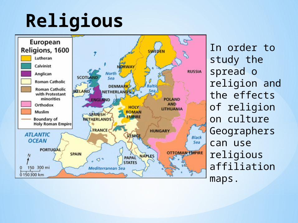
Religious affiliation map In order to
study the spread o religion and the effects of religion on culture Geographers can use religious affiliation maps.

Languages of Europe In order to study the culture of a country or a continent Geographers can use a language map.
These maps can be important to businesses or travelers as well.

*Quick check!
*What is one reason that geographers would study and map religion and languages?
*A) It’s good to have all kinds of data to study in case we need it.
*B) Governments use maps like these to help provide services to all members of their country
*C) Maps like these can show cultural changes over time.
*D)Businesses can use maps like these to target their advertising and sell goods that the people in a region or country need and want.
*E) All of the above!!!