developing capacity for land reforms · pdf file•developing capacity for land reforms...
TRANSCRIPT
•DEVELOPING CAPACITY FOR LAND
REFORMS THROUGH GEOSPATIAL
COMPETENCIES AND
EDUCATION(8353)• (TS05G-TEEAHING & LEARNING FOR THE FUTURE)
BY
•CHIGBU NJIKE(Ph.D) & OKOYE
VERONICA UGONMA(MSc.)
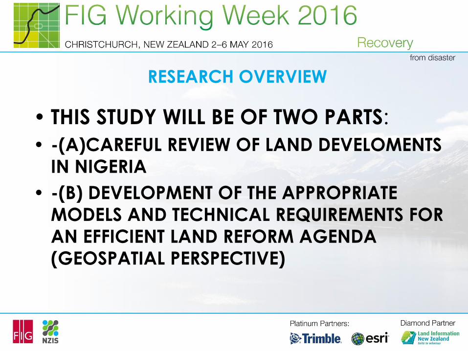
RESEARCH OVERVIEW
• THIS STUDY WILL BE OF TWO PARTS:
• -(A)CAREFUL REVIEW OF LAND DEVELOMENTS
IN NIGERIA
• -(B) DEVELOPMENT OF THE APPROPRIATE
MODELS AND TECHNICAL REQUIREMENTS FOR
AN EFFICIENT LAND REFORM AGENDA
(GEOSPATIAL PERSPECTIVE)
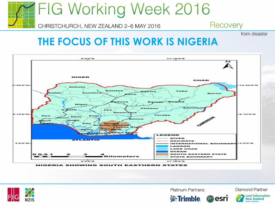
THE FOCUS OF THIS WORK IS NIGERIA
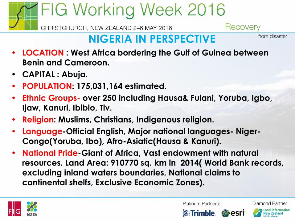
NIGERIA IN PERSPECTIVE• LOCATION : West Africa bordering the Gulf of Guinea between
Benin and Cameroon.
• CAPITAL : Abuja.
• POPULATION: 175,031,164 estimated.
• Ethnic Groups- over 250 including Hausa& Fulani, Yoruba, Igbo,
Ijaw, Kanuri, Ibibio, Tiv.
• Religion: Muslims, Christians, Indigenous religion.
• Language-Official English, Major national languages- Niger-
Congo(Yoruba, Ibo), Afro-Asiatic(Hausa & Kanuri).
• National Pride-Giant of Africa, Vast endowment with natural
resources. Land Area: 910770 sq. km in 2014( World Bank records,
excluding inland waters boundaries, National claims to continental shelfs, Exclusive Economic Zones).
INTRODUCTION
• Throughout civilization, land remains the most
important asset of any individual or society.
• It is the basis of human existence on which all
economic, political, social and cultural activities
thrive.
• use and management of land determine greatly
the extent and nature of development of all
societies, including Nigeria (Draft National Land
Policy, 2015).
INTRODUCTION
• It is the resource that has no cost of
production and, although its usage can be
switched from a less to more profitable one,
its supply cannot be increased (Adeniyi,
2013).
• The term ‘land’ includes all physical
elements in the wealth of a nation bestowed
by nature such as climate, environment,
fields, forests, minerals, mountains, lakes,streams, seas, and animals
INTRODUCTION
• The central role of land in the economic, social,
political and socio-cultural development of the
country cannot be over-emphasized.
• Land can be used in the following areas:
• i. For Sustainable housing delivery
• ii. For accelerate growth of urban economies
• iii. For rural planning and development
(agricultural land).
• (iv) For farming, livestock production, and related activities.
INTRODUCTION
• v. For transportation sector of the economy
• vi. As forest land to provide for many households
sustenance
• vii. For tourism which contributes significantly to
Nigerian GDP
• viii.For sports infrastructure
• ix. For educational infrastructure
• x. For grazing reserve.
• xi. For industrial development.
INTRODUCTION
• For energy infrastructure which is a critical
driving force of economic growth and
development of any country by enhancing
productivity and quality of life.
• xiii.For coastal, maritime, wetlands and water
resources management.
• xiv. For security infrastructure. This covers
military, paramilitary, financial, economic, and
social security infrastructures (Draft National
Land Policy.2015
INTRODUCTION
• Most elements of the Act are disregarded by
the majority of the land owners. Sale of land,
forbidden by the Act, has been reoccurring
unabated.
• The Act has mot mitigated land speculation;
rather it has driven it underground with
attendant under development of the
country.
INTRODUCTION
• This has led to overall under development of
Nigeria; furthermore, there had been total
neglect or selective neglect of the impact of
geospatial competencies in the realization of
the land reform agenda and efficient land
administration.
TRADITIONAL LAND TENURE SYSTEM
• Traditional tenure system placed major
constraints upon the achievement of efficient
agricultural production and physical
development, which led to land use act-
promulgation by the government in 1978.
• This land use act promulgation by the
government thirty years ago failed to take
into sufficient consideration the modifications
that have taken place in the traditional
tenure system by treating land as free good.
RESEARCH ISSUE AND GAPS HOPED TO BE FILLED
• In Kenya, according to Njuguna and Baya (2013),
the structural framework and principles for the
management and administration of land inherited
from colonial times has largely failed to instill
confidence in the land market.
• Some of the problems within the land sector in Kenya
may be attributed to its colonial history and
proliferation of statutes governing ownership and use
of land, the quality and security of tenure,
environmental issues, broad socio-economic
patterns and demographic trends.
RESEARCH ISSUE AND GAPS HOPED TO BE FILLED
• According to Njuguna & Baya, Kenya does not have a
clearly articulated national policy that spells out the
relationship between the people, the STATE and the
land. This problem(lack of national land policy) led to
haphazard manner of land administration in KENYA.
• In Rwanda, for many years ago, rights over land for
women and female orphans were not recognized. The
causative factors were the existence of inefficient land
administration system and the prevalence of
traditional system of land tenure which were
unfavorable and female gender discriminatory
(Uwayezu & Mugiraneza, 2011).
•
RESEARCH ISSUE AND GAPS HOPED TO BE FILLED
• The land administration situation in Ghana prior to the
implementation of the Land Administration Project has
been aptly described in the National Land Policy of
1999 as follows:
• (i) General indiscipline in the land market
characterized by a high spate of land encroachments.
• (ii) Indeterminate boundaries of customary owned
lands resulting directly from lack of reliable
maps/plans, and the use of unapproved, old or
inaccurate maps, leading to land conflicts and
litigation.
RESEARCH ISSUE AND GAPS HOPED TO BE FILLED
• (iii) Compulsory acquisition by government of large tracts of lands,
which have not been utilized to the full and for which payment of
compensation has been delayed.
• (iv) Inadequate security of land tenure due to conflict of interests
between and within land-owning groups and the state, land
racketeering, slow disposal of land cases by the courts and a weak
land administration system.
• (v) Difficult accessibility to land for agricultural, industrial,
commercial and residential development purposes due to
conflicting claims to ownership, and varied and outmoded land
disposal procedures
RESEARCH ISSUE AND GAPS HOPED TO BE FILLED
• Weak land administration system characterized by lack of
comprehensive land policy framework, reliance on inadequate
and outdated legislation, lack of adequate functional and
coordinated geographic information systems and networks, as
well as of opaque guidelines; poor capacity and capability to
initiate and coordinate policy actions, let alone resolve
contradictory policies and policy actions among various land
delivery agencies.
• The net effect of these constraints is a distorted and
dysfunctional land market that is not investor and development
oriented and which cannot guarantee security of tenure,
resulting in high transaction costs and high incidence of poverty.
THRUST OF THIS WORK-ADVOCACY
• Based on the identified gaps and inherent short-
comings of land administration in Rwanda, Kenya,
Ghana and Nigeria, “the thrust of this research” is to
trace the long history land administration before and
during the land use act in Nigeria, the land reform
process so far and and the grains to be harnessed
from the application of geospatial competencies and
education in the overall Land Reform Programme in
Nigeria.
•
WHAT IS LAND REFORM?
• Puja Mondal(www.yourart.com) in the article
titled “ Land Reforms in India, defined Land
reforms as the redistribution of property rights
in land for the benefit of small farmers and
agricultural labourers. In a broader sense,
land reforms include two types of institutional
changes. One relates to agrarian relationship
and the other to the size of the unit of
cultivation.
WHAT IS LAND REFORM?
• A united Nations publication has defined land
reforms as measures concerning the reform of the
land tenure only. All other measures are included in
agricultural reorganization.
• Hence, according to Lipton, land reforms are only
those reforms in land which improve the distribution
of income among the persons affected by these
measures.

OBJECTIVES OF LAND REFORMS
• The following are the major objectives of land reforms:
• (i) increasing productivity (ii) Ensuring social justice
(iii)Attaining a planned growth (iv) Providing incentives
(v) Employment creation.
• Philip Raup noted that land reforms should be a
synergy of redistribution of rights in land and supporting
measures that are necessary to achieve three
objectives of land reforms-social, political health and
agricultural output expansion. However, some of
thought had argued that these three core objectives
can not be achieved at the same time.
OBJECTIVES OF LAND REFORMS• Sanket Suman opined in his work entitled “Land
Reforms: Meaning, Objectives and Different
Measures” that land reforms constitutes the most
important package of measures to improve the
economic conditions agricultural tenants.
• He noted that land reforms aims at the redistribution
of land ownership in favour of the cultivating class,
regulation and rationalization of rent, improving size
of farms and providing security of tenure in order to
transfer in traditional agriculture and raise cultivators
to new pedestals.

OBJECTIVES OF LAND REFORMS
• He further stated that in the ultimate analysis,
agricultural development and rise in
productivity depends upon two factors-
technological and institutional.
• Land reforms become indispensable to this
end and thus help to move towards
establishing an egalitarian society by ending
the exploitation of the poor by the rich and
narrowing economic inequality.
GEOSPATIAL SCIENCE AND LAND REFORMS ??
• Geospatial science is a discipline that
focuses on using information technology to
understand people, places, and processes of
the earth. Spatial analysis of human and
physical variables is fundamental to the
discipline.
• Remote sensing, Geographic information
system, and Global positioning systems
technologies are commonly used as
measurement , observation and analysis
tools.
GEOSPATIAL SCIENCE AND LAND REFORMS ??
• The discipline is a science of foremost because the
scientific method is used to answer questions and
draw conclusions( evidence based). Tools of inquiry in
geospatial science include formulating hypotheses,
collecting data, conducting statistical analysis of the
data, and making conclusions that are supported by
data and evidence.
• What differentiates geospatial sciences from other
disciplines is the conclusion made include spatial
component(http://www.radford.edu/contents/csat/
accessed on 15/02/2016).
WHAT IS GEOSPATIAL DATA & ANALYSIS?
• Geospatial data is a record if it is created or
received in the course of doing mapping,
surveying or EPA business, and it provides
evidences of the Agency’s actions,
programs, and other activities. For example,
maps( vector, raster, thematic) used to
examine developments patterns and
conduct scenarios for growth management
and transportation planning.
WHAT IS GEOSPATIAL DATA & ANALYSIS?
• Thus, geospatial analysis is the gathering ,
display, and manipulation of imagery, GPS,
Satellite photography and historical (iconic)
data, described explicitly in terms of
georeferenced coordinates, or implicitly in
terms of street address, postal code, forest and
identifier as they are applied to geographic
models.
WHAT IS GEOSPATIAL DATA & ANALYSIS?
• Geoinformatics(classically called Surveyors), are
responsible for using geographic data that supports
military/civilian operations for Disaster Relief and
Homeland Security.
• They collect, analyze and distribute spatial information
to represent the terrain and its possible
effects(anthropogenic factors).
WHAT IS GEOSPATIAL DATA & ANALYSIS?
• The task of having a sustainable national
development has become so complex, that the
demand for current and up-to-date geospatial
information is increasing on daily basis (Igbokwe,
2010).
• Traditionally, Surveyors are legally responsible for
acquisition of geospatial data for mapping in
national planning and development using classical
survey techniques.
WHAT IS GEOSPATIAL DATA & ANALYSIS?
• These classical survey techniques include
chaining with tapes, traversing with
theodolites, trilateration, triangulation, Astro-
fix, etc.
• These classical survey techniques are tedious
and time consuming, they used survey
algorithms that invariably affect the data
acquisition, processing, storing and sharing
processes
LAND REFORM IN NIGERIA-THE JOURNEY SOFAR!!
• Chigbu et al.(2016)-Gender land policies in Sub-Saharan Africa:
Panacea Hunger and Poverty( http://www.conftool.com),World
Bank Annual Conference on Land and Poverty,2016, Washington
DC, the authors identified that, land globally provides house holds
with basic necessities for living.
• It provides the basic starting point for shelter, subsistence andmarket production in developing countries like in Sub-Saharan
Africa. Despite the importance of land in S/A women land rights
are still being treated with kid-gloves.
• Therefore, there is an advocacy for the scaling-up of gender
sensitive land policies and reforms as a panacea for hunger and
poverty.
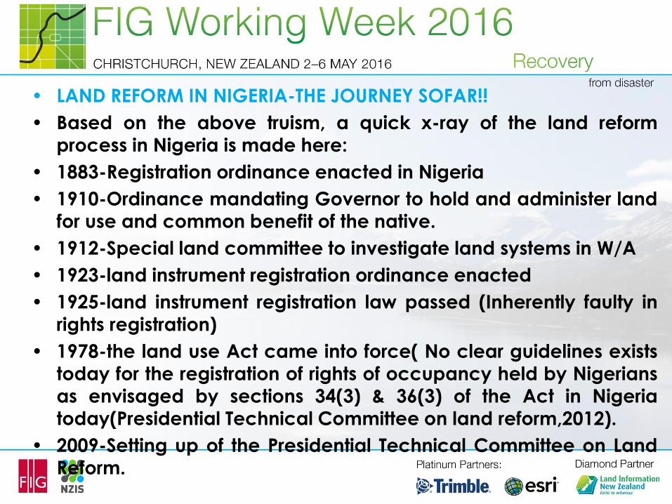
• LAND REFORM IN NIGERIA-THE JOURNEY SOFAR!!
• Based on the above truism, a quick x-ray of the land reformprocess in Nigeria is made here:
• 1883-Registration ordinance enacted in Nigeria
• 1910-Ordinance mandating Governor to hold and administer land
for use and common benefit of the native.
• 1912-Special land committee to investigate land systems in W/A
• 1923-land instrument registration ordinance enacted
• 1925-land instrument registration law passed (Inherently faulty inrights registration)
• 1978-the land use Act came into force( No clear guidelines exists
today for the registration of rights of occupancy held by Nigerians
as envisaged by sections 34(3) & 36(3) of the Act in Nigeriatoday(Presidential Technical Committee on land reform,2012).
• 2009-Setting up of the Presidential Technical Committee on Land
Reform.
LAND REFORM IN NIGERIA-THE JOURNEY SOFAR!!
• The PTCLR(2012) noted strongly that attempt made by some states
to address continued land registration have always been equated
to mean the computerization of the Registration process and
nothing more. They observed that in spite of the various
computerization projects embarked upon by states, land
registration remained cumbersome, with low patronage by the
people. This is also a common phenomenon all over the world
where computers alone are deployed with no actual process in
place to attract land owners for registration. In the absence of any
transparent and participatory land registration process, theacquisition of all types of GIS system of different specifications is
leaving the system more chaotic.
LAND REFORM IN NIGERIA-THE JOURNEY SOFAR!!
• SLTR-ADVOCACY: In the midst of the chaos on the land registrationprocess in Nigeria, the PTCLR identified the SLTR-Systematic Land
Titling Registration as the reasonable and preferred method for the
rapid and transparent registration of interest in land under the land
use Act.
• HOWEVER, the SLTR, REQUIRES the following for success:
• (i)Has been in existence in other countries since 1980
• (ii)Requires collaborative participation by land owners to identify
their boundaries with the endorsement of their neighbouring landowners giving credence to the transparency and validity of
the outcome( clear cadastral/legal surveying).
• (iii) Incorporates a community-based process to resolve disputes(
crowd sourcing/Fit-for-purpose principle).
LAND REFORM IN NIGERIA-THE JOURNEY SOFAR!!
• Most importantly, the SLTR process ensures that
parcels of land are not registered any more in
isolation but that the process ensures that all land
comprised in the registration area is registered at the
time, thereby making the process secure and cost-
efficient. This is where the role of geospatial science
and the contributions of surveyors in Land reforms
Agenda of Nigeria would be harnessed.
• The big question is , can there be any proper land
REFORM without proper Geospatial Competency and
Education?
8-MAN PRESIDENTIAL TECHNICAL COMMITTEE
• On April 2, 2009, the president inaugurated an 8-man Presidential
Technical Committee on Land Reform with 7 mandates:
• (i)to collaborate and provide technical assistance to state and
LGAs to undertake cadastral survey nationwide.
• (ii) to determine individuals’ “ possessory” rights using best
practices and most appropriate technology to determine the
process of identification of locations(xyz) and title registration of
title holdings.
• (iii) to ensure that cadastral land boundaries and title holdings are
demarcated in such a way that communities, hamlets, villages
areas, towns , etc. will be recognized
8-MAN PRESIDENTIAL TECHNICAL COMMITTEE
• (iv) to encourage and assist state and local Governments to
establish an arbitration / adjudication mechanism for land
ownership conflict resolution;
• (v) to make recommendations for the establishment of National
Depository for Land Title Holdings and Records in all states of the
Federation and the Federal Capital Territory.
• (vi) to make recommendations for the establishment of a
mechanism for land valuation in both urban and rural areas in allaspects of the Federation; and
• (vii) to make any other recommendations that will ensure effective,
simplified, sustainable and successful land administration in Nigeria.
PLACE OF GEOSPATIAL COMPETENCY/EDUCATION IN LAND REFORM
PARADIGM
• The seven thematic mandates of the PTCLR
presupposes that a careful plan should be
made to train, develop and sustain the
required technical capacity(in Surveying and
Geoinformatics Discipline and allied fields) in
providing the technical requirements for the
Land Reform programme in Nigeria
GEOSPATIAL COMPETENCY AND EDUCATION IN L/R
• Thus, Igbokwe (2010) opines that the
acquisition of geospatial data in Nigeria, has
not kept pace with the tremendous
development so far witnessed in the country.
Consequently, map data and other forms of
geographic information existing in various
government institutions are old and outdated
because they are not regularly updated
(Igbokwe, 2010).
GEOSPATIAL COMPETENCY AND EDUCATION IN L/R
• This daunting problem calls for the use of a
robust technique that will help in speedy
acquisition of geospatial information for a
sustained national development. Thus, remote
sensing, which is geospatial science and
technology that plays important role in the
generation and distribution of geoinformation
in a timely manner and at the required scale
and quality (Igbokwe, 2010) comes to mind.
PART B- TECHNICAL REQUIREMENTS & CAPACITY
DEVELOPMENT • The Land reform seeks “ to ensure that land cadastral
boundaries and title holdings are demarcated in such a way
that communities , hamlets, villages, village areas, towns, etc.
will be recognized. This mandate requires a comprehensive
cadastral survey of virtually the whole country.
• A cadastral survey is the mapping of a country on a scale large
enough to show the land holdings of individuals or groups ofindividuals or entities.
• This involved: (i) Field survey (ii)Time-defined process of
clarification or adjudication(iii) confirmation of claims (rights)
through the registration of the title documents or statutorycertificates of occupancy in the appropriate land Registry.
OUR ADVOCACY-
• Development of Appropriate/Competent Technical Know-
how(through careful Education Planning)
• Adequate Curriculum Development(Schools, Polytechnics,Universities)
• Development of Synergy with appropriate Technical/Educational
Regulatory bodies(NBTE-National Board for Technical Education in
Nigeria, NUC-National Universities’ Commission in Nigeria,
SURCON-Surveyors’ Council of Nigeria( Statutorily mandated to
regulate Surveying in all ramifications in Nigeria)
• Industry Based training
• Graduate work/Internship/Pupillage
• Professional Qualification/Practice

CONSLUSION AND RECOMMENDATION
• CONCLUSION:
• No country in this world can develop beyond the street
or pedestal level without careful educational planning
in all spheres of the National life. The efforts of the
Presidential Technical Committee on Land Reform is
commendable in selecting eight(8) universities for the
preparation of the “customized” curriculum for the
“training of the trainers”. However, a lot needs to be
done in synergizing with other stakeholders in the
“walking the talk”.
RECOMMENDATIONS
• The following are recommended:
• Training of adequate geospatial capacity in the areas of Remote
sensing, GPS, Specialized Surveying equipment, Hydrography,
and Mapping generally. This will be a form of win-win strategy.
• Encouragement of Educational Institutions in terms of provision of
the Hi-tech Equipment for training, grants, increased Educational
Trust Funds, etc. Efforts of the Surveyors’ Council of Nigeria
(SURCON) is highly commendable for yearly providing academic scholarships, grants and equipment to deserving Polytechnics
and Universities in Nigeria.
• Attracting Young ones to the profession in order to maintain a
continuous life cycle. Any profession that refuses to procreate will go into extinction.
• BINLOGRAPHICAL NOTES
• Chigbu NJIKE (mnis) is the Head of Department of Surveying and
Geoinformatics of Abia State Polytechnic Aba, Abia State, Nigeria (An
Academic Member of FIG). He holds a Ph.D in Surveying and
Geoinformatics and presently appointed to the office of Director of
Physical Planning of Abia State Polytechnic, Aba, Nigeria. Chigbu is a
regular participant at FIG Working Weeks and World Bank Annual Land
and Poverty Conferences in Washington District of Columbia (DC). He
has many scholarly works to his credit. He is an active member of
Nigerian Institution of Surveyors (NIS) and also a member of the
Surveyor’s Council of Nigeria (SURCON). Dr. Chigbu, Njike is a Seventh-
day Adventist Christian , married to Mrs Jennifer Eziaku Chigbu and the
marriage is blessed with three Children. His research interest is in
Landuse and Land cover Mapping and Environmental sustainability using
Geospatial techniques. He has a great passion in taking the Young
Surveyors to the next level through constructive engagement and
capacity building.

BIBLIOGRAPHY
• e-mail/contacts
• [email protected]/[email protected]
• OKOYE VERONICA UGONMA is a Lecturer in the Department of
Urban & Regional Planning of Abia State Polytechnic Aba,
Nigeria. She holds a Master’s Degree in Urban and Regional
planning and presently doing a Ph.D programme in her field ofstudy. Her research interest is in urban planning and change
detection Studies. She is currently the Head of the Department of
Urban and Regional Planning of Abia State Polytechnic, Aba,
Nigeria.
• e-mail/contact:

THANKS FOR YOUR
ATTENTION
&
GOD BLESS YOU ALL