delisting targets for loss of fish/wildlife habitat
TRANSCRIPT

DELISTING TARGETS FOR LOSS OF FISH/WILDLIFE HABITAT BENEFICIAL USE IMPAIRMENT OF THE ST. CLAIR RIVER AREA OF CONCERN
Prepared by: Submitted to: St. Clair River Bi-National Public Advisory Council Michigan Department of Environmental Quality Habitat Subcommittee Office of the Great Lakes
Lansing, Michigan
With assistance from:
2200 Commonwealth Blvd, Suite 300 Ann Arbor, MI 48105 Adopted: January 8, 2009 734-769-3004 Revised: June 5, 2013

Delisting Targets for Fish/Wildlife Habitat BUI in St. Clair River AOC i
ACKNOWLEDGMENTS
The St. Clair River Binational Public Advisory Council (BPAC) for the St. Clair River Area of Concern (AOC) would like to acknowledge the United States Environmental Protection Agency (EPA) Great Lakes National Program Office (GLNPO) for funding the original development of this plan in 2009 and updates to this plan in 2012. Thanks are due to Mr. Tony Kizlauskas and Mrs. Rose Ellison at GLNPO and Ms. Christine Aiello, Ms. Christy Clark and Mr. Rick Hobrla at MDEQ for all of their assistance with the original project and continued updates. We would also like to thank all of the people who contributed their time on the St. Clair River Habitat Subcommittee from 2007 – 2009 during the original project and between 2011 and 2012 when the plan was updated. Many experts contributed their time, efforts, and talent toward the preparation and update of this report:
Jeff Braunscheidel, Michigan Department of Natural Resources Jim Clatworthy, Oakland University, BPAC Member Christy Clark, DEQ (2010-2011) and DTE (2012) John Darling, DNR Paulette Duhaime, BPAC Member Rose Ellison, U.S. Environmental Protection Agency Melanie Foose, DEQ AOC Coordinator Fred Fuller, former St. Clair County Drain Commissioner, BPAC member Terry Gill, Greenwood Township Supervisor, BPAC Member Bob Haas, Michigan Department of Natural Resources Richard Hobrla, Michigan Department of Environmental Quality Kathy Johnson, Diver and Filmmaker Fred Kemp, St. Clair River Binational Public Advisory Council Kristen O’Reilly, St. Clair County Health Department Ernie Kafcas, Michigan Department of Natural Resources Sandra Kok, Environment Canada Gregory Lashbrook, Diver and Filmmaker Janice Littlefield, BPAC U.S. Co-Chair Terry Mcfaden, DNR Chuck Miller, Clay Township Phragmites Control Board Dave Mifsud, Herpetological Resource and Management, LLC Judy Ogden, Blue Water Sport Fishing Association, BPAC Member Glen Palmgren, DNR Mark Richardson, St. Clair River Binational Public Advisory Council Ed Schools, Michigan Natural Features Inventory Dave Sheldon, St. Clair County Community College Patty Troy, U.S. Co-Chair BPAC Dave Dortman, St. Clair-Detroit River Sturgeon for Tomorrow Witey Simons, BPAC member Harsens Island Frank Schonover, BPAC member Harsens Island Bob Williams, Clay Township Phragmites Control Board Dennis Wilson, DNR

Delisting Targets for Fish/Wildlife Habitat BUI in St. Clair River AOC ii
Front Cover Photo Credit:
Photos used in the collage on the front cover were obtained from the Friends of the St. Clair River 2006 Photo Contest Entries. Individual photographers, clockwise from top left, are Steve Pondo, Paul Blair, Victor Adamko, Dave Trzasko, Greg Lashbrook, and Grace Grogan.

Delisting Targets for Fish/Wildlife Habitat BUI in St. Clair River AOC iii
TABLE OF CONTENTS
1.0 Introduction .......................................................................................................................................... 1
2.0 Background ......................................................................................................................................... 2
3.0 Historical Population and Habitat Issues ............................................................................................. 6
3.1 Populations Issues ........................................................................................................................ 6 3.2 Habitat Issues ............................................................................................................................. 12 4.0 Description of Impairments ................................................................................................................ 16 4.1 In-River Habitat ........................................................................................................................... 16 4.2 Shallow Water/Nearshore Habitat ................................................................................................ 16 4.3 Tributary Habitat .......................................................................................................................... 17 5.0 Ongoing Habitat and Population Planning Processes in the AOC ..................................................... 18 6.0 Delisting Criteria – Target Project Descriptions.................................................................................. 21
7.0 Reporting on Habitat Restoration Actions to the MDEQ .................................................................... 42 8.0 References ........................................................................................................................................ 43
LIST OF FIGURES Figure 2-1: U.S. Boundary of the St. Clair River Area of Concern ................................................................ 5 Figure 3-1: U.S. St. Clair River AOC: Upper Reach ...................................................................................... 7 Figure 3-2: U.S. St. Clair River AOC: Lower Reach ...................................................................................... 8 Figure 6-1: Target Project Locations .......................................................................................................... 22

Delisting Targets for Fish/Wildlife Habitat BUI in St. Clair River AOC 1
1.0 INTRODUCTION The purpose of this report is to outline the criteria for the removal of the Loss of Fish and Wildlife Habitat Beneficial Use Impairment (BUI) from the St. Clair River Area of Concern (AOC). The criteria allow for protection and restoration of the fish and wildlife habitat in the AOC and clearly define an end point for removing the Loss of Fish and Wildlife Habitat BUI. The delisting targets are presented on a project basis and were developed independent of the existing Remedial Action Plan (RAP). This planning document provides an acceptable solution to the fairly common situation where the RAP did not include specific targets for removal of each BUI. Following a project criterion, ten target habitat restoration projects are described. Successful completion of these projects will signify that the Loss of Fish and Wildlife Habitat BUI can be removed from the St. Clair River AOC. The site specific projects included in this report represent a cross-section of implementation projects that are necessary to restore the Fish and Wildlife Habitat beneficial use to the St. Clair River.

Delisting Targets for Fish/Wildlife Habitat BUI in St. Clair River AOC 2
2.0 BACKGROUND The St. Clair River is located at the northern end of the connecting waterways between Lake Huron and Lake Erie. The connecting waterways are comprised of the Detroit River, Lake St. Clair, and the study area, the St. Clair River. The area covered by this planning document is the U.S. portion of the St. Clair River AOC, which is bounded in the north by the Blue Water Bridges and in the south by Lake St. Clair (See Figure 2-1). Seaway Island, Harsens Island, Russell Island, St. John’s Marsh and Big Muscamoot Bay are included in the southern extent of the St. Clair River. In 1985, the U.S. and Canadian governments identified the St. Clair River as one of forty-three Areas of Concern (AOCs) in the Great Lakes; and in 1992 the St. Clair River Binational Public Advisory Council (BPAC) developed the Stage I RAP. The Stage I RAP provides a description of the environmental problems in the St. Clair River and identifies the beneficial uses that are impaired (BUIs) and the causes of impairment. One of the BUIs in the St. Clair River AOC is Loss of Fish and Wildlife Habitat. The 1995 Stage I RAP listed the Loss of Fish and Wildlife Habitat BUI as impaired due to the significant loss of wetlands and extensive bulk-heading and infilling of the St. Clair River shoreline. Wetland impairment as a result of dyke construction impacted wetland functionality and availability of fish habitat. Significant shoreline alterations, including extensive bulk-heading and infilling has occurred along much of the river, eliminating and/or altering the littoral zone (shallow water areas) which has resulted in the loss of spawning, rearing and feeding sites for many fish species. In 2008, the Michigan Department of Environmental Quality (MDEQ) revised their Guidance for Delisting Michigan’s Areas of Concern (Guidance). The Guidance provides the criteria that must be met for removal of each BUI from the list of impaired beneficial uses within an AOC. To address the Loss of Fish and Wildlife Habitat BUI, the Guidance requires that a local aquatic habitat restoration plan be developed and implemented. This document serves that purpose. The plan must contain the following components (MDEQ, 2008):
1. A short narrative on historical fish and wildlife habitat or population issues in the AOC, including how habitat or populations have been impaired by water quality.
2. Description of the impairment(s) and location for each aquatic habitat or population site, or for multiple sites where determined appropriate at the local level to address all habitat or population issues identified in the RAP and RAP updates.
3. A locally derived restoration target for each impacted habitat or population site. Sources of information for targets may include data from social science surveys, if appropriate. Habitat restoration targets may be based on restoration of fish and wildlife populations, if appropriate.
4. A list of all other ongoing habitat or population planning processes in the AOC, and a description of their relationship to the restoration projects proposed in the plan.
5. A scope of work for restoring each impacted aquatic habitat or population site. The scope of work should describe specific habitat or population restoration action(s) to be completed, including:
a. Project description b. Impaired Habitat to be Addressed c. Timetable d. Funding

Delisting Targets for Fish/Wildlife Habitat BUI in St. Clair River AOC 3
e. Responsible entities f. Indicators and monitoring g. Evaluation process based on indicators h. Public involvement
6. A component for reporting on habitat or population restoration implementation actions to MDEQ. Removal of the Loss of Fish and Wildlife Habitat BUI will be based on achievement of full implementation of actions of the steps above. Habitat values and populations need not be fully restored prior to removal of the BUI, as some may take many years to recover after actions are complete. This document addresses the six components of the MDEQ Guidance, as follows:
MDEQ Required Component Corresponding Section of this Plan
1. Narrative on the historical habitat and population issues in the AOC Section 3.0
2. Description of the impairment(s) and location for each site Section 4.0
3. List of all ongoing related habitat and population planning processes in the AOC
Section 5.0
4. Locally derived restoration target for each site Section 6.0
5. Scope of work for each site Section 6.0
6. Method for project reporting to MDEQ Section 7.0
In 2007 and 2008, when the Habitat Subcommittee originally developed this plan, they felt they lacked enough quantifiable information about the degree or location of fish and wildlife habitat losses in the AOC to develop specific habitat targets such as “restoration of x # of shoreline miles”, or “x # of coastal wetland acreage”, etc. The subcommittee decided a project approach would be more appropriate and that ultimately once BPAC felt the projects described in this document had been successfully completed, the Loss of Fish and Wildlife Habitat BUI would be considered restored. The development of projects in 2008 relied on two primary resources:
1. The Stage II RAP, which identified four candidate sites for habitat restoration within the U.S. portion of the AOC. Each of these sites is located within the St. Clair River delta region.
2. The local knowledge of the Habitat Subcommittee regarding fish and wildlife populations, habitat impairments, and the opportunities for restoration.
In 2009, BPAC approved 10 restoration projects as the criteria for removing the Loss of Fish and Wildlife Habitat BUI, with the understanding that the plan would be updated once critical studies within the AOC were completed. In 2011, the following studies were completed providing BPAC with additional information regarding the habitat conditions on the U.S. side of the St. Clair River:
1. Potential Conservation Areas Assessment and Natural Features Summary for Macomb and St. Clair Counties, Michigan Natural Features Inventory (MNFI),
Delisting Targets for Fish/Wildlife Habitat BUI in St. Clair River AOC 4
2. Physical and Biological Characteristics and Changes in the St. Clair-Detroit River Waterway, The U.S. Geological Survey (USGS), and
3. The Blue Water Report, Gregory A.D.
In 2012, the U.S. Habitat Subcommittee began meeting to revise the 2009 Delisting Targets for Loss of Fish/Wildlife Beneficial Use Impairment of the St. Clair River Area of Concern (Fish & Wildlife Plan) with the goal of accomplishing the following objectives: update progress on target sites since 2009, re-evaluate and update the list of target sites, and consider information gained from the MNFI, USGS and Gregory A.D. studies. This version of the Fish & Wildlife Plan revises the original target projects by splitting two of the original projects into four separate projects, eliminating four of the original projects, and adding two new target projects (Restoration of In-River Habitat and the Harsens Island Habitat Restoration). The revised target projects list, including the most up-to-date information about these projects, can be found in Section 6. The following describes the four target projects that the Habitat Subcommittee deemed unfeasible and removed from the original 2009 list:
Marine City Shoreline Restoration Project: Freighter loading and storage activities at this location are not compatible with habitat restoration.
Green Bulkhead Project: Correspondence with the coordinator of a pilot-project in Cleveland, OH revealed that green bulk-heading techniques are unsuitable for high flow environments like the St. Clair River, their long-term maintenance costs are high, and their habitat benefit is still being determined.
Harsens Island Property Acquisition & Restoration: Complications with the land acquisition at this project location may delay this project for several years or it may not even be possible. The Habitat Subcommittee did not want to hold up the habitat BUI removal process and replaced it with the Harsens Island Habitat Restoration Project which can be completed by 2014.
Wetland Restoration and Preservation by Mitigation Program: This project did not have foreseeable and measurable results within the next few years.

Delisting Targets for Fish/Wildlife Habitat BUI in St. Clair River AOC 5
Figure 2-1: U.S. Boundary of the St. Clair River Area of Concern
Delisting Targets for Fish/Wildlife Habitat BUI in St. Clair River AOC 6
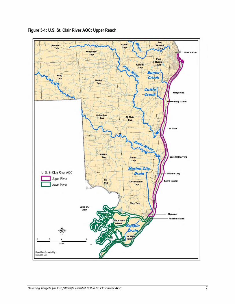
3.0 HISTORICAL POPULATION AND HABITAT ISSUES IN THE AOC Over the past century the St. Clair River AOC’s fish and wildlife habitat has undergone dramatic changes. Pressures from shipping, agriculture, industry, and urban development have severely damaged critical habitat. The loss of vegetated shorelines, the dredging, filling, draining and development of coastal wetlands, the mining of gravel, and the dredging of the river have all resulted in degraded habitat quality and loss of native species distribution and abundance in the St. Clair River ecosystem, especially spawning, rearing, and feeding sites for many species of fish and wildlife associated with shoreline habitats. The following provides a summary of the historical habitat and population issues in the St. Clair River AOC. For planning purposes, the river has been divided into two segments: the “Upper River” and the “Lower River”. This delineation was established because of the significant differences between their habitat restoration and preservation needs. As shown in Figures 3-1 and 3-2, the Upper River includes the entire river north of Russell Island, while the Lower River includes the St. Clair River delta. 3.1 Population Issues Information about the current and historical fish and wildlife populations in the AOC is vital for understanding their most critical habitat restoration and preservation needs. The following information should be used by project sponsors to target and customize their projects for supporting these populations to the maximum extent possible. Reptiles and Amphibians Within the St. Clair River AOC, a number of species of amphibian and reptile are present. Some rare or sensitive species known to occur include eastern fox snake, queen snake, northern water snake, Blanding’s turtle, spotted turtle, northern map turtle, spiny soft-shell turtle, and mudpuppy. Many are indicator species of environmental health and ecosystem quality. A number of species like the northern water snake, queen snake, northern map turtle, spiny soft-shell turtle and mudpuppy are important consumers of riverine invasive species including round gobies and rusty crayfish. The mudpuppy is the obligate host for the State Endangered salamander mussel. These and other species use the river and adjacent habitat of the St. Clair River. This stretch of habitat serves as a potentially significant corridor of movement for a number of species. Protection and creation of tributary and shoreline habitat for amphibians and reptiles is critical for preserving biodiversity of the riverine habitat along the AOC. Amphibian and reptile use in an area is often driven by the function of the resource and less by the aesthetics. Often riprap shorelines and old field habitat can provide necessary habitat in developed landscapes for herpetofauna. Shoreline armoring via rock can provide critical habitat for a number of common and rare amphibian and reptile species.
Inventories of amphibians and
reptiles and consideration of
their habitat needs should be
completed before a restoration
project begins.
Current and historical fish &
wildlife information should be
used by project sponsors to
improve populations to the
maximum extent possible.
Delisting Targets for Fish/Wildlife Habitat BUI in St. Clair River AOC 7
Figure 3-1: U.S. St. Clair River AOC: Upper Reach

Delisting Targets for Fish/Wildlife Habitat BUI in St. Clair River AOC 8
Figure 3-2. U.S. St. Clair River AOC: Lower Reach

Delisting Targets for Fish/Wildlife Habitat BUI in St. Clair River AOC 9
Mussels The introduction of invasive species, particularly zebra mussels, to the Great Lakes has resulted in significant declines in native mussel populations. The St. Clair River is considered one of the few refuges in the Great Lakes that still contain healthy populations of native mussels. Freshwater mussels are often considered ideal sentinel organisms for degradation or improvement of aquatic systems and overall aquatic biodiversity given their sensitivities to habitat changes and their lifecycle dependence on host fish populations (Zanatta, et al., 2010). Documentation of native mussels in the Upper River is limited, but in June, 2012, Gregory A.D. discovered a new bed of mussels while scuba surveying the shoreline area in Port Huron along a section of the Upper St. Clair River Restoration Project (Project 3 in Section 6.0). Biologists were able to identify at least five different native species from their underwater video of the mussel bed including the state threatened species, black sandshell. The St. Clair River delta provides the most well documented refuge for native mussels in the Great Lakes (Rathbun, 2012). Surveys in the St. Clair River delta between 1999 and 2002 revealed the presence of 22 of the 35 known historical native mussel species co-occurring with invasive zebra mussels. A total of 1,875 live mussels representing 22 species were found during snorkeling surveys of 32 shallow sites throughout the St. Clair River delta (McGoldrick, et al., 2009). The shallow bays within the St. Clair River delta were determined to provide directional flows and soft sediments that may limit zebra mussel access and impacts to native mussels. A more recent study led by Central Michigan University professor David Zanatta was initiated to examine genetic diversity between the coastal refuges in the St. Clair River AOC and the nearby tributaries to the St. Clair River AOC. The 2010 and 2011 field work from this study revealed native mussel populations within the St. Clair River delta to be similar to those identified in the previous studies. The St. Clair River delta likely supports the largest living freshwater mussel community in the lower Great Lakes and includes several species that have been listed as Endangered or Threatened in the U.S., Canada and/or the State of Michigan, making it an important refuge for the conservation of native mussels (McGoldrick, et al., 2009). Freshwater mussels have become the most imperiled group of living organisms in North America as a result of human impacts such as overharvest, pollution, impoundment of rivers, and the introduction of exotic species. Protection of the native freshwater mussel refuges within the St. Clair River AOC is critical to protecting the remaining populations, to prevent additional mussel species from becoming listed as endangered and/or threatened, and to maintain and improve biodiversity and water quality of the St. Clair River. Non-game Birds The St. Clair River AOC is critical for a variety of non-game bird populations during spring and fall migrations. Non-game birds need forested riparian habitat during migration, especially in the spring,
The recent discovery of native
mussel populations in the
Upper St. Clair River highlights
the need for conducting a full
natural feature inventory, both
on land and under the water,
before any of the
recommended restoration
projects begin.

Delisting Targets for Fish/Wildlife Habitat BUI in St. Clair River AOC 10
because of the abundant food, water and shelter resources it provides them. Historically, the AOC corridor was dominated by a dense riparian forest, but the majority of these forests were destroyed by timbering and agriculture practices. Currently, very little forested habitat remains in the AOC and the forests that remain are significantly fragmented. Common species that can be seen migrating through the AOC corridor are: rose-breasted grosbeak, ovenbird, red-eye vireo, wood thrush, Northern Oriole (Baltimore Race), American redstart, cedar waxwing, and a large variety of warblers. The Cornell Lab of Ornithology and the National Audubon Society maintain an online database of bird sightings by recreational and professional birders (www.ebird.org). Launched in 2002, the tool provides rich data sources for basic information on bird abundance and distribution. A review of this data indicates that 20 of the 43 State special concern species of birds were sighted within the AOC corridor. Additionally, 7 other special concern species have been found near the AOC, within the U.S. and Canadian watershed areas (Haas, 2012). Waterfowl The St. Clair River delta is one of the most critical areas for waterfowl breeding and staging during the migration in the entire Great Lakes Region. Waterfowl that breed in the St. Clair River delta include, but are not limited to, mallard, black duck, blue-winged teal and redhead. Far more species of waterfowl use the delta during the migration, as it is located on both the Atlantic Flyway and the Mississippi Flyway, with over 800,000 ducks passing through the area annually. Diving ducks such as canvasback, redhead and scaup feed on the wild celery, waterweed, and pondweed of the submergent marsh, before heading southeastward to the Chesapeake Bay, although up to 15,000 overwinter on Belle Isle and the Detroit River. Dabbling ducks such as green-winged teal, northern shoveler and northern pintail feed on the eelgrass, widgeon grass, and seeds of sedges, bulrushes, wild rice, pondweeds, and smartweeds. The area is a major staging ground for tundra swan and migratory Canada geese, as well. Rare birds that nest or forage in the marshes around the St. Clair River delta include king rail, least bittern, black-crowned night heron, common tern, Forster's tern, bald eagle, northern harrier, and marsh wren.
“The [St. Clair River] delta’s wetlands provide important feeding and resting habitats at a critical location along the Mississippi and Atlantic flyways, and are internationally recognized as being of continental significance to hundreds of thousands of migratory waterfowl, shorebirds, and songbirds. In addition the marsh provides valuable habitat to over sixty-five species of fish for spawning, nursery areas, shelter or feeding. [This] coastal area is currently home to several occurrences of three globally impaired natural communities: lake plain prairie, lake plain oak opening and Great Lakes marsh. In additional, numerous rare plants and animals associated with these rare communities continue to be found” (MNFI, 2011).
A 2011 study conducted by the Michigan Natural Features Inventory identified critical natural features that should be targets for conservation and protection in St. Clair and Macomb counties. Only 5.5% of the study area was identified as the highest priority. Of the highest priority sites, 2,172 acres in the southern St. Clair River AOC ranked third. “This area encompasses the majority of the St. John’s Marshland State Wildlife Area, and contains over 265 acres of lakeplain wet prairie and over 170 different native plant species” (MNFI, 2011) making protection of this remaining habitat critical in achieving the goals of the BPAC.
Re-establishing forested
riparian corridors and forest
connectivity is critical for
resident and migrating non-
game birds.

Delisting Targets for Fish/Wildlife Habitat BUI in St. Clair River AOC 11
The Michigan Department of Natural Resources (DNR) currently manages large tracts of land in the St. Clair River AOC for waterfowl and wildlife and hunting activities. Phragmites control has been an increasing problem for the DNR, especially in the St. Clair River delta where it has covered hundreds of acres of land and coastal area. Fisheries Early changes in the fish community of the St. Clair River have been largely attributed to exploitation by commercial and recreational fisheries, construction of dams on important tributaries, extensive nearshore modification (diking and draining of wetlands, breakwall construction, etc.), and degraded water quality associated with human activities in the watershed. Based on commercial and recreational fishing records, it is clear that the structure of the fish community in the river had changed significantly since the late 1800’s (GLFC, 2003). Lake sturgeon abundance was greatly reduced by the early 1900’s; lake whitefish and lake herring had essentially disappeared from the system by 1920. In contrast, alewife and rainbow smelt colonized the system and were well established by the 1950’s. The St. Clair River system underwent even more ecological changes since the 1970’s. Pollution controls reduced nutrient inputs, water levels peaked and then declined, aquatic macrophytes increased in densities and distribution, and the intentional and unintentional introduction of aquatic species has resulted in major changes in the river’s ecosystem. Rainbow trout, brown trout, and chinook salmon were established through stocking in the 1970’s. White perch colonized the system in the 1980’s, as well and zebra mussels; while round gobies became abundant throughout the system in the 1990’s (GLFC, 2003). The fish community responded to these changes. The growing volume of aquatic macrophytes provided smallmouth bass and muskellunge with increased spawning and nursery habitat and they became more abundant and widely distributed. Walleye recruitment, however, declined; possibly due to reduced larval food availability caused by mussel filtering of algae and zooplankton, or increased predation on juveniles by smallmouth bass and muskellunge. As water clarity increased due to mussel filtering, a preference for low light conditions drove walleye to deeper water and places with higher turbidity, such as the shipping channels or the water masses from tributaries such as the Thames or Sydenham Rivers, which caused them to become less widely distributed (Thomas, 2011). The present fish community is being influenced by an intensive recreational fishery, continuing loss of coastal wetland and shallow nearshore habitats, and continued nutrient inputs (GLFC, 2003). Even with the many changes in the St. Clair River, from an ecological standpoint, the trophic structure of the fish community has shown remarkable stability (GLFC, 2003). The present fish community in the St. Clair River system is a dynamic and diverse mixture of warm water and cool water species. The abundance and distribution of fish species within the system varies spatially and temporally, on both a seasonal and annual basis. Important native coldwater species in the St. Clair River are lake trout, lake herring, and lake whitefish. These species are seasonal and at the southern limits of their natural ranges. Lake sturgeon, northern pike, muskellunge, walleye, and yellow perch are also important cool water fish in the St. Clair River, but unlike the others, they are present throughout the entire year (Edsall, 1988). The St. Clair River delta serves as an extensive spawning and nursery area for native warm water species including longnose gar, bowfin, and several species of minnows and sunfishes (Edsall, 1988). Alewife, rainbow smelt, coho
Continued support for invasive
plant removal, especially
Phragmites, in the St. Clair
River delta is critical for
maintaining waterfowl
populations in the AOC.

Delisting Targets for Fish/Wildlife Habitat BUI in St. Clair River AOC 12
and chinook salmon, rainbow and brown trout, common carp, and white perch are abundant or important introduced species (Edsall, 1988); and, collectively, walleye, yellow perch, muskellunge, smallmouth bass, and northern pike have sustained an ecological function as important predators, despite changes in their habitat, relative abundance, and forage patterns over the last 30 years. A diverse assemblage of native and introduced fish species has provided a stable forage base for these predator populations (GLFC, 2003). The northern madtom (Federally Threatened) is an example of a shallow water species that was once known to occur along the entire length of the St. Clair River, but is now severely threatened due to shoreline conversion and loss of habitat.
“Nichols et al. (2003) reported that this area (the head of the St. Clair River to the mouth of the Black River) supports thousands of spawning lake sturgeon. Mohr (1999) estimated the Blue Water lake sturgeon spawning population at 29,200 adults. Boase and Hill (2002) also found that lake sturgeon using this reef had traveled from Lake Huron, as well as from lakes Erie and St. Clair and the Detroit River. Others have postulated that this fish spawning ground at Port Huron could be a sturgeon population source for other areas in the Great Lakes (Manny and Mohr 2011). Boase and Hill (2002) further state that ―disturbance or alteration to the site could have profound effects on local and distant populations of lake sturgeon. Welsh and McCain (2004) found substantial gene exchange between the lake sturgeon populations in the Detroit and St. Clair Rivers with populations in the Niagara River, which supports the idea that alteration of the Port Huron spawning site could have far-reaching negative impacts on lake sturgeon rehabilitation in the central Great Lakes region.” (Bennion and Manny, 2011)
A list of the species which are known to utilize the area from the Blue Water Bridge to the Black River, both historically and currently, is available in the Blue Water Report. (Gregory A.D., 2011) 3.2 Habitat Issues The Habitat Subcommittee has prioritized three habitat types as paramount for restoration and protection activities in the St. Clair River AOC:
In-river habitat;
Shallow water/nearshore habitat; and
Tributary habitat.
The following provides background information on conditions and past studies of these types of habitat. In-River Habitat The construction of the shipping channel in the St. Clair River greatly altered the hydraulic structure of the river and disturbed large areas of river bottom through dredging and spoil disposal (Bennion and Manny, 2011). These activities and the continued maintenance of the shipping channel have greatly altered the spawning grounds for thousands of fish within the Lake Huron-Erie corridor.
The head of the St. Clair River
and one mile downstream are
considered to be one of the
largest and healthiest lake
sturgeon spawning grounds in
the Great Lakes.
Delisting Targets for Fish/Wildlife Habitat BUI in St. Clair River AOC 13
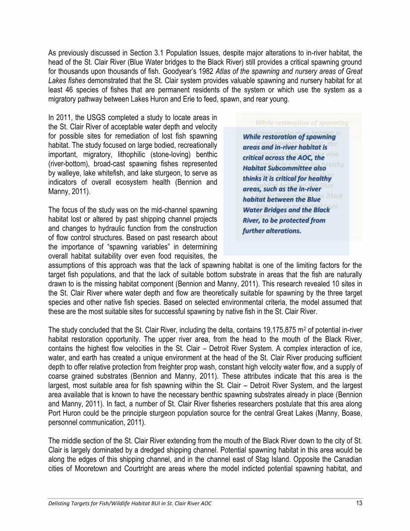
As previously discussed in Section 3.1 Population Issues, despite major alterations to in-river habitat, the head of the St. Clair River (Blue Water bridges to the Black River) still provides a critical spawning ground for thousands upon thousands of fish. Goodyear’s 1982 Atlas of the spawning and nursery areas of Great Lakes fishes demonstrated that the St. Clair system provides valuable spawning and nursery habitat for at least 46 species of fishes that are permanent residents of the system or which use the system as a migratory pathway between Lakes Huron and Erie to feed, spawn, and rear young. In 2011, the USGS completed a study to locate areas in the St. Clair River of acceptable water depth and velocity for possible sites for remediation of lost fish spawning habitat. The study focused on large bodied, recreationally important, migratory, lithophilic (stone-loving) benthic (river-bottom), broad-cast spawning fishes represented by walleye, lake whitefish, and lake sturgeon, to serve as indicators of overall ecosystem health (Bennion and Manny, 2011). The focus of the study was on the mid-channel spawning habitat lost or altered by past shipping channel projects and changes to hydraulic function from the construction of flow control structures. Based on past research about the importance of “spawning variables” in determining overall habitat suitability over even food requisites, the assumptions of this approach was that the lack of spawning habitat is one of the limiting factors for the target fish populations, and that the lack of suitable bottom substrate in areas that the fish are naturally drawn to is the missing habitat component (Bennion and Manny, 2011). This research revealed 10 sites in the St. Clair River where water depth and flow are theoretically suitable for spawning by the three target species and other native fish species. Based on selected environmental criteria, the model assumed that these are the most suitable sites for successful spawning by native fish in the St. Clair River. The study concluded that the St. Clair River, including the delta, contains 19,175,875 m2 of potential in-river habitat restoration opportunity. The upper river area, from the head to the mouth of the Black River, contains the highest flow velocities in the St. Clair – Detroit River System. A complex interaction of ice, water, and earth has created a unique environment at the head of the St. Clair River producing sufficient depth to offer relative protection from freighter prop wash, constant high velocity water flow, and a supply of coarse grained substrates (Bennion and Manny, 2011). These attributes indicate that this area is the largest, most suitable area for fish spawning within the St. Clair – Detroit River System, and the largest area available that is known to have the necessary benthic spawning substrates already in place (Bennion and Manny, 2011). In fact, a number of St. Clair River fisheries researchers postulate that this area along Port Huron could be the principle sturgeon population source for the central Great Lakes (Manny, Boase, personnel communication, 2011). The middle section of the St. Clair River extending from the mouth of the Black River down to the city of St. Clair is largely dominated by a dredged shipping channel. Potential spawning habitat in this area would be along the edges of this shipping channel, and in the channel east of Stag Island. Opposite the Canadian cities of Mooretown and Courtright are areas where the model indicted potential spawning habitat, and
While restoration of spawning
areas and in-river habitat is
critical across the AOC, the
Habitat Subcommittee also
thinks it is critical for healthy
areas, such as the in-river
habitat between the Blue
Water Bridges and the Black
River, to be protected from
further alterations.
Delisting Targets for Fish/Wildlife Habitat BUI in St. Clair River AOC 14
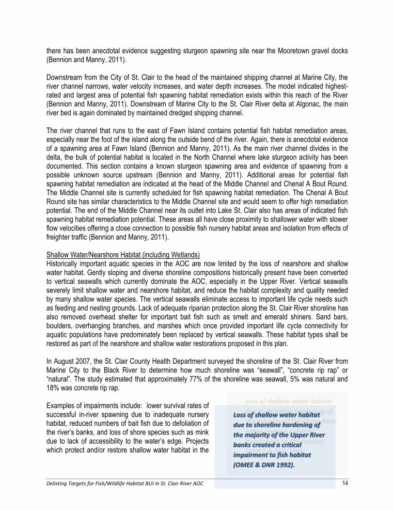
there has been anecdotal evidence suggesting sturgeon spawning site near the Mooretown gravel docks (Bennion and Manny, 2011). Downstream from the City of St. Clair to the head of the maintained shipping channel at Marine City, the river channel narrows, water velocity increases, and water depth increases. The model indicated highest-rated and largest area of potential fish spawning habitat remediation exists within this reach of the River (Bennion and Manny, 2011). Downstream of Marine City to the St. Clair River delta at Algonac, the main river bed is again dominated by maintained dredged shipping channel. The river channel that runs to the east of Fawn Island contains potential fish habitat remediation areas, especially near the foot of the island along the outside bend of the river. Again, there is anecdotal evidence of a spawning area at Fawn Island (Bennion and Manny, 2011). As the main river channel divides in the delta, the bulk of potential habitat is located in the North Channel where lake sturgeon activity has been documented. This section contains a known sturgeon spawning area and evidence of spawning from a possible unknown source upstream (Bennion and Manny, 2011). Additional areas for potential fish spawning habitat remediation are indicated at the head of the Middle Channel and Chenal A Bout Round. The Middle Channel site is currently scheduled for fish spawning habitat remediation. The Chenal A Bout Round site has similar characteristics to the Middle Channel site and would seem to offer high remediation potential. The end of the Middle Channel near its outlet into Lake St. Clair also has areas of indicated fish spawning habitat remediation potential. These areas all have close proximity to shallower water with slower flow velocities offering a close connection to possible fish nursery habitat areas and isolation from effects of freighter traffic (Bennion and Manny, 2011). Shallow Water/Nearshore Habitat (including Wetlands) Historically important aquatic species in the AOC are now limited by the loss of nearshore and shallow water habitat. Gently sloping and diverse shoreline compositions historically present have been converted to vertical seawalls which currently dominate the AOC, especially in the Upper River. Vertical seawalls severely limit shallow water and nearshore habitat, and reduce the habitat complexity and quality needed by many shallow water species. The vertical seawalls eliminate access to important life cycle needs such as feeding and nesting grounds. Lack of adequate riparian protection along the St. Clair River shoreline has also removed overhead shelter for important bait fish such as smelt and emerald shiners. Sand bars, boulders, overhanging branches, and marshes which once provided important life cycle connectivity for aquatic populations have predominately been replaced by vertical seawalls. These habitat types shall be restored as part of the nearshore and shallow water restorations proposed in this plan. In August 2007, the St. Clair County Health Department surveyed the shoreline of the St. Clair River from Marine City to the Black River to determine how much shoreline was “seawall”, “concrete rip rap” or “natural”. The study estimated that approximately 77% of the shoreline was seawall, 5% was natural and 18% was concrete rip rap. Examples of impairments include: lower survival rates of successful in-river spawning due to inadequate nursery habitat, reduced numbers of bait fish due to defoliation of the river’s banks, and loss of shore species such as mink due to lack of accessibility to the water’s edge. Projects which protect and/or restore shallow water habitat in the
Loss of shallow water habitat
due to shoreline hardening of
the majority of the Upper River
banks created a critical
impairment to fish habitat
(OMEE & DNR 1992).

Delisting Targets for Fish/Wildlife Habitat BUI in St. Clair River AOC 15
Upper River will directly support the goal of delisting the AOC. Extensive bulkheading and infilling has occurred along much of the river resulting in the loss of spawning, rearing and feeding sites for many fish species. Much of the original shoreline and/or the littoral zone (shallow water areas) has been eliminated which resulted in major losses of fish and wildlife habitat (OMEE & DNR, 1992). Between 1873 and 1973, wetland losses of 72% occurred on the Michigan side of Lake St. Clair, including losses within the AOC. Drainage for agriculture accounted for 92% of the losses and the remainder was due to marina and cottage development (OMEE & DNR, 1992). At the southern end of the AOC, the St. Clair River delta which is also part of Lake St. Clair is an example of a globally threatened fresh water coastal marsh system. This freshwater marsh, also known as the St. Clair Flats, is considered to be the only major river delta in the Great Lakes and the largest freshwater delta in the U.S. According to the 2011 MNFI report, there are still 3,117 acres of Great Lakes marsh left along the Lake St. Clair nearshore zone, but historically there were 11,150 acres. While there is still a large tract of Great Lakes marsh left in the delta, it is important to remember that this is approximately 72% less than the amount of this habitat type that used to exist in this area (Edsall, 1988). The St. Clair River delta provides an extensive spawning and nursery area for numerous resident and migrating fish species. Virtually the entire delta and the shoreline of Anchor Bay in Lake St. Clair serve as a nursery area for smallmouth bass, which spawn in the tributaries of the St. Clair River and in the river proper near Stag Island (Edsall, 1988). Tributary Habitat Historically the St. Clair River shoreline had several small tributaries including, the Marine City Drain – a low-gradient canal-like tributary, Bunce Creek, the Krispin Drain (also known as the Harsens Island Drain), and Cuttle Creek, that discharged directly to the St. Clair River. The nearshore and shoreline were covered with dense vegetation providing additional respite for the fish and wildlife dependent on the tributary, riparian and nearshore environments. Currently, the majorities of these small tributaries are enclosed in stormwater systems and discharge either 50 – 100 feet before the river or right into the river through a seawall. The ones that discharge shortly before the river can generally be described as highly degraded ditches filled with invasive plants and concrete rip rap (O’Reilly, 2012). This limits the tributary habitat that could be provided by the interior waterways.
Today, there are only four
“stream-like” tributaries on the
U.S. side of the river that
represent reasonable
opportunities for restoring
tributary habitat.

Delisting Targets for Fish/Wildlife Habitat BUI in St. Clair River AOC 16
4.0 DESCRIPTION OF IMPAIRMENTS Habitat impairments, conditions and opportunities for restoration and protection vary greatly between the upper and lower portions of the river. One impairment that is consistent across the river’s habitat types is invasive plants. Currently Phragmites australis has covered hundreds of acres across the St. Clair River Watershed and most densely across the St. Clair River delta. Phragmites has dramatically affected fish and wildlife habitat by choking out native species and impeding hydrology. The most critical habitat restoration and protection activities are summarized as follows: Upper River:
Preservation of spawning habitat from the Blue Water Bridges to the Black River
Restoration of shallow water/ nearshore and tributary habitat
Restoration of in-river habitat
Lower River:
Restoration of tributary habitat
Restoration of hydrologic connections
Management of Phragmites australis
Restoration of in-river habitat Impairments for each type of habitat are further discussed below. 4.1 In-River Habitat As previously discussed, in-river habitat has been historically altered due to the construction of the navigation channel and continues to be affected due to continued maintenance. More than 23 million m3 of material has been removed from the channel since 1920 (Edsall, 1988). According to Edsall, “navigation-related dredging has unquestionably altered the character of the St. Clair River and Lake St. Clair by altering flow regimes and replacing what was undoubtedly productive shoal-water habitat with less productive channel habitat. Collectively, the historical loss of shoal and littoral waters, the removal of gravel, and the lack of delta growth represent loss of habitat that was utilized by many Great Lakes fishes to satisfy spawning and other early life history requirements” (Edsall, 1988). 4.2 Shallow Water/Nearshore Habitat Shallow water and nearshore habitat is in much shorter supply in the Upper River than the Lower River. Only approximately 5% of the shoreline from Marine City to Port Huron is void of concrete rip rap or sea wall. The Habitat Subcommittee recognizes that concrete rip rap can provide habitat for amphibians and reptiles when located within areas of natural shoreline, however large extents of concrete rip rap provides minimal benefit to fish species. Considering the presence of high quality spawning habitat and lack of shallow water and nearshore habitat, restoration work in the Upper River should focus on shoreline
Control and long term
maintenance strategies for
invasive plant species,
especially Phragmites, are a
priority across the AOC; most
importantly in the St. Clair
River delta.

Delisting Targets for Fish/Wildlife Habitat BUI in St. Clair River AOC 17
restoration, wetland restoration and hydraulic reconnection, restoration of tributaries and tributary spawning habitat enhancements. An important consideration when targeting locations for shallow water/nearshore habitat restoration is to locate them downstream of and in the prevailing wind direction from known or restored spawning areas. This will assist small fry to easily find nursery areas after they hatch and float to the surface. Shallow water/nearshore habitat restoration should also consider the needs of wildlife species. An initial habitat assessment and inventory is critical for identifying what existing features are providing beneficial habitat for these species. Additional recommendations for addressing the habitat needs of wildlife include:
Provide basking sites along shoreline or
nearshore habitats such as logs or islands and exposed riprap or tree snags.
Create nearshore wetland habitat (both emergent and submergent) and protected embayment to
increase breeding, foraging, and hibernation sites for turtles and snakes.
Providing connectivity between upland and aquatic habitats through removal of seawalls, addition
of riprap to bridge the barrier where seawalls remain, and design ramp structures where seawall
are necessary.
Maintain existing riprap and rocky structure in-river and nearshore as this is likely being used by
these species seasonally.
4.3 Tributary Habitat As previously discussed, the majorities of small tributaries that drain directly to the St. Clair River have been enclosed and exist underneath buildings and through urban development. Existing infrastructure provides little opportunity for restoration of these tributaries except for the following four tributaries: the Marine City Drain, Bunce Creek, Krispin Drain, and Cuttle Creek. Specific impairments to nearshore and tributary habitats include loss of foliage and loss of variation in natural shoreline materials. In addition, fish access to these streams is limited due to obstructions such as perched culverts, weirs, invasive plants and sedimentation.
Habitat management in the
near shore zone should focus
on restoration of
Upper River
Near shore/shallow
water habitat
Lower River
Near shore/ shallow
water habitat
Coastal hydrology
Continued management
for invasive plant species
Habitat management in the
tributary areas should focus on
Upper and Lower River
Restoring in-stream,
riparian and littoral
zones health, and
Removing impediments
to fish access.

Delisting Targets for Fish/Wildlife Habitat BUI in St. Clair River AOC 18
5.0 ONGOING HABITAT AND POPULATION PLANNING PROCESSES IN THE AOC
This section provides a summary of the organizations currently active in planning and implementing habitat management within the AOC. It is important for project sponsors to coordinate their efforts with these organizations. Michigan Department of Natural Resources Historically the majority of preservation, conservation and restoration efforts in the St. Clair River AOC have largely consisted of the management activities by the DNR Wildlife, Fishery and Parks & Recreation Divisions. The DNR currently manage several areas in the southern portion of the AOC including the Algonac State Park, and wildlife areas in St. John’s Marsh and Harsens Island. The Fisheries Division also evaluates the fish communities in the AOC especially with regard to sturgeon. One of the most significant habitat management activities the DNR has been involved with over the last 10 years is the management of Phragmites australis throughout the delta and the restoration of lakeplain prairie and oak openings at the Algonac State Park. The DNR has spent enormous resources trying to control Phragmites and hundreds of thousands of dollars in grant funds from the State Wildlife Grant and the American Recovery and Reinvestment Act (ARRA) to restore these globally threatened ecosystems. Much of the restoration activities involve prescribed burning and control of invasive species. The dedication of the Algonac Prairie and Savanna Natural Area, a state natural area, in 2008 is a significant accomplishment for the long-term protection of the unique natural features at the park. Huron-Erie Corridor Initiative The purpose of the Huron-Erie Corridor (HEC) Initiative is to create relevant new science that will assist resource managers in making decisions concerning restoration of native aquatic species and their habitats. It is an international, collaborative partnership including federal, tribal, state, provincial, local, and non-governmental participants. The goal of the Initiative is to restore and improve the ecological function and resilience of the ecosystem. And, maintain healthy, diverse, and productive aquatic ecosystems that will in turn provide societal, economic, and environmental benefits to the Great Lakes region and throughout the U.S. and Canada. This is a collaborative, science-based adaptive management approach that allows flexibility to address natural resource issues in complex and ever-changing environments. The research themes of the Initiative are management-driven to meet the science information needs of resource managers. They include: restoration ecology of native species and their habitats, to restore habitat for sustainable natural resource use by the public; effects of aquatic invasive species on native aquatic species, to investigate potential threats of invasive species such as competition for food and habitat, and predation on native species; and, conservation biology of native species, to maintain healthy, diverse, and productive aquatic ecosystems throughout the St. Clair – Detroit River system for the use and enjoyment of the public. The HEC steering committee was formed to determine research strategies and direction, establish collaborations, and pursue funding opportunities using a consensus-based approach. It is comprised of partners who manage and protect this ecologically and economically valuable Corridor. The group meets
Delisting Targets for Fish/Wildlife Habitat BUI in St. Clair River AOC 19
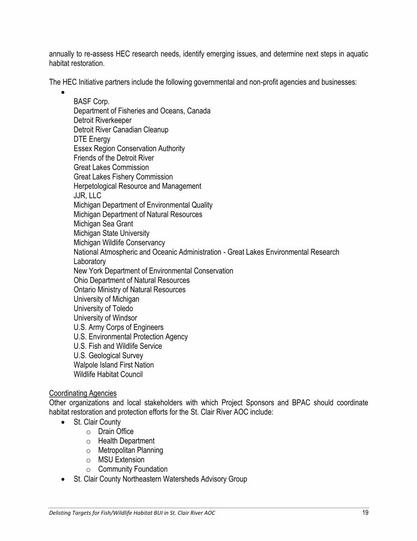
annually to re-assess HEC research needs, identify emerging issues, and determine next steps in aquatic habitat restoration. The HEC Initiative partners include the following governmental and non-profit agencies and businesses:
BASF Corp. Department of Fisheries and Oceans, Canada Detroit Riverkeeper Detroit River Canadian Cleanup DTE Energy Essex Region Conservation Authority Friends of the Detroit River Great Lakes Commission Great Lakes Fishery Commission Herpetological Resource and Management JJR, LLC Michigan Department of Environmental Quality Michigan Department of Natural Resources Michigan Sea Grant Michigan State University Michigan Wildlife Conservancy National Atmospheric and Oceanic Administration - Great Lakes Environmental Research Laboratory New York Department of Environmental Conservation Ohio Department of Natural Resources Ontario Ministry of Natural Resources University of Michigan University of Toledo University of Windsor U.S. Army Corps of Engineers U.S. Environmental Protection Agency U.S. Fish and Wildlife Service U.S. Geological Survey Walpole Island First Nation Wildlife Habitat Council
Coordinating Agencies Other organizations and local stakeholders with which Project Sponsors and BPAC should coordinate habitat restoration and protection efforts for the St. Clair River AOC include:
St. Clair County o Drain Office o Health Department o Metropolitan Planning o MSU Extension o Community Foundation
St. Clair County Northeastern Watersheds Advisory Group

Delisting Targets for Fish/Wildlife Habitat BUI in St. Clair River AOC 20
Local Municipalities
Southeast Michigan Council of Governments (SEMCOG) as part of the Lake St. Clair/ St. Clair River Strategic Implementation Plan
Friends of the St. Clair River Watershed
Blue Water Sport Fishing Association
Sturgeons for Tomorrow

Delisting Targets for Fish/Wildlife Habitat BUI in St. Clair River AOC 21
6.0 DELISTING CRITERIA – TARGET PROJECT DESCRIPTIONS This section describes the scope of work for each target restoration project that serves as the criteria for removing the Loss of Fish and Wildlife Habitat BUI from the St. Clair River AOC. According to the Stage 1 RAP, the principle problems leading to the BUI designation were the loss of fish and wildlife habitat and wetland function in the in-river and nearshore zones, as well as in the St. Clair River delta, due to in-filling, bulkheading, and changes in the river and delta flow regimes due to navigational dredging. The St. Clair River AOC Habitat Subcommittee believes that the projects listed in this plan best represent the remaining opportunities for in-river, shallow water, and tributary fish habitat improvement in the St. Clair River AOC. Long term environmental response to habitat restoration is notably difficult to quantify in advance without completing a full-scale habitat baseline study and comprehensive modeling. For the purpose of addressing the BUI, the projects in this plan were selected based on various evidence and judgment indicting the best opportunities to maximize ecological gain compared to other areas in the St. Clair River. Habitat restoration opportunities depend on not only the habitat needs of the river but also the publically owned land available for projects. When restoring habitat within the St. Clair River, it is critical to consider connectivity of habitat for various life cycles for any given species. It is most desirable for projects to address areas where all of the components required for each life cycle come together. Therefore, preference was given to projects that would accomplish or improve habitat connectivity. The in-river target projects were identified through a sustainability model developed by USGS (Bennion and Manny, 2011) to predict the location and conductivity of fish spawning and nursery areas. The shallow water / nearshore habitat and tributary projects were identified by the Habitat Subcommittee. However, if it is determined that the habitat restoration objectives of any project cannot be met, then the Habitat Subcommittee will entertain alternative projects that provide similar or greater benefit. Because the St. Clair River is part of the St. Clair – Detroit River Great Lakes Connecting Waterway and the habitat function of the river remains intrinsically important to Lakes Huron and Erie, as well as the ecosystem of the Great Lakes overall, this plan presumes that future habitat restoration actions in the St. Clair River and St. Clair River delta will continue beyond removal of the Loss of Fish and Wildlife Habitat BUI designation. Habitat improvement in the St. Clair River cannot be compared to other un-impacted areas of the Great Lakes because the only comparable areas in the Great Lakes are other connecting waterways which are all, or in part, AOCs. The St. Clair River delta is arguably the most significant wetland feature in the Great Lakes and part of the delta has been recognized as globally significant. Therefore, there are no other comparisons in the Great Lakes to the magnitude of the habitat function of the St. Clair River delta. Since the St. Clair River is a particularly unique AOC and has experienced historic and irreparable alterations to significant Great Lakes habitat, full implementation of the key habitat restoration opportunities represented by the target projects identified in this plan provides the measure of success in addressing the Loss of Fish and Wildlife Habitat BUI. Figure 6-1 shows the location of each target restoration project.

Delisting Targets for Fish/Wildlife Habitat BUI in St. Clair River AOC 22
Figure 6-1: Target Project Locations
Target Projects 1. Port Huron St. Clair River Shoreline Restoration –
North 2. Port Huron St. Clair River Shoreline Restoration –
South 3. Upper St. Clair River Shoreline Restoration 4. Bunce Creek Fish Passage Restoration 5. Marysville St. Clair River Living Shoreline
Restoration 6. Cuttle Creek Restoration 7. Cottrellville Township Shoreline Preservation and
Restoration 8. Marine City Drain Habitat Improvements 9. Harsens Island Habitat Restoration 10. Restoration of In-River Habitat of the St. Clair River

PROJECT 1 - PORT HURON ST. CLAIR RIVER SHORELINE RESTORATION – NORTH
Delisting Targets for Fish/Wildlife Habitat BUI in St. Clair River AOC 23
Within the northern reach of the St. Clair River AOC, and at the end of Lincoln Avenue in Port Huron, there is approximately 322 lineal feet of St. Clair River shoreline that provided an opportunity for restoring the nearshore/shallow water habitat in the Upper River. In 2012, the City restored over 4,800 square feet of shallow water/nearshore and riparian habitats; assessed and removed marine debris and rubble, as necessary; and restored and stabilized the river bank. An unanticipated part of this project was working with the USGS to replace spawning substrate near the edge of the shipping channel near this project site. This was done as a result of the pre assessment dive and communications with the Habitat Committee that led the City to do less debris removal in the near shore habitat than originally anticipated. Funds were then redirected to this pilot project to restore in-river spawning habitat for lake sturgeon. Additional project details are summarized below:
Impaired Habitat to be Addressed: Shallow water/nearshore habitat Timetable: Construction of the project was complete in the spring of 2012. Final underwater site assessments dives will be completed in the fall of 2012. Funding: $1.3 million awarded from GLRI in 2010 and $140,000 provided as matching funds by the City. The final amount of GLRI funds expended by the City amounted to $940,300. Responsible Entities: City of Port Huron Indicators & Monitoring: A pre-construction assessment was conducted for aquatic species utilization and substrate conditions. Evaluation Process: An evaluation of this project is pending the results of post assessment dives planned 2012 and 2013. The objective is to improve aquatic utilization of nearshore zone based on pre- and post-construction data. Public Involvement: Public input was sought from BPAC and the BPAC Habitat Committee during the design phase of this project.
PROJECT COMPLETE
Fall 2012
$1.3 million GLRI
$140,000 City of Port Huron

PROJECT 2 - PORT HURON ST. CLAIR RIVER SHORELINE RESTORATION –SOUTH
Delisting Targets for Fish/Wildlife Habitat BUI in St. Clair River AOC 24
Location: 480 feet of St. Clair River shoreline just south of Glenwood Street in Port Huron. Property Owner: City of Port Huron Purpose of the Project: Improve nearshore habitat above and below the water line Proposed Activity: Selectively replace existing broken concrete rip rap with rock revetment and vegetated rip rap along shoreline. Establish a 25 foot buffer of native vegetation. Construction Elements:
Install fill Replace road crossing culvert
X Regrade and stabilize banks Dredge/Excavate
X Place rip rap and rock revetment
Build in-stream habitat X Remove invasive species
Remove weir X Install upland vegetative buffer
Impaired Habitat to be Addressed: Shallow water/nearshore habitat. Timetable: It is anticipated that an in-depth feasibility study and habitat assessment would take approximately 6 months and design and construction could take an additional year. Funding: $2 million Responsible Entities: The City of Port Huron. Indicators & Monitoring: Vegetation diversity (including stem densities), habitat utilization, macroinvertebrates, herpatofauna and aquatic species. Evaluation Process: Improve stem density measurements, fish, macroinvertebrates, and herpatofauna diversity/population based on pre- and post-construction monitoring. Public Involvement: Input from the Habitat Subcommittee should be sought during the feasibility and design phases of this project. State and federal agencies often solicit public input during the permitting, planning, and/or implementation phases of projects. Educational signage should be installed as the site is expected to be used by the public for recreational purposes. Background The shoreline at this project location is approximately 480 feet in length and 0.4-mile south of Project 1; just south of Glenwood Street in Port Huron. This shoreline is currently comprised of large concrete rip rap, sparse trees, invasive plants, and eroding recreational paths. This project seeks to improve nearshore habitat by focusing on the preservation of underwater aquatic habitat and restoration of shoreline habitat.
Source: http://www.terraerosion.com/VegetatedRiprap.htm
Vegetated Rip Rap Shoreline Protection

PROJECT 2 - PORT HURON ST. CLAIR RIVER SHORELINE RESTORATION –SOUTH
Delisting Targets for Fish/Wildlife Habitat BUI in St. Clair River AOC 25
The City of Port Huron has developed preliminary conceptual designs for this project that show seawall and riprap along the entire shoreline, much like what has been implemented at Project #11. Nonetheless, the Subcommittee would like the City to consider vegetative rip rap and rock revetments which would provide better habitat opportunities. Therefore, the Habitat Subcommittee recommends a combination of restoration and preservation practices at this site including, but not limited to:
Preservation
The completion of a thorough assessment of the underwater habitat before any restoration activities are designed. This area currently contains areas of healthy habitat, including some nearshore broken concrete rip rap that should be preserved.
The establishment of a permanent 25 foot buffer of native vegetation including trees and vegetation which provide aquatic shade and habitat;
Restoration
The restoration of a variable and sinuous shoreline that provides both soft and hard shoreline habitats for a variety of fish and wildlife such as birds, small mammals, amphibians and reptiles; and,
The utilization of softer engineering techniques (such as vegetative rip rap and rock revetments), as feasible, for bank stabilization.
Finally, the Habitat Subcommittee would like to encourage the consideration of public recreational access in the design of this project. Currently this area is heavily used for public recreation (fishing and swimming) by many residents in the summer months. It is currently common to see 20 – 30 people swimming along this stretch of the river on a hot August day.
Existing Conditions
1 The opinion of the City’s Engineer is that 1) harden structures are needed to withstand winter ice flows and hydrologic pressures of the current at this location 2) there are limits on how much spawning habitat can be restored, and 3) in-river habitat restoration will not be possible at this location.
Shoreline Looking North
Shoreline Looking South

PROJECT 3 - UPPER ST. CLAIR RIVER SHORELINE RESTORATION
Delisting Targets for Fish/Wildlife Habitat BUI in St. Clair River AOC 26
Location: 0.8 miles of St. Clair River shoreline in Port Huron. Property Owner: St. Clair County Community Foundation Purpose of the Project: Create shallow water and nearshore habitat Proposed Activity: Stabilize eroded banks. Create wetland, riparian, and fish spawning habitat. Construction Elements:
Install fill Replace road crossing culvert
X Regrade and stabilize banks Dredge/Excavate
X Place rip rap X Build in-stream habitat X Remove invasive species
Remove weir X Plant native vegetation
Impaired Habitat to be Addressed: Shallow water/nearshore habitat Timetable: Design for the shoreline restoration has been completed. The Community Foundation received $250,000 from the USFWS to restore 500 feet of shoreline. A full assessment of the underwater habitat site utilization is pending. A grant, supported by the BPAC, from the National Oceanic and Atmospheric Administration (NOAA) was awarded in early September 2012 with the project to be completed by the end of 2014. Another grant application for $150,000 to Sustain Our Great Lakes (SOGL) is pending. Funding: $5 million ($2 million from the National Oceanic and Atmospheric Administration’s (NOAA) Great Lakes Habitat Restoration Program, $2.85 million from private sources, and $150,000 from the Community Foundation) Responsible Entities: The St. Clair County Community Foundation Indicators & Monitoring: Baseline wildlife assessment of the site, including amphibian, bird, aquatic and macroinvertebrate diversity is currently underway. Similar post-construction studies can be completed to measure success. Pre and post-construction monitoring of larval and juvenile fish; underwater site assessments; and native and invasive vegetation were proposed under the current grant requests. Evaluation Process: Improve vegetation, fish, herpatofauna and avian diversity/population based on pre- and post-construction monitoring. Public Involvement: The Community Foundation solicited extensive public input during the development of the Master Plan for the site. Additionally, the Community Foundation has partnered with MNFI, the St.
PROJECT UNDERWAY
$2 million: NOAA
$2.85 million: private sources
$150,000: Community Foundation

PROJECT 3 - UPPER ST. CLAIR RIVER SHORELINE RESTORATION
Delisting Targets for Fish/Wildlife Habitat BUI in St. Clair River AOC 27
Clair County Health Department, and the YMCA to apply for grants to fund additional public education and involvement activities such as the development of educational programs, signage, and brochures. Background Approximately 65 acres of property along the St. Clair River, downstream of the Black River and within the City of Port Huron, is currently owned by Acheson Ventures, with the exception of a 30’ width of shoreline approximately 0.8 mile long that runs along the St. Clair River. This portion of the shoreline was deeded to the St. Clair County Community Foundation in 2012 and provides a unique opportunity to stabilize erosion, soften shoreline and construct shallow water habitat in a very publically accessible location. As part of the Community Foundation’s proposed restoration of this shoreline, they plan to implement the following activities:
1. Complete a baseline biological assessment of fish and wildlife prior to construction; 2. Remove marine debris and invasive riparian plant communities; 3. Construct wetland and riparian habitat, avian stop-over grounds, spawning and riparian habitat
for fish, freshwater mussels, and aquatic salamanders; 4. Install native landscape plantings; 5. Assess spawning sites and nearby nursery habitat after construction; and 6. Implement educational outreach activities for the public and local stakeholders.
Project Location (in red outline)
Black River

PROJECT 4 - BUNCE CREEK FISH PASSAGE RESTORATION
Delisting Targets for Fish/Wildlife Habitat BUI in St. Clair River AOC 28
Location: Bunce Creek, City of Marysville Property Owner: St. Clair County Drain Commissioner’s Office, DTE Energy Purpose of the Project: Improve nearshore habitat above and below the water line Proposed Activity: Daylight the creek. Install in-stream habitat and native vegetation Construction Elements:
Install fill Replace road crossing culvert
X Regrade and stabilize banks Dredge/Excavate Place rip rap
X Build in-stream habitat X Remove invasive species
Remove weir X Plant upland vegetative buffer X Daylight creek
Impaired Habitat to be Addressed: Tributary habitat Timetable: 2013/ 2014 Funding: $2 million Responsible Entities: The St. Clair County Drain Commissioner. The City of Marysville and DTE Energy might also be sponsors. Indicators & Monitoring: Aquatic species within Bunce Creek and evidence of fish passage to the St. Clair River. Evaluation Process: Improve fish diversity/population based on pre- and post-construction monitoring. Public Involvement: Public input during the feasibility study phase of this project is appropriate. State and federal agencies often solicit public input during the permitting, planning, and/or implementation phases of projects.
Background Bunce Creek is the largest of the only two creek-like tributaries on the U.S. side of the St. Clair River that have the potential of being opened up for fish spawning and nursery habitat. Bunce Creek has a watershed of approximately 12 square miles which includes portions of City of Marysville and the townships of Port Huron and Kimball. It has 11 branches totaling 20 miles in length. It has recently been partially restored by the St. Clair County Drain Commissioner with the creation of three regional detention areas in the headwaters, bankfull bench excavation adding floodplain storage, low flow channel design and the preservation of shade trees on the stream channels wherever possible. Its branches flow through many
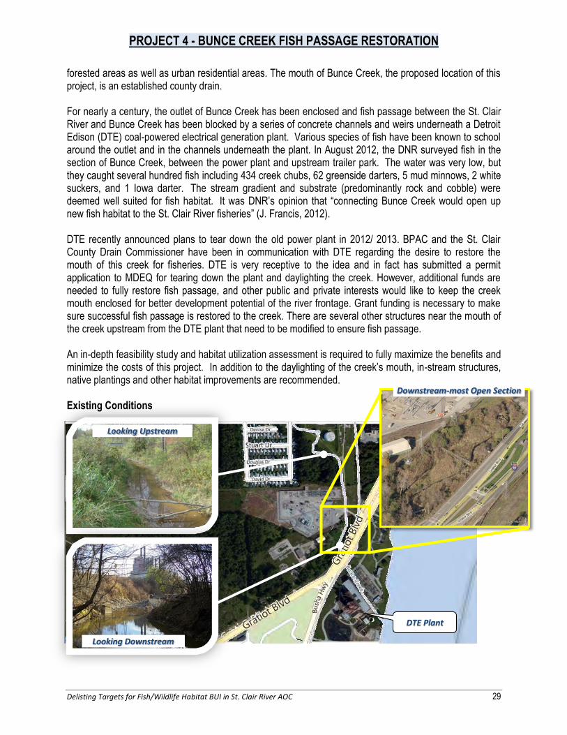
PROJECT 4 - BUNCE CREEK FISH PASSAGE RESTORATION
Delisting Targets for Fish/Wildlife Habitat BUI in St. Clair River AOC 29
forested areas as well as urban residential areas. The mouth of Bunce Creek, the proposed location of this project, is an established county drain. For nearly a century, the outlet of Bunce Creek has been enclosed and fish passage between the St. Clair River and Bunce Creek has been blocked by a series of concrete channels and weirs underneath a Detroit Edison (DTE) coal-powered electrical generation plant. Various species of fish have been known to school around the outlet and in the channels underneath the plant. In August 2012, the DNR surveyed fish in the section of Bunce Creek, between the power plant and upstream trailer park. The water was very low, but they caught several hundred fish including 434 creek chubs, 62 greenside darters, 5 mud minnows, 2 white suckers, and 1 Iowa darter. The stream gradient and substrate (predominantly rock and cobble) were deemed well suited for fish habitat. It was DNR’s opinion that “connecting Bunce Creek would open up new fish habitat to the St. Clair River fisheries” (J. Francis, 2012). DTE recently announced plans to tear down the old power plant in 2012/ 2013. BPAC and the St. Clair County Drain Commissioner have been in communication with DTE regarding the desire to restore the mouth of this creek for fisheries. DTE is very receptive to the idea and in fact has submitted a permit application to MDEQ for tearing down the plant and daylighting the creek. However, additional funds are needed to fully restore fish passage, and other public and private interests would like to keep the creek mouth enclosed for better development potential of the river frontage. Grant funding is necessary to make sure successful fish passage is restored to the creek. There are several other structures near the mouth of the creek upstream from the DTE plant that need to be modified to ensure fish passage. An in-depth feasibility study and habitat utilization assessment is required to fully maximize the benefits and minimize the costs of this project. In addition to the daylighting of the creek’s mouth, in-stream structures, native plantings and other habitat improvements are recommended. Existing Conditions
Looking Upstream
Looking Downstream
Downstream-most Open Section
DTE Plant

PROJECT 5 - MARYSVILLE ST. CLAIR RIVER LIVING SHORELINE RESTORATION
Delisting Targets for Fish/Wildlife Habitat BUI in St. Clair River AOC 30
Location: St. Clair River Shoreline upstream of Cuttle Creek confluence, City of Marysville Property Owner: City of Marysville Purpose of the Project: Improve nearshore and shallow water habitat Proposed Activity: Replace 2,500 feet of seawall, with rip rap and softened features. Construction Elements:
Install fill Replace road crossing culvert
X Regrade and stabilize banks Dredge/Excavate Place rip rap
X Build in-stream habitat Remove invasive species Remove weir Plant upland vegetative buffer
Impaired Habitat to be Addressed: Shallow water/nearshore habitat. Timetable: Funding for this project was obtained from the U.S. Environmental Protection Agency (EPA) through the Great Lakes Restoration Initiative (GLRI) in 2010; construction is expected to be complete in the fall of 2012. Funding: $1.3 million Responsible Entities: Marysville is the sponsor for this project. The St. Clair County Health Department (SCCHD) is a project partner. Indicators & Monitoring: Fish densities, substrate characteristics, and aquatic macrophytes using hydro-acoustic equipment. Evaluation Process: Improve fish and aquatic macrophytes diversity/population based on pre- and post-construction monitoring. Public Involvement: Marysville and the St. Clair County Health Department provided several opportunities for public input and questions about the project via newspaper articles, newsletter articles, and televised presentations to the Marysville City Council. Project information was also provided at the 2012 “Marysville Days” fair. Background In 2011, the St. Clair River shoreline in Marysville, north of the confluence with Cuttle Creek, was comprised of a failing steel seawall. The failing seawall provided an opportunity for replacement with vegetative shoreline practices. This project replaced 2,500 feet of seawall along this shoreline with a
PROJECT UNDERWAY
$1.3 million: GLRI

PROJECT 5 - MARYSVILLE ST. CLAIR RIVER LIVING SHORELINE RESTORATION
Delisting Targets for Fish/Wildlife Habitat BUI in St. Clair River AOC 31
vegetated “softened” shoreline to provide nearshore and shallow water habitat. This project is adjacent to Cuttle Creek and provides connectivity to the nearshore habitat restoration project planned for Cuttle Creek, Project 6. This project is located approximately 9 miles downstream of the existing spawning area under the Blue Water Bridges and will provide nursery habitat for many of the fish species spawning in this section of the river.

PROJECT 6 - CUTTLE CREEK RESTORATION
Delisting Targets for Fish/Wildlife Habitat BUI in St. Clair River AOC 32
Location: The downstream most 1,500 feet of Cuttle Creek within the City of Marysville. Property Owner: City of Marysville Purpose of the Project: Provide tributary and in-stream fish habitat to and restore eroded streambanks. Proposed Activity: Remove a concrete weir, a perched culvert and the in-line pond that inhibit fish passage. Restore eroding banks through soft-engineering practices; remove invasive plants; re-vegetate banks with native plants and enhance the in-stream habitat. Construction Elements:
Install fill X Replace road crossing culvert X Regrade and stabilize banks
Dredge/Excavate X Place rip rap X Build in-stream habitat X Remove invasive species X Remove weir
Impaired Habitat to be Addressed: Tributary habitat Timetable: In-depth feasibility study, habitat utilization assessment and permitting may take six months. Design and construction of improvements could take an additional year. Funding: $500,000 Responsible Entities: City of Marysville Indicators & Monitoring: Macroinvertebrates and evidence of fish passage to the St. Clair River. Evaluation Process: Improve macroinvertebrate monitoring score from “poor” to “good” and increase fish diversity and population based on pre- and post-construction monitoring. Public Involvement: Public input during the feasibility study phase is appropriate. Macroinvertebrate monitoring by FOSCRW and the SCCHD would also provide a good source of public involvement. Background: This project is located in the downstream most 1,500 feet of Cuttle Creek, just south of Project 5 and approximately 9 miles downstream of the Blue Water Bridges. Cuttle Creek is the second largest creek-like tributary in the Upper River that still provides reasonable opportunity for restoration. Cuttle Creek is 3.4 miles long and the last ½ mile of this creek is located within the Marysville Golf Course. Currently this project location has an abundance of riparian vegetation that is an average of 50 feet wide, but it is full of invasive plants and evidence of past dumping activity. The creek’s substrate is coarse sand and gravel mixed in with concrete rip rap. Approximately 100 feet upstream of its outlet, there is a concrete weir, approximately 900 feet further upstream is a large perched culvert, and approximately 500 feet further upstream is an in-line irrigation pond.

PROJECT 6 - CUTTLE CREEK RESTORATION
Delisting Targets for Fish/Wildlife Habitat BUI in St. Clair River AOC 33
In 2009, the DNR conducted fish shocking at the project location and found “…relatively deep pools containing emerald shiners, brown trout, small mouth bass, and spotted shiners. Over 400 feet, a total of 664 fish were caught representing 17 species. Fish shocking in Cuttle Creek upstream of the golf course showed the number of fish to be six times less than that at the mouth and species diversity was dramatically lower highlighting the detrimental effects of the fish passage barriers. Jim Francis of the DNR said, “Cuttle Creek provides important habitat for brown trout which will contribute to the sport fishery of the St. Clair River. Removal of the perched culvert and dam would provide additional habitat for Great Lakes species that would increase production in the St. Clair River.” This project seeks to remove a concrete weir, a perched culvert and the in-line pond that inhibit fish passage. It also seeks to restore eroding banks through soft-engineering practices; remove invasive plants; re-vegetate banks with native plants and enhance the in-stream habitat. In 2012, this project was ranked as the number two priority by the USACE Lake St. Clair/ St. Clair River Strategic Implementation Planning process. This means that out of the 70+ projects that were submitted for prioritization across southeast Michigan , this project was deemed the number two priority for restoring habitat on the U.S. side of the St. Clair River and Lake St. Clair. No preliminary design, feasibility studies or habitat utilization assessments have been conducted. Cuttle Creek Existing Conditions
Perched culvert
Eroded streambanks
Pond outlet
Creek outlet

PROJECT 7 - COTTRELLVILLE TWP. SHORELINE PRESERVATION & RESTORATION
Delisting Targets for Fish/Wildlife Habitat BUI in St. Clair River AOC 34
Location: 1.5 acre property with 320 feet of the St. Clair River shoreline in Cottrellville Township Property Owner: Cottrellville Township. Purpose of the Project: Improve nearshore and shallow water habitat Proposed Activity: Soften shoreline and install nearshore habitat Construction Elements:
Install fill Replace road crossing culvert
X Regrade and stabilize shoreline Dredge/Excavate Place rip rap
X Build in-stream habitat X Remove invasive species
Remove weir X Plant upland native vegetation
Impaired Habitat to be Addressed: Shallow water/nearshore habitat Timetable: Design and construction could be completed in two years if grant funding is provided. Funding: A $337,700 grant from the Michigan Natural Resources Trust Fund (MNRTF) for property acquisition has been approved, with another $113,000 committed as match by Cottrellville Township and the St. Clair County Parks and Recreation Commission. Natural shoreline restoration is anticipated to cost approximately $500,000. Potential funding sources may include: U.S. EPA, U.S. Army Corps of Engineers, and National Oceanic and Atmospheric Administration’s (NOAA) Great Lakes Habitat Restoration Program, among others.
Responsible Entities: Cottrellville Township. Potential project partners include BPAC, FOSCRW, SCCHD, and the SCC Parks and Recreation Commission. Indicators & Monitoring: Acquisition of this property by the Township represents partial success. Stability of the shoreline to enhance the shallow water and nearshore habitat will represent total completion. Pre and post-construction assessment of vegetation diversity, habitat utilization, macroinvertebrates, herpatofauna and aquatic species shall be conducted to evaluate project success. Evaluation Process: Improved vegetation, fish, macroinvertebrates and herpatofauna diversity/population based on pre- and post-construction monitoring. Public Involvement: There has already been considerable public participation in conjunction with the MNRTF land acquisition grant process. Additional public meetings and input would be part of the engineering and design process.

PROJECT 7 - COTTRELLVILLE TWP. SHORELINE PRESERVATION & RESTORATION
Delisting Targets for Fish/Wildlife Habitat BUI in St. Clair River AOC 35
Background This project is located on a 1.5-acre property along the St. Clair River in Cottrellville Township and contains approximately 320 feet of shoreline that is ideal for restoration of nearshore and shallow water habitat. In July 2012, Cottrellville Township received $337,000 in grant funding from the Michigan Natural Resources Trust Fund (MNRTF) to purchase this property for a new township park with nearshore and shallow water habitat restoration. The township expects to finalize the acquisition of the property in the fall of 2012. The site currently consists of about 200 feet of filled shoreline that is buttressed by a dilapidated wooden seawall. There are three old boat docks extending out from the bank. There is also a portion of the shoreline that is relatively natural, though it is eroded and is being invaded by Phragmites. Upstream and downstream from the site, there are several other parcels that may be acquirable in the future to expand the park. Cottrellville Township is interested in some limited public recreational use for this site, which should be able to coexist with the natural shoreline restoration. There is very little public access along the U.S. side of the St. Clair River and this site could provide an important river viewing area, a place to just watch the river and wildlife, as well as to picnic. Some township members have also suggested this could provide an access site for handicapped fishermen for which there is no specific site along the river. A portion of the new park property is on the west side of M-29 which follows the river. This parcel currently contains some dilapidated tourist cabins, which could be torn down to provide parking space. The western boundary of this parcel adjoins with the Algonac State Park and St. Clair County’s Bridge-to-Bay Hiking and Biking Trail. No preliminary design, feasibility studies or habitat utilization assessments have been conducted. Existing Conditions (Township parcels outlined in red)
Shoreline looking south
Upland area
Shoreline looking north

PROJECT 8 - MARINE CITY DRAIN HABITAT IMPROVEMENTS
Delisting Targets for Fish/Wildlife Habitat BUI in St. Clair River AOC 36
Location: Marine City Drain near the City of Algonac Property Owner: St. Clair County Drain Commissioner, private Purpose of the Project: Improve tributary and connected wetland habitat Proposed Activity: Remove invasive species; purchase land near the mouth at the St. Clair River for wetland edge and shallow water habitat improvements; construct habitat improvements and restoration Construction Elements:
Install fill Replace road crossing culvert
X Regrade and stabilize banks Dredge/Excavate Place rip rap
X Build in-stream habitat X Remove invasive species
Remove weir X Install native vegetation X Land acquisition
Impaired Habitat to be Addressed: Protection and restoration of tributary habitat. Timetable: A detailed feasibility study and land acquisition could take one year. Design and construction of the project could take an additional year. Funding: $1.5 million. Responsible Entities: The St. Clair County Drain Commissioner. Indicators & Monitoring: Pre and post construction monitoring of aquatic species within the Drain and plant species in the riparian areas could be performed to show project success. Evaluation Process: Improve vegetation, fish, macroinvertebrates and herpatofauna diversity/population based on pre- and post-construction monitoring. Public Involvement: Public input and input from the DNR staff at Algonac State Park is especially important for this project. Background The Marine City Drain (also known as the Marine City Dredge Cut) is a large low-gradient open drain, about 6.5 miles in length, which flows into the St. Clair River at the north boundary of the City of Algonac. The drain is under the jurisdiction of the St. Clair County Drain Commissioner, who has easements of 100 feet on each side of the drain centerline. It was first dredged in the late 1800’s to drain the swamps southwest of Marine City, was last dredged in 1948, and has filled in with sediment and the invasive species, Phragmites australis.
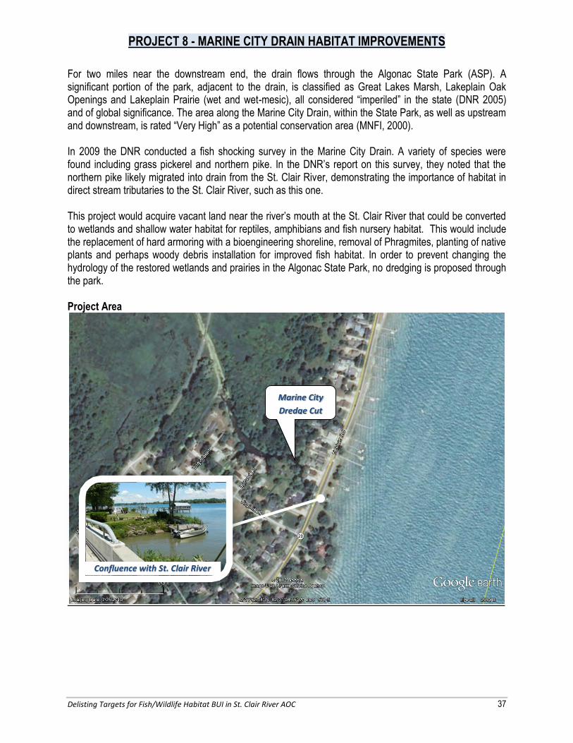
PROJECT 8 - MARINE CITY DRAIN HABITAT IMPROVEMENTS
Delisting Targets for Fish/Wildlife Habitat BUI in St. Clair River AOC 37
For two miles near the downstream end, the drain flows through the Algonac State Park (ASP). A significant portion of the park, adjacent to the drain, is classified as Great Lakes Marsh, Lakeplain Oak Openings and Lakeplain Prairie (wet and wet-mesic), all considered “imperiled” in the state (DNR 2005) and of global significance. The area along the Marine City Drain, within the State Park, as well as upstream and downstream, is rated “Very High” as a potential conservation area (MNFI, 2000). In 2009 the DNR conducted a fish shocking survey in the Marine City Drain. A variety of species were found including grass pickerel and northern pike. In the DNR’s report on this survey, they noted that the northern pike likely migrated into drain from the St. Clair River, demonstrating the importance of habitat in direct stream tributaries to the St. Clair River, such as this one. This project would acquire vacant land near the river’s mouth at the St. Clair River that could be converted to wetlands and shallow water habitat for reptiles, amphibians and fish nursery habitat. This would include the replacement of hard armoring with a bioengineering shoreline, removal of Phragmites, planting of native plants and perhaps woody debris installation for improved fish habitat. In order to prevent changing the hydrology of the restored wetlands and prairies in the Algonac State Park, no dredging is proposed through the park. Project Area
Marine City
Dredge Cut
Confluence with St. Clair River

PROJECT 9: HARSENS ISLAND HABITAT RESTORATION
Delisting Targets for Fish/Wildlife Habitat BUI in St. Clair River AOC 38
Location: Harsens Island Property Owner: St. Clair County Drain Commissioner, DNR, private Purpose of the Project: Improve tributary and upland habitat Proposed Activity: Dredge internal waterways, remove invasive species and plant native vegetation. Construction Elements:
Install fill X Replace road crossing culvert X Regrade and stabilize banks X Dredge/Excavate
Place rip rap X Build in-stream habitat X Remove invasive species
Remove weir X Plant native vegetation
Impaired Habitat to be Addressed: Tributary, Upland, and Nearshore/ shallow-water habitat Timetable: 2013/2014 Funding: $500,000 Responsible Entities: Clay Township, the St. Clair County Drain Commissioner, the DNR, the Clay Township Phragmites Board Indicators & Monitoring: Pre and post-construction assessment of vegetation diversity and composition including stem density, habitat utilization, fishery, macroinvertebrates, herpatofauna and bird species Evaluation Process: Improve vegetation diversity, composition and stem density, and fish, macroinvertebrate, herpatofauna and avian diversity/population based on pre- and post-construction monitoring. Public Involvement: Opportunity for input on restoration design should be given to BPAC and the DNR. The Clay Township Phragmites Board, the St. Clair County Metropolitan Planning Commission, the St. Clair County Health Department, and the Friends of the St. Clair River Watershed are likely partners for public participation and education efforts. Background Harsens Island, part of Clay Township and in the heart of the St. Clair River delta, contains 10,300 acres of DNR wildlife habitat. The DNR relies on man-made dikes and channels to periodically flood and support this wildlife habitat. These practices in the southwest portion of the island are limited by a lack of water in the Krispin Drain (also known as the Harsens Island Drain) and in an unnamed tributary that was formerly connected to it. Currently, the drain and unnamed tributary are clogged with sediment and Phragmites.

PROJECT 9: HARSENS ISLAND HABITAT RESTORATION
Delisting Targets for Fish/Wildlife Habitat BUI in St. Clair River AOC 39
The Krispin Drain is the only waterway on Harsens Island that is under the jurisdiction of the St. Clair County Drain Commissioner. It is approximately four miles in length and traverses the middle of the island. The Drain Office holds a 200 foot easement in order to conduct maintenance on the drain. The southernmost two miles of the drain run through the DNR’s wildlife refuge. Historically this drain was connected to an unnamed tributary on the western portion of the island, and was used by local fish to access tributary and nearshore/shallow water habitat in the heart of the delta. This access is now blocked by sediment and Phragmites. Over the last five years, Phragmites control in the delta has become a monumental effort. Phragmites control practices that have been implemented include herbicide, cutting, burning, and flooding. In 2010, Clay Township established a voluntary township-wide Phragmites management program under the Clay Township Phragmites Advisory Board (PAB). In 2011, the DNR and Ducks Unlimited received a $950,000 grant for Phragmites control. Currently, their combined effort encompasses more than 1,600 acres of private and state land across the delta and Anchor Bay. In 2011, the PAB spearheaded efforts to begin removing Phragmites from the Krispin Drain by selective spraying, cutting and burning. This project seeks to reestablish flow and restore tributary and upland habitat in the Krispin Drain. This will be done by hydraulically re-connecting the drain to the unnamed tributary, and expanding Phragmites control and habitat restoration along the drain and DNR wildlife areas to the southwest. The restored hydrology and tributary habitat will benefit 1) the DNR’s management of wildlife habitat adjacent and downstream, 2) the local fisheries by allowing access to tributary and shallow water/nearshore habitats, and 3) the public by improving opportunities for kayaking and wildlife viewing. Project Area
Unnamed
Tributary
Krispin Drain

PROJECT 10: RESTORATION OF IN-RIVER HABITAT OF THE ST. CLAIR RIVER
Delisting Targets for Fish/Wildlife Habitat BUI in St. Clair River AOC 40
Location: St. Clair River, multiple locations Property Owner: State of Michigan Purpose of the Project: Improve in-stream habitat Proposed Activity: Create fish spawning habitat. Construction Elements:
Impaired Habitat to be Addressed: In-river habitat Timetable: 2013 and 2014 Funding: Estimated project costs are $2,300,000. The USGS will implement these projects through an interagency agreement with the U.S. EPA. Responsible Entities: USGS, U.S. EPA Indicators & Monitoring: Two years of pre-construction and post-construction monitoring of fish egg deposition, larval fish production and geospatial modeling of fish spawning and nursery habitat connectivity at and downstream of the selected sites. The scientific assessments will measure the increase in fish production at the sites, as a result of this fish spawning habitat construction project. Concurrently, geospatial modeling will be conducted to assess connectivity of St. Clair River fish spawning habitat site to fish nursery habitat in the two rivers, the St. Clair River delta, and Lake St. Clair. Evaluation Process: Improve fish spawning numbers based on pre- and post-construction monitoring. Public Involvement: Public input from the BPAC and Huron-Erie Corridor Initiative partners during the design phase of this project may be appropriate. Also, State and federal agencies will solicit public input during the permitting, planning, and/or implementation phases of the projects. Finally, Michigan Sea Grant plans to conduct outreach on the results of the remediation work with the Great Lakes community.
Install fill Replace road crossing culvert Regrade and stabilize banks Dredge/Excavate Place rip rap
X Build in-stream habitat Remove invasive species Remove weir Plant native vegetation
PROJECT UNDERWAY
$2.4 million: GLRI

PROJECT 10: RESTORATION OF IN-RIVER HABITAT OF THE ST. CLAIR RIVER
Delisting Targets for Fish/Wildlife Habitat BUI in St. Clair River AOC 41
Background As previously discussed in Section 4.1, the USGS has been studying the St. Clair River to identify suitable areas for restoration of spawning habitat by desirable fish, such as lake sturgeon, lake whitefish, and walleye. This research revealed 10 sites in the St. Clair River where water depth and flow may be suitable for restoration projects. Of these 10 sites, USGS, USEPA, NOAA, DNR and the Habitat Subcommittee narrowed down the key target areas where restoration projects will likely be the most successful. These target areas are as follows:
1. Downstream from City of St. Clair to the head of shipping channel at Marine City - The USGS identified this area as the largest and highest-rated area of potential fish spawning habitat remediation in the river. The deep holes in the upper third of this reach, along East China Township, offer conditions similar to those at the head of the St. Clair River; and
2. Mouth of the North Channel where the river divides into the delta. The USGS plans to conduct further analysis at each target site before restoration projects are initiated.

Delisting Targets for Fish/Wildlife Habitat BUI in St. Clair River AOC 42
7.0 REPORTING ON HABITAT RESTORATION ACTIONS TO THE MDEQ The St. Clair River BPAC will take an active role in reporting any activities related to significant fish and wildlife restoration efforts. The BPAC may request notification of any MDEQ/USACE Joint Permit Applications within the AOC as a way of tracking implementation projects. Progress on associated targets will be reported to MDEQ via the BPAC support staff or BPAC chair. Progress reports will be periodically developed in written form and will also be discussed with the St. Clair River AOC coordinator from the MDEQ.

Delisting Targets for Fish/Wildlife Habitat BUI in St. Clair River AOC 43
8.0 REFERENCES Bennion, D.H., and B.A. Manny. 2011. Physical and biological characteristics and changes in the St. Clair-
Detroit River Waterway. Remediation of fish spawning habitat in the Huron-Erie Corridor: Completion Report for EPA Project Number DW-14-95773201-0. 34 pp.
Dutz, Jodi. The St. Clair River Area of Concern Bi-national Habitat Management Plan. 1998. Edsall, T. A., B. A. Manny, and C. N. Raphael. 1988. The St. Clair River and Lake St. Clair, Michigan: an
Ecological Profile. U.S. Fish Wildlife Service Biological Report 85 (7.03).
Francis, Jim. Michigan Department of Natural Resources. Personal communication via email to Kristen O’Reilly. September 4, 2012.
Fuller, Fred. “RE: St. Clair AOC Habitat BUI Delisting Target Project - Draft Documents.” E-mail to Lisa Lenfestey. March 24, 2008.
Geomatics International Inc. A Natural Heritage System for the St. Clair River Watershed. Burlington:
Ontario, 1997. Goodyear, C. D., T. A. Edsall, D. M. O. Dempsey, G. D. Moss, and P. E. Polanski. 1982. Atlas of the
Spawning and Nursery Areas of Great Lakes Fishes. Vol. VI-St. Clair River, Vol. VII-Lake St. Clair. Vol. VIII-Detroit River. U.S. Fish Wildlife Service FWS/OBS-82/52.
Great Lakes Fishery Commission. Draft Fish Community Goal and Objectives for the St. Clair System.
2003. Gregory A.D. 2011. Blue Water Report for the St. Clair River Hydrokinetic Project. Federal Energy
Regulation Commission Permit #13694. Haas, Bob. “Special Concern Birds in AOC.” Email to Kristen O’Reilly. March 25, 2012. Lapointe, N. W. R., Corkum, L. D, and Mandrak, N. E. 2010. Macrohabitat Associations of Fishes in
Shallow Waters of the Detroit River. Journal of Fish Biology 76:446–466. Accessed on 3/26/2012 at http://huron-erie.org/_files/Lapointe%20et%20al.%202010.pdf
Mayne, Greg. The St. Clair River Area of Concern Remedial Action Plan Progress Report. 1998-2003.
McGoldrick, Daryl J., et al., Characteristics of a Refuge for Native Freshwater Mussels (Bivalvia: Unionidae) in Lake St. Clair, Journal of great Lakes research 25 (2009) 137-146
Michigan Department of Environmental Quality. Guidance for Delisting Michigan’s Great Lakes Areas of Concern. Lansing, Michigan. 2006.
Michigan Department of Environmental Quality. Guidance for Delisting Michigan’s Great Lakes Areas of Concern. Report MI/DEQ/WB-06/001. 2008.
Delisting Targets for Fish/Wildlife Habitat BUI in St. Clair River AOC 44
Michigan Department of Natural Resources. General Management Plan: Algonac State Park. Lansing, MI.
May 2005. Michigan Natural Features Inventory. Accessed 1/15/08 at http://web4.msue.msu.edu/mnfi/. Michigan Natural Features Inventory. 2011. Potential Conservation Areas Assessment and Natural
Features Summary for Macomb and St. Clair Counties. Prepared for Macomb County Department of Planning and Economic Development. Report No. 2011-03.
Ontario Ministry of Environment and Energy and Michigan Department of Natural Resources. The St. Clair
River Area of Concern Environmental Conditions and Problem Definitions Stage 1. 1992. Ontario Ministry of Environment and Energy and Michigan Department of Natural Resources. Water Use
Goals Remedial Measures and Implementation Strategy. 1995.
O’Reilly, Kristen. St. Clair County Health Department. Personal communication. February, 2012.
Rathbun, Joe. Michigan Department of Environmental Quality. Personal communication. February, 2012.
Thomas, M., Wills, T. 2011. Status of Fisheries in Michigan Waters of Lake Erie and Lake St. Clair. Michigan Dept. of Natural Resources, Fisheries Division, Mt. Clemens Fisheries Research Station. Accessed 3/26/2012 at: http://www.michigan.gov/documents/dnr/LSCFRS_Status2011_Final_378942_7.pdf.
U.S. Army Corps of Engineers Detroit District. St. Clair River and Lake St. Clair Comprehensive Management Plan. 2004.
U.S. Environmental Protection Agency St. Clair River Area of Concern. Accessed 1/1/2008 at: http://www.epa.gov/glnpo/aoc/st-clair.html.
Zanatta, David, et al., Great Lakes Fish and Wildlife Restoration Act Full proposal FY 2010.