dave bolton roadmap - mde.state.md.us
TRANSCRIPT

A Roadmap for the Scientific AssessmentA Roadmap for the Scientific Assessmentof Maryland’s Coastal Plain Groundwaterof Maryland’s Coastal Plain Groundwater
ResourcesResources
David W. BoltonMaryland Geological Survey
Robert J. ShedlockU.S. Geological Survey
James M. GerhartU.S. Geological Survey
Emery T. CleavesMaryland Geological Survey
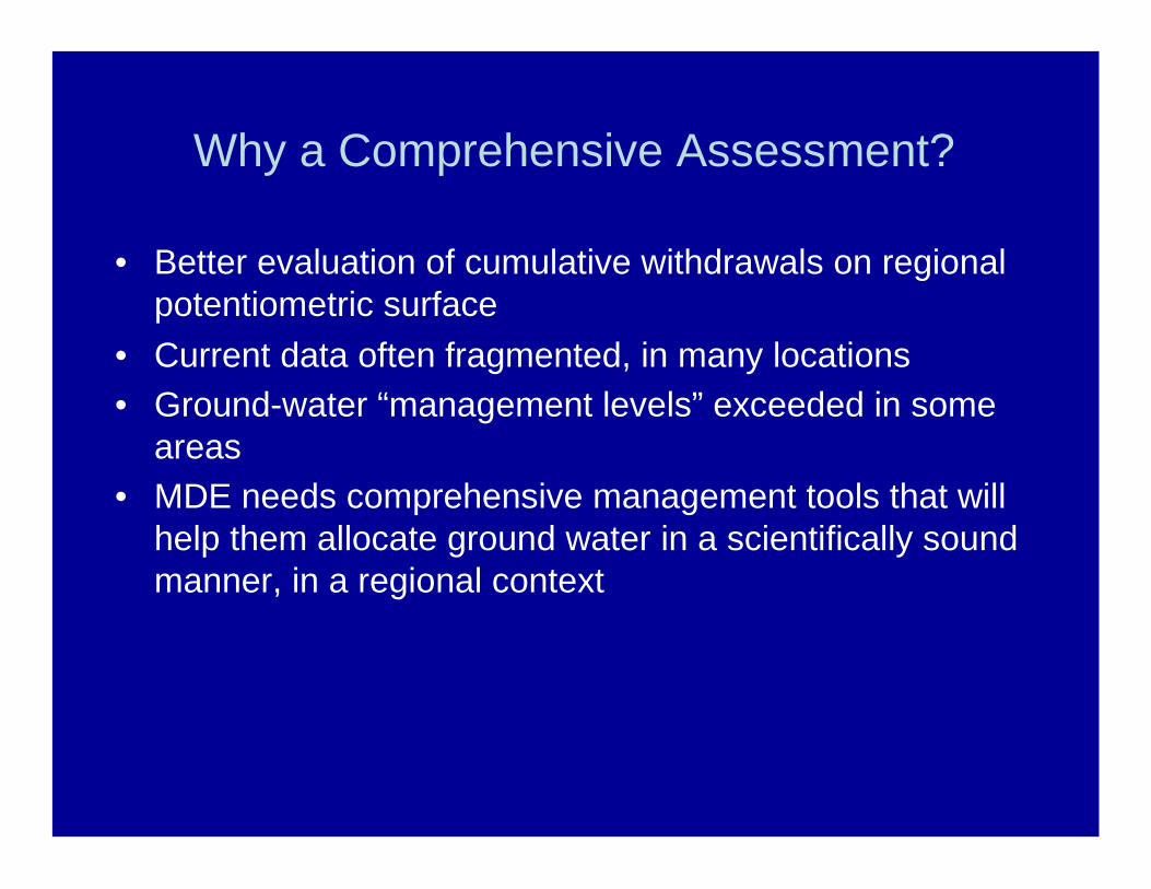
Why a Comprehensive Assessment?
• Better evaluation of cumulative withdrawals on regionalpotentiometric surface
• Current data often fragmented, in many locations• Ground-water “management levels” exceeded in some
areas• MDE needs comprehensive management tools that will
help them allocate ground water in a scientifically soundmanner, in a regional context

Declining Water Levels inSouthern Maryland
SM Df 71Aquia Formation
1975 1980 1985 1990 1995 2000 2005
WA
TE
RLE
VE
L(F
EE
TB
ELO
WL
AN
DS
UR
FA
CE
)
100
120
140
160
180
200
220
Well location
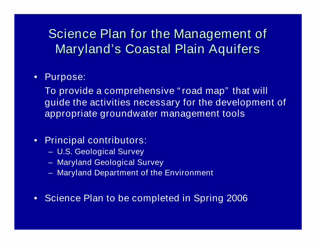
Science Plan for the Management ofScience Plan for the Management ofMaryland’s Coastal Plain AquifersMaryland’s Coastal Plain Aquifers
• Purpose:To provide a comprehensive “road map” that willguide the activities necessary for the development ofappropriate groundwater management tools
• Principal contributors:– U.S. Geological Survey– Maryland Geological Survey– Maryland Department of the Environment
• Science Plan to be completed in Spring 2006
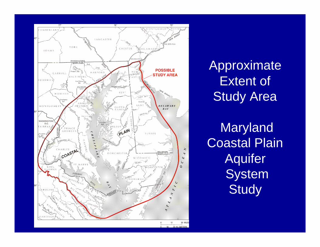
ApproximateExtent of
Study Area
MarylandCoastal Plain
AquiferSystemStudy
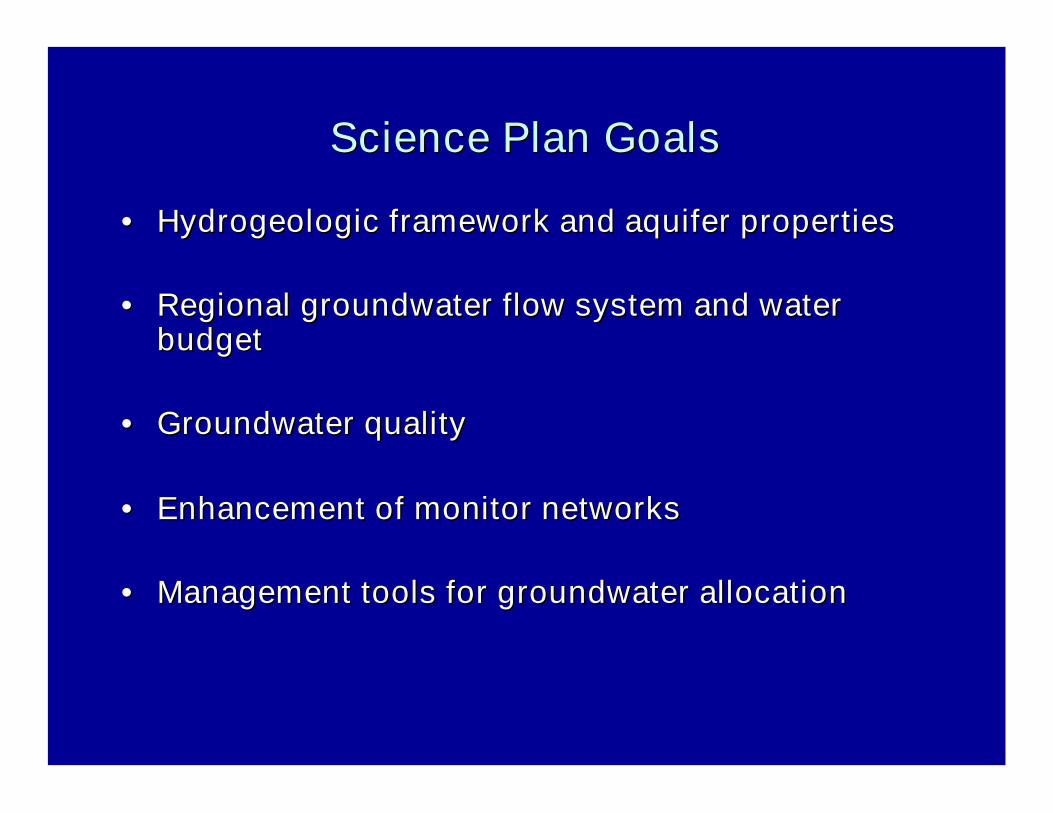
Science Plan GoalsScience Plan Goals
•• Hydrogeologic framework and aquifer propertiesHydrogeologic framework and aquifer properties
•• Regional groundwater flow system and waterRegional groundwater flow system and waterbudgetbudget
•• Groundwater qualityGroundwater quality
•• Enhancement of monitor networksEnhancement of monitor networks
•• Management tools for groundwater allocationManagement tools for groundwater allocation
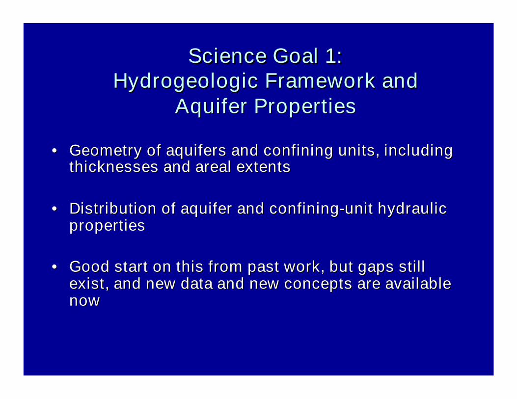
Science Goal 1:Science Goal 1:Hydrogeologic Framework andHydrogeologic Framework and
Aquifer PropertiesAquifer Properties
•• Geometry of aquifers and confining units, includingGeometry of aquifers and confining units, includingthicknesses andthicknesses and arealareal extentsextents
•• Distribution of aquifer and confiningDistribution of aquifer and confining--unit hydraulicunit hydraulicpropertiesproperties
•• Good start on this from past work, but gaps stillGood start on this from past work, but gaps stillexist, and new data and new concepts are availableexist, and new data and new concepts are availablenownow
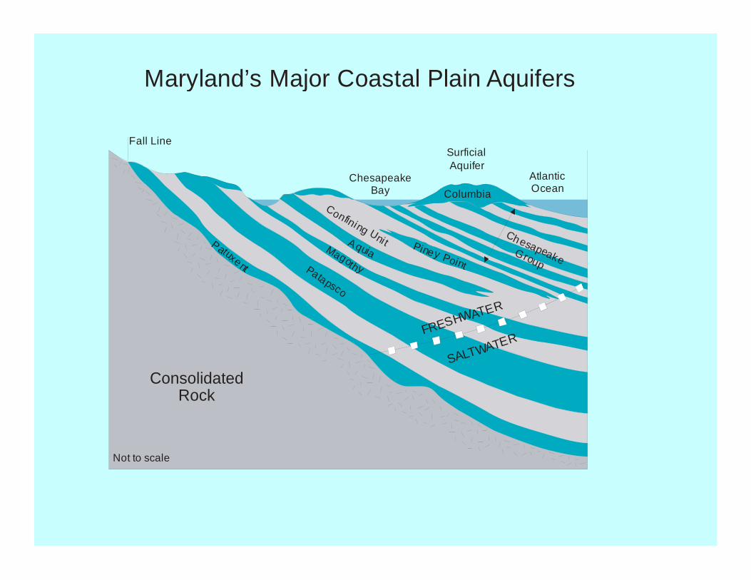
ConsolidatedRock
Fall Line
ChesapeakeBay
AtlanticOcean
Not to scale
SurficialAquifer
Columbia
ChesapeakeGroup
Piney Point
AquiaMagothyPatapsco
Patuxent
Confining Unit
FRESHWATER
SALTWATER
Maryland’s Major Coastal Plain Aquifers

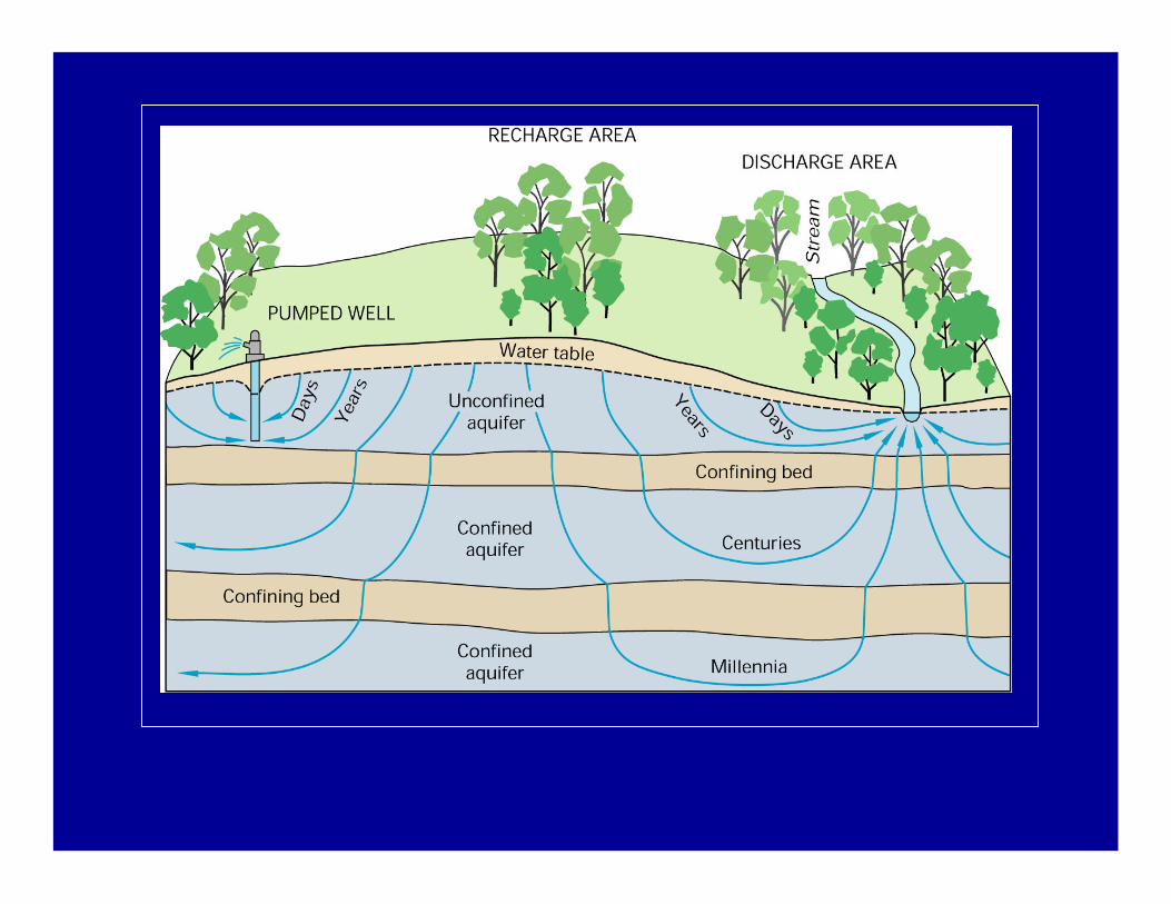
Science Goal 2: Regional GroundScience Goal 2: Regional Ground--WaterWaterFlow System and Water BudgetFlow System and Water Budget
•• GroundGround--water flow directions and velocitieswater flow directions and velocities
•• Sources and sinks of ground water for each majorSources and sinks of ground water for each majoraquifer, and how they change withaquifer, and how they change with pumpagepumpage
•• Recharge and leakage studiesRecharge and leakage studies
•• PumpagePumpage data managementdata management
•• Regional ground water flow model, with local gridRegional ground water flow model, with local gridrefinements and optimization capabilityrefinements and optimization capability

GroundGround--Water Flow SystemWater Flow System
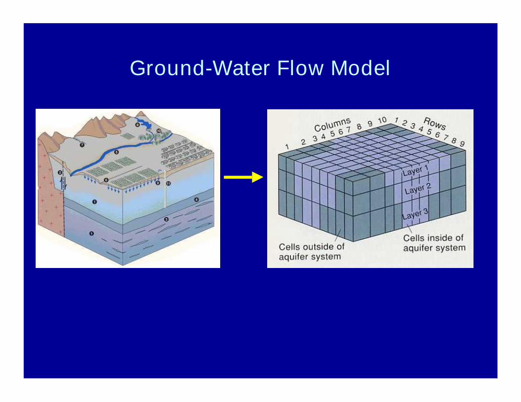
Ground-Water Flow Model
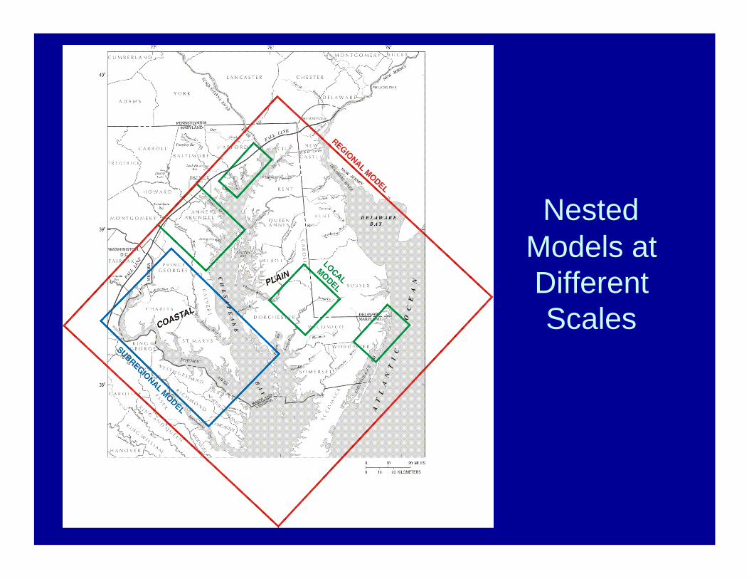
NestedModels atDifferentScales
Science Goal 3: Water Quality inScience Goal 3: Water Quality inthe Major Coastal Plain Aquifersthe Major Coastal Plain Aquifers
• Need– Suitability for water use– Delineation of contaminated areas– Data in different databases, formats
• Proposed study activities– Map distribution of regulated constituents– Assess potential for saltwater/brackish water intrusion– Develop conceptual framework for geochemical
evolution– Evaluate water-quality monitoring needs
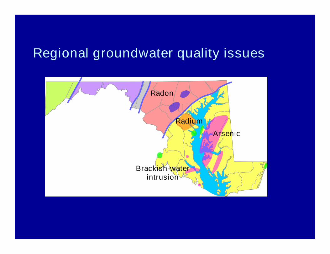
Regional groundwater quality issues
Radon
Radium
Arsenic
Brackish-waterintrusion
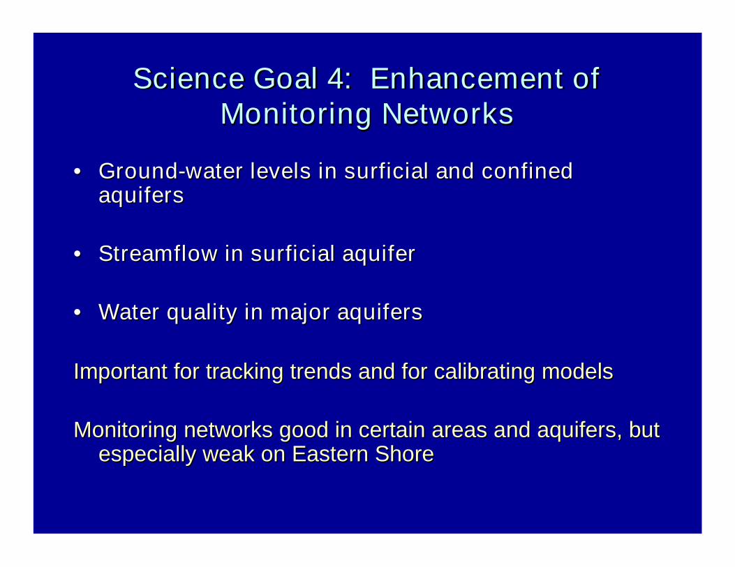
Science Goal 4: Enhancement ofScience Goal 4: Enhancement ofMonitoring NetworksMonitoring Networks
•• GroundGround--water levels in surficial and confinedwater levels in surficial and confinedaquifersaquifers
•• Streamflow in surficial aquiferStreamflow in surficial aquifer
•• Water quality in major aquifersWater quality in major aquifers
Important for tracking trends and for calibrating modelsImportant for tracking trends and for calibrating models
Monitoring networks good in certain areas and aquifers, butMonitoring networks good in certain areas and aquifers, butespecially weak on Eastern Shoreespecially weak on Eastern Shore
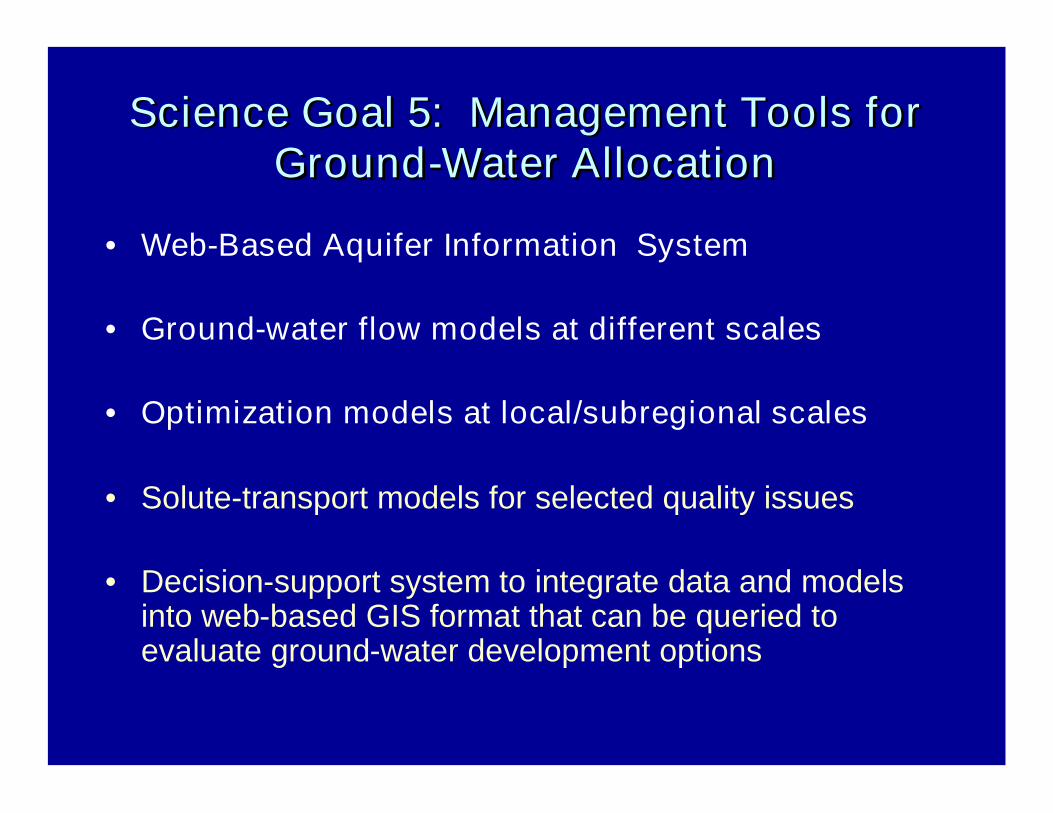
Science Goal 5: Management Tools forScience Goal 5: Management Tools forGroundGround--Water AllocationWater Allocation
• Web-Based Aquifer Information System
• Ground-water flow models at different scales
• Optimization models at local/subregional scales
• Solute-transport models for selected quality issues
• Decision-support system to integrate data and modelsinto web-based GIS format that can be queried toevaluate ground-water development options

• Relevant State policies• Ground-water permits• Allocation processes• Development plans• Appropriations
• Ground-water levels• Streamflow• Pumpage• Water quality• Geophysical logs
• Ground-water flow• Optimization• Solute transport
• Aquifer tests• Recharge estimates• Ground-water/surface-
water interactions• Water budgets
WebWeb--BasedBasedUserUser
InterfaceInterface
Information Hydrologic Data
Hydrologic Models Hydrologic Analyses
Coastal Plain Aquifer Information System


General Approach for Optimization Modeling
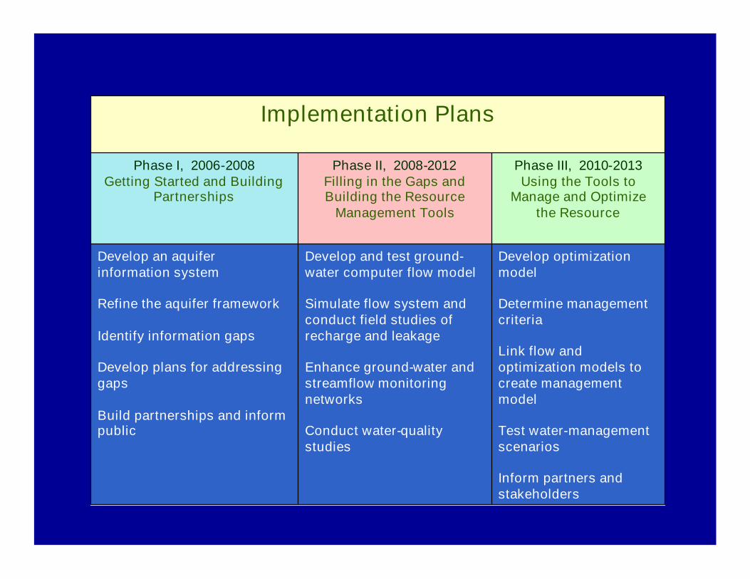
Implementation Plans
Develop optimizationmodel
Determine managementcriteria
Link flow andoptimization models tocreate managementmodel
Test water-managementscenarios
Inform partners andstakeholders
Develop and test ground-water computer flow model
Simulate flow system andconduct field studies ofrecharge and leakage
Enhance ground-water andstreamflow monitoringnetworks
Conduct water-qualitystudies
Develop an aquiferinformation system
Refine the aquifer framework
Identify information gaps
Develop plans for addressinggaps
Build partnerships and informpublic
Phase III, 2010-2013Using the Tools to
Manage and Optimizethe Resource
Phase II, 2008-2012Filling in the Gaps andBuilding the Resource
Management Tools
Phase I, 2006-2008Getting Started and Building
Partnerships