d ow n tow n vancouvervancouver.ca/files/cov/downtown-local-bus-service-review-final... · study...
TRANSCRIPT
Final Summary Report | August 2015
Downtown Vancouver Local Bus Service Review

P a g e | 2
Contents
Executive Summary ............................................................................................................3
Study Process .......................................................................................................................... 3
Network Vision ......................................................................................................................... 4
Immediate ...........................................................................................................................5
Near-term ........................................................................................................................... 6
Background and Purpose ..................................................................................................8
Study Process ..................................................................................................................... 10
Phase 1: Issues and Opportunities ....................................................................................... 10
Key Themes ...................................................................................................................... 12
Phase 2: Alternative Network Designs and Evaluation ...................................................... 13
Special Topic Workshops ................................................................................................. 13
Geographic-Based Workshops ........................................................................................ 14
Preliminary Evaluation of the Network Design Concepts ........................................... 16
Phase 2 Consultation ....................................................................................................... 17
Phase 3: Network Vision and Recommended Actions ....................................................... 21
Concept Refinement ........................................................................................................ 21
Cambie Bridge Route (17) ............................................................................................... 24
Eastern Corridor Routes (3, 4, 7, 8, 19, 200’s) .............................................................. 24
Recommended Actions ................................................................................................... 25
City of Vancouver ................................................................................................................. 25
TransLink ................................................................................................................................ 25
TransLink and the City ......................................................................................................... 26
Next Steps ........................................................................................................................... 28

P a g e | 3
Executive Summary
The purpose of the Downtown Vancouver Local Bus Service Review (DBSR) is to develop a shared, one-to-five year vision for the downtown bus network. The vision will guide decision making at TransLink and the City of Vancouver (the City) to ensure efforts are coordinated toward achieving our common goals. The DBSR incorporates the goals and policies of the City’s recently adopted Transportation 2040 Plan, and builds on TransLink’s Vancouver/UBC Area Transit Plan, focusing on downtown areas that have experienced substantial change in recent years.
Issues and opportunities
• Understand current issues and gaps in the downtown bus network.
• Identify opportunities to inform the development of alternative network designs.
Alternative networkdesigns and evaluation
• Present alternative network design concepts
of the downtown local bus network for public
discussion.
• Use feedback to evaluate alternatives.
Recommendednetwork vision
• Recommend actions to achieve this vision.
• Identify a common near-term vision for the downtown local bus network.
Phase
Summer 2013 2014 Summer 2015
1 2 3
WE ARE HERE
STUDY PROCESS The DBSR followed a three-phase study process to better understand the current and anticipated transit service issues in the downtown core to:
1. Develop alternative scenarios for changes to the downtown transit network to be implemented over the next one-to-five years;
2. Evaluate these alternatives to establish a network vision; and
3. Provide recommendations on preferred actions with respect to infrastructure investment and transit service planning.

P a g e | 4
These recommendations will help guide decision making at TransLink and the City of Vancouver through their respective planning and implementation processes.
NETWORK VISION
The downtown bus network effectively and reliably connects downtown neighbourhoods and enables convenient transit connections to the broader city and region. The downtown transit network is consistent and easy to understand, with clear communication of temporary detours associated with road closures and special events.
The following list of priorities provides a road map to achieving the network vision for the local bus network in downtown Vancouver. These priorities are financially viable options that meet the objectives of the DBSR and result in improved transit connections, better reliability, and an aligned local downtown network that works with current land use patterns.
Priorities for the next one-to-five years have been separated into two focus areas:
1) Immediate: targeted for implementation over the next one-to-two years; and
2) Near-term: for subsequent completion and in some cases require further analysis.

P a g e | 5
IMMEDIATE
Extend the 6 Davie/Downtown to connect the West End, Yaletown and Gastown.
• Extend 6 Davie/Downtown trolley service eastward along Davie Street to the Yaletown-Roundhouse Canada Line Station.
• Extend trolley service along Pacific Boulevard and Cambie Street towards Waterfront Station.
• Finalize layover or last stop accommodation plans; options include: Cambie at Pender, or adjust existing location at Davie at Denman.
Consolidate the C23 Davie/Main and C21 Yaletown/Beach services.
• Combine the C23 Davie/Main and C21 Yaletown/Beach into a new C21 service connecting English Bay to Yaletown-Roundhouse, Stadium-Chinatown and Main Street stations via Beach Avenue, Pacific and Expo Boulevards.
• Remove the layover or last stop, from Morton Avenue by implementing necessary parking, traffic engineering and bus stop changes along Bidwell Street and Station Street.
• Engage community members to ensure public support for this new routing on Bidwell Street.
Figure 1: Immediate Priority – Route 6
C O A L H A R B O U R
F A L S E C R E E K
NELSON
DAVIE
BEACH
PENDER
HOWE
BUTE
ROBSON
GEORGIAHARO
JERVIS
HOMER
COMOX
HORNBY
BURRARD
CORDOVA
BARCLAY
ALBERNI
SMITHE
NICOLA
RICHARDS
EXPO
THURLOW
PACIFIC
SEYMOUR
PENDRELL
GRANVILLE
CAMBIE
DRAKE
CARDERO
MAIN
BEATTY
BURNABY
DENMAN
BROUGHTON
HARWOOD
GILFORD
KEEFER
CHILC
O
WATER
WATERFRONT
UNION
POWELL
BIDWELL
BAYSHORE
CITADEL
LAGOON
NELSON
CAMB
IE
BRID
GE
DUNSMUIR
HASTINGS
GRANVILLE
BRIDGE
BURRARD
BRIDGE
6
extension (dotted)
Figure 2: Immediate Priority – Route C21
C O A L H A R B O U R
F A L S E C R E E K
NELSON
DAVIE
BEACH
PENDER
HOWE
BUTE
ROBSON
GEORGIAHARO
JERVIS
HOMER
COMOX
HORNBY
BURRARD
CORDOVA
BARCLAY
ALBERNI
SMITHE
NICOLA
RICHARDS
EXPO
THURLOW
PACIFIC
SEYMOUR
PENDRELL
GRANVILLE
CAMBIE
DRAKE
CARDERO
MAIN
BEATTY
BURNABY
DENMAN
BROUGHTON
HARWOOD
GILFORD
KEEFER
CHILC
O
WATER
WATERFRONT
UNION
POWELL
BIDWELLBAYSHORE
CITADEL
LAGOON
NELSON
CAMB
IE
BRID
GE
DUNSMUIR
HASTINGS
GRANVILLE
BRIDGE
BURRARD
BRIDGE C21
Explore C21 terminus changes

P a g e | 6
Determine route for the 5 Robson/Downtown to improve consistency and reliability, based on an expected City of Vancouver decision regarding frequency and duration of road closures of the 800-block of Robson Street.
• If road closures and required transit detours are frequent or prolonged, re-route 5 Robson/Downtown via Burrard Street to provide a more consistent service for customers year-round.
• If road closures and required transit detours are infrequent and not prolonged, re-route 5 Robson/Downtown via Seymour and Richards streets to provide access to high-demand destinations year-round, with occasional detours.
• In either case, the 5 Robson/Downtown and 6 Davie/Downtown routes will be coordinated so they can share layover space for vehicle downtime.
NOTE: definition of “frequency” and “duration” will be determined by TransLink with input from the City of Vancouver.
NEAR-TERM
Simplify city-wide/regional transit services (3, 4, 7, 8, 200s) on eastern corridors.
• Pursue opportunities to realign bus service in a more predictable and easy to understand way.
Review design of 17 Oak/Downtown following implementation of immediate priorities.
• Reevaluate alternative network designs for the 17 Oak/Downtown based on emerging ridership patterns following the implementation of service changes to the 5 Robson/Downtown and 6 Davie/Downtown.
Improve service reliability and customer experience.
• Increase communications between TransLink and the City so that transit customers can be better informed in advance of temporary detours to accommodate road closures.

P a g e | 7
• Explore opportunities to assess and improve travel times and reliability in areas where changes could have a significant impact. Priority corridors for this study area include:
– Burrard Street – Georgia Street – West End Corridors (Robson, Denman and Davie streets) – Granville Corridor (Seymour, Granville and Howe streets) – Eastern Corridors (Hastings and Pender streets)
• Projects may include:
– Review of stop spacing and amenities. – Implement transit priority measures.

P a g e | 8
Background and Purpose
Local bus services in Vancouver’s downtown core are some of the most productive and in-demand services in the region. However, their current design pre-dates much of the growth and investment within downtown that has occurred over the past decade. The current Vancouver/UBC Area Transit Plan (ATP) was completed in 2005. Since this time, the downtown core has experienced significant change including high growth in areas east of Granville, such as Yaletown and Downtown South, as well as the introduction of new rapid transit infrastructure (Canada Line).
While TransLink continues to update Area Transit Plans (now expanded to more comprehensive Area Transport Plans) on an ongoing basis, an update to the Vancouver/UBC ATP will not be prepared for several years. TransLink conducts local corridor/area reviews on an as-needed basis, supplemental to this planning process as part of ongoing management of the transit network. The Downtown Vancouver Local Bus Service Review (DBSR) is one such review.
The City and TransLink have identified the need for a detailed review of local bus services in the downtown core. This will help develop a unified vision for the transit network for the next one-to-five years. Recent land use and street geometry changes within the downtown (particularly east of Granville Street) have implications for the downtown transit network which need to be identified and addressed with solutions.
The most notable changes are proposed under the City’s Transportation 2040 plan, and include: (1) the potential removal of the Georgia and Dunsmuir Viaducts and replacement with a reconfigured at-grade road network; (2) consideration of a permanent pedestrian plaza on the 800-block of Robson Street; and (3)
Study Boundary Area
TO
Rogers Arena
QueenElizabethTheatre
St Paul'sHospital
Canada Place
EdgewaterCasino
BC PlaceStadium
ScienceWorld
CentralStation
SinclairCentre
Granville Island
West End
StanleyPark
CommunityCentre
Library
SFU
BCIT Woodward's
Dr SunYat-Sen
ClassicalChineseGarden
Coal HarbourCommunity Centre
Figure 3: DBSR Study Boundary Area
P a g e | 9
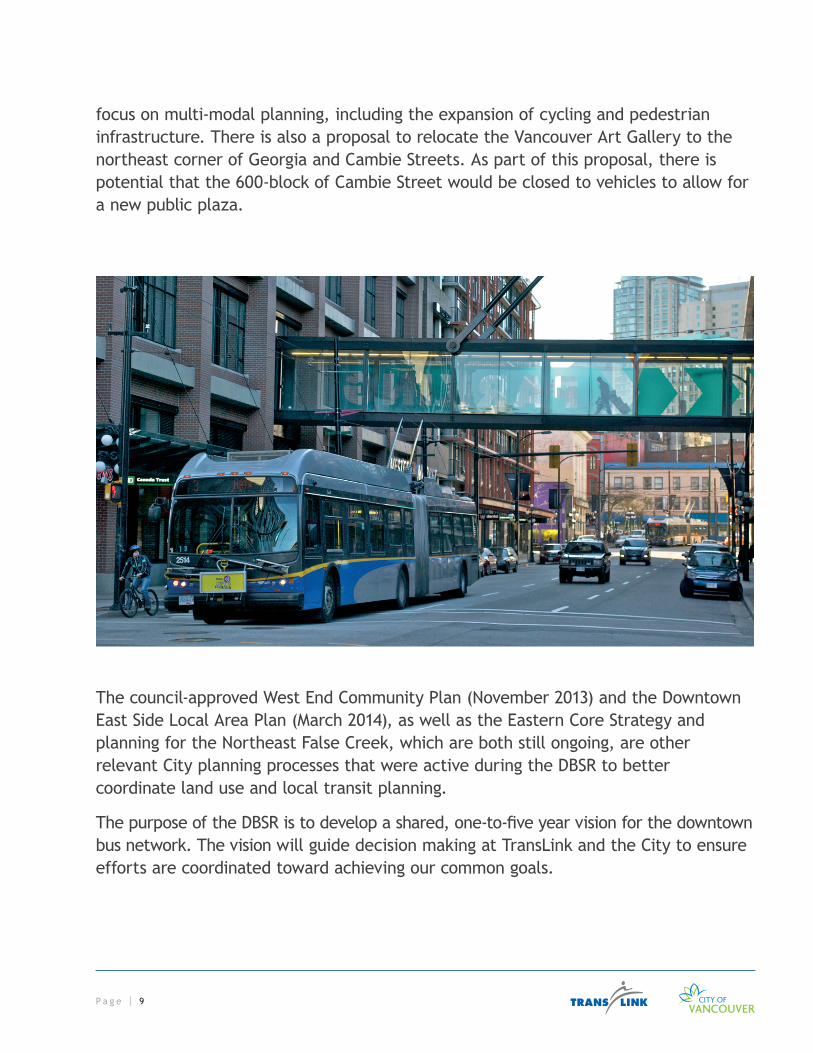
focus on multi-modal planning, including the expansion of cycling and pedestrian infrastructure. There is also a proposal to relocate the Vancouver Art Gallery to the northeast corner of Georgia and Cambie Streets. As part of this proposal, there is potential that the 600-block of Cambie Street would be closed to vehicles to allow for a new public plaza.
The council-approved West End Community Plan (November 2013) and the Downtown East Side Local Area Plan (March 2014), as well as the Eastern Core Strategy and planning for the Northeast False Creek, which are both still ongoing, are other relevant City planning processes that were active during the DBSR to better coordinate land use and local transit planning.
The purpose of the DBSR is to develop a shared, one-to-five year vision for the downtown bus network. The vision will guide decision making at TransLink and the City to ensure efforts are coordinated toward achieving our common goals.
P a g e | 1 0
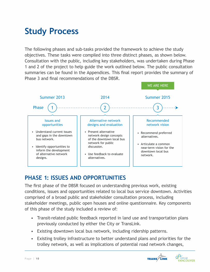
Study Process
The following phases and sub-tasks provided the framework to achieve the study objectives. These tasks were compiled into three distinct phases, as shown below. Consultation with the public, including key stakeholders, was undertaken during Phase 1 and 2 of the project to help guide the work outlined below. The public consultation summaries can be found in the Appendices. This final report provides the summary of Phase 3 and final recommendations of the DBSR.
Issues and opportunities
• Understand current issues and gaps in the downtown bus network.
• Identify opportunities to inform the development of alternative network designs.
Alternative networkdesigns and evaluation
• Present alternative network design concepts
of the downtown local bus network for public
discussion.
• Use feedback to evaluate alternatives.
Recommendednetwork vision
• Recommend preferred alternatives.
• Articulate a common near-term vision for the downtown local bus network.
Phase
Summer 2013 2014 Summer 2015
1 2 3
WE ARE HERE
PHASE 1: ISSUES AND OPPORTUNITIESThe first phase of the DBSR focused on understanding previous work, existing conditions, issues and opportunities related to local bus service downtown. Activities comprised of a broad public and stakeholder consultation process, including stakeholder meetings, public open houses and online questionnaire. Key components of this phase of the study included a review of:
• Transit-related public feedback reported in land use and transportation plans previously conducted by either the City or TransLink.
• Existing downtown local bus network, including ridership patterns.
• Existing trolley infrastructure to better understand plans and priorities for the trolley network, as well as implications of potential road network changes,

P a g e | 11
existing infrastructure investments, and considerations for expansion, such as electrical requirements like a rectifier station.
• Transit priority measures that could be implemented along main travel streets, including, but not limited to: rush-hour parking restrictions, bus only lanes, bus stop upgrades or traffic calming measures.
• Roadway and infrastructure changes under consideration by the City, including VIVA Vancouver initiated seasonal closures of Granville Street and 800-block Robson Street, viaduct changes, and potential closure of 600-block Cambie Street as part of the new Vancouver Art Gallery proposal.
Phase 1 also included a TransLink and City workshop with transit consultant Jarrett Walker to explore the issues, opportunities and considerations presented by the current downtown bus network. Items identified include, but are not limited to, the need for:
• Better bus connections between the West End, Yaletown and Gastown.
• Fewer travel patterns disruptions resulting from Granville Street closures.
• An easier to understand bus network in CBD/Gastown/Chinatown area.
• More transit service options in Coal Harbour and the south side of Stanley Park.
• Connections between regional and downtown services.
• A complete grid of bus services across the peninsula east-west and north-south.
• Simplified services running on adjacent corridors where feasible.

P a g e | 1 2
KEY THEMESKey themes raised in Phase 1 were consistent with feedback received through previous transportation and community plan processes conducted by both the City or TransLink.
Top 10 key themes from Phase 1 public consultation
• Update the downtown network to reflect changing development patterns.
• Increase service frequency, particularly during peak hours, evenings and weekends.
• Design routes to be simple, direct, and easy to understand.
• Design routes to be consistent and dependable, avoiding temporary re-routes as much as possible.
• Improve communication of closures/re-routes to customers.
• Improve reliability of services (reduce bunching).
• Improve connections between downtown neighbourhoods.
• Integrate bus services with rapid transit.
• Improve bus stop amenities and accessibility.
• Consider introducing a downtown “circulator,” potentially with free service.
Identify Issues and Opportunities
Public Input Technical Analysis
Phas
e 1
ALTERNATIVE NETWORK DESIGNS & EVALUATION
Phase 2

P a g e | 1 3
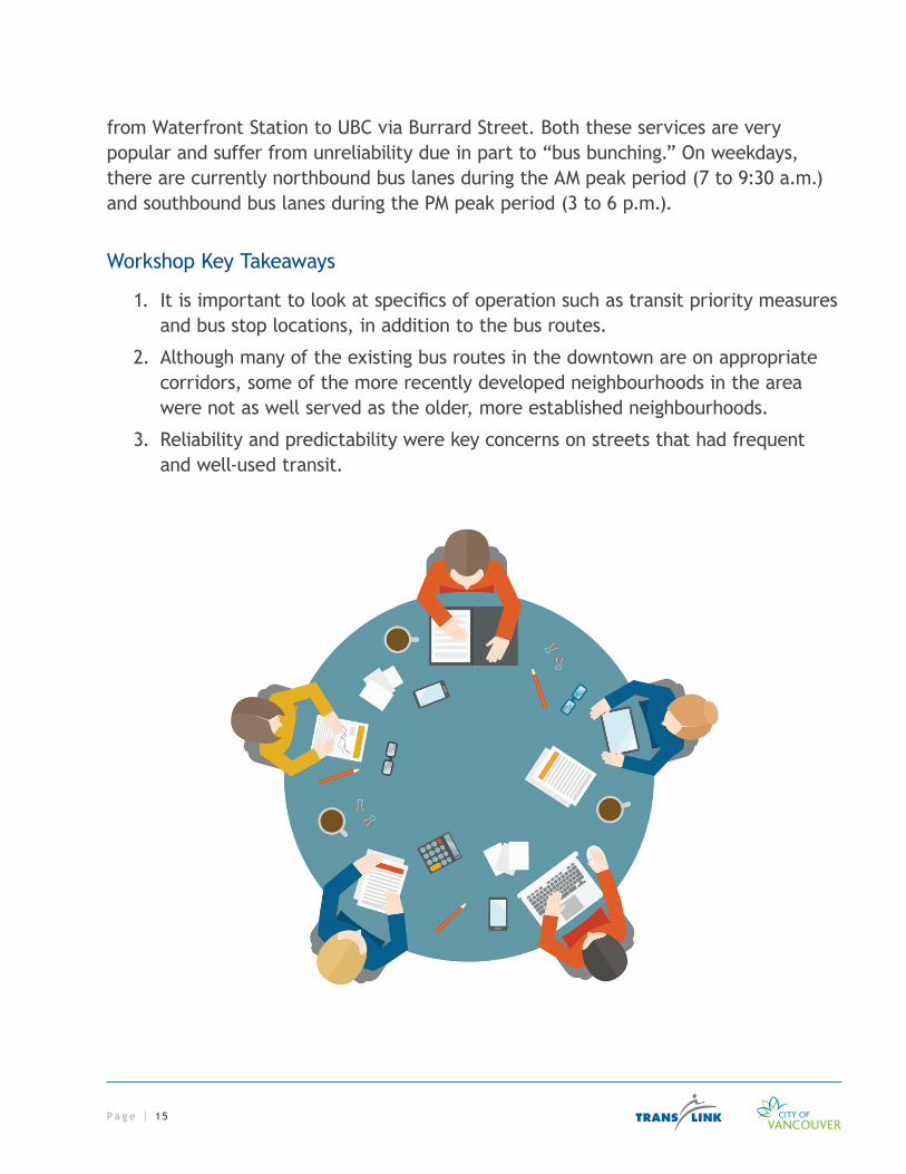
PHASE 2: ALTERNATIVE NETWORK DESIGNS AND EVALUATIONDuring Phase 2, a series of six joint internal workshops between TransLink and the City were held to address themes identified in Phase 1 and identify alternative network design concepts and improvements for the downtown bus network. Three of the workshops focused on special topics related to the downtown bus network while the other three were organized around a geographical area of downtown.
SPECIAL TOPIC WORKSHOPSThese workshops were used to:
1. Help inform the development of network design concepts; and
2. Identify improvements that will be explored and implemented through other processes. For example, station upgrade processes can help to integrate active modes of transportation into stations, communication processes can help to achieve better information sharing related to special events, and street furniture contract processes can improve bus stop amenities.
Intermodal connections: Topics discussed included a review of all current and planned station upgrades; transit station amenities (including secured bike parking); plans for future cycling infrastructure; pedestrian wayfinding; bus stops and real time information; and integration of transit with car share services.
Special events: Topics discussed included a review of special events ranging from single day events such as the Sun Run, Marathon or Car Free Day, to scheduled closures such as the Vancouver Police Department’s Granville Entertainment District weekend closures and VIVA Vancouver’s Robson Square installations, and spontaneous or unplanned events such as protests and rallies. Finally, construction related impacts were also reviewed. Traffic management plans were discussed for each special event type. Communications opportunities for special event transit disruptions were also discussed and focused on methods used to communicate internally within the City and TransLink, between agencies (City/TransLink and/or Coast Mountain Bus Company) and with the public.
Accessibility and the public realm: Discussion included a review of the accessibility of stops and transit vehicles, bus stop amenities and a review of the street furniture contract. Pedestrian and transit signage, including schedule information at bus stops were also important topics covered in the workshop.

P a g e | 1 4
GEOGRAPHIC-BASED WORKSHOPS Using geographic-based workshops the staff team was able to group all of the concepts into six focus areas, to better generate technically feasible alternatives to the existing transit network. A comprehensive list of 31 network design concepts was developed. This included variations on concepts that would be affected by the potential closures of the 800-block of Robson Street or the 600-block of Cambie Street.
Downtown-only routes: This involves the four bus routes (5, 6, C21, and C23) that provide service exclusively within the established downtown boundary.
Cambie Bridge route: A review of the 17 route, currently the only bus route that travels into and out of the downtown via the Cambie Bridge. Presently, the 17 completes a one-way loop downtown which serves primarily as a turnaround of the Oak Street bus, and is the only bus route that provides service through the south-eastern portion of downtown.
Eastern Corridor route: An exploration of the numerous bus services that enter and exit the downtown through the eastern corridor (i.e. Pender, Hastings, Cordova, and Powell Streets). This corridor includes both local and regional services from the North Shore, via Second Narrows Bridge. New routes that would use the street network resulting from the potential removal of the Georgia/Dunsmuir Viaducts were discussed in Phase 1. However, these design concepts were not carried forward as it is unlikely that the work required to remove the viaducts and build the new road network will be complete within the five year time frame of this review.
Granville Bridge routes: The Granville Corridor includes seven different services (4, 6, 7, 10, 14, 16, and 50), carrying passengers into and out of the downtown via the Granville Bridge, providing key connections to major destinations and rapid transit services. Bus services are periodically relocated to Seymour Street (northbound) and Howe Street (southbound) throughout the year to accommodate different activities that take place on Granville Street. This relocation of service can result in confusion for customers and reliability issues for bus travel time.
Lions Gate Bridge routes: Georgia Street hosts several services from the North Shore via Lions Gate Bridge. These are largely regionally focused services aimed at commuters and also provide a local service along this corridor to residents of Coal Harbour and the West End.
Burrard Corridor: The 2 and 22 bus routes provide transit service along the stretch of Burrard from Pender to Burrard Street Bridge. Also, the 44 provides an express service
P a g e | 1 5
from Waterfront Station to UBC via Burrard Street. Both these services are very popular and suffer from unreliability due in part to “bus bunching.” On weekdays, there are currently northbound bus lanes during the AM peak period (7 to 9:30 a.m.) and southbound bus lanes during the PM peak period (3 to 6 p.m.).
Workshop Key Takeaways
1. It is important to look at specifics of operation such as transit priority measures and bus stop locations, in addition to the bus routes.
2. Although many of the existing bus routes in the downtown are on appropriate corridors, some of the more recently developed neighbourhoods in the area were not as well served as the older, more established neighbourhoods.
3. Reliability and predictability were key concerns on streets that had frequent and well-used transit.

P a g e | 1 6
PRELIMINARY EVALUATION OF THE NETWORK DESIGN CONCEPTS Each of the 31 alternative design concepts was assessed using the Multiple Account Evaluation (MAE) separately by the City and TransLink staff. To assist with the assessment, TransLink worked with a consultant to develop capital and operating cost estimates for each of the concepts.
This list of alternatives was reviewed and cut to a shortlist of the most promising network design concepts to be shared for public input. After staff evaluation, three focus areas contained concepts that were not moved forward:
1. Granville Corridor – While permanently removing transit service from Granville Street was considered, the most promising concept for this corridor was to retain services along Granville Street whenever possible and reroute via Seymour and Howe as it operates today.
2. Lions Gate Services – The greatest improvements to services coming across the Lions Gate Bridge along Georgia Street were shown to be related to transit priority measures rather than new service designs.
3. Burrard Corridor – Similar to the Lions Gate Services, the Burrard Corridor improvements related to transit priority measures rather than new service designs.
Deliverability Economy Financial Environment Land Use Transportation Social & Community
Develop Alternatives
Multiple Account Evaluation
Consult on Promising Network Design Concepts
A) Downtown-only Routes B) Cambie Bridge Route C) Eastern Corridor Routes
A) Downtown-only Routes B) Cambie Bridge Route C) Eastern Corridor Routes
D) Granville Bridge Routes E) Lions Gate Bridge Routes F) Burrard Bridge Routes
Ph
ase
2
P a g e | 1 7
PHASE 2 CONSULTATIONFeedback received through Phase 2 of consultation was used to inform and evaluate the final set of alternatives. During this second phase of consultation, City and TransLink staff presented:
• An overview of the DBSR
• A summary of what we heard in Phase 1
• The approach taken to develop and evaluate revised network design concepts
• Details of promising network design concepts in three areas, including the redesign of:
– Downtown-only routes – Cambie Bridge route – Eastern Corridor routes
• Next steps
Feedback was gathered through:
• Meetings with key stakeholders
– DBSR Stakeholder Working Group and Transportation 2040 Advisory Committee, March 20, 2014
– West End Seniors Community Planning Table, March 28, 2014
• Open houses
– West End Community Centre, April 5, 2014 – Yaletown Roundhouse Community Centre, April 9, 2014 – Woodward’s Atrium, April 10, 2014 – Vancouver Public Library, April 12, 2014
• Online questionnaire (April 2 to 21, 2014)
Phase 2 Consultation Results
Outreach to downtown residents, organizations, businesses and stakeholders was achieved through several channels. Over 300 people attended the four public open houses, and approximately 990 people completed the questionnaire, either online or in writing, during the public consultation period from April 2 to 21, 2014. Input was gathered to gain a better understanding of how the network design concepts would
P a g e | 1 8
work for them as compared to the services in place today. Respondents were also asked if they agreed or disagreed that TransLink and the City had identified the main benefits and trade-offs associated with each concept, or if there were additional benefits and trade-offs they felt the DBSR should consider.
Details of the outcomes of this phase of consultation including the questionnaire can be found in the Phase 2 Consultation Summary document. The results of this consultation were used to complete the MAE for the Deliverability account.
General Themes
There was broad support for the design concepts presented during Phase 2. Members of the public were generally in agreement that TransLink and City staff had identified the main benefits and trade-offs for each concept. In addition to network changes, there was a strong desire for increased frequency and improved reliability among all transit services in the downtown area.
Although it is outside the framework of the DBSR, there was also an interest in improving transit priority measures along main travel streets including Burrard, Georgia, Granville, Hastings and Pender; bus stop upgrades; integration of services with the cycling network; and changes to bus routes in or near the downtown.
Downtown-only Routes (5, 6, C21, C23)
Key themes for the two network design alternatives presented for the downtown-only routes were:
• Support for standard-sized buses along the full length of Davie Street.
• Connecting to Yaletown Station on the Canada Line.
• Desire to maintain year-round transit service along Robson Street at least as far east as Granville Street.
In general, there was more widespread support for Concept A1 than Concept A2 (see Figure 4) due to the improved connections between the West End, Yaletown and Gastown and the connection to the SkyTrain.
P a g e | 1 9
C O A L H A R B O U R
F A L S E C R E E K
NELSON
DAVIE
BEACH
PENDER
HOWE
BUTE
ROBSON
GEORGIAHARO
JERVIS
HOMER
COMOX
HORNBY
BURRARD
CORDOVA
BARCLAY
ALBERNI
SMITHE
NICOLA
RICHARDS
EXPO
THURLOW
PACIFIC
SEYMOUR
PENDRELL
GRANVILLE
CAMBIE
DRAKE
CARDERO
MAIN
BEATTY
BURNABY
DENMAN
BROUGHTON
HARWOOD
GILFORD
KEEFER
CHILC
O
WATER
WATERFRONT
UNION
POWELL
BIDWELL
BAYSHORE
CITADEL
LAGOONNELSON
CAMB
IE
BRID
GE
DUNSMUIR
HASTINGS
GRANVILLE
BRIDGE
BURRARD
BRIDGE
6
5
C21C21
C O A L H A R B O U R
F A L S E C R E E K
NELSON
DAVIE
BEACH
PENDER
HOWE
BUTE
ROBSON
GEORGIAHARO
JERVIS
HOMERCOMOX
HORNBY
BURRARD
CORDOVA
BARCLAY
ALBERNI
SMITHE
NICOLA
RICHARDS
EXPO
THURLOW
PACIFIC
SEYMOUR
PENDRELL
GRANVILLE
CAMBIE
DRAKE
CARDERO
MAIN
BEATTY
BURNABY
DENMAN
BROUGHTON
HARWOOD
GILFORD
KEEFER
CHILC
O
WATER
WATERFRONT
UNION
POWELL
BIDWELL
BAYSHORE
CITADEL
LAGOON
NELSON
CAMB
IE
BRID
GE
DUNSMUIR
HASTINGS
GRANVILLE
BRIDGE
BURRARD
BRIDGE C23
C21
6
5C O A L
H A R B O U R
F A L S E C R E E K
NELSON
DAVIE
BEACH
PENDER
HOWE
BUTE
ROBSON
GEORGIAHARO
JERVIS
HOMER
COMOX
HORNBY
BURRARD
CORDOVA
BARCLAY
ALBERNI
SMITHE
NICOLA
RICHARDS
EXPO
THURLOW
PACIFIC
SEYMOUR
PENDRELL
GRANVILLE
CAMBIE
DRAKE
CARDERO
MAIN
BEATTY
BURNABY
DENMAN
BROUGHTON
HARWOOD
GILFORD
KEEFER
CHILC
O
WATER
WATERFRONT
UNION
POWELL
BIDWELL
BAYSHORE
CITADEL
LAGOON
NELSON
CAMB
IE
BRID
GE
DUNSMUIR
HASTINGS
GRANVILLE
BRIDGE
BURRARD
BRIDGE C21C21
6
5
Business as Usual Concept A1 Concept A2
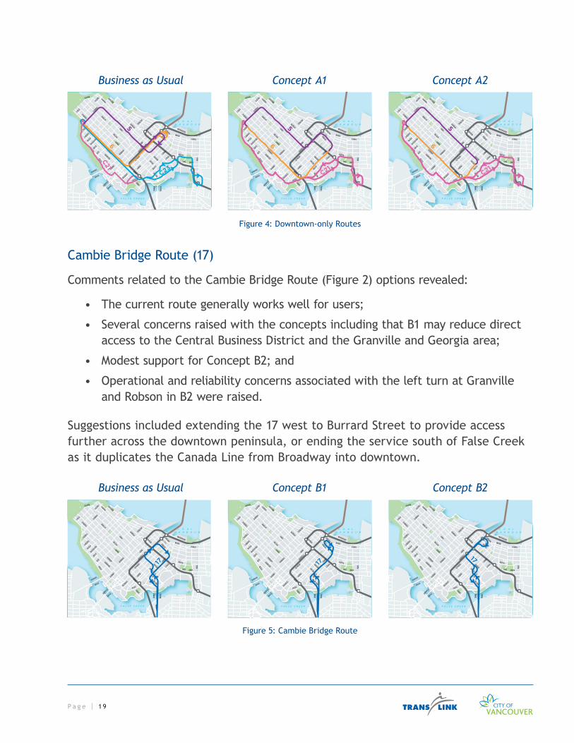
Figure 4: Downtown-only Routes
Cambie Bridge Route (17)
Comments related to the Cambie Bridge Route (Figure 2) options revealed:
• The current route generally works well for users;
• Several concerns raised with the concepts including that B1 may reduce direct access to the Central Business District and the Granville and Georgia area;
• Modest support for Concept B2; and
• Operational and reliability concerns associated with the left turn at Granville and Robson in B2 were raised.
Suggestions included extending the 17 west to Burrard Street to provide access further across the downtown peninsula, or ending the service south of False Creek as it duplicates the Canada Line from Broadway into downtown.
C O A L H A R B O U R
F A L S E C R E E K
NELSON
DAVIE
BEACH
PENDER
HOWE
BUTE
ROBSON
GEORGIAHARO
JERVIS
HOMER
COMOX
HORNBY
BURRARD
CORDOVA
BARCLAY
ALBERNI
SMITHE
NICOLA
RICHARDS
EXPO
THURLOW
PACIFIC
SEYMOUR
PENDRELL
GRANVILLE
CAMBIE
DRAKE
CARDERO
MAIN
BEATTY
BURNABY
DENMAN
BROUGHTON
HARWOOD
GILFORD
KEEFER
CHILC
O
WATER
WATERFRONT
UNION
POWELL
BIDWELL
BAYSHORE
CITADEL
LAGOON
NELSON
CAMB
IE
BRID
GE
DUNSMUIR
HASTINGS
GRANVILLE
BRIDGE
BURRARD
BRIDGE
17
Business as Usual Concept B1 Concept B2
Figure 5: Cambie Bridge Route

P a g e | 2 0
Eastern Corridor Routes (3, 4, 7, 8, 19, 200’s)
Key themes regarding Concept C1 centered on support for simplifying routes on the eastern corridors. However, some concern was heard in relation to walking distances for transfers between Main Street and eastbound services on Hastings Street, as well as perceptions of personal safety at this location.
Business as Usual Concept C1
C O A L H A R B O U R
F A L S E C R E E K
DAVIE
HOWE
ROBSON
GEORGIA
HOMER
BURRARD
SMITHE
RICHARDS
EXPO
THURLOW
PACIFIC
SEYMOUR
GRANVILLE
CAMBIE
DRAKE
MAIN
BEATTY
KEEFER
WATER
WATERFRONT
UNION
POWELL
CITADEL
NELSON
CAMB
IE
BRID
GE
DUNSMUIR
3, 8
19
19
4, 74, 7, 200sPENDER
CORDOVA
HASTINGS
C O A L H A R B O U R
F A L S E C R E E K
DAVIE
PENDER
HOWE
ROBSON
GEORGIA
HOMER
BURRARD
CORDOVA
SMITHERICH
ARDS
EXPO
THURLOW
PACIFICSEY
MOURGRANVILL
E
CAMBIE
DRAKE
MAIN
BEATTY
KEEFER
WATER
WATERFRONT
UNION
POWELL
CITADEL
NELSON
CAMB
IE
BRID
GE
DUNSMUIRHASTINGS
4, 7, 200s
3, 8
19
19
4, 7
Figure 6: Eastern Corridor Routes
Suggestions for a more comprehensive transit priority corridor on Hastings Street were also received. Given the study boundary area for this review, it was determined that this work was out of scope, and should be investigated as part of a Hastings B-Line implementation project.

P a g e | 2 1
PHASE 3: NETWORK VISION AND RECOMMENDED ACTIONS
CONCEPT REFINEMENTResults from Phase 2 public consultation, along with additional technical work, were used to refine concepts and to develop the Network Vision and associated recommended actions.
Downtown-only Routes (5, 6, C21, C23)
Following the pubic consultation, further technical analysis was conducted on the Downtown-Only Route concepts. Further refinement of the C21 Yaletown/Beach showed that removing the layover from Morton Avenue enables a new route through Bidwell Street. This reduces travel time by avoiding intersections on Morton Avenue, and provides access to the same origins and destinations, as well as better connections to the 6 Davie/Downtown service.
Further analysis of options for routes 5 Robson/Downtown and 6 Davie/Downtown determined that for Concept A1 (Figure 4), the right turn from southbound Granville Street to westbound Robson Street was not operationally feasible due to significant delays to other bus services on Granville Street. A route for the 5 Robson/Downtown using Seymour and Richards was chosen as the most promising alternative to Granville Street.
Although Concept A2 did not evaluate as well as Concept A1 during the public consultation, the team saw merit in a bus route that extended the majority of Robson Street. For this reason, an alternative concept was developed to extend service of the 5 Robson/Downtown and 6 Davie/Downtown. This alternative (Figure 7) allowed for better access to Gastown and Stadium-Chinatown Station on both routes.
C O A L H A R B O U R
F A L S E C R E E K
NELSON
DAVIE
BEACH
PENDER
HOWE
BUTE
ROBSON
GEORGIAHARO
JERVIS
HOMER
COMOX
HORNBY
BURRARD
CORDOVA
BARCLAY
ALBERNI
SMITHE
NICOLA
RICHARDS
EXPO
THURLOW
PACIFIC
SEYMOUR
PENDRELL
GRANVILLE
CAMBIE
DRAKE
CARDERO
MAIN
BEATTY
BURNABY
DENMAN
BROUGHTON
HARWOOD
GILFORD
KEEFER
CHILC
O
WATER
WATERFRONT
UNION
POWELL
BIDWELL
BAYSHORE
CITADEL
LAGOON
NELSON
CAMB
IE
BRID
GE
DUNSMUIR
HASTINGS
GRANVILLE
BRIDGE
BURRARD
BRIDGE
6
5
C21
Figure 7: Concept A2(b)
P a g e | 2 2
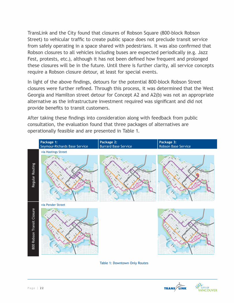
TransLink and the City found that closures of Robson Square (800-block Robson Street) to vehicular traffic to create public space does not preclude transit service from safely operating in a space shared with pedestrians. It was also confirmed that Robson closures to all vehicles including buses are expected periodically (e.g. Jazz Fest, protests, etc.), although it has not been defined how frequent and prolonged these closures will be in the future. Until there is further clarity, all service concepts require a Robson closure detour, at least for special events.
In light of the above findings, detours for the potential 800-block Robson Street closures were further refined. Through this process, it was determined that the West Georgia and Hamilton street detour for Concept A2 and A2(b) was not an appropriate alternative as the infrastructure investment required was significant and did not provide benefits to transit customers.
After taking these findings into consideration along with feedback from public consultation, the evaluation found that three packages of alternatives are operationally feasible and are presented in Table 1.
Package 1:Seymour-Richards Base Service
Package 2:Burrard Base Service
Package 3:Robson Base Service
Regu
lar
Rout
ing
C O A L H A R B O U R
F A L S E C R E E K
NELSON
DAVIE
BEACH
PENDER
HOWE
BUTE
ROBSON
GEORGIAHARO
JERVIS
HOMER
COMOX
HORNBY
BURRARD
CORDOVA
BARCLAY
ALBERNI
SMITHE
NICOLA
RICHARDS
EXPO
THURLOW
PACIFIC
SEYMOUR
PENDRELL
GRANVILLE
CAMBIE
DRAKE
CARDERO
MAIN
BEATTY
BURNABY
DENMAN
BROUGHTON
HARWOOD
GILFORD
KEEFER
CHILC
O
WATER
WATERFRONT
UNION
POWELL
BIDWELL
BAYSHORE
CITADEL
LAGOON
NELSON
CAMB
IE
BRID
GE
DUNSMUIR
HASTINGS
GRANVILLE
BRIDGE
BURRARD
BRIDGE
6
5
C21
C O A L H A R B O U R
F A L S E C R E E K
NELSON
DAVIE
BEACH
PENDER
HOWE
BUTE
ROBSON
GEORGIAHARO
JERVIS
HOMER
COMOXHORNBY
BURRARD
CORDOVA
BARCLAY
ALBERNI
SMITHE
NICOLA
RICHARDS
EXPO
THURLOW
PACIFIC
SEYMOUR
PENDRELL
GRANVILLE
CAMBIE
DRAKE
CARDERO
MAIN
BEATTY
BURNABY
DENMAN
BROUGHTON
HARWOOD
GILFORD
KEEFER
CHILC
O
WATER
WATERFRONT
UNION
POWELL
BIDWELL
BAYSHORE
CITADEL
LAGOON
NELSON
CAMB
IE
BRID
GE
DUNSMUIR
HASTINGS
GRANVILLE
BRIDGE
BURRARD
BRIDGE
6
5
C21
C O A L H A R B O U R
F A L S E C R E E K
NELSON
DAVIE
BEACH
PENDER
HOWE
BUTE
ROBSON
GEORGIAHARO
JERVIS
HOMER
COMOX
HORNBY
BURRARD
CORDOVA
BARCLAY
ALBERNI
SMITHE
NICOLA
RICHARDS
EXPO
THURLOW
PACIFIC
SEYMOUR
PENDRELL
GRANVILLE
CAMBIE
DRAKE
CARDERO
MAIN
BEATTY
BURNABY
DENMAN
BROUGHTON
HARWOOD
GILFORD
KEEFER
CHILC
O
WATER
WATERFRONT
UNION
POWELL
BIDWELL
BAYSHORE
CITADEL
LAGOON
NELSON
CAMB
IE
BRID
GE
DUNSMUIR
HASTINGS
GRANVILLE
BRIDGE
BURRARD
BRIDGE
6
5
C21
C O A L H A R B O U R
F A L S E C R E E K
NELSON
DAVIE
BEACH
PENDER
HOWE
BUTE
ROBSON
GEORGIAHARO
JERVIS
HOMER
COMOX
HORNBY
BURRARD
CORDOVA
BARCLAY
ALBERNI
SMITHE
NICOLA
RICHARDS
EXPO
THURLOW
PACIFIC
SEYMOUR
PENDRELL
GRANVILLE
CAMBIE
DRAKE
CARDERO
MAIN
BEATTY
BURNABY
DENMAN
BROUGHTON
HARWOOD
GILFORD
KEEFER
CHILC
O
WATER
WATERFRONT
UNION
POWELL
BIDWELL
BAYSHORE
CITADEL
LAGOON
NELSON
CAMB
IE
BRID
GE
DUNSMUIR
HASTINGS
GRANVILLE
BRIDGE
BURRARD
BRIDGE
6
5
C21
via Pender Street
via Hastings Street
800
Robs
on T
rans
it C
losu
re
Table 1: Downtown Only Routes

P a g e | 2 3
The technical analysis found that their associated infrastructure and service costs are very similar. However, these service concepts provide different benefits.
Package 1: The Seymour-Richards streets base service reaches important destinations, but is more difficult to understand during Robson closures.
Package 2: The Burrard Street base service is easy to understand at all times, but is further from some important destinations.
Package 3: The Robson Street base service reaches important destinations, but the route is not easy to understand during Robson closures.
The selection of a final alternative shall be based on evaluating access to important origins and destinations and assessing how understandable the service design is for customers. The technical recommendation also depends on the likely frequency of Robson Square closures:
• Package 2, if road closures and required transit detours are frequent or prolonged, then re-route 5 Robson/Downtown via Burrard Street to provide a more consistent service for customers year-round;
• Package 1, if road closures and required transit detours are infrequent and not prolonged, then re-route 5 Robson/Downtown via Seymour and Richards streets to provide access to high-demand bus stops year-round, with occasional detours.
• In either case, the 5 Robson/Downtown and 6 Davie/Downtown routes will be coordinated so they can share layover space for vehicle downtime.
NOTE: definition of “frequency” and “duration” will be determined by TransLink with input from the City of Vancouver.
Once the City of Vancouver confirms the expected future programming of Robson Square closures for the next five years as well as longer term, a final alignment will be confirmed for the 5 Robson/Downtown, and the process for funding acquisition and service change delivery can continue. As the decision for final alignment for the 6 Davie/Downtown has been confirmed, the process for trolley infrastructure changes can proceed as an immediate network priority.

P a g e | 2 4
CAMBIE BRIDGE ROUTE (17)Draft concepts of the Cambie Bridge service were not further refined. Feedback from the public received through Phase 2 consultation revealed that the current route generally works well for users. Technical analysis also revealed operational concerns regarding reliability of particular turning movements in draft concepts, and it is expected that ridership patterns would change after implementation of the above mentioned changes to the 5 Robson/Downtown and 6 Davie/Downtown.
In light of the above findings, reassessment of draft concepts for the 17 Oak/Downtown is recommended after the implementation of changes to the 6 Davie/Downtown and 5 Robson/Downtown.
EASTERN CORRIDOR ROUTES (3, 4, 7, 8, 19, 200’s)Previous tasks identified opportunities to realign bus services in the eastern corridor. The Downtown Eastside Local Area Plan has identified Gastown and Water Street as areas where relevant improvements to the pedestrian realm and road network will occur, and could impact transit operations. These changes could impact bus services not included in the existing corridor concept (Figure 6), such as the 50 Waterfront Station/False Creek South. Further assessment of eastern core network changes and consultation are recommended upon the confirmation of road network changes.

P a g e | 2 5
Recommended Actions
CITY OF VANCOUVER 1. Confirmation of expected programming of Robson Square closures for the near
and long-term, to determine year-round route of the 5 Robson/Downtown.
2. Ensure technical design work completed by TransLink and the City in support of maintaining transit service is taken into consideration as part of public space design and decision-making, including:
• 800-block of Robson Street for Robson Square
• 600-block of Cambie Street for Vancouver Art Gallery and associated public space
TRANSLINK1. Based on City of Vancouver expected programming of Robson Square closures
for the near and long-term:
– If road closures and required transit detours are infrequent and not prolonged, re-route 5 Robson/Downtown via Seymour and Richards streets to provide access to high-demand bus stops year-round, with occasional detours.
– If road closures and required transit detours are frequent or prolonged, re-route 5 Robson/Downtown via Burrard Street to provide a more consistent service for customers year-round.
2. Implement identified routing changes through TransLink’s established planning and implementation processes:
• Extend 6 Davie/Downtown service east via Davie, Pacific, Cambie and Hastings streets.
• Implement 5 Robson/Downtown to coordinate operations with the new 6 Davie/Downtown and provide through-service from Robson/Denman streets to Davie/Yaletown.
• Merge the C23 Yaletown/Davie/Main St Station and C21 Yaletown/Beach by removing the Davie Street segment, which becomes redundant with the extension of the 6 Davie/Downtown.

P a g e | 2 6
3. Invest in trolley overhead improvements to enable service changes above, including:
• Davie Street east of Richards Street;
• Pacific Boulevard between Davie and Cambie streets;
• Cambie Street between Pacific Boulevard and Hastings Street; and
• Turning and passing wires/switches at or near several intersections.
TRANSLINK AND THE CITY 1. Pursue reviews of travel times and reliability, with consideration of stop
spacing, transit priority, and amenities, including:
• West End Corridors (Robson, Denman and Davie Streets)
• Burrard Street
• Georgia Street
• Granville Corridor (Seymour, Granville and Howe Streets)
• Eastern Corridors (Hastings and Pender Streets)
2. Implement parking, road and intersection improvements, traffic engineering and bus stop changes to accommodate associated service changes, including:
• Extend the 6 Davie/Downtown east of Granville, and along Pacific and Cambie.
• Remove the C21 Yaletown/Beach layover from Morton Avenue.
• Finalize proposal for layover accommodation for the 5 Robson/Downtown and 6 Davie/Downtown at Cambie at Pender (preferred location), or adjust existing layover location at Davie Street at Denman Street if preferred option is not feasible. Implement parking, road geometry and bus stop changes accordingly.
• Investigate additional bus layover facilities as part of the City’s Central Waterfront Hub redevelopment to strengthen this multi-modal hub.
• Investigate additional bus layover facilities at Station Street as preferred layover location for the C21 Yaletown/Beach route.
3. Consider further routing proposals consistent with the vision through TransLink’s ongoing management of the transit network, including:
• Eastern corridor proposals to lines 3, 4, 7, 8, 19 and 200’s, as included in ‘Concept 1’ presented in Figure 6.

P a g e | 2 7
• Change services that provide basic coverage in the Gastown area (e.g. 50 Waterfront Station/False Creek South).
• Engage additional stakeholder and public consultation as appropriate, once the road network in the area has been defined.
4. Improve communication of road closures and associated transit detours in partnership with City of Vancouver Special Events, Vancouver Police Department and Coast Mountain Bus Company.

P a g e | 2 8
Next StepsThe DBSR developed a shared, one-to-five year vision for the downtown bus network and identified and evaluated immediate and near-term priorities. The resulting vision will guide decision making at TransLink and the City to ensure efforts are coordinated toward achieving our common goals.
TransLink will undertake detailed planning and design work for the identified routing changes. Through its established planning, consultation and implementation processes, the immediate and near-term priorities will be considered for implementation based on regional priorities.
The City of Vancouver will confirm expected programming of Robson Square closures for the near and long-term, and ensure technical design work completed by TransLink and the City is taken into consideration as part of its decision-making.