d ave w ilkinson, p resenter title: “i know where i am and how i got here” 1
TRANSCRIPT
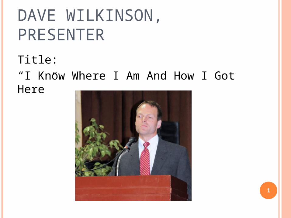
DAVE WILKINSON, PRESENTERTitle:“I Know Where I Am And How I Got Here”
1
BERTHOLD LOWENFELDBERTHOLD LOWENFELD
Blindness imposes the following limitations:
In the range and variety of experiences
In the ability to get about
In the control of the environment and the self in relation to it. (1948)
2
Cra
ig L. P
hillip
s, MS E
d. C
OM
S
GGLOBAL LOBAL PPOSITIONING OSITIONING SSYSTEM 101YSTEM 101
First GPS satellite was launched in 1978
Built to last about 10 years
Weighs approximately 2,000 pounds
17 feet across with solar panels
3
Cra
ig L. P
hillip
s, MS E
d. C
OM
S
GGLOBAL LOBAL PPOSITIONING OSITIONING SSYSTEM 101YSTEM 101
Satellites orbit 12,000 miles above Earth
24 satellites constantly moving
Two complete orbits in less than 24 hours
Travelling at speeds of roughly 7,000 miles an hour
4
Cra
ig L. P
hillip
s, MS E
d. C
OM
S
GGLOBAL LOBAL PPOSITIONING OSITIONING SSYSTEM 101YSTEM 101
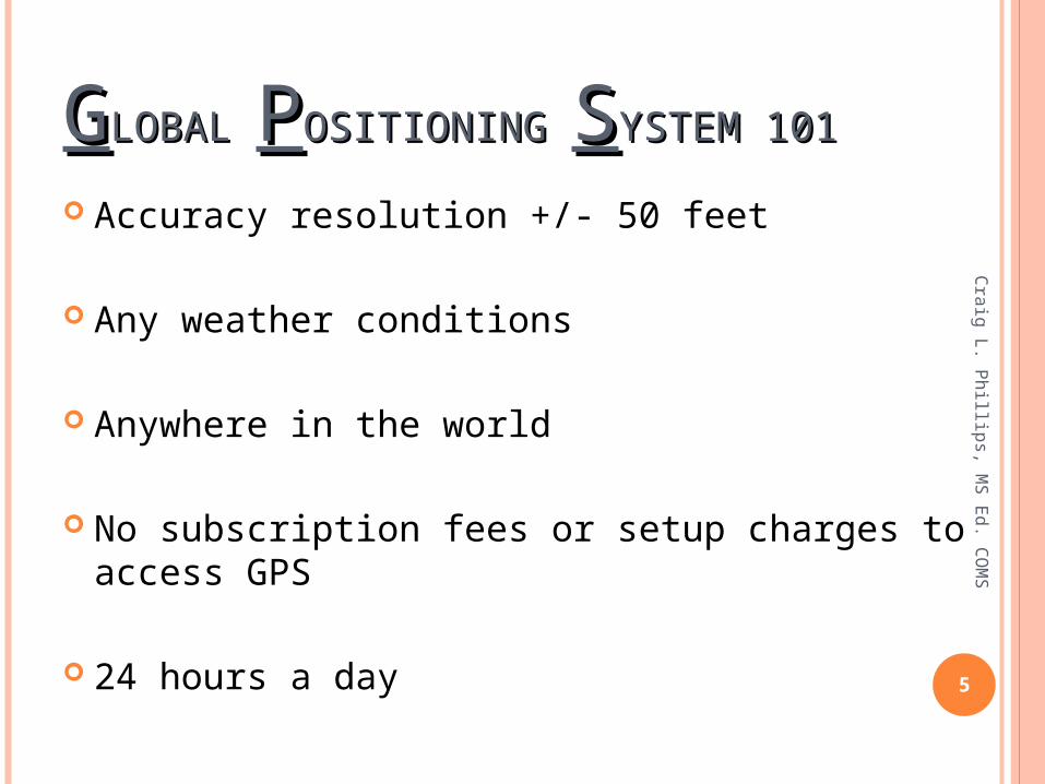
Accuracy resolution +/- 50 feet
Any weather conditions
Anywhere in the world
No subscription fees or setup charges to access GPS
24 hours a day 5
Cra
ig L. P
hillip
s, MS E
d. C
OM
S
GGLOBAL LOBAL PPOSITIONING OSITIONING SSYSTEM 101YSTEM 101
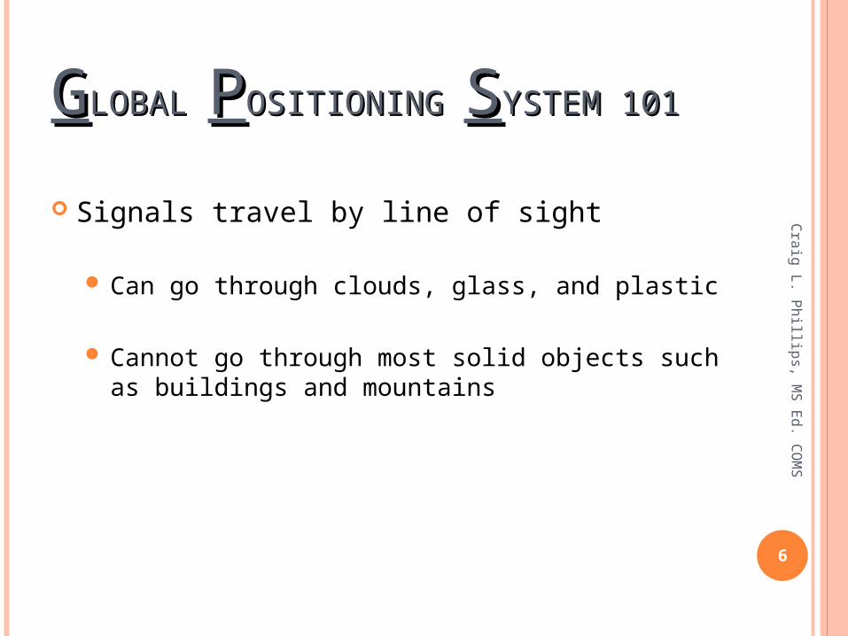
Signals travel by line of sight
Can go through clouds, glass, and plastic
Cannot go through most solid objects such as buildings and mountains
6
Cra
ig L. P
hillip
s, MS E
d. C
OM
S
GGLOBAL LOBAL PPOSITIONING OSITIONING SSYSTEM 101YSTEM 101
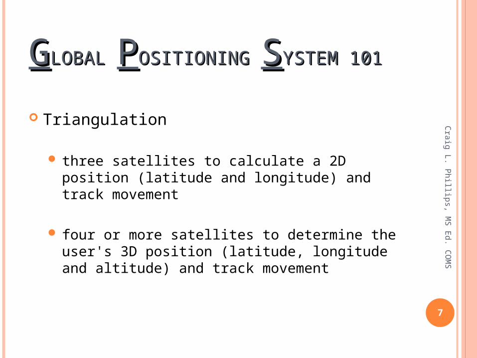
Triangulation
three satellites to calculate a 2D position (latitude and longitude) and track movement
four or more satellites to determine the user's 3D position (latitude, longitude and altitude) and track movement
7
Cra
ig L. P
hillip
s, MS E
d. C
OM
S
PPOINT OINT OOF F IINTEREST = POINTEREST = POI
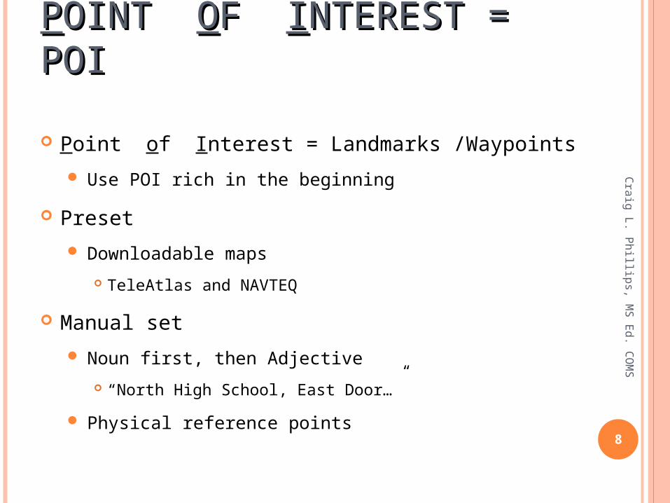
Point of Interest = Landmarks /Waypoints
Use POI rich in the beginning
Preset
Downloadable maps
TeleAtlas and NAVTEQ
Manual set
Noun first, then Adjective
“North High School, East Door…”
Physical reference points8
Cra
ig L. P
hillip
s, MS E
d. C
OM
S
SOURCES OF GPS ERRORSOURCES OF GPS ERRORC
raig
L. Phillip
s, MS E
d. C
OM
S
9
Signal slows as it passes through the atmosphere
Signal multipath occurs when the GPS signal is reflected off objects such as tall buildings or large rock surfaces before it reaches the receiver.
Number of satellites visible-buildings, terrain, electronic interference, or sometimes even dense foliage can block signal reception
Receiver clock errors- receiver's built-in clock is not as accurate as the atomic clocks onboard the GPS satellites.
CONSIDERATIONSCONSIDERATIONS
Craig L. Phillips, MS Ed. COMS
10
Everything is relative.
Take a cheat sheet on lessons…use it.
The device is a where and when tool.
GPS does not supplant O & M skills.
It’s about what works for the student not you.
FOUR STAGES OF FOUR STAGES OF LEARNINGLEARNING
Unconsciously Incompetent
Consciously Incompetent
Consciously Competent
Unconsciously Competent11
Cra
ig L. P
hillip
s, MS E
d. C
OM
S
Cra
ig L. P
hillip
s, MS E
d. C
OM
S
12
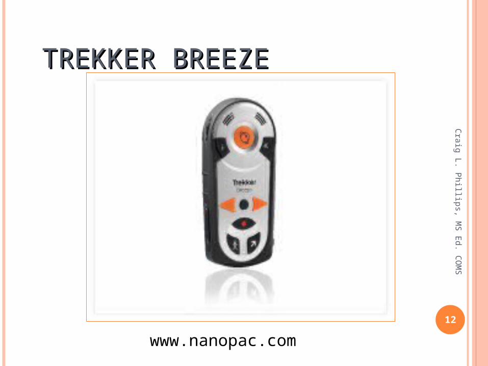
TREKKER BREEZETREKKER BREEZE
www.nanopac.com
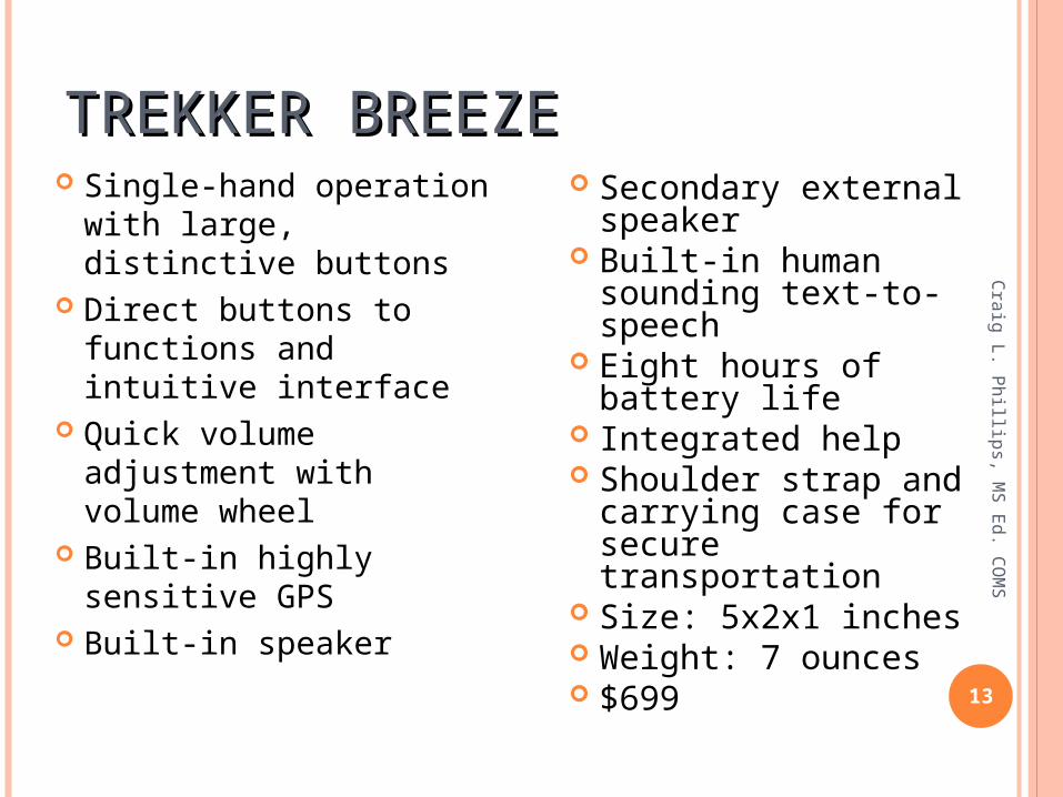
TREKKER BREEZETREKKER BREEZEC
raig
L. Phillip
s, MS E
d. C
OM
S
13
Single-hand operation with large, distinctive buttons
Direct buttons to functions and intuitive interface
Quick volume adjustment with volume wheel
Built-in highly sensitive GPS
Built-in speaker
Secondary external speaker
Built-in human sounding text-to-speech
Eight hours of battery life
Integrated help Shoulder strap and
carrying case for secure transportation
Size: 5x2x1 inches Weight: 7 ounces $699

KAPTEN MOBILITY
14
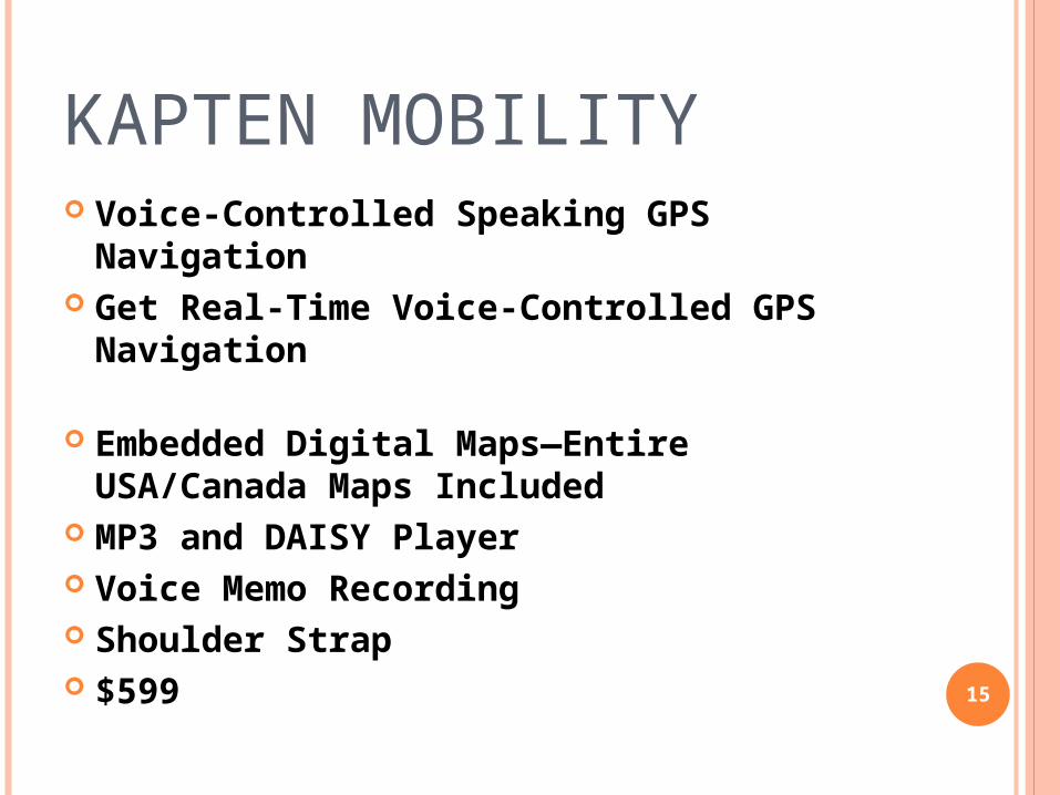
KAPTEN MOBILITY Voice-Controlled Speaking GPS
Navigation Get Real-Time Voice-Controlled GPS
Navigation
Embedded Digital Maps—Entire USA/Canada Maps Included
MP3 and DAISY Player Voice Memo Recording Shoulder Strap $599 15

SENDERO GPS
16
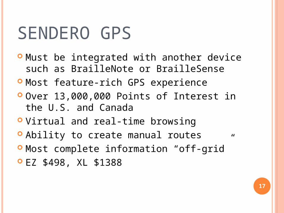
SENDERO GPS Must be integrated with another device such
as BrailleNote or BrailleSense Most feature-rich GPS experience Over 13,000,000 Points of Interest in the U.S.
and Canada Virtual and real-time browsing Ability to create manual routes Most complete information “off-grid” EZ $498, XL $1388
17
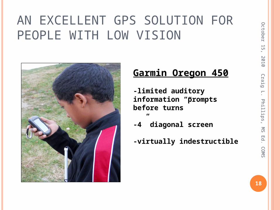
AN EXCELLENT GPS SOLUTION FOR PEOPLE WITH LOW VISION
Octo
ber 1
5, 2
01
0
18
Cra
ig L. P
hillip
s, MS E
d. C
OM
S
Garmin Oregon 450
-limited auditory information “prompts before turns”
-4” diagonal screen
-virtually indestructible
GPS FOR I-DEVICES
19
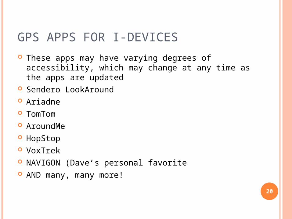
GPS APPS FOR I-DEVICES These apps may have varying degrees of accessibility,
which may change at any time as the apps are updated
Sendero LookAround Ariadne TomTom AroundMe HopStop VoxTrek NAVIGON (Dave’s personal favorite AND many, many more!
20
CURRICULAR CURRICULAR INTEGRATIONINTEGRATION
Conceptual Development
Literacy
PE
Geography
Mathematics
Social Competency
21
Cra
ig L. P
hillip
s, MS E
d. C
OM
S
FYI…
“i feel like i'm "cheating" somehow, when i don't
have to keep track of what street is what, where
it's located, what direction i'm heading, etc... it
frees my mind up to concentrate on other aspects
of orientation...and then, listening to the gps as i'm
riding in a car, realizing the breadth of this world
that is outside my car window i have heretofore
never gotten to interact with...amazing, simply
amazing...”22
Cra
ig L. P
hillip
s, MS E
d. C
OM
S

SOURCESSOURCES
www.garmin.com
www.humanware.com
www.sendero.com
www.50states.com
LeaderDogs for the Blind Trekker GPS
Training23
Cra
ig L. P
hillip
s, MS E
d. C
OM
S
DAVE WILKINSONDAVE WILKINSON
24
NanoPac, Inc.4823 S Sheridan
Rd., Suite 302O: 800-580-6086C: 918-527-0688