claytor lake project no. 739 recreation assessment & angler use survey study kickoff meeting...
TRANSCRIPT

Claytor Lake Project No. 739Recreation Assessment & Angler Use Survey Study
Kickoff Meeting
January 24, 2007
Presentation Agenda
• Experience• Objectives• Relicensing Relevance• Geographic and Temporal Scope• Methods
– Recreation Use Assessment – Angler Use Survey
• Study Schedule

Recreation and Angler Use Qualifications and Experience
• Smith Mountain Lake Project, VA, AEP• Keowee-Toxaway Project, SC, Duke Energy• Upper Chattooga River GA, SC & NC, USDA Forest Service• Catawba-Wateree Project, NC & SC, Duke Energy• Spokane River Project/Coeur d’Alene Lake, ID & WA, Avista• Lake of the Ozarks/Osage Project, MO, AmerenUE• Holyoke Project, MA, Holyoke Water Power Company• Fifteen Miles Falls Project VT & NH, TransCanada Hydro
Northeast

• Document facilities and activities
• Collect information on use, user preferences, and user perceptions
• Forecast recreational use numbers and activity trends over the term of an anticipated license
• Characterize typical boating densities on the lake
Recreation Use Study Overall Study Objectives
Recreation
• The information obtained from the study will be the basis for determining whether or not additional recreational facilities are needed, what those facilities should be, if
required, and where to best locate the facilities.
Angler Use
• Study results will be useful relative to operational and management decisions
Recreation Use StudyRelicensing Relevance

• Data collection efforts at the lake will include areas within the project boundary for the Claytor Lake Project and extend to public access areas below the dam along the New River to the U.S. Hwy. 460 Bridge near Glen Lyn, VA.
• The study will also assess and consider regional recreation resources within 60 miles of the Project.
• Field work scheduled between March 1 through November 30th, 2007
Recreation Use Study Geographic & Temporal Scope

Allisonia (VDGIF)
Lowman’s Ferry
Conrad Bros. Marine
Rock House Marine
Dublin Public Access
Claytor Lake S.P.
New River (VDGIF)
Harry DeHaven Co. Park)
Claytor Dam Picnic Area
New River Trail S.P.

Upper Zone
Middle Zone
Lower Zone
Riverview Park
Dudley’s Landing
Peppers Ferry Bridge (Rt 114)
Whitehorne (VDGIF)
McCoy
Eggleston
PembrokeBluff City
Narrows 1 (Lurich Rd)
Rich Creek (VDGIF)Glen Lyn
Ripplemead
Narrows 2 (Lurich Rd)

Recreation Assessment Study Components
• Facility Inventory
• Existing Use & Activity Estimates
• Future Use & Activity Estimates
• Boating Density

Recreation Assessment Study Facility Inventory - Methods
• Conduct site visits to each publicly accessible site at the Project to document the facilities and resources
• Identify and characterize the public facilities and amenities at each site
• GPS & Photographs
Allisonia Public Boat Ramp

• Existing Public Use - traffic counts, spot counts, and interviews.
• Shoreline Resident Use - mailed questionnaire.
• Potential Visitors - mailed questionnaire.
• Use from other shoreline operators, e.g. publicly accessible marinas, home owner association marinas, state parks, etc. - interviews and/or spot counts.
Recreation Assessment Study Use and Needs Assessment - Methods

Recreation Use StudyPublic Use Sampling Effort
• Claytor Lake Access Point Interview and Spot Counts– March 1 to November 30
– 20 days/month
– 14 weekdays, 6 weekend days
– 2 zones (#1:C.L.S.P., Dublin, Harry DeHaven, Below the Dam, Dam Picnic Area; #2: Rock House, Conrad Bros., Lowman’s Ferry, Allisonia); equal weight
– AM or PM focus – start time considers day length

Recreation Use StudyNew River Sampling Effort
• River Access Point Interviews and Spot Counts– Public Boat Launch Sites (13 Total)
– March 1 to November 30
– 9 days/month
– 3 zones
– equal weight probabilities between zones
– 6 weekend/3 weekdays
– 8 hr sampling day
– Time at each access point is sampling day length minus driving time (equal time at each site)
– Start time will focus the study on either AM or PM – equal weight

Recreation Assessment Study Future Recreational Use Assessment - Methods
• Future recreation demand will be assessed in 10-year increments out to 2050.
• Growth in recreation activities projections will be from “Outdoor Recreation in American Life: A National Assessment of Demand and Supply Trends” by Cordell et. al., 1999.
• VA population and recreation trend estimates will be evaluated within the context of Cordell’s future use predictions.

• Aerial photographs of watercraft:– Project area: 11 days between Memorial Day and
Labor Day.
– New River: 3 days; near the start of sampling in April, in mid summer, and after Labor Day.
• A stratified random sampling weekdays, weekends, and holidays.
• The boats will be digitized off of the photographs and entered into a GIS for analysis.
Recreation Assessment Study Existing Boating Density Analysis - Methods
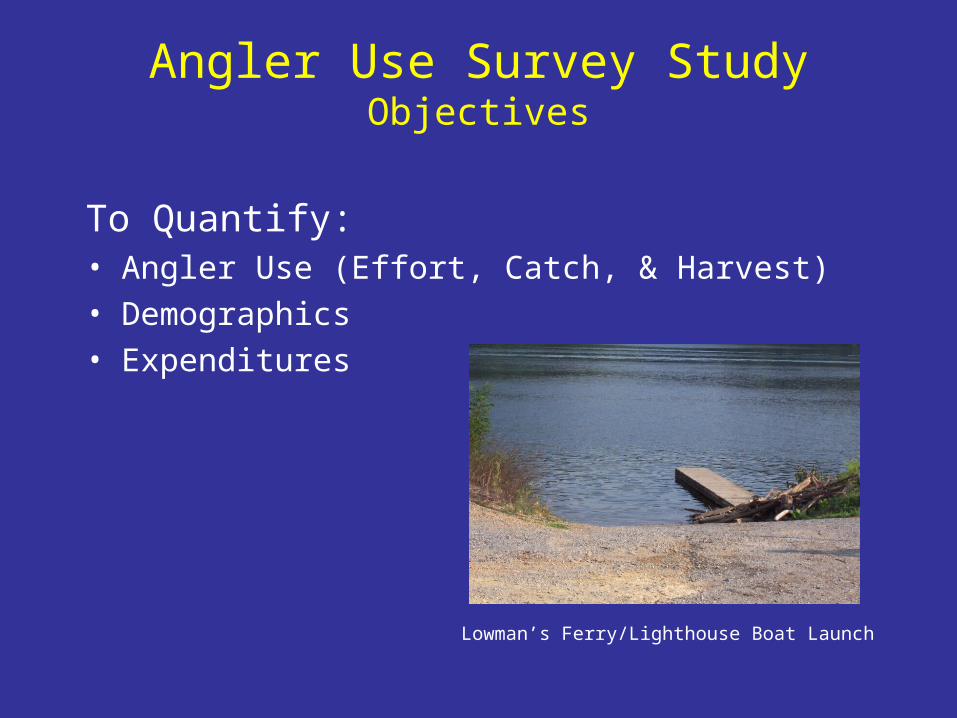
Angler Use Survey StudyObjectives
To Quantify:• Angler Use (Effort, Catch, & Harvest)
• Demographics
• Expenditures
Lowman’s Ferry/Lighthouse Boat Launch

Angler Use Survey StudyMethods
• A roving creel survey on Claytor Lake and an access point survey at the area directly below Claytor dam.
• Interviews and instantaneous count
• 2 sampling zones (all on water anglers as well as bank/pier anglers at S.P. and Harry DeHaven County Park.
• Monthly zone weights developed in consultation with VDGIF
• 5 weekdays/5 weekend days – all holidays sampled.
• AM/PM start times weighted 0.3/0.7 respectively

Angler Use Survey StudyMethods
• The interview will follow similar surveys by VDGIF and be developed in consultation with VDGIF
– Angler effort, catch, and harvest
– Species preference
– Angler demographics
– Trip expenditures and % within 20 miles
– Consumer surplus
– Awareness of VDH fish consumption advisories and resulting changes in fishing habits
– Striped bass and hybrid striped bass angler size preferences

Recreation and Angler Use StudyExpected Results
• Inventory of sites and opportunities within the Project
• Visitor profile information
• Characterization of use, activities, and preferences
• Expected changes in recreation activity at the Project for next 50 years
• Characterization of boating density
• Angler effort, catch, and harvest
• Species preferences

• Pre-study meeting – February 2007
• Begin field work – March 1, 2007
• Study Plan progress updates – May & November 2007
• Field work ends – November 30, 2007
• Draft report – January 2008
Recreation Use StudySchedule
Lowman’s Ferry Bridge, Claytor Lake

Questions?
View New River from Eggleston Bridge, looking upstream