city planning commission meeting agenda
TRANSCRIPT
1
City Planning Commission 101 First Street SE
Cedar Rapids, IA 52401 Telephone: (319) 286-5041
CITY PLANNING COMMISSION MEETING
Thursday, January 2, 2014 3:00 PM
City Hall Council Chambers 101 First Street SE, Cedar Rapids, IA 52401
AGENDA
Opening Statement Roll Call Approval of the Minutes Adoption of the Agenda
CONSENT AGENDA Note: The following items will be approved by one motion without separate discussion unless City Planning Commission requests an item be removed to be considered separately. Any interested party may also request such individual consideration for an item by indicating that request to the Commission Chair prior to the motion and vote on the Consent Agenda. 1. Case Name: The Commons on Ellis Boulevard Addition (Preliminary Plat)
Recommendation for approval of a Major Preliminary Plat, for property at 1320 Ellis Boulevard NW, 1324 Ellis Boulevard NW and 1328 Ellis Boulevard NW as requested by Compass Commercial Services (Applicant) and New Bo Development Group LLC (Titleholder). Case No: PRPT-007328-2013; Case Manager: Chris Strecker
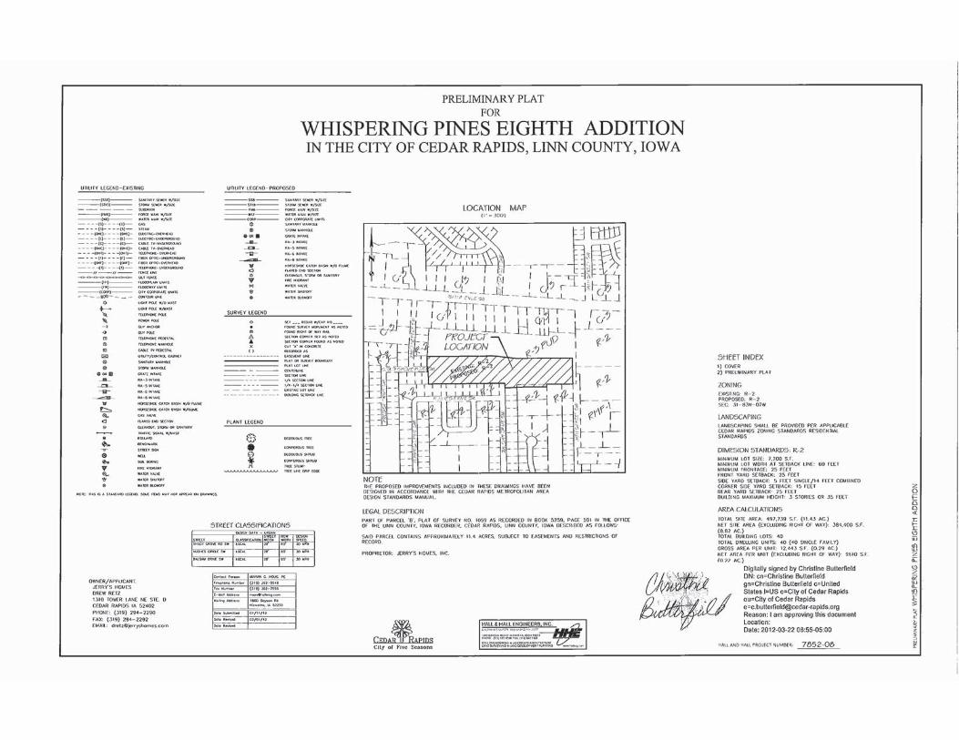
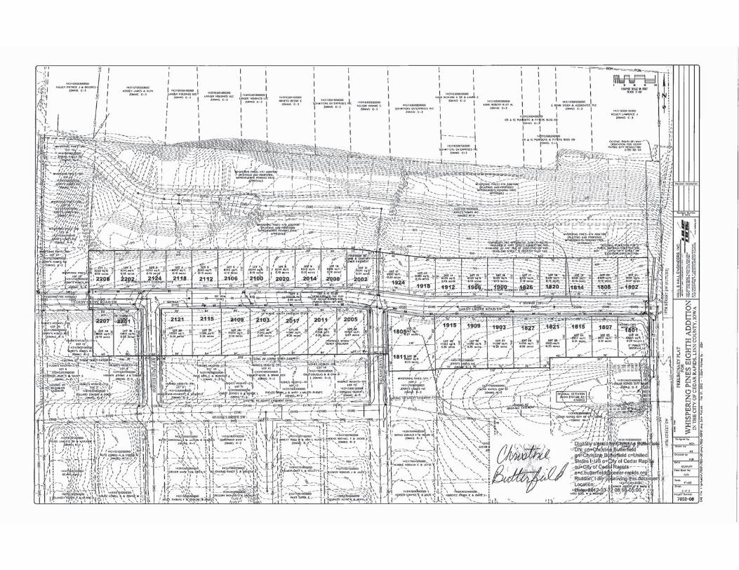
2. Case Name: Whispering Pines 8th Addition (Major Preliminary Plat)
Recommendation for approval of a time extension for an approved Major Preliminary Plat, for property south of 16th Avenue SW & east of 23rd Street SW as requested by Jerry’s Homes, Inc. (Titleholder). Case No: PRPT-007580-2013; Case Manager: Joe Mailander
REGULAR AGENDA
1. Case Name: 418, 420, 424 and 428 9th Street NW (Rezoning)
Recommendation for approval of a rezoning from RMF-1, Multiple Family Residential Zone District to PUD-2, Planned Unit Development Two Zone District as requested by Richard J. & Michelle L. Lendemann (Applicants/Titleholders) . Case No: RZNE-007160-2013; Case Manager: Vern Zakostelecky

2
2. Case Name: 3135 J Street SW (FLUMA and Rezoning) a) Recommendation for an amendment to the Future Land Use Map in the City’s Comprehensive
Plan from Office and Low Density Residential to Commercial as requested by JKLR LLC (Applicant) and James H. Hoke (Titleholder). Case No: FLUMA-007527-2013; Case Manager: Vern Zakostelecky
b) Recommendation for approval of a rezoning from R-3, Single Family Residential Zone District and O-S, Office/Service Zone District to C-3, Regional Commercial Zone District as requested by JKLR LLC (Applicant) and James H. Hoke (Titleholder). Case No: RZNE-007161-2013; Case Manager: Vern Zakostelecky
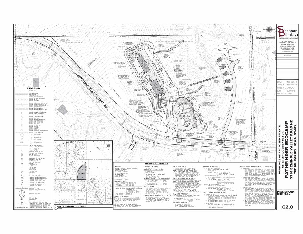
3. Case Name: 3510 Seminole Valley Road NE (Conditional Use)
Recommendation for approval of a conditional use for Campground in an A, Agriculture Zone District as requested by Pathfinder Outdoor Education Center, LLC (Applicant) and Paul D. and Jane A. Pate (Titleholders) Case No: COND-007159-2013 Case Manager: Dave Houg
New Business 1. Election of Officers for 2014- Chair & Vice Chair Selection
Training Opportunities
Announcements
1
City Planning Commission City of Cedar Rapids
101 First Street SE Cedar Rapids, IA 52401
Telephone: (319) 286-5041
MINUTES
CITY PLANNING COMMISSION REGULAR MEETING, Thursday, December 12, 2013 @ 3:00 p.m.
Cedar Rapids City Hall Council Chambers, 101 First Street SE
Members Present: Scott Overland, Chair Samantha Dahlby Carletta Knox-Seymour Richard Pankey Virginia Wilts Members Absent: Jim Halverson, Vice – Chair Allan Thoms Mike Tertinger DSD Staff: Vern Zakostelecky, Planner Dave Houg, Plats & Zoning Conditions Coordinator CD Staff: Seth Gunnerson, Planner Betty Sheets, Administrative Assistant The meeting was called to order at 3:00 p.m. Opening statements were presented stating the protocol of the meeting and the purpose of the City Planning Commission. Roll call was answered with four (4) Commissioners present. Commissioner Overland called for any additions or corrections to the minutes. Commissioner Overland stated with no additions or corrections, the November 21, 2013 Minutes stand approved. Commissioner Overland called for any additions or corrections to the agenda. Commissioner Overland stated with no additions or corrections, the agenda stands approved. 1. Case Name: 880 74th Street NE (Rezoning)
Case No: RZNE-006757-2013 Case Manager: Vern Zakostelecky Recommendation for approval of a rezoning from R-3, Single Family Residence Zone District to RMF-1, Multiple Family Residence Zone District as requested by Abode Construction, Inc. (Applicant) and Phyllis M. Rausch (Titleholder)
2
Mr. Zakostelecky stated this property is located between C Avenue and Council Street NE to allow for 4-unit single-family owner occupied homes. The initial rezoning occurred in 2000. This portion of the site was rezoned to R-3 for single family detached housing. On the west side it was rezoned for multi-family and the market demand for those units has exceeded expectations. The applicant did hold a neighborhood meeting with no major issues expressed. The rezoning includes 8.8 acres, 11 4-plex buildings for a total of 44 housing units with 2 stall garages. Total parking provided is 88 parking spaces with additional parking in front of garage spaces and street parking. Storm water management is not required on this site. Mr. Zakostelecky showed a location map, aerial photo, site plan as well as elevations of the proposed homes. Commissioner Overland called for questions of Mr. Zakostelecky. No questions were presented. Commissioner Overland called for a representative of the applicant. Brian Vogel, Hall & Hall Engineers, 1860 Boyson Road, Hiawatha, IA stated he would be happy to answer any questions. Commissioner Overland called for questions of the applicant. No questions were presented. Commissioner Overland called for members of the public who wished to speak. No one from the public wished to speak. Commissioner Overland called for a motion to approve the rezoning. Commissioner Wilts made a motion to approve the rezoning from R-3, Single Family Residence Zone District to RMF-1, Multiple Family Residence Zone District. Commissioner Knox-Seymour seconded the motion. Commissioner Overland called for discussion on the motion. No discussion was held on the motion. Commissioner Overland called for a vote on the motion. The motion passed unanimously with none opposed. 2. Case Name: 4001 and 4009 Blairs Ferry Road NE (Rezoning)
RZNE-006769-2013 Case Manager: Vern Zakostelecky Recommendation for approval of a rezoning from A, Agriculture Zone District to C-2,
Community Commercial Zone District as requested by Buffalo Evangelical United Brethren Church (Applicant/Titleholders)
Mr. Zakostelecky showed the Commission a location map of the property and surrounding area. To the east is a Casey’s convenience and the area to the south and west is zoned agriculture with commercial across the street in Hiawatha to the north. The Future Land Use Map (FLUMA) shows commercial and office to the south and west. The site is developed with a small church and parsonage and the comtemplated redevelopment is for a Good Year Tire store. The applicant has met with the Historic Preservation Commission (HPC) and HPC will meet with them to do a walk through with a salvage company to identify parts of the structure that can be salvaged for reuse on other structures. This will be a 6,800 sq. ft. building with 31 parking spaces and two handicap spaces. Access will be off Blairs Ferry Road with a fence along the south property line and staff asked the developer to extend the fence along the south property line to screen the parking lot on the east end of the proposed building. Storm water management is proposed along Blairs Ferry Road. Mr. Zakostelecky showed an aerial map, site plan and elevations.
3
Commissioner Overland called for questions of Mr. Zakostelecky. Commission Pankey asked where the proposed fencing would be. Mr. Zakostelecky the fencing will begin at the southwest corner of the site and ends at the east side of the building but staff would prefer to see the fencing be extended at the east property line. This type of business can produce noise and screening is advised. Commissioner Wilts asked if Traffic Engineering looked at the traffic situation. Mr. Zakostelecky stated that Traffic Engineering did review this project and had no major issue or concerns. Commissioner Overland called for a representative of the applicant. Dan Schmidt, Brain Engineering, Inc. spoke on behalf of the applicant. Dan indicated the applicant was fine with extending the screen fencing along the entire south property line. Commissioner Overland called for questions of the applicant. Commissioner Pankey asked how the driveway lined up with Miller Road. Dan indicated it was close to lining up with a commercial driveway on the north side of Blairs Ferry Road. Commissioner Knox-Seymour asked if the Church did not exist anymore. The applicant stated that this church has been closed and for sale for a long time. Commissioner Overland called for members of the public who wished to speak. No member of the public wished to speak. Commissioner Overland called for a motion to approve the rezoning. Commissioner Pankey made a motion to approve the rezoning in A, Agriculture Zone District to C-2, Community Commercial Zone District. Commissioner Dalhby seconded the motion. Commissioner Overland called for discussion on the motion. No discussion was presented. Commissioner Overland called for a vote on the motion. The motion passed unanimously with none opposed. 3. Case Name: 5940 Rockwell Drive NE (Preliminary Site Development Plan)
Case No: PSDP006973-2013 Case Manager: Dave Houg
Recommendation for approval of a Preliminary Site Development Plan zoned O-S, Office Service Zone District as requested by Martin Combs Custom Homes (Applicant) and Juan Valles-Zamora and Danielle E. Valles (Titleholders).
Mr. Houg stated this was a request for approval of a preliminary site plan and showed a site plan, aerial photo, a street view, rendering of the building. A meeting with the neighbors was held and a 6 foot screen fence as well as heavy plantings will be provided to the rear of the building. Commissioner Overland called for questions of Mr. Houg. Commissioner Dalhby stated when the BioLife building was built there was some flooding issues has this been discussed to prevent this from happening again because several homes had water in their basements. Mr. Houg stated that rain gardens and detention swales along Rockwell Drive will be provided to prevent that from happening.

4
Commissioner Overland called for a representative of the applicant. Ghassen Halloush, AllTrans, Inc. 1930 St. Andrews Court NE, Cedar Rapids, IA on behalf of the applicant stated that they met with neighbors and they had concerns regarding fencing and lighting and they addressed their concerns with revisions to the site plan . The neighbors did not want windows in the back of the building, so the developer will not put any windows in the rear of the building, just two doors. In terms of storm water issue that will be addressed. Commissioner Overland called for questions of the applicant. No questions were presented. Commission Pankey asked if the exterior of the building was masonry. Mr. Halloush did not know if it was masonry. Mr. Houg stated that the actual building plans have not been presented to the city yet. Mr. Zakostelecky stated that when the Administrative Site Plan is submitted they will have to present the building designs so that it meets the City’s Design Standards. Commissioner Overland called for members of the public who wished to speak. Commissioner Overland called for a motion to approve the Preliminary Site Development Plan. Commissioner Dalhby made a motion to approve the Preliminary Site Development Plan zoned O-S, Office Service Zone District. Commissioner Knox-Seymour seconded the motion. Commissioner Overland called for discussion on the motion. No discussion was presented. Commissioner Overland called for a vote on the motion. The motion passed unanimously with none opposed. 3:20 P.M. Jim Halverson, Vice – Chair arrived New Business
1. Digital Sign Ordinance – Seth Gunnerson
Mr. Gunnerson stated on July 26, 2013 the City Council adopted the Digital Sign Ordinance, which set display criteria standards for on and off-premise signs in the community. One of the provisions of the ordinance is a prohibition on full motion video on digital signs in the community, effective January 1, 2014. At the time staff committed to come up with a process to allow exceptions to be approved by the City. Staff then looked into whether this would be best handled through the existing Conditional Use Process, or if a separate permit process could be instituted that would be approved by City Council. Staff researched options and notes the following:
State law requires a separation of powers, where the legislative body creating the regulation should not be the body which enforces the regulation. This is interpreted to mean that appeals or exceptions to the ordinance should not be ruled on by City Council.
Appeals or exceptions to zoning issues are, by state code, exclusively the domain of the Board of Adjustment. The limitation on video on signs is in a gray area, and could be interpreted to not be exclusively a zoning issue.
If locational considerations are a factor in determining the permit, then the matter may be a zoning issue, which would be reviewed by the Board of Adjustment.

5
Based on research, staff is recommending the following:
Full motion video would be permitted by Conditional Use in all commercial and industrial districts.
Limitations on full motion video shall not apply to scoreboards or video displays not intended to be viewed from the public right of way.
Limitations shall not apply to video displayed to special events, such as movie nights, which would be reviewed and approved separately by City Staff.
Commissioner Overland called for questions of Mr. Gunnerson. Commissioner Pankey asked if this ordinance applies to the Event Center. Mr. Gunnerson stated yes in the future if the Event Center decided to show video they would have to comply. Commissioner Pankey further asked if a sign owner came forward and they received a conditional use permit to allow full motion video on a billboard, would there be limits on the video distracting drivers. Would not want to limit advertising but limit potentially distracting elements. Mr. Gunnerson stated that City staff could look at placing conditions on approvals as requests come in. Commissioner Halverson asked if there are any studies that reflect the impact of animated signage. Mr. Gunnerson stated that a lot of research was conducted regulating digital signs and studies from safety point of view. Most studies focused on billboards. Some studies found an impact and others did not. Mr. Gunnerson stated that it is difficult to quantify the impact, and that while safety is often a concern, many cities adopt sign regulations based on aesthetics. Commissioner Wilts asked if digital signs are approved for billboards, how will this be monitored? Mr. Gunnerson stated that staff will be able to go back to the billboard owners to make them aware of the complaints. Commissioner Overland called for a motion to approve the digital sign ordinance. Commissioner Halverson made a motion to approve the digital ordinance. Commissioner Pankey seconded the motion. Commissioner Overland called for discussion on the motion. No discussion was presented. Commissioner Overland called for a vote on the motion. The motion passed unanimously with none opposed. The meeting was adjourned at 3:35pm Respectfully Submitted,
Betty Sheets, Administrative Assistant Community Development
1
Development Services Department 500 15th Avenue SW
Cedar Rapids, IA 52404 Telephone: (319) 286-5820
STAFF REPORT TO CITY PLANNING COMMISSION Major Preliminary Plat
CPC Date: January 2, 2014 To: City Planning Commission From: Development Services Department Applicant: NewBo Development Group, LLC Titleholder: NewBo Development Group, LLC Plat Name: The Commons on Ellis Boulevard First Addition Case Number: PRPT-007328-2013 Location: 1320, 1324 and 1328 Ellis Boulevard NW Request: Approval of a Major Preliminary Plat Case Manager: Chris Strecker, Development Services BACKGROUND INFORMATION: The applicant is requesting platting to allow for the development of 4-unit and 5-unit row house apartment buildings. The property is currently undeveloped and in the Ellis Overlay District. The lots proposed for development previously contained homes that were damaged as a result of the Flood of 2008. The City purchased the properties through the Voluntary Acquisition Program and demolished the homes. The project has been reviewed by City Council and was recommended to be forwarded to the State for possible funding through the fifth round of the Multi-Family New Construction Program. The State reviewed the project and awarded funds for the 4-unit row house to assist in developing the project for affordable flood replacement housing. The 5-unit row house was not approved for State funding and the City has worked with the applicant to provide ROOTs funds to assist the applicant in developing affordable work force housing. For financing purposes, the property owner is requesting platting in order to have each unit on an individual property. The 5-unit townhomes will be a zero lot line development. City Council approved rezoning to the PUD-2 Zoning District and the Preliminary Site Development Plan for this property by Ordinance No. 053-13, dated September 10, 2013. The plat includes 15,429 sq. ft. of land area and a total of five lots. FINDINGS: The City Planning Commission may review the application based on the following criteria:
1. That the proposed use and development will be consistent with the intent and purposes
of the Comprehensive Plan and other applicable codes and regulations. Staff Comments: The proposed use and development are consistent with the intent and purposes of the Comprehensive Plan and all City codes and regulations.

2
RECOMMENDED CONDITIONS:
If the City Planning Commission recommends approval of the proposed rezoning, adoption of the following conditions as recommended by City Departments should be considered. The City Planning Commission may approve with additional conditions or remove any of the recommended conditions:
Staff Comments: There are no recommended conditions.
CIV
IL E
NG
INE
ER
ING
LAN
D S
UR
VE
YIN
G
PH
ON
E:
(319
) 36
2-95
48 F
AX
: (31
9) 3
62-7
595
1860
BO
YS
ON
RO
AD
, HIA
WA
TH
A, I
OW
A 5
2233
HA
LL &
HA
LL E
NG
INE
ER
S, I
NC
.
LAN
D D
EV
ELO
PM
EN
T P
LAN
NIN
GLA
ND
SC
AP
E A
RC
HIT
EC
TU
RE
ww
w.h
alle
ng.c
om
ZONING
APPLICANT/OWNER
CONTACT PERSON
LEGAL DESCIPTION
DIMENSIONAL STANDARDS
IN THE CITY OF CEDAR RAPIDS, LINN COUNTY, IOWA
PRELIMINARY PLAT
THE COMMONS ON ELLIS BOULEVARDFOR
FO
RP
RE
LIM
INA
RY
PL
AT
TH
E C
OM
MO
NS
ON
EL
LIS
BO
UL
EV
AR
DIN
TH
E C
ITY
OF
CE
DA
R R
AP
IDS
, LIN
N C
OU
NT
Y, I
OW
A
www.halleng.comLANDSCAPE ARCHITECTURE
LAND DEVELOPMENT PLANNING
HALL & HALL ENGINEERS, INC.
1860 BOYSON ROAD, HIAWATHA, IOWA 52233PHONE: (319) 362-9548 FAX: (319) 362-7595
LAND SURVEYINGCIVIL ENGINEERING
ELLI
S B
OULE
VARD
NW
8TH
STR
EET
NW
L AVENUE NW
M AVENUE NW
NOTESTREET CLASSIFICATIONS
AREA
1
Development Services Department 1211 6th Street SW
Cedar Rapids, IA 52404 Telephone: (319) 286-5822
STAFF REPORT TO CITY PLANNING COMMISSION Major Preliminary Plat
CPC Date: January 2, 2014 To: City Planning Commission From: Development Services Department Applicant: Jerry’s Homes Titleholder: Jerry’s Homes Plat Name: Whispering Pines 8th Addition Case Number: PRPT-007580-2013 Location: s/o 16th Avenue SW and e/o 23rd Street SW Request: Time Extension for a Major Preliminary Plat Case Manager: Joe Mailander, Development Services BACKGROUND INFORMATION: The applicant, Jerry’s Homes is requesting extension of a Preliminary Site Development Plan for the Whispering Pines 8th Addition to Cedar Rapids. The previously approved plat has 40 parcels for future residential development located south of 16th Avenue SW and east of 23rd Street SW. The plat was first approved on March 1st, 2012. The Major Preliminary Plat as submitted includes the following:
Total site area is 1.43 acres. The proposed subdivision includes 40 lots fronting onto Shady Grove Road SW which
will connect to the 18th Street SW extension. Access to the proposed lots will be from 23rd Street SW, Balsam Drive SW and 18th
Street SW. All proposed streets within the development will be public streets and will be designed to meet City standards.
Storm water management will be designed to exceed the requirements of the City Storm Water Management Ordinance.
FINDINGS: The City Planning Commission may review the application based on the following criteria:
1. That the proposed use and development will be consistent with the intent and purposes
of the Comprehensive Plan and other applicable codes and regulations. Staff Comments: The proposed use and development are consistent with the intent and purposes of the Comprehensive Plan and all City codes and regulations.
2
RECOMMENDED CONDITIONS:
If the City Planning Commission recommends extension of the preliminary plat, the previously approved conditions as recommended by City Departments should be considered. The City Planning Commission may approve with additional conditions or remove any of the recommended conditions: 1. The Developer shall maintain storm water quality improvements serving this site. The
Developer shall include an acceptable agreement to maintain storm water quality improvements as part of final plat approval. The Developer will use all reasonable measures to protect storm water quality facilities and downstream detention basin(s) from sediment runoff and damage. All construction activities are subject to the Municipal Code Chapter 71 “Erosion and Sediment Control for Construction Sites” until such time that all disturbed areas are completely stabilized and developed. The Developer shall remove sediment from, reseed, and otherwise repair said storm water quality facilities and detention basin(s) should development related damage occur after the basin has been accepted by the City.
2. PRIOR TO THE ISSUANCE OF A CERTIFICATE OF OCCUPANCY, the property owner shall be responsible to construct 4’ wide concrete sidewalk along the streets on this site. The property owner shall construct the sidewalk improvements in accordance with City Standards, ADA requirements, and improvement plans accepted by the City Public Works Director/City Engineer.
3. PRIOR TO THE ISSUANCE OF A CERTIFICATE OF OCCUPANCY, the property owner shall be responsible to construct 5’ wide concrete sidewalk along 18th Street SW adjoining this site. The property owner shall construct the sidewalk improvements in accordance with City Standards, ADA requirements, and improvement plans accepted by the City Public Works Director/City Engineer. The property owner may request deferral of the sidewalk installation requirement in accordance with the City Sidewalk Installation Policy.
4. The property owner is responsible to extend sanitary sewer to serve the development. If sewer extensions crossing private property are necessary to serve the subject property, as determined by the City Public Works Director/City Engineer, the property owner shall be responsible for the related costs including, but not limited to, planning and design of the sewer, acquisition of right-of-way and/or easements, construction, administration, inspection and other incidental costs.
5. PRIOR TO THE ISSUANCE OF A CERTIFICATE OF OCCUPANCY, for the lot(s) through which overland conveyance of the 100-year storm event will occur, the property owner shall provide certification by a civil engineer licensed in the State of Iowa verifying the runoff from the 100-year storm event can be conveyed through the site without damage to building structures, OR, The property owner shall provide a certification by a Civil Engineer or Land Surveyor licensed in the State of Iowa the drainage way has been constructed in accordance with drainage plans approved by the City.
6. WITH RESPECT TO STORM WATER MANAGEMENT FOR THIS SITE, the property owner shall be responsible to: a) pay a proportionate fee as approved by the City Public Works Director/City Engineer for the construction of any approved off-site regional storm water management facility (City CIP Project No. 304043). The property owner’s civil engineer shall provide calculations for each final plat to determine the cost participation for each platting phase based on the approved cost opinion for said regional basin. b) The property owner shall be responsible for the dedication of any other on-site easements to accommodate the approved storm water management plan. c) At the time of final platting the lands north of Lot B, Cerka’s 2nd Addition and Parcel A, Plat of Survey No. 1438 (south of this site), or at such time as deemed necessary by the City, whichever occurs first, the property owner shall dedicate slope grading and/or storm water management easements at no cost to the City for construction of any regional storm water detention facility to be located adjacent to lands owned by the owner of this site. The easement agreements shall be submitted to the City at such time as an overall storm water management plan is approved for this site by the City
3
Public Works Director/City Engineer including an off-site regional storm water management facility adjacent to said lands. d) storm water management plans, certified by a civil engineer licensed in the State of Iowa shall be approved by the City Public Works Director/City Engineer PRIOR TO FINAL PLAT CONSIDERATION BY CITY COUNCIL.
7. AS PART OF FINAL PLAT SUBMITTAL TO CITY COUNCIL, the property owner shall submit to the City an Agreement to Dedicate Slope Grading Easements at no cost to the City for grading associated with the 18th Street SW project (CIP # 301500). The City Public Works Department shall furnish the Agreement form upon request by the property owner.
8. AS PART OF FINAL PLAT SUBMITTAL TO CITY COUNCIL, the property owner shall be responsible to dedicate to the public at no cost to the City of additional street right-of-way along future 18th Street SW providing a minimum 40’’ half width right-of-way adjoining this site. Additional right-of-way beyond the 40’ width may be required to accommodate the City’s 18th Street SW improvement project (CIP 301500). The right-of-way shall be dedicated at the time the property owner’s land west of and adjoining the right-of-way area is final platted, or at such time as requested by the City, whichever occurs first.
9. AS PART OF FINAL PLAT SUBMITTAL TO CITY COUNCIL, the property owner shall be responsible to submit to the City a signed Concrete Pavement Petition and Assessment Agreement for improvements in 18th Street SW adjoining this site (CIP # 301500). In the Agreement the property owner shall agree to be responsible for one-half the cost of a 28’ wide pavement and associated improvements in 18th Street SW adjoining Whispering Pine Additions. The City Public Works Department shall provide a copy of the Agreement form upon request by the property owner.
10. AS PART OF FINAL PLAT SUBMITTAL TO CITY COUNCIL, access control shall be established such that direct access from the lots of this addition to 18th Street SW is prohibited.


1
Development Services Department City Services Center 500 15th Avenue SW
Cedar Rapids, IA 52404 Telephone: (319) 286-5043
STAFF REPORT TO CITY PLANNING COMMISSION
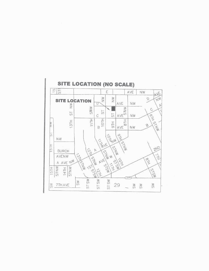
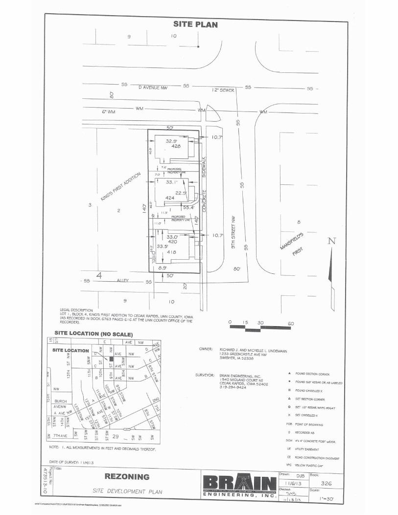
Rezoning with a Preliminary Site Development Plan CPC Date: January 2, 2014 To: City Planning Commission From: Development Services Department Applicant: Richards J. and Michelle L. Lindemann Titleholder: Richards J. and Michelle L. Lindemann Case Number: RZNE-007160-2013 Location: 418, 420, 424 and 428 9th Street NW Request: Rezoning from RMF-1, Multiple Family Residence Zone District to PUD-2,
Planned Unit Development Two Zone District Case Manager: Vern Zakostelecky, Development Services Department BACKGROUND INFORMATION: The property is a single lot currently developed with 3-houses, one that’s a duplex. All 3-residential structures were built in 1905 and are in the older established Northwest Neighborhood. The applicant is requesting rezoning to allow the property to be subdivided into 3-lots so the structures can be sold separately. If approved, the applicant will submit an application for formal subdivision approval. As part of the PUD-2 Zoning approval, the applicant is requesting the following modifications to the Zoning ordinance: Reduction in front, rear and corner side yard setbacks. Reduction in minimum lot size/area. Allow the one structure to continue to be used as a duplex. Increase in minimum lot coverage area.
FINDINGS: Section 32.02.030.C.5.e of the Zoning Ordinance requires the City Planning Commission to review the application based on the following criteria: 1. Whether the amendment is required to correct a technical mistake in the existing
zoning regulations.
Staff Comments: This amendment is not to correct a technical mistake on the existing Zoning Map.
2. Whether the amendment is consistent with the Future Land Use Policy Plan and other
elements of the Comprehensive Plan.
Staff Comments: The subject property is shown as Low Density Residential on the Future Land Use Map (FLUM) in the City’s Comprehensive Plan. As such, the request to rezone to the
2
PUD-2 Zoning District is in accord with the FLUM and the Goals and Objectives of the City’s Comprehensive Plan since there is no physical change to how the properties will be used.
3. Whether the amendment is consistent with the characteristics of the surrounding area,
including any changing conditions.
Staff Comments: The property is currently developed with 3-residential structures. The use of the property will not change and traffic will be generally the same as it is today. The City’s Traffic Engineering Department has no issues or concerns. The general area is an older developed residential neighborhood. The proposed change in zoning is consistent with the characteristics of the surrounding area, including any changing conditions. Staff has not received any objections to this application.
4. Whether the property is suitable for all of the uses permitted in the proposed district.
Staff Comments: The subject property is suitable for all uses permitted in the PUD-2 Zoning District.
5. Whether the proposed amendment will protect existing neighborhoods from nearby
development at heights and densities that are out of scale with the existing neighborhood.
Staff Comments: There are not physical changes proposed for the property other than establishing lot lines between the structures.
6. Whether facilities and services (including sewage and waste disposal, water, gas, electricity, police and fire protection, and roads and transportation, as applicable) will be available to serve the subject property while maintaining adequate levels of service to existing development.
Staff Comments: This parcel is located in an area that is already served by sanitary sewer, storm sewer, water, gas, electricity, police and fire protection, and roads and transportation facilities are in place. The property is already served with all necessary services and will not have a negative impact on the levels of service to the existing development in the general area.
7. The Site Development Plan is consistent with the previously approved Preliminary Plan
for the property (if applicable).
Staff Comments: This provision is not applicable. RECOMMENDED CONDITIONS: If the City Planning Commission recommends approval of the proposed rezoning use, adoption of the following conditions as recommended by City Departments should be considered. The City Planning Commission may approve with additional conditions. 1. Subject property shall be platted per State and City platting regulations. 2. Based on City Council approval of this request for rezoning to the PUD-2, Planned Unit
Development Zone District the following modifications are provided to allow the property to be subdivided into three lots with one structure on each lot:

3
a. Reductions in front, rear and corner side yard setbacks. b. Reductions in minimum lot size/area. c. Allow the one structure (418 & 420 9th St. NW) to continue to be used as a duplex. d. Increase in minimum lot coverage area. e. Allow the property to be subdivided into three lots with one principal structure on each lot.

Elevations

1
Development Services Department City Service Center
500 15th Avenue SW Cedar Rapids, IA 52404
Telephone: (319) 286-5043
STAFF REPORT TO CITY PLANNING COMMISSION
Future Land Use Map Amendment
CPC Date: January 2, 2014 To: City Planning Commission From: Development Services Department Applicant: JKLR LLC, Jim Schmitt Titleholder: James H. Hoke Case Number: FLUMA-007527-2013 Location: 3135 J Street SW Request: Future Land Use Map Amendment from Office and Low Density
Residential to Commercial Case Manager: Vern Zakostelecky, Development Services Department
BACKGROUND INFORMATION: The property is currently undeveloped and the applicant is requesting an amendment to the Future Land Use Map in the City’s Comprehensive Plan and rezoning to allow development of the property for a self-service storage facility. The applicant held a neighborhood meeting on October 29, 2013 and no issues or concerns were expressed. The Preliminary Site Development Plan, which accompanies the rezoning request, includes the following improvements: Total site area-85,224 sq. ft. (0.69 acres). Total number of proposed buildings-5. Total area of proposed commercial buildings-25,075 sq. ft. Total proposed hard surface area-including proposed buildings, parking, & drives-58,360 s. f. Total proposed parking-13 spaces including 1-handicap space-required-15 spaces. Total open/green spaces- 26,864 sq. ft. (31.5% of total site area). Access from will be from J Street SW. Screen fencing is proposed along the north property line. Decorative fencing is proposed along J Street SW. Storm water management will be provided at the southeast corner of the site. FINDINGS: Chapter IV.E., Policy 1.6.4. of the Comprehensive Plan requires the City Planning Commission to review the application based on the following criteria: 1. Will be consistent with the Plan priorities
Staff Comments: The Future Land Use Map in the Comprehensive Plan shows the property as Office and Low Density Residential. The proposed use will provide a low intensity use and will give residents and businesses in the general area an option of storage of personal belongs and business equipment and products. The City’s Comprehensive Plan includes

2
goals and objectives that provide for transition zoning and buffering from more intensive existing and planned uses. A case can be made that the requested amendment is consistent with the Plan’s goals and objectives as stated below: Plan Goals, Objectives and Policies: • Policy1.1.2 Maintain compatible transitions between different land use and housing
types through effective land use and site design regulations. This policy is intended to allow for development of a planned mix of uses within neighborhoods.
• Policy 1.1.3 Protect stable single-family neighborhoods from the intrusion of incompatible residential and non-residential land uses. This policy is intended to protect neighborhoods from blighting influences; it is not intended to preclude development of different types of residences, local commercial centers or community services within neighborhoods if they can be designed and maintained in a manner that enhances neighborhood stability.
• Policy 1.3.2 Distribute retail, service, office and business park development throughout the City to improve access from residential neighborhoods.
• Policy 1.3.3 Ensure that new development and redevelopment projects within and near neighborhoods are designed to protect residents from unsafe or congested streets, excessive reduction of light or air circulation, and other impacts which reduce neighborhood stability.
• Potential neighborhood commercial development sites are not all shown on the Future Land Use Map. These small-scale (e.g., less than 5 acres for the entire district) developments generally are appropriate at the intersection of 2 collector or higher classification streets where they can be compatibly integrated with adjacent residential neighborhoods.
• Utilize in-fill sites for development/redevelopment rather than development on the fringe/greenfield development sites.
2. Will be compatible with future land uses for surrounding areas of the community
Staff Comments: The property is currently undeveloped. The proposed development is at the intersection of two major arterial streets. There is non-residential development on the other three corners of this intersection. To the north and east of the proposed development site is single family residential. The proposed use will generate very little traffic that will be spread out over the course of a week. The City’s Traffic Engineering Department has no issues or concerns. The proposed development is consistent with the characteristics of the development at the other three corners of the intersection of J Street SW and 33rd Avenue SW. If screen fencing and landscape buffering is provide along the north property, the impacts to the residential neighborhood should be minimal. Staff has not received any objections to this application.
3. Will not create a shortage of any particular type of residential or non-residential land
Staff Comments: The proposed Future Land Use Map amendment for this property will not create a shortage of any particular type of residential or non-residential land.

3
4. Will enhance the overall quality of life in the community
Staff Comments: The proposed Future Land Use Map amendment and development of this property will provide an additional choice for residents and businesses in the general area for storage of personal belongs and business equipment. It also provides products in the southwest quadrant of the City and a transition zoning/use from the major arterial street traffic and non-residential development to the south and west of the single-family residential in the area.
If the City Planning Commission determines that the requested land use is not appropriate for this location, based on inconsistency with the Comprehensive Plan, the Commission should recommend denial of the proposed Future Land Use Map amendment to City Council. Should the Commission determine that the proposed land use is appropriate; the Commission should make a recommendation to City Council to amend the Future Land Use Map designation from OFFICE AND LOW DENSITY RESIDENTIAL to the requested COMMERCIAL use designation.
1
Development Services Department City Services Center 500 15th Avenue SW
Cedar Rapids, IA 52404 Telephone: (319) 286-5043
STAFF REPORT TO CITY PLANNING COMMISSION
Rezoning with a Preliminary Site Development Plan CPC Date: January 2, 2014 To: City Planning Commission From: Development Services Department Applicant: JKLR LLC, Jim Schmitt Titleholder: James H. Hoke Case Number: RZNE-007161-2013 Location: 3135 J Street SW Request: Rezoning from O-S, Office/Service Zone District and R-3, Single Family
Residence Zone District to C-3, Regional Commercial Zone District Case Manager: Vern Zakostelecky, Development Services Department BACKGROUND INFORMATION: The property is currently undeveloped and the applicant is requesting rezoning to allow development of the property for a self-service storage facility. The applicant has also submitted an application for a Future Land Use Map Amendment (FLUMA) in the City’s Comprehensive Plan from Office and Low Density Residential to Commercial. The applicant held a neighborhood meeting on October 29, 2013 and no issues or concerns were expressed. The Preliminary Site Development Plan consists of the following improvements: Total site area-85,224 sq. ft. (0.69 acres). Total number of proposed buildings-5. Total area of proposed commercial buildings-25,075 sq. ft. Total proposed hard surface area-including proposed buildings, parking, & drives-58,360 sq. ft. Total proposed parking-13 spaces including 1-handicap space-required-15 spaces. Total open/green spaces- 26,864 sq. ft. (31.5% of total site area). Access will be from J Street SW. Screen fencing is proposed along the north property line. Decorative fencing is proposed along J Street SW. Storm water management will be provided at the southeast corner of the site. FINDINGS: Section 32.02.030.C.5.e of the Zoning Ordinance requires the City Planning Commission to review the application based on the following criteria: 1. Whether the amendment is required to correct a technical mistake in the existing
zoning regulations.
Staff Comments: This amendment is not to correct a technical mistake on the existing Zoning Map.

2
2. Whether the amendment is consistent with the Future Land Use Policy Plan and other
elements of the Comprehensive Plan.
Staff Comments: The subject property proposed is generally shown as Office and Low Density Residential on the Future Land Use Map (FLUM) in the City’s Comprehensive Plan. As such, the request to rezone to the C-3 Zoning District is not in accord with the FLUM of the City’s Comprehensive Plan. The Comprehensive Plan does encourage non-residential development at the corners of the intersections of 2-major or minor arterial streets such as J Street and 33rd Avenue SW. The applicant has also submitted a request for an amendment to the Future Land Use Map to Commercial.
3. Whether the amendment is consistent with the characteristics of the surrounding area,
including any changing conditions.
Staff Comments: The property is currently undeveloped. The proposed development is at the intersection of two minor arterial streets. There is non-residential development at the other three corners of this intersection. To the north and east of the proposed development site is single family residential. The proposed use will generate very little traffic that will be spread out over the course of a week. The City’s Traffic Engineering Department has no issues or concerns. The proposed development is consistent with the characteristics of the development at the other three corners of the intersection of J Street SW and 33rd Avenue SW. If screen fencing and landscape buffering is provide along the north property, the impacts to the residential neighborhood should be minimal. Staff has not received any objections to this application.
4. Whether the property is suitable for all of the uses permitted in the proposed district.
Staff Comments: The subject property is suitable for all uses permitted in the C-3 Zoning District.
5. Whether the proposed amendment will protect existing neighborhoods from nearby
development at heights and densities that are out of scale with the existing neighborhood.
Staff Comments: The proposed development will be designed to meet minimum design standards with regard to building design, storm water management, landscaping and other site design elements. The applicant is proposing one-story and two-story buildings. The two-story buildings will be cut into the slope, so they will appear to be one-story from the north. The proposed buildings should not be out of scale with the surrounding neighborhood based on location, site design and topography.
6. Whether facilities and services (including sewage and waste disposal, water, gas, electricity, police and fire protection, and roads and transportation, as applicable) will be available to serve the subject property while maintaining adequate levels of service to existing development.
Staff Comments: This parcel is located in an area that is already served by sanitary sewer, storm sewer, water, gas, electricity, police and fire protection, and roads and transportation facilities are in place. Redevelopment of this property will not have a negative impact on the

3
levels of service to the existing development in the general area. 7. The Site Development Plan is consistent with the previously approved Preliminary Plan
for the property (if applicable).
Staff Comments: The previously approved site plan for the O-S zoned portion of this property was for a speculative office building. The property owner has been unable to market the property for office uses and is now considering different marketing and development plan for the site.
RECOMMENDED CONDITIONS: If the City Planning Commission recommends approval of the proposed rezoning use, adoption of the following conditions as recommended by City Departments should be considered. The City Planning Commission may approve with additional conditions. 1. PRIOR TO THE ISSUANCE OF A FINAL CERTIFICATE OF OCCUPANCY, the property owner
shall be responsible to submit to the City a signed Agreement for Private Storm Water Detention. The City Public Works Department shall provide a copy of the Agreement form upon request by the property owner.
2. PRIOR TO THE ISSUANCE OF A FINAL CERTIFICATE OF OCCUPANCY, the property owner shall be responsible to construct 5‘ wide concrete sidewalk along Woodland Drive SW adjoining this site. The property owner shall construct the sidewalk improvements in accordance with City Standards, ADA requirements, and improvement plans accepted by the City Public Works Director/City Engineer. The property owner may request deferral of the sidewalk installation requirement if in accordance with the sidewalk installation policy. If a deferral is requested, please submit a formal request with documentation verifying deferral eligibility (cross sections, drawings, etc.).
3. PRIOR TO THE ISSUANCE OF A FINAL CERTIFICATE OF OCCUPANCY, the property owner shall be responsible to construct 6’ wide concrete sidewalk along J Street SW and 33rd Avenue SW adjoining this site. The City will reimburse the property owner for a 1’ wide portion of the 6’ wide sidewalk in accordance with City policy. The property owner shall construct the sidewalk improvements in accordance with City Standards, ADA requirements, and improvement plans accepted by the City Public Works Director/City Engineer. The property owner may request deferral of the sidewalk installation requirement if in accordance with the sidewalk installation policy. If a deferral is requested, please submit a formal request with documentation verifying deferral eligibility (cross sections, drawings, etc.).
4. Said lots are to be combined so as to constitute a single zoning lot and tax parcel. 5. Effective screening shall be provided and maintained per provisions of the Zoning Ordinance where
adjacent to an "R" District or a variance be obtained. 6. No fence, wall, or combinations of such items exceeding a height of 3 feet above ground level shall
be erected within the required front yard or a variance must be obtained. 7. The enclosure for the dumpster will need be a full screen enclosure including the gates and
preferably designed using the same building material as the principal building as per Subsection 32.05.030.A.7. of the Zoning Ordinance.
8. Design guidelines and standards as specified in Subsection 32.05.030.C. shall be met or a variance must be obtained.
9. Lighting fixtures shall be shielded in a manner that shall not direct illumination on adjacent residential properties, or on any public right-of-way as per Subsection 32.05.030.B. of the Zoning Ordinance.
10. That all parking, drives, and storage areas be surfaced per provisions of the Zoning Ordinance. Surfacing to include asphalt, concrete, brick or asphaltic macadam.


1
Development Services Department Public Works Building
1211 Sixth Street SW Cedar Rapids, IA 52404
Telephone: (319) 286-5168
STAFF REPORT TO CITY PLANNING COMMISSION Conditional Use with a Preliminary Site Development Plan
CPC Date: January 2, 2014 To: City Planning Commission From: Development Services Department Applicant: David Blankenship / Pathfinder Outdoor Education Center, LLC Titleholders: Paul D. & Jane A. Pate Case Number: COND-007159-2013 Location: 3510 Seminole Valley Road NE Request: Conditional Use approval for a Campground in an A, Agriculture Zone
District Case Manager: Dave Houg, Development Services Department
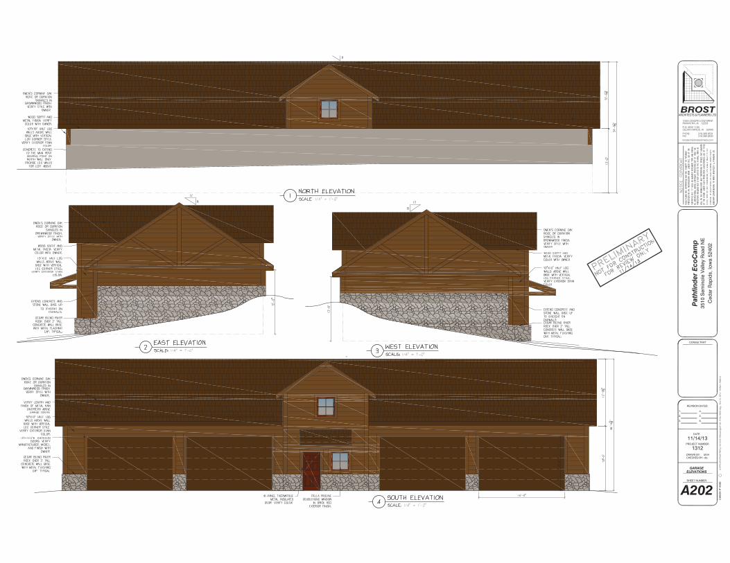
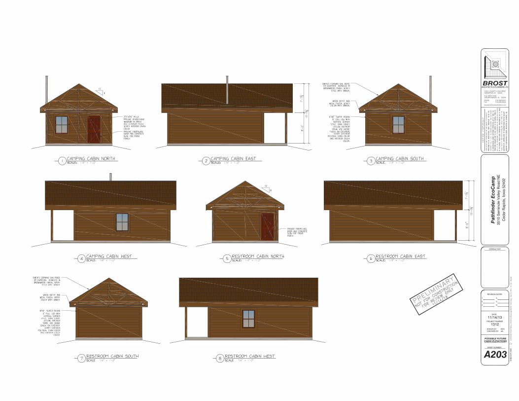
BACKGROUND INFORMATION: The applicant wishes to develop a youth outdoor educational camp. The improvements will include a lodge building, garage building and potentially five future cabins. The site plan submitted shows the following characteristics:
Total site area: 566,342 sq. ft. (13.0 acres) Total square feet of existing structures: all were removed in 2008 Total square feet of proposed covered area: 78,657 sq. ft. (14% of area) Total existing open area: 12.37 acres Total proposed open area: 11.19 acres
FINDINGS: Section 32.02.030.D.9 of the Zoning Ordinance requires the City Planning Commission to review the application based on the following criteria: 1. That the conditional use applied for is permitted in the district within which the property is located.
Staff Comments: The proposed use is permitted if approved for a conditional use in the Agriculture Zone District.

2
2. That the proposed use and development will be consistent with the intent and purpose of this Ordinance and with the Future Land Use Policy Plan and other elements of the Comprehensive Plan.
Staff Comments: This area is designated as Low Density Residential on the City’s Future Land Use Map. Conditional Use approval for a campground would be in line with the subject property and surrounding area’s existing uses and future land use designations.
3. That the proposed use and development will not have a substantial adverse effect upon adjacent property, and the character of the neighborhood, traffic conditions, parking, utility and service facilities, and other factors affecting the public health, safety, and welfare.
Staff Comments: Based upon the proposed setbacks, screening and topography of the area, any effects of the proposed conditional use should be negligible and compatible with the existing conditions and infrastructure in the area.
4. That the proposed development or use will be located, designed, constructed and operated in such a manner that it will be compatible with the immediate neighborhood and will not interfere with the orderly use, development and improvement of surrounding property.
Staff Comments: The proposed structures will be setback over 200 feet from the street and most of the currently forested areas will be retained.
5. That adequate measures have been or will be taken to assure adequate access designed to minimize traffic congestion and to assure adequate service by essential public services and facilities including utilities, storm water drainage, and similar facilities.
Staff Comments: There are no anticipated changes to the traffic patterns or required public services and facilities necessary to serve the site.
6. That the proposed building, development, or use will comply with any additional standards imposed on it by provisions of this Ordinance for the district in which the property is located.
Staff Comments: The building and site will comply with all provisions of the Ordinance and the Agriculture Zoning District.
7. Whether, and to what extent, all reasonable steps possible have been, or will be, taken to minimize any potential adverse effects on the surrounding property through building design, site design, landscaping, and screening.
Staff Comments: The proposed design situates the main structures centrally on a large lot, well away from the adjacent street and adjacent properties.

3
8. The Site Development Plan is consistent with the previously approved Preliminary Plans for the property (if applicable)
Staff Comments: This parcel was previously developed as a single-family dwelling, which was removed in 2008.
9. The Site Development Plan conforms to all applicable requirements of this Ordinance.
Staff Comments: The site development plan conforms to all applicable requirements of Chapter 32.
RECOMMENDED CONDITIONS: 1. PRIOR TO THE ISSUANCE OF A FINAL CERTIFICATE OF OCCUPANCY, the
property owner shall be responsible to submit a Street Reservation and Utility Relocation Agreement for re-aligning Seminole Valley Road NE and any necessary construction frontage roads and access.
2. PRIOR TO THE ISSUANCE OF A FINAL CERTIFICATE OF OCCUPANCY, the property owner shall be responsible to submit to the City a signed Concrete Pavement and Sidewalk Petition and Assessment Agreement for Street Improvements along Seminole Valley Road NE adjoining this site. The City Public Works Department shall furnish the Agreement form upon request by the property owner.
3. PRIOR TO THE ISSUANCE OF A FINAL CERTIFICATE OF OCCUPANCY, the property owner shall be responsible to submit to the City sanitary sewer connection and private sanitary sewer facilities agreements. The City Public Works Department shall furnish the Agreement form upon request by the property owner.


1
City Planning Commission 101 First Street SE
Cedar Rapids, IA 52401 Telephone: (319) 286-5041
CITY PLANNING COMMISSION MEETING Thursday, January 23, 2014
3:00 PM City Hall Council Chambers
101 First Street SE, Cedar Rapids, IA 52401
AGENDA
Opening Statement Roll Call Approval of the Minutes Adoption of the Agenda REGULAR AGENDA 1. Case Name: 837 44th Street SE (FLUMA and Rezoning)
a) Request for an amendment to the Future Land Use Map in the City’s Comprehensive
Plan from Low Density Residential to Institution as requested by Randall J. and Christine C. Maher (Applicants/Titleholders). Case No: FLUMA-007145-2013 Case Manager: Vern Zakostelecky
b) Recommendation for approval of a rezoning from RMF-1, Multiple Family Residence Zone District to I-1, Light Industrial Zone District as requested by Randall J. and Christine C. Maher (Applicants/Titleholders). Case No: RZNE-007144-2013 Case Manager: Vern Zakostelecky
2. Case Name: 1103 and 1201 Blairs Ferry Road NE (Rezoning)
Recommendation for approval of a rezoning from I-1, Light Industrial Zone District and C-2, Community Commercial Zone District to PUD-1, Planned Unit Development Zone District as requested by Hunter Companies LLC (Applicant), Nash Finch Companies, Chicago Central & Pacific Railroad Co and Northwestern States (Titleholders). Case No: RZNE-003536-2013 Case Manager: Vern Zakostelecky
New Business Consider amending Chapter 32 of the Municipal Code, the Zoning Ordinance, to require
a conditional use permit and a distance separation of 300 feet between liquor stores and other certain protected uses. CIP/DID #287979
Training Opportunities Announcements