city of jeffersonville, in strengthening the city’s civic ... · why plan for more than just cars...
TRANSCRIPT

Court Avenue Corridor AIA SDAT
City of Jeffersonville, IN
Strengthening the City’s Civic Spine

AIA SDAT Process
• We came – 3 days with 6 professionals from across the country
– June (New York), Judie (Phoenix), Paula (Seattle), Pat (Los
Angeles), Marc (Brooklyn), and Taryn (Tampa)
• We saw– Toured Court Avenue, from I-65 to Graham St.
• We listened– 1 day of stakeholder meetings & community workshop
• We planned– 2 days of intensive brainstorming, research, diagramming &
sketching
• Complete report to follow
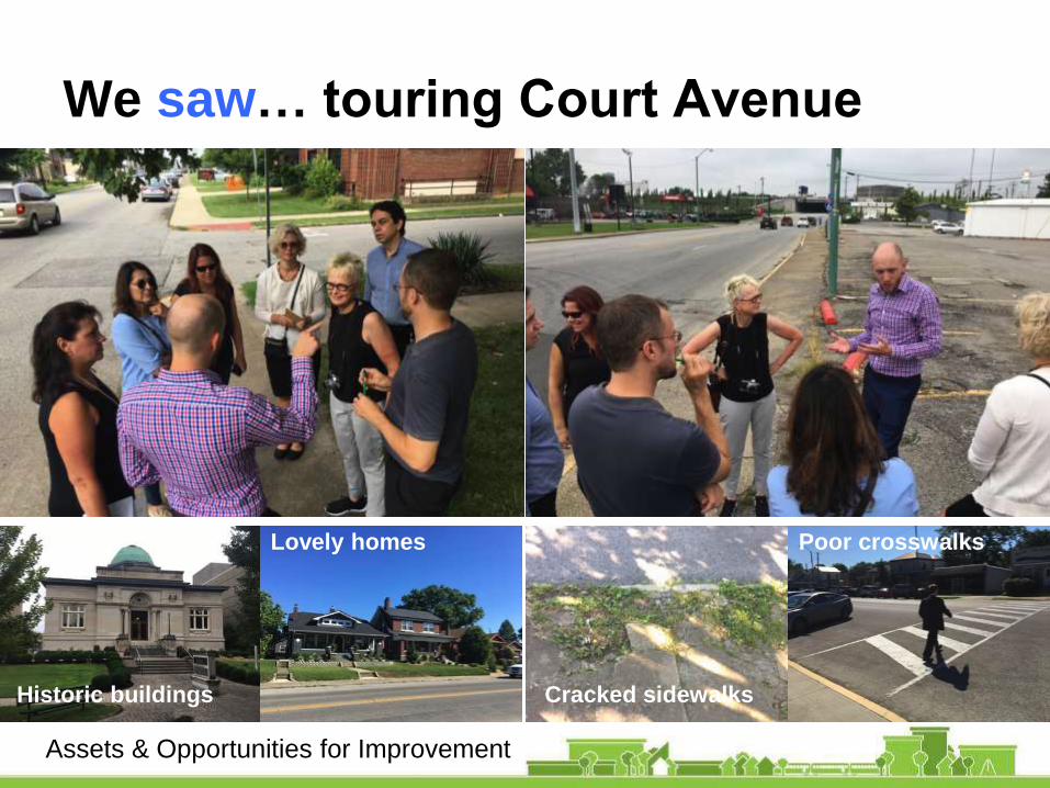
We saw… touring Court Avenue
Cracked sidewalks
Poor crosswalks
Historic buildings
Lovely homes
Assets & Opportunities for Improvement

We saw… touring Court Avenue
And a side trip
to Schimpff’s
Candy!
Also, Café on Meigs,
Adrienne’s, Pearl St.
Game & Coffee, etc.
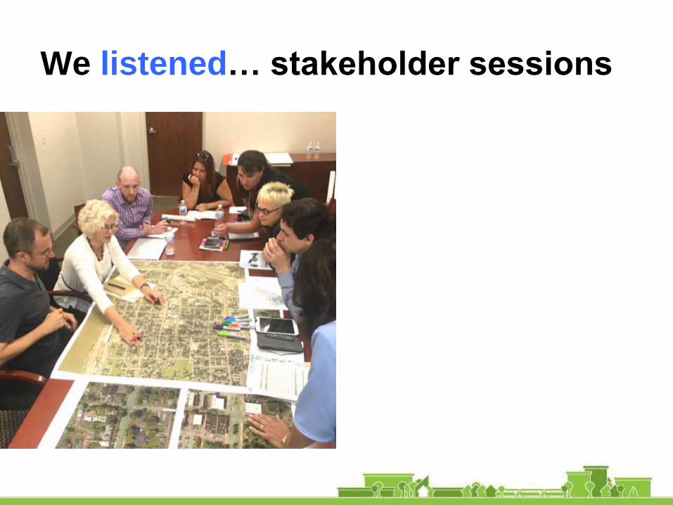
We listened… stakeholder sessions

We listened… community workshops

What we heard
• Court Ave. Feels Neglected and Unloved (“Bleak”)
– Unsafe for all users: drivers, parkers, and walkers
– And bicyclists? Forget about it...
• Parking, Parking, Parking!
• Corridor Turns into a Ghost Town after 5 pm
– You love your homes and businesses, but downtown lacks
conveniences and amenities, such as a grocery store
– The public/civic realm is tired and under-activated
• Desire to Strengthen the Downtown District
– Capitalize on ped/bike visitors from Big Four Pedestrian Bridge
– Improve experience of driver entry points from highways
– Realize potential of underutilized and vacant land parcels
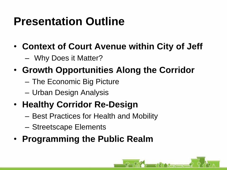
Presentation Outline
• Context of Court Avenue within City of Jeff
– Why Does it Matter?
• Growth Opportunities Along the Corridor
– The Economic Big Picture
– Urban Design Analysis
• Healthy Corridor Re-Design
– Best Practices for Health and Mobility
– Streetscape Elements
• Programming the Public Realm

Context of Court Avenue
Why Does it Matter?
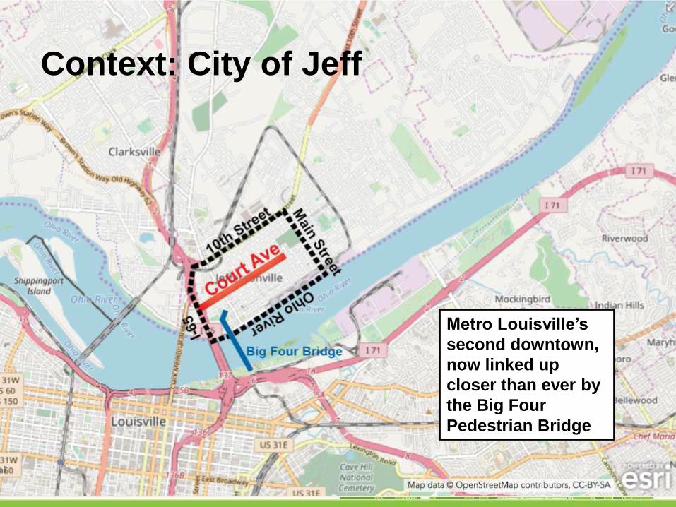
Context: City of Jeff
Metro Louisville’s
second downtown,
now linked up
closer than ever by
the Big Four
Pedestrian Bridge
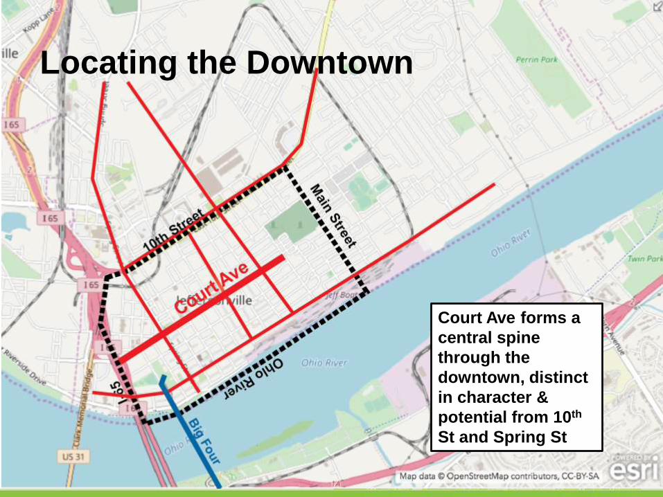
Locating the Downtown
Court Ave forms a
central spine
through the
downtown, distinct
in character &
potential from 10th
St and Spring St
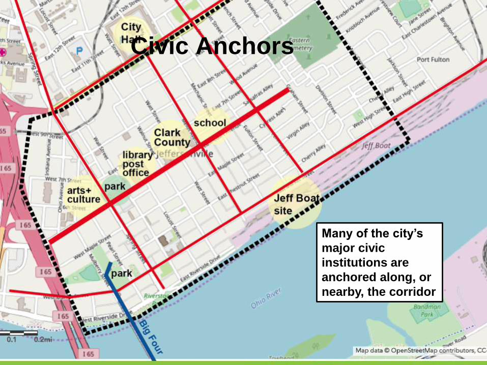
Civic Anchors
Many of the city’s
major civic
institutions are
anchored along, or
nearby, the corridor
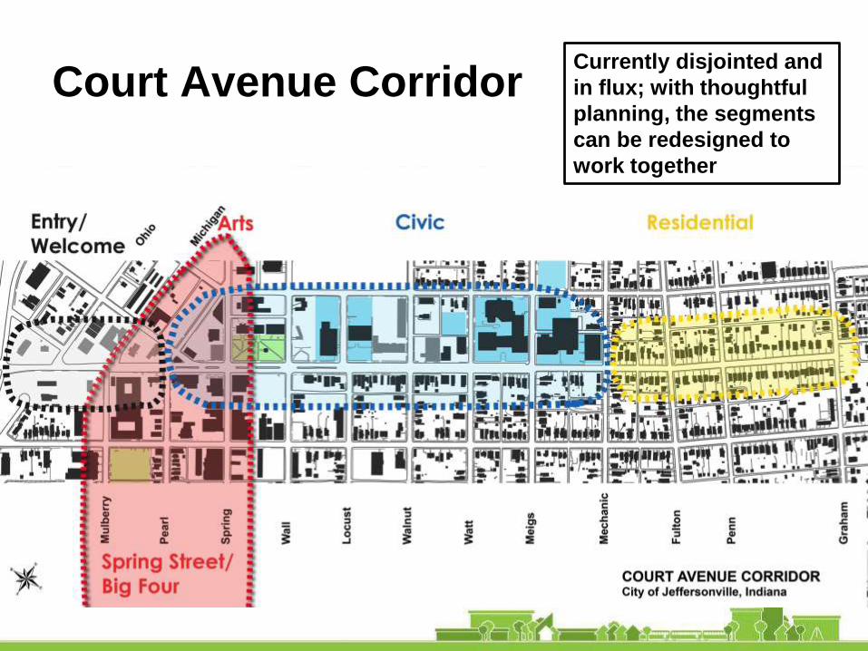
Court Avenue CorridorCurrently disjointed and
in flux; with thoughtful
planning, the segments
can be redesigned to
work together
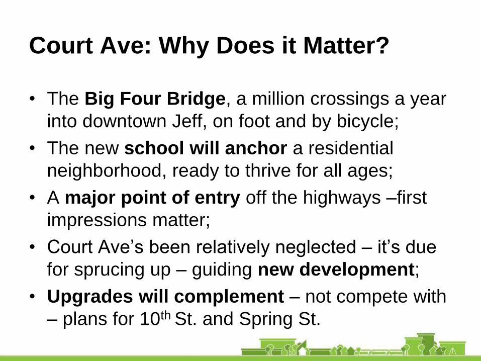
Court Ave: Why Does it Matter?
• The Big Four Bridge, a million crossings a year
into downtown Jeff, on foot and by bicycle;
• The new school will anchor a residential
neighborhood, ready to thrive for all ages;
• A major point of entry off the highways –first
impressions matter;
• Court Ave’s been relatively neglected – it’s due
for sprucing up – guiding new development;
• Upgrades will complement – not compete with
– plans for 10th St. and Spring St.

Growth Opportunities Along the
Corridor:
The Economic Big Picture

Big Picture – What are the Factors that
Influence Economic Development?
• Demographics of the area
• Historical and projected population and
employment growth
• Availability of skilled and unskilled
workforce
• Availability of sites and buildings
• Access to suppliers
• Proximity to competition

Jeffersonville City Key Demographics
• 2018-2028
Projected Growth
Rate - 4.2%
• Higher educational
attainment lags the
state (22.7% vs.
24.6%)
• White collar workers
comprise 55.1%
Source: U.S. Census Bureau, Esri forecasts for 2018
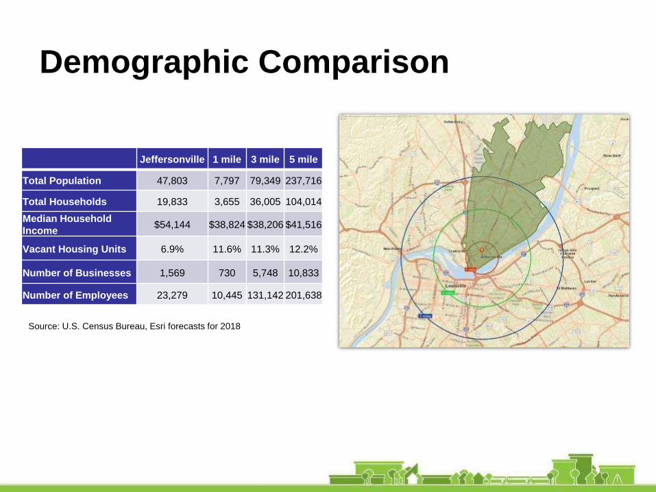
Demographic Comparison
Jeffersonville 1 mile 3 mile 5 mile
Total Population 47,803 7,797 79,349 237,716
Total Households 19,833 3,655 36,005 104,014
Median Household
Income$54,144 $38,824 $38,206 $41,516
Vacant Housing Units 6.9% 11.6% 11.3% 12.2%
Number of Businesses 1,569 730 5,748 10,833
Number of Employees 23,279 10,445 131,142 201,638
Source: U.S. Census Bureau, Esri forecasts for 2018

One Mile Radius Compared to
Jeffersonville City
Within the 1 Mile Radius
• Contains 16% of
Jeffersonville’s population
• 47% of total business
establishments
• 45% of total employment
• Daytime population is
double the resident
population

Key Employment Sectors within One
Mile Radius
Jeffersonville1 Mile Radius
Retail Trade 11.3% 10.1%
Finance & Insurance 6.1% 6.3%
Professional, Scientific & Tech Services 8.2% 11.2%
Health Care & Social Assistance 11.2% 15.2%
Other Services (except Public
Administration)13.3% 11.9%
Public Administration 5.7% 9.0%
Source: U.S. Census Bureau, Esri forecasts for 2018
Where People Live and Work
• Employed in Jeffersonville but live elsewhere - 24,627
• Employed and living in Jeffersonville – 6,503
• Total employed in Jeffersonville - 31,130
Source: LEHD On the Map, 2015

Jeffersonville Assets
• Civic center uses for all of Jeffersonville (government,
courts, library)
• New elementary school
• Growing visitor destination
• Concentration of professional and health services

Opportunities
• Redevelop vacant and underutilized properties
(Opportunity Sites)
• Increase the number of people living downtown
• Growing visitor industry facilitated by the Big Four Bridge
• Attract a food market
• Arts and Cultural district that includes Vintage Fire
Museum and the Clark County Museum
• Build upon downtown renaissance

Growth Opportunities Along the
Corridor:
Urban Design Analysis
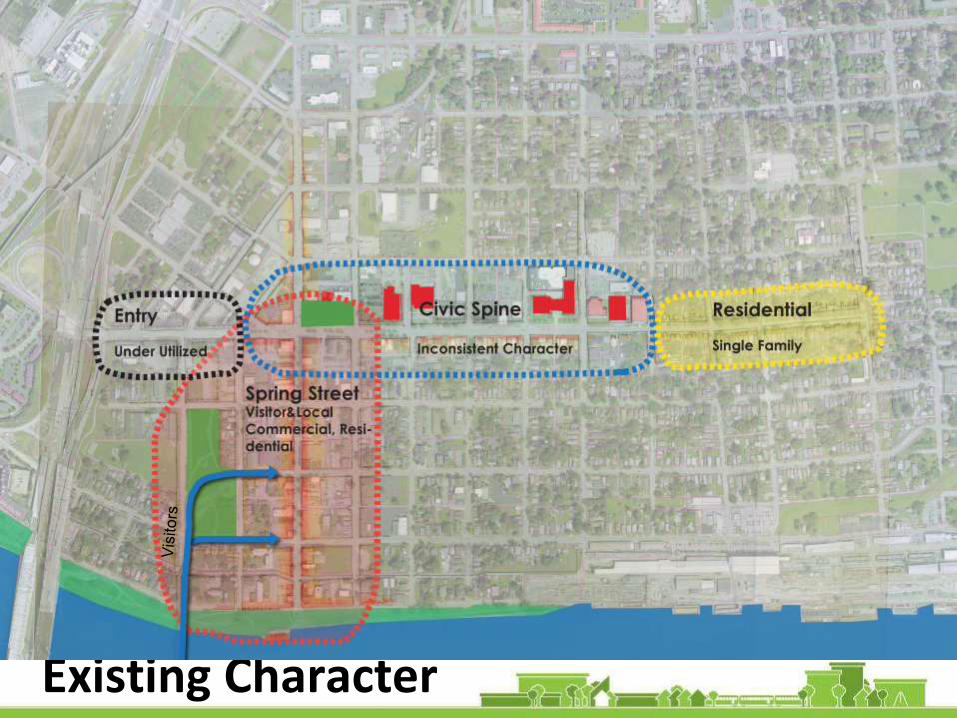
Existing Character

Underutilized Lots
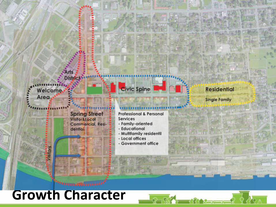
Growth Character

New Growth

Growth Opportunities
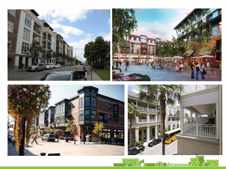

Mixed-use/ Multifamily
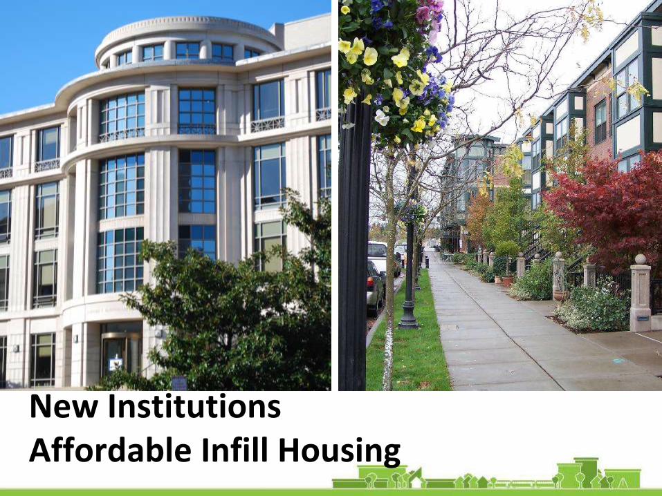
New InstitutionsAffordable Infill Housing

Growth Cycle
Want local commercial
• Grocery
• Personal Services
• Bank
Local Retail Requires:
• More residential households to support businesses
Residential Requires:
• Active areas Spring Street
• Good Parks
• Walkable Street
• Jobs

Temporary Street Retrofit
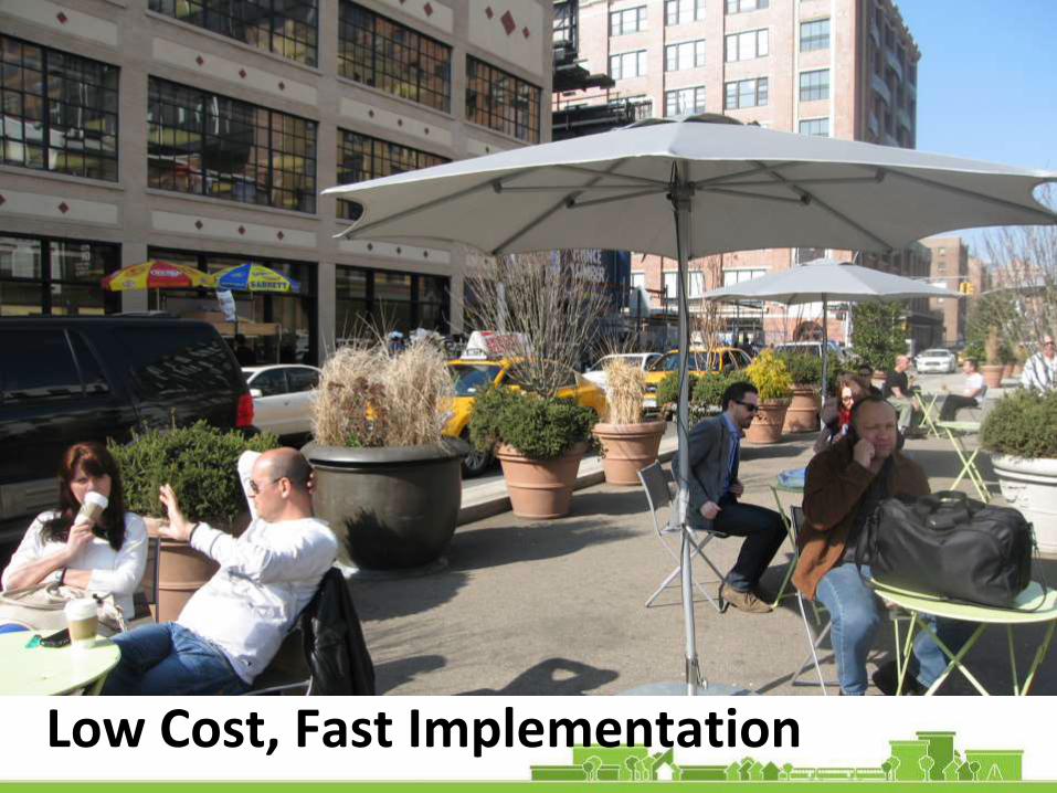
Low Cost, Fast Implementation
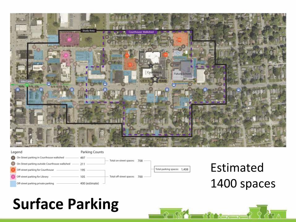
Parking
Surface Parking
Estimated 1400 spaces
Parking
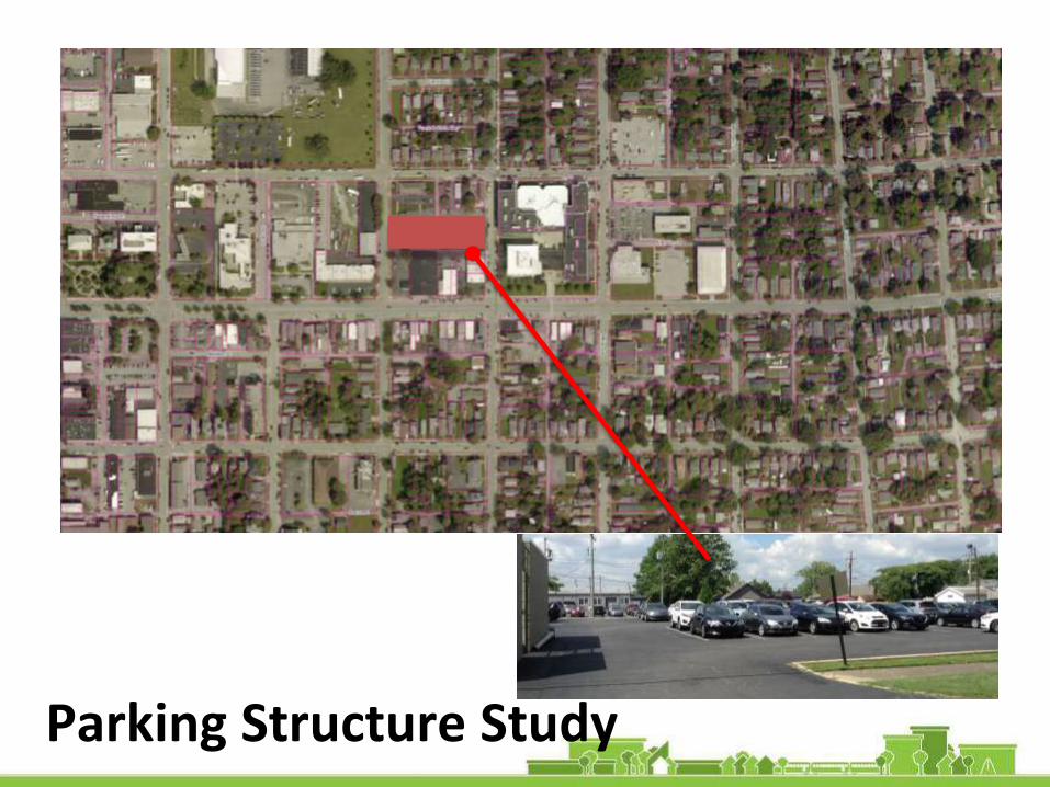
Parking Structure Study
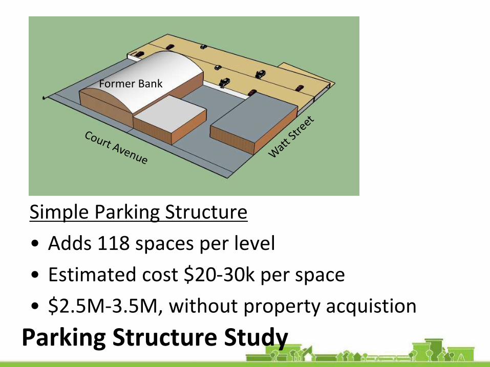
Parking Structure Study
Simple Parking Structure
• Adds 118 spaces per level
• Estimated cost $20-30k per space
• $2.5M-3.5M, without property acquistion
Former Bank
Healthy Corridor Re-Design:
Best Practices for Health + Mobility

HEALTHY CORRIDOR Re-DESIGN
Rendering Courtesy of Tumwater, WA
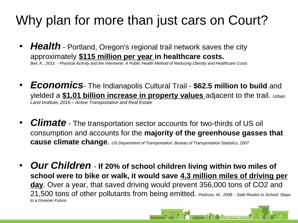
Why plan for more than just cars on Court?
• Health - Portland, Oregon's regional trail network saves the city
approximately $115 million per year in healthcare costs.Beil, K., 2011 - Physical Activity and the Intertwine: A Public Health Method of Reducing Obesity and Healthcare Costs
• Economics- The Indianapolis Cultural Trail - $62.5 million to build and
yielded a $1.01 billion increase in property values adjacent to the trail. Urban
Land Institute, 2016 – Active Transportation and Real Estate
• Climate - The transportation sector accounts for two-thirds of US oil
consumption and accounts for the majority of the greenhouse gasses that
cause climate change. US Department of Transportation, Bureau of Transportation Statistics, 2007
• Our Children - If 20% of school children living within two miles of
school were to bike or walk, it would save 4.3 million miles of driving per
day. Over a year, that saved driving would prevent 356,000 tons of CO2 and
21,500 tons of other pollutants from being emitted. Pedroso, M., 2008 - Safe Routes to School: Steps
to a Greener Future

Source: The Smart Math of Mixed-Use Development, Joe Minicozzi
Mixed Use Development & Infrastructure
• Asheville, NC Example:
City sees 800% higher
returns on downtown
redevelopment than
suburban big box
• 15 US Cities:
Average $360,000 more in
tax revenue generated per
acre with downtown
redevelopment
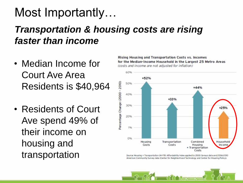
Most Importantly…
Transportation & housing costs are rising
faster than income
• Median Income for
Court Ave Area
Residents is $40,964
• Residents of Court
Ave spend 49% of
their income on
housing and
transportation

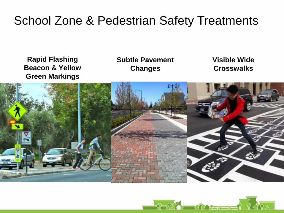
School Zone & Pedestrian Safety Treatments
Rapid Flashing
Beacon & Yellow
Green Markings
Subtle Pavement
Changes
Visible Wide
Crosswalks
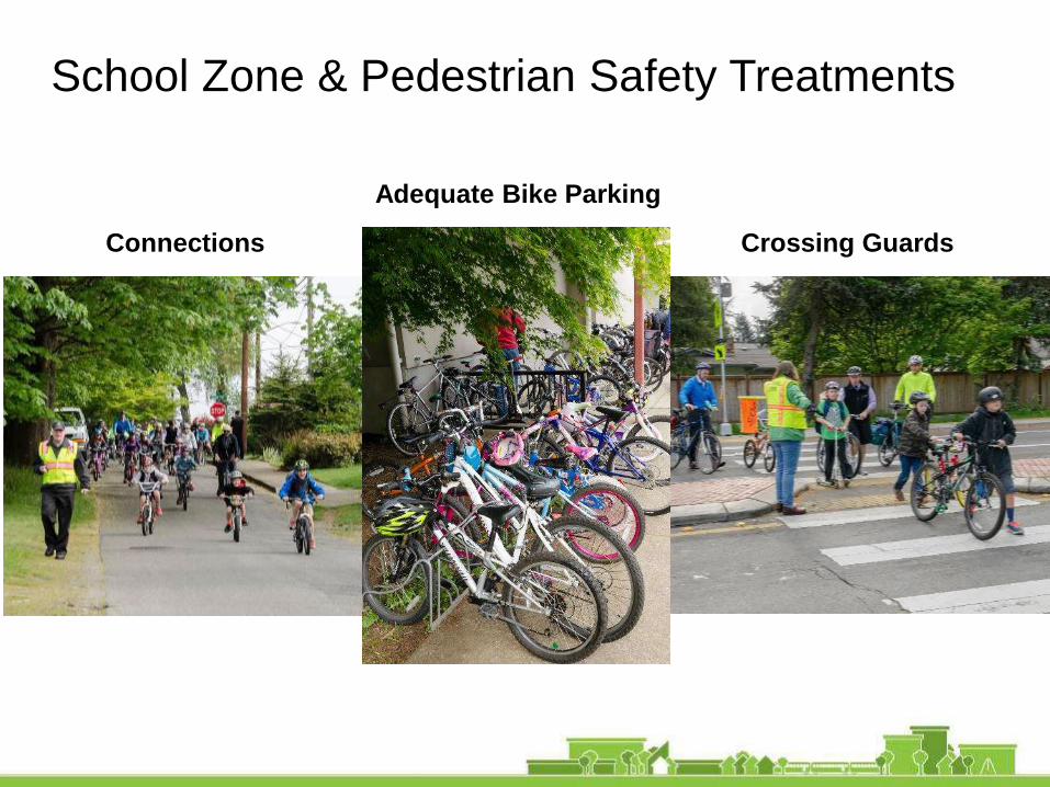
School Zone & Pedestrian Safety Treatments
Connections Crossing Guards
Adequate Bike Parking

Low Cost Speed Management

Practical Design for Bicycle Safety -
What Do Bicyclists Need?

Design for Bicycle Safety
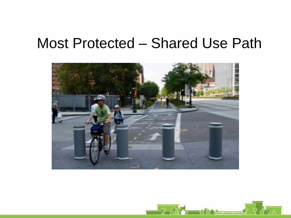
Most Protected – Shared Use Path
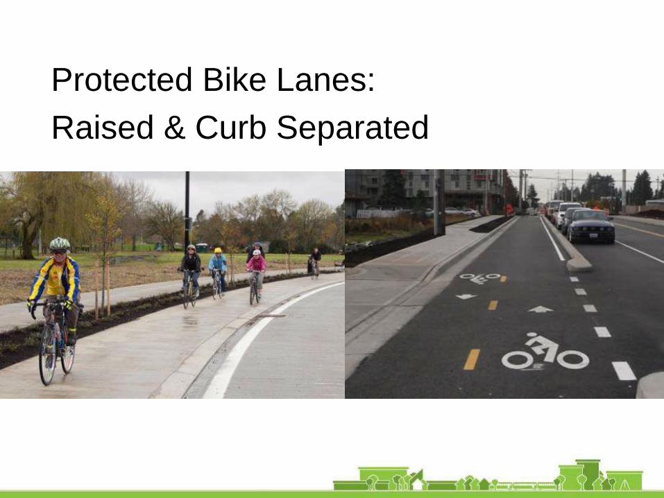
Protected Bike Lanes:
Raised & Curb Separated
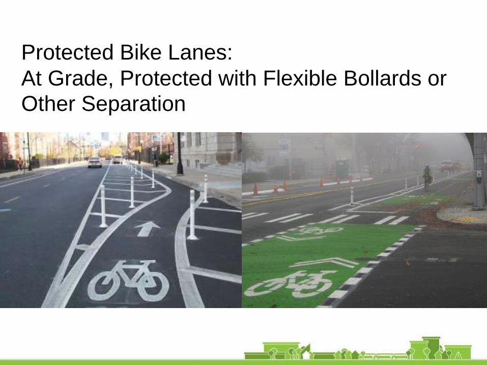
Protected Bike Lanes:
At Grade, Protected with Flexible Bollards or Other Separation

Low Impact Development –
Stormwater Management
School Site Improvements
Communities can realize cost savings of
30% to 60% by integrating green infrastructure
improvements in road reconstruction, utility
restoration, or roof replacements. –Real Cost of Green Infrastructure, 2015

Low Impact Development (LID)
School Site Improvements

Low Impact Development –Pervious Concrete

Low Impact Development –In Neighborhoods

Re-designing Court Avenue
I heard you say…
• Crossing the street is like playing a
game of Frogger
• New School will be a challenge –
parking, more traffic, drop off
• Corridor is stuck in the 70s and
needs to be spruced up
• The area just off I-65 is terrible,
impassible, bleak
• We want a “Family Avenue” with
Mom and Pops, boutiques, galleries
and services as well as civic center

Corridor Phasing Rules of Thumb
1 - Establish a Gateway
2 - Create a Center
3 - Define the Edges
4 - Strengthen Connections
1 2
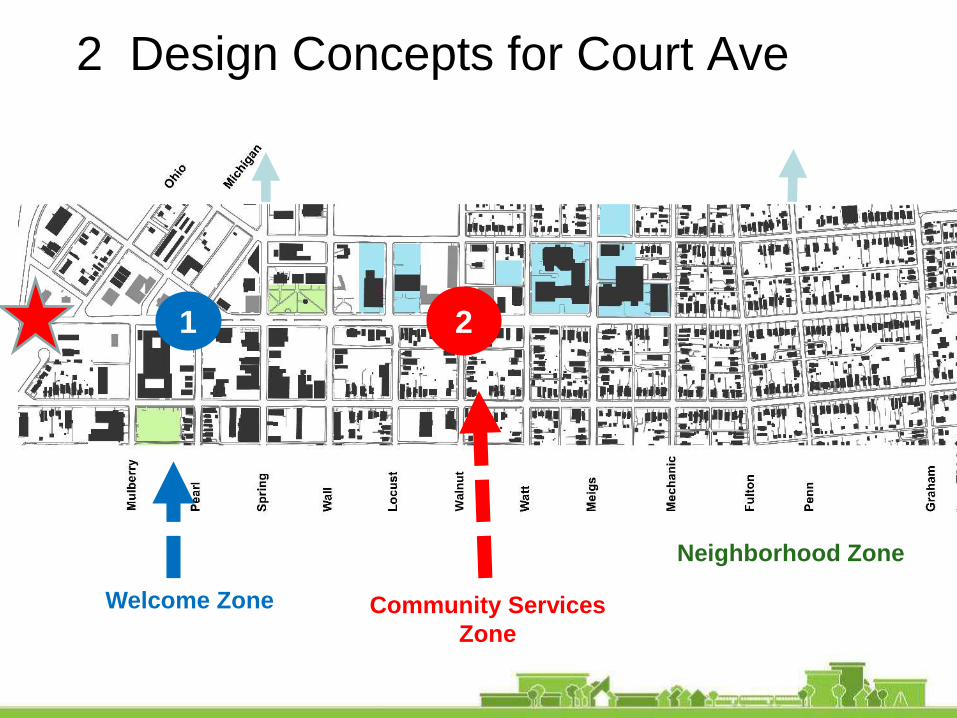
2 Design Concepts for Court Ave
Wa
lnu
t
Welcome Zone Community Services
Zone
Neighborhood Zone

Welcome Zone – Nearest to I-65
TRAFFIC CIRCLE CONCEPT
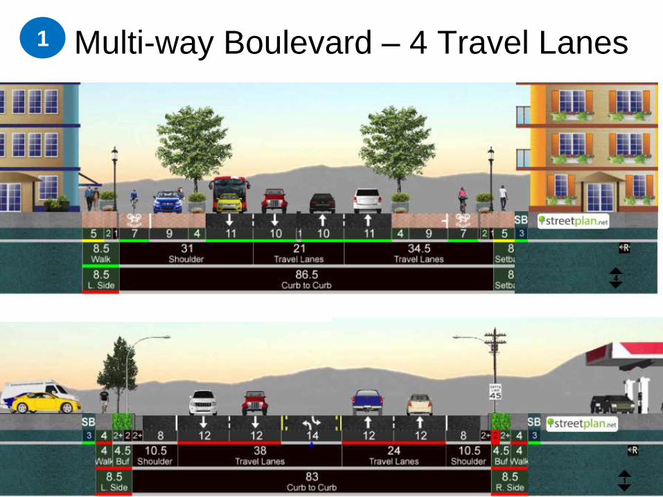
Multi-way Boulevard – 4 Travel Lanes1
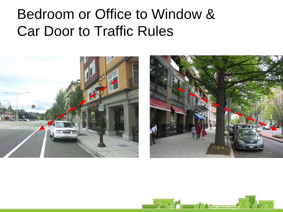
Bedroom or Office to Window &
Car Door to Traffic Rules
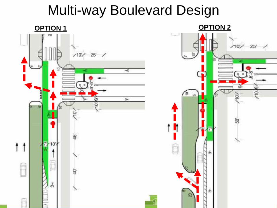
Multi-way Boulevard DesignOPTION 1 OPTION 2

Multi-Way Boulevard Slip Lane –
Bothell WA
1

Multi-way Boulevard-2 Lanes & 2-way Bike
Lane2

Civic Zone –
School Area
School Area Concept
2
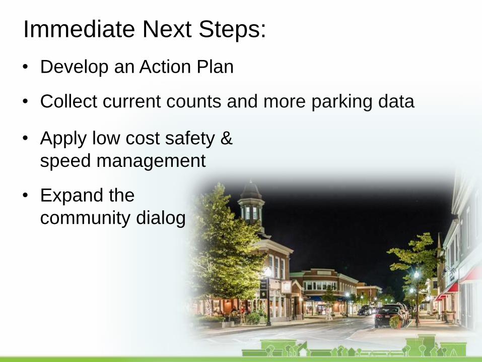
Immediate Next Steps:
• Develop an Action Plan
• Collect current counts and more parking data
• Apply low cost safety &
speed management
• Expand the
community dialog

1. Slow traffic down
2. Make it easier to cross Court Avenue
3. Consistent improvements - “trees all the way”
4. Diagonal parking is unsafe
5. Add bike lanes on one east-west street
What We Heard – CivicS
prin
g S
t.
Meig
sA
ve.

travel lanetravel lane
Spring St. to Meigs St. looking east
70' roadway
100' right-of-way
0' 16'10'
14' sidewalk 16' sidewalk
angled parkingparking5-7' 5'
park-way
walk-way
EXISTING
Street Cross Section
• One lane each way for 12,000
ADT (<20,000-25,000ADT)
• 32’ of “excess” roadway
• Existing mostly 14-16’ sidewalks
: Opportunities

Street Cross Section: OpportunitiesStart by thinking of streets as places
What kind of place do you want Court Avenue to be?
"If we can develop and design streets so that they are wonderful,
fulfilling places to be,…then we will have successfully designed about
one-third of the city directly and had an immense impact on the
rest." Allan B. Jacobs

2. Center Multi-Use Area
travel lanetravel lane
70' roadway
100' right-of-way
0' 16'10'
14' sidewalk 16' sidewalk
parkingparking7' 7'
park- way
walk-way
Spring St. to Meigs St. looking east
CENTER MULTI-USE AREA
9'7'Multi-use area
18' 18'34'
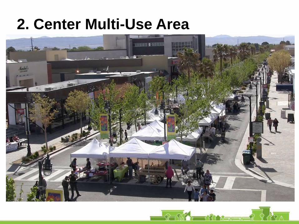
2. Center Multi-Use Area

3. Separated Bike Lanes/Median
travel lanetravel lane
Spring St. to Meigs St. looking east
66' roadway
100' right-of-way
0' 16'10'
14' sidewalk 16' sidewalk
parkingparking
7' 7'park-way
walk-way
SEPARATED BIKE LANES
9'7'Median
7'bikelane
3'buf-fer
18' 3'buf-fer
7'bikelane
14' 18'
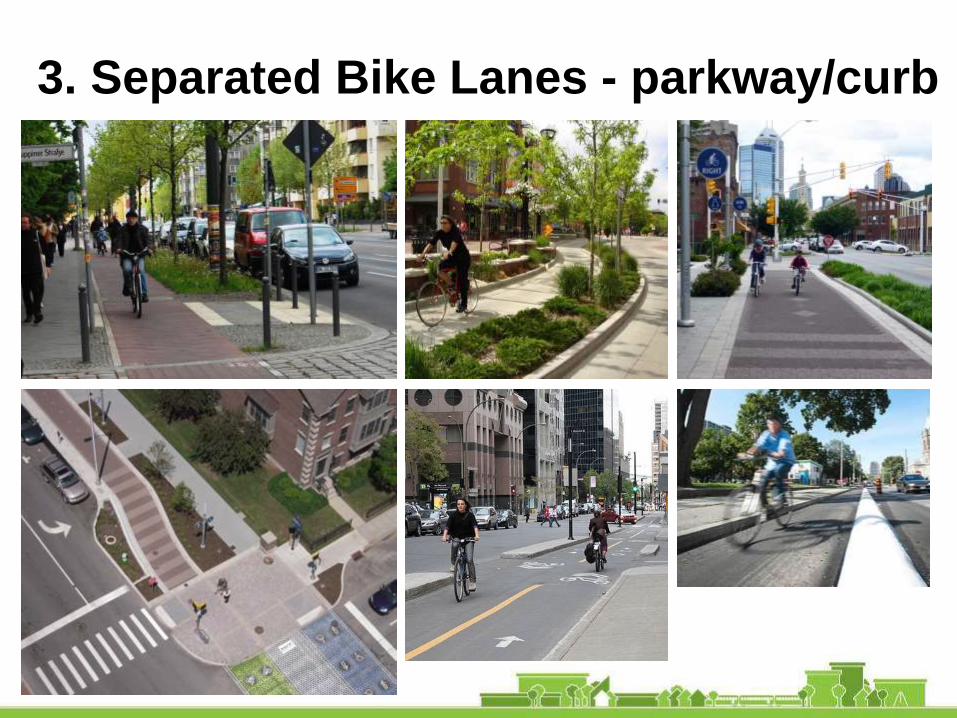
3. Separated Bike Lanes - parkway/curb
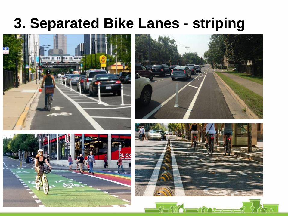
3. Separated Bike Lanes - striping
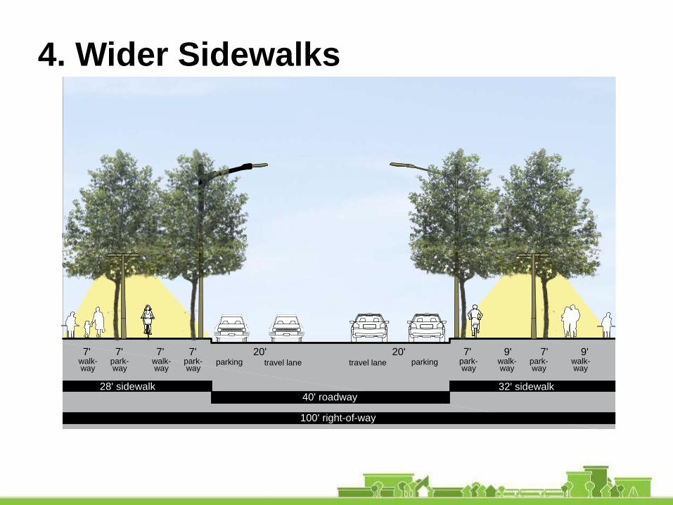
4. Wider Sidewalks
travel lanetravel lane
Spring St. to Meigs St. looking east 0' 10'
9'20'7'parking
16'
park-way
parking 7'
WIDER SIDEWALKS
walk-way
7'20'
40' roadway28' sidewalk
100' right-of-way
32' sidewalk
7'park-way
7'walk-way
9'7'park-way
walk-way
park-way
walk-way

4. Wider Sidewalks

Slow traffic/make it easier to cross – long term:
• Narrow the roadway
Pedestrian Safety – All Districts
travel lanetravel lane
Spring St. to Meigs St. looking east 0' 10'
9'20'7'parking
16'
park-way
parking 7'
WIDER SIDEWALKS
walk-way
7'20'
40' roadway28' sidewalk
100' right-of-way
32' sidewalk
7'park-way
7'walk-way
9'7'park-way
walk-way
park-way
walk-way
travel lanetravel lane
Spring St. to Meigs St. looking east
70' roadway
100' right-of-way
0' 16'10'
14' sidewalk 16' sidewalk
angled parkingparking5-7' 5'
park-way
walk-way
EXISTING

Pedestrian Safety – Everywhere
Slow traffic/make it easier to cross – short term:
• Strip the lanes and curb extensions

Standard crosswalk width and design
Pedestrian Safety

Consistent corner ramps
Pedestrian Safety
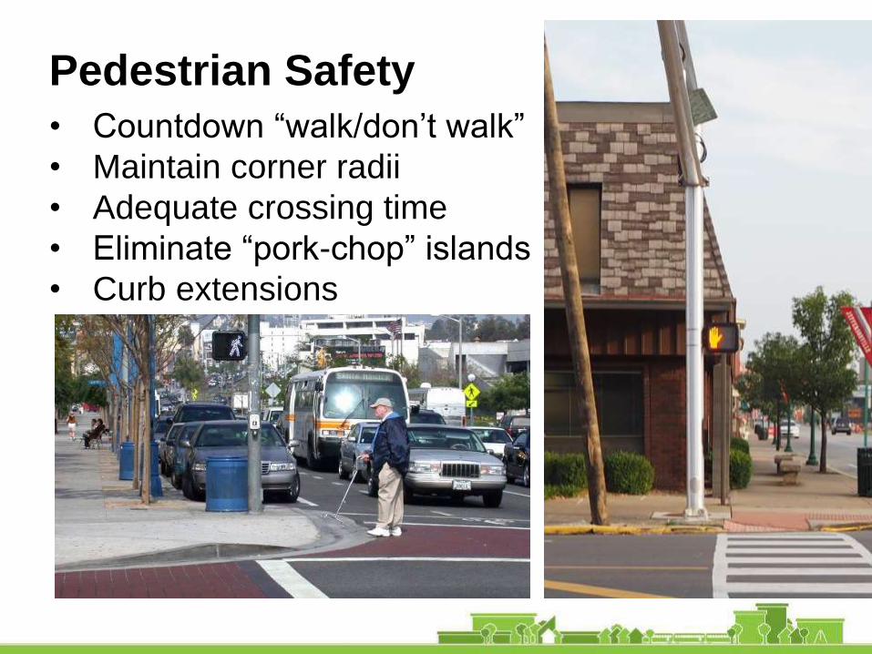
• Countdown “walk/don’t walk”
• Maintain corner radii
• Adequate crossing time
• Eliminate “pork-chop” islands
• Curb extensions
Pedestrian Safety

• At least one block in all directions
• 15 mph
• Design flexibility, e.g.:
- fluorescent yellow-green signs and striping
- stop signs
- speed traps
Safe Routes to Schools
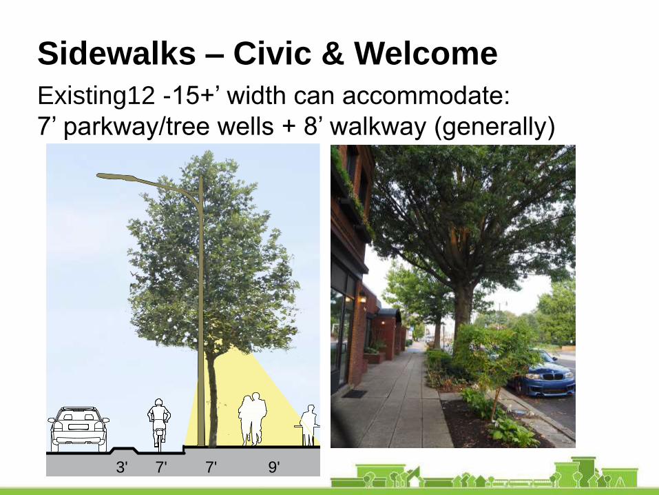
Sidewalks – Civic & Welcome
Existing12 -15+’ width can accommodate:
7’ parkway/tree wells + 8’ walkway (generally)
travel lanetravel lane
Spring St. to Meigs St. looking east
66' roadway
100' right-of-way
0' 16'10'
14' sidewalk 16' sidewalk
parkingparking
7' 7'park-way
walk-way
SEPARATED BIKE LANES
9'7'Median
7'bikelane
3'buf-fer
18' 3'buf-fer
7'bikelane
14' 18'
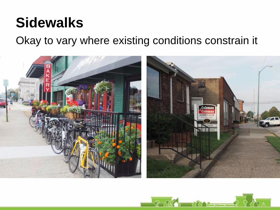
Okay to vary where existing conditions constrain it
Sidewalks

But new development should stay out of the ROW
and provide parkways and street trees
Sidewalks
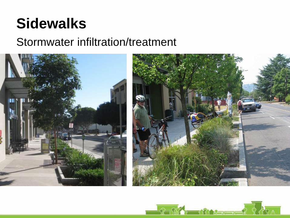
Stormwater infiltration/treatment
Sidewalks
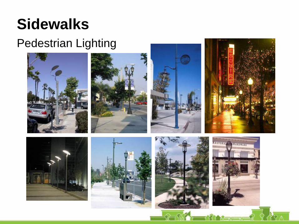
Pedestrian Lighting
Sidewalks

Roadway Lighting
Sidewalks
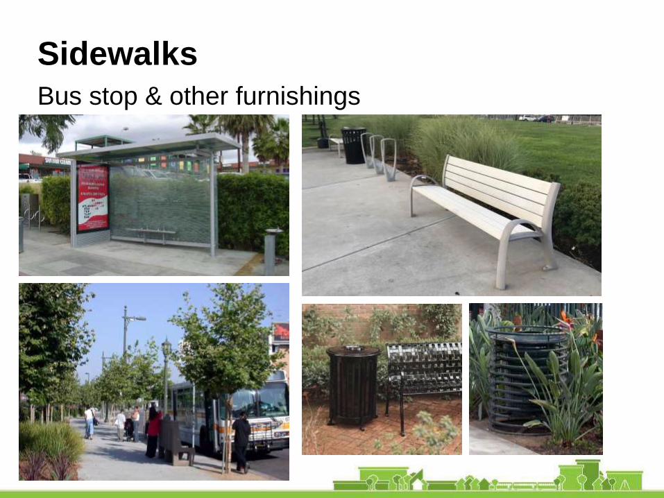
Bus stop & other furnishings
Sidewalks
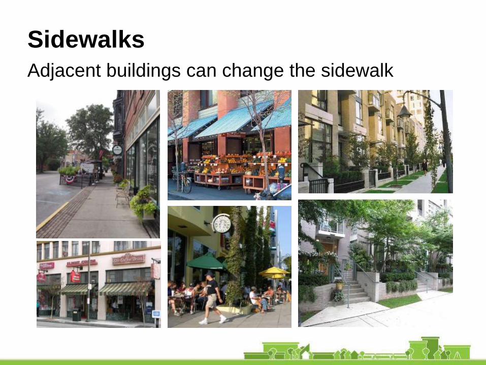
Sidewalks
Adjacent buildings can change the sidewalk

The Future? Striping and trees only

1. Clear transition from Civic to Residential
2. Slow traffic down
3. Consider parkways in residential area
4. “Trees all the way”
5. Enforcement, e.g., no parking on sidewalk
What We Heard – ResidentialM
eig
sA
ve.
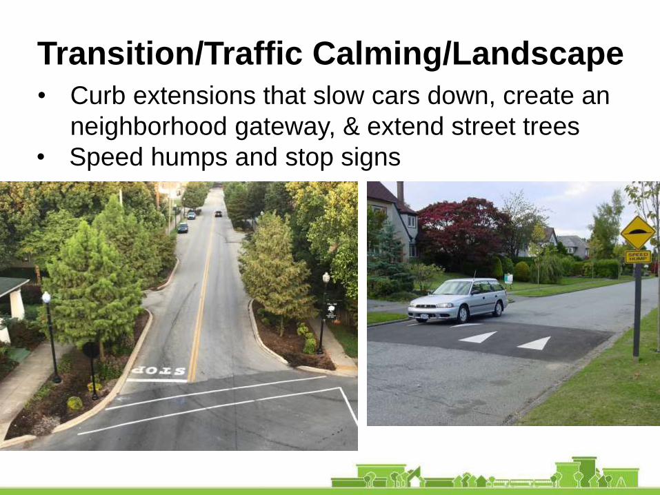
• Curb extensions that slow cars down, create an
neighborhood gateway, & extend street trees
Transition/Traffic Calming/Landscape
• Speed humps and stop signs

Programming the Public Realm
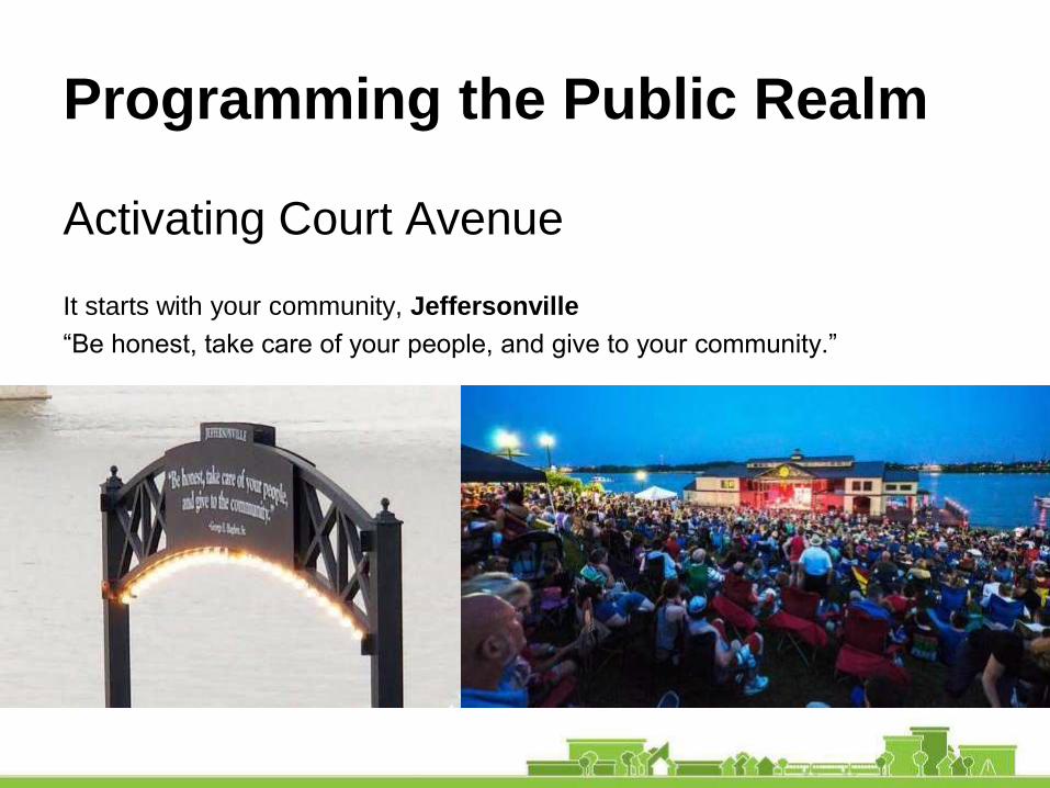
Programming the Public Realm
Activating Court Avenue
It starts with your community, Jeffersonville
“Be honest, take care of your people, and give to your community.”

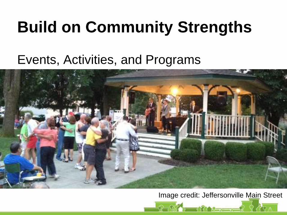
Build on Community Strengths
Events, Activities, and Programs
Image credit: Jeffersonville Main Street
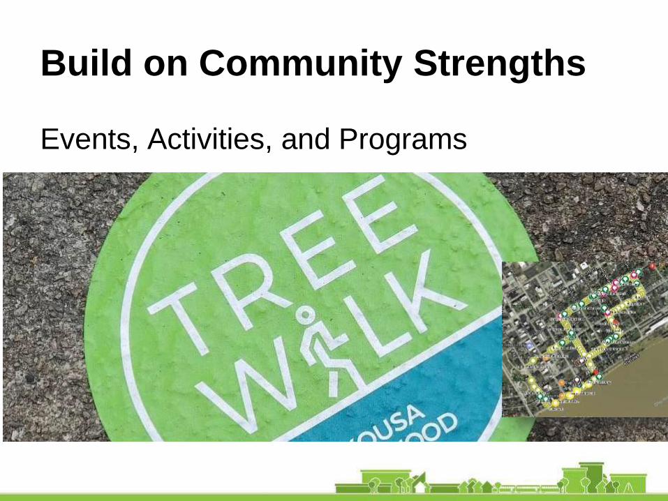
Build on Community Strengths
Events, Activities, and Programs
Image credit: Jeffersonville Main Street
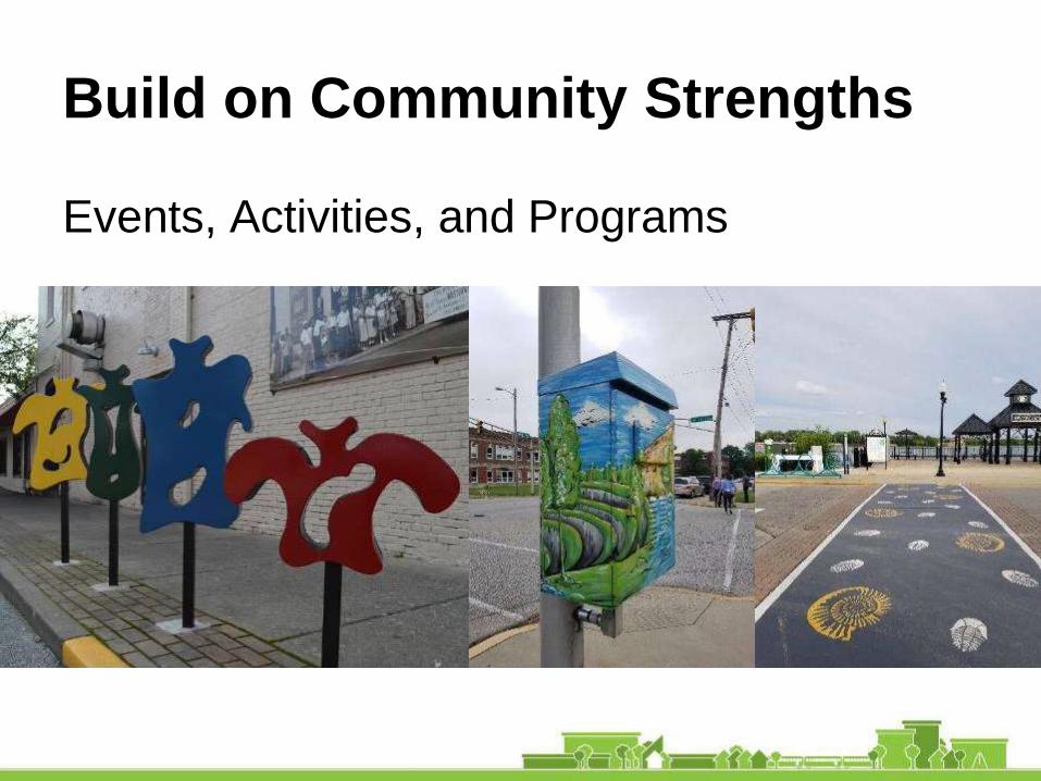
Build on Community Strengths
Events, Activities, and Programs
Build on Community Strengths
Events, Activities, and Programs
Activate the Civic Spine
Court Avenue
“We found that if you make more road space, you
get more cars. If you make more bike lanes, you
get more bikes. If you make more spaces for
people, you get more people and of course then
you get more public life.” -Jen Gehl
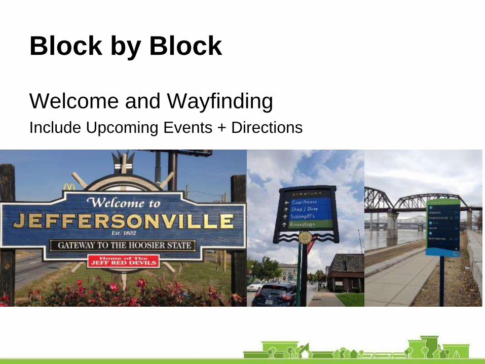
Block by Block
Welcome and WayfindingInclude Upcoming Events + Directions
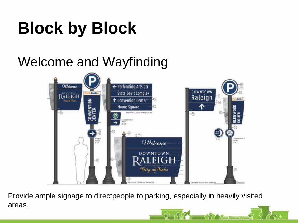
Block by Block
Welcome and Wayfinding
Provide ample signage to directpeople to parking, especially in heavily visited
areas.

Block by Block
Activation Strategies
Use the civic and Institutional buildings as wayfinding
nodes to help define where you are in downtown
Staged, inexpensive interventions can help “make-over”
undesirable spaces into cherished community places.
Often called “tactical urbanism” these interventions can
be temporary or permanent, or set the stage for long-term
infrastructure improvements.
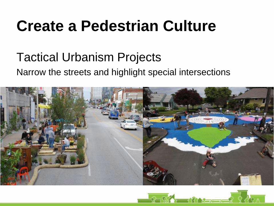
Create a Pedestrian Culture
Tactical Urbanism ProjectsNarrow the streets and highlight special intersections

Create a Pedestrian Culture
Tactical Urbanism ProjectsHelp people get around on foot, or bike
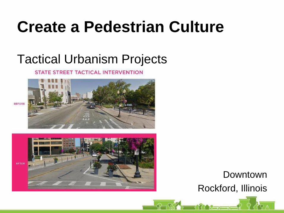
Create a Pedestrian Culture
Tactical Urbanism Projects
Downtown
Rockford, Illinois

Block by Block
Avenue Anchors
Institutional and Civic Sites
Warder Park
Public Library
Court House
Elementary School
Field House

Block Activation Plan
Shared Spaces and Connections6th Street Corner
Close the short segment of 6th Street to create a
community gathering space
Block Activation Plan
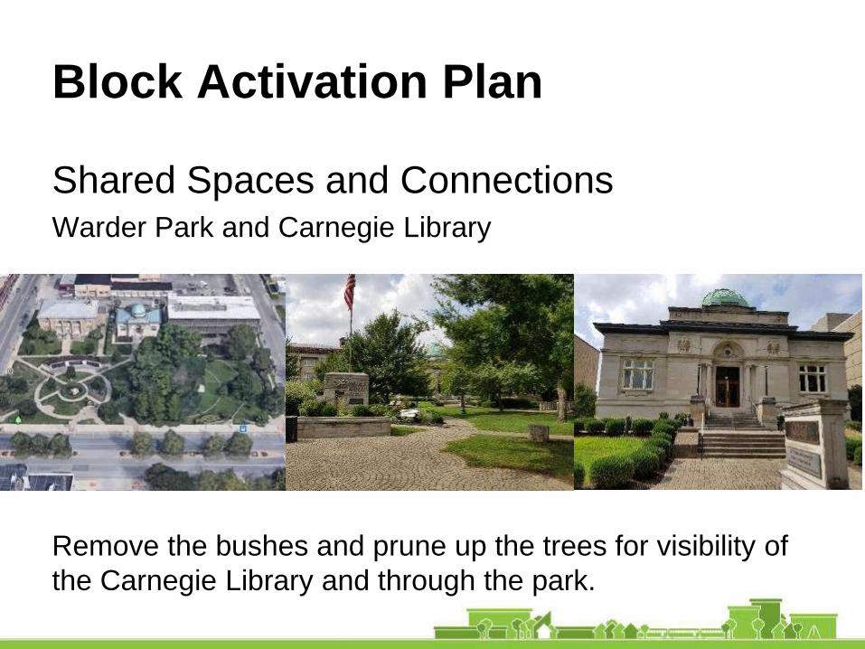
Shared Spaces and ConnectionsWarder Park and Carnegie Library
Remove the bushes and prune up the trees for visibility of
the Carnegie Library and through the park.
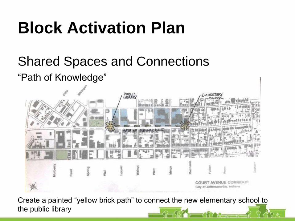
Shared Spaces and Connections“Path of Knowledge”
Create a painted “yellow brick path” to connect the new elementary school to
the public library
Block Activation Plan

Community Partnerships
Collaborate for Success
Jeffersonville Mainstreet Program
Arts Center and Public Art
Clark County School District
Neighborhood Associations
City Pride
Leadership Southern Indiana
Jeffersonville Township Public Library
Ogle Foundation

Community Partnerships
Programed Events
Get the community engaged in Jeff
Partner with local businesses to host small events
that require minimal set-up.
Ideas:
Civic Day: City University Game Day in the Park
Court on Court Field Day in the Park
Sidewalk Salon Botanical Garden
History Happy Hour Food Trucks on Court
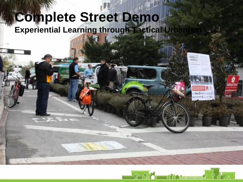
Complete Street DemoExperiential Learning through Tactical Urbanism

A Guide to Community Conversations
Urbanism on Tap (UOT) is an event series where
spaces of casual conversation become places of
civic education.
UOT brings ideas about cities to the local bar, pub,
or tavern to raise awareness, and exchange
knowledge and experience.
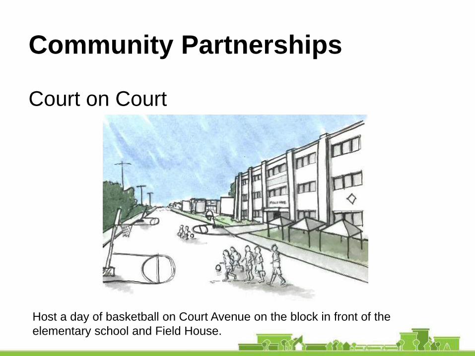
Community Partnerships
Court on Court
Host a day of basketball on Court Avenue on the block in front of the
elementary school and Field House.

Community Partnerships
Food Trucks on Court
Food trucks and other vendors can activate Court after 5pm during concerts
and other scheduled events, particularly if Court Avenue is closed to traffic.
Revisit the City ordinance to allow for mobile vendors. Encourage local
businesses to put out tents or carts.
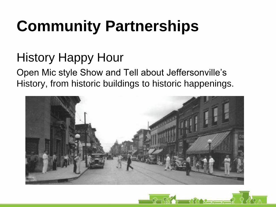
Community Partnerships
History Happy HourOpen Mic style Show and Tell about Jeffersonville’s
History, from historic buildings to historic happenings.
Summing Up
We planned… for the City’s Civic Spine
Events: Temporary programming to enliven the public
realm for residents and visitors;
Paint: New striping and crosswalks, bulb outs, street
trees, etc., for safety and beautification;
Funding: Apply for support to a healthy corridor redesign,
especially to support new school;
Infill development: Underutilized and vacant lots can
support desirable downtown uses;
Market: Economic indicators suggest that a revitalized
corridor will further the downtown renaissance and benefit
the city at large.
Questions? www.aia.org/liv_sdat
Court Avenue Corridor AIA SDAT
City of Jeffersonville, IN
Strengthening the City’s Civic Spine