chapter 6 cultural and heritage values - nrc.nsw.gov.au assessment - red gum/red gum - ar … ·...
TRANSCRIPT

Cultural and heritage values
6.1 Overview 134
6.2 Indigenous nations in the bioregion 134
6.3 Indigenous organisations in the bioregion 136
6.4 Indigenous heritage values of the Riverina bioregion 136
6.5 Indigenous uses, values and concerns 141
6.6 Land management with greater Indigenous involvement 143
6.7 Non-Indigenous cultural values 144
6.8 Non-Indigenous heritage sites and items 146
Chapter 6

134 Riverina Bioregion Regional Forest Assessment: River red gum and woodland forests
6.1 Overview
The Riverina bioregion supports cultural and heritage values for both Indigenous and non-Indigenous people. The heritage of the Riverina region reflects the historical and continuing interactions between the forests and their surrounding communities.
Heritage is all the things that make up Australia’s identity: our spirit, our ingenuity, our historic buildings and our unique living landscapes. Our heritage is a legacy of the past, a living, integral part of life today and the stories and places we pass on to our future generations (DEWHA, 2009a).
This chapter explores contemporary Indigenous aspirations, values and interests, as well as the non-Indigenous cultural and heritage values of the forests. It supports Step 2 of the analytical framework by:
• describingIndigenousvalues,usesandheritage,andsuggesting options for improving the level of Indigenous involvement in land management
• outliningtheresultsofconsultationswith Indigenous organisations
• describingthecontemporaryculturalandheritagevaluesrelated to the river red gum forests.
The key findings of this chapter are:
• Indigenouscommunitieshaveastrongspiritualconnection to the forests. Access to the forests and the ability to visit special places, and continue practices such as hunting, fishing, collecting foods, and telling stories is critical for cultural survival. Like environmental flows, cultural flows are also highly valued by Indigenous communities.
• LocalIndigenouscommunitieshighlightedthatarole in forest management, supporting greater self-dependency and improving employment opportunities were their primary concerns. Irrespective of future land use decisions, it is important that the process of understanding the aspirations of Indigenous people in the Riverina bioregion continues.
• Non-Indigenousculturalheritageoftheregionisencapsulated in the connections between local communities, the timber industry and the forests, as well as the historical use of river red gum in river transport.
• ForRiverinacommunitiesandtowns,theriverredgumforests are the areas where they live, work and play. The forests and the associated heritage form a strong part of people’s connection to place and their personal identity.
• Futurelandmanagers,irrespectiveoftenure,needtocontinue to engage with Indigenous and non-Indigenous communities to better map cultural and heritage uses, values, aspirations and concerns.
6.2 Indigenous nations in the bioregion
Indigenous communities of many nations have occupied the red gum forests for at least 10,000 years (Yarkuwa submission, 2009) with records suggesting that the Murray region was one of the most heavily occupied before European arrival.
Indigenous people of the Riverina shaped and managed the environment in which they lived. Studies of traditional interactions between Indigenous people and the environment suggest that fire was used extensively. In 1883 Curr observed (as cited in Atkinson, 2005) both annual mosaic burning and the Yorta Yorta people setting fire to grass and trees as frequently as every five years, either accidentally or systematically, for hunting purposes. This burning is likely to have assisted woodland formation (as river red gum is a fire-sensitive species) and may have contributed to the maintenance of a forest-grasslandboundaryinsomeareas(NavinOfficer,2009)although the specific details around pre-settlement fire regimes is actively debated (e.g. Benson and Redpath, 1997; Bowman, 1998; Esplin et al., 2003; Jurskis, 2009).
According to Tindale (1974) the traditional tribal groups or nations listed in Table 6.1 were resident in the Riverina bioregion.
Figure 6.1 shows the general location of traditional Indigenous language groups in parts of the Riverina bioregion (information and map based on Horton, 1996). The bioregion is bisected by a number of traditional boundaries which are largely based on linguistic evidence. These boundaries can be misleading because the movement of the people varied seasonally and their settlement patterns were fluid. This is an indicative map only to reflect the general locale of nations and should not be used as the basis for any tenure or boundary decisions.
Table 6.1: Traditional tribal groups or nations of the Riverina bioregion
Local Aboriginal Land Councils in the bioregion
Barapa Barapa Barindji Barkindji Dadi Dadi Danggali
Djadjawurung Kureinji Latje Latje Madi Madi Meru
NariNari Ngurraiillam Taunguong Wadi Wadi Waveroo
Wamba Wamba Wergaia Wiradjuri Wongaibon Yitha Yitha
Yorta Yorta

Figure 6.1: Indicative traditional Indigenous language groups (not to be used for native title purposes)
136 Riverina Bioregion Regional Forest Assessment: River red gum and woodland forests
6.3 Indigenous organisations in the bioregion
InNSW,LocalAboriginalLandCouncils (LALCs), Indigenousnations, Aboriginal Community Working Parties, Traditional Owner groups and Elders’ groups are the representative bodies for the interests, concerns and aspirations of Indigenous people.
MurrayLowerDarlingRivers IndigenousNations(MLDRIN) isa confederation of Indigenous nations and includes a number of Traditional Owners from the lower, southern part of the Murray-Darling Basin. Current delegates of MLDRIN comefrom the Barapa Barapa, Latji Latji,MuttiMutti, Ngarrindjeri,Taungurung, Yorta Yorta, Wadi Wadi, Wamba Wamba, Wergaia andWiradjuriNations.MLDRINwasformedin1998duringtheYorta Yorta native title case.
In1977theNSWIndigenousLandCouncilwasformedasalobby group for Indigenous land rights. Then in 1983, NSWenacted the formalcreationofLALCs,under theNSWLand Rights Act, as a mechanism for compensating Indigenous peopleforlossofland.Thereare121LALCsacrossNSW,andalong with other Indigenous organisations and DECCW they have responsibilities related to Indigenous cultural heritage.
Table 6.2 lists the LALCs that are either partially or wholly within the Riverina bioregion (see also Figure 6.2).
6.4 Indigenous heritage values of the Riverina bioregion
The Riverina bioregion supports a rich cultural heritage for Indigenous people. Indigenous cultural heritage relates to places with traditional significance. The resources, utilisation of the environment and the knowledge passed down through generations also suggest that the red gum areas were highly valued by Indigenous people for survival.
6.4.1 Indigenous heritage
For Indigenous people the Riverina bioregion is a culturallandscape with archaeological sites that have ongoing spiritual and cultural significance. The significance of sites is often tied to its context within the landscape or to stories of recent and Dreaming ancestors. Some sites may have significance independent of the landscape, but more often the significance of a site relates to its contextwithinthelandscape.Furthermore,broader landscapes and landforms may be culturally significant, relating to stories of recent ancestors or embodying the actions of Dreaming ancestors, even without evidence of physical sites.
The fabric of the land itself and its resources are also culturally important. For Indigenous people, cultural, spiritual, natural,physical and economic values are interlinked and heritage is only a subset of the overall values of importance. While the protection of archaeological sites plays a major role in the cultural heritage of Indigenous people, this alone does not reflect their social and economic aspirations in the 21st century (Ward, 2008).
Indigenous cultural heritage is important because of its relevance in the present, and should not be misunderstood as relics of the past. Indigenous cultural heritage relates to places with traditional significance, places of mythology or stories, archaeological sites, post-contact sites (missions, fringe camps and stations) and the plants and animals associated with traditional and cultural values. While Indigenous cultural heritage tends to be divided between physical/conceptual and ancient/recent, there is an interrelationship between these different aspects and their relationship with the overall landscape.
Table 6.2: Local Aboriginal Land Councils in the Riverina bioregion
Local Aboriginal Land Councils in the bioregion
Albury and District Balranald Cummergunja Dareton
Deniliquin Griffith Hay Ivanhoe
Leeton and District Moama Murrin Bridge Narrandera
Wagga Wagga Wamba Wamba Yota Yota
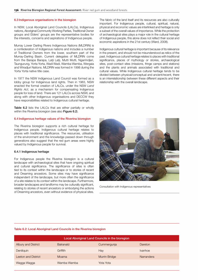
Consultation with Indigenous representatives

Figure 6.2: Map of Local Aboriginal Land Councils in the NSW section of the Riverina bioregion

138 Riverina Bioregion Regional Forest Assessment: River red gum and woodland forests
While this assessment sought to understand the Indigenous cultural heritage of the region, theNRC recognises that thisknowledge is the property of the local Indigenous people, and to provide a more detailed heritage assessment is not appropriate for this assessment nor necessary. For thepurposesofthisassessmenttheNRCsoughttounderstandthedepth of connection that exists between the local Indigenous communities and the surrounding landscapes.
Indigenous sites
There are comparatively few records of Indigenous history compared with non-Indigenous social and historical information heldbytheNationalLibrarydatabase.Theprincipallanduseofthe Riverina bioregion over the last 130 years has been sheep and cattle grazing. The 1880s and 1890s saw rapid land use change and large-scale agricultural developments. In this context the Indigenous heritage of the region has not been well assessed or conserved, with most of the area freehold and cleared (Pardoe and Martin, 2001). Land clearing for irrigation, usually involves laser leveling which removes evidence of landforms and sites from the landscape as noted by White (cited in Purcell, 2003).
A cultural heritage desktop audit from 2003 found that while information was scarce, a total of 993 Indigenous heritage sites were found across the Riverina bioregion. The table shows that a range of important sites exist. Table 6.3 shows the number of sites from the Lachlan, Murrumbidgee and Murray fans subregions.
Estimates of Indigenous populations along the Riverina vary, but it is commonly believed that the Central Murray area may have been one of the most highly populated places in Australia, prior to European arrival (Webb, 1984). The Indigenous cultural heritage that exists in the Riverina bioregion includes oven (earth) mounds, artefact scatters, modified (scarred/carved) trees, hearths, rock art sites, shell middens, burials, potential archaeological deposits, ceremonial/Dreaming sites, fish traps, stone arrangements, resource and gathering sites, and stone quarries(NavinOfficer,2009).
Table 6.3: Desktop audit of Indigenous heritage sites in the Riverina bioregion (Purcell, 2003)
Site type Lachlan Murrumbidgee Murray fans
Aboriginal place 0 1 1
Axe grinding groove 1 0 0
Bora/ceremonial 1 1 0
Burial 5 36 47
Contact, mission 0 2 1
Fishtrap 0 1 1
Isolated find 2 4 4
Midden 2 19 15
Mound (oven) 1 87 248
Naturalmyths 0 0 4
Ochre quarry 0 0 1
Open camp site 13 105 21
Quarry 1 0 0
Scarred tree 18 147 199
Shelter deposit 1 0 0
Stone arrangement 0 1 0
Water hole/well 0 0 2
Total 45 404 544
Note:Theabovetableisforindicativepurposesonly.Duetothedatewhenthisauditwasconductedtheexactsize of the Riverina bioregion differs to what is used for this assessment, as the IBRA (bioregion) boundaries are different.

Chapter 6: Cultural and heritage values 139
Box 6.1: Taroo (Lake Victoria)
Taroo or Lake Victoria, located on the western border of the bioregion is both a physically and culturally significant feature in the landscape. It is a shallow freshwater lake in southwestern NSW, close to the South Australianand Victorian borders which is significant to Indigenous people and the broader Australian community at a national level. Water regulation has contributed to the erosion of the lakeshore and the exposure of Indigenous cultural heritage, in particular burial grounds. The river red gum forests along the lakeshore is the most culturally significant feature and is now the subject of a landscape management plan.
Throughout 1841 the Indigenous people of Lake Victoria engaged in one of the strongest resistance campaigns against European invasion. For several months theIndigenous people were successful in their defense, until 27 August 1841, when combined forces and a police expedition from Adelaide resulted in what became known as the Rufus River Massacre.
The Lake is also connected to Dreaming stories about the creator of the Murray River and has special spiritual significance (MDBC, 2002).
Recorded history of traditional tribal groups
A significant aspect of Indigenous heritage sites in the Riverina is the high counts of registered burials. Further, Indigenousmound sites are unique to the Riverina region and the highest frequency of mound sites in Australia occurs here (Coutts, 1981). In the Werai Forest alone there are 12 traditional cemeteries.
Forests NSW’s policies for cultural heritage management
Forests NSW has developed policies, plans and operationalguidelines on how to identify and manage cultural heritage. These outline how Forests NSW works with Indigenouscommunities, how cultural heritage will be protected, and how cultural awareness will be promoted amongst staff.
To enable cultural heritage practices to continue Forests NSWEcologically Sustainable Forest Management Plan outlines thatForestsNSWwillgivefavourableconsiderationtoproposalsfromAboriginalcommunities touseareasofStateForest.TheNRCunderstands from discussions with local Indigenous communities
Table 6.4: Types of Indigenous archaeological sites found in the Riverina bioregion (Aboriginal Affairs Victoria factsheet)
Type Description Characteristics
Scarred trees Trees where the bark has been removed for various purposes including: canoes, containers and shields.
Regular in shape, but varying in size.
Slightly pointed or rounded ends.
Used as landmarks or directional markers for navigation.
Burials Evidence of human bones, exposed through disturbance or erosion.
Usually found in soft soils and sand.
Freshwatermiddens Concentration of freshwater shells, the result of eating and cooking freshwater shellfish.
Size can vary greatly from 1m long to 1000 metres long.
Foundalongriverbanksandfloodplains.
Stone quarries Outcrops of stone where Indigenous people collected materials for tools.
Evidence of flaking, crushing and battering of stones.
Pits and trenches around the base of the outcrop.
Often stone tool artefacts such as hammerstones, anvils and grinding stones.
Surface scatters Accumulation of remains from Indigenous activities such as charcoal, animal bone, shell and ochre.
Frequentlylocatednearareliablesource of fresh water, exposed through disturbance or erosion.
Scar tree near Murrumbidgee River

140 Riverina Bioregion Regional Forest Assessment: River red gum and woodland forests
around Deniliquin and Forests NSW staff that cooperativerelationships have been fostered in recent years (Yarkuwa, Atkinson,KandRodda,G,ForestsNSW,pers.comm.,2009).
Forests NSW has programs to manage and encourageIndigenous involvement in State Forests. These include jobcreation programs, programs to investigate and develop joint/co-management arrangements (Forests NSW, 2009c).The proposal for an Indigenous Protected Area between ForestsNSWandYarkuwaIndigenousKnowledgeAboriginalCorporation is discussed later.
The operational guidelines prescribe restrictions for forestry activities. This includes controls to protect Indigenous sites, relics and places, such as the requirement of a 10–50 metre buffer around Indigenous sites. An Aboriginal heritage inspection and report should be completed for each compartment or operational area, prior to forestry operations commencing.
ForestsNSWseekstoengagelocalIndigenousrepresentativesin cultural heritage identification work and provides Indigenous culturalawareness training forForestsNSWstaff to instillanoperational culture that better understands cultural heritage (ForestsNSW,2006,Rodda,G,ForestsNSW,pers.comm.,2009). Under the National Parks and Wildlife Act 1974,ForestsNSWisrequiredtomanagetheheritagevaluesofStateForestsand provide statutory protection for all Indigenous objects and places(ForestsNSW,2008).
Forests NSW management of Indigenous sites
Forests NSW maintains a database of known Indigenousheritage sites which draws on the Aboriginal Heritage Information Management System database maintained by DECCW, forest management records, and from consultation withIndigenouscommunities(ForestsNSW,2008).TheForestsNSWEIS(ForestsNSW,2008)reportstherehavebeen1,063site recordings in the 120,050 hectares of the south-western StateForests,ascapturedbelowinTable 6.5.
The value and context that can be gained from these figures is limited and is a function of the scope and number of surveys conducted.Fewersitesdoesnotequatetolesssignificanceas a larger survey would most likely reveal more sites. Nordoes the data provide a degree of the significance of the sites. AcomprehensivesurveyacrosstheentireStateForestestatewould most likely reveal the presence of more sites.
During consultations Indigenous people expressed concern that despite the development of these policies they were not being uniformly enforced.
6.4.2 Consultation with Indigenous organisations during the assessment
The NRC has sought to constructively engage withrepresentative Indigenous bodies and concerned individuals in the region. Unfortunately, due to the timeframe for the assessment it was not possible to consult in all regions or with all nations or organisations. Subsequently a number of organisations and regions are not represented.
Table 6.5: Number of Indigenous heritage site recordings in State Forests with greater than 25 recorded sites (ForestsNSW,2008)
State Forest no. State Forest name Area of State Forest No. of site recordings
90 Banangalite 1,294 39
384 Werai 9,454 349
398 Millewa 20,938 77
558 Gulpa lsland 5,478 76
576 Moira 10,578 84
615 Campbells Island 3,812 38
625 Koondrook 15,140 291
773 Lake Victoria 4,397 29
Sub total 71,091 983
Total in Riverina bioregion 120,050 1,063
Note:ThistableisindicativeonlyandshouldbeconsideredinthecontextofareasthatwereactuallysurveyedforIndigenous sites. The actual number of sites is expected to be far greater.

Chapter 6: Cultural and heritage values 141
The NRC met with groups to explain the focus, scope and background of the assessment and to hear and better understand the concerns and aspirations of the Indigenous people in the region regarding the river red gum forests in the Riverina. As part of the assessment the NRC consulted with the organisations listed in Table 6.6.
While the NRC did not meet with all the LALCs in the region, it met with representatives from the Deniliquin LALC on a number of occasions and discussed the assessment with the Cummergunja LALC. The NRC held a two-day workshop with MLDRIN in October 2009. The comments expressed during this process and in submissions received are included in the paragraphs below. The full report from this consultation can be found in Appendix 8.
The NRC found there was a diversity of views in terms of future aspirations and Forests NSW management. Many organisations and individuals were supportive of Forests NSW. They felt Forests NSW was a good land manager that conducted meaningful engagement with the community, while others were less positive.
The NRC found that more work towards a common understanding around who can speak for Country, and resolution around boundaries is needed. As the workshop facilitator Tony McAvoy observed, “the degree to which it [NRC’s report] will make use of Indigenous options in the solution to this problem, will in part be limited by the Indigenous community’s ability to resolve internal disputes”.
6.5 Indigenous uses, values and concerns
As the first nations of Australia, Indigenous people have inherent rights to be involved in decisions that affect Country and their strong connection to it. Indigenous people are the original custodians of the land and waters and seek to maintain an ongoing connection with Country.
The Australian Government’s recent endorsement of the United Nations Declaration on the Right of Indigenous Peoples (UNDRIP) establishes the Australian Government’s commitment to the status given to Indigenous peoples.
6.5.1 Indigenous uses of the river red gum forests
Indigenous culture has evolved over time, adapting to new settings and contexts. While fishing and hunting may be regarded as recreational practices common to many people, for Indigenous people such activities also have cultural meaning, as they involve returning to Country and the associated spiritual connection. Some of the bush foods in the river red gum forests include fish, waterbirds, yabbies, mussels, turtles, possums, kangaroos, emus, cumbungi, reeds, water lily, dandelions, angled pig face, sow thistle and lerp (Pardoe, 1998).
Understanding by non-Indigenous people of the significance of red gum environments from an Indigenous perspective can be assisted by Use and Occupancy Mapping, a social science methodology which maps an Indigenous person’s relationship with the land and waters. This type of mapping helps resolve the lack of visible evidence for contemporary cultural relationships.1 ‘Use’ refers to activities such as hunting, trapping, fishing, gathering of medicinal and ceremonial plants. ‘Occupancy’ refers to areas Traditional Owners regard as their own through place naming, traditional stories, spiritual places or burial grounds.
Recent use and occupancy mapping was conducted to explore Indigenous people’s connection to the Werai Forest (Yarkuwa, 2009). So far, more than 10,000 locations have been identified by current generations as areas where cultural activities have taken place, although mapping is not yet complete.
6.5.2 Indigenous values and concerns associated with the river red gum forests
The specific values of different Indigenous representative groups are described below. The high-level and common concerns expressed by MLDRIN include:
• accesstotheforests
• improvedcomplianceintheprotectionofIndigenouscultural heritage sites in the forests
• culturalwaterflows
• economicself-determination.
The NRC also met with other Indigenous community members who expressed support for Forests NSW practices in terms of community engagement, land management and identification of cultural sites.
Cummergunja expressed strong support for Forests NSW. Kevin Atkinson informed the NRC that he believes forestry is important for the health of the forests and that the decline in forest health is the result of reduced water availability. He says Cummergunja have enjoyed good relations with Forests NSW who have undertaken cultural mapping with them and conducted meaningful community engagement (Cummergunja submission, 2009).
1 In recognising that the values, aspirations and contributions of Indigenous people is integral to NRM, The Living Murray Initiative recently employed the use and occupancy mapping technique with the Yorta Yorta people in Australia (Ward, 2009).
Table 6.6: Indigenous communities consulted
Organisation
Barapa Barapa (MLDRIN representatives)
Culpra Milli Indigenous Corporation
Cummergunja Local Aboriginal Land Council
Deniliquin Local Aboriginal Land Council
Mutti Mutti (MLDRIN representatives)
Yorta Yorta Nation Aboriginal Corporation
Wamba Wamba (MLDRIN representatives)
Wiradjuiri (MLDRIN representatives)
Wadi Wadi (MLDRIN representatives)
Yarkuwa Indigenous Knowledge Centre Indigenous Corporation

142 Riverina Bioregion Regional Forest Assessment: River red gum and woodland forests
Access
Country is at the core of Indigenous well-being. As described by Jackson (2005), “for Indigenous Australians, their personal, cultural and spiritual identity, their sense of belonging and sense of security, are inextricably linked to water and Country.”
The health of Country, the ability to hunt and collect foods from the bush, and return to Country individually and with others were expressed to the NRC as fundamental needs for Indigenous people. While the NRC heard a diversity of views regarding the future of the forests, the ability to visit the forests, and to continue practices such as hunting, fishing, collecting foods, telling stories and visiting special places, was uniformly expressed across the Indigenous communities met with by the NRC. Access enables the survival of culture through the continuation and sometimes renewal of practices, stories and connections.
Cultural knowledge and practice is central to Indigenous peoples’ sense of identity, culture and spirituality. As one Wiradjuri elder put it: “Continuing our culture is a matter of religious freedom. All Australians have the right under the Constitution to worship however they wish. Denying Indigenous people access to the forests is denying them their religion.”
Box 6.2: Moonacullah Mission
The Moonacullah Mission is located northwest of Deniliquin on the banks of the Edward River. Between 12-14 families were settled there with a mission manager who was also the school teacher. To this day Moonacullah attracts large groups of families especially during the holidays and in the change of seasons.
People gather to tell stories of the past, spend time with each other, learn cultural practices and spend time in Country. The change of season attracts people because of the different food types available and to watch the landscape change.
It holds special historic and contemporary meaning to the local Indigenous people. Many of the Indigenous families in the region can trace their familial connection back to Moonacullah.
A burial site is located near the mission which has been fenced and protected by Forests NSW. Other burials are said to also exist in proximity to the mission (Taylor, S and Baxter, D, pers. comm., 2009).
Protection of Indigenous sites
While Forests NSW has comprehensive operational guidelines for management of Indigenous cultural heritage, some Indigenous people stated to the NRC that they were frustrated and upset that culturally significant sites such as scarred trees and burials, had been used for timber or damaged, albeit inadvertently, on public and private land. The MLDRIN representatives who met with the NRC expressed the grief caused by damage to their places of spiritual significance and heritage. While much of the damage may have happened many years ago, it still causes pain. The impact is that “people feel lost in their own Country” when scarred and other trees used as landmarks, are removed.
Cultural water flows
Central to an Indigenous worldview is the necessity of integrated custodianship between land and waters. Indigenous peoples’ survival in Australia relied upon knowledge of the episodic and seasonal patterns (and reliability) of creeks, rivers, waterholes, wetlands, springs and soaks. Increasingly the value of traditional Indigenous knowledge and land management practices – in particular fire management and medicinal properties of plants – is being recognised.
In its submission to the NRC, MLDRIN highlighted that cultural water, beyond environmental water, is required so that Indigenous people are empowered to meaningfully fulfill their responsibilities to care for Country. MLDRIN noted that they have long understood the strong links between forest health andfloods.Theyrequestedthatfutureforestmanagementbetiedtoadequateflows,especiallywhereit involvesincreasedpartnership with local Indigenous communities.
The NSW Water Management Act 2003 allows for cultural water access licences. While examples exist, the Indigenous communities in the region expressed a strong desire for increasedculturalwaterflowstosupportarangeofenvironmental,economic and cultural outcomes. The Culpra Mill Indigenous Corporation has been involved in the allocation of environmental water for river red gums along the Tarpaulin Creek Culpra Station and Malley Cliffs State Forest (Pearce, 2009).
Box 6.3: Cultural allocation – Murrumbidgee Regulated Water Sharing Plan
The Murrumbidgee Regulated River Water Sharing Plan contains a provision for a water allocation for cultural purposes, a sub-category of high-security access licences, and allows for water to be taken for Indigenous domestic and cultural purposes (NSW Office of Water, 2009). The Murrumbidgee Traditional Owners and Cultural Heritage Reference Group is working with DECCW and the Murrumbidgee CMA to develop a cultural watering plan that will identify sites/places where the 1,250 ML can be delivered to culturally significant areas (Murrumbidgee CMA, 2009).
Socio-economic determination, employment and training
The creation of employment opportunities and greater socio-economic determination, is a fundamental concern which was repeatedly expressed across the Indigenous communities met by the NRC. The goal of engendering greater self-responsibility is at the forefront of Indigenous aspirations.
As part of the Environmental Impact Statement, Forests NSW initiated a process to discuss the future of the forests in 2008, via a workshop held with MLDRIN.
As part of the assessment the NRC has made an initial attempt to start the process of better understand time constraint the goals of the Indigenous people in the Riverina. During the assessment the NRC heard not only of the long-term pain caused by exclusion, but also of the welcoming support for the attempt to be given a voice in the assessment process.
6.6 Land management with greater Indigenous involvement
While the percentage of land in the Indigenous estate across

Chapter 6: Cultural and heritage values 143
2008). The ability of Indigenous people to connect with their traditional land and waters has deteriorated with the declining health of these systems (Ward, 2008). The local Indigenous communitieswhometwiththeNRCexpressedastrongdesirefor greater involvement in the management of the forests.
The range of options discussed below may facilitate a process for greater Indigenous involvement in land management. This goalisalsosupportedbytheNSWStatePlanwhichaimstoprovide greater opportunities for Indigenous people to take part in the management of Country, including joint management of NationalParks(NSWGovernment,2009).
While boundaries may not be resolved in the bioregion, all Indigenous representative bodies that the NRC met with,including Indigenous nations and LALCs, expressed the interest and desire to look after “River Country”. In their view, greater land management responsibilities would provide multiple benefits such as: employment opportunities for local Indigenous people, the ability to continue cultural practices, increased broader community understanding around Indigenous values, and training opportunities in conservation and employment in land management for local Indigenous people.
6.6.1 Indigenous Protected Areas
Indigenous Protected Areas (IPAs) are owned and managed by Indigenous communities for the protection of their significant natural and cultural values. IPAs make a significant contribution to biodiversity conservation and make up 23 per centoftheNationalReserveSystem(DEWHA,2009a).InsideIPAs Indigenous communities develop a plan to manage the natural and cultural values of the landscape, and are provided support to manage threats such as weeds, pests and bushfire (DEWHA, 2009a).
Yarkuwa Indigenous Knowledge Centre Indigenous Corporation, in partnership with Forests NSW and theAustralian Government, is currently exploring options under the IPA program for joint management of the northern part of theWeraiForest.Thisprojectisuniqueinthatitincorporatestraditional environmental and ecological knowledge with forestry practices under the IPA progam.
The initiation of this program between Forests NSW andYarkuwa Indigenous Knowledge Centre demonstrates the goodwill and sense of partnership that has been fostered by both sides. Such collaborative work is a positive step for greater Indigenous involvement in land management.
Box 6.4: Toogimbe Indigenous Protected Area
Toogimbe Indigenous Protected Area is a pastoral property spanning about 460 square kilometres near the town of Hay in the Riverina bioregion. Toogimbe is owned and managedbytheNariNariTribalCouncilandwasdeclaredan IPA in March 2004.
The property dates back to when farming was introduced in the bioregion. The features of Toogimbe include flat former pasture lands, eucalypt-lined creeks and wetlands. The Hay area was a major trade route for Indigenous people, supporting a vast social and cultural network.
The IPA activities involve protecting the scarred trees, campsites and burial mounds, reconnecting Indigenous people to their land, wetland flooding, replanting vegetation and controlling weeds and feral animals. Toogimbe’s wetlands are home to totem animals and traditional medicines and the traditional life of the Nari Nari peoplecentres around these wetlands.
The Nari Nari Tribal Council aims to continue timberharvesting for community use in a sustainable manner. The revegetation is a major undertaking. In 2005, 2.5 kilograms of local seed was collected and 8,500 seedlings planted. TheNariNariTribalCouncilhasalsoconstructedabushtucker garden and bird hides in the wetlands.
6.6.2 Joint management of National Parks
Joint management is where the Department of Environment, Climate Change and Water share responsibility for park management with Indigenous communities. This arrangement is recognised through a formal agreement such as a Memorandum of Understanding, an Indigenous Land Use Agreement or Aboriginal Ownership and leaseback under Part 4A of the National Parks and Wildlife Act 1974.
Both DECCW and the Indigenous communities seek benefits from joint management. For DECCW the aims include bettermanagement and protection of the natural and cultural heritage oftheparks.FortheIndigenouscommunitiesthebenefitsmayinclude greater socio-economic outcomes through employment, training and capacity building and a connection to Country.
The different requirements for the range of options for joint management between DECCW and Indigenous communities is described below.
6.6.3 Memorandum of Understanding
A Memorandum of Understanding is a voluntary agreement between DECCW and the Indigenous communities. It formalises the arrangement but is not legally binding, nor is it a recognition of native title rights.
6.6.4 Indigenous Land Use Agreements
An Indigenous Land Use Agreement (ILUA) is with native title holders or claimants and addresses the exercise of native title rights. An ILUA must follow the process set out in the Native Title Act 1993. In the past the NSW Government has onlyentered into an ILUA if there has been a native title claim over the land (DECCW, 2009).

144 Riverina Bioregion Regional Forest Assessment: River red gum and woodland forests
6.6.5 Aboriginal Ownership and lease-back
For Aboriginal Ownership or leaseback the park must be aland claim under the Aboriginal Land Rights Act 1983 and identified for nature conservation by the Government or listed on Schedule 14 of the National Parks and Wildlife Act 1974. Schedule 14 is the list of parks and reserves of significance to Indigenous people. It is necessary for the Aboriginal Land Council(s) and the Government to agree on the lease arrangements. Ownership of the park is transferred to the LocalAboriginalLandCouncil(s)andleasedbacktotheNSWGovernment for joint management.
The National Parks and Wildlife Act 1974 sets out the legislative requirements for parks to be listed on Schedule 14, the list of parks which can be returned to Indigenous ownership (DECCW, 2009).
6.7 Non-Indigenous cultural values
The non-Indigenous cultural values of the river red gums centres around historical and contemporary connections with the forests, and their role in the economic development of the region. Given the long history of interaction between local communities and the forests, for many residents the forests form a key part of their identity – either through their own connections, their family history or the history of the towns in which they live. This section explores the non-Indigenous cultural values and heritage of the region.
6.7.1 Contemporary non-Indigenous cultural values
River red gums are Australian icons. They are immortalised in Australian art, poetry and song. For visitors to the Riverina,and the people who live there, the river red gum forests are an intrinsic part of the landscape they love.
Visitors and locals alike talk about their enjoyment of the leisure opportunities the forests provide. Locals talk about the businesses they have built up, sometimes over generations, on income generated from the forests. They might talk about the history of the region, linked heavily to the rivers and their floodplain forests, or they might focus on the recreation and cultural values of the forests. Many rejoice in the sense of freedom they have through camping or fishing in the forests.
The Murray and its tributaries, with their floodplain forests, are dominant in the landscape. They are a dominant cultural backdrop to the communities that have grown along their floodplain boundaries. Not only are they major features in aphysical sense, they are an intrinsic component of the human geography of the region. It is no more possible to separate the river red gum forests from the towns than it would be to separate beaches from coastal communities (Teese and Wright, 2000).
Spending time in these forests, or in the towns of the Riverina, and talking with locals or people who visit regularly provides a sense that the river red gum forests have a deeper, more spiritual place in the lives of locals than is first apparent.
The livelihood of people in river towns was intrinsically linked to the river and many current residents hold memories of this generational link to the river. Many of the current day timber industry owners and operators are descendants of early settlers or mill operators. Most of the mill operators, such as the Rowe and Dankert families, have lived in and contributed to the region for generations.
Current generations feel that same close connection to this landscape as their great-grandparents did. They want the same sense of ‘place’ for their children and they want to see viable, secure and rewarding futures for future generations in their home towns.
Forallthecommunitiesthatliveintheproximityoftheriverredgum forests, such as Koondrook-Barham, Barooga, Balranald, Darlington Point, Deniliquin and Mathoura, these forests are their playgrounds. They are places to relax and spend time with family and friends (Teese and Wright, 2000). The forests are also a destination for people from outside the region, in particularvisitorsfromMelbourne.Formoreinformationaboutthe economic value of tourism see Chapter 5.
These forests are changing, through a combination of human intervention and a variable and changing climate, and the communities in the Riverina will feel these losses. They will feel the changes in their economy, but also feel the impact on their personal and community values and the identity and culture of their towns.
6.7.2 Recreation activities
Forlocalresidents,theforestssupportadiverserangeofnon-commercial values, including access for fishing, swimming, boating and collection of domestic firewood.
VisitorstoStateForestsengageinawiderangeofactivities,including organised events and tours and individual activities. Entry to the State Forests is free for most individual visitorswhile groups are required to take out special purposes permits toundertakeorganisedactivities(ForestsNSW,2005).
Camping
Campfires and barbecues are some of the most traditional aspects of recreation in the State Forests of the Riverina.CampinginStateForestsispopularbecause:
• itisfree
• peoplearenotrestrictedtodesignatedspots; they can camp in large groups
• theycanhavecampfiresinsomelocations (outside of fire ban periods)
• theyarenotrequiredtonotifyanyoneoruse booking systems.
Sketch courtesy of RW Arnott

Chapter 6: Cultural and heritage values 145
AnecdotalevidencefromtheNRC’stoursoftheregionindicatesthat campers enjoy the freedom of dispersed camping in State Forests, where people are free to camp where they chooseand are not confined by allocated camping sites. The open and flat terrain of the Riverina region also encourages a high degree of dispersed camping. Typically dispersed camping does not include facilities, such as toilets, drinking water or fireplaces.
AnotherappealofcampinginStateForestsisthatholidaymakersare permitted to bring their dogs, although restrictions may apply in some areas. This is an important value as many pet owners make decisions about where they holiday based on whether their dogs are permitted. People living in the region also enjoy walking their dogs in the area, while enjoying the scenery.
A number of camp sites in the bioregion provide facilities such as bush toilets, tables, water supply and fireplaces.
The bioregion also offers something for those seeking a more remote camping experience, where camp sites are located away from tracks, requiring users to arrive on foot or by boat. People participate in numerous activities whilst camping such as swimming, picnics, day walks, drinking, touring and travelling to local towns.
Water-based activities
Boating, water-skiing and wake-boarding are common recreational activities in the Riverina bioregion and are supported by a small number of boat ramps (largely confined to the Murray Irrigation Area).
Canoeing and kayaking are popular ways to access shallow areas and provide good transport for bird-watching. Houseboats are another popular way to relax and explore the region and can be hired out of most major centres along the Murray River.
Recreational fishing is an increasingly popular activity, appealing to individuals and families alike. The rivers in the region are home to native species such as freshwater crayfish, golden perch and Murray cod, and introduced species such as redfin, trout and European carp. Recreational fishers may access the river by four-wheel drive, boat or from the riverbank.
ANSWfishing licence isrequiredtofish intheMurrayRiver. Inaddition, there are closed seasons and size and bag limits for many species, including the Murray cod. There are many fishing clubs that organise social fishing competitions and some clubs actively stock the rivers with native fish, in addition to fish stocking programs run by the Department of Industry and Investment.
Vehicle-based activities
Theextensivenetworkofroadsandtrails intheStateForestsallow for active forms of recreation. Car touring, cycling, mountain biking, horse riding and hiking are all popular pursuits. There are a number of designated forest drives in the river red gumforestsforusebyfour-wheeldrivesandtrailbikes(ForestsNSW, 2004). These trails are also shared by walkers and horse riders.
Four-wheeldrivingisapopularactivitywhichgivesparticipantsaccess to remote areas of the State Forests of the Riverinabioregion. The extensive network of roads and fire trails in the area provides diverse opportunities both for short trips or extended tours.
Many people enjoy motorbike and trail riding as it gives them a way to see areas that many other people do not get to see. Mountain biking is also popular.
Hunting in State Forests
Recreational hunting of feral pigs and goats, foxes, rabbits and hares, wild deer and wild dogs is permitted in some State Forests in the Riverina under the Game and Feral Animal Control Act 2002. Hunting for game species, such as some species of deer, ducks and quail, is also permitted but during openseasonsonly.TheGameCouncilofNSW(2009)suggeststhat people generally hunt feral animals to be in the outdoors, to socialise, to help reduce feral animal species, for food in some cases, or in pursuit of trophies such as skins.
PeoplewishingtohuntferalanimalsinStateForestsmustholdacurrentRestrictedNSWGameHuntingLicence(R-Licence)issuedby theGameCouncilofNSW.TheR-Licence isonlyavailable to hunters who have completed the mandatory training and accreditation program as members of Game Council–approved hunting organisations. They must also have writtenpermissionfromtheGameCouncilofNSW,obtainedthrough a booking system (Game Council of NSW, 2009).HuntingisnotpermittedinNationalParks.
Walking activities
Bushwalking is a popular activity in the State Forests of theRiverina bioregion, with both day walks and extended and overnight trips available. Many of the walking tracks, board walks and bird hides are within easy access to main towns.
Walking trails wind their way along the creeks and rivers and are some of the many recreational facilities provided within the Riverina bioregion. Forests NSW also maintain map boards,signposting and interpretative signage providing walkers with an opportunity to learn about the birdlife, wetlands and red gum forests(ForestsNSW,2008).WalkersintheStateForestsoftheRiverina bioregion have access to designated walker-only tracks and camps, although they are also permitted to use vehicle tracks and to camp at sites that are also accessible by car.
There are a number of Indigenous walking trails and educational walks in the bioregion. In addition, Forests NSW’s regionalstaff members conduct a variety of interpretive tours for local andvisitingindustry,naturalistandacademicgroups(Forests NSW,2008).
Camping is a popular recreational activity

146 Riverina Bioregion Regional Forest Assessment: River red gum and woodland forests
Nature-based activities
The State Forests of the Riverina provide for a number ofpassive recreational activities such as picnicking, painting, photography and bird watching. The State Forests includea number of bird habitats giving visitors the opportunity to observe many different bird species. There are also a number of purpose-built bird hides in the bioregion.
Cockatoos, robins, parrots and kingfishers are some of the birds commonly found in the forests. The lakes and lagoons in the wetland areas also support populations of waterbirds including swans, pelicans, ibis, cormorants, spoonbills and many types of duck.
There are a number of Tourist and Visitor Information Centres to provide groups and individuals with the opportunity to learn more about the surrounding area, including the heritage and ecology of the region.
Organised events
Major events and organised activities are held in the State Forests every year, attracting tens of thousands of visitors.These events are authorised by special-purpose permits.
Events range from car rallies, festivals, fishing tournaments, boat races and athletic events through to more unusual pursuits such as sled-dog racing, rogaining and carriage driving.
ThePeachesandCreamFestivalisheldbienniallyaroundthesecond or third weekend in January. It is Australia’s longest running festival, with a town parade and music festival located at Thompson’s Beach, the largest inland beach on the Murray River.
The ‘Southern 80’ is an annual high-speed 80-kilometre ski race held on the Murray River in the border towns of Echuca (Victoria)andMoama(NSW) inFebruary.TheSouthern80skirace has been going for over 40 years and attracts over 400 competitors and over 40,000 spectators (Moama Water Sports Club website), many of whom camp along the river.
Recreational experiences in National Parks
InadditiontotherecreationalexperienceofvisitingStateForestsand Western Lands Leases, there are also existing opportunities forpeopletoenjoyNationalParksinthebioregion.
The largest National Park in the bioregion, Yanga providesopportunities for walking, cycling, drive tours, wildlife observation and canoeing. Significant investment has been channelled into developing tourist interpretation centres at the Yanga homestead and woolshed. These centres depict the park’s natural and cultural values.
6.8 Non-Indigenous heritage
European cultural heritage is related mainly to the historical connections between the river red gum and woodland forests and the development of the Riverina region. While relatively few significant sites and structures remain as testament to this history, modern day communities have long-standing connections with the river red gum forests that form part of the cultural heritage of the region.
6.8.1 Development of the bioregion and the associated heritage
The river red gum and woodland forests of the Riverina bioregion have been an important resource for communities along the Murray River since the first European settlers arrived in the 1820s. Due to the significant modification of landscapes across the region, cultural heritage items in the Riverina bioregion are limited to the remaining sites and structures, such as the Echuca Wharf, and the natural heritage of the forests themselves.
Red gum timber has been used extensively, especially across Victoria. It is a red, hard, durable timber, resistant to decay and termites. Its slow-rotting character has meant that it has been widely used for building foundations, railway sleepers, wharves and fences. In the 1920s it was chosen as the emblem for the NationalSchoolofForestryattheAustralianNationalUniversityin Canberra, demonstrating its timber value and iconic status.
6.8.2 Development in the bioregion
The development history can be categorised into early exploration and settlement up to the late 1800s, intensification of river red gum use and regulation through to 1980, followed by an increasing focus on balancing environmental and use values in more recent decades.
John Oxley first explored the region in 1817, following the Lachlan River near Booligal (Eardley, 1999). Twenty years later he was followed by Thomas Mitchell who explored the junction of the Murrumbidgee and Lachlan rivers in 1836. Charles Sturt then explored the Murrumbidgee and lower Lachlan between 1828 and 1831.
During the 1850s to late 1800s the expansion of river trade and introduction of railways led to increased cutting of river red gum timber. River red gum was used in river transport, to fuel the paddle-steamers and the timber was fast becoming
BirdhideinMoiraStateForest–photocourtesyofDII

Chapter 6: Cultural and heritage values 147
a major item of trade. Steamboats or paddle-steamers were introduced to the Murray River in 1853 for commercial trade and operated principally between Goolwa and Echuca.
Ports with associated infrastructure were established at Echuca, Swan Hill, Albury and Wahgunyah. The wharf at Echuca in Victoria was built entirely from red gum timber and is listedasanitemofNationalHeritage(DEWHA,2009a).Townssuch as Darlington Point emerged as suppliers of river red gum timber to fuel the river steamboats (HO and DUAP, 1996).
In 1915 the historic Murray Waters Agreement was signed, establishing 26 weirs and locks, paving the way for increased regulation of the Murray River, central to the irrigation development of the area. In 1912, the Murrumbidgee Irrigation Area started diverting water from the Murrrumbidgee at Narrandera.ConstructionoftheHume,BurrinjuckandBloweringDams proceeded in 1936, 1928 and 1968 respectively. The Riverina region became known for its large-scale rice industries, dependent on water security (Eardley, 1999).
Historical phases of river red gum timber
Intensified use and recognition of the value of river red gum from the late 1800s led to more formalised forestry management. By the end of the 1800s, concern over widespread uncontrolled logging led to most of the remaining forests being reserved as forest lease or timber reserves. In the early 1900s many of these leases and reserves were dedicated as State Forestsunder the Forestry Act 1916 (GHD, 2009). Some living trees or ‘ringers’ remain as survivors of the organised ringbarking practices carried out during this period.
Due to its durability, strength and resistance to water and insects, red gums timber was, and still is, highly valued for railway sleepers. The economic use of the red gum forests was expanded to supply timber to the Melbourne market and to export markets of the British colonies which were heavily engagedinrailwayandwharfbuilding(ForestsNSW,2008).
From the 1980s, the environmental and cultural heritagevalues as well as timber production values were increasingly recognised.ForestsNSWworkedwithtimberoperators,NGOsand community groups as well as other government agencies to develop policies to promote and support these non-use values. Permanent reservation areas for flora reserves and cultural heritage sites, retention of hollow habitat trees for fauna and the recognitionof theCentralMurrayStateForestsasWetlandsofInternational Importance are some example of Forests NSW’spractices that reflect ecologically sustainable management (GHD, 2009).Formoreaboutrecentforestrymanagementpracticesandthe impact on environmental values see Chapter 11.
6.7.3 Non-Indigenous heritage sites and items
The historic Yanga Station, timber jinkers and the Echuca Wharf are some tangible links to the heritage of the region that is inextricably tied to the river red gum. In addition to Lake Victoria’s significance to Indigenous people because of the Rufus River Massacre, it is also important to other Australians because of its use in World War II.
The early steamer navigators William Randell and FrancisCadell are remembered by the adoption of street names in their honour across many towns along the Murray, Murrumbidgee and Darling rivers.
Yanga Station
In the 1840s the region was settled by cattle graziers, and by the 1860s sheep had become the primary stock. The historic Yanga Station heralds back to this era of prosperous grazing. Yanga is located near the town of Balranald and covered around 80,000 hectares. The explorer William Charles Wentworth leased Yanga in 1847. At the time it was gazetted to run 1,500 beef cattle and 30,000 sheep. According to Yanga’s website, it was originally called Tala and renamed Yanga in 1862, which means ‘mother’ in the local Indigenous language (www.yanga.com).
The homestead was built using a ‘drop log’ construction in white cypress, otherwise known as Murray pine. It is claimed that the first telephone in Australia was installed at Yanga Station. The woolshed could accommodate 3,000 sheep and 40 shearers, testamenttothestrengthofthewoolindustryatthetime.From1919 to 2006, the Black family ran Yanga Station. The Black family had a strong stewardship ethos, restoring and protecting the heritage (NPA website). In 1998, Yanga employed BesMurray as the cultural heritage coordinator to ensure that both Indigenous and other Australian cultural heritage is respected and protected.
In2006theNSWGovernmentboughtYangaStationcreatingaNationalPark,withinteractivetouristcentresthatdepictthecultural heritage of the Yanga homestead and woolshed.
Timber jinkers
Timber jinkers, otherwise known as log buggies, were constructed from red gum and used to transport timber from the harvest locations to the sawmills. They were hauled by a team of horses or bullocks. Bullocks were used in slow and difficult terrain. The proximity of the jinker illustrated above to the Berry Jerry Forest suggests it was used to transportred gum from the forest to the sawmill or from the sawmill to the Murrumbidgee River. The jinker is rare, with only a few examples remaining in museums. It is a representative example of the animal-drawn log trolley used on the sandy soils and riverbanksofinlandNSWandVictoria,providingalinktotheearly clearing and milling activities of the Riverina (Migration Heritage Centre, 2009).
A timber jinker – Jindera c.1900 – source Museum of the Riverina collection (www.migrationheritage.nsw.gov.au)

148 Riverina Bioregion Regional Forest Assessment: River red gum and woodland forests
Echuca Wharf
In the late 1800s Echuca Wharf was an important site on the busy Murray River (DEWHA, 2009a). It is testament to the major role of river trade in the pastoral boom and the rapid economic growth and development of the colonies during this time, which ultimatelyledtoFederation.Today,thewharfisamajortouristattraction of the region. It is still operational with three tourist cruising paddle-steamers leaving from the wharf daily.
Echuca Wharf was built in 1864, almost entirely of locally felled and milled river red gum timber. The original wharf was 333 metres in length and built at 15 metres above low-flood level. This ensured it could unload goods year round, in times of both low-water level and flood. Cranes, wool press and bond stores were accommodated on the uppermost level.
After the Second World War, all but 75 metres of the wharf was demolished to provide for Melbourne’s domestic firewood. In the 1960s the local historical society moved to restore the wharf. Today, the remaining structure is part of the central section of the original wharf. As a National Heritage–listedstructure, original red gum timber is used in all maintenance and upgrades of the wharf.
Since the 1960s, the wharf and paddle-steamers have found new life, servicing the tourist industry. Echuca now boasts the largest number of paddleboats in the world.
In the Second World War, Lake Victoria was used as an air-to-ground gunnery range for the Royal Australian Airforce’s Mildura-based training unit. There were a number of crashes at the lake. Remnants of spent ammunition have been found around the shores of the lake and some of the aircraft has been salvaged. Remains of some aircraft along with the remains of some of the aircrew are still in the lake.
Box 6.5: Early steamer navigation of the Murray River
WilliamRandellandFrancisCadellweretwoMurray-Darlingnavigation pioneers. In 1853 they completed construction of steamers for use on the Murray River; Randell, the Mary Ann and Cadell, the Lady Augusta. The Mary Ann began its voyage on 15 August 1853, it reached the Darling junction on 3 September and the Murrumbidgee junction on 14 September, where it was overtaken by the Lady Augusta. Over the next few days it was a tight race, with the boats passing and re-passing each other. On 17 September 1853 the Lady Augusta reached Swan Hill four hours before the Mary Ann. The Mary Ann continued up the river and reached Moama on 24 September 1853. In their honour many towns along the Murray, Murrumbidgee and Darling rivers have named streets after them (MDBC, 2003).
A river paddle boats at Echuca
Heritage sign at Echuca Wharf