c h a p t e r 2 earth patterns -...
TRANSCRIPT

Earth PatternsChapter
22
To learn more about Earth’s structureand landforms, view The World andIts People Chapters 1 and 2videos.
50
Chapter Overview Visit the Our WorldToday: People, Places, and IssuesWeb site at and click onChapter 2—Chapter Overviews to previewinformation about Earth.
Earth Patterns
tx.owt.glencoe.com

Skydiving over Key West, Florida
▼
Skydiving over Key West, Florida
▼Summarizing Vocabulary Study Foldable To fully understandwhat you read you must be able to identify and explain key vocabulary terms.Use this foldable to identify, define, and use important terms in Chapter 2.
Tabs will formas you cut.
Step 1 Fold a sheet of notebook paper in half from side to side.
Step 2 On one side, cut along every third line.
Step 3 Label your foldable as you readthe chapter. The first vocabulary term islabeled on the model below.
Reading and Writing As you read the chapter, select and write keyvocabulary terms on the front tabs of your foldable. Then write the definition of each term under the tabs. After each definition, write a sentence using eachvocabulary term correctly.
Spaceship Earth A famous inventor once compared
the planet Earth to a large spaceshiphurtling through the galaxy. Thespaceship-planet carries all theresources needed for its journey. Aspassengers on this ship, it is importantto know something about how the“ship”works to avoid costly repairsand breakdowns.
Ge
og
rap
hy
Usually forms10 tabs.

How would you go about making an
accurate map of the world?
Scientists decided the best
way to map the earth was
to see it from space. In
February 2000, the
space shuttle
Endeavour used a
special camera called
a radar camera to
take pictures of the
land below. By using
radar, the camera was
not hampered by clouds
or darkness.
11
Why do geographers want to know exactly what the earth lookslike? Think about the following: In China, the spring flooding of theYangtze (YANG•SEE) River threatens people and crops every year. In1998 the floods killed more than 4,000 people. Using informationgathered from land and climate studies, the Chinese government builtdams to hold some of the floodwaters back.
This is just one example of how people around the world use geo-graphic knowledge collected from various sources. When you studygeography, you learn about the earth’s land, water, plants, and ani-mals. You learn about how the continents were formed and whatcauses erosion. This is physical geography. Geographers also study people—where they live, how they live, how they change and areinfluenced by their environment, and how different groups compareto one another. This is human geography.
Guide to Reading
Main Idea
Geographers usevarious tools tounderstand theworld.
Terms to Know
• geography • landform • environment • region • Global Positioning
System (GPS) • geographic
informationsystems (GIS)
Reading Strategy
Create a chart likethis one and writethree details orexamples for eachheading.
How Geographers View the World1.2.3.
Tools of Geography1.2.3.
Uses of Geography1.2.3.
52 CHAPTER 2

A Geographer’s View of Place Geographers look at major issues—like the flooding of the
Yangtze—that affect millions of people. They also look at localissues—such as where is the best place for a company to build a newstore in town. Whether an issue is major or local, geographers try tounderstand both its physical characteristics and human systems.
Physical Characteristics Geographers study places. They look atwhere something is located on the earth. They also try to understandwhat the place is like. They ask: What features make a place similar toor different from other places?
To answer this question, geographers identify the landforms of aplace.Landforms are individual features of the land,such as mountainsand valleys. Geographers also look at water. Is the place near an oceanor on a river? Does it have plentiful or very little freshwater? They con-sider whether the soil will produce crops.They see how much rain theplace usually receives and how hot or cold the area is. They find outwhether the place has minerals, trees, or other resources.
Human Systems Geographers also observe the social characteris-tics of the people living in the place. Do many or only a few peoplelive there? Do they live close together or far apart? Why? What kind ofgovernment do they have? What religions do they follow? What kindsof work do they do? What languages do they speak?
On Location
•
•
Varied Landforms
This mountain valley inFrance and this desertin Africa have very different physical characteristics.
Place List physicalfeatures shown in thephotographs.
Earth Patterns
54 CHAPTER 2
People and Places Geographers are especially interested in howpeople interact with their environment, or natural surroundings.People can have a major impact on the environment. Remember howthe Chinese built dams along the Yangtze? When they did so, theychanged the way the river behaved in flood season.
Regions Geographers also look at the big picture, or how individ-ual places relate to other places. In other words, geographers look atregions, or areas that share common characteristics. Regions can berelatively small—like your state or town. They can also be huge—likeall of the western United States. Some regions may even include sev-eral countries.
What do geographers study to determine the social characteristics of a place?
The Tools of Geography Geographers need tools to study people and places. Maps and
globes are two tools they use to organize information about places.
Collecting Data for Mapping Earth How do geographers gatherinformation so that they can make accurate maps? One way is to takephotographs from high above the earth. Some of these are calledLANDSAT images and show details such as the shape of the land, whatplants cover an area, and how land is being used. Special cameras caneven reveal information hidden by ice and snow.
How do geographers accurately label the exact locations of placeson a map? Believe it or not, the best way to find a location is fromouter space. Satellites traveling around the earth make up the GlobalPositioning System (GPS). A GPS receiver is a special device thatreceives signals from these satellites. When the receiver is put at alocation, the GPS satellite can tell the exact latitude and longitude ofthat place. As a result, a mapmaker can know where exactly on theearth the particular area is located. GPS devices are even installed invehicles to help drivers find their way.
Geographic Information Systems Today geographers useanother powerful tool in their work—computers. Special computersoftware called geographic information systems (GIS) helps geog-raphers gather many different kinds of information about the sameplace. After typing in all the data they collect, geographers use thesoftware to combine and overlap the information on special maps.
In the 1990s, a logging company in California wanted to cut downparts of a forest. Environmental groups said that doing so woulddestroy the nesting areas of some rare birds. Geographers using GISsoftware created one map that showed the forest and another mapthat showed the nesting sites—and then overlapped these two maps.People could then see which areas had to be protected and whichcould be cut.
What is the difference between GPS and GIS?
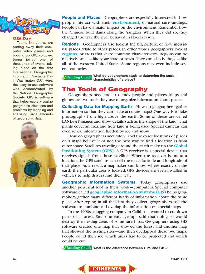
GIS DayTeens, like Jenna, are
putting away their com-puter video games andbooting up GIS software.Jenna joined one of thousands of events tak-ing place on the firstInternational GeographicInformation Systems Dayin Washington, D.C. Here,the easy-to-use softwarewas demonstrated by the National GeographicSociety. GIS is softwarethat helps users visualizegeographic situations andproblems by mapping andanalyzing large amounts of geographic data.

Earth Patterns 55
Uses of Geography Geographic information is used in planning. Government leaders
use geographic information to plan new services in their communi-ties.They might plan how to handle disasters or how much new hous-ing to allow in an area. Companies can see where people are movingin a region in order to make plans for expanding.
Some businesses offer geographic information to their customers.Suppose you were looking for an apartment to rent. Some real estateagents have computer programs that can identify all the apartments ofa certain size and price in an area. They can create a map so that youcan see exactly where each apartment is located.
Finally, geographic information helps people manage resources.Many natural resources, such as oil or coal, are available only in limitedsupply and must be managed carefully so that they do not run out.Geographic information can help locate more natural resources.
Why do people have to manage resources carefully?
AssessmentAssessment11Defining Terms 1. Define geography, landform, environment,
region, Global Positioning System (GPS),geographic information systems (GIS).
Recalling Facts 2. Place What two kinds of characteristics of a
place do geographers study?
3. Technology What are the main tools of geography?
4. Human/Environment Interaction What arethree uses for geography?
Critical Thinking 5. Understanding Cause and Effect Identify
three physical characteristics of yourregion. How have these characteristicsaffected the way people live there?
6. Categorizing Information Give fiveexamples of regions. Begin with an areanear you that shares common characteris-tics, then look for larger and larger regions.
Graphic Organizer 7. Organizing Information Create a diagram
like this one. In the center, write the name of aplace you would like to visit. In the outer ovals,identify the types of geographic informationyou would like to learn about this place.
Applying Social Studies Skills
8. Analyzing Maps Find Egypt on the map onpage RA21 of the Reference Atlas. Along whatphysical feature do you think most Egyptianslive? Why? Turn to the population map of Egypton page 9 of the Geography Handbook to seeif you are correct.
Web Activity Visit theOur World Today:People, Places, andIssues Web site at
andclick on Chapter 2—Student WebActivities to learnmore about geographicinformation systems.
tx.owt.glencoe.com

Geographic Information Systems What if a farmer could save money by
applying fertilizer only to the crops thatneeded it? Today, thanks to computer tech-nology called geographic information sys-tems (GIS), farmers can do just that.
The Technology
Geographic information systems (GIS) usecomputer software to combine and display awide range of information about an area. Itstarts with a map showing a specific location on the earth. This map is then linked with otherinformation about that same place, such as satel-lite photos, amounts of rainfall, or housinglocations.
Think of geographic information systems as astack of transparencies. Each transparency showsthe same general background but highlights dif-ferent information. The first transparency mayshow a base map of an area. Only the bordersmay appear. The second transparency may showonly rivers and highways. The third may highlightmountains and other physical features, buildings,or cities.
In a similar way, GIS technology places layersof information onto a base map. It can thenswitch each layer of information on or off, allow-ing data to be viewed in many different ways. Inthe case of the farmer mentioned above, GIS soft-ware combines information about soil type, plantneeds, and last year’s crop to pinpoint exact areasthat need fertilizer.
How It Is Used
GIS technology allows users to quickly pulltogether data from many different sources andconstruct maps tailored to specific needs. Thishelps people analyze past events, predict futurescenarios, and make sound decisions.
A person who is deciding where to build anew store can use GIS technology to help selectthe best location. The process might begin with a list of possible sites. The store owner gathersinformation about the areas surrounding eachplace. This could include shoppers’ ages,incomes, and educations; where shoppers live;traffic patterns; and information about otherstores in the area. The GIS software then builds a computerized map composed of these layers of information. The store owner can use theinformation to decide on a new store location.
PEOPLEPEOPLE
56 CHAPTER 2
Graphic image created using ArcView® GIS software, and provided hcourtesy of Environmental Systems Research Institute, Inc.
1. What is GIS technology?
2. How does GIS software analyze data in a varietyof ways?
3. Drawing Conclusions Create a list of questionsthat you would want answered to locate the bestplace to add a new school to your district.

57
Guide to Reading
Main Idea
Landforms in alltheir variety affecthow people live.
Terms to Know
• plate tectonics• fault• plain• plateau• canyon• aquifer• climate• tropics• greenhouse effect
Reading Strategy
Create a diagram likethis one. In each ofthe surroundingcircles, write thename of a landformand a fact about it.
22
Forces beneath the earth’s surface
shape the land and the lives of the
people who live on it. Here in
the Azores, a volcano
makes cooking easy.
People wrap meat and
vegetables in a cloth
and bury the bundle
in a hole where heat
from deep inside the
earth rises to the sur-
face. The temperature
reaches 200°F (93°C),
which is hot enough to
steam the food.
It is amazing to think that the earth thousands of miles beneath yourfeet is so hot that it has turned metal into liquid.Although you may notfeel these forces, what lies inside the earth affects what lies on top.Mountains, deserts, and other landscapes were formed over time byforces acting below the earth’s surface—and they are still changingtoday. Some forces work slowly and show no results for thousands ofyears. Others appear suddenly and have dramatic, and sometimes verydestructive, effects.
Forces Beneath the Earth’s CrustYou have probably watched science shows about earthquakes and
volcanoes. You have probably also seen news on television discussingthe destruction caused by earthquakes. These disasters result fromforces at work inside the earth.
Plate Movements Scientists have developed a theory about theearth’s structure called plate tectonics. This theory states that the crustis not an unbroken shell but consists of plates,or huge slabs of rock,that
Landforms

move.The plates float on top of liquid rock just below the earth’s crust.They move—but often in different directions.Oceans and continents siton these gigantic plates, as the diagram above shows.
When Plates Meet Sometimes, these plates push against eachother. When this happens, one of three events occurs, depending onwhat kinds of plates are involved.
If two continental plates smash into each other, the collision pro-duces high mountain ranges. This kind of collision produced theHimalaya mountain range in South Asia.
If a continental plate and an ocean plate move against each other,the thicker continental plate slides over the thinner ocean plate. Thedownward force of the lower plate causes molten rock to build up.Then, as magma, it erupts to form volcanic mountains.
Sometimes two plates do not meet head-on but move alongsideeach other. To picture this, put your two hands together and thenmove them in opposite directions. When this action occurs in theearth, the two plates move apart. This movement creates faults, orcracks in the earth’s crust. Violent earthquakes can happen near thesefaults. One of the most famous faults in the United States is the SanAndreas Fault in California. The earth’s movement along this faultcaused a severe earthquake in San Francisco in 1906 and another,less serious quake there in 1989.
What happens when two continental plates collide?
58 CHAPTER 2
Tectonic Plate Boundaries
AtlanticOcean
IndianOcean
Pacific Ocean
120°E
60°N
30°N
0°
30°S
60°S
150°E 180° 150°W 120°W 90°W 60°W 30°W 0° 30°E 60°E 90°E
Plate boundaryEarthquake
Miller projection
Volcano
S
W E
N
Most of North Americasits on one plate.
Region What pattern doyou see among plateboundaries, earthquakes,and volcanoes?
Analyzingthe Diagram
Types of LandformsLook at the illustration on pages 14 and 15 of the Geography
Handbook. Notice the many different forms that the land may take.Which ones are familiar to you? Which ones are new to you?
On Land Mountains are huge towers of rock formed by the collisionof the earth’s tectonic plates or by volcanoes. Some mountains may bea few thousand feet high. Others can soar higher than 20,000 feet(6,096 m).The world’s tallest mountain is Mount Everest,located in SouthAsia’s Himalaya mountain ranges. It towers at 29,035 feet (8,850 m)—nearly 5.5 miles (8.9 km) high.
In contrast, plains and plateaus are mostly flat. What makes themdifferent from each other is their elevation, or height above sea level.Plains are low-lying stretches of flat or gently rolling land. Plateaus arealso flat but have higher elevations.
Between mountains or hills lie valleys. A valley is a long stretch ofland lower than the land on either side.You often find rivers at the bot-tom of valleys. Canyons are steep-sided lowlands that rivers have cutthrough plateaus. One of the most famous canyons is the GrandCanyon in Arizona. Over time the Colorado River flowed over aplateau and carved through rock to form the Grand Canyon.
How are plains and plateaus different?
Bodies of WaterAbout 70 percent of the earth’s surface is water. Most of
that water is salt water, which people and animals cannotdrink. Only a small percentage is freshwater, which is drink-able. People and most animals need freshwater to live. Manyother creatures, however, make their homes in the earth’ssaltwater oceans and seas.
On Location
•
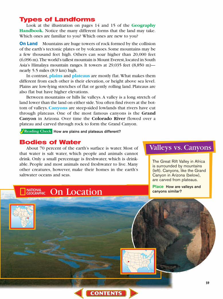
Valleys vs. Canyons
The Great Rift Valley in Africais surrounded by mountains(left). Canyons, like the GrandCanyon in Arizona (below),are carved from plateaus.
Place How are valleys andcanyons similar?
•
59

60 CHAPTER 2
Salt Water All the oceans on the earth are part of a huge, continu-ous body of salt water—almost 98 percent of the planet’s water. Thefour major oceans are the Pacific Ocean, the Atlantic Ocean, the IndianOcean, and the Arctic Ocean.
Freshwater Only about 2 percent of the water on the earth is fresh-water. Eighty percent of that freshwater is frozen in glaciers, or giantsheets of ice. Only a tiny fraction of the world’s freshwater—not evenfour-hundredths of a percent—is found in lakes and rivers.
When you think of freshwater, you probably think of mighty riversand huge lakes.People can get freshwater from another source, though.Groundwater is water that fills tiny cracks and holes in the rock layersbelow the surface of the earth. This is a vital source of water becausethere is 10 times more groundwater than there is water in rivers andlakes. Groundwater can be tapped by wells. Some areas have aquifers,or underground rock layers that water flows through. In regions withlittle rainfall, both farmers and city dwellers sometimes have to dependon aquifers and other groundwater for most of their water supply.
Which is more plentiful, salt water or freshwater?
ClimateClimate is the usual, predictable pattern of weather in an area over
a long period of time. It is one reason people decide to live in a partic-ular place.One important influence on climate is the angle at which thesun’s rays hit the earth. In general, temperatures are higher in placeswhere the rays strike the earth’s surface more directly than in placeswhere they strike the surface at an angle. This means that places in lowlatitudes—regions near the Equator—usually have warmer climates thanplaces at higher latitudes. Generally, warmer climates are found in thetropics—areas near the Equator that lie between the Tropic of Cancer(23!/2°N latitude) and the Tropic of Capricorn (23!/2°S latitude).
The combined effects of water, wind, and land also influence theclimate at a given place. In general, water warms and cools moreslowly than land. In land areas where strong winds blow in from overthe ocean, temperatures tend to be less varied than in places at thesame latitude that do not benefit from these winds.
Finally, altitude,or elevation,of a place affects its climate.As altitudeincreases, air temperatures decrease.This means that places at high ele-vations that are quite close to the Equator can have cool climates.
The Impact of People on Climate You may have noticed that tem-peratures in large cities are generally higher than those in nearby ruralareas. Why is that? City streets and buildings absorb more of the sun’srays than do the plants and trees of rural areas.
Cities are warmer even in winter. People burn fuels to warmhouses,power industry,and move cars and buses along the streets.Thisburning raises the temperature in the city. The burning also releases acloud of chemicals into the air. These chemicals blanket the city andhold in more of the sun’s heat, creating a so-called heat island. The
Mt. PinatuboMt. Pinatubo (PEE•nah•
TOO•boh) is a volcanicmountain in the PhilippineIslands. Its eruption in theearly 1990s impacted theworld’s climate. The pow-erful explosion shot ashand sulfur dioxide into theearth’s atmosphere, whichblocked some of the sun’srays from reaching theearth. The world’s climatewas cooler for two yearsafter the volcano’s blast.

burning of fuels is creating a worldwide problem.In the past 200 years,people have burned coal, oil, and natural gas as sources of energy.Burning these fuels releases certain gases into the air.
Some scientists believe that the buildup of these gases presentsdangers. It creates a greenhouse effect—like a greenhouse, the gasesprevent the warm air from rising and escaping into the atmosphere.Asa result, the overall temperature of the earth will increase.
In some countries, people are clearing large areas of rain forests.They want to sell the lumber from the trees.They also want to use theland to grow crops or as pasture for cattle. People often clear theforests by burning down trees in an area. This burning releases gasesinto the air, just like burning oil or natural gas does.
Another danger of clearing the rain forests is related to rainfall.Water on the earth’s surface evaporates and then falls as rain. In therain forests, much of this water evaporates from the leaves of trees. Ifthe trees are cut, less water will evaporate.As a result, less rain will fall.Scientists worry that, over time, the area that now holds rain forestswill actually become dry and unable to grow anything.
Not all scientists agree about the greenhouse effect. Some arguethat the world is not warming. Others say that even if it is, predictionsof disaster are extreme. Many scientists are studying world tempera-ture trends closely. They hope to be able to discover whether thegreenhouse effect is a real threat.
What is the greenhouse effect?
AssessmentAssessment22Define Terms1. Define plate tectonics, fault, plain, plateau,
canyon, aquifer, climate, tropics, greenhouseeffect.
Recalling Facts2. Region Name three types of landforms.
3. Movement What is one reason people decideto settle in a particular area?
4. Place What are the world’s four oceans?
5. Region Why do the areas near the Equatorhave warmer climates than other areas?
Critical Thinking6. Drawing Conclusions Why do you think
it is important to keep groundwater free ofdangerous chemicals?
7. Summarizing How does clearing of therain forests affect climate?
Graphic Organizer8. Organizing Information Create a diagram
like this one. List at least four sources of fresh-water and salt water on the lines under eachheading.
WaterSalt
WaterFresh-water
Applying Social Studies Skills
9. Analyzing Diagrams Look at the diagram oftectonic plate boundaries on page 58. Whymight it be a problem that most of the world’spopulation lives along the western edge of thePacific Ocean?

Applying the Skill
Find a map in a newspaper or magazine.Use the map key to explain three things themap is showing.
Practice key skills with GlencoeSkillbuilder Interactive Workbook, Level 1.
To understand what a map is showing,you must read the map key, or legend. Themap key explains the meaning of special col-ors, symbols, and lines on the map.
Learning the SkillColors in the map key may represent dif-
ferent elevations or heights of land, climateareas, or languages. Lines may stand forrivers, streets, or boundaries.
Maps also have a compass rose showingdirections. The cardinal directions are north,south, east, and west. North and south arethe directions of the North and South Poles.If you stand facing north, east is the direc-tion to your right. West is the direction toyour left. The compass rose might also showintermediate directions, or those that fallbetween the cardinal directions. For exam-ple, the intermediate direction northeastfalls between north and east. To use a map key, follow these steps:
• Read the map title.• Read the map key to find out what
special information it gives.
• Find examples of each map key color,line, or symbol on the map.
• Use the compass rose to identify the fourcardinal directions.
Practicing the SkillLook at the map of Washington, D.C.,
below, to answer the following questions.
1. What does a red square represent?
2. What does a blue square represent?
3. Does the Washington Monument lie eastor west of the Lincoln Memorial?
4. From the White House, in what directionwould you go to get to the Capitol?
62
Using a Map Key
TheWhiteHouse
Dept.of theTreasury
OldExecutive
OfficeBuilding
NationalPortraitGallery
National Museumof American Art
J. Edgar HooverFBI Building
NationalArchives
Dept. ofJustice
National Museumof Natural History
NationalMuseum of
AmericanHistory
National Air andSpace Museum
HirshhornMuseumSmithsonian
InstitutionCastle
NationalGallery of Art
U.S.Capitol
NationalPostal
Museum
LincolnMemorial
Korean WarVeterans Memorial
Vietnam VeteransMemorial
WashingtonMonument
U.S. HolocaustMemorialMuseum
23R
D S
T.
INDEPENDENCE AVE.
CONSTITUTION AVE.
9TH
ST.
PENNSYLVANIA AVE.
CONSTITUTION AVE.
17TH
ST.
CONSTITUTION AVE.
14TH
ST
.
NO
RTH
CA
PITO
L S
T.
INDEPENDENCE AVE.
Reflecting Pool
0.25
0.250 mi.
0 km
EW
N
S
Washington, D.C.•
OExecuti
OffiBuildin

63
The rapidly growing number of people threatens the delicate bal-ance of life in the world.More and more people use more water.Theyneed more land to live on and to grow more food. Spreading industryfouls the air. Humans must act carefully to be sure not to destroy theearth that sustains life.
Water UsePeople, plants, and animals need freshwater to live. People need
clean water to drink. They also need water for their crops and theiranimals. In fact, as much as 70 percent of the water used is for farm-ing. You read earlier that 70 percent of the earth’s surface is water.However, only a small fraction of the world’s water is freshwater.Because the earth’s supply of freshwater is limited, people must man-age this precious resource carefully.
Guide to Reading
Main Idea
The actions peopletake can have seriouseffects on theenvironment.
Terms to Know
• conservation • pesticide• ecosystem• crop rotation• erosion • deforestation • acid rain
Reading Strategy
Create a diagram likethis one. On thelines, write at leasttwo problems thatare caused by humanuse of water, land,and air.
What happens when we harm the
environment? It is possible that
some plants and animals
might be gone forever. This
scientist hopes to prevent
that. She works at a seed
bank. Behind her, stored
at �4°F (�20°C), are
jars of plant seeds
from around the world.
Should any of these
4,000 types of plants
become extinct, these
seeds can start growing
them again.
33
HumanUse of
Air
WaterLand

Water Management Some regions receive heavy rainfall in somemonths of the year and little, or none, in other months. They can man-age their water supply by building storage areas to hold the heavyrains for later use.
Managing water supplies involves two main steps. The first step isconservation, or the careful use of resources so that they are notwasted. Did you know that 6 or 7 gallons (23 to 27 liters) of water godown the drain every minute that you shower? Taking short showersinstead of baths is an easy way to prevent wasting water.
The second approach to managing the water supply is to avoid pol-luting water.Some manufacturing processes use water.Sometimes thoseprocesses result in dangerous chemicals or dirt entering the water sup-ply. Many farmers overuse fertilizers to help their crops grow. Many alsouse pesticides, or powerful chemicals that kill crop-destroying insects.These products are needed to increase food production, but they canseep into the water supply and cause harm.
How can manufacturing and farming harm thewater supply?
Land UseAs humans expand their communities, they invade ecosystems.
These are places where the plants and animals are dependent upon oneanother—and their particular surroundings—for survival. For example,some people may want to drain a wet, marshy area to get rid of disease-carrying mosquitoes and make the soil useful for farming.When the area
On Location
Madeira Islands
This hillside has beenterraced to allow theowner to build a houseand plant crops.
Human/EnvironmentInteraction Howwould terraced fieldshelp prevent erosion?
64 CHAPTER 2
•
Earth Patterns 65
is drained, however, the ecosystem isdestroyed. In managing land, humansmust recognize that some soils are notsuited for growing certain crops.Benefits must be weighed against losses.
Soil To grow food, soil needs to havecertain minerals. Farmers add fertiliz-ers to the soil to supply some of theseminerals. Some also practice croprotation, or changing what they plantin a field to avoid using up all the min-erals in the soil. Some crops—likebeans—actually restore valuable min-erals to the soil. Many farmers nowplant bean crops every three years tobuild the soil back up.
If people do not carefully managethe soil, it can erode away. In erosion,wind or water carries soil away, leavingthe land less fertile than before. Haveyou ever seen a group of trees alongsidea farmer’s field? The farmer may haveplanted those trees to block the windand prevent erosion. In the tropics, ero-sion presents a problem—especially iffarmers plant their crops on slopingland. When heavy rains come, the soilmay simply wash down the hillside.
Forests Some areas of the worldhave thick forests of tall trees. Growingpopulations in these countries often turn to these lush forests as asource of land to grow food. Yet deforestation, or cutting downforests, is a problem—especially in the tropics. Rains in these areas areextremely heavy. When the tree roots are no longer there to providenutrients or to hold the soil, the water can wash the nutrients and thesoil away. Then farmers have to move and cut trees in another sectionof forest. As a result more of the forest is lost.
What problem can result from erosion?
Air PollutionIndustries and vehicles that burn fossil fuels are the main sources
of air pollution. Throughout the world, fumes from cars and othervehicles pollute the air. When sulfur oxides from coal-burning powerplants and nitrogen oxides from cars combine with moisture in theair, they form acids. When acidic moisture falls to Earth as rain orsnow, it is called acid rain. Acid rain can corrode structures, damageforests, and harm organisms.
On Location
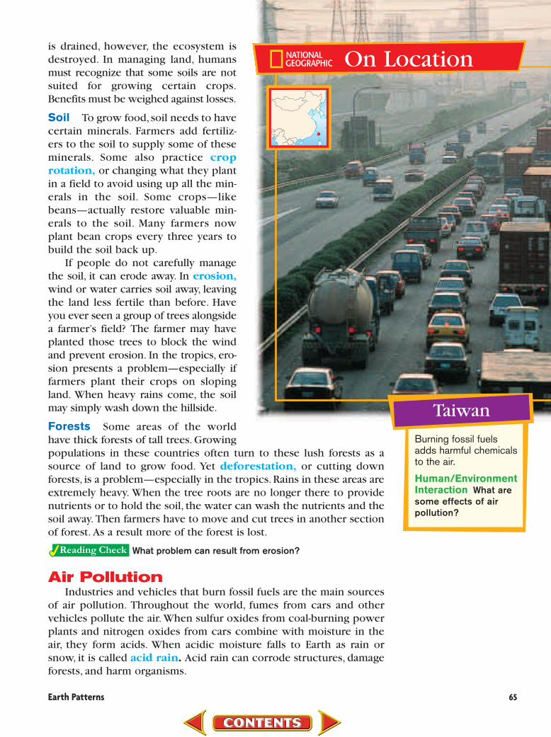
Taiwan
Burning fossil fuelsadds harmful chemicalsto the air.
Human/EnvironmentInteraction What aresome effects of airpollution?
•

Some scientists believe that increasing amounts of pollutants inthe atmosphere will cause the earth to warm. While not all expertsagree, some scientists say that the increase in temperature can havedisastrous effects. Glaciers and ice caps may melt, raising the levelof the world’s seas. Higher seas could flood coastal cities. Warmertemperatures can also affect the land, making it no longer able toproduce food.
What causes highly acidic rain?
Balancing People and ResourcesWater, land, and air are among people’s most precious resources.
We need water and air to live.We need land to grow food.Only by car-ing for these resources can we be sure that we will still have them touse in the future.
Sometimes, though, protecting the environment for the futureseems to clash with feeding people in the present. For example, farm-ers destroy the rain forests not because they want to but because theyneed to feed their families. They dislike being told by people in othercountries that they should save the rain forests. Before they stop cut-ting down the rain forests, these farmers will need to find new ways tomeet their needs.
How does saving the rain forests clash with currenthuman needs?
AssessmentAssessment33Defining Terms1. Define conservation, pesticide, ecosystem,
crop rotation, erosion, deforestation, acid rain.
Recalling Facts2. Human/Environment Interaction How do
human activities affect ecosystems?
3. Human/Environment Interaction What aretwo ways of managing water?
4. Economics Why do farmers practice croprotation?
Critical Thinking5. Making Comparisons Which resource—
water, soil, or air—do you think is mostprecious to people? Why?
6. Analyzing Information What eco-systems were affected by the growth ofyour community?
Graphic Organizer7. Organizing Information Create a diagram
like this one and list three potential results ofglobal warming.
Globalwarming
Applying Social Studies Skills
8. Analyzing Photographs Look at the OnLocation photo of Taiwan on page 65. List waysthe environment has been changed and ways itis still being changed.
66 CHAPTER 2

Chapter
22
Terms to Know geography landform environment region Global Positioning System
(GPS) geographic information
systems (GIS)
Main Idea Geographers use various tools to understand the world. ✓Place Geographers study the physical and social characteristics of
places.✓Human/Environment Interaction Geographers are especially
interested in how people interact with their environment.✓Technology To study the earth, geographers use maps, globes,
photographs, the Global Positioning System, and geographic infor-mation systems.
✓Economics People can use information from geography to plan,make decisions, and manage resources.
Section 1 Thinking Like a Geographer Section 1
Reading ReviewReading Review
Earth Patterns
Physical Geography Terms to Know plate tectonicsfaultplainplateaucanyonaquiferclimatetropicsgreenhouse effect
Main Idea Landforms in all their variety affect how people live. ✓Movement Earthquakes and volcanoes can reshape the land.✓Location Mountains, plateaus, valleys, and other landforms are
found on the earth.✓Science Humans and most animals need freshwater to live. Only a
small fraction of the world’s freshwater is found in rivers and lakes.✓Region The tropics, near the Equator, receive more of the sun’s
direct rays than other regions.✓Culture Human actions such as building cities, burning fuels, and
clearing the rain forests can affect climate.
Section 2Section 2
People and the Environment Terms to Know conservationpesticideecosystemcrop rotationerosiondeforestationacid rain
Main Idea The actions people take can have serious effects on the environment. ✓Human/Environment
Interaction People need to manage water resourcesbecause the earth’s freshwatersupply is limited.
✓Human/EnvironmentInteraction Air pollution hasdamaging effects on the landand on people’s health.
Section 3Section 3
This pool formed by an underground spring is an unusual sight in Mexico’s Chihuahua Desert. #
Chapter
22Assessment
and ActivitiesAssessment
and ActivitiesUsing Key Terms Match the terms in Part A with their definitions in Part B.
A.1. environment 7. erosion
2. landform 8. canyon
3. region 9. fault
4. plate tectonics 10. tropics
5. ecosystem
6. geographic information systems
B.a. area that shares common characteristics
b. wearing away of the earth’s surface
c. theory that the earth’s crust consists ofhuge slabs of rock that move
d. system of plant, animal, and human interdependence
e. special software that helps geographersgather and use information
f. natural surroundings
g. areas near the Equator
h. crack in the earth’s crust
i. steep-sided lowland that a river has cutthrough a plateau
j. particular feature of the land
Reviewing the Main Ideas Section 1 Thinking Like a Geographer 11. Place Give three examples of the physi-
cal characteristics of a place.12. Region How is a region different from a
place? 13. Human/Environment Interaction Give
an example of how people use geographicknowledge.
Section 2 Physical Geography 14. Movement In what ways do the plates in
the earth’s crust move?15. Place Which have a higher elevation—
plains or plateaus?16. Human/Environment Interaction Why
are cities warmer than nearby rural areas? 17. Human/Environment Interaction What
problem has been caused by the burningof fuels?
Section 3 People and the Environment 18. Human/Environment Interaction
What two steps are involved in watermanagement?
19. Human/Environment Interaction Howcan farmers restore the minerals in soil?
20. Human/Environment Interaction Whattwo problems can result from air pollution?
68 CHAPTER 2
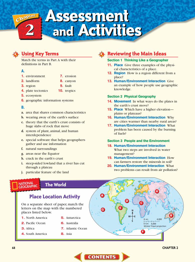
Place Location ActivityOn a separate sheet of paper, match theletters on the map with the numberedplaces listed below.
1. North America 5. Antarctica
2. Pacific Ocean 6. Australia
3. Africa 7. Atlantic Ocean
4. South America 8. Asia
The World
A
C
E
F
D
G
B
H
Winkel Tripel projection4,000
4,0000 mi.
0 km
N
S
EW

PA
NG
A E ANORTHAMERICA
NORTHAMERICA
EURASIA
EURASIA
AFRICA
AFRICA
SOUTHAMERICA
SOUTHAMERICA
ANTARCTICA
ANTARCTICA
AUSTRALIA
AUSTRALIA
INDIA
INDIA
Continental Drift
65 million years ago
200 million years ago
Directions: Study the maps below, and thenanswer the question that follows.
1. What “supercontinent” do many scientistsbelieve existed 200 million years ago? A EurasiaB PangaeaC GondwanaD Antarctica
Critical Thinking 21. Analyzing Information From where does
the freshwater in your community come?How can you find out?
22. Sequencing Information Make a chart likethe one below, and list the ways you useelectricity from the moment you wake upuntil you go to sleep. In the second column,write how you would perform the sameactivity if you had no electricity to rely on.
Current Events Journal23. Writing a Paragraph Global Positioning
System units are now available for people touse for such activities as driving, hiking, andboating. Write a paragraph describing howthe use of these units could save lives.
Mental Mapping Activity 24. Focusing on the Region Create a map of
the world’s oceans and continents. Label thefollowing items:
• Equator • Pacific Ocean• North America • Africa• high latitude climate regions • tropical climate regions
Technology Skills Activity25. Developing Multimedia Presentations
Research how your state’s climate influ-ences its culture, including tourist attrac-tions, types of clothing, and the economy.Use your research to develop a television orradio commercial promoting your state.
69
Activities With Electricity Without Electricity
Self-Check Quiz Visit the Our WorldToday: People, Places, and IssuesWeb site at and click onChapter 2—Self-Check Quizzes toprepare for the Chapter Test.
Test-Taking Tip: Use information on themaps to answer this question. Read the titleabove the maps and then the two subtitles.If you reread the question, you see it is ask-ing about a certain time period. Make sureyou use the correct map above to answerthe question.
tx.owt.glencoe.com
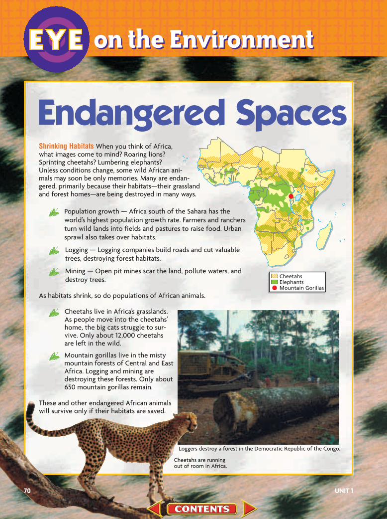
Shrinking Habitats When you think of Africa, what images come to mind? Roaring lions? Sprinting cheetahs? Lumbering elephants? Unless conditions change, some wild African ani-mals may soon be only memories. Many are endan-gered, primarily because their habitats—their grassland and forest homes—are being destroyed in many ways.
Population growth — Africa south of the Sahara has theworld’s highest population growth rate. Farmers and ranchersturn wild lands into fields and pastures to raise food. Urbansprawl also takes over habitats.
Logging — Logging companies build roads and cut valuabletrees, destroying forest habitats.
Mining — Open pit mines scar the land, pollute waters, anddestroy trees.
As habitats shrink, so do populations of African animals.
Cheetahs live in Africa’s grasslands.As people move into the cheetahs’home, the big cats struggle to sur-vive. Only about 12,000 cheetahsare left in the wild.
Mountain gorillas live in the mistymountain forests of Central and EastAfrica. Logging and mining aredestroying these forests. Only about650 mountain gorillas remain.
These and other endangered African animalswill survive only if their habitats are saved.
Endangered Spaces
Loggers destroy a forest in the Democratic Republic of the Congo.
Cheetahs are running out of room in Africa.
70 UNIT 1
ttttttttttttttttttttttttttttttttttttttttttttton the Environmenton the EnvironmentIEYE
CheetahsElephantsMountain Gorillas

The Cheetah Conservation Fund Cheetahs in Africa are get-ting a helping hand from the Cheetah Conservation Fund(CCF). This organization is based in Namibia, which ishome to about 2,500 cheetahs. Namibian ranchers oftentrap and shoot cheetahs to protect their livestock. TheCCF has donated about 80 special herding dogs to ranch-ers. The dogs protect the livestock and keep cheetahs outof harm’s way at the same time. The CCF also teaches vil-lagers and schoolchildren about cheetahs and about why it isimportant to save these big cats and their habitats.
Protecting Gorillas For nearly 20 years, Dian Fossey studied moun-tain gorillas in Rwanda. Through her book, Gorillas inthe Mist, which was made into a movie, Fossey toldothers about mountain gorillas and how their survivalwas threatened by habitat destruction and poaching.Fossey established the Karisoke Research Center andan international fund to support gorilla conservation.
Dian Fossey fought fiercely to end gorilla poach-ing. Although Fossey was murdered at Karisoke in1985, the Dian Fossey Gorilla Fund Internationalcontinues its work protecting mountain gorillas and
their habitat.
Making a Difference Namibian childrenlearn about cheetahs.
A mountain gorilla
What Can You Do?Adopt a CheetahYou and your classmates can help save chee-
tahs in the wild by adopting one. To learn
more, contact the Cheetah Conservation
Fund at www.cheetah.org
Find Out MoreWhat animal habitats are endangered where
you live? Work with a partner to investigate
endangered spaces in your area. Summarize
your findings in a report to the class.
``````````````````````````
71
ttttttttttttttttttttttttttttttttttttttttttttt