brizzolara creek: reflections on the water that...
TRANSCRIPT

1
BRIZZOLARA CREEK:
REFLECTIONS ON THE WATER THAT TRANSFORMED MY LIFE
by
Jessica Viramontes
English Department
College of Liberal Arts
California Polytechnic State University
San Luis Obispo
2006

2
Planting area looking upstream, Oct. 2005
Lounging against the broad trunk of an ancient sycamore tree, I find myself at
peace with myself and the world around me. The giant leaves float to the ground like
kites on a gentle ocean breeze and gently come to rest on the dark brown earth. Squirrels
work along the creek, running over deep piles of crispy leaves and making sounds that
could be from a giant. The clear water of the 3.3 mile long Brizzolara Creek looks like
liquid glass and the soothing sounds of the flow colliding with the smooth rocks fill my
ears. These noises, the sounds of a natural environment retaking what was once so
heavily altered by man, silence the stress that consumes my life in every other setting.
How was I lucky enough to find this place?
In October of 2005, I participated in a riparian enhancement project concerning an
area behind the Abattoir, the slaughterhouse located on the campus of Cal Poly. Along
with a group of about 20 other students, 200 native plants
were given a new home in an area that used to be the
stomping ground of massive bulls. This delicate process—
the placing of each plant in the designated spot, piercing
the parched earth with overworked shovels, coaxing the
struggling plants from their plastic containers, and
depositing them in the earth for safekeeping—left a remarkable imprint on my life. This
was the beginning of my affair with Brizzolara Creek. No longer was I a lover of some
ambiguous “environment,” a concept without a face. This “environment” became the soil,
trees, and the vegetation that surrounded me and evoked in me a determination to do
everything in my power to enhance it.

3
Sitting in a tuft of bright green grass and gazing at the broad branches of the
sycamore, I remember so vividly the day in October that ignited my curiosity in
Brizzolara Creek. It motivated me to dig deeper into the area’s historical significance and
present condition. My investigation began in January 2006 at the San Luis Obispo
County Library where I researched the history surrounding Brizzolara Creek. Based on a
recommendation by the librarian, I went the San Luis Obispo Historical Society research
room where I met a volunteer named Don Rivara. His ancestors owned the area
surrounding Brizzolara Creek at one time and he explained the relationships between the
families that owned the land in the late nineteenth century. Interested in the current
condition of the creek, I then met with Kim Busby who is the Water Quality Management
Specialist on campus. She described the enhancement projects that have already taken
place or are slated to occur in the near future. According to Ms. Busby, a student housing
project had the potential to significantly affect the creek, so I interviewed the project
manager, Scott Bloom. Mr. Bloom detailed the plan of the site, including drainage issues,
landscape designs, and enhancement plans for the creek. My last stop was the Regional
Water Quality Control Board where I met with Chris Rose to get water quality
information. Meeting with these professionals from different disciplines and
understanding how they have made a connection to the creek, made me realize the that a
place like Brizzolara Creek can be appreciated from different perspectives. Fortunately,
the Coastal Resources Institute on campus has extensive photographic records; the
pictures in this research paper were taken by Melissa Daugherty and Amelie Charneaux.
4
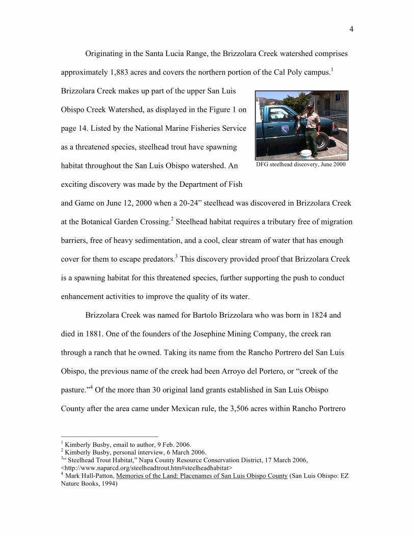
DFG steelhead discovery, June 2000
Originating in the Santa Lucia Range, the Brizzolara Creek watershed comprises
approximately 1,883 acres and covers the northern portion of the Cal Poly campus.1
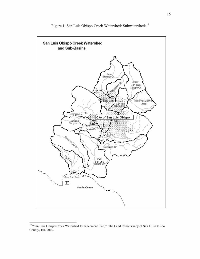
Brizzolara Creek makes up part of the upper San Luis
Obispo Creek Watershed, as displayed in the Figure 1 on
page 14. Listed by the National Marine Fisheries Service
as a threatened species, steelhead trout have spawning
habitat throughout the San Luis Obispo watershed. An
exciting discovery was made by the Department of Fish
and Game on June 12, 2000 when a 20-24” steelhead was discovered in Brizzolara Creek
at the Botanical Garden Crossing.2 Steelhead habitat requires a tributary free of migration
barriers, free of heavy sedimentation, and a cool, clear stream of water that has enough
cover for them to escape predators.3 This discovery provided proof that Brizzolara Creek
is a spawning habitat for this threatened species, further supporting the push to conduct
enhancement activities to improve the quality of its water.
Brizzolara Creek was named for Bartolo Brizzolara who was born in 1824 and
died in 1881. One of the founders of the Josephine Mining Company, the creek ran
through a ranch that he owned. Taking its name from the Rancho Portrero del San Luis
Obispo, the previous name of the creek had been Arroyo del Portero, or “creek of the
pasture.”4 Of the more than 30 original land grants established in San Luis Obispo
County after the area came under Mexican rule, the 3,506 acres within Rancho Portrero
1 Kimberly Busby, email to author, 9 Feb. 2006. 2 Kimberly Busby, personal interview, 6 March 2006. 3“ Steelhead Trout Habitat,” Napa County Resource Conservation District, 17 March 2006, <http://www.naparcd.org/steelheadtrout.htm#steelheadhabitat> 4 Mark Hall-Patton, Memories of the Land: Placenames of San Luis Obispo County (San Luis Obispo: EZ Nature Books, 1994)

5
de San Luis Obispo included what is now Brizzolara Creek.5 Before Brizzolara owned
the property, it belonged to Maria Conception Boronda who became a grantee of the
Portrero de San Luis Obispo on November 8, 1842, and moved onto the property in 1847.
Her husband died and she remarried Jose Maria Munoz. A trade took place shortly after
the marriage and part of the Portrero Rancho was exchanged with Pedro Quintana for two
houses and some acreage. There was a flaw in the title of the land which was first owned
by Don Francisco Estevan Quintana, so the Quintana family was able to keep control of
the land and pass it on to their children.6
Instead of reflecting the name of the Brizzolara family that settled the area in the
nineteenth century, the United States Geologic Survey created confusion when it
inaccurately used the name Brizziolari Creek on its maps and other publication material.
The mistake will soon be rectified, as Ms. Busby recently made a proposal to the US
Board on Geographic Names to change the name of Brizziolari Creek to Brizzolara
Creek. The proposal was approved at a November 10, 2005 meeting and will soon be
announced by the public affairs office on campus.7
Brizzolara Creek has been predominately affected by the activities of the
university, which was established in 1903. The effects of the way land around the creek
has been used, have influenced the creek and made it what it is today. The Brizzolara
Creek watershed can be divided into three distinct reaches based on distinct land uses
5 US Army Corps of Engineers Los Angeles District, “FINAL Survey Report for Flood Control and Related Purposes, San Luis Obispo County Streams, California” Feb. 1987. 6 Chester Porter, “Maria: Pioneer lady of the Coast,” Santa Maria Times 10 May 1976. 7 Kimberly Busby, email to author, 21 Feb. 2006.

6
throughout its history: the “Headwaters Reach”, the “Urbanized Reach”, and the
“Agriculture Reach.”8
The upper “Headwaters Reach” was used by ranchers for cattle grazing. This
reach is composed of the headwaters and follows the creek
as it makes its way through Poly Canyon past a botanical
garden and architectural study area. The unpaved Poly
Canyon Road follows Brizzolara Creek and provides a
walking trail that hikers may use as access to the many
trails scattered throughout the canyon. Located upslope
of Brizzolara Creek is an open gravel pit mine that is next
to the Solid Waste Disposal Site/Landfill that has been
decommissioned. The mine produces 5,000 cubic yards
per year for the maintenance of campus roads and is
approximately 3 acres in size with one acre actively
excavated. The landfill, once used as a disposal site for all of the waste from campus
between 1950 and 1972, is approximately 4 acres and the waste is buried underneath an
average of fifty feet of soil.9 Across the creek is the Bull Test Site which collects the
water from the nearby hill and drains into the creek.
Beginning at the end of Poly Canyon and covering the main campus core is the
“Urbanized Reach.” This reach runs beside an irrigation training field, parking lots, and
buildings used by the Farm Shop before it travels under Via Carta. Near Blacksmith
Crossing is a metal weir that was installed almost one year ago; it channels the water in 8 Dr. James Vilkitis, “Brizzolara Creek Management and Enhancement Plan for Salmonids” 19 May 2004. 9 Cal Poly Risk Management Department, “Water Quality Management Plan Cal Poly Land in San Luis Obispo Creek and Chorro Creek Watersheds,” Jan 2005.
Flat top of landfill, Jan. 2006
Red rock gravel pit mine, Jan. 2006

7
order to make the creek a more viable habitat for steelhead. Along the banks past Via
Carta is evidence of the replanting activities conducted by the City and Regional
Planning Department. For the last few years, classes
within the department have made an effort to plant native
vegetation along the banks to help stabilize and prevent
the loss of soil. The fish ladder, located below Highland
Drive, is a structure made
of concrete that facilitates
the upstream migration of anadromous fish like the
steelhead. Land uses throughout this reach include campus
buildings, agriculture, recreation fields, paved roads, and
parking lots.
The third reach, the “Agriculture Reach,” is an area used for row crops and
orchards. This reach is heavily vegetated and is where the creek goes into a canyon that is
largely undisturbed. This reach joins with Stenner Creek at the Mustang Village
residential area located adjacent to Cal Poly property.
My involvement with Brizzolara Creek is through the Coastal Resources Institute
(CRI) which was created to take advantage of the wealth of knowledge that exists at Cal
Poly. The goal of CRI is to apply the expertise of the different departments on campus in
order to solve problems related to the management of natural resources.10 Dr. Vilkitis of
the Natural Resources Management Department is the Director of CRI. Nearly five years
ago, the State Water Resources Control Board decided to fund water quality
10 Coastal Resources Institute Home Page, 2 April 2002, Cal Poly San Luis Obispo, 14 March 2006 <www.calpoly.edu/~cri/>
Fish weir looking upstream, 2005
Fish ladder looking upstream, March 2006

8
improvement projects on lands belonging to Cal Poly that are located in the Chorro and
San Luis Obispo Creek Watersheds. The funds were for two categories of projects:
Erosion and Sediment Control and Protection and
Enhancement of Riparian Corridor. In the first category,
CRI made plans to upgrade fencing along the creeks
located on campus, improve culverts along Poly Canyon
Road, build detention basins for water at the gravel
mine, and revegetate 6,667 square yards of eroding
slope on the side of the road leading to the mine. For the second category, CRI proposed
to manage the revegetation and bank stabilization of 1,400 linear feet of Brizzolara Creek
behind the Abattoir across from the Bull Test Areas.11
Five years after CRI received the funds to improve water quality in Brizzolara
Creek, many of the projects in the Erosion and Sediment Control category have been
completed. The mine, nearby landfill and the road leading to those sites contribute to
erosion and sediment overload problems in Brizzolara Creek. To keep the soil from
washing into the creek, engineering fabric and wattles were installed to slow the speed of
the water and keep it from cutting into the slopes, grass seed and
hay were spread over the side of the mountain to encourage
vegetation that will help to keep the soil on the slopes of the hill
and out of the creek, and two pools were dug at the base of the
pit to slow and trap sediment before it follows a culvert down the
hill and into Brizzolara Creek. As part of the revegetation
11 “San Luis Obispo Creek Watershed Enhancement Plan,” The Land Conservancy of San Luis Obispo County, Jan. 2002.
Water detention basin, Feb. 2006
Mountainside where grass and hay were spread, March 2006
9
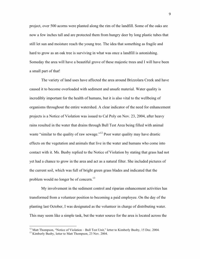
project, over 500 acorns were planted along the rim of the landfill. Some of the oaks are
now a few inches tall and are protected them from hungry deer by long plastic tubes that
still let sun and moisture reach the young tree. The idea that something as fragile and
hard to grow as an oak tree is surviving in what was once a landfill is astonishing.
Someday the area will have a beautiful grove of these majestic trees and I will have been
a small part of that!
The variety of land uses have affected the area around Brizzolara Creek and have
caused it to become overloaded with sediment and unsafe material. Water quality is
incredibly important for the health of humans, but it is also vital to the wellbeing of
organisms throughout the entire watershed. A clear indicator of the need for enhancement
projects is a Notice of Violation was issued to Cal Poly on Nov. 23, 2004, after heavy
rains resulted in the water that drains through Bull Test Area being filled with animal
waste “similar to the quality of raw sewage.”12 Poor water quality may have drastic
effects on the vegetation and animals that live in the water and humans who come into
contact with it. Ms. Busby replied to the Notice of Violation by stating that grass had not
yet had a chance to grow in the area and act as a natural filter. She included pictures of
the current soil, which was full of bright green grass blades and indicated that the
problem would no longer be of concern.13
My involvement in the sediment control and riparian enhancement activities has
transformed from a volunteer position to becoming a paid employee. On the day of the
planting last October, I was designated as the volunteer in charge of distributing water.
This may seem like a simple task, but the water source for the area is located across the
12 Matt Thompson, “Notice of Violation – Bull Test Unit,” letter to Kimberly Busby, 15 Dec. 2004. 13 Kimberly Busby, letter to Matt Thompson, 23 Nov. 2004.

10
creek and up the steep bank within the confines of the Bull Test Area. Three hoses were
needed and even then, the water still had to be transported by buckets to about 1/3 of the
plants. Until the end of December, I guided this small area through a dry spell by
watering each plant by hand about three times per week. When the rigors of college life
and the frustrations of work burned me out, I would retreat to my riparian paradise and
surround myself with the rejuvenating powers of Mother Nature.
At the end of 2005, Dr. Vilkitis asked me to become a student assistant to help out
with erosion control and weeding projects. When the winter rains descended upon the
central coast and sated the thirst of this fledgling riparian area, the dry grass and hard soil
turned into bright green vegetation springing forth from moist, rich earth. Now that my
watering responsibilities were taken over by a more natural process, my focus turned to
making sure that the planted natives would not have to compete with the invasive grasses
and weeds that were quickly taking over the field that had once been so bare and void of
life. To protect the plants from deer, plastic cylinders were placed over them. Cradling a
plant in one’s hand a installing a protective shell is an awesome process.
As spring begins, my weekends and free afternoons are consumed by the
seemingly endless list of tasks. The native plants grow and so do the invasive species.
Weeds are a major issue and we are at a decisive stage where the decision must be made
as to whether chemical or physical methods may be used
to control or remove them. The rains are still heavy and
erosion is still a concern, so I recently installed hay
blankets and waddles on a dirt road behind the Abattoir to
slow the water. This was a challenging task undertaken Wattles in the culvert and hay on the road, Feb, 2006
11
with very little instruction, so it was interesting to see how I was and was not successful.
During the first rain after I finished the project, I noticed that the water was still finding
its way underneath the hay blankets. I stapled the blankets more thoroughly to encourage
the water to flow on top of the blankets and away from the soil. The wattles that I
installed needed to be adjusted so that they were further
apart; it is necessary that they be installed so that they
slow the water by forming pools. I learned how these
tools are supposed be implemented and what it looks like
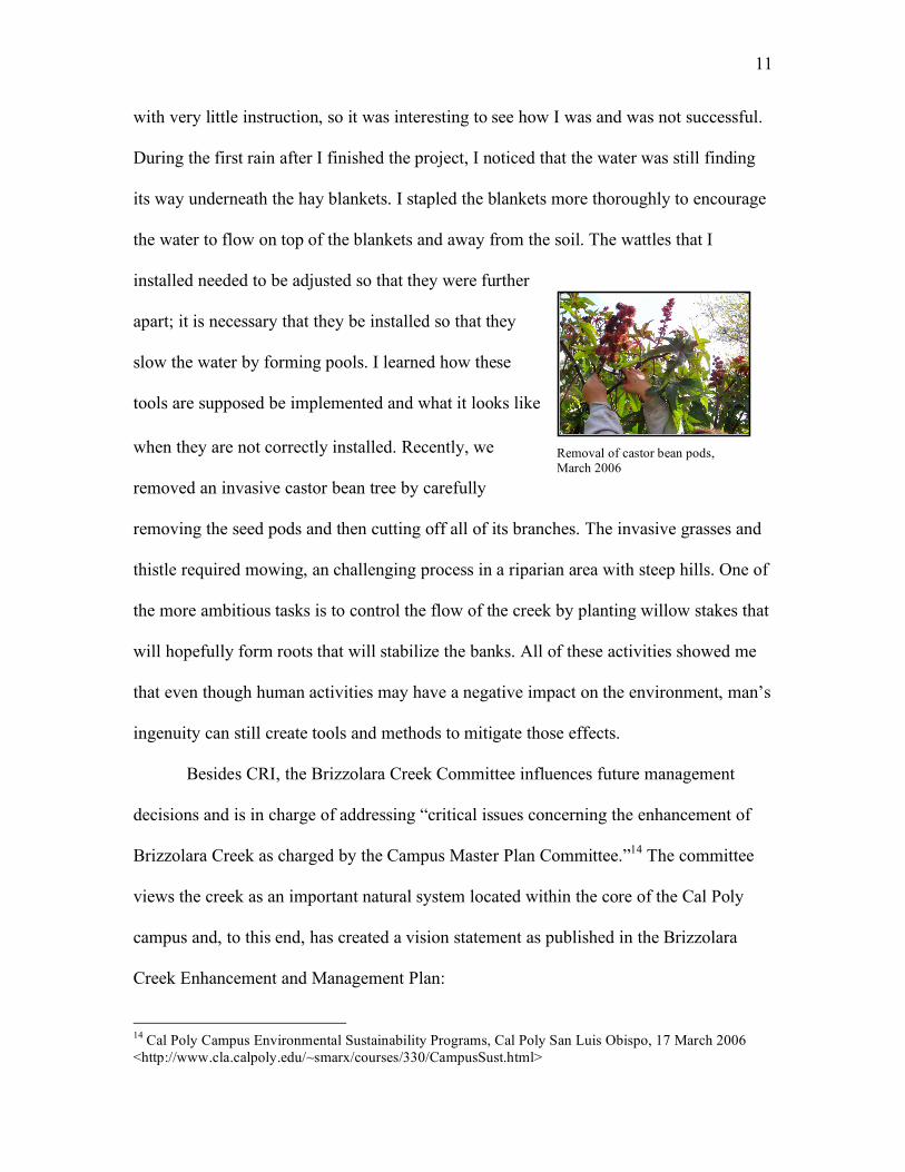
when they are not correctly installed. Recently, we
removed an invasive castor bean tree by carefully
removing the seed pods and then cutting off all of its branches. The invasive grasses and
thistle required mowing, an challenging process in a riparian area with steep hills. One of
the more ambitious tasks is to control the flow of the creek by planting willow stakes that
will hopefully form roots that will stabilize the banks. All of these activities showed me
that even though human activities may have a negative impact on the environment, man’s
ingenuity can still create tools and methods to mitigate those effects.
Besides CRI, the Brizzolara Creek Committee influences future management
decisions and is in charge of addressing “critical issues concerning the enhancement of
Brizzolara Creek as charged by the Campus Master Plan Committee.”14 The committee
views the creek as an important natural system located within the core of the Cal Poly
campus and, to this end, has created a vision statement as published in the Brizzolara
Creek Enhancement and Management Plan:
14 Cal Poly Campus Environmental Sustainability Programs, Cal Poly San Luis Obispo, 17 March 2006 <http://www.cla.calpoly.edu/~smarx/courses/330/CampusSust.html>
Removal of castor bean pods, March 2006
12
Cal Poly envisions Brizzolara Creek as a natural system, which provides
high quality water for biological, physical, educational and recreational
uses on campus as well as for downstream users in perpetuity. This vision
encompasses three aspects of the creek system:
1) Clear running water year round supporting abundant natural aquatic
and riparian systems,
2) Students and faculty studying and conducting research to further their
educational goals within the context of a polytechnic educational
institution, and
3) The creek system providing a pleasing and appreciated visual landscape
within its campus environment.15
The Brizzolara Creek Committee recognizes the importance of protecting the integrity of
the creek for all types of users in locations on and off campus. The committee
understands that by working to improve the quality of this creek also enhances the rest of
the watershed.
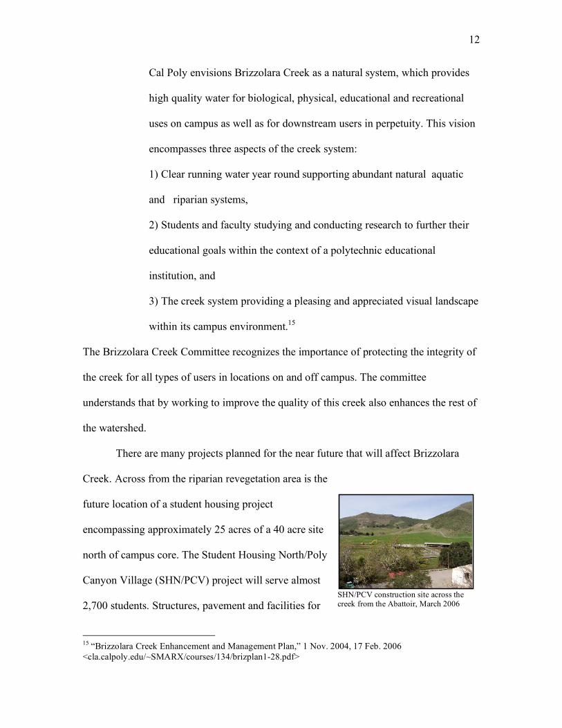
There are many projects planned for the near future that will affect Brizzolara
Creek. Across from the riparian revegetation area is the
future location of a student housing project
encompassing approximately 25 acres of a 40 acre site
north of campus core. The Student Housing North/Poly
Canyon Village (SHN/PCV) project will serve almost
2,700 students. Structures, pavement and facilities for
15 “Brizzolara Creek Enhancement and Management Plan,” 1 Nov. 2004, 17 Feb. 2006 <cla.calpoly.edu/~SMARX/courses/134/brizplan1-28.pdf>
SHN/PCV construction site across the creek from the Abattoir, March 2006

13
agriculture will be demolished and/or moved from their current location south of
Brizzolara Creek. The structures slated for demolition include the Abattoir, Horseshoeing
Unit, Bull Test Site, Feed Mill and Rose Float Building. Once this area is cleared out, the
exposed soil will be revegetated with native plant species using $75,000 from the budget
for the SHN/PCV project.16 Dr. Brian Dietterick, of the Natural Resources Management
Department, is in charge of creating a proposal and work plan for the enhancement of the
creek bank and channel that will detail a plan for revegetation of the site where buildings
and asphalt will be removed. This document should be completed by the end of March,
2006.
As part of its vision statement, the Brizzolara Creek Committee conducted a
workshop concerning how the construction of SHN/PCV may affect the creek. A wide
variety of issues ranging from the design ideas for bridges to encouraging students to take
ownership of the environment were discussed in this meeting. The goal is to protect the
integrity of the creek while also integrating it into the rest of campus.17
Additionally, the rebuilding of the foundation of Building 9, the Farm Shop, is
slated to begin this August. The side of the building functions as a bank for Brizzolara
Creek just upstream of Via Carta. The creek runs extremely quickly through this area due
to channelization which increases the speed of the water and the rate at which it erodes
the banks and stream bed. In the earthquake of 2003, the foundation developed a large
crack and became eligible for money from the Federal Emergency Management Agency
(FEMA). Despite rules that FEMA money should be used to rebuild buildings as they
16 Scott Bloom, personal interview, 7 Feb. 2006. 17 “Flip Chart Notes from Student Housing North Workshop: Brizzolara Creek and the Environment,” 21 March 2003.

14
were, Ms. Busby and others were able to convince the agency that it would be better for
the health of the creek to set the building back from the bank and let the creek return to a
more natural state.18
As the sun sets on this beautiful day, I wonder how Brizzolara Creek will look in
a few years. Will the effort and resources of so many individuals have any effect on the
area? Will my time with CRI help to improve the water quality? My hope is that my work
along Brizzolara Creek has improved the quality of the water and the habitat for all of the
organisms that live there. I owe so much to this majestic place; it is near the creek where
I found my true self, in the water that I recognized my honest reflection for the first time.
18 Kimberly Busby, personal interview, 10 March 2006.
15
Figure 1. San Luis Obispo Creek Watershed: Subwatersheds19
19 “San Luis Obispo Creek Watershed Enhancement Plan,” The Land Conservancy of San Luis Obispo County, Jan. 2002.