books and resources essentials of geosystems
TRANSCRIPT

1
Chapter 1 Elemental Geosystems
The Essentials of Geography
Books and resources
• TEXTBOOK: Elemental Geosystems, 6/E, By Christopherson
• LAB BOOK: Encounter Geosystems by Christopherson and Thomsen
• Web search: “Earth Science Centralia”
• www.mygeoscienceplace.com
Essentials of Geosystems• Define geography, and physical geography in
particular.• Describe systems analysis, open and closed systems,
feedback information, and system operations, and relate these concepts to Earth systems.
• Explain Earth’s reference grid: latitude and longitude, plus latitudinal geographic zones and time.
• Define cartography and mapping basics: map scale and map projections.
• Describe remote sensing and explain geographic information system (GIS) as tools used in geographic analysis.
Geography (from geo, "Earth," and grapbein, "to write") is the science that studies relationships among geographic areas, natural systems, society, cultural activities, and the interdependence of all these over space.
Physical geography - examination of natural environments: the nature of physical elements and processes; their distribution and interrelationships
“spatial” refers to the nature and character of physicalspace
EG6_CO_01
F-5 tornado destruction in Greensburg Kansas, 2007.
EG6_Figure_01_1_1_NR-L
Harlequin frog, p. 14
Spatial scale
EG6 Figure 01 01-L
Five spatial themes of geography: location, place, movement, regions, human-Earth relationships

2
EG6_Figure_01_02-L
Relationships between physical geography and human/cultural geography. Note list of organizations on p. 4.
EG6_Figure_01_1_1_FS-L
The Scientific Method
Hypothesis = educated guess;(important role is to be testable)
Scientific theory = widely accepted explanation of a natural phenomenon that fits all the data
EG6_Figure_01_03-L
Open system – matter and energy transformed
Earth is an open system wrt Sun’s E and closed wrt resources and matter
EG6_Figure_01_04-L
The leaf, a natural open system. Light + CO2 + H2O + nutrients = O2 + carbos (sugars) throughphotosynthesis.
EG6_Figure_01_06-L
System equilibrium: steady state vs. dynamic; tipping points are thresholds where conditions can change abruptly.
EG6_Figure_01_07-L
Mount Pinatubo 1991 eruption

3
EG6 Figure 01 09-L
Earth’s four main environmental spheres
EG6_Figure_01_10-L
Equitorial and polar circumference; dashed = perf circle
EG6_Figure_01_11-LEratosthenes in 247 BC calculated Earth’s circumference at 28,738 mi (close to 24,860!!!)
EG6_Figure_01_12a-L
Parallels of latitude EG6_Figure_01_12b-L
4
EG6_Figure_01_13_L
Latitudinal geographic zones EG6_Figure_01_14a-L
Meridians of longitude
EG6_Figure_01_14b-L
EG6_Figure_01_15a_L
Small circles and great circles
EG6_Figure_01_15b_L
EG6_Figure_01_15c_L

5
EG6_Figure_01_2_1_FS-L
Clock times determine longitudeEG6_Figure_01_2_1_NR-L
Triangulation via GPS satellites, p. 20
EG6_Figure_01_2_2_NR_LEG6_Figure_01_2_3_NR-L Using GPSGPS on Mount Everest
EG6_Figure_01_16-L
Earth’s coordinate system
EG6_Figure_01_17-L
Modern international time zones
EG6_Figure_01_18-L
International date line ~ 180°

6
EG6_Figure_01_19-L
EG6 Figure 01 20
Projections
Mercator ~ “true shape” (AD 1569); advantage = “rhumbline” of constant direction is straight. Areas are bogus—exaggerated at poles.
EG6 Figure 01 21a-LEG6_Figure_01_21b-L
EG6_Figure_01_21c-L EG6_Figure_01_21d-L
7
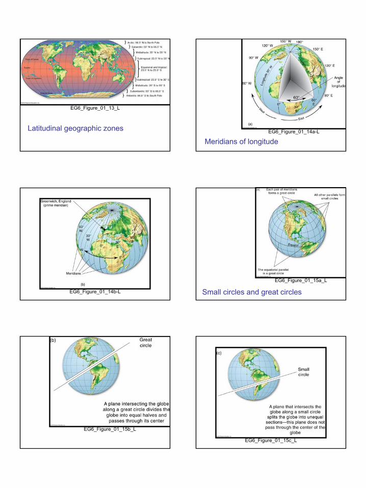
EG6_Figure_01_22a-L EG6_Figure_01_22b-L
Rhumb line = shortest distance but in a constant direction (on Mercator projection)
EG6 Figure 01 23-L
Remote sensing, p. 28
EG6_Figure_01_24-L
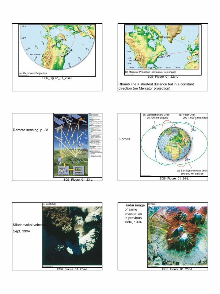
3 orbits
EG6 Figure 01 25a-L
Kliuchevskoi volcano
Sept. 1994
EG6 Figure 01 25b-L
Radar image of same eruption as in previous slide, 1994

8
EG6 Figure 01 25c-L
June 26, 2002 Terra image of Kamchatka
EG6_Figure_01_26-L
Radarsatmosaic
EG6 Figure 01 27-L
GOES 12 first image from, 23.300 mi
GOES = geostationary operational environmental satelllites
EG6 Figure 01 28-L
EROS data center in Souix Falls SD; http://edc.usgs.gov
EG6 Figure 01 29a-L
GIS
EG6_Figure_01_29b-L

9
EG6_Figure_01_29c-L
EG6_Table_01_01
EG6 Table 01 02