board of county commissioners public hearing october 23, 2007
TRANSCRIPT

Board of County CommissionersBoard of County Commissioners
PUBLIC HEARINGPUBLIC HEARINGOctober 23, 2007October 23, 2007
Board of County Commissioners Board of County Commissioners
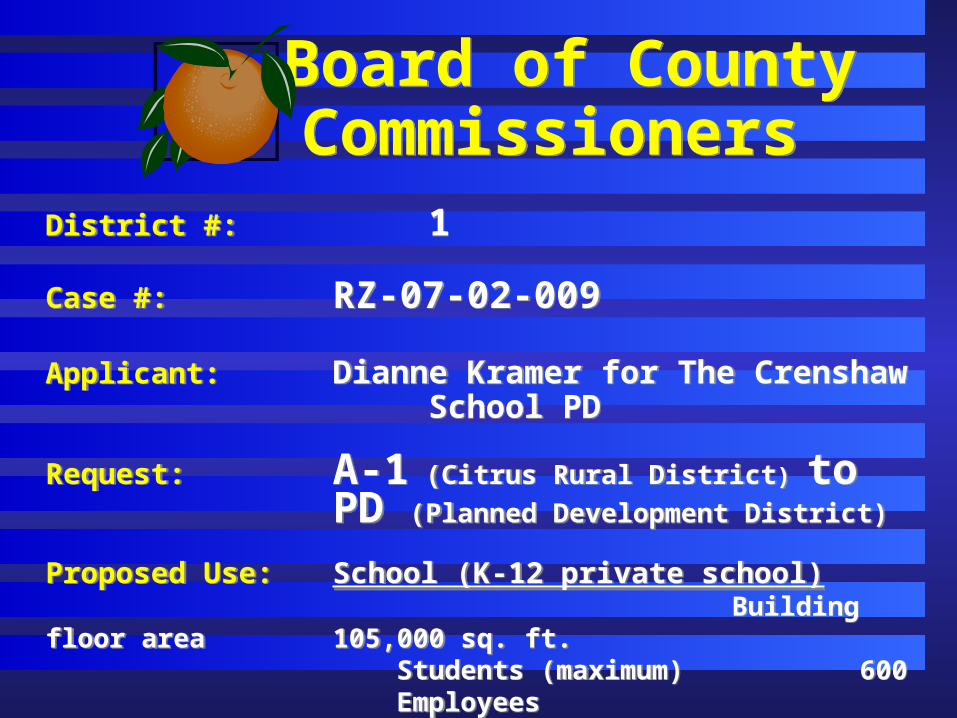
District #: 1
Case #: RZ-07-02-009
Applicant: Dianne Kramer for The Crenshaw School PD
Request: A-1 (Citrus Rural District) to
PD (Planned Development District)
Proposed Use: School (K-12 private school) Building floor area 105,000 sq. ft.
Students (maximum) 600 Employees 55
District #: 1
Case #: RZ-07-02-009
Applicant: Dianne Kramer for The Crenshaw School PD
Request: A-1 (Citrus Rural District) to
PD (Planned Development District)
Proposed Use: School (K-12 private school) Building floor area 105,000 sq. ft.
Students (maximum) 600 Employees 55
Board of County Commissioners Board of County Commissioners
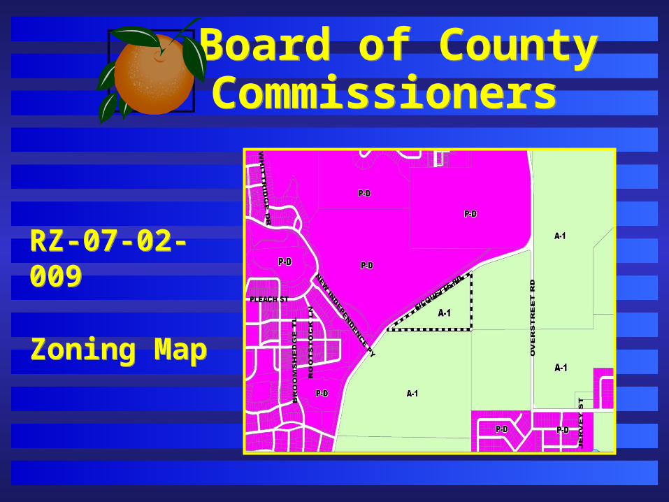
RZ-07-02-009
Zoning Map
RZ-07-02-009
Zoning Map

Board of County Commissioners Board of County Commissioners
RZ-07-02-009
FutureLandUse Map
RZ-07-02-009
FutureLandUse Map

Board of County Commissioners Board of County Commissioners
RZ-07-02-009
Horizon WestLandUse Map
RZ-07-02-009
Horizon WestLandUse Map

Board of County Commissioners Board of County Commissioners
The Crenshaw School
LandUsePlan

Board of County Commissioners Board of County Commissioners
Project : Lake Ola Grove Planned Development- Lake Ola Grove PSP
District #: 2
Proposed Use: 15 Single-family dwelling units:- Min. living area: 2500 sq. ft.
- Min. lot width: 130 ft.- Min. lot area: 43,560 sq. ft.
Project : Lake Ola Grove Planned Development- Lake Ola Grove PSP
District #: 2
Proposed Use: 15 Single-family dwelling units:- Min. living area: 2500 sq. ft.
- Min. lot width: 130 ft.- Min. lot area: 43,560 sq. ft.

Board of County Commissioners Board of County Commissioners
Lake Ola Grove PD/Lake Ola Grove PSP
Location Map
Lake Ola Grove PD/Lake Ola Grove PSP
Location Map

Board of County Commissioners Board of County Commissioners
Lake Ola Grove PD/Lake Ola Grove
Preliminary SubdivisionPlan
Lake Ola Grove PD/Lake Ola Grove
Preliminary SubdivisionPlan
Board of County Commissioners Board of County Commissioners
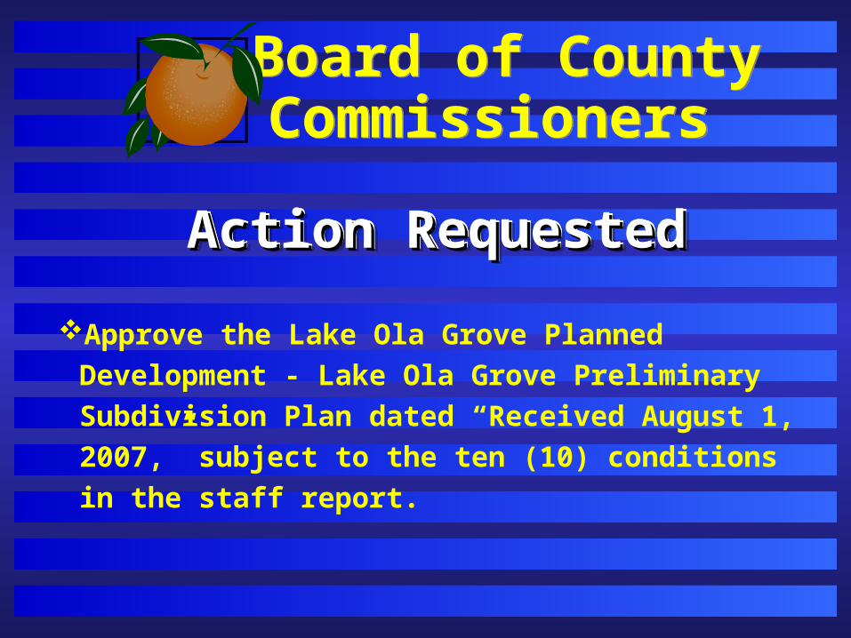
Approve the Lake Ola Grove Planned Development -
Lake Ola Grove Preliminary Subdivision Plan dated
“Received August 1, 2007,” subject to the ten (10)
conditions in the staff report.
Action RequestedAction RequestedAction RequestedAction Requested

Board of County Commissioners Board of County Commissioners
Project : Estates at Wekiva Planned Development- Estates at Wekiva PSP and the Joint Use Stormwater Retention Area Agreement
District #: 2
Proposed Use: 33 Single-family dwelling units:- Min. living area: 2000 sq. ft.
- Min. lot width: 85 ft.- Min. lot depth: 120 feet
Project : Estates at Wekiva Planned Development- Estates at Wekiva PSP and the Joint Use Stormwater Retention Area Agreement
District #: 2
Proposed Use: 33 Single-family dwelling units:- Min. living area: 2000 sq. ft.
- Min. lot width: 85 ft.- Min. lot depth: 120 feet
Board of County Commissioners Board of County Commissioners
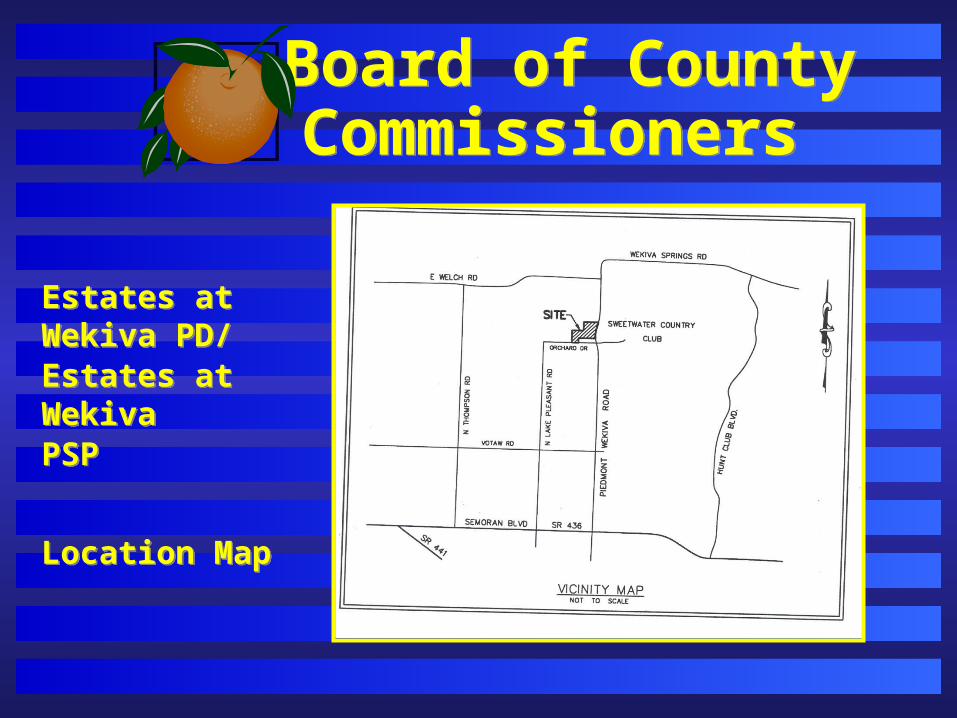
Estates at Wekiva PD/Estates at WekivaPSP
Location Map
Estates at Wekiva PD/Estates at WekivaPSP
Location Map
Board of County Commissioners Board of County Commissioners
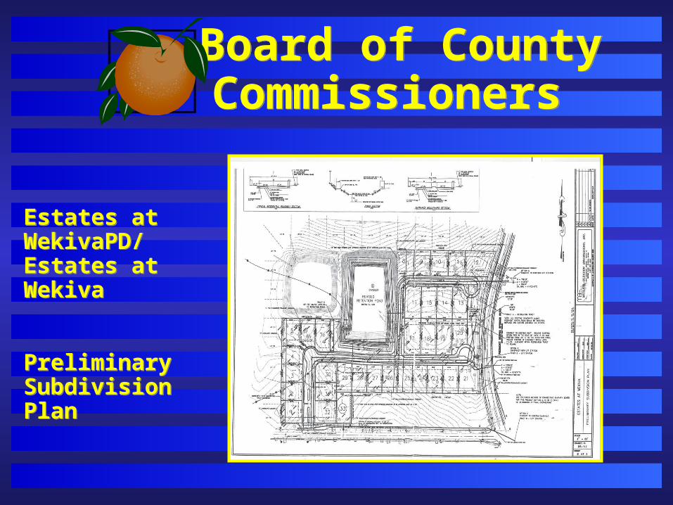
Estates at WekivaPD/Estates at Wekiva
Preliminary SubdivisionPlan
Estates at WekivaPD/Estates at Wekiva
Preliminary SubdivisionPlan

Board of County Commissioners Board of County Commissioners
Approve the Estates at Wekiva Planned Development -
Estates at Wekiva Preliminary Subdivision Plan and
the Joint Use Stormwater Retention Area Agreement
dated “Received May 30, 2007,” subject to the eight (8)
conditions in the staff report.
Action RequestedAction RequestedAction RequestedAction Requested

Board of County Commissioners Board of County Commissioners
Project : Signature Lakes PD/LUP - Substantial Change
Applicant: Lance Bennett of MSCW, Inc.,
District #: 1
Project : Signature Lakes PD/LUP - Substantial Change
Applicant: Lance Bennett of MSCW, Inc.,
District #: 1

Board of County Commissioners Board of County Commissioners
RequestRequestTo consider a substantial change to grant the following five (5) waivers to reconcile the Horizon West-approved PD guidelines by the PD Zoning Code: (1) A waiver from Section 38-1258(f), which requires a 6-foot high masonry, brick, or block wall between multi-family and single-family residences, (2) A waiver from Section 38-1258(g), to allow multi-family to directly access a right-of-way serving single-family residences, (3) A waiver from Section 38-1258(i), which requires the multi-family tract to be fenced when directly across from single-family residences, (4) A waiver from Section 38-1258(a), which requires that the maximum building height be restricted to one story when within 100 feet of single-family residences, and (5) A waiver from Section 38-1258(e), to allow parking for multi-family to be less than 25 feet from single-family residences and to require a 25-foot Type C landscape buffer. No additional entitlements are being sought with this request.
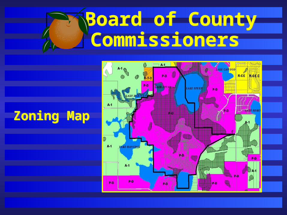
Board of County Commissioners Board of County Commissioners
Zoning MapZoning Map

Board of County Commissioners Board of County Commissioners
Future Land Use Map
Future Land Use Map
Board of County Commissioners Board of County Commissioners
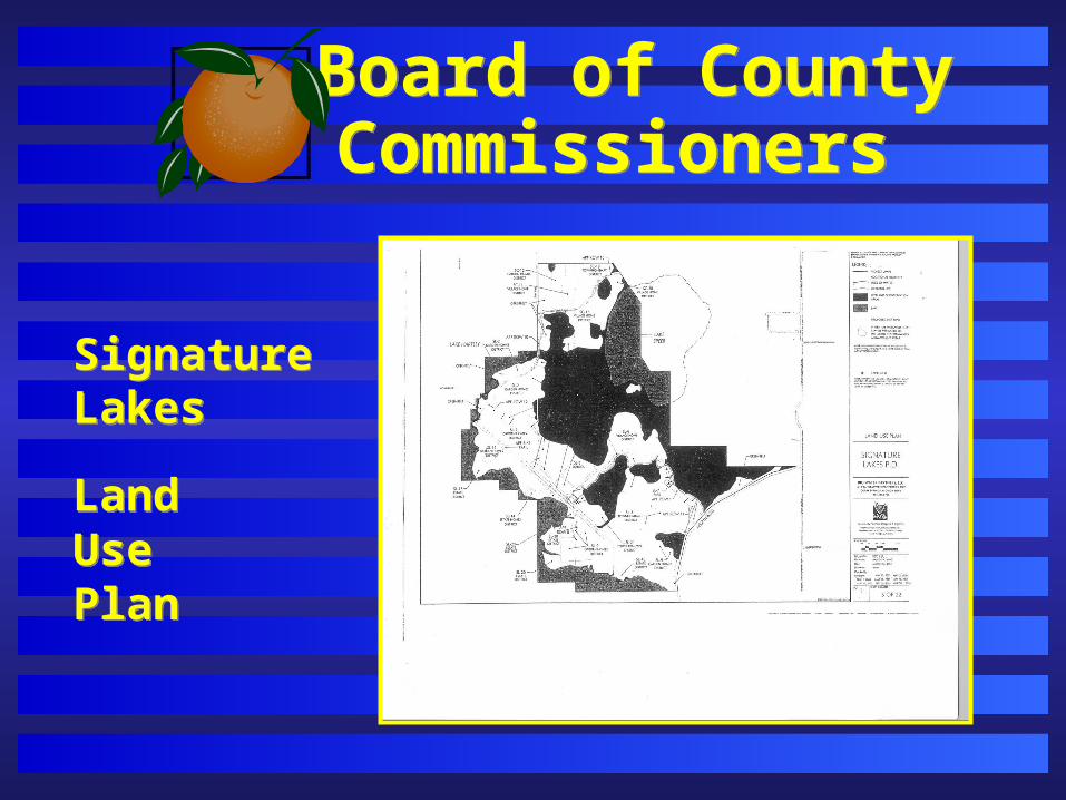
Signature Lakes
LandUse Plan
Signature Lakes
LandUse Plan
Board of County Commissioners Board of County Commissioners
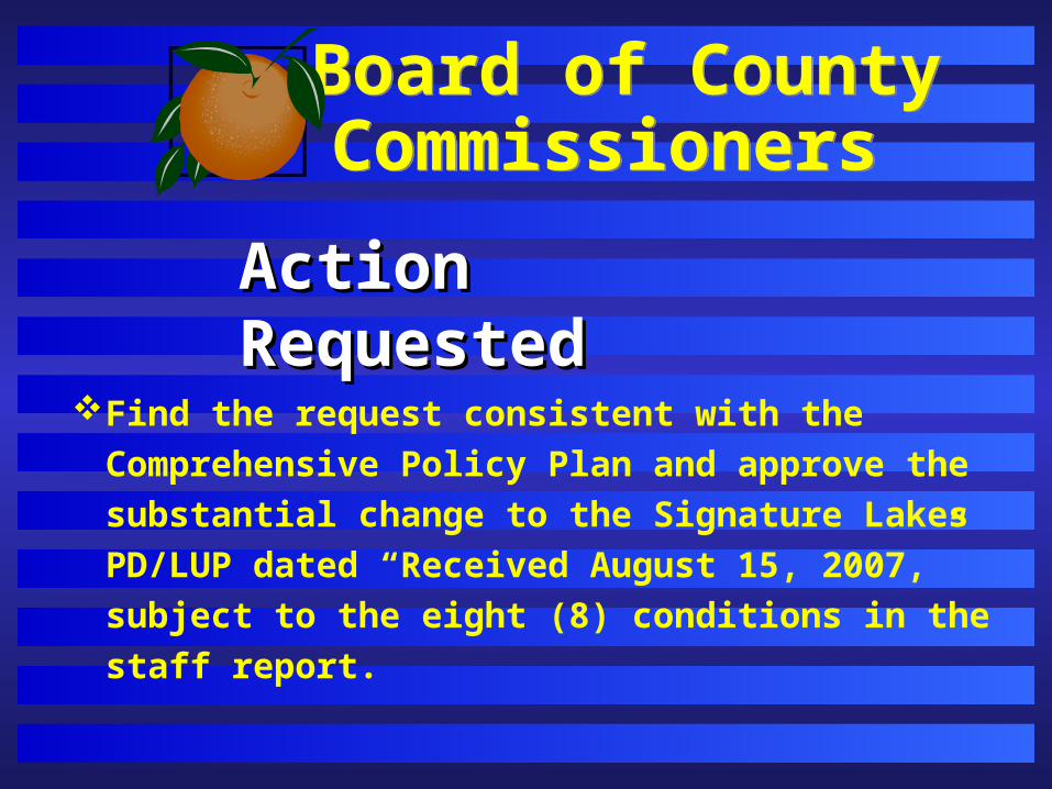
Action RequestedAction Requested
Find the request consistent with the Comprehensive
Policy Plan and approve the substantial change to the
Signature Lakes PD/LUP dated “Received August 15,
2007,” subject to the eight (8) conditions in the staff
report.
Board of County Commissioners Board of County Commissioners
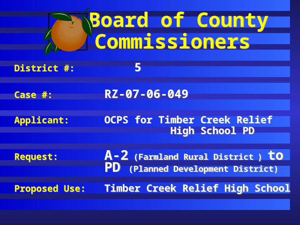
District #: 5
Case #: RZ-07-06-049
Applicant: OCPS for Timber Creek Relief High School PD
Request: A-2 (Farmland Rural District ) toPD (Planned Development District)
Proposed Use: Timber Creek Relief High School
District #: 5
Case #: RZ-07-06-049
Applicant: OCPS for Timber Creek Relief High School PD
Request: A-2 (Farmland Rural District ) toPD (Planned Development District)
Proposed Use: Timber Creek Relief High School
Board of County Commissioners Board of County Commissioners
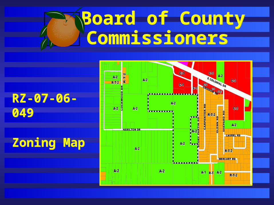
RZ-07-06-049
Zoning Map
RZ-07-06-049
Zoning Map
Board of County Commissioners Board of County Commissioners
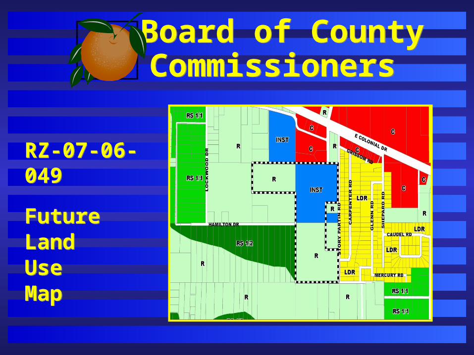
RZ-07-06-049
FutureLandUse Map
RZ-07-06-049
FutureLandUse Map
Board of County Commissioners Board of County Commissioners
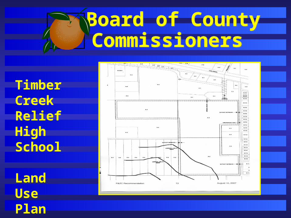
Timber Creek Relief High School
LandUsePlan
Board of County Commissioners Board of County Commissioners
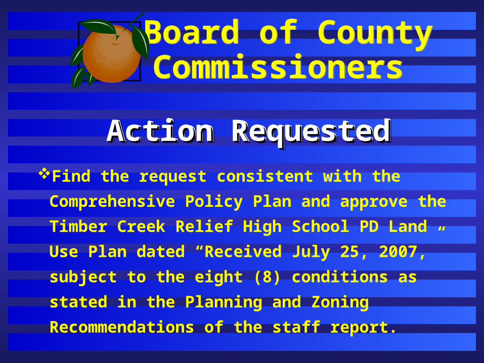
Action RequestedAction RequestedAction RequestedAction RequestedFind the request consistent with the Comprehensive
Policy Plan and approve the Timber Creek Relief High
School PD Land Use Plan dated “Received July 25,
2007,” subject to the eight (8) conditions as stated in
the Planning and Zoning Recommendations of the
staff report.
Board of County Commissioners Board of County Commissioners
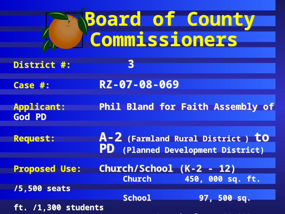
District #: 3
Case #: RZ-07-08-069
Applicant: Phil Bland for Faith Assembly of God PD Request: A-2 (Farmland Rural District ) to
PD (Planned Development District)
Proposed Use: Church/School (K-2 - 12) Church 450, 000 sq. ft. /5,500 seats School 97, 500 sq. ft. /1,300 students
Preschool 25,000 sq. ft. /325 students
Board of County Commissioners Board of County Commissioners
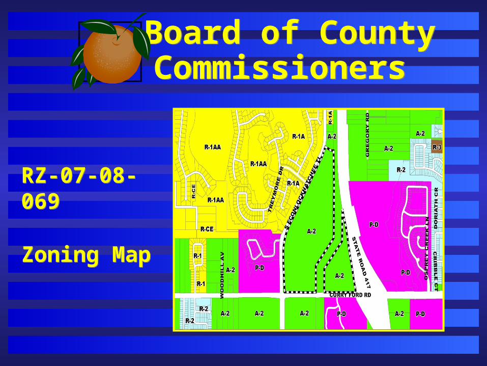
RZ-07-08-069
Zoning Map
RZ-07-08-069
Zoning Map
Board of County Commissioners Board of County Commissioners
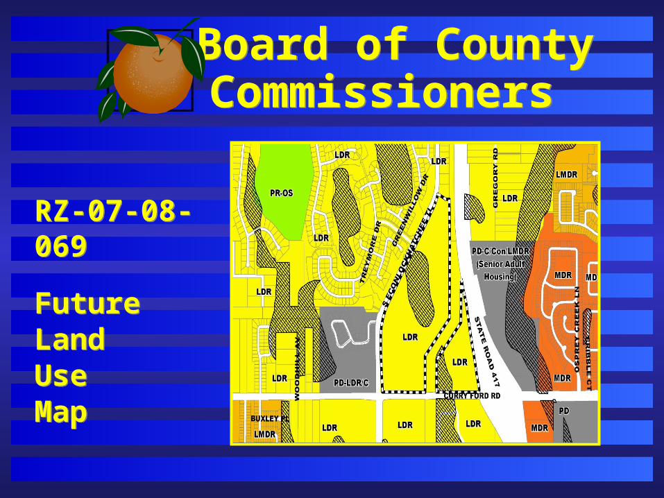
RZ-07-08-069
FutureLandUse Map
RZ-07-08-069
FutureLandUse Map

Board of County Commissioners Board of County Commissioners
Faith Assembly of God
LandUsePlan
Board of County Commissioners Board of County Commissioners
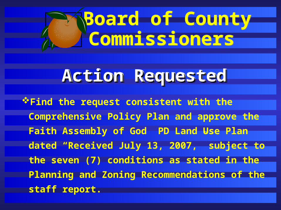
Action RequestedAction RequestedAction RequestedAction RequestedFind the request consistent with the Comprehensive
Policy Plan and approve the Faith Assembly of God
PD Land Use Plan dated “Received July 13, 2007,”
subject to the seven (7) conditions as stated in the
Planning and Zoning Recommendations of the staff
report.
Board of County Commissioners Board of County Commissioners
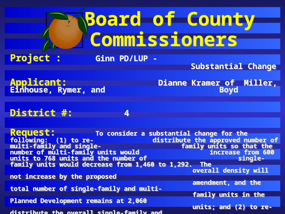
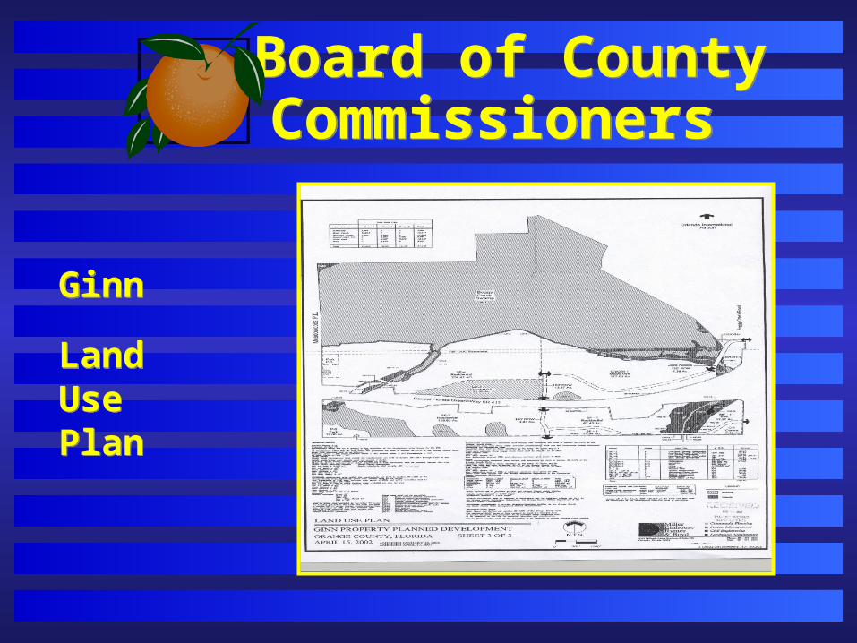
Project : Ginn PD/LUP - Substantial Change
Applicant: Dianne Kramer of Miller, Einhouse, Rymer, and Boyd
District #: 4
Request: To consider a substantial change for the following: (1) to re-distribute the approved number of multi-family and single-family units so that the number of multi-family units would increase from 600 units to 768 units and the number of single-family units would decrease from 1,460 to 1,292. The
overall density will not increase by the proposed amendment, and the total number of single-family and multi- family units in the Planned Development remains at 2,060 units; and (2) to re-distribute the overall single-family and multi-family acreages. The multi-family acreage located north of State Road 417 (MF-2) would increase from 314 to 482
acres. The single-family acreage for the parcel east of the multi-family parcel will decrease from 266.95 to
234.41 acres.
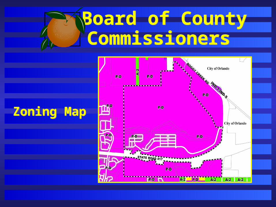
Board of County Commissioners Board of County Commissioners
Zoning MapZoning Map
Board of County Commissioners Board of County Commissioners
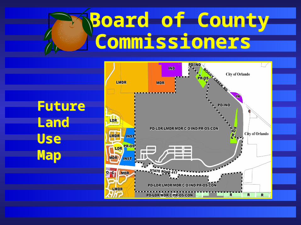
Future Land Use Map
Future Land Use Map
Board of County Commissioners Board of County Commissioners
Ginn
LandUse Plan
Ginn
LandUse Plan
Board of County Commissioners Board of County Commissioners
Action RequestedAction Requested
Find the request consistent with the Comprehensive
Policy Plan and approve the substantial change to the
Ginn Property PD/LUP dated “Received April 18,
2007,” subject to the three (3) conditions in the staff
report.

Board of County CommissionersBoard of County Commissioners
PUBLIC HEARINGPUBLIC HEARING