bmg lipi - pacific climate change portal filein anyer, java and in denpassar, bali. parents are...
TRANSCRIPT
Intergovernmental Oceanographic Commission (IOC)United Nations Educational, Scientific and Cultural Organization (UNESCO)1, rue Miollis75 735 Paris Cedex 15FranceTel: +33 1 45 68 39 83Fax: +33 1 45 68 58 12Web: http://ioc.unesco.org
Intergovernmental Oceanographic Commission
International Tsunami Information Centre
United Nations International Strategy for Disaster Reduction for Asia & the Pacific (UN/ISDR Asia & Pacific)c/o UNESCAP - United Nations Conference Centre BuildingRajdamnern Nok Avenue, Bangkok 10200ThailandTel: +66 (0)2 288 2766Fax: +66 (0)2 288 1050E-mail: [email protected]: http://www.unisdr.org/asiapacific/
Meteorological and Geophysical Agency (BMG)Jl. Angkasa I No.2KemayoranP.O. Box 3540Jakarta 10720IndonesiaTel: +62 21 424 6321Fax: +62 21 654 6316E-mail: [email protected]: http://www.bmg.go.id
Indonesian Institute of Sciences (LIPI)COREMAPJI. Raden Saleh 43Jakarta 10330 Indonesia Tel: +62 21 314 3080 Fax: +62 21 327 958 E-mail: [email protected] Web: http://www.lipi.go.id
BMG LIPI
BMG LIPI
Bibliographic reference:UNESCO-IOC. Tsunami Warning! IOC Information Document No. 1223 (IOC/INF-1223)© 2006
ACKNOWLEDGMENTS
The Intergovernmental Coordination Group for the Pacific Tsunami Warning and Mitigation System of the Intergovernmental Oceanographic Commission of UNESCO, at its Thirteenth Session in Ensenada, Mexico (September 1991), encouraged the preparation of a book designed to inform young persons about tsunamis, the dangers which they present, and what should be done to save lives and property.
The authors of this book are Dr. George Pararas-Carayannis, Ms. Patricia Wilson, Mr. Richard Sillcox, Dr. Laura Kong, Mr. Brian Yanagi, and Ms. Tammy Kaitoku. The illustrations were created by Mr. Joe Hunt and Mr. Ernest Burnett.
The ITIC is pleased to present a customized version of Tsunami Warning! for countries of the Indian Ocean. This revision uses a tsunami source off the western coast of Sumatra, Indonesia. The booklet illustrates the standard operating procedures followed by tsunami warning centres and emergency response agencies after a large earthquake occurs, and before, during, and after a tsunami hits the coast.
This booklet was made possible through the contributions of the United Nations Inter Agency Secretariat of the International Strategy for Disaster Reduction (UN/ISDR). The ITIC thanks the Meteorological and Geophysical Agency (BMG) of Indonesia for its review and translation of the Indian Ocean version of Tsunami Warning!
To learn more about tsunamis and what you should do when a tsunami is coming, we encourage you to read the ITIC’s Tsunami The Great Waves.
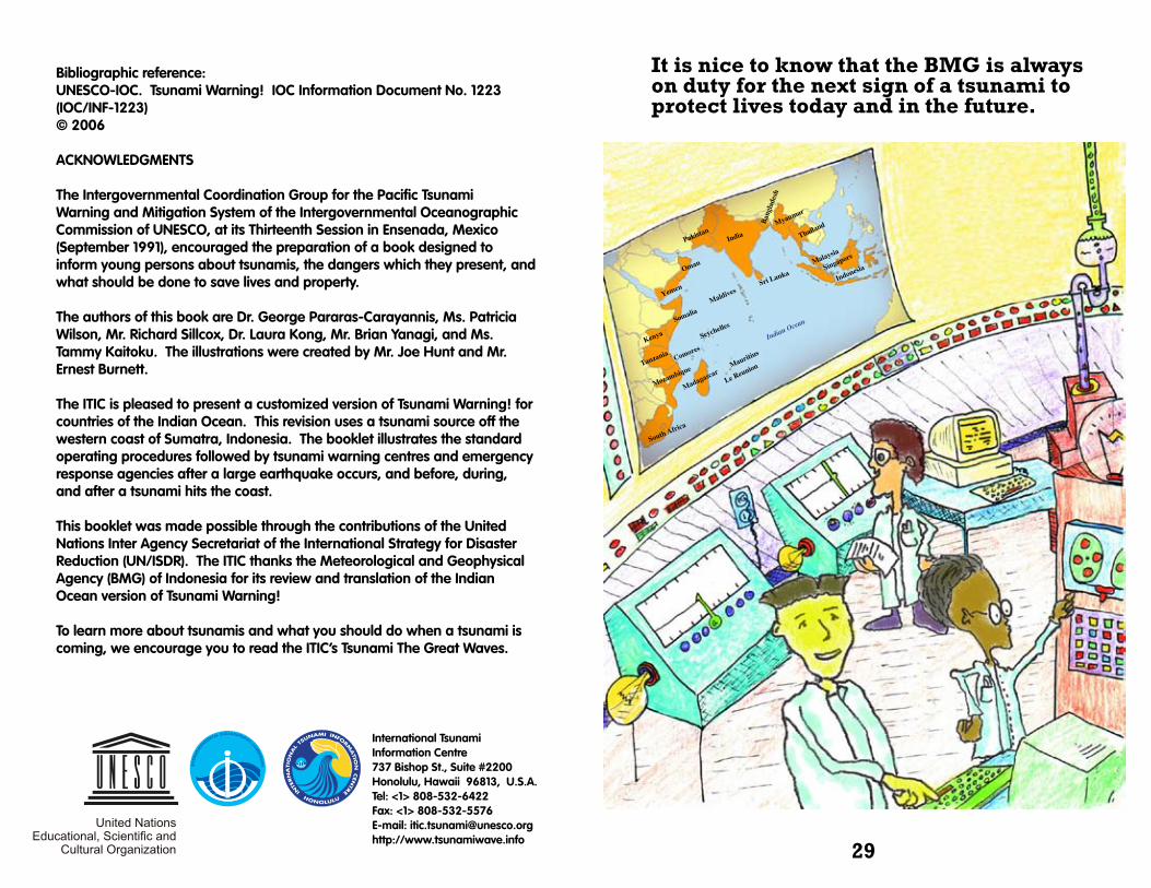
It is nice to know that the BMG is always on duty for the next sign of a tsunami to protect lives today and in the future.
29
International Tsunami Information Centre737 Bishop St., Suite #2200Honolulu, Hawaii 96813, U.S.A.Tel: <1> 808-532-6422Fax: <1> 808-532-5576E-mail: [email protected]://www.tsunamiwave.info
Yemen
IndiaPakistan
Maldives
Ban
glad
esh
Myanmar
Thailand
Malaysia
Indonesia
Indian Ocean
Mauritius
Comores
Madagascar
SeychellesSomalia
Oman
Kenya
Tanzania
Mozambique
Sri Lanka
Le Reunion
South Africa
Singapore
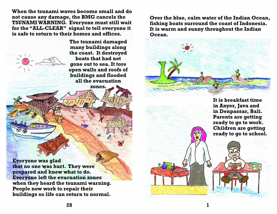
When the tsunami waves become small and do not cause any damage, the BMG cancels the TSUNAMI WARNING. Everyone must still wait for the “ALL-CLEAR” signal to tell everyone it is safe to return to their homes and offices.
Everyone was gladthat no one was hurt. They were prepared and knew what to do. Everyone left the evacuation zones when they heard the tsunami warning. People now work to repair their buildings so life can return to normal.
Over the blue, calm water of the Indian Ocean, fishing boats surround the coast of Indonesia. It is warm and sunny throughout the Indian Ocean.
It is breakfast time in Anyer, Java and in Denpassar, Bali. Parents are getting ready to go to work. Children are getting ready to go to school.
The tsunami damaged many buildings along the coast. It destroyed
boats that had not gone out to sea. It tore open walls and roofs of buildings and flooded
all the evacuation zones.
128
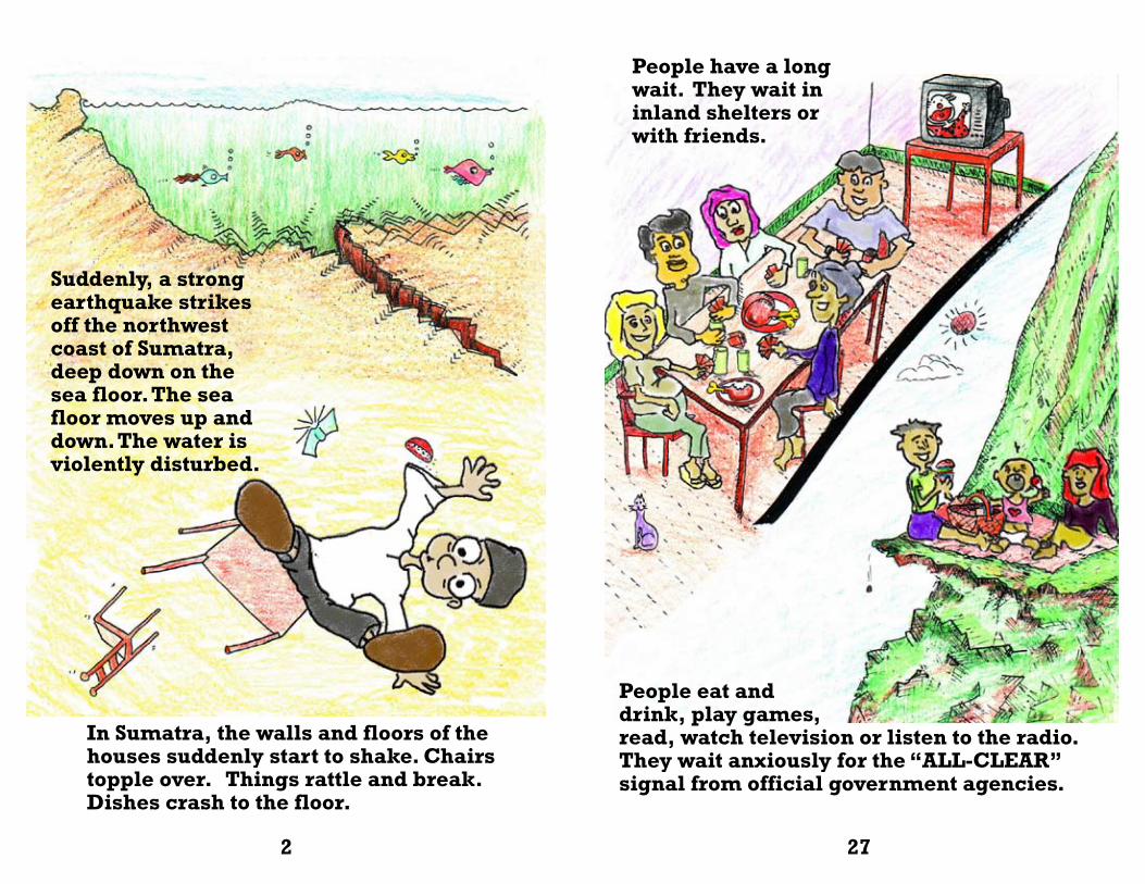
People have a long wait. They wait in inland shelters or with friends.
People eat and drink, play games, read, watch television or listen to the radio. They wait anxiously for the “ALL-CLEAR” signal from official government agencies.
Suddenly, a strong earthquake strikes off the northwest coast of Sumatra, deep down on the sea floor. The sea floor moves up and down. The water is violently disturbed.
In Sumatra, the walls and floors of the houses suddenly start to shake. Chairs topple over. Things rattle and break. Dishes crash to the floor.
2 27

The first tsunami wave arrives. Around some parts of the islands, coral reefs help to break the force of the tsunami.
But at bays, the waves can be very big because the sides of the bay shorten the length of the wave and push it upwards. There are multiple waves in this tsunami and they come every hour for the next six hours.
It is an earthquake! People know what to do. They do not run outside.
The earthquake sends out shock waves in all directions. The sea surface is also disturbed. Big waves are formed. These powerful waves are called tsunamis. These waves travel fast across the sea. They are dangerous and they can kill.
26
.. Some shores are protected by trees and mangrove forests which lessen the wave force even more. But the waves in these areas can still be large and dangerous.
3
They take cover under tables, desks, or in doorways to protect themselves from falling objects.
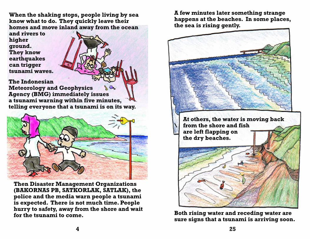
When the shaking stops, people living by sea know what to do. They quickly leave their homes and move inland away from the ocean and rivers to higher ground. They know earthquakes can trigger tsunami waves.
A few minutes later something strange happens at the beaches. In some places, the sea is rising gently.
At others, the water is moving back \ from the shore and fish are left flapping on the dry beaches.
Both rising water and receding water are sure signs that a tsunami is arriving soon.
4 25
Then Disaster Management Organizations (BAKORNAS PB, SATKORLAK, SATLAK), the police and the media warn people a tsunami is expected. There is not much time. People hurry to safety, away from the shore and wait for the tsunami to come.
The Indonesian Meteorology and Geophysics Agency (BMG) immediately issues a tsunami warning within five minutes, telling everyone that a tsunami is on its way.
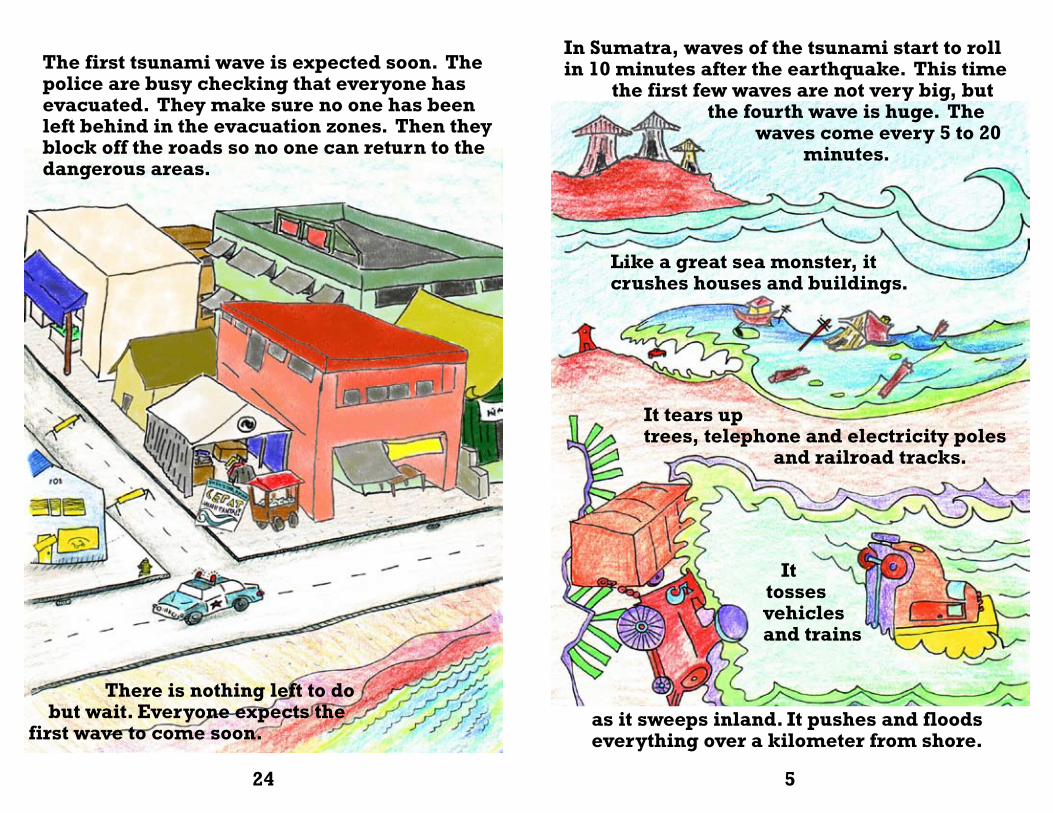
The first tsunami wave is expected soon. The police are busy checking that everyone has evacuated. They make sure no one has been left behind in the evacuation zones. Then they block off the roads so no one can return to the dangerous areas.
In Sumatra, waves of the tsunami start to roll in 10 minutes after the earthquake. This time the first few waves are not very big, but the fourth wave is huge. The waves come every 5 to 20 minutes.
Like a great sea monster, it crushes houses and buildings.
It tears uptrees, telephone and electricity poles and railroad tracks.
It tosses vehicles and trains
as it sweeps inland. It pushes and floods everything over a kilometer from shore.
24 5
There is nothing left to do but wait. Everyone expects the first wave to come soon.
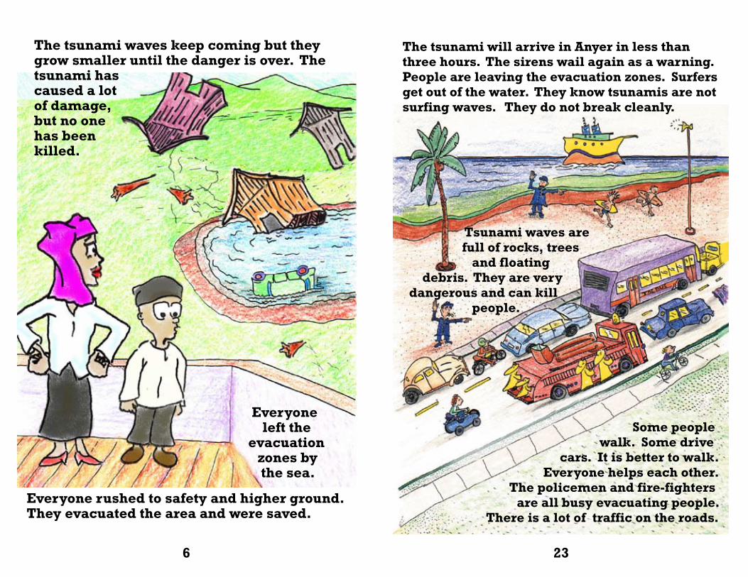
The tsunami waves keep coming but they grow smaller until the danger is over. The tsunami has caused a lot of damage, but no one has beenkilled.
Everyone left the evacuation zones by the sea.
The tsunami will arrive in Anyer in less than three hours. The sirens wail again as a warning. People are leaving the evacuation zones. Surfers get out of the water. They know tsunamis are not surfing waves. They do not break cleanly.
Some people walk. Some drive cars. It is better to walk. Everyone helps each other. The policemen and fire-fighters are all busy evacuating people. There is a lot of traffic on the roads.
6 23
Everyone rushed to safety and higher ground. They evacuated the area and were saved.
Tsunami waves are full of rocks, trees and floating debris. They are very dangerous and can kill people.
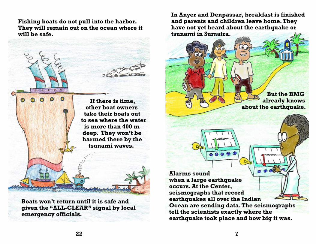
Fishing boats do not pull into the harbor. They will remain out on the ocean where it will be safe.
In Anyer and Denpassar, breakfast is finished and parents and children leave home. They have not yet heard about the earthquake or tsunami in Sumatra.
But the BMG already knows about the earthquake.
22 7
If there is time, other boat owners take their boats out to sea where the water is more than 400 m deep. They won’t be harmed there by the tsunami waves.
Boats won’t return until it is safe and given the “ALL-CLEAR” signal by local emergency officials.
Alarms sound when a large earthquake occurs. At the Center, seismographs that record earthquakes all over the Indian Ocean are sending data. The seismographstell the scientists exactly where theearthquake took place and how big it was.
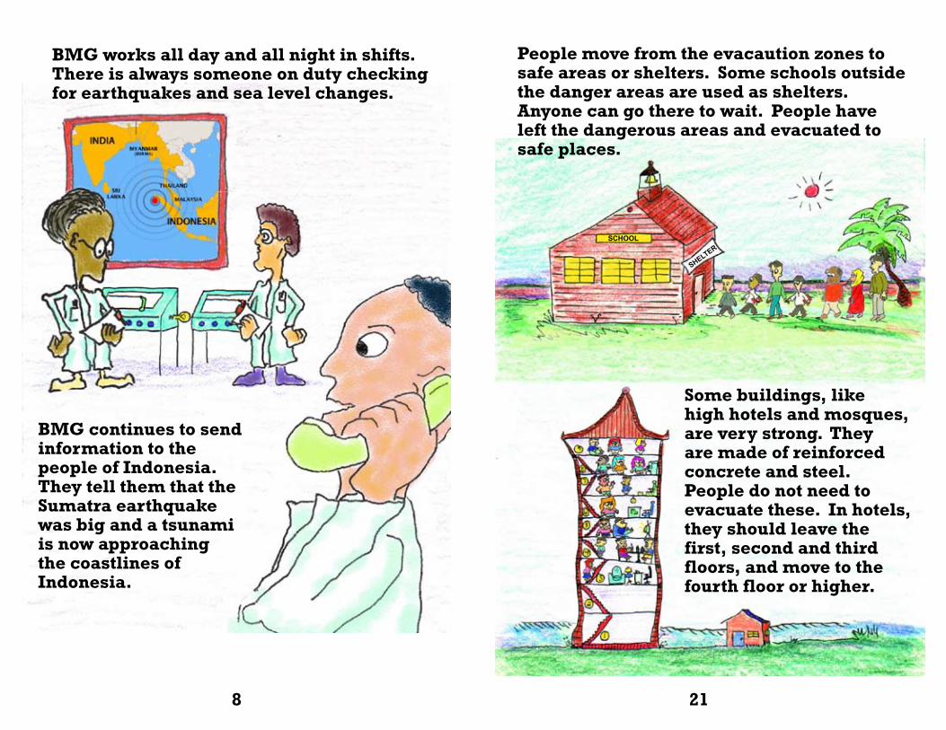
BMG works all day and all night in shifts. There is always someone on duty checking for earthquakes and sea level changes.
BMG continues to send information to the people of Indonesia. They tell them that the Sumatra earthquake was big and a tsunami is now approaching the coastlines of Indonesia.
People move from the evacaution zones to safe areas or shelters. Some schools outside the danger areas are used as shelters. Anyone can go there to wait. People have left the dangerous areas and evacuated to safe places.
Some buildings, like high hotels and mosques, are very strong. They are made of reinforced concrete and steel. People do not need to evacuate these. In hotels, they should leave the first, second and third floors, and move to the fourth floor or higher.
SCHOOL
SHELTER
8 21
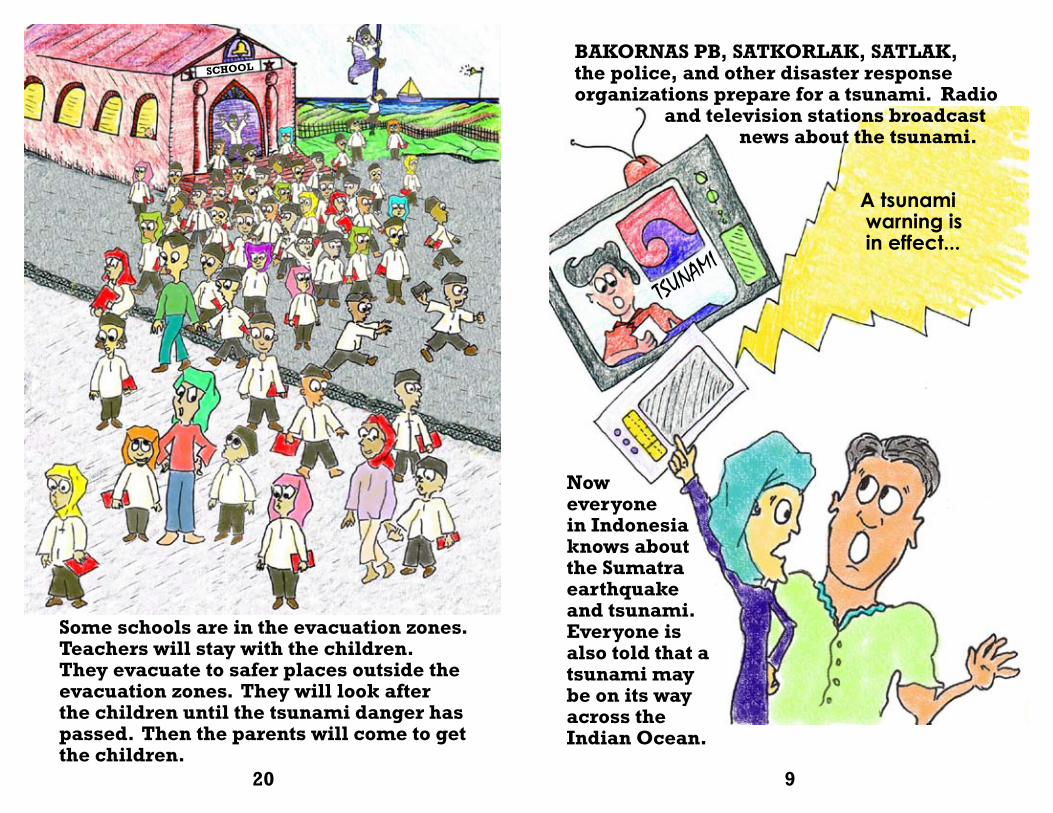
Some schools are in the evacuation zones. Teachers will stay with the children. They evacuate to safer places outside the evacuation zones. They will look after the children until the tsunami danger has passed. Then the parents will come to get the children.
A tsunami warning is in effect...
Now everyone in Indonesia knows about the Sumatra earthquake and tsunami.Everyone is also told that a tsunami may be on its way across the Indian Ocean.
TSUNAMI
SCHOOLBAKORNAS PB, SATKORLAK, SATLAK, the police, and other disaster response organizations prepare for a tsunami. Radio and television stations broadcast news about the tsunami.
20 9
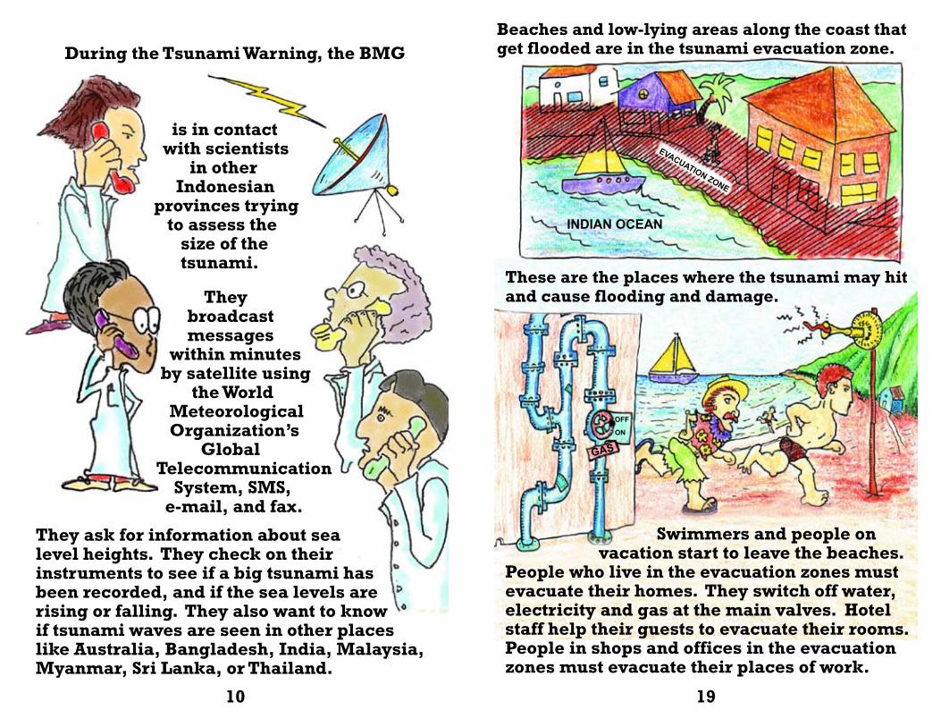
Beaches and low-lying areas along the coast that get flooded are in the tsunami evacuation zone.
Swimmers and people on vacation start to leave the beaches. People who live in the evacuation zones must evacuate their homes. They switch off water, electricity and gas at the main valves. Hotel staff help their guests to evacuate their rooms. People in shops and offices in the evacuation zones must evacuate their places of work.
INDIAN OCEAN
EVACUATION ZONE
GAS
OFF
ON
During the Tsunami Warning, the BMG
is in contact with scientists in other Indonesian provinces trying to assess the size of the tsunami.
They ask for information about sea level heights. They check on their instruments to see if a big tsunami has been recorded, and if the sea levels are rising or falling. They also want to know if tsunami waves are seen in other places like Australia, Bangladesh, India, Malaysia, Myanmar, Sri Lanka, or Thailand.
10 19
They broadcast messages within minutes by satellite using the World Meteorological Organization’s Global Telecommunication System, SMS, e-mail, and fax.
These are the places where the tsunami may hit and cause flooding and damage.
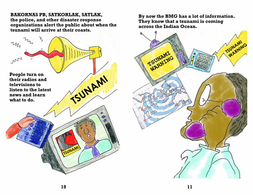
BAKORNAS PB, SATKORLAK, SATLAK, the police, and other disaster response organizations alert the public about when the tsunami will arrive at their coasts.
TSUNAMI
By now the BMG has a lot of information. They know that a tsunami is coming across the Indian Ocean.
TSUNAMI
WARNING
TSUNAMI
WARNING
TSUNAMI
18 11
People turn on their radios and televisions to listen to the latest news and learn what to do.
TSUNAMI
WARNING
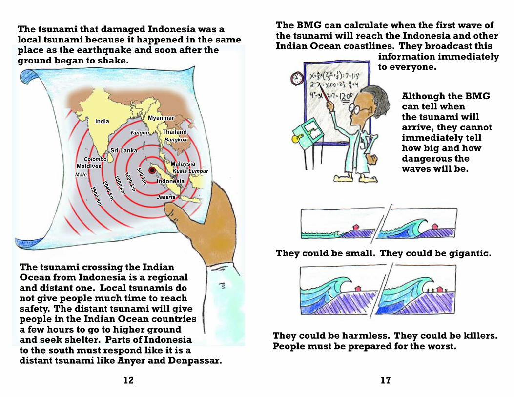
The tsunami that damaged Indonesia was a local tsunami because it happened in the same place as the earthquake and soon after the ground began to shake.
The BMG can calculate when the first wave of the tsunami will reach the Indonesia and other Indian Ocean coastlines. They broadcast this information immediately to everyone.
They could be small. They could be gigantic.
They could be harmless. They could be killers. People must be prepared for the worst.
Although the BMG can tell when the tsunami will arrive, they cannot immediately tell how big and how dangerous the waves will be.
12 17
The tsunami crossing the Indian Ocean from Indonesia is a regional and distant one. Local tsunamis do not give people much time to reach safety. The distant tsunami will give people in the Indian Ocean countries a few hours to go to higher ground and seek shelter. Parts of Indonesia to the south must respond like it is a distant tsunami like Anyer and Denpassar.
Myanmar
Yangon ThailandBangkok
Sri Lanka
MaldivesColombo
India
Malaysia
Male Kuala Lumpur
Indonesia
Jakarta
500 km
1000 km
1500 km
2000 km
2500 km
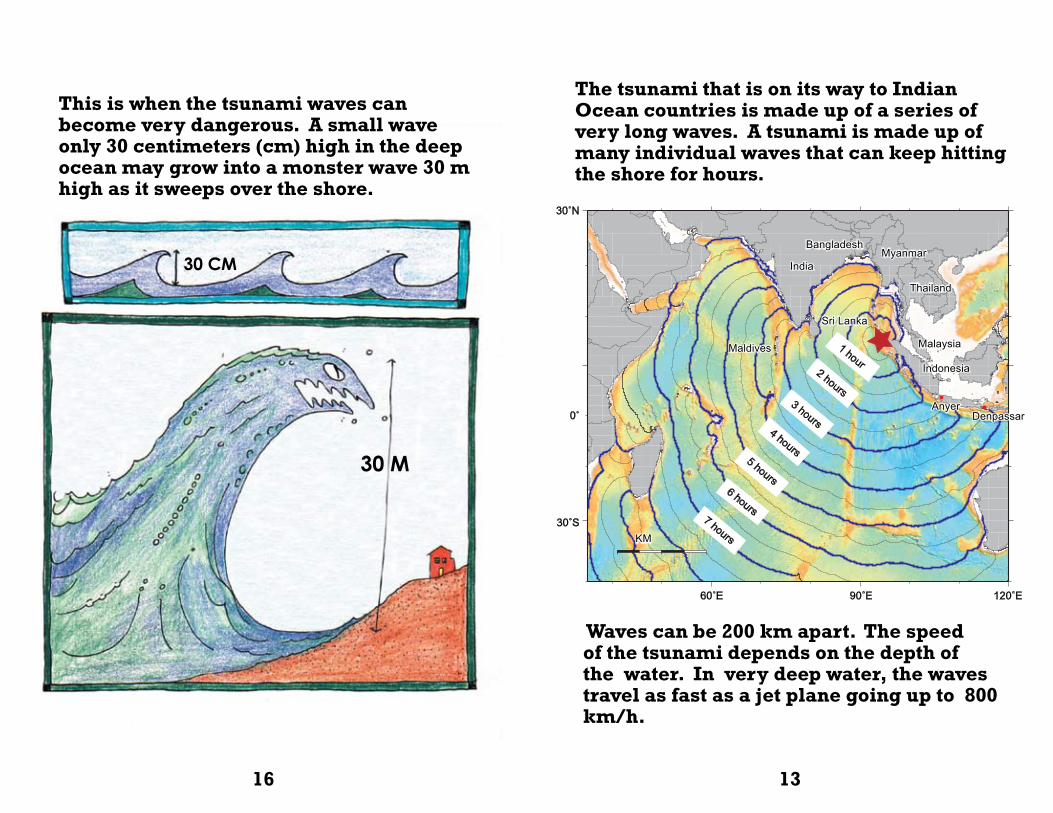
This is when the tsunami waves can become very dangerous. A small wave only 30 centimeters (cm) high in the deep ocean may grow into a monster wave 30 m high as it sweeps over the shore.
The tsunami that is on its way to Indian Ocean countries is made up of a series of very long waves. A tsunami is made up of many individual waves that can keep hitting the shore for hours.
30 M
30 CM
Waves can be 200 km apart. The speed of the tsunami depends on the depth of the water. In very deep water, the waves travel as fast as a jet plane going up to 800 km/h.
16 13
India
BangladeshMyanmar
Thailand
Malaysia
Indonesia
Maldives
Sri Lanka
1 hour2 hours
3 hours4 hours
5 hours6 hours
7 hoursKM
30˚N
0˚
30˚S
60˚E 90˚E 120˚E
AnyerDenpassar
• •
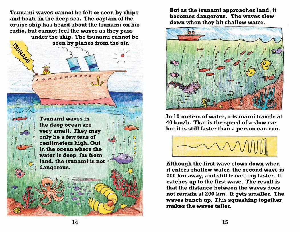
Tsunami waves in the deep ocean are very small. They may only be a few tens of centimeters high. Out in the ocean where the water is deep, far from land, the tsunami is not dangerous.
Although the first wave slows down when it enters shallow water, the second wave is 200 km away, and still travelling faster. It catches up to the first wave. The result is that the distance between the waves does not remain at 200 km. It gets smaller. The waves bunch up. This squashing together makes the waves taller.
TSUNAMI
Tsunami waves cannot be felt or seen by ships and boats in the deep sea. The captain of the cruise ship has heard about the tsunami on his radio, but cannot feel the waves as they pass under the ship. The tsunami cannot be seen by planes from the air.
But as the tsunami approaches land, it becomes dangerous. The waves slow down when they hit shallow water.
In 10 meters of water, a tsunami travels at 40 km/h. That is the speed of a slow car but it is still faster than a person can run.
14 15