asx: znc for personal use only16th august 2016 gold targets at zenith’s split rocks project in...
TRANSCRIPT
16th August 2016
Gold Targets at Zenith’s Split Rocks Project In addition to the lithium targets identified by Zenith at its new 100% owned Split
Rocks Project, a review of previous exploration activity has to date defined several
gold targets that warrant testing;
Gold intersections in historic, shallow drilling northeast of the British Hill gold
deposit include: 34m @ 0.48g/t gold (Au) including 7m @ 1.57 g/t Au, and 1m @
8.67g/t Au from an adjacent hole, open to the southwest and not followed up by
previous explorers;
In addition two gold auger soil anomalies on a regionally gold mineralised shear
zone are located central to Zenith’s project:
o Northern auger soil anomaly is 1.2km long, >10ppb Au with individual soil
results up to 1g/t Au, coincident with major jog in regional shear zone;
o Southern auger anomaly 1km long x 800m wide, > 10ppb Au with soil results up
to 0.12g/t Au;
o These significant gold geochemical anomalies are open and untested by drilling;
Initial surface mapping and confirmatory surface sampling to precede planned drill
testing of the gold targets.
Zenith Minerals Limited (“Zenith” or “the Company”) is pleased to advise that a review of previous exploration activity conducted within its new 100% owned exploration licence applications at Split Rocks in the Forrestania Greenstone Belt of Western Australia has identified several gold targets that warrant testing.
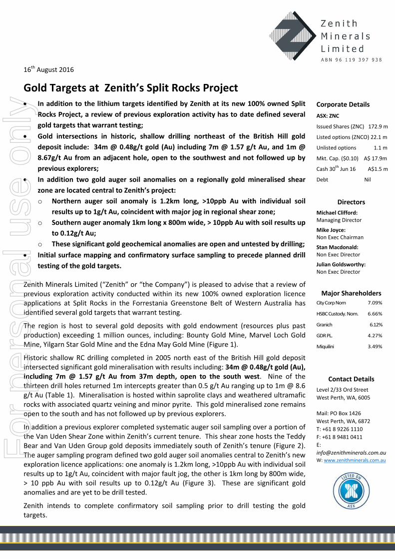
The region is host to several gold deposits with gold endowment (resources plus past production) exceeding 1 million ounces, including: Bounty Gold Mine, Marvel Loch Gold Mine, Yilgarn Star Gold Mine and the Edna May Gold Mine (Figure 1).
Historic shallow RC drilling completed in 2005 north east of the British Hill gold deposit intersected significant gold mineralisation with results including: 34m @ 0.48g/t gold (Au), including 7m @ 1.57 g/t Au from 37m depth, open to the south west. Nine of the thirteen drill holes returned 1m intercepts greater than 0.5 g/t Au ranging up to 1m @ 8.6 g/t Au (Table 1). Mineralisation is hosted within saprolite clays and weathered ultramafic rocks with associated quartz veining and minor pyrite. This gold mineralised zone remains open to the south and has not followed up by previous explorers.
In addition a previous explorer completed systematic auger soil sampling over a portion of the Van Uden Shear Zone within Zenith’s current tenure. This shear zone hosts the Teddy Bear and Van Uden Group gold deposits immediately south of Zenith’s tenure (Figure 2). The auger sampling program defined two gold auger soil anomalies central to Zenith’s new exploration licence applications: one anomaly is 1.2km long, >10ppb Au with individual soil results up to 1g/t Au, coincident with major fault jog, the other is 1km long by 800m wide, > 10 ppb Au with soil results up to 0.12g/t Au (Figure 3). These are significant gold anomalies and are yet to be drill tested.
Zenith intends to complete confirmatory soil sampling prior to drill testing the gold targets.
Corporate Details
ASX: ZNC
Issued Shares (ZNC) 172.9 m
Listed options (ZNCO) 22.1 m
Unlisted options 1.1 m
Mkt. Cap. ($0.10) A$ 17.9m
Cash 30th
Jun 16 A$1.5 m
Debt Nil
Directors
Michael Clifford: Managing Director
Mike Joyce: Non Exec Chairman
Stan Macdonald: Non Exec Director
Julian Goldsworthy: Non Exec Director
Major Shareholders City Corp Nom 7.09%
HSBC Custody. Nom. 6.66%
Granich 6.12%
GDR PL. 4.27%
Miquilini 3.49%
Contact Details
Level 2/33 Ord Street
West Perth, WA, 6005
Mail: PO Box 1426
West Perth, WA, 6872
T: +61 8 9226 1110
F: +61 8 9481 0411
E:
[email protected] W: www.zenithminerals.com.au
For
per
sona
l use
onl
y

Figure 1: Split Rocks Project Tenure and Regional Gold Endowment
Hole ID From (m) To (m) Interval (m) Gold Grade g/t
FDUP001 92 93 1 2.59
FDUP002 21 22 1 2.44
37 39 2 0.50
82 83 1 8.60
FDUP003 36 70 34 0.48
including 37 44 7 1.57
and 68 69 1 0.50
95 96 1 0.70
FDUP004 49 50 1 0.51
FDUP005 35 37 2 0.62
43 44 1 0.52
FDUP008 36 37 1 0.83
69 71 2 0.61
FDUP009 61 62 1 0.60
FDUP010 37 38 1 1.27
FDUP011 40 41 1 6.32
Table 1: Split Rocks Project Significant Gold Intersections from previous drilling north of British Hill
For
per
sona
l use
onl
y
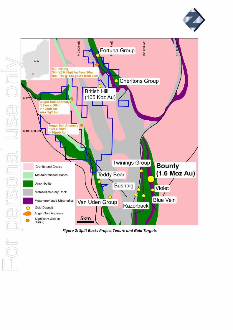
Figure 2: Split Rocks Project Tenure and Gold Targets
For
per
sona
l use
onl
y
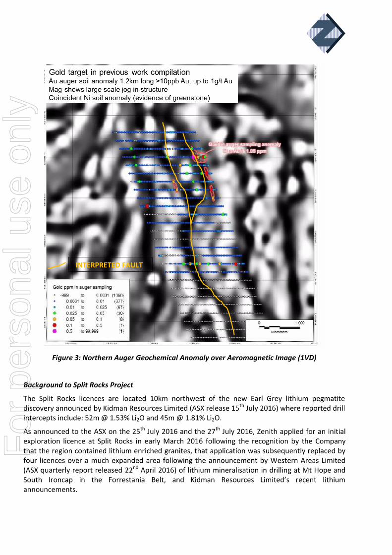
Figure 3: Northern Auger Geochemical Anomaly over Aeromagnetic Image (1VD)
Background to Split Rocks Project
The Split Rocks licences are located 10km northwest of the new Earl Grey lithium pegmatite discovery announced by Kidman Resources Limited (ASX release 15th July 2016) where reported drill intercepts include: 52m @ 1.53% Li2O and 45m @ 1.81% Li2O.
As announced to the ASX on the 25th July 2016 and the 27th July 2016, Zenith applied for an initial exploration licence at Split Rocks in early March 2016 following the recognition by the Company that the region contained lithium enriched granites, that application was subsequently replaced by four licences over a much expanded area following the announcement by Western Areas Limited (ASX quarterly report released 22nd April 2016) of lithium mineralisation in drilling at Mt Hope and South Ironcap in the Forrestania Belt, and Kidman Resources Limited’s recent lithium announcements.
INTERPRETED FAULT
For
per
sona
l use
onl
y
Competent Persons Statement
The information in this report that relates to Exploration Results is based on information compiled by Mr Michael Clifford, who is a Member of the Australian Institute of Geoscientists and an employee of Zenith Minerals Limited. Mr Clifford has sufficient experience which is relevant to the style of mineralisation and type of deposit under consideration and to the activity which he is undertaking to qualify as a Competent Person as defined in the 2012 Edition of the 'Australasian Code for Reporting of Exploration Results, Mineral Resources and Ore Reserves'. Mr Clifford consents to the inclusion in the report of the matters based on his information in the form and context in which it appears.
16th August 2016
For further information contact:
Zenith Minerals Limited Media and Broker Enquiries
Directors Michael Clifford or Mike Joyce Andrew Rowell
E: [email protected] E: [email protected] Phone +61 8 9226 1110 Ph +61 8 6314 6300
For
per
sona
l use
onl
y
About Zenith
Zenith is advancing its project portfolio of high-quality, gold, lithium and base metal
projects whilst building a superior project base of high-quality advanced exploration
assets:
San Domingo Lithium, Arizona USA (ZNC 100%)
9km x 1.5km lithium pegmatite field, initial surface sampling returned: 5m @ 1.97%Li2O
including 2.4m @ 2.49% Li2ORock
Surface sampling in progress
Kavaklitepe Gold Project, Turkey (Teck earning 70%)
Recent (2013) grass roots gold discovery in Tethyan Belt
Large, virtually drill-ready, high order gold soil / IP anomaly >1km strike
Rock chip traverses to 54m @ 3.33g/t gold, including 21.5m @ 7.2 g/t gold
Initial drill results: 9 m @ 5.2 g/t Au from surface and 7.8 m @ 7.3 g/t Au from 3.3 m
below surface
Drilling in progress
Develin Creek Copper-Zinc-Silver-Gold, QLD (ZNC initial 51%)
3 known VHMS massive sulphide deposits with JORC resources, 50km of strike of host
volcanics
2011 drilling outside resource; 13.2 metres @ 3.3% copper, 4.0% zinc, 30g/t silver and
0.4g/t gold
Drilling to extend known deposits, geophysics, geochemistry to detect new targets
Mt Minnie Gold Project, WA (ZNC 100%)
Major regional fault. Alteration, geochemistry, rock samples to 21.5 g/t Au
Drill testing planned 2016
Earaheedy Manganese Project, WA (ZNC 100%)
New manganese province discovered by ZNC, potential DSO drill intersections (+40%Mn)
Mt Alexander Iron Ore, WA (ZNC 100%)
JORC magnetite Resource 566 Mt @ 30.0% Fe close to West Pilbara coast, 50% of target
untested.
Seeking development partner/ buyer for iron project
Other
Evaluating new lithium project opportunities
For
per
sona
l use
onl
y
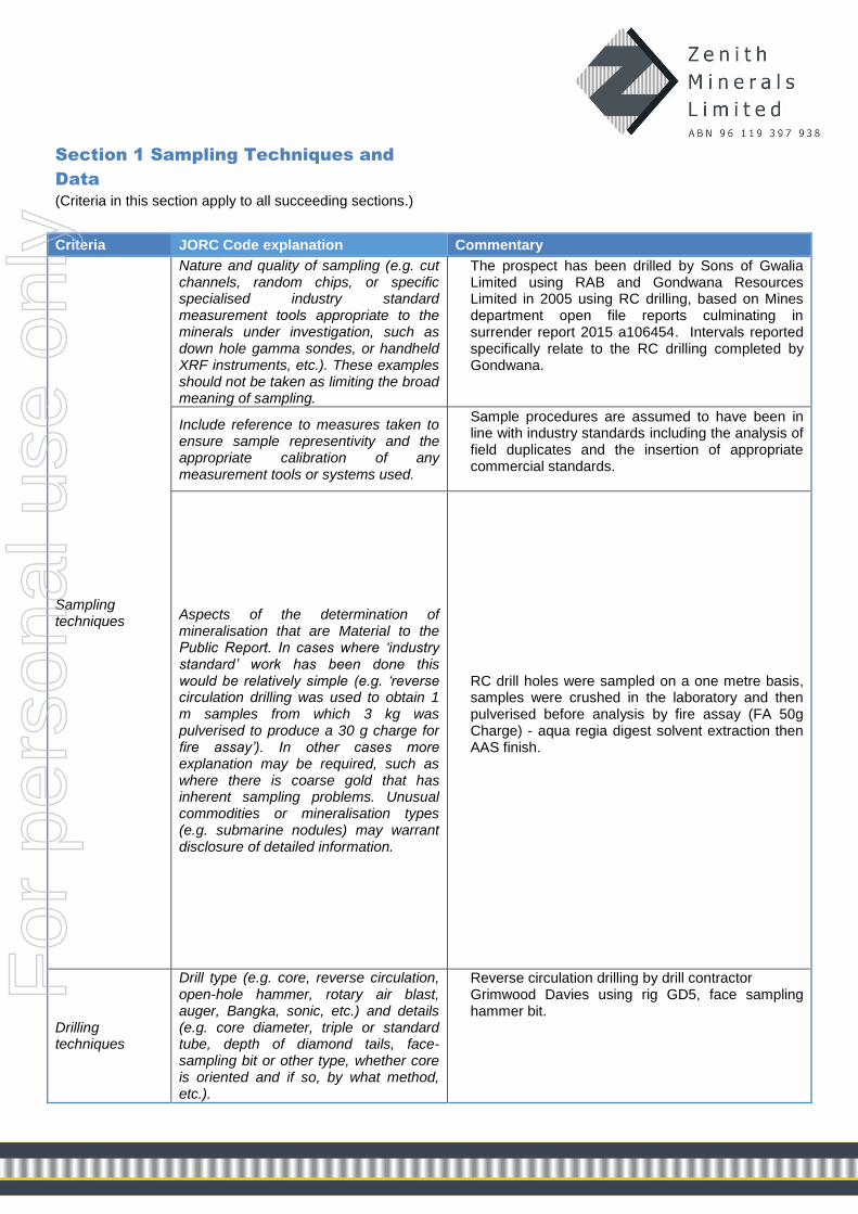
Section 1 Sampling Techniques and
Data
(Criteria in this section apply to all succeeding sections.)
Criteria JORC Code explanation Commentary
Sampling techniques
Nature and quality of sampling (e.g. cut channels, random chips, or specific specialised industry standard measurement tools appropriate to the minerals under investigation, such as down hole gamma sondes, or handheld XRF instruments, etc.). These examples should not be taken as limiting the broad meaning of sampling.
The prospect has been drilled by Sons of Gwalia Limited using RAB and Gondwana Resources Limited in 2005 using RC drilling, based on Mines department open file reports culminating in surrender report 2015 a106454. Intervals reported specifically relate to the RC drilling completed by Gondwana.
Include reference to measures taken to ensure sample representivity and the appropriate calibration of any measurement tools or systems used.
Sample procedures are assumed to have been in line with industry standards including the analysis of field duplicates and the insertion of appropriate commercial standards.
Aspects of the determination of mineralisation that are Material to the Public Report. In cases where ‘industry standard’ work has been done this would be relatively simple (e.g. ‘reverse circulation drilling was used to obtain 1 m samples from which 3 kg was pulverised to produce a 30 g charge for fire assay’). In other cases more explanation may be required, such as where there is coarse gold that has inherent sampling problems. Unusual commodities or mineralisation types (e.g. submarine nodules) may warrant disclosure of detailed information.
RC drill holes were sampled on a one metre basis, samples were crushed in the laboratory and then pulverised before analysis by fire assay (FA 50g Charge) - aqua regia digest solvent extraction then AAS finish.
Drilling techniques
Drill type (e.g. core, reverse circulation, open-hole hammer, rotary air blast, auger, Bangka, sonic, etc.) and details (e.g. core diameter, triple or standard tube, depth of diamond tails, face-sampling bit or other type, whether core is oriented and if so, by what method, etc.).
Reverse circulation drilling by drill contractor Grimwood Davies using rig GD5, face sampling hammer bit.
For
per
sona
l use
onl
y

Drill sample recovery
Method of recording and assessing core and chip sample recoveries and results assessed.
Insufficient information is available in the open file reports to document method of recording and assessing core and chip sample recoveries and results assessed. The intercepts reported in this release are of geological/exploration interest and the lack of information does not materially affect the veracity of the results as a target warranting further drill follow-up.
Measures taken to maximise sample recovery and ensure representative nature of the samples.
RC samples taken as 1m split.
Whether a relationship exists between sample recovery and grade and whether sample bias may have occurred due to preferential loss/gain of fine/coarse material.
Insufficient information is available in the open file reports to document if a relationship exists between sample recovery and grade and whether sample bias may have occurred due to preferential loss/gain of fine/coarse material. The intercepts reported in this release are of geological/exploration interest and the lack of information does not materially affect the veracity of the results as a target warranting further drill follow-up.
Logging
Whether core and chip samples have been geologically and geotechnically logged to a level of detail to support appropriate Mineral Resource estimation, mining studies and metallurgical studies.
RC samples have been geologically logged by a qualified geologist.
Whether logging is qualitative or quantitative in nature. Core (or costean, channel, etc.) photography.
Logging recorded the lithology, oxidation state, colour, alteration, veining, presence or absence of sulphide minerals and species.
The total length and percentage of the relevant intersections logged.
All drill holes are logged in full.
Sub-sampling techniques and sample preparation
If core, whether cut or sawn and whether quarter, half or all core taken.
No drill core taken
If non-core, whether riffled, tube sampled, rotary split, etc. and whether sampled wet or dry.
Insufficient information is available in the open file reports to document the specific RC sampling methodology. The intercepts reported in this release are of geological/exploration interest and the lack of information does not materially affect the veracity of the results as a target warranting further drill follow-up.
For all sample types, the nature, quality and appropriateness of the sample preparation technique.
Samples were sent to Analabs Welshpool, crushed a pulverised. A 50g sub-samples was then analysed by fire assay. F
or p
erso
nal u
se o
nly
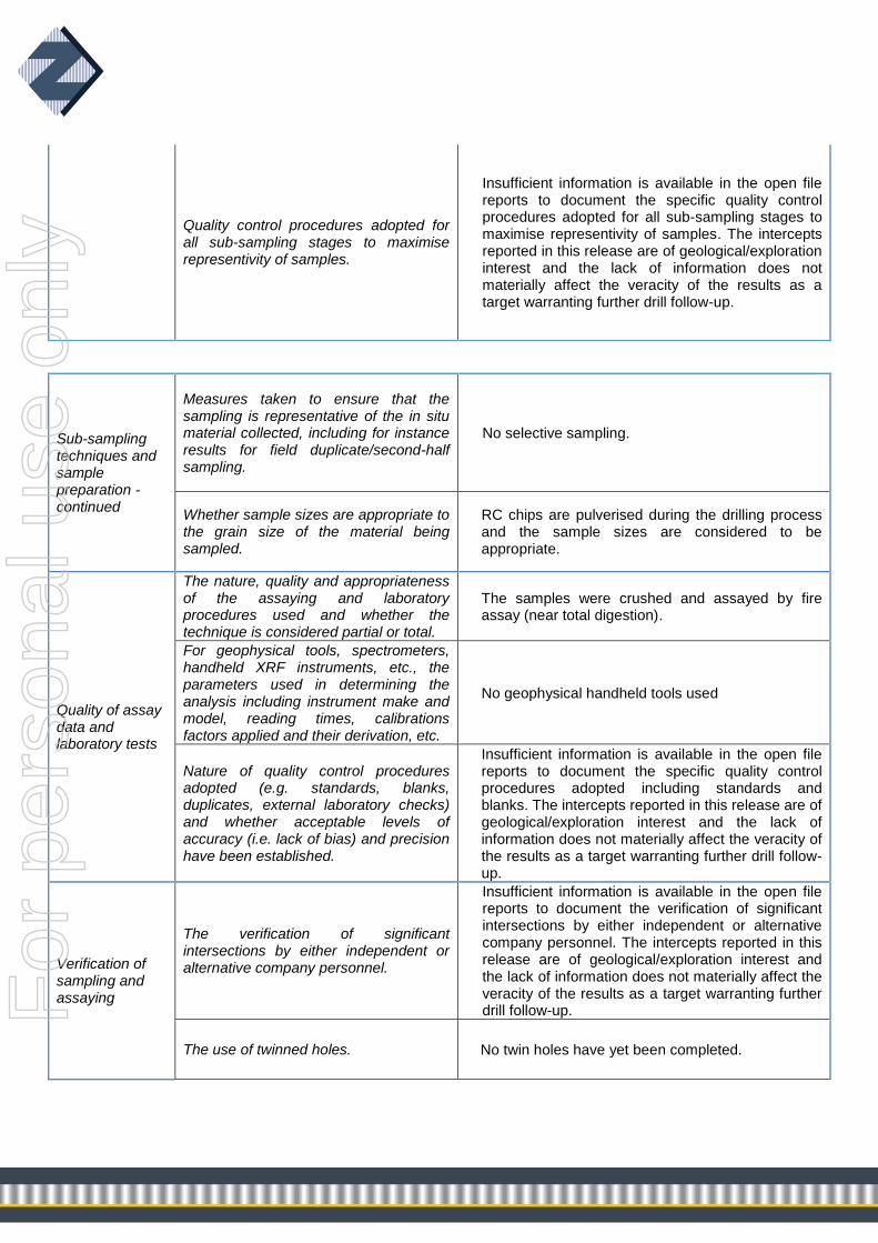
Quality control procedures adopted for all sub-sampling stages to maximise representivity of samples.
Insufficient information is available in the open file reports to document the specific quality control procedures adopted for all sub-sampling stages to maximise representivity of samples. The intercepts reported in this release are of geological/exploration interest and the lack of information does not materially affect the veracity of the results as a target warranting further drill follow-up.
Sub-sampling techniques and sample preparation - continued
Measures taken to ensure that the sampling is representative of the in situ material collected, including for instance results for field duplicate/second-half sampling.
No selective sampling.
Whether sample sizes are appropriate to the grain size of the material being sampled.
RC chips are pulverised during the drilling process and the sample sizes are considered to be appropriate.
Quality of assay data and laboratory tests
The nature, quality and appropriateness of the assaying and laboratory procedures used and whether the technique is considered partial or total.
The samples were crushed and assayed by fire assay (near total digestion).
For geophysical tools, spectrometers, handheld XRF instruments, etc., the parameters used in determining the analysis including instrument make and model, reading times, calibrations factors applied and their derivation, etc.
No geophysical handheld tools used
Nature of quality control procedures adopted (e.g. standards, blanks, duplicates, external laboratory checks) and whether acceptable levels of accuracy (i.e. lack of bias) and precision have been established.
Insufficient information is available in the open file reports to document the specific quality control procedures adopted including standards and blanks. The intercepts reported in this release are of geological/exploration interest and the lack of information does not materially affect the veracity of the results as a target warranting further drill follow-up.
Verification of sampling and assaying
The verification of significant intersections by either independent or alternative company personnel.
Insufficient information is available in the open file reports to document the verification of significant intersections by either independent or alternative company personnel. The intercepts reported in this release are of geological/exploration interest and the lack of information does not materially affect the veracity of the results as a target warranting further drill follow-up.
The use of twinned holes. No twin holes have yet been completed.
For
per
sona
l use
onl
y
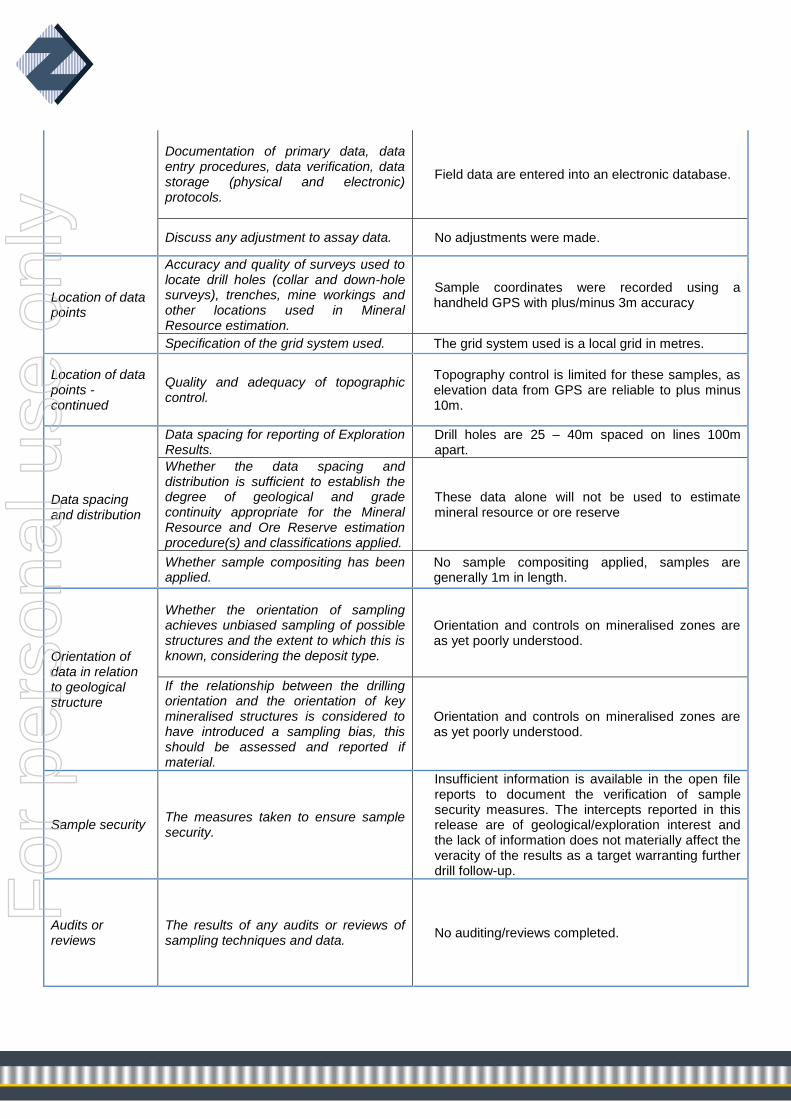
Documentation of primary data, data entry procedures, data verification, data storage (physical and electronic) protocols.
Field data are entered into an electronic database.
Discuss any adjustment to assay data. No adjustments were made.
Location of data points
Accuracy and quality of surveys used to locate drill holes (collar and down-hole surveys), trenches, mine workings and other locations used in Mineral Resource estimation.
Sample coordinates were recorded using a handheld GPS with plus/minus 3m accuracy
Specification of the grid system used. The grid system used is a local grid in metres.
Location of data points - continued
Quality and adequacy of topographic control.
Topography control is limited for these samples, as elevation data from GPS are reliable to plus minus 10m.
Data spacing and distribution
Data spacing for reporting of Exploration Results.
Drill holes are 25 – 40m spaced on lines 100m apart.
Whether the data spacing and distribution is sufficient to establish the degree of geological and grade continuity appropriate for the Mineral Resource and Ore Reserve estimation procedure(s) and classifications applied.
These data alone will not be used to estimate mineral resource or ore reserve
Whether sample compositing has been applied.
No sample compositing applied, samples are generally 1m in length.
Orientation of data in relation to geological structure
Whether the orientation of sampling achieves unbiased sampling of possible structures and the extent to which this is known, considering the deposit type.
Orientation and controls on mineralised zones are as yet poorly understood.
If the relationship between the drilling orientation and the orientation of key mineralised structures is considered to have introduced a sampling bias, this should be assessed and reported if material.
Orientation and controls on mineralised zones are as yet poorly understood.
Sample security The measures taken to ensure sample security.
Insufficient information is available in the open file reports to document the verification of sample security measures. The intercepts reported in this release are of geological/exploration interest and the lack of information does not materially affect the veracity of the results as a target warranting further drill follow-up.
Audits or reviews
The results of any audits or reviews of sampling techniques and data.
No auditing/reviews completed.
For
per
sona
l use
onl
y

Section 2 Reporting of Exploration Results (Criteria listed in the preceding section also apply to this section.)
Criteria JORC Code explanation Commentary
Mineral tenement and land tenure status
Type, reference name/number, location and ownership including agreements or material issues with third parties such as joint ventures, partnerships, overriding royalties, native title interests, historical sites, wilderness or national park and environmental settings.
The Split Rocks project is 100% owned by a wholly owned subsidiary of Zenith Minerals Limited.
The security of the tenure held at the time of reporting along with any known impediments to obtaining a licence to operate in the area.
All licences are in the application stage with no known impediment to future granting of a mining lease. The granting of applications will be subject to future agreements governing the areas of underlying miscellaneous licences that protect road access easements.
Exploration done by other parties
Acknowledgment and appraisal of exploration by other parties.
Exploration has been conducted by Sons of Gwalia Limited who undertook limited RAB drilling following up surface geochemical anomalies, those anomalies were subsequently followed up by Gondwana Resources Limited using RC drilling.
Geology Deposit type, geological setting and style of mineralisation.
The project comprises gold mineralisation hosted in saprolite clays above bedrock comprising Archaean age ultramafic, mafic and sedimentary lithologies. The prospect area is considered prospective for mesothermal lode gold style mineralisation.
Drill hole Information
A summary of all information material to the understanding of the exploration results including a tabulation of the following information for all Material drill holes:
Hole ID Local E Local
N RL Depth
FDUP001 9700 9662.5 1000 105
FDUP002 9700 9687.5 1000 99
FDUP003 9700 9630 1000 98
FDUP004 9800 9640 1000 80
FDUP005 9800 9620 1000 80
FDUP006 9800 9597.5 1000 97
FDUP007 9800 9570 1000 100
FDUP008 9900 9637.5 1000 105
FDUP009 9900 9560 1000 99
FDUP010 10000 9610 1000 80
FDUP011 10000 9585 1000 80
FDUP012 10000 9560 1000 80
FDUP013 10000 9535 1000 80
Al holes drilled vertically.
o easting and northing of the drill hole collar
o elevation or RL (Reduced Level – elevation above sea level in metres) of the drill hole collar
o dip and azimuth of the hole
o down hole length and interception depth
o hole length.
If the exclusion of this information is justified on the basis that the information is not Material and this exclusion does not detract from the understanding of the report, the Competent Person should clearly explain why this is the case.
For
per
sona
l use
onl
y

Data aggregation methods
In reporting Exploration Results, weighting averaging techniques, maximum and/or minimum grade truncations (e.g. cutting of high grades) and cut-off grades are usually Material and should be stated.
Drill intersections reported in this release are calculated using the following criteria:
Minimum reportable average gold grade of intercept of 0.4 g/t Au
Length weighted arithmetic average gold grades;
Lower cut-off gold grade of 0.4 g/t Au;
No high-grade gold top cuts;
Treatment of repeat assays (arithmetic average of all repeat fire assay results);
Where aggregate intercepts incorporate short lengths of high grade results and longer lengths of low grade results, the procedure used for such aggregation should be stated and some typical examples of such aggregations should be shown in detail.
Refer to above
Data aggregation methods - continued
The assumptions used for any reporting of metal equivalent values should be clearly stated.
No metal equivalents used.
Relationship between mineralisation widths and intercept lengths
These relationships are particularly important in the reporting of Exploration Results.
Reported mineralised intercepts are down-hole lengths
If the geometry of the mineralisation with respect to the drill hole angle is known, its nature should be reported.
Orientation and controls on mineralised zones are as yet poorly understood.
If it is not known and only the down hole lengths are reported, there should be a clear statement to this effect (e.g. ‘down hole length, true width not known’).
Down hole lengths, true width not known
Diagrams
Appropriate maps and sections (with scales) and tabulations of intercepts should be included for any significant discovery being reported These should include, but not be limited to a plan view of drill hole collar locations and appropriate sectional views.
Refer to descriptions in body of text
Balanced reporting
Where comprehensive reporting of all Exploration Results is not practicable, representative reporting of both low and high grades and/or widths should be practiced to avoid misleading reporting of Exploration Results.
Low and high grade results reported in body of text and table.
For
per
sona
l use
onl
y
Other substantive exploration data
Other exploration data, if meaningful and material, should be reported including (but not limited to): geological observations; geophysical survey results; geochemical survey results; bulk samples – size and method of treatment; metallurgical test results; bulk density, groundwater, geotechnical and rock characteristics; potential deleterious or contaminating substances.
No other significant exploration data reportable at this stage of the project.
Further work
The nature and scale of planned further work (e.g. tests for lateral extensions or depth extensions or large-scale step-out drilling).
Drilling is planned to test subsurface grade continuity and extents, particularly to the SW where gold mineralisation remains open.
Diagrams clearly highlighting the areas of possible extensions, including the main geological interpretations and future drilling areas, provided this information is not commercially sensitive.
Further details to be provided in a future ASX pertaining to a drill follow-up proposal.
For
per
sona
l use
onl
y