arizona state university - space syntax | science … architekten \ landscape projects \ latham...
TRANSCRIPT

1

2
Public sector clients Aberdeenshire Council \ AMEC Developments Limited \ Arizona State University \ Ashford Borough Council \ Auburn Council \ Barbican Arts Centre \ Boston University \ British Railways Board \ China Academy of Urban Planning and Design \ City of Berkeley, California \ Colchester Borough Council \ Crossrail UK \ Derby City Council \ Dessau Institute of Architecture \ Derwent New Deal Partnership \ Dublin City Council \ English Partnerships \ Gateshead Borough Council \ Gemini Hospital \ Glasgow City Council \ Glasgow University \ Gravesham Borough Council \ Greenwich Council \ Hampshire County Council \ IDA Arkitekter \ Imperial College London \ Kent Architecture Centre \ Kent County Council \ King Fahd University of Petroleum and Minerals \ King’s Cross Partnership \ London Development Agency \ London School of Economics \ Lotus 2000 \ Ministère de la Recherche, Université de Compiègne \ Ministry of Housing and Urbanism, Chile \ Newcastle City Council \ Newcastle University \ Newham 2012 \ NHS Estates \ North Shore City Council \ Nottingham City Council \ Oxford City Council \ Palma de Mallorca Town Hall \ Renaissance Southend \ Riga City Council \ Rotherham Metropolitan Borough Council \ Royal Academy of Arts \ Sandwell Metropolitan Borough Council \ Seattle City Council \ Shoreditch Trust \ South Bank Centre \ State of New South Wales \ Stockport Metropolitan Borough Council \ Tate \ Thames Chase Community Forest \ Thanet District Council \ The American Mission Hospital in Bahrain \ The British Museum \ The City of Gosnells \ The City of Moreland \ The City of Nottingham \ The City Planning Authority of the City of Stockholm \ The Corporation of London \ The Countryside Agency \ The Department of Health and National Patient Safety Agency \ The European Green Link Project \ The French Ministry of Civil Works, Transport, Housing and Tourism \ The Government Offi ce for London \ The Greater London Authority \ The Jubilee Bridge Trust \ The Lombardy Regional Government’s New Seat \ The London Borough of Camden \ The London Borough of Croydon \ The London Borough of Ealing \ The London Borough of Islington \ The London Borough of Lambeth \ The London Borough of Merton \ The London Borough of Redbridge \ The London Borough of Southwark \ The London Borough of Tower Hamlets \ The London Borough of Waltham Forest \ The Municipality of Jeddah \ The Municipality of Ljubljana \ The Municipality of Molenbeek \ The Public \ The Romanian Ministry of Development \ The Royal Academy of Arts \ The Royal Borough of Kensington and Chelsea \ The Seoul Borough of Songpa \ The Spanish Government \ The Stockwell Partnership \ The Strategic Walks Project \ The Thames Gateway Partnership \ The Victoria & Albert Museum \ The Victoria State Department of Infrastructure \ Tower Hamlets HARCA \ Transport for London \ UMIST \ Union Railways \ University College London \ Visit Manchester \ Westminster City Council Private sector clients AB Vassilopoulos \ ALBIS Projektentwicklungs \ Apax Partners\ Arnotts Properties \ Ashwell Developments \ BAA \ Baträger Austria Immobilien \ Berkeley Homes \ British Airways \ Buckingham Properties \ Capital & Counties \ Central London Partnership \ Chelsea Design Centre \ Chelsfi eld \ CIT Markborough \ Countryside Properties \ Daewoo \ Development Securities \ Discovery Group \ Dream Hub Project Financial Investment \ Elizabeth Bridge Unit Trust \ Eurostation \ Exchequer Partnership \ Exemplar Properties \ Favermead \ First Base \ Fitzwilliam Hotel \ Gloucester Heritage Urban Regeneration \ Goodman \ Greycoat \ Grosvenor \ Hammerson UK \ Hampton Trust \ Harrods Department Store \ Heron International \

3
Howell Henry Chaldecott Lury & Partners \ Hutchison Whampoa \ ISIS Waterside Regeneration \ Jeddah Development and Urban Regeneration \ L&R Consulting \ Laing Construction \ Land Securities \ Learning and Skills Council \ Legal & General Assurance Society \ Lend Lease \ London International Financial Futures and Options Exchange \ London Trocadero \ London & Amsterdam Countryside \ MAB Boufonds \ MacDonald Egan \ MCA Developments \ Mercers’ Company \ Mitsui Fudosan \ More London Developments \ MORI \ Multiplex \ Muse Developments \ Ogilvy & Mather \ Partnership Smartinska \ Peter Stratton \ Places for People \ Portfolio Holdings \ Powergen\ Proctor Matthews\ Qatar Foundation \ Railtrack \ Robert Turley Associates \ Ropemaker Properties \ Roughton Architects \ Sainsbury’s \ Segro \ Silverlink Properties \ Skanska Innisfree Consortium \ Smedvig Capital \ SmithKline Beecham \ South Bank Centre \ Spacescape \ St James’ Homes \ St Modwen \ Stanhope \ Steamboat \ Stratford City Developments \ Taylor Woodrow Capital Developments \ The British Land Company \ The Capital Link Partnership \ The Hong Kong and Shanghai Banking Corporation \ The New Bracknell Company \ The Ogden Group of Companies \ Treasury Holdings Partners Aedas \ AFH Shaw Sprunt \ AHMM Architects \ Alan Baxter Associates \ Albert Noonan Architects \ Allied Works \ Allies & Morrison \ Anshen/Dyer Architects \ Arup \ Asymptote \ Ateliers Jean Nouvel \ Atkins \ ATU \ Aukett Fitzroy Robinson \ Battle McCarthy \ BDP Architects \ Behnisch, Behnisch & Partners \ Bennetts Associates \ Benoy Architects \ Beyond Green \ Bovis Lend Lease \ Buro Four \ Buschow Henley Architects \ Colin Buchanan \ COOPARCH \ CZWG Architects \ David Lock Associates \ Davis Langdon \ East Architecture \ EDAW \ EEDA Everest \ Expedition Engineering \ FaulknerBrowns \ Firma Marcus \ Fletcher Priest Architects \ FLUID \ Foster + Partners \ GEA \ General Public Agency \ GeoData Institute \ GMW Architects \ Grimshaw \ Gross Max Landscape Architects \ Gustafson Porter \ Guthrie Nichol \ Habiterra \ Halcrow Fox \ Hamilton Associates \ Happold Consulting \ Harcourt Developments \ Herzog & de Meuron \ HKR architects \ HOK Architects \ Hopkins \ Hosoya Schaefer Architects \ Hudson Yards Development Corporation \ Hyder Consulting \ Jasper Jacobs Associates \ JDDK \ Jerde \ Jim Walker \ JMP \ John McAslan + Partners \ John Thompson & Partners \ Kohn Pedersen Fox Associates \ Konrath Wennemar Architekten \ Landscape Projects \ Latham Architects \ Lifschutz Davidson Sandilands Architects \ MacCormac Jamieson Prichard Architects \ make \ Management Consultants \ Martha Schwarz & Partners \ Michael Hopkins & Partners \ Morrison Brink Stonor \ Mott MacDonald \ NGM Architects \ Northcroft \ ORMS \ Paul Murrain \ Percy Thomas \ Purcell Miller Tritton \ Rafael Viñoly Architects \ Renaisi \ Roger Tym Partners \ Richard Rogers Partnership \ Rick Mather Architects \ Robert Myers Associates \ Rogers Stirk Harbour \ Roughan & O’Donovan \ RPS Architects \ Savills \ Shepperd Robson Architects \ Sir Michael Hopkins & Partners \ Skidmore, Owings & Merrill \ Squire and Partners \ Stanley Sidings \ Stegen & Remy \ Stock Woolstencroft \ Studio Egret West \ SvR Consulting \ Symonds \ TEAM Tourism Consulting \ Technical Aid for Nottinghamshire Communities \ Tectus Architects \ Terry Farrell & Partners \ The Architects Design Group \ The Dublin Institute of Technology \ The Kent Architecture Centre \ The Prince’s Foundation \ The Thames Promenade Company \ Tibbalds Planning & Urban Design \ Turner & Townsend \ Urban Practitioners \ URS \ Waring & Netts \ West 8 \ Whitelaw Turkington \ Wilkinson Eyre Architects \ XC02 Energy \ YNNO

4

5
Space Syntax provides strategic, evidence-based consulting services in economics, planning, design, transport and property development.
Combining extensive global experience with robust and sophisticated technologies, we forecast the effects of planning and design decisions on the movement and interaction of people in buildings and urban areas.
We work to de-risk property investment decisions, showing how the layout of places can be optimised to enhance the social, economic and environmental value of developments. Using a highly graphic, data-rich and audience-engaging set of techniques, we help our clients achieve powerful results quickly.
Our track record includes some of the world’s most prestigious and challenging projects.

6
7
Space Syntax’s approach combines global experience with advanced spatial technology. We offer a science-based, human-focused approach to the planning and design of buildings and urban areas.
We show how the layout of space infl uences the social, economic and environmental performance of places from the scale of the entire city to the scale of the individual street and building.
We measure the strength of spatial layouts, both existing and proposed and we show how spatial layout impacts fundamentally on the way that people move, interact and transact in streets and buildings.
We produce planning and design proposals that enhance economic activity, foster social conviviality and reduce carbon emissions. Often this means creating spatial layouts that encourage walking – a high quality public realm providing high levels of access between people and places.
We use forecast models to test planning and design ideas from an early conceptual stage right through to detailed design and post-occupancy.
Empowering peopleThe Space Syntax approach empowers people to make informed decisions about the planning, design and operation of places. We add value through a unique, evidence-based service offer:
We create places by producing visionary planning and design ideas, leading and supporting multi-disciplinary teams.
We shape knowledge by undertaking research, developing technology and generating new knowledge.
We inform practice by training people in the use of our approach.We are expert, independent and widely respected for the support we provide to public, private and community-based decision takers.
“A natural solution made commercially obvious.” Simon Harris, Simon Harris & Co
Washington DC, Spatial accessibility modelUsed to demonstrate the impact of spatial layout changes on the economic, social and environ-mental performance of the city.
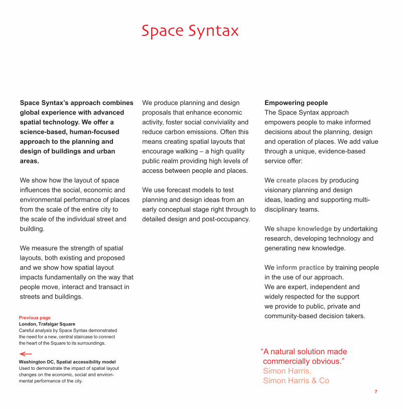
Previous pageLondon, Trafalgar Square Careful analysis by Space Syntax demonstrated the need for a new, central staircase to connect the heart of the Square to its surroundings.

8
create space : create value

9
The spatial layout of buildings and urban places exerts a powerful infl uence on human behaviour. The way that places connect is directly related to the way that people move, interact and transact.
Space connects or segregates; brings people into social and economic relationships or keeps them apart; helps people save time or consigns them to carbon-intensive lifestyles; enhances real estate value or damages investments; increases safety or encourages criminal behaviour.
Well designed spatial layouts produce safe and vibrant places and, in doing so, create enormous levels of social, economic and environmental capital.
Poor layouts risk functional failure, loss of investment and social harm. The urban landscape is littered with failed development, much of it caused by misunderstanding how spatial layout affects human performance.
Space Syntax provides a trusted, evidence-based approach to the analysis and design of spatial layout patterns.
We help people to see, in clear and straightforward terms, how buildings and urban places can be designed to optimise their functional performance.
Why space matters
“ I know these techniques work from the tough environment of practice. I love the world of analysis, observation, research but also of passion, imprecision, the hunch. Space Syntax is the testing of the interaction of these opposing worlds.” Norman Foster

10
Revealing unseen opportunities and creating better ideas
This is the key strength of the Space Syntax approach. Our reputation is based on a highly creative use of technology to identify the essential design features of urban and building design projects. These are typically aspects of the location, linkages, layout, land use and landscaping of a project that infl uence human activity and, in doing so, drive the social, economic and environmental performance of places.
The fi rst step towards the identifi cation of new opportunities is in the ‘diagnosis’ of existing situations through Baseline Studies, which identify opportunities and inspire design ideas for capitalising on them.
Measuring and improving the likelihood of success
The Space Syntax approach is built on a set of evidence-based methods that forecast whether proposed policies, strategies, plans, and designs will work to create the social, economic and environmental benefi ts that they are expected to.
We give stakeholders and decision-makers reassurance when a design is developing in a favourable way, or we alert them when it is in danger of going off track and they need to act. In the latter case, our approach helps to reduce or mitigate the risk of functional failure.
At every stage, the Space Syntax approach aims to boost ‘returns’ of many sorts: land value, rental income from, for example, enhanced footfall in retail areas, safety in streets and buildings, increased interaction between people in buildings.
Facilitating communication on project teams and with stakeholders
Our methods allow us to speak a common, ‘spatial’ language that bridges across disciplinary boundaries and translates the objectives of planners, designers, transport engineers, economists, developers, investors and members of the public in such a way that they can be understood by all and organised into meaningful, practical frameworks for action.
How we add value
Liverpool, St John’s CentreRedesign of the spatial layout of the existing, multi-level shopping centre to integrate it with the movement network of Liverpool city centre, for Land Securities.

11

12

13
London, Covent GardenUrban Baseline Study of human activity patterns and urban design characteristics at Covent Garden, leading to the generation and evaluation of design concepts for redevelopment, with KPF architects for Capital & Counties.
MissionSpace Syntax Limited’s mission is to enhance the social, economic and environmental performance of buildings and urban places by developing and applying a science-based, human-focused approach to their planning, design and operation.
VisionOur vision is of a built environment that works well for the people that use it. This requires the right balance of interconnectedness, movement, awareness, encounter and exchange at every scale. It means the delivery of places in which different kinds of human activity can thrive.
RoleWe exist to provide leadership and cumulative tested knowledge to support the development, dissemination and application of this approach.

14

15
Our clients are public, private and community agencies:
Property investors and developers aiming to optimise land value, whether for rental or sale
Public municipalities seeking to plan their cities to attract and retain investment
Community groups looking for evidence to develop and defend a local vision
Building operators searching for better ways to bring people into and move them through space.
Our clients value people
People drive our clients’ business: the way they move; their patterns of behaviour; how they browse througshops; how they travel to their homes and places of work; whether they prefer certain locations or avoid others; how well they communicate; if they are satisfi ed by the places they are in and whether they will come again.
Our clients value space
They buy it and sell it. They lay it out and fi ll it with attractions. They judge its merits. They occupy it and change it. They are rewarded by its success and are burdened with it if it has failed. Space is an increasingly rare commodity.
Projects, clients & partners
Building layout designSpace Syntax technology evaluates spatial layouts, identifying constraints and opportunities in them. Analysis is then used to generate spatial design solutions, evaluating candidate proposals.
“We realised Space Syntax were light years ahead of everybody else. This scheme will last for 200 years. We needed the best and the best is what we’ve got.” Councillor John Jowers, Colchester Borough Council

16
“I am very interested in what Space Syntax can do. Their techniques allow people who don’t understand architectural plans to enter into design conversations.” UK National Health Service nurse at public consultation event
Knowledge domainsSustainabilityAccessibilitySocial cohesion & inclusionSafety & security
ProductsUrban Baseline StudiesSpatial Development StrategiesConcept MasterplansSite Development StrategiesPublic Realm Designs
ProcessSpace Syntax provides strategic urban development advice to public and private agencies, identifying the physical and spatial infrastructure needed to deliver social, economic and environmental regeneration across urban settlements and their regions. We either bring together and lead multi-disciplinary teams or we provide specialist design input to other lead consultants.
Working across scales, between the global and the local, our work spans what are often divisions between architecture, planning and urban economics.
Our approach is unique in the way that we take design inputs – in terms of layout, land use, density and transportation – and evaluate the combined effects of these on ‘critical’ outputs such as movement patterns, land value and urban safety.We take a two-step approach to ideas development.
First, using world-leading techniques of urban evaluation, we ‘diagnose’ existing patterns of movement, value and crime. We create Urban Baseline Studies, studying existing places to measure the strength of their current spatial layouts, movement patterns, land values and social cohesion. We use our diagnostic analysis to demonstrate how social, economic and environmental indicators are influenced by physical and spatial conditions.
Second, we develop visionary urban planning concepts in the form of Spatial Development Strategies, Concept Masterplans, Site Development Strategies and Public Realm Designs. We run forecast models to show how these proposals will impact on social, economic and environmental performance. We use the results of our Urban Baseline Studies to evolve planning and design solutions so that new development connects effectively into existing places. In our experience this means that the final product has a much better chance of success.
Urban planning & designOverview
Nottingham, Old Market SquareSite analysis and public realm design input with Gustafson Porter Landscape Architects, for Nottingham City Council Competition winning entry, completed in 2007.
Over the pageLondon, Princes CircusCreation of a strategic public realm vision, using analysis of spatial layout and human activity patterns to inform the emerging designs, for the London Borough of Camden.

17

18

19
The convention in urban planning and design is to separate consulting practice into sectors such as ‘retail’, ‘commercial’, ‘residential’ and ‘healthcare’. However, the reality of delivering spatially-based, mixed-use planning and design advice means that this separation is overly simplistic.
Our clients approach us with problems concerning social, economic and environmental value. The projects we work on are often large and complex but their effects are felt at a local level by the individual moving and interacting in space.
We provide evidence-based planning and design solutions that span between sectors and address one or more knowledge ‘domains’. Our work in each knowledge domain is supported by top-quality academic research as well as over 20 years of international practice.
SustainabilitySuccessful, sustainable places rely on effective spatial layout. Understanding the effects of space on functional performance – in terms of passing trade, property value and natural surveillance – increases value and reduces risk in the development process.
From urban masterplanning to public space design, we work to deliver proposals that anticipate use patterns and deliver the social, economic and environmental expectations of stakeholders.
AccessibilityPatterns of movement and space use are fundamentally influenced by the configuration of space and by the location of activity generators and attractors. We measure levels of accessibility in existing and proposed environments.
From the design of safe street crossings to multi-modal interchanges, Space Syntax studies provide public and private agencies with robust techniques for evaluating the social, economic and environmental impact of accessibility proposals.
We co-ordinate pedestrian, cycling and vehicle strategies through observation, analysis and forecasting of movement flows. Our work helps shape and support ideas to improve accessibility for all movement modes at every scale – from entire regions to individual streets.
Social cohesion & exclusionOur worldwide body of research has demonstrated the fundamental role of space in bringing people together or keeping them apart. The separation of car and pedestrian was once justified on the basis of convenience and road safety.
In a similar vein, land uses were zoned to concentrate functions in the belief that critical mass and clean borders were the solution. Why then are we working today in exactly the opposite direction to mix modes, mix uses and blur boundaries?
The answer lies in the realisation that our previously unsophisticated methods of planning and designing places have led to greater damage than benefit.
All modes of urban space use – whether in cars or wheelchairs, on public transport, cycles or foot – use spatial networks to move through towns and cities. The way we design those networks can either enhance or inhibit the ability of people to move.
Our work shows how accessibility influences mobility and how this then has measurable effects on social, environmental and economic outcomes.
Crime & securityOur research into the effects of planning and design on urban and building safety show very strong correlations between layout and all kinds of crime.Traditional street patterns are consistently the safest and the most ‘modern’ hierarchical layouts the worst. Results linking socio-economic as well as spatial data strongly indicate that rich and poor alike benefit from living in traditional streets.Inside buildings, including hospitals and schools, we have applied similar thinking to understand and then design against the effects of poor layout on petty crime, assault and bullying.
Urban planning & designKnowledge domains

20

21
Regional & urban plansHow much beneficial movement can be generated to and through the site? Which are the key linkages? What are the appropriate kinds and densities of new land uses? What impact is new development likely to have back on its setting?
Our evidence-based urban forecasting tools allow us to take the Urban Baseline Study and develop it into a Spatial Design Strategy, understanding the potentials for creating new land use attractions, density levels and, ultimately, land values. We identify potential new spatial connections to and through a site, the location of new urban centres as well as the locations of key land use attractions. We test the social, economic and environmental impact of the Spatial Design Strategy.
Urban masterplansHow should a masterplan design respond to the physical and environmental potentials of a site? How should the spatial layout be designed? How should land use and density be distributed within this layout? How can the social, economic and environmental impacts of development proposals be forecast?
We begin the process of creating a Concept Masterplan by applying our techniques of spatial analysis at the scale of the site. To do so, we optimise the relationship between development proposals and the surrounding area to define a spatial layout and urban block structure.
We continue to refine the proposed layout and to distribute public spaces, land use and density, combining accessibility and attraction to ensure the greatest chances of success in terms of movement patterns, land use and density distribution, land value and crime.Using evidence-based design processes allows Concept Masterplan options to be objectively assessed alongside each other, creating clear pathways for stakeholder consultation and, ultimately, decision-taking.
Site development strategiesHow can detailed design considerations such as landscape and building design ensure the over-arching aims of a development are delivered consistently? How can this argument be used to strengthen a planning application?
By using increasingly sophisticated analyses we develop the Concept Masterplan design to a more detailed resolution as a Site Development Strategy. This means making sure that considerations such as active building frontages, shading, massing, public realm and landscape respond to forecast patterns of movement and activity. These forecasts are used to market the design to potential tenants not only in terms of how it will look but also in terms of how it will work for users on the ground.
By continuing to work up to the Site Development Strategy, the smaller scale design of the public realm is integrated with the wider scale strategic design issues. Our experience has shown that, by following an iterative, evidence-based design process, the likelihood of stakeholder buy-in is increased, as is the approval of planning applications.
Streets parks & public spacesSpace Syntax specialises in bringing together architectural design, transport design and urban design into the common field of “public realm design”. Urban value is often lost in the design of the public realm, for example if it is difficult to cross a road or find somewhere to stop and sit.
We have extensive global experience in public space design, landscape design and the design of urban streetscapes. We follow our two-step process of problem diagnosis followed by visionary design creation, using evidence-based techniques of surveying, analysing and forecasting to test and develop proposals.
Urban planning & designProcess and products
Ealing Strategic Centre Area Action PlanDelivery of a qualitative and quantitative appraisal of the town centre’s spatial structure, option generation and option testing of a proposed Area Action Plan, for Ealing

22
23
Space Syntax specialises in the planning and design of human behaviour patterns in new and existing buildings. Our work focuses on the key role that spatial design plays in the way buildings work.
We advise on a wide range of building types including:- healthcare- education- workplaces- retail- cultural buildings- transport.
We use a two-stage approach:
At the diagnostic stage, we help designers, managers and occupiers to understand how and why their hospital buildings operate the way they do. When appropriate, we undertake movement and space use surveys. We interview and questionnaire staff and visitors to gather data on their perceptions and priorities.
We show how the design of horizontal and vertical circulation influences user behaviour such as purchasing patterns in retail environments, circulation patterns in galleries and patterns of interaction in work environments.
This information is then used at the design stage to provide an evidence-based, creative input. We assist in the development of retail and curatorial strategies and we work to make schools and hospitals safe, convivial and, ultimately, fit for purpose. We use forecast models to demonstrate how, in plan and section, building designs are going to work. Working in close collaboration with our clients and partners we help deliver buildings that provide conviviality, comfort and safety for their users.
Our approach helps to reduce significant risk in the planning, design and operation of buildings.
Knowledge domainsCommunication & innovationInnovation in the workplace is often the result of informal, ‘unplanned’ interaction, especially between colleagues working in different parts of the same building.Space Syntax analysis demonstrates why some buildings are more successful at this than others; how interaction can be generated in new designs; and what can be done to re-work failed layouts.
Movement & wayfindingThe physical layout of rooms, corridors and vertical connections exerts a strong influence over patterns of exploratory movement in retail environments, museums and galleries. Understanding the effects of spatial layout on visitor activity allows design proposals to be generated that facilitate access and encourage natural wayfinding.
We offer layout appraisal, investment advice, strategic design and monitoring services to the funders, owners and occupiers of complex buildings. Combining detailed observation studies with customer flow models and sales data analysis, we help to generate schemes that optimise patterns of moving, browsing and buying.
Spatial components in cultureDifferent cultures assemble space in different ways. Spatial layout reinforces cultural identity. Understanding quantifiable differences between the spatial patterns of Western European, Middle Eastern and North American building layouts, for example, allows us to design for local conditions without imposing predetermined solutions.
Building planning & designOverview
London, Millennium Bridge Delivery of strategic spatial design advice to locate a new pedestrian link across the River Thames, for the Trustees of the Tate Gallery.

24
Existing
Problematic area
Option 1 Isolated, unintegrated layout
Option 2Partly integrated layout
Option 3Highly integrated layout
Improved circulation

25
HealthcareSpace Syntax has developed world-leading methods for analysing spatial layout, observing patterns of space use within the hospital environment and designing ward layouts and hospital circulation which optimise space use, wayfinding and interaction. These techniques work by measuring the properties of spatial layouts that users perceive: lines of sight along streets and corridors, visual fields from reception areas and nurse stations and degrees of openness and privacy.
EducationThe strength of a learning organisation is shaped as much by the informal, day-to-day contact of its members as it is by formal gatherings at scheduled appointments. The careful design of educational buildings can radically enhance the likelihood of these otherwise unplanned encounters.
A well designed building uses its common circulation spaces, both indoors and outdoors, to supplement the formal process of education and knowledge generation by providing staff and students with opportunities for informal, face-to-face contact. The aims in doing so are increased levels of creativity and innovation as well as an improved sense of community culture and wellbeing.
WorkplacesInnovation in the workplace is often the result of unplanned interaction. Critical information leading to business innovation comes from such informal encounters, typically between colleagues working in different departments who are not otherwise programmed to come together.
Space Syntax works with clients to identify the connections between the layout of space in buildings and the patterns of human behaviour that occur within them. We show how to create levels of movement, encounter and interaction that drive business performance.
Cultural buildingsSpace Syntax works with cultural institutions to show how the behaviour and experience of visitors is affected by the spatial layout of buildings. Using this knowledge, we help our clients devise intervention strategies to improve visitor satisfaction.
RetailSpace Syntax’s evidence-based approach to retail development helps owners, investors and occupiers in two key areas: first, to understand the performance of existing retail operations and second, to enhance retail success through the careful design of spatial layout and product placement.
At the urban scale, we work with our clients to identify “location value” in terms of the potential for attracting trade at a particular location. We profile development portfolios and advise on the retail offer these will most likely support.
Inside shops and retail centres, we show how space can be designed to influence customer behaviour in terms of movement, product interaction and sales activity.
Building planning & designSectors
“The perspective you brought to our campus masterplanning exercise was invaluable. Space Syntax is the best thing we’ve come upon in a long time.” Dean Wolf, Executive Vice President of Auraria Higher Education Center in Denver
Building layout designSpace Syntax technology evaluates spatial layouts, identifying constraints and opportunities in them. Analysis is then used to generate spatial design solutions, evaluating candidate proposals.

26

27
London, Westminster AcademySpace Syntax advised Alford Hall Monaghan Morris architects on the spatial layout design of the multiple award-winning academy. © Tim Soar
Retail Transport Healthcare Cultural Education WorkplacesReturn on investment * * * * * *Business effectiveness * * * * * *Speed of design & planning process
* * * * * *User wayfi nding, comfort & convenience
* * * * * *Retail performance & revenue growth
* * *Staff communication & productivity
* * * *Safety & security * * *Staff satisfaction & retention * * * *Visitor satisfaction * * * *Tenant satisfaction & retention * * *Organisational character & identity
* * * * *Development & dissemination of knowledge/culture
* * * *Community engagement * * *Patient recovery & cost of care *Patient privacy & dignity *Infection control *Engagement with collections & performances
*
Client objectives

28
Retail Transport Healthcare Cultural Education Workplaces
Pre-planning & design
Portfolio evaluation: buy/sell/keep/develop * * * *Growth/downsizing strategy * * * * *Site evaluation & selection * * * * * *Building evaluation & selection * * *Competitor analysis & precedent studies * * * * * *Existing user behaviour analysis * * * * * *Working culture defi nition * * * *Planning & design
Critical review of development proposals * * * * * *Masterplan/campus design * * * * * *Overall building layout design * * * * * *Department/ward/gallery layout design * * * * * *Furniture/display layout design * * * * * *User behaviour forecasting * * * * * *User group profi ling * * * * * *Character & identity creation * * * * *Retail & catering strategy * * * *Wayfi nding & signage strategy * * * * * *Curatorial strategy *Planning support * * * * * *Tenant negotiations * * *Post-planning & design
User fl ow enhancement (signage & wayfi nding) * * * * * *Tenant lease/renewals negotiations * * *Performance benchmarking * * * * * *Staff interaction enhancement (layout redesign) * * * *Accommodating growth & downsizing * * * * * *
Products

29
Retail Transport Healthcare Cultural Education WorkplacesData collection surveys
User fl ow volume/density * * * * * *Staff/visitor/patient/student interaction
* * * *User attitudes interviews/questionnaires
* * * * * *Customer purchase patterns * *Visitor route choice/object engagement
* * * *Rental distribution * *User interaction & communication * * * *Data analysis
Location accessibility analysis (public & private transport)
* * * * * *Building layout effi ciency * * * * * *Vertical movement effi ciency * * * * * *Object/display attraction * * * *Departmental structure & location * * * * *Movement network capacity * * * * * *Entrance/exit capacity * * * * * *Sales density/rental distribution * * *Impact simulation
User fl ow volume & density * * * * * *Retail & catering effectiveness * * *User interaction & communication intensity
* * * *
Safety & security effectiveness * * *
Process
Over the pageMunich, spatial accessibility modelAnalysis of the spatial structure of Munich has contributed to the creation of urban development and management strategies, for Munich City Council.

30

31
Case studies

32
Valuing urban layoutTools for spatial sustainability
LocationThe Greater South East of England
Duration2007 - 2008
Key featuresDevelopment of an urban layout value map of the Greater South East of England.
Training programme for Local Authorities and other stakeholders.
Creation of “UrbanValue” software tools to value urban layout.
i-VALUL One of the largest projects in the UrbanBuzz knowledge exchange programme, i-VALUL is led by Space Syntax and brings together over 20 public, private, higher education and voluntary sector organisations, including CABE, SEEDA, EEDA, UEL, UCL, GLA Economics, Savills Research, CBuchanan and JMP.
The outputs of i-VALUL provide planners, designers and community members with “UrbanValue” tools to overcome restrictions that prevent layout factors from being objectively assessed in terms of their social and economic value impacts.
What does i-VALUL do?
i-VALUL delivers new knowledge, techniques and services to planners, designers and community members by exploiting existing, multi-disciplinary experience.
Its findings have applications in five main areas:
• town centre vitality• street quality• residential property value• residential security• personal safety.
Who benefits from i-VALUL?
The findings of i-VALUL support the case for improving street layout design and provide evidence of the likely economic returns to be gained from investing in high-quality residential and town centre street layouts. The new “UrbanValue” tools that i-VALUL has created will help to identify public sector development priorities, offering private sector investors a greater level of confidence and a more secure framework in which to invest.
UrbanBuzzBuilding sustainable communities
A
Higher risk = £691,000 costLower crime risk = £1,590,000 saving

33
A Value of residential security Comparison between the burglary rates (black dots) and urban layouts of two different residential areas. Layout valuation tools allow these differences to be monetised.
This pageUrban layout value map of the Greater South East of England, providing a major resource for spatial decision-taking.
“Well-informed decisions in place making are essential for building sustainable communities and as such the impact of Space Syntax is signifi cant.” Dr Carol Dair, Director Oxford Institute of Sustainable Development

34

35

36
Background
One of the main objectives of the the Strategic Planning Framework for Jeddah, completed by Space Syntax in 2006, was to develop a strategic approach to the improvement of the numerous unplanned settlements in the city.
These areas underwent a massive period of growth in the 1950s and 1960s, but then became overpopulated and stagnated. Their current condition is a mixture of physical and social problems that are getting worse as the city continues to grow.
Challenges
The central areas, in particular, lack physical street connections between their interiors and the surrounding urban fabric.This inhibits reinvestment in these areas and exacerbates the cycle of overcrowding, capital flight, and social segregation.
Problems include:
• deteriorated socio economic, physical, health and environmental conditions• lack of proper maintenance• illegal occupation of private and government land• insecurity of land ownership• concentration of non-Saudi population• internal infrastructure is poorly connected with the surrounding areas.
Jeddah Unplanned Settlements Improvement Plan
ClientMunicipality of Jeddah
LocationJeddah, Saudi Arabia
Duration2006 - 2008
Key features Macro scale planning.Regeneration and redevelopment.Urban and regional context.
A B
Previous pagesJeddah, Strategic Planning FrameworkDevelopment of spatial planning guidelines for the entire city region, based on evaluation of existing urban layout, land use and environmental characteristics.
Jeddah, Unplanned SettlementsDevelopment of settlement-specific, needs-based strategies including design guidelines and detailed.

37
Solution
In order to address the social and economic isolation of the Unplanned Settlements, an advanced spatial diagnostic methodology was developed to show which were the most important routes in each of the settlements.
First, the intensified and isolated core of the settlement was detected by local accessibility technique. Based on this analysis, a strategy was developed to realign and link the smaller fragments to the larger structure of city-wide routes.
The result is to create a smooth transition from city-wide access to local routes within the unplanned settlements; thus reconnecting the settlements to the larger city while preserving their unique character and sense of place.
The outcome of the exercise better integrates he Unplanned Settlements with their surroundings and at the same time encourages social and economic improvement over time.
C
AAnalysis of key large-scale linkages and development density.
BAnalysis of local spatial accessibility.
CMethodology to identify, then interconnect networks of local, intermediate and global movement.
Over the page Jeddah, Central Urban Area Masterplan Development of masterplan concept for the regeneration of a major, 500Ha part of the city centre.
“What we know and feel about cities is hard to put into words or images, still harder to enumerate. Space Syntax has the vocabulary, graphics and data to do this.” Paul Fisher, Daily Telegraph

38

39

40
Elephant & Castle Southern Crossing
ClientLondon Borough of Southwark
LocationLondon, Southwark
Duration2006 - 2008
Policy objectives Overcoming social exclusion.Improving pedestrian safety. Growing a local movement economy.Enhancing the public realm.
Services Urban design vision.Design options generation.Spatial severance analysis. Pedestrian forecast modelling.Stakeholder negotiations.Detailed design development.3D visualisation.
A B
Regeneration context
Space Syntax has acted as specialist design advisor for the regeneration of the Elephant & Castle in central London since 2001. Our evidence-based approach, with its focus on the design of the public realm, has assisted the London Borough of Southwark and its consultant team – including Foster and Partners/make (masterplanning), Tibbalds (planning & urban design) and JMP (transport) - in generating proposals for the comprehensive redevelopment of one of London’s most blighted urban centres.
Site analysis
In order to understand the behaviour of pedestrians at the new crossings, careful research was conducted on numerous case studies throughout central London. The studies revealed that straight crossings which are located on pedestrians’ natural desire lines were used more frequently and more safely. Staggered crossings and those offset from pedestrians’ natural paths of movement were less well-used with greater numbers of pedestrians crossing outside of the formal crossing and during the red pedestrian signal phase. Additionally, straight crossings aligned with desire lines were on average 40% shorter than staggered ones.

41
The proposal
The Southern Crossing at the Elephant and Castle in central London replaces the existing network of unpopular subways with three safe, convenient and comfortable surface crossings.
Working in partnership with transport consultants JMP, Space Syntax has created a design for this important junction, which is emblematic of the further public realm – focused regeneration of the area. Each of the three sides of the crossing aligns with strategic pedestrian desire lines, ensuring that the design provides convenient connections across the wider area. The simplicity of the overall form is carried through into the detailed design of the paving layout and the location of seating areas, signage and lighting.
Detailed design
The overall triangular layout of the crossing is not only the most suitable shape to align with pedestrian routes but it also creates a strong sense of identity through its form and detailed design.
The palette of materials draws on precedents found elsewhere in London and has been selected to provide a subtle backdrop to foreground projects such as the redesigned St. Mary’s Churchyard by Martha Schwartz and Partners.
C
A Existing, unpleasant subway.
B Pedestrian movement survey and pedestrian forecast modelling.
C Aerial view from the east showing the redesigned St. Mary’s Churchyard in the background.
Over the page The triangular form of the crossing provides a strong sense of design identity.
Detail of one of the three wayfinding medallions, which provide pedestrians with directions to key local and large-scale destinations.

42

43

44
Nottingham Old Market Square Public realm transformation
ClientNottingham City Council
LocationNottingham, United Kingdom
Duration2004 - 2006
A B
Regeneration context
Space Syntax undertook extensive site analysis and provided public realm design advice to Gustafson Porter Landscape Architects when developing a concept for the regeneration of Nottingham’s Old Market Square. After Trafalgar Square this is the second largest public space in Britain.
Findings
Our findings provided evidence of limited and inefficient pedestrian activity in the square. For example, our survey of movement patterns showed that 78% of pedestrians avoided the heart of the space.
The outcome
The new design has simple, highly accessible routes that pass through the square from corner to corner, bringing pedestrian animation to the very centre.
The redesigned square has won multiple design awards. Recognition includes RIBA and CABE public space awards and three Civic Trust awards.

45
C
A Visibility analysis revealing the diagonal “desire lines” (in red) that formed the basis of the design concept.
B Pedestrian movement survey (pre redesign), showing higher movement levels in red, then orange and yellow to lower movement volumes in green and then blue.
C Observation of actual pedestrian routes (pre redesign) indicating higher flows around the edges of the square. DObservation of actual pedestrian routes (pre redesign) focusing on diagonal routes across the square and showing how many of these avoided the heart ofthe space.
D

46
Trafalgar Square A World Square for All
ClientWestminster City Council
LocationLondon, United Kingdom
Duration1996 - 2003
A Vision: the new central staircase, as proposed.
B Reality: photo of new central staircase in use.
A B
The problem
The network of public spaces in central London between Trafalgar Square and Parliament Square is the heart of national government and, for many, the heart of London. A masterplan for the area was commissioned in 1996 by Westminster City Council and the Greater London Authority, calling for improvements in the quality of the public realm, which – although of supreme historic importance – was perceived to be unpleasant, unsafe, and dominated by traffic.
Our contribution
We provided an initial analysis of pedestrian activity patterns, which highlighted two key issues: Londoners avoided the centre of Trafalgar Square and tourists failed to make the journey between Trafalgar Square and Parliament Square. Our identification of these problems underpinned Norman Foster’s competition entry and helped his team secure the commission.
We then undertook an intensive observation study of pedestrians in the area and developed the most advanced pedestrian movement model of that time. This model allowed us to quickly diagnose problems throughout the masterplan area and identify design solutions. These included a major, new staircase into Trafalgar Square, selective pedestrianisation of the public realm and the re-connection of Parliament Square to the wider area.
But, given the historic importance of the context, these solutions required a very convincing technical argument. We were charged with assembling evidence for that argument.

47
The outcome
The evidence proved compelling, and permission to move forward was granted by all bodies concerned. Trafalgar Square was the first element of the masterplan completed in 2003 and has been a huge success, with levels of pedestrian movement in the square increasing by thirteen times.
The space is now animated throughout the day by tourists and Londoners alike, demonstrating that the UK can create great public spaces to rival those in the rest of Europe.
C
C Observation of pedestrian activity patterns (post redesign) showing the popularity of the new central staircase (red dots) as well as the diagonal movement of people passing through the heart of the space (blue lines).
DSpatial accessibility analysis (pre redesign) revealing the spatial isolation of the heart of the Square (green and blue lines).
ESpatial accessibility analysis (post redesign) showing how the heart of the Square is now embedded in the spatial network of central London (red lines).
E
D

48
China, Yi Ning Spatial masterplan
ClientChina Academy of Urban Planning and Design (CAUPD)
LocationYi Ning, China
Duration2007 - 2008
A B
Background
The China Academy of Urban Planning and Design (CAUPD) developed a detailed masterplan for the Nan Shi district of Yi Ning city. This masterplan proposes an approach that differs from the masterplan approved by the City Council. Space Syntax was invited by CAUPD to evaluate the viability of the new masterplan, in particular the degree to which it preserves and enhances the historic legacy of Nan Shi district.
Our contribution
Space Syntax carried out a study of the current spatial layout structure of Nan Shi, then reviewed the candidate masterplans. Our aim was to unlock hidden spatial potentials. We made recommendations to optimise the CAUPD masterplan, in particular with regard to the location and accessibility of key public facilities. The evidence produced through this process provided a “bottom-up” planning approach to complement the “top down” masterplan vision.
The outcome
We made a proposal to fine-tune the existing street network while making the fewest possible changes to the historic fabric. We identified key east-west linkages that would both strengthen the internal structure of the area and better connect it to its wider context.

49
C
A Spatial accessibility analysis of the existing city layout.
B Spatial accessibility analysis incorporating Space Syntax’s layout modification recommendations.
CDiagram showing key east-west linkages and the location of key public facilities.
DPublic participation during the community planning process.
D

50
Brixton Town Centre Interchange
ClientLondon Borough of Lambeth
LocationLondon, United Kingdom
Duration2000
A B
The problem
The Local Authority wanted to encourage more commercial investment in one of London’s most dynamic but notoriously troubled centres. We were charged with crafting the design element of an investment strategy aimed at preserving the unique character of the area, invigorating its failed backwaters and expanding the boundaries for viable commercial development.
Our contribution
How the area functioned was not obvious, so we undertook a series of pedestrian modelling studies and focused on the area’s numerous dangerous spaces. Some of these spaces, particularly those around the railway station, were not used very much except for drug dealing and assault. On the other hand, the High Street was overcrowded, forcing pedestrians to walk in the busy roadway and leap safety barriers to cross the road.
A Existing routes plus potential new routes.
B Development strategy around existing and new routes.
“When we show people your work it’s interesting to see how the sparks light up within them.” Ian Plowright, London Borough of Lewisham

51
The models quickly revealed that the area’s problems were greatly influenced by the highly fragmented nature of the town centre, with few direct routes other than along the High Street. Our plan to unlock the area’s investment potential was based on distributing pedestrian movement more evenly throughout the town centre. This involved creating a series of new pedestrian linkages by opening up the railway arches near the station and generally relieving pressure on the High Street by removing metal barriers and widening footways.
The outcome
We have delivered both a diagnosis of the current problem and a vision for the transformation of Brixton town centre. Our work has focused investment thinking and encouraged regeneration planning.
C
C 3D aerial view of the strategic design proposals.
DAnalysis of land uses.
ESpatial accessibility analysis of the development strategy, indicating a significant uplift in pedestrian access as a result of the proposals.
E
D

52
London’s South Bank Public realm masterplan
ClientThe South Bank Centre
LocationLondon, United Kingdom
Duration1989 - 2009
A Spatial accessibility model of London’s South Bank showing poorly used routes in blue.
B South Bank Centre as proposed showing highly connected, new routes in orange and yellow, indicating high levels of natural surveillance.
A B
The problem
London’s South Bank hosts some of the world’s premier cultural facilities and has long been frequented by many kinds of people: local residents, workers, tourists and commuters, as well as music, theatre and museum goers. Despite all these elements, however, it had never achieved the urban buzz expected of it. We were hired by the South Bank Centre management to help diagnose and treat the problem.
Our contribution
We were able to trace the problem primarily to the area’s circulation system. Our evidence showed that the spatial layout of the area directed different groups of people onto different routes. This left many spaces empty for much of the time because several groups of people were present only at certain times of day. Underused spaces were colonised by anti-social activity or groups who detered further use. The result was a spiral of decline in which there were relatively few locations where commercial, retail or catering outlets were viable.
Our recommendations largely focused on integrating the various user groups by providing new direct routes between Waterloo International Station, the Hungerford Bridge and the Riverwalk. We also sited new attractors in integrated locations, to take advantage of passing flows and added two new significant public spaces to act as attractors and orientation points.
The outcome
Our recommendations have reversed the downward spiral. Many of the spaces in the South Bank Centre now feature a mix of different user groups as well as successful new catering and retail establishments.

53© Michael Davis

54

55

56
Victoria station concourseComplex urban interchange
ClientRailtrack PLC
LocationLondon, United Kingdom
Duration2002 - 2003
A B
Space Syntax acted as an industrial sponsor and project manager in the “RaCMIT” (Refurbishment and Customer Movement Integration Tool) research project. We worked alongside University College London, Railtrack PLC, British Land PLC and Laing PLC. The research aimed to investigate the effects of refurbishment in complex buildings on pedestrian movement patterns, and to develop a model for forecasting the likely effects of proposed refurbishment works.We looked at three case studies where the interaction between refurbishment and pedestrian movement was critical to business performance.
The objectives of the research at Victoria were to investigate differences in pedestrian activity before and during refurbishment works in the station. These involved the closure of an important
pedestrian route into the station.
In particular, the research aimed to:
• establish patterns of movement at different times of the day during a weekday and weekend, both before and during the closure
• analyse the dispersal patterns of
pedestrians to and from the station and surrounding area
• establish patterns of stationary pedestrian activity
• analyse movement into station retail facilities
• assess differences in spending patterns before and during the closure
• assess the degree to which changes in spatial layout can be implicated in changes to the patterns of pedestrian movement and customer behaviour.
The research found that customer flows can be robustly forecast on the basis of spatial analysis, as can areas of informal stationary activity.
A Spatial accessibility analysis of the station concourse, with natural wayfinding routes in red and orange.
B Spatial accessibility analysis of the wider urban setting.
Previous pagesElephant & Castle masterplanSpace Syntax has acted as spatial design consultant to the London Borough of Southwark since 2002. Our work has deeply infl uenced the emerging masterplan, which overcomes the current problem of severance by embedding itself within the local street network, creating smaller urban blocks (red and orange) to encourage local movement.
Observation study of actual fl ows.

57

58
St. Botolph’s Quarter, Colchester A masterplan for commercial andcultural change
ClientColchester Borough Council
LocationColchester, United Kingdom
Duration2002 - 2005
A Existing context, showing the numerous “pocket” sites that have been integrated by the masterplan.
B Aerial view of the strategic design proposals.
On the next pageUrban codes diagram, establishing the principal linkages as well as the key local buildings, views and viewing places.
A B
The problem
The Local Authority of Britain’s oldest recorded town required a masterplan to promote commercial, cultural and residential growth of the town centre whilst being sensitive to its history.
Our contribution
We won the commission through competition and then led a group of property agents and stakeholder consultation experts in developing the designs. We have responded to input from a wide range of stakeholders, including the general public, local businesses, English Heritage and CABE.
Our proposals reconnect the existing, fragmented fabric of the town centre with major new mixed use development. We have helped negotiate land swaps between the public and private sectors to put the right development in the right part of the town centre.
Over the pageMasterplan layout, consolidating the existing commercial retail core of the town while creating a new “Cultural Quarter”.
Queen Street/Berryfi eld Cultural Quarter, looking north.
.

59

60

61

62
Jeddah central urban areaMasterplan design guidelines
ClientJeddah Urban Development Co.
LocationJeddah, Saudi Arabia
Duration2006 - 2007
Key features of this projectMacro scale planning.Development framework.Public and private interaction.Regional context.
A B
Space Syntax led a concept masterplan for the regeneration and development of a major, 500ha part of Jeddah city centre, with Abdulaziz Kamel Consulting Bureau and Arup for Urban Development Co. Ltd. This is a very challenging area of central Jeddah, where the historic core, waterfront, unplanned areas and major arteries of the city meet.
The planning concept proposes a permeable zone along the whole of the Waterfront Area including public facilities such as parks and playgrounds, restaurants and cafés. Vehicular traffic will be reduced to a route system outside the historic core of the city, while all other routes prioritise pedestrians, public transport and service vehicles. This system will be connected to existing and proposed new radial routes through the areas surrounding the historic core of the city.
The design of the new route structure will provide high standards of pedestrian amenity, with landscape used to modify the micro-climate. The radial routes will allow city core activity to diffuse into surrounding neighbourhoods.
The greatest potentials for regeneration were identified around the lagoons and the development areas near the proposed Shoreline Park. This area has been assigned to Urban Development Company, a local property development company. Space Syntax is assisting this consortium in preparing masterplan design guidelines for a comprehensive masterplan proposal which is currently developed by a high profile, multidisciplinary team of international designers and engineers.
A continuation of the pedestrian environments of the historic souqs, Nada and Qabil, will provide additional shopping, tourism and leisure opportunities in a comfortable environment, whilst significantly contributing to employment and the local economy.
A Analysis of walking distances from the historic core influenced the location of a new bridge across the lagoon.
B The urban grain of the proposed master-plan is in keeping with the block size and morphology of the historic core.
Masterplan layout, showing the predominance of east-west connections to “catch” the breeze from the Red Sea.

63
64

65

66
JeddahStrategic Planning Framework
ClientMunicipality of Jeddah
LocationJeddah, Saudi Arabia
Duration2005 - 2006
Key features of this projectStrategic planning and design.Macro scale planning.Client approach.Regional context.
A B
Background
Space Syntax was commissioned by the Municipality of Jeddah to create a spatial development strategy for the city. Working closely with the Municipality we have built an evidence-based development strategy and design guidelines.
The project covered three potential scenarios for the whole city and developed proposals for a number of action areas which include the Old Airport site, the historic core, central urban areas, waterfront areas, and unplanned settlements.
One of the key aims of the proposal was to rebalance the growth of the city to the north by strengthening the city centre and its immediate surroundings.
This was achieved by proposing new developments on the Old Airport site, the central waterfront area and in the unplanned areas surrounding the city centre.
Challenges
The most challenging aspect of this project was the sheer complexity of the social, cultural, economic and environmental issues that had to be integrated. Jeddah’s population is extremely diverse, hosting immigrant communities from the entire Muslim world, as well as the strong Arabian host culture. Many migrants are extremely poor, living in poor conditions in older buildings or unplanned developments.
Previous pagesJeddah, Tayyarah SquareCreation of concept designs for the redevelopment of a major traffic intersection into a mixed use local centre.

67
In order for Jeddah to realise its potential and benefit from the cultural and social diversity of it population, it is essential that the poorer and more affluent segments of the community, and the different ethnic groups be brought together into an inclusive society. The spatial structure of the urban landscape is possibly the most important mechanism at the disposal of planners seeking to achieve these objectives.
Solution
Space syntax analysis techniques were used first as a diagnostic tool to understand how the history and evolution of the city’s structure has led to patterns of density, land use and socio-economic settlement.
The spatial causes of what are seen as barriers to social cohesion were identified and a priority list of objectives for the masterplan that was drawn up. Next, the analysis was turned into an option appraisal to allow different solution strategies to be tested and their likely impacts measured. A spatial strategy and a development density strategy were defined for the whole city, including its peripheral development areas and detailed urban design guidelines were defined for each development area.
The Strategic Planning Framework has been adopted by the Municipality of Jeddah in 2006 and is part of the emerging Jeddah Plan.
C
A Jeddah’s historic core.
B Strategic land use planning for the centre of Jeddah.
C Analysis of retail location, showing how the commercial focus of the city has drifted northwards, away from the historic core, as the city has grown in recent years.

68
Margate’s historic coreRediscovery and regeneration
ClientThanet District Council and Kent County Council
LocationMargate, United Kingdom
Duration1999
A B
The problem
Margate’s Old Town is a unique, historic environment but is cut off from the wider town centre and under-used. Our public sector clients, Thanet District Council and Kent County Council, wanted a solution to unlock the potential of the Old Town and attract investment there.
Our contribution
We began by identifying and illustrating the key physical constraints to social and economic regeneration in the Old Town. We based our diagnosis on a careful analysis of the historic evolution of the centre, its current patterns of economic activity and its patterns of pedestrian movement.
We found that the Old Town has a simple, usable internal layout but is largely impenetrable from the outside. Visitors to Margate simply could not find their way in.
We identified a significant opportunity to create a new, highly visible route into the Old Town, which became known as “Old Town Way”. We tested this route using a pedestrian movement model and found it was likely to bring substantial improvements in pedestrian flows. Old Town Way became the catalyst for the overall regeneration plan.
The outcome
Our diagnosis and subsequent design vision helped to raise the profile of the Old Town in the eyes of developers and policymakers. A Margate Masterplan - which highlights the importance of drawing movement into the Old Town - has been commissioned and has received strong public support.
A Spatial accessibility analysis, demonstrating the spatial isolation of the Historic Core (broken lines).
B Visibility analysis of Market Square, Cecil Square and Promenade Square, describing the disconnected urban fabric that the design vision overcame.
View of the Design Concept highlighting the route of Old Town Way.

69
C

70
Princes Circus Public realm design concept
ClientLondon Borough of Camden
LocationLondon, United Kingdom
Duration1999
A B
The problem
Pedestrian movement around Princes Circus today is impeded by fast-moving traffic and complicated pedestrian crossings. The public spaces are fragmented, unattractive, and confusing both for people who live and work in the area.
Many people – especially tourists – fail to make the short journey between Covent Garden and the British Museum via Princes Circus because the space appears uninviting and impenetrable. Instead, they take the Underground, resulting in a 30 minute train journey instead of a 5 minute walk. Low levels of pedestrian movement have blighted the local economy and encouraged drug dealing and other anti-social activities.
Our contribution
Space Syntax was asked by the London Borough of Camden to redesign Princes Circus to address its present failings. The resulting proposals turn the unpleasant traffic junction into a major route between Covent Garden and Bloomsbury.

71
The designs emerged following careful analysis and detailed observation studies which showed that, although Princes Circus is strategically located, it forms a barrier to movement through the area. However, with the creation of a new pedestrian link between north and south, Princes Circus can become a focus for everyday pedestrian activity in the local area. In the new design, traffic is reorganised to flow down the sides and across the bottom of the spaces, rather than through the middle of each. This allows the creation of a more effective network of pedestrian routes. A clear landscaping concept – a north-south “catwalk” between two anchor spaces – provides the framework for the lighting and signage strategy.
The outcome
The Space Syntax design concept has helped marshal the interests of residents and businesses in the local area, including the British Museum.
The design itself has been adopted by local landowner, Legal and General which is redeveloping its St Giles Court site on the south-west side of Princes Circus.
C
A Plan of the design proposal, which creates a new, linear connection between Covent Garden and Bloomsbury.
B Aerial view looking south from the British Museum towards Covent Garden.
C View looking southwest from New Oxford Street towards Covent Garden.

72

73
EuropeUKTim Stonor+44 (0) 20 7400 [email protected]
BelgiumGuido Stegen+32 (0) 24 111 [email protected]
GermanyAnna Rose +44 (0) 20 7400 [email protected]
RomaniaEsenghiul Abdul +40 (0) 21 312 3835 / [email protected]
Asia PacificAustraliaMartin Butterworth+61 (0) 29 361 [email protected]
ChinaTim Stonor / Ed Parham+44 (0) 20 7400 [email protected]
JapanSeiji Takamatsu+81 (0) 3 3403 [email protected]
AfricaSouth AfricaBridget Horner+27 (0) 31 201 [email protected]
Middle EastMiddle EastDr Kayvan Karimi / Ed Parham +44 (0) 20 7400 [email protected]
North AmericaUSAIpek Kaynar Rohloff+1 (0) 734 239 [email protected]
South AmericaBrazilSao PauloDr Beatriz Campos+55 (0)9670 [email protected]
Rio de JaneiroViviane Cunha+55 (0)21 2226 [email protected]
ChileChristian Beros-Contreras +56 (0) 28 974 [email protected]
www.spacesyntax.com
London, Elephant and CastleCreating a New Civic Heart3D aerial view of the strategic design proposals.

74
Public sector clients Aberdeenshire Council \ AMEC Developments Limited \ Arizona State University \ Ashford Borough Council \ Auburn Council \ Barbican Arts Centre \ Boston University \ British Railways Board \ China Academy of Urban Planning and Design \ City of Berkeley, California \ Colchester Borough Council \ Crossrail UK \ Derby City Council \ Dessau Institute of Architecture \ Derwent New Deal Partnership \ Dublin City Council \ English Partnerships \ Gateshead Borough Council \ Gemini Hospital \ Glasgow City Council \ Glasgow University \ Gravesham Borough Council \ Greenwich Council \ Hampshire County Council \ IDA Arkitekter \ Imperial College London \ Kent Architecture Centre \ Kent County Council \ King Fahd University of Petroleum and Minerals \ King’s Cross Partnership \ London Development Agency \ London School of Economics \ Lotus 2000 \ Ministère de la Recherche, Université de Compiègne \ Ministry of Housing and Urbanism, Chile \ Newcastle City Council \ Newcastle University \ Newham 2012 \ NHS Estates \ North Shore City Council \ Nottingham City Council \ Oxford City Council \ Palma de Mallorca Town Hall \ Renaissance Southend \ Riga City Council \ Rotherham Metropolitan Borough Council \ Royal Academy of Arts \ Sandwell Metropolitan Borough Council \ Seattle City Council \ Shoreditch Trust \ South Bank Centre \ State of New South Wales \ Stockport Metropolitan Borough Council \ Tate \ Thames Chase Community Forest \ Thanet District Council \ The American Mission Hospital in Bahrain \ The British Museum \ The City of Gosnells \ The City of Moreland \ The City of Nottingham \ The City Planning Authority of the City of Stockholm \ The Corporation of London \ The Countryside Agency \ The Department of Health and National Patient Safety Agency \ The European Green Link Project \ The French Ministry of Civil Works, Transport, Housing and Tourism \ The Government Offi ce for London \ The Greater London Authority \ The Jubilee Bridge Trust \ The Lombardy Regional Government’s New Seat \ The London Borough of Camden \ The London Borough of Croydon \ The London Borough of Ealing \ The London Borough of Islington \ The London Borough of Lambeth \ The London Borough of Merton \ The London Borough of Redbridge \ The London Borough of Southwark \ The London Borough of Tower Hamlets \ The London Borough of Waltham Forest \ The Municipality of Jeddah \ The Municipality of Ljubljana \ The Municipality of Molenbeek \ The Public \ The Romanian Ministry of Development \ The Royal Academy of Arts \ The Royal Borough of Kensington and Chelsea \ The Seoul Borough of Songpa \ The Spanish Government \ The Stockwell Partnership \ The Strategic Walks Project \ The Thames Gateway Partnership \ The Victoria & Albert Museum \ The Victoria State Department of Infrastructure \ Tower Hamlets HARCA \ Transport for London \ UMIST \ Union Railways \ University College London \ Visit Manchester \ Westminster City Council Private sector clients AB Vassilopoulos \ ALBIS Projektentwicklungs \ Apax Partners\ Arnotts Properties \ Ashwell Developments \ BAA \ Baträger Austria Immobilien \ Berkeley Homes \ British Airways \ Buckingham Properties \ Capital & Counties \ Central London Partnership \ Chelsea Design Centre \ Chelsfi eld \ CIT Markborough \ Countryside Properties \ Daewoo \ Development Securities \ Discovery Group \ Dream Hub Project Financial Investment \ Elizabeth Bridge Unit Trust \ Eurostation \ Exchequer Partnership \ Exemplar Properties \ Favermead \ First Base \ Fitzwilliam Hotel \ Gloucester Heritage Urban Regeneration \ Goodman \ Greycoat \ Grosvenor \ Hammerson UK \ Hampton Trust \ Harrods Department Store \ Heron International \

75
Howell Henry Chaldecott Lury & Partners \ Hutchison Whampoa \ ISIS Waterside Regeneration \ Jeddah Development and Urban Regeneration \ L&R Consulting \ Laing Construction \ Land Securities \ Learning and Skills Council \ Legal & General Assurance Society \ Lend Lease \ London International Financial Futures and Options Exchange \ London Trocadero \ London & Amsterdam Countryside \ MAB Boufonds \ MacDonald Egan \ MCA Developments \ Mercers’ Company \ Mitsui Fudosan \ More London Developments \ MORI \ Multiplex \ Muse Developments \ Ogilvy & Mather \ Partnership Smartinska \ Peter Stratton \ Places for People \ Portfolio Holdings \ Powergen\ Proctor Matthews\ Qatar Foundation \ Railtrack \ Robert Turley Associates \ Ropemaker Properties \ Roughton Architects \ Sainsbury’s \ Segro \ Silverlink Properties \ Skanska Innisfree Consortium \ Smedvig Capital \ SmithKline Beecham \ South Bank Centre \ Spacescape \ St James’ Homes \ St Modwen \ Stanhope \ Steamboat \ Stratford City Developments \ Taylor Woodrow Capital Developments \ The British Land Company \ The Capital Link Partnership \ The Hong Kong and Shanghai Banking Corporation \ The New Bracknell Company \ The Ogden Group of Companies \ Treasury Holdings Partners Aedas \ AFH Shaw Sprunt \ AHMM Architects \ Alan Baxter Associates \ Albert Noonan Architects \ Allied Works \ Allies & Morrison \ Anshen/Dyer Architects \ Arup \ Asymptote \ Ateliers Jean Nouvel \ Atkins \ ATU \ Aukett Fitzroy Robinson \ Battle McCarthy \ BDP Architects \ Behnisch, Behnisch & Partners \ Bennetts Associates \ Benoy Architects \ Beyond Green \ Bovis Lend Lease \ Buro Four \ Buschow Henley Architects \ Colin Buchanan \ COOPARCH \ CZWG Architects \ David Lock Associates \ Davis Langdon \ East Architecture \ EDAW \ EEDA Everest \ Expedition Engineering \ FaulknerBrowns \ Firma Marcus \ Fletcher Priest Architects \ FLUID \ Foster + Partners \ GEA \ General Public Agency \ GeoData Institute \ GMW Architects \ Grimshaw \ Gross Max Landscape Architects \ Gustafson Porter \ Guthrie Nichol \ Habiterra \ Halcrow Fox \ Hamilton Associates \ Happold Consulting \ Harcourt Developments \ Herzog & de Meuron \ HKR architects \ HOK Architects \ Hopkins \ Hosoya Schaefer Architects \ Hudson Yards Development Corporation \ Hyder Consulting \ Jasper Jacobs Associates \ JDDK \ Jerde \ Jim Walker \ JMP \ John McAslan + Partners \ John Thompson & Partners \ Kohn Pedersen Fox Associates \ Konrath Wennemar Architekten \ Landscape Projects \ Latham Architects \ Lifschutz Davidson Sandilands Architects \ MacCormac Jamieson Prichard Architects \ make \ Management Consultants \ Martha Schwarz & Partners \ Michael Hopkins & Partners \ Morrison Brink Stonor \ Mott MacDonald \ NGM Architects \ Northcroft \ ORMS \ Paul Murrain \ Percy Thomas \ Purcell Miller Tritton \ Rafael Viñoly Architects \ Renaisi \ Roger Tym Partners \ Richard Rogers Partnership \ Rick Mather Architects \ Robert Myers Associates \ Rogers Stirk Harbour \ Roughan & O’Donovan \ RPS Architects \ Savills \ Shepperd Robson Architects \ Sir Michael Hopkins & Partners \ Skidmore, Owings & Merrill \ Squire and Partners \ Stanley Sidings \ Stegen & Remy \ Stock Woolstencroft \ Studio Egret West \ SvR Consulting \ Symonds \ TEAM Tourism Consulting \ Technical Aid for Nottinghamshire Communities \ Tectus Architects \ Terry Farrell & Partners \ The Architects Design Group \ The Dublin Institute of Technology \ The Kent Architecture Centre \ The Prince’s Foundation \ The Thames Promenade Company \ Tibbalds Planning & Urban Design \ Turner & Townsend \ Urban Practitioners \ URS \ Waring & Netts \ West 8 \ Whitelaw Turkington \ Wilkinson Eyre Architects \ XC02 Energy \ YNNO

76