area and grid referencing
DESCRIPTION
AREA AND GRID REFERENCING. Grid lines. Grid lines on a map allow us to locate places. On a topographic map, vertical lines are called eastings . The horizontal lines are called northings . You can remember this by: CRAWL BEFORE YOU CLIMB!. AREA REFERENCE. - PowerPoint PPT PresentationTRANSCRIPT

AREA AND GRID REFERENCING
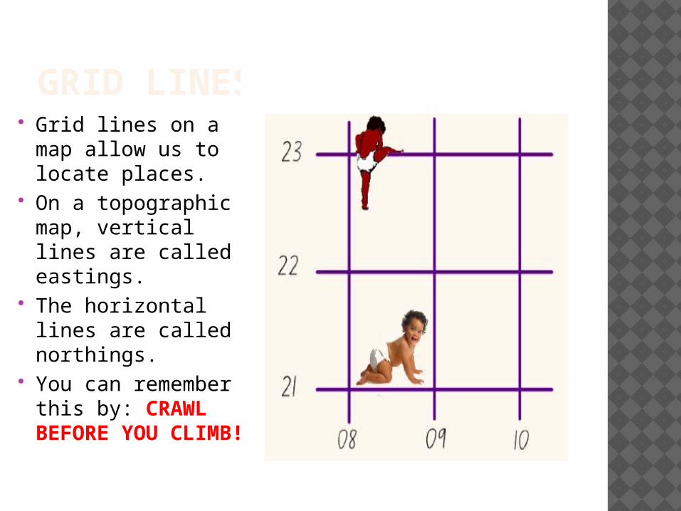
GRID LINES Grid lines on a map
allow us to locate places.
On a topographic map, vertical lines are called eastings.
The horizontal lines are called northings.
You can remember this by: CRAWL BEFORE YOU CLIMB!

AREA REFERENCE

LEN – A * AT AR3380, A ? AT AR3177, A AT AR3480, A @ AT AR7832, A $ AT AR 3280
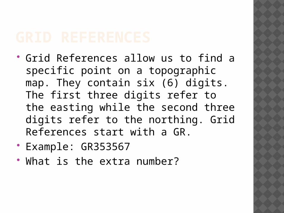
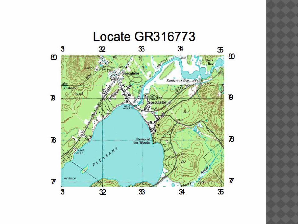
GRID REFERENCES Grid References allow us to find a
specific point on a topographic map. They contain six (6) digits. The first three digits refer to the easting while the second three digits refer to the northing. Grid References start with a GR.
Example: GR353567 What is the extra number?
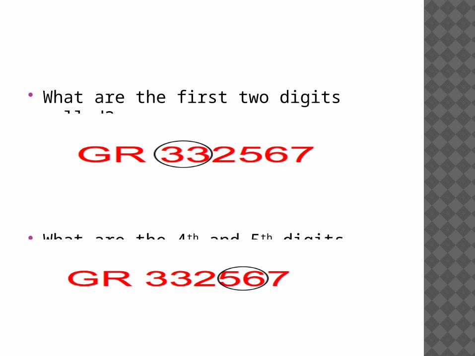
What are the first two digits called?
What are the 4th and 5th digits called?
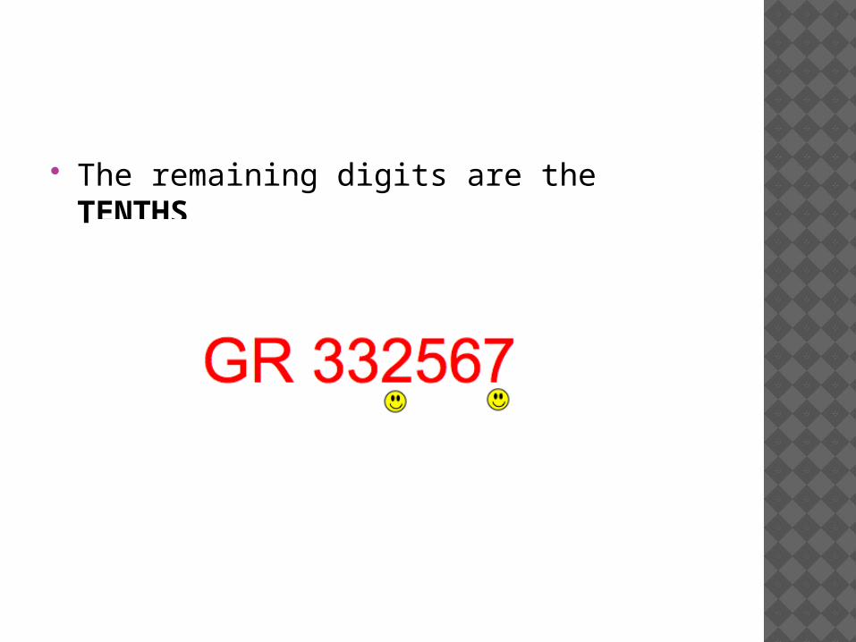
The remaining digits are the TENTHS
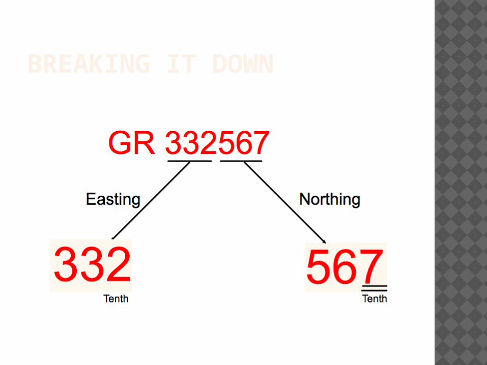
BREAKING IT DOWN

TENTHS To work out
the tenths, you need to divide each grid square into ten equal parts.