appendix f-7 - nps
TRANSCRIPT

APPENDIX F-7
WATER SUPPLY ASSESSMENT
Water Supply Assessment
For The
CEMEX Eliot Quarry SMP-23 Reclamation Plan
Amendment Project
Alameda County, California
Prepared for:
CEMEX Construction Materials Pacific, LLC 2365 Iron Point Road, Suite 120
Folsom, CA 95630
Prepared by:
Dr. Andrew A. Kopania California Professional Geologist No. 4711
California Certified Hydrogeologist No. HG31 EMKO Environmental, Inc.
551 Lakecrest Drive El Dorado Hills, California 95762
April 22, 2019
____________________________
Dr. Andrew A. Kopania
EMKO Environmental, Inc. i
Water Supply Assessment For The
CEMEX Eliot Quarry SMP-23 Reclamation Plan
Amendment Project Alameda County, California
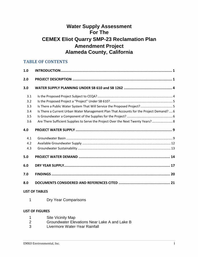
TABLE OF CONTENTS
1.0 INTRODUCTION .......................................................................................................... 1
2.0 PROJECT DESCRIPTION ............................................................................................... 1
3.0 WATER SUPPLY PLANNING UNDER SB 610 and SB 1262 .............................................. 4
3.1 Is the Proposed Project Subject to CEQA? .................................................................................... 4
3.2 Is the Proposed Project a “Project” Under SB 610? ...................................................................... 5
3.3 Is There a Public Water System That Will Service the Proposed Project? .................................... 5
3.4 Is There a Current Urban Water Management Plan That Accounts for the Project Demand? .... 6
3.5 Is Groundwater a Component of the Supplies for the Project? ................................................... 6
3.6 Are There Sufficient Supplies to Serve the Project Over the Next Twenty Years? ....................... 8
4.0 PROJECT WATER SUPPLY ............................................................................................ 9
4.1 Groundwater Basin ....................................................................................................................... 9
4.2 Available Groundwater Supply ................................................................................................... 12
4.3 Groundwater Sustainability ........................................................................................................ 13
5.0 PROJECT WATER DEMAND ....................................................................................... 14
6.0 DRY YEAR SUPPLY..................................................................................................... 17
7.0 FINDINGS ................................................................................................................. 20
8.0 DOCUMENTS CONSIDERED AND REFERENCES CITED ................................................. 21
LIST OF TABLES
1 Dry Year Comparisons
LIST OF FIGURES
1 Site Vicinity Map 2 Groundwater Elevations Near Lake A and Lake B 3 Livermore Water-Year Rainfall
EMKO Environmental, Inc. 1
Water Supply Assessment For The
CEMEX Eliot Quarry SMP-23 Reclamation Plan
Amendment Project
Alameda County, California
1.0 INTRODUCTION
The CEMEX Eliot Quarry site is located in unincorporated Alameda County, California
between the cities of Livermore and Pleasanton (Figure 1). This report has been
prepared to identify the water demand of the proposed Project, as identified in Section
2.0, below, and provide an analysis of the available water supply to support the current
Application for Reclamation Plan Amendment and California Environmental Quality Act
(CEQA) environmental analysis.
Water Code Sections 10910 through 10915 were amended by Senate Bill 610 (SB 610)
in 2002. SB 610 requires that under specific circumstances, as detailed below, an
assessment of available water supplies must be conducted. The purpose of the
assessment is to determine if available water supplies are sufficient to serve the
demand generated by the Project, as well as the reasonably foreseeable demand in the
region over the next 20 years under average normal year, single dry year, and multiple
dry year conditions. Water Code Section 10910 was further amended by SB 1262 on
September 24, 2016 to require a Water Supply Assessment to include additional
information regarding the groundwater basin designation and adjacent water systems.
This report provides the information required for a Water Supply Assessment (WSA), as
described in the October 2003 Guidebook for Implementation of Senate Bill 610 and
Senate Bill 221 of 2001 to Assist Water Suppliers, Cities, and Counties in Integrating
Water and Land Use Planning, published by the California Department of Water
Resources (DWR Guidebook) along with the additional information required by SB
1262.
2.0 PROJECT DESCRIPTION
CEMEX Construction Materials Pacific, LLC. (“CEMEX”) owns and operates the Eliot
Quarry, a ±920-acre sand and gravel mining facility, located between the cities of
Livermore and Pleasanton, at 1544 Stanley Boulevard in unincorporated Alameda
County. CEMEX and its predecessors-in-interest have been continuously mining for
sand and gravel at the Eliot Quarry since at least 1906. In addition to mining and
reclamation, existing permitted and accessory uses at the Eliot Quarry include
aggregate, asphalt and ready-mix concrete processing, as well as ancillary uses such

CEMEX Eliot Quarry SB 610 Water Supply Assessment
EMKO Environmental, Inc. 2
as aggregate stockpiling, load-out, sales, construction materials recycling, and
equipment storage and maintenance. CEMEX’s mining operations at the site are
vested per pre-1957 mining activities and Alameda County Quarry Permits Q-1 (1957),
Q-4 (1957), and Q-76 (1969). Surface mining reclamation activities at the site are
currently conducted pursuant to Surface Mining Permit and Reclamation Plan No. SMP-
23 (“SMP-23”), approved in 1987.
Under the Eliot Quarry SMP-23 Reclamation Plan Amendment Project (“Project”),
CEMEX proposes a revised Reclamation Plan that serves to adjust reclamation
boundaries and contours, enhance drainage and water conveyance facilities,
incorporate a pedestrian and bike trail, and achieve current surface mining reclamation
standards. The planned post-mining end uses are water management, open space,
and agriculture (non-prime).
Consistent with prior approvals, the Project will develop Lake A and Lake B, which are
the first two lakes in the Chain of Lakes pursuant to the Alameda County Specific Plan
for Livermore-Amador Valley Quarry Area Reclamation adopted in 1981 (“Specific

CEMEX Eliot Quarry SB 610 Water Supply Assessment
EMKO Environmental, Inc. 3
Plan”). Upon reclamation, Lake A and Lake B, along with their appurtenant water
conveyance facilities, will be dedicated to the Zone 7 Water Agency (“Zone 7”) for
purposes of water storage, conveyance and recharge management.
Lake A reclamation will include installation of a surface water diversion from the Arroyo
del Valle (“ADV”) to Lake A; conversion of a berm that is currently located in Lake A that
blocks water to a small island to allow water to flow across the lake; installation of a
water conveyance pipeline from Lake A to future Lake C (located off-site to the
northwest); and an overflow outlet to allow water to flow back into ADV when Lake A
water levels are high to prevent flooding in the localized area. The final surface area of
Lake A will be 81 acres as compared to 208 acres in SMP-23. No further mining will
occur in Lake A.
Lake B reclamation will include installation of a pipeline turn-out from Lake A, a water
pipeline conduit to future Lake C, and an overflow outlet to allow water to flow back into
ADV when Lake B water levels are high. The final bottom elevation of Lake B is
proposed at 150 feet above mean sea level (“msl”), in order to maximize the available
aggregate resource. The final surface area of Lake B will be 208 acres as compared to
243 acres in SMP-23.
To facilitate the southerly progression of Lake B, the Project includes realignment and
restoration of a ±5,800 linear foot reach of the ADV. The proposed ADV realignment
will result in an enhanced riparian corridor that flows around, rather than through (as
currently anticipated in SMP-23), Lake B. The ADV realignment was contemplated in
the Specific Plan and subject to environmental review in 1981.
Outside of Lake A and Lake B, reclamation treatment for other disturbed areas,
including the Lake J excavation (not part of the Chain of Lakes), processing plant sites,
and process water ponds will involve backfills and/or grading for a return to open space
and/or agriculture.
The Project is a modification of an approved project. Except as outlined above, CEMEX
proposes no change to any fundamental element of the existing operation (e.g., mining
methods, processing operations, production levels, truck traffic, or hours of operation).
A more complete description of the proposed Project is contained in CEMEX’s Project
Description, Revised Reclamation Plan, and other application materials provided to the
County.
CEMEX Eliot Quarry SB 610 Water Supply Assessment
EMKO Environmental, Inc. 4
3.0 WATER SUPPLY PLANNING UNDER SB 610 and SB 1262
SB 610, effective January 1, 2002, amends Sections 10910 through 10915 of the Water
Code by requiring preparation of a WSA for development projects subject to CEQA and
other criteria, as discussed below. SB 610 also amends Section 10631 of the Water
Code, which relates to Urban Water Management Plans (UWMPs). The WSA process
under SB 610 is designed to rely on the information typically contained in UWMPs,
where available.
On September 24, 2016, SB 1262 further amended Section 10910 of the Water Code to
require additional information related to adjacent public water systems and the status of
the groundwater basin. These amendments provide additional consistency with the
Sustainable Groundwater Management Act of 2014, as discussed further in Section 4.3.
The first steps in the WSA process are to determine whether SB 610 applies to the
proposed Project. If so, then documentation of available water supplies, anticipated
Project demand, and the sufficiency of supplies must be conducted. These issues are
summarized by the following questions, as outlined in the DWR Guidebook:
1. Is the proposed Project subject to CEQA?
2. Is the proposed Project a “Project” under SB 610?
3. Is there a public water system that will service the proposed Project?
4. Is there a current UWMP that accounts for the project demand?
5. Is groundwater a component of the supplies for the Project?
6. Are there sufficient supplies to serve the Project over the next twenty years?
Each of these issues are discussed in the following sections as they relate to the Project
3.1 Is the Proposed Project Subject to CEQA?
The first step in the SB 610 process is to determine whether the proposed project is
subject to CEQA. Water Code Section 10910(a) states that any city or county that
determines that an application meets the definition of “project”, per Water Code Section
10912 (see Section 3.2, below), and is subject to CEQA, shall prepare a water supply
assessment for the project. CEQA applies to projects requiring issuance of a
discretionary permit by a public agency, projects undertaken by a public agency, or
projects funded by a public agency. The proposed amendments to the 1987 SMP-23
Reclamation Plan, as described in Section 2.0, require discretionary approval by
Alameda County, a public agency. Therefore, the Project is subject to CEQA. This

CEMEX Eliot Quarry SB 610 Water Supply Assessment
EMKO Environmental, Inc. 5
WSA has been prepared to support the environmental review being conducted by
Alameda County under CEQA.
3.2 Is the Proposed Project a “Project” Under SB 610?
The second step in the SB 610 process is to determine if the proposed Project meets
the definition of “project” under Water Code Section 10912(a). Under Section 10912(a)
a “project” is defined as meeting any of the following criteria:
1. a proposed residential development of more than 500 dwelling units;
2. a proposed shopping center or business establishment employing more than
1,000 persons or having more than 500,000 square feet of floor space;
3. a proposed commercial office building employing more than 1,000 persons or
having more than 250,000 square feet of floor space;
4. a proposed hotel or motel, or both, having more than 500 rooms;
5. a proposed industrial, manufacturing, or processing plant, or industrial park
planned to house more than 1,000 persons, occupying more than 40 acres of
land, or having more than 650,000 square feet of floor area;
6. a mixed-use project that includes one or more of the projects defined above; or
7. a project that would demand an amount of water equivalent to, or greater than,
the amount of water required by a 500 dwelling unit project.
The proposed amendments to the reclamation plan for the Eliot Quarry will occur on an
industrial site that is larger than 40 acres and thus this WSA is being prepared in
accordance with category 5, above.
3.3 Is There a Public Water System That Will Service the Proposed Project?
Section 10912(c) of the Water Code identifies a public water system as a system for the
provision of piped water to the public for human consumption that has 3,000 or more
service connections. There are no public water systems that serve the project site. As
described below, the project provides its own water needs through mine pit dewatering
and a groundwater well. In addition, the project will not be connected to a water
system, such that the project will not result in an existing water system becoming a
public water system as a result of the project (per SB 1262 modifications to Water Code
Section 10910(b)). While the project will carry out a portion of the Specific Plan’s
objectives for the Chain of Lakes, the Chain of Lakes provides no potable water and has
no customer connections.
CEMEX Eliot Quarry SB 610 Water Supply Assessment
EMKO Environmental, Inc. 6
The nearest public water systems to the Eliot Quarry include the City of Pleasanton
Water Service, located to the west of the Project site, and California Water Service
Company’s service area in the southwestern part of the City of Livermore, located to the
east and northeast of the Project site. The proposed amendments to SMP-23 are
anticipated to enhance recharge of the groundwater aquifers in the region and reduce
evaporative loss of groundwater, consistent with the objectives of the Specific Plan
(EMKO, 2019). Therefore, the proposed project will not reduce the available water
supply for nearby public water systems.
3.4 Is There a Current Urban Water Management Plan That Accounts for the Project
Demand?
The Water Code requires that all public water systems providing water for municipal
purposes to more than 3,000 customers, or supplying more than 3,000 acre feet per
year, must prepare an UWMP. The DWR Guidebook (page iii) states that SB 610
repeatedly refers to the UWMP as a planning document that can be used to meet the
standards set forth in the statute, and that UWMPs act as a foundation to fulfill the
requirements of the statute. Zone 7 has prepared an UWMP (Zone 7, 2016). The Zone
7 UWMP addresses a broad range of water sources and water demands, not just
groundwater. Evaporative loss of water from gravel quarries and subsequent recharge
under the Specific Plan are not addressed in the UWMP. However, the entire
Livermore-Amador Groundwater Basin is covered by the Zone 7 Groundwater
Management Plan (GWMP) (Jones and Stokes, 2005). This WSA is based upon
available and relevant information, including public documents, the technical studies
and assessments submitted with the application for the proposed project, and other
relevant documents, as cited in Section 8.0, such as the Zone 7 GWMP and relevant
information in the UWMP. Since this WSA has been prepared for use by the CEQA
lead agency, this document includes an evaluation of whether the total projected water
supplies, determined to be available during normal, single dry, and multiple dry water
years during a 20-year projection, will meet the projected water demand associated with
the proposed project, in addition to existing and planned future uses, including
agricultural and manufacturing uses, in accordance with Water Code § 10910(c)(4).
While agricultural uses are planned after reclamation, no manufacturing uses are
proposed for the Project site after it is reclaimed.
3.5 Is Groundwater a Component of the Supplies for the Project?
Water Code Section 10910(f), paragraphs 1 through 5, must be addressed if
groundwater is a source of supply for the proposed project. The CEMEX Eliot Quarry
and related processing facilities currently obtain all the water necessary for operations
from groundwater, including a combination of water pumped from the Lake B and Lake

CEMEX Eliot Quarry SB 610 Water Supply Assessment
EMKO Environmental, Inc. 7
J pits to keep them dewatered and an onsite well to provide makeup water for concrete
production and potable water for employee use. No other sources of water are
anticipated to be affected by the proposed Project. Therefore, the project will affect only
groundwater and an assessment of groundwater is included in this document.
Water Code Section 10910(f) paragraphs 1 through 5, as modified by SB 1262, state:
(f) If a water supply for a proposed project includes groundwater, the following additional information shall be included in the water supply assessment:
(1) A review of any information contained in the urban water management plan relevant to the identified water supply for the proposed project.
(2) (A) A description of any groundwater basin or basins from which the proposed project will be supplied. (B) For those basins for which a court or the board has adjudicated the rights to pump groundwater, a copy of the order or decree adopted by the court or the board and a description of the amount of groundwater the public water system, or the city or county if either is required to comply with this part pursuant to subdivision (b), has the legal right to pump under the order or decree. (C) For a basin that has not been adjudicated that is a basin designated as high- or medium priority pursuant to Section 10722.4, information regarding the following: (i) Whether the department has identified the basin as being subject to critical conditions of overdraft pursuant to Section 12924; and (ii) If a groundwater sustainability agency has adopted a groundwater sustainability plan or has an approved alternative, a copy of that alternative or plan. (D) For a basin that has not been adjudicated that is a basin designated as low- or very-low priority pursuant to Section 10722.4, information as to whether the department has identified the basin or basins as overdrafted or has projected that the basin will become overdrafted if present management conditions continue, in the most current bulletin of the department that characterizes the condition of the groundwater basin, and a detailed description by the public water system, or the city or county if either is required to comply with this part pursuant to subdivision (b), of the efforts being undertaken in the basin or basins to eliminate the long-term overdraft condition.
(3) A detailed description and analysis of the amount and location of groundwater pumped by the public water system, or the city or county if either is required to comply with this part pursuant to subdivision (b), for the past five years from any groundwater basin from which the proposed project will be supplied. The description and analysis shall be based on information that is reasonably available, including, but not limited to, historic use records.
(4) A detailed description and analysis of the amount and location of groundwater that is projected to be pumped by the public water system, or the city or county if either is required to comply with this part pursuant to subdivision (b), from any basin from which the proposed project will be supplied. The description and analysis shall be based on information that is reasonably available, including, but not limited to, historic use records.

CEMEX Eliot Quarry SB 610 Water Supply Assessment
EMKO Environmental, Inc. 8
(5) An analysis of the sufficiency of the groundwater from the basin or basins from which the proposed project will be supplied to meet the projected water demand associated with the proposed project. A water assessment shall not be required to include the information required by this paragraph if the public water system determines, as part of the review required by paragraph (1), that the sufficiency of groundwater necessary to meet the initial and projected water demand associated with the project was addressed in the description and analysis required by paragraph (4) of subdivision (b) of Section 10631.
Pursuant to paragraph 1, there is not an UWMP that addresses the project demand, or
the adjacent and surrounding properties, as discussed in Section 3.4. Therefore, the
information and evaluations presented in this WSA are based primarily on other
publicly-available reports and documents from the California Department of Water
Resources and Zone 7, including the Specific Plan and the GWMP, along with the site-
specific groundwater studies previously conducted at the CEMEX Eliot Quarry.
Paragraph 2 is addressed in Section 4.1, below, including a description of the
groundwater basin and groundwater conditions.
As previously discussed, there is not an urban water management plan that covers the
project area. To address the items described in Paragraph 3, Section 5.0 presents
available information regarding current and future water consumption at the CEMEX
Eliot Quarry.
To address paragraph 4, Section 4.2 includes a discussion of the amount and location
of groundwater pumping and recharge that occurs throughout the groundwater basin.
Section 5.0 presents available information regarding current and future water
consumption at the CEMEX Eliot Quarry.
The Paragraph 5 requirement to provide an analysis of the sufficiency of the
groundwater basin to meet the projected water demand associated with the proposed
project is addressed in Section 6.0, below.
3.6 Are There Sufficient Supplies to Serve the Project Over the Next Twenty Years?
Water Code Section 10910(c)(4) requires the WSA to “include a discussion with regard
to whether the total projected water supplies, determined to be available by the city or
county for the project during normal, single dry, and multiple dry water years during a
20-year projection, will meet the projected water demand associated with the proposed
project, in addition to existing and future planned uses, including agricultural and
manufacturing uses.”

CEMEX Eliot Quarry SB 610 Water Supply Assessment
EMKO Environmental, Inc. 9
The sufficiency of water supply for the proposed Project is addressed in Section 7.0,
below.
4.0 PROJECT WATER SUPPLY
Water for the CEMEX Eliot Quarry is sourced onsite and supplied by the Applicant. The
current water supply comes from groundwater, including a combination of water
pumped from the Lake B and Lake J pits to keep them dewatered, an onsite well to
provide makeup water for concrete production and potable water for employee use, and
a well along Vineyard Avenue that is used to irrigate the Lake A trail landscaping.
Water demand for the proposed Project is discussed in Section 5.0 and will consist
primarily of evaporation from the reclaimed mining pits. Since the evaporative loss will
primarily come from groundwater, information regarding the groundwater basin is
provided in this section, along with an estimate of the amount of groundwater that is
available for Project use. In addition, the potential implications of the Sustainable
Groundwater Management Act of 2014 and future regulatory requirements are
discussed.
4.1 Groundwater Basin
DWR refers to the Livermore-Amador Groundwater Basin as the Livermore Valley
Groundwater Basin (Basin Number 2-10) (DWR 2003). The information presented in
this section has been summarized primarily from the Hydrostratigraphic Investigations
of the Aquifer Recharge Potential for Lakes C and D of the Chain of Lakes, Livermore,
California (Alameda County Flood Control and Water Conservation District Zone 7,
2011), the Groundwater Management Plan for Livermore-Amador Valley Groundwater
Basin (Prepared for Zone 7 Water Agency by Jones and Stokes, 2005), Groundwater
Hydrology and Water Quality Analysis Report for the CEMEX Eliot Quarry SMP-23
Reclamation Plan Amendment Project, Alameda County, California (EMKO
Environmental, Inc., 2019), and Zone 7 groundwater and surface water data.
The CEMEX Eliot Quarry is located within the Livermore-Amador Valley, an east-west
trending inland alluvial basin located in northeastern Alameda County (Figure 1). An
alluvial basin is a valley that has been filled with sediments deposited predominantly by
streams and rivers. The basin is surrounded primarily by north-south trending faults
and hills of the Diablo Range. The Livermore-Amador Valley encompasses
approximately 42,000 acres, is about 14 miles long (east to west), and varies from three
miles to six miles wide (north to south). The Livermore Valley Groundwater Basin is
located in the central part of the Livermore-Amador Valley. The Main Basin is a part of
the Livermore Valley Groundwater Basin that contains the highest-yielding aquifers and
the best groundwater quality. The CEMEX Eliot Quarry is located within the southeast
corner of the Main Basin.
CEMEX Eliot Quarry SB 610 Water Supply Assessment
EMKO Environmental, Inc. 10
The Livermore-Amador Valley is partially filled with alluvial fan, stream, and lake
deposits, collectively referred to as alluvium. The alluvium in the valley consists of
unconsolidated gravel, sand, silt, and clay. Alluvial fans occur where streams and rivers
from hilly or mountainous areas enter a valley and deposit very coarse sediment,
primarily sand and gravel. The silt and clay were deposited in floodplain areas or lakes
that developed at different times across the basin. The alluvium is relatively young from
a geologic perspective, being deposited during the Pleistocene and Holocene geologic
epochs (younger than 1.6 million years old). In the west-central area of the basin, the
alluvium is up to 800 feet thick, but thins along the margins of the valley.
The southeastern and central parts of the Main Basin area contain the coarsest alluvial
fan deposits. These alluvial fan deposits were formed by the ancestral and present
Arroyo del Valle and Arroyo Mocho. The coarse alluvial fan deposits are economically
important aggregate deposits, which has resulted in the widespread aggregate mining in
the Main Basin area. The coarse alluvial fan deposits also comprise some of the most
significant groundwater recharge areas in the Livermore-Amador Valley.
Two primary aquifer zones have been identified in the Main Basin. The Upper Aquifer
Zone is present to depths of up to 150 feet below ground surface (ft bgs). The Lower
Aquifer Zone is present to depths of more than 500 ft bgs. In the central part of the
Main Basin, a thick clay layer, up to 50 feet thick, separates the two aquifer zones. This
clay layer is referred to as an aquitard zone. In the CEMEX Eliot Quarry area, however,
data from borehole and well logs indicates that the aquitard is much thinner and
discontinuous, and is not present in some locations (Brown & Caldwell, 2004; Jeff Light
Geologic Consulting, 2018; EMKO Environmental, Inc., 2019). Thus, in the area of the
Project, the two aquifer zones are connected hydraulically.
Water levels have been measured in numerous wells by Zone 7 for many decades.
Figure 2 presents a hydrograph showing the groundwater elevations in two wells
adjacent to the CEMEX Eliot Quarry, along with the annual rainfall totals for each year
shown (see Section 6.0 for more detailed discussion of the rainfall data). Well 30D2 is
located to the south of Lake A and Well 23J1 is located to the south of Lake B. Lake A
and Lake B will be the two main surface water bodies at the Eliot Quarry after mining is
completed and the site is reclaimed. The two selected wells have the longest period of
groundwater measurements of any of the wells monitored at or adjacent to the CEMEX
Eliot Quarry property.
As shown on Figure 2, the water level data for Well 30D2 do not vary significantly over
time. The lack of significant variation is most likely due to the proximity to Arroyo del
Valle and the likelihood that this well is completed within a different geologic formation

CEMEX Eliot Quarry SB 610 Water Supply Assessment
EMKO Environmental, Inc. 11
than that which comprises the main aquifer units in the groundwater basin (EMKO
Environmental, Inc., 2019).
As exemplified by the hydrograph for Well 23J1 on Figure 2, most wells completed in
the main aquifer units typically have a dual cyclical pattern (EMKO Environmental, Inc.,
2019). Long-term cycles are related to climatic changes such as wet periods and
drought periods. For example, significant dry periods in the late 1980s-early 1990s, in
the early and late 2000s, and in the early-mid 2010s are reflected in lower water levels
in many wells1. Shorter annual cycles are due to recharge during the wet season and
extraction during the dry season each year. Peak water levels generally occur between
March and May and minimum water levels generally occur in August or September
within each annual cycle (EMKO Environmental, Inc., 2019). The average depth to
groundwater in the Project area is approximately 40 ft bgs.
The long term climatic cycles can result in water-level changes of up to 100 feet. The
annual cycles typically range in magnitude from about 15 feet to 40 feet. As discussed
1 A more detailed discussion of drought periods is presented in Section 6.0.

CEMEX Eliot Quarry SB 610 Water Supply Assessment
EMKO Environmental, Inc. 12
above, however, the aquifer units are generally more than 500 feet thick in the project
area.
According to the Department of Water Resources, the Livermore-Amador Groundwater
Basin is a medium priority basin according to the SGMA Basin Prioritization Dashboard
(https://gis.water.ca.gov/app/bp2018-dashboard/p1/, accessed February 26, 2019) and
is not subject to conditions of critical overdraft. See Section 4.3 for additional
discussion of groundwater sustainability.
4.2 Available Groundwater Supply
According to the Zone 7 GWMP (Jones and Stokes, 2005), the Main Basin area of the
Livermore-Amador Groundwater Basin has a storage capacity of more than 250,000
AF. The CEMEX Eliot Quarry is located in the southern part of the Main Basin. Historic
low groundwater storage occurred in the early 1960s, estimated to be 128,000 AF. The
basin reached full capacity in 1983. However, drought conditions in 1977 and from
1987 to 1992 caused groundwater levels to decrease to near historic-low values in
some parts of the basin. As indicated on Figure 2, groundwater levels in some wells
near the CEMEX Eliot Quarry decreased to near historic low levels as a result of the
2012-2015 drought but have since recovered (see additional discussion in Section 6.0).
Groundwater recharge occurs from natural sources, artificial recharge, and recharge
related to gravel mining (Jones and Stokes, 2005). Natural groundwater recharge in the
basin occurs primarily from rainfall runoff into local streams. The average natural
recharge is estimated to be 13,400 AF/yr (Jones and Stokes, 2005). Artificial recharge
occurs by release of surface water from the South Bay Aqueduct or Lake Del Valle to
streams or recharge ponds. Artificial recharge may range from 12,300 AF/yr to 20,000
AF/yr under conditions that existed at the time the Zone 7 GWMP was prepared (Jones
and Stokes, 2005). Gravel mining recharge may occur by discharge of water to former
gravel mining pits or discharges from pit dewatering into streams, where the water
subsequently percolates back to the subsurface. The Zone 7 GWMP does not provide
an estimate of recharge related to gravel mining, but the Specific Plan estimates that up
to 8,700 AF/yr of unregulated flow in Arroyo Mocho and flood releases from Lake Del
Valle could be diverted into the Chain of Lakes for groundwater recharge. Zone 7 also
jointly holds water rights to divert up to 60,000 AF/yr for “beneficial use”, which could be
used to provide surface water for groundwater recharge in the Chain of Lakes under the
Specific Plan, once mining is completed in all of the basins that are part of the Chain of
Lakes and appropriate diversion structures are constructed.
Approximately 35 percent of the total water demand in the Livermore-Amador Valley is
supplied by groundwater (Jones and Stokes, 2005). Groundwater extraction in 2005

CEMEX Eliot Quarry SB 610 Water Supply Assessment
EMKO Environmental, Inc. 13
was reported to be approximately 12,000 AF/yr of pumping by Zone 7, 3,000 AF/yr
evaporative losses from gravel mining operations, 7,200 AF/yr municipal pumping by
several water retailers, 1,200 AF/yr private pumping, and 500 AF/yr irrigation pumping
(Jones and Stokes, 2005). Thus, total groundwater usage in the basin averages
approximately 24,000 AF/yr. In normal meteorological and hydrologic conditions, the
natural and artificial recharge of 25,700 AF/yr to 33,400 AF/yr is more than sufficient to
balance the groundwater pumping in the basin and to help replenish groundwater
supplies.
4.3 Groundwater Sustainability
A series of three bills passed by the California legislature were signed by Governor
Brown on September 16, 2014. These three bills, Assembly Bill (AB) 1739, SB 1168,
and SB 1319, together comprise the Sustainable Groundwater Management Act of
2014 (SGMA). SGMA provides a structure under which local agencies are to develop a
sustainable groundwater management program. SGMA focuses on basins or
subbasins designated by DWR as high- or medium priority basins. As discussed in
Section 4.1, the Livermore-Amador Groundwater Basin is designated as having medium
priority. However, the subbasin is not subject to critical conditions of overdraft.
SGMA requires the establishment of a Groundwater Sustainability Agency (GSA),
development of a Groundwater Sustainability Plan (GSP), and achievement of
groundwater sustainability within 20 years. The GSAs allow for locally-controlled
groundwater management and provide tools and authorities for these local agencies to
achieve sustainability goals. For medium and high priority basins, the GSAs must have
been established by June 30, 2017. Any local water or land use agency or combination
of local agencies overlying a groundwater basin may elect to be a GSA. Zone 7 applied
to be the GSA for the Livermore-Amador Groundwater Basin in December 2016 and
has proposed to use its existing Groundwater Management Plan (Jones and Stokes,
2005) as an Alternative GSP by submitting documentation to DWR that demonstrate
that the basin has been operated within its sustainable yield over at least the last 10
years (https://sgma.water.ca.gov/portal/alternative/print/2).
DWR must make a determination if the existing Groundwater Management Plan and
monitoring programs form an acceptable Alternative GSP by January 2022. However,
completion of the proposed Project would not occur until approximately 30 to 35 years
later. Lake A and Lake B will become part of the Chain of Lakes, operated by Zone 7
for use in water storage and groundwater recharge in accordance with the Specific
Plan. In addition, Ponds C and D may become part of future Lakes C and D, which will
also be part of the Chain of Lakes. Any other programs implemented by the GSP to

CEMEX Eliot Quarry SB 610 Water Supply Assessment
EMKO Environmental, Inc. 14
comply with SGMA would be in addition to any current requirements under SB 610, SB
1262, and CEQA for this proposed Project.
5.0 BASELINE AND PROJECT WATER DEMAND
The proposed Project is a change to the reclaimed conditions at the Eliot Quarry. As a
result, the Project water demand includes the water anticipated to reclaim the site and
the subsequent consumptive water use of the proposed reclaimed conditions, which will
not be fully implemented for several decades. This section provides a comparison
between the water demand of the existing baseline conditions at the Eliot Quarry and
the anticipated water demand from the proposed amendments to the SMP-23
Reclamation Plan.
Baseline Water Demand
There is not always a clear distinction between certain reclamation actions and mining-
related activities. For example, realignment of Arroyo del Valle would be conducted
before mining in Lake B can extend farther to the south. While realignment of the
arroyo changes the reclaimed configuration of Lake B, it is not being conducted to
reclaim the Lake B mining disturbance. Thus, water use for the realignment (primarily
construction-related dust control and water added to fill material to reach compaction
specs) will be a mining-related water use and is not included in this analysis.
In addition, current dewatering of the Lake B and Lake J mining pits are not
consumptive uses of water. The water pumped from the active excavations offsets
groundwater pumping for consumptive uses such as dust control and aggregate
processing, or it is routed to onsite ponds where it may percolate back into the
subsurface. Evaporation from these ponds, however, is a baseline consumptive use
and is discussed below.
Two different baseline consumptive water use conditions have been considered (EMKO
Environmental, Inc., 2019). The first is the consumptive water use under the current
operating conditions (i.e. operating baseline conditions). The second is the
consumptive water use that would occur under existing conditions if all operations
ceased and water was allowed to fill the existing excavations (i.e. non-operating
baseline conditions).
Current operating water uses at the Eliot Quarry include water that is used to process
the aggregate and remains in the product that is shipped from the site, dust control,
water provided to East Bay Regional Park District (EBRPD) to help maintain the water
CEMEX Eliot Quarry SB 610 Water Supply Assessment
EMKO Environmental, Inc. 15
level in Shadow Cliffs Lake2, water used to manufacture concrete, potable water use,
and water used for landscape irrigation along the Lake A trail. Additional consumptive
water demand occurs due to evaporation from existing water surfaces on the site.
Water for aggregate processing, dust control, and Shadow Cliffs is supplied from ponds
that hold water that is pumped from the active mining pits (Lake B and Lake J) to keep
them dewatered. Based on aggregate production information provided by CEMEX
(personal communication, 2013-2017 Mining Operation Annual Reports, Deborah
Haldeman of CEMEX to Yasha Saber of Compass Land Group), an average of
1,182,325 tons of aggregate are produced per year at the Eliot Quarry. The produced
aggregate is assumed to have a moisture content of 5 percent by weight, based on
reported field capacities for such material
(https://www.sciencedirect.com/topics/agricultural-and-biological-sciences/field-capacity;
https://nrcca.cals.cornell.edu/soil/CA2/CA0212.1-3.php; both accessed February 1,
2019). Therefore, approximately 44 AF/yr are shipped with the aggregate product.
Dust control consumes approximately 100,000 gallons per day on average, with peak
dry season dust control water use up to 128,000 gallons per day (personal
communication, Grantt Franco of CEMEX to Yasha Saber of Compass Land Group,
February 5, 2019). Assuming that dust control occurs for 200 days per year, the
existing dust control water demand is approximately 61 AF/yr. Pumping to Shadow
Cliffs is approximated at 10 AF/yr. A well located on the Project site is used to provide
water for ready mix concrete and potable supply for employee restrooms. The annual
use for concrete ranges from 6 AF to 9 AF based on an average annual concrete
production of 90,338 cubic yards (personal communication, Michelle Bunch of CEMEX
to Yasha Saber of Compass Land Group, December 4, 2018) and a water requirement
of 20 gallons to 30 gallons per cubic yard (U.S. EPA, 2006;
https://www.concretenetwork.com/concrete/slabs/ratio.htm;
https://www.concretenetwork.com/concrete/slabs/ratio.htm; both accessed February 1,
2019). Approximately 240,000 tons of hot-mix asphalt were shipped from the site on
average per year for the period 2013-2017 (personal communication, Donald Roland of
Granite Construction Company to Yasha Saber of Compass Land Group, November 26,
2018). Water is not used to manufacture hot-mix asphalt, other than for dust control,
which is included in the dust control estimate provided above in this paragraph.
According to the American Water Works Association
(http://www.drinktap.org/consumerdnn/Home/WaterInformation/Conservation/WaterUse
Statistics/tabid/85/Default.aspx, accessed 2016), water use in a commercial setting (i.e.
2 SMP-23 discharges to Shadow Cliffs occur pursuant to Waste Discharge Requirements Regionwide National
Pollutant Discharge Elimination System (“NPDES”) Permit No. CAG982001 under Order No. R2-2015-0035, as
originally documented in a Notice of General Permit Coverage issued on March 25, 2003.
CEMEX Eliot Quarry SB 610 Water Supply Assessment
EMKO Environmental, Inc. 16
toilets and faucets using water-efficient fixtures) is approximately 20 gallons per worker
per day. Approximately 55 persons are currently employed at the Project site
(Compass Land Group 2019a, based on the production information sources cited in the
paragraph above). Therefore, the anticipated potable water demand is anticipated to be
1,100 gallons per day for 200 days per year, which is approximately 0.75 AF/yr.
According to CEMEX, based on irrigation parameters in the CEMEX Lake A – Trail
Corridor Revised Landscape Plan (Teichert Materials, May 2016) and the as-built
CEMEX Lake A – Vineyard Trail Corridor Landscape Planting Summary (Triangle
Properties, 2017), approximately 0.25 AF per year are used to irrigate the recently
installed landscaping along the Lake A trail. Thus, the current operational demand is
approximately 125 AF/yr, based on information provided by CEMEX.
Existing water surfaces on the site include Lake A, the Main Silt Pond, the freshwater
pond north of Lake B, an area in the western part of Lake B, a makeup water pond for
the aggregate plant, Ponds C and D that are located east of the freshwater pond and
west of Lakes C and D, respectively, and several former mining pits located along
Arroyo del Valle. The existing water surface area for these features is approximately
231.5 acres (EMKO Environmental, Inc., 2019). Evaporative loss is estimated based on
an average Class A Pan evaporation rate for the region of about 63 inches per year and
a lake evaporation factor of 0.7 (DWR, 1975). Thus, for the existing water surface area
at the Eliot Quarry, the baseline evaporative loss is approximately 850 AF/yr.
If all operations ceased and water was allowed to fill the existing excavations, the total
water surface area would be 400 acres, which includes the acreages for Lake A, Lake
B, Lake J, the Main Silt Pond, the freshwater pond north of Lake B, Ponds C and D, and
former mining pits located along Arroyo del Valle (EMKO Environmental, Inc., 2019).
Under the non-operating baseline conditions, the annual evaporative loss from the 400
acres of water surface would be approximately 1,470 AF/yr and the irrigation demand
for the Lake A trail landscaping would be 0.25 AF/yr.
Thus, for baseline conditions, the total consumptive use of water ranges from 975 AF/yr
for active operating conditions to 1,470 AF/yr if all mining and dewatering were to
cease. The active operating baseline scenario includes 125 AF/yr for operational
demand and 850 AF/yr of evaporation from existing water surfaces. The non-operating
baseline scenario of 1,470 AF/yr consists of evaporation and landscaping irrigation only,
since there would be no ongoing operations.
CEMEX Eliot Quarry SB 610 Water Supply Assessment
EMKO Environmental, Inc. 17
Project Water Demand
Water demand during reclamation will be variable. The water demand during
construction will be primarily for dust control and to aid in compaction. In addition,
reclamation will be conducted, at least in part, concurrently with mining (e.g. Lake A will
likely be reclaimed while mining is occurring in Lake J). The overall annual construction
water demand is anticipated to be comparable to the current dust control water use at
the site, which is estimated to be approximately 61 AF/yr (EMKO Environmental, Inc.,
2019).
Once reclamation is completed, the total area of water surface will be 355 acres,
(EMKO Environmental, Inc., 2019). The annual average evaporation from this surface
area will be 1,300 AF/yr, based on an average Class A Pan evaporation rate for the
region of about 63 inches per year and a lake evaporation factor of 0.7 (DWR, 1975).
Irrigation water demand will include 0.25 AF/yr for the Lake A trail and 0.45 AF/yr for the
landscaping improvements that would be installed around the perimeter of Lake A
(personal communication, Michael Engle of Cunningham Engineering to Yasha Saber of
Compass Land Group, January 29, 2019). Thus, the total Project water demand would
be up to 1,362 AF/yr, with 95 percent of that demand being evaporation from water
surfaces that would be dedicated to Zone 7 (Lake A, Lake B, Pond C, Pond D, and the
Fresh Water Pond that would become part of Lake B). The large proportion of Project
water demand due to evaporation demonstrates that potential additional irrigation
demand that may occur on other parts of the reclaimed Project Site (e.g., irrigation
along the Vineyard Avenue Lake B trail and realigned Arroyo del Valle) would be de
minimis and would not affect the overall evaluation of water use.
Comparison of Baseline and Project Water Demand
The overall reclamation demand of up to 1,362 AF/yr is more than the baseline
operational water demand of 975 AF/yr but less than the baseline non-operational water
demand of 1,470 AF/yr if all mining and dewatering were to cease at this time. As
described in the Revised Reclamation Plan (Compass Land Group, 2019), reclamation
construction at Lake A is anticipated to occur in 2022 and 2023. Therefore, for those
two years, the water demand would consist of the operational baseline water demand of
975 AF/yr plus up to 61 AF/yr for reclamation dust control and other construction needs,
or a total of 1,036 AF/yr (EMKO Environmental, Inc., 2019).
6.0 DRY YEAR SUPPLY
To evaluate the amount and sustainability of dry-year water supply for the project,
historical rainfall data and groundwater levels were evaluated. Publicly-available rainfall

CEMEX Eliot Quarry SB 610 Water Supply Assessment
EMKO Environmental, Inc. 18
data from the Western Regional Climate Center for the City of Livermore were used for
this evaluation (WRCC, 2019). Rainfall data for the City of Livermore have been
recorded monthly by the East Bay Municipal Utility District since 1931.
Rainfall data were evaluated for a water year, not a calendar year. A water year begins
on October 1 and extends to September 30 of the next calendar year. This time period
better-represents the seasonal rainfall patterns in California than does a calendar year.
In this report, a water year is designated by the year in which it ends. For example, the
period from October 1, 1976 through September 30, 1977 is designated as the 1977
water year. The annual water-year rainfall from 1932 to 2018 for Livermore is shown on
Figure 3. The average water-year rainfall at Livermore for this period is 14.15 inches.
The average annual rainfall amount is plotted as the red line on Figure 3.
Table 1 shows the driest single year and driest multiple-year periods since 1932. For
each period, the rainfall totals for each year during the period are added together and
then divided by the number of years in the period. For example, for the three-year
period from 1975 to 1977, the annual rainfall amounts for each year were 12.82 inches,
6.23 inches, and 6.02 inches. Adding those values together yields 25.07 inches and
dividing by three (i.e. the number of years) equals 8.36 inches. The multiple-year
average of 8.36 inches can then be compared directly to the normal annual average
rainfall of 14.15 inches to determine that during this three-year dry period, the total
rainfall amount was 59 percent of normal, as indicated in Table 1.

CEMEX Eliot Quarry SB 610 Water Supply Assessment
EMKO Environmental, Inc. 19
The single driest water year was 1977, with only 43 percent of normal rainfall. The
driest two-year period recorded at Livermore was from 1976 to 1977, with 44 percent of
normal rainfall. The driest three-year period occurred from 1975 to 1977, with 60
percent of normal rainfall. Table 3 also provides a summary of the driest four-year, five-
year, and six-year periods since 1932. The recent four-year drought period from 2012
to 2015 is also shown in Table 3 for comparison with the driest four-year period, which
was from 1987 to 1990 in Livermore. The recent four-year drought period was only the
third driest four-year period on record for Livermore.
Table 3 Dry Year Comparisons
Driest
Single Year
Driest Two-
Year Period
Driest
Three-Year
Period
Driest Four-
Year Period
Driest Five-
Year Period
Driest Six-
Year Period
Recent
Four-Year
Drought
Period
Water Years 1977 1976-1977 1975-1977 1987-1990 1987-1991 1972-1977 2012-2015
Annual Average 6.02 6.13 8.36 9.52 9.88 9.86 9.86
Percent of Normal 43% 43% 59% 67% 70% 70% 70%
Upon completion of mining, and implementation of the proposed Project, Lake A and
Lake B will become part of the Chain of Lakes3, to be operated by Zone 7. Zone 7 will
divert water that it owns into the Chain of Lakes to provide groundwater recharge in
accordance with the Specific Plan. Section IV of the Specific Plan states that one of the
Specific Objectives of the Plan is “to mitigate exposure of groundwater to evaporative
losses due to mining operations” (Specific Objective No. 2). Evaporative losses would
be mitigated by diverting water from Arroyo del Valle into the Chain of Lakes at Lake A
and conveying that water to locations within the Chain of Lakes where it would recharge
groundwater.
As discussed in Section 4.2, groundwater demand in the Livermore-Amador
Groundwater Basin is approximately 24,000 AF/yr (Jones and Stokes, 2005), whereas
existing natural and artificial recharge may range from about 25,000 AF/yr to over
30,000 AF/yr. Under the Specific Plan, artificial recharge may be increased by as much
as 60,000 AF/yr. The Zone 7 UWMP provides estimates of water demand under normal
year, single dry year, and multiple dry year scenarios over a 20-year period (Zone 7,
2016, Tables 7-12, 7-13, and 7-14a through 7-14c). The estimates in the UWMP
include both surface water supplies and pumping of groundwater, in addition to surface
water demands for groundwater recharge. The UWMP concludes that under each 3 Ponds C and D would become part of Lakes C and D, respectively, which are also components of the Chain of
Lakes.

CEMEX Eliot Quarry SB 610 Water Supply Assessment
EMKO Environmental, Inc. 20
scenario (normal, single dry, and multiple dry years) the available water supply will
exceed the water demand. The ability to maintain adequate supplies in dry year
scenarios occurs primarily by increased use of groundwater supplies and the direct use
of surface water that would have otherwise been used for groundwater recharge. The
Specific Plan provides a mechanism by which the available storage capacity of the
groundwater basin acts as a reservoir which may be recharged during wet periods while
providing a source of supply during dry periods.
The UWMP (Zone 7, 2016) projects that during normal rainfall periods the annual
available water (projected supplies in excess of demands) would range from 6,545
AF/yr to 11,345 AF/yr over a 20-year period. During single and multiple dry year
scenarios, the annual available water would range from 12,320 AF/yr to 29,700 AF/yr,
primarily due to a temporary increased reliance on groundwater. Due to the cyclical
nature of normal and dry rainfall periods (see Figure 3), the temporary increased
reliance is not anticipated to exceed the sustainable yield of the groundwater basin or to
result in conditions of overdraft (Zone 7, 2016; Jones and Stokes, 2005). As described
in Section 5.0, the annual water demand for the proposed Project would include up to
one acre-foot for landscape irrigation, 61 AF for dust control during construction, and
evaporative loss of 1,300 AF from water surfaces, or a maximum of 1,362 AF/yr. This
volume of water is substantially less than the projected annual available water identified
in the UWMP (Zone 7, 2016). In addition, the increased recharge that will occur in the
Chain of Lakes once the proposed Project is implemented will more than offset the
evaporative water demand during normal, single dry and multiple dry-year conditions,
as intended in the Specific Objectives of the Specific Plan.
7.0 FINDINGS
This WSA has been prepared in accordance with SB 610 and SB 1262 to support the
CEQA environmental review for the proposed Project and provides an assessment of
water supply adequacy for the Project in accordance with Water Code Sections 10910
through 10915.
The water demand for the proposed project will consist of evaporation from the
reclaimed mining excavations, water needed for construction, and a small amount of
landscape irrigation. The total demand is estimated to be approximately 1,362 AF/yr.
The proposed Project would allow Zone 7 to implement parts of the Specific Plan that
will substantially increase groundwater recharge using the Chain of Lakes, of which
Lake A and Lake B will be a part. Review of groundwater elevations, rainfall data, and
the Zone 7 GWMP indicates that there will be sufficient water available for the proposed
Project during single and multiple dry years. However, the proposed Project will not be

CEMEX Eliot Quarry SB 610 Water Supply Assessment
EMKO Environmental, Inc. 21
completed for approximately 30 to 35 years. Therefore, over the next 20 years, which is
the timeframe of analysis for a WSA under SB 610, the water demand at the Eliot
Quarry will be comparable to that which currently exists for existing (baseline)
operational uses and evaporation from the small ponds at the site, which is estimated to
be 975 AF/yr, plus nominal irrigation demands of less than one AF/yr, as described in
Section 5.0 (EMKO Environmental, Inc., 2019). As discussed in Section 5.0,
reclamation construction at Lake A is anticipated to occur in 2022 and 2023 (Compass
Land Group, 2019). For those two years, the water demand would include up to 61
AF/yr for dust control and other construction needs, beyond the 975 AF/yr existing
operational demand (EMKO Environmental, Inc., 2019). Thus, for a period of up to two
years during the next 20 years, the water demand could increase to approximately
1,036 AF/yr to conduct the reclamation of Lake A. The operational and evaporative
water demand over the next 20 years is less than that which will occur under the
proposed Project. Therefore, there will also be sufficient water available for the on-
going operations during single and multiple dry years over the next 20 years.
8.0 DOCUMENTS CONSIDERED AND REFERENCES CITED
Alameda County, 1981, Specific Plan for the Livermore-Amador Valley Quarry Area Reclamation.
Alameda County Community Development Agency, 2005, Initial Study and Mitigated Negative Declaration, Amendment to SMP-16 Reclamation Plan.
American Water Works Association, Water Use Statistics, http://www.drinktap.org/home/water-information/conservation/water-use-statistics.aspx, updated December 10, 2012, accessed May 10, 2013.
Brown & Caldwell, 2004, Final Report, Pleasanton Quarry Hydrogeologic Data Evaluation for CalMat Co. dba Vulcan Materials Company, Western Division.
Compass Land Group, 2019, Revised Reclamation Plan for the Eliot Quarry (SMP-23),
including civil sheets prepared by Spinardi and Associates.
Department of Water Resources (DWR), 1966, Bulletin No. 118-2, Livermore and Sunol
Valleys, Evaluation of Groundwater Resources, Appendix A: Geology.
Department of Water Resources, 1974, Evaluation of Groundwater Resources:
Livermore and Sunol Valleys, California’s Groundwater, Bulletin 118-2.
Department of Water Resources, Vegetative Water Use in California, 1974, Bulletin 113-3, 1975.

CEMEX Eliot Quarry SB 610 Water Supply Assessment
EMKO Environmental, Inc. 22
Department of Water Resources, Evaporation from Water Surfaces in California, Bulletin 73-79, 1979.
Department of Water Resources, Crop Water Use in California, Bulletin 113-4, 1986.
Department of Water Resources, 2003, California’s Groundwater, Bulletin 118 – Update 2003.
Department of Water Resources, 2019, SGMA Basin Prioritization Dashboard (https://gis.water.ca.gov/app/bp2018-dashboard/p1/, accessed February 26, 2019
Department of Water Resources, California Data Exchange Center, www.cdec.water.ca.gov
EMKO Environmental, Inc., 2019, Groundwater Hydrology and Water Quality Analysis Report for the CEMEX Eliot Quarry SMP-23 Reclamation Plan Amendment Project, Alameda County, California.
Jeff Light Geologic Consulting, 2018, Clay Bed Modeling, Eliot Quarry-CEMEX
Aggregates, Alameda County, California.
Jones and Stokes, 2005, Groundwater Management Plan for Livermore-Amador Valley
Groundwater Basin (prepared for Zone 7 Water Agency).
U.S. EPA, 2006, AP-42: Compilation of Air Emissions Factors, Chapter 11.12, Concrete
Batching.
Western Regional Climate Center (WRCC), 2019, https://wrcc.dri.edu/cgi-bin/cliMAIN.pl?ca4997, accessed February 26, 2019.
Zone 7, 2011, Hydrostratigraphic Investigations of the Aquifer Recharge Potential for Lakes C and D of the Chain of Lakes, Livermore, California.
Zone 7 Water Agency, July 2012, Annual Report for the Groundwater Management
Program, 2011 Water Year, Livermore Valley Groundwater Basin.
Zone 7 Water Agency, March 2016, 2015 Urban Water Management Plan
(http://zone7water.com/images/pdf_docs/water_supply/urban_water_mgmt_plan_20
15.pdf).
Zone 7 Water Agency website (http://www.zone7water.com/), accessed multiple times
in April, May, and June 2012, in April and May 2013, and on February 26, 2019.