an overview of fsu applied research tools for tropical cyclones robert hart andrew murray, ben...
TRANSCRIPT
An overview of FSU applied research tools for tropical
cyclonesRobert Hart
Andrew Murray, Ben Schenkel, Ryan TruchelutDept of Meteorology
Florida State University
http://moe.met.fsu.edu
[Changes to moe.eoas.fsu.edu in late 2010]
32ND WMO HC MeetingHamilton, Bermuda
11 March 2010

Motivation of Research• The work conducted by our group has always focused heavily
on bridging the gap between research and application
• It is founded in the immense respect for forecasters and the position they are in -- trying to develop tools that can help them, but also help explain the “whys” of the science.
• We have always received, and wish to continue to receive, feedback on the products produced from both the research and application populations
• Please email [email protected] if you have any questions or requests. Forgive us if it takes more than a day or two to reply.
• But always remember the work shown is not official --- always defer to official forecasts
Outline of tools discussed
• Expanded landfall risk and preferred pathways
• Short-term intensity change using hurricane core measurements
• Structural analysis, forecasting, and predictability
• A few newer developments if time
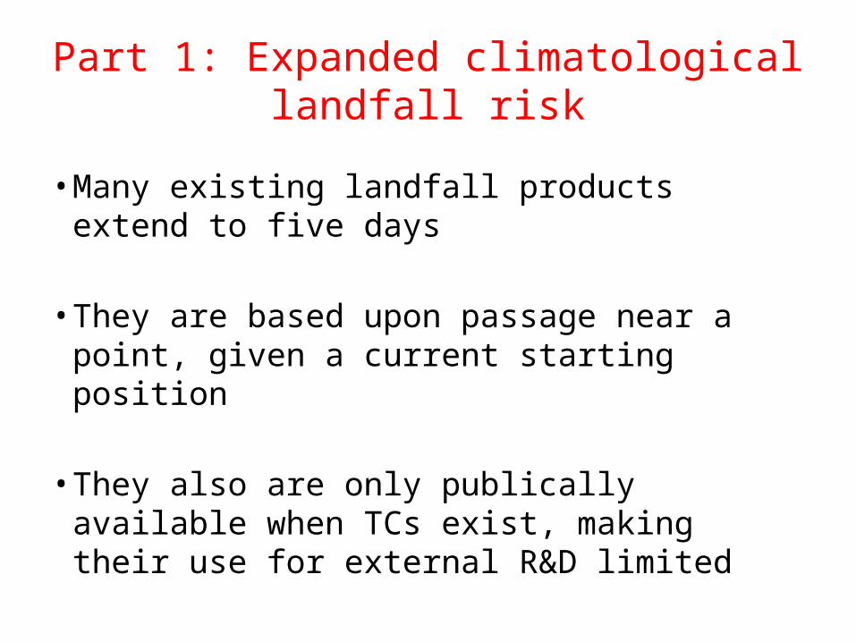
Part 1: Expanded climatological landfall risk
• Many existing landfall products extend to five days
• They are based upon passage near a point, given a current starting position
• They also are only publically available when TCs exist, making their use for external R&D limited
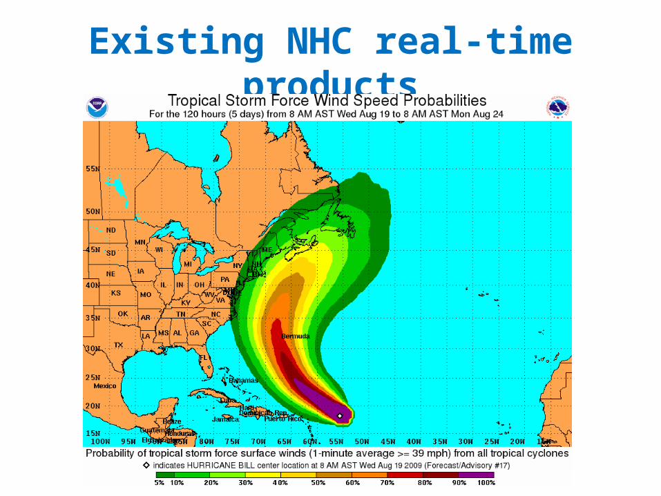
Existing NHC real-time products
What would be additionally helpful• Climatological maps of landfall probability to highlight
“pathways” of enhanced threat well more than 5 days in advance– “What is the most preferred pathway for a TC to make eventual landfall
in Bermuda?
– What latitude should a wave depart Africa to be at greatest risk for landfall in the Caribbean?
• The climatological length of time to landfall
• Real-time updates for current TC positions
• Note: Funded by RPI/BIOS in 2009

Datasets
• 6hourly global best-track datasets over the past century
– Linearly interpolated to 10-minute timesteps to capture landfall on narrow landmasses
• 0.0833 degree latitude & longitude (5-9km) land-sea mask from NCEP

Method• Define a “landfall or land-crossing” region (e.g. Florida) or “within a certain
distance” of a location (e.g. Bermuda)
• Use the 10-minute interpolated best-track database to determine every storm that crosses through that region, noting the time of first passage (and whether passage occurred at a required wind speed)
• Repeat for all storms in the best-track database
• Produce a gridded analysis of the percentage of the time a storm in a given location eventually makes landfall

Results: Landfall “anywhere”

Hurricane Landfall “anywhere”
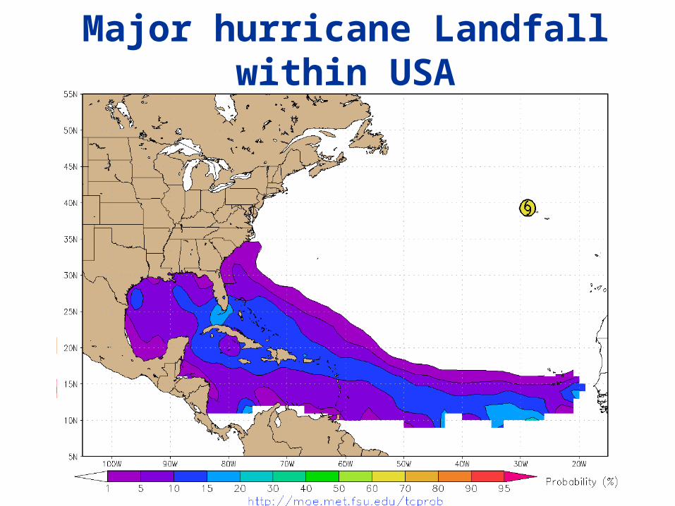
Major hurricane Landfall within USA
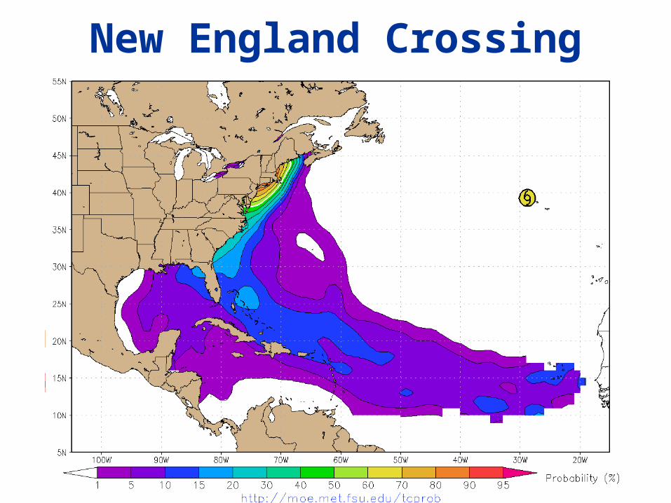
New England Crossing

Time to New England Crossing

Hurricane crossing of Florida

Passing within 100km of Bermuda
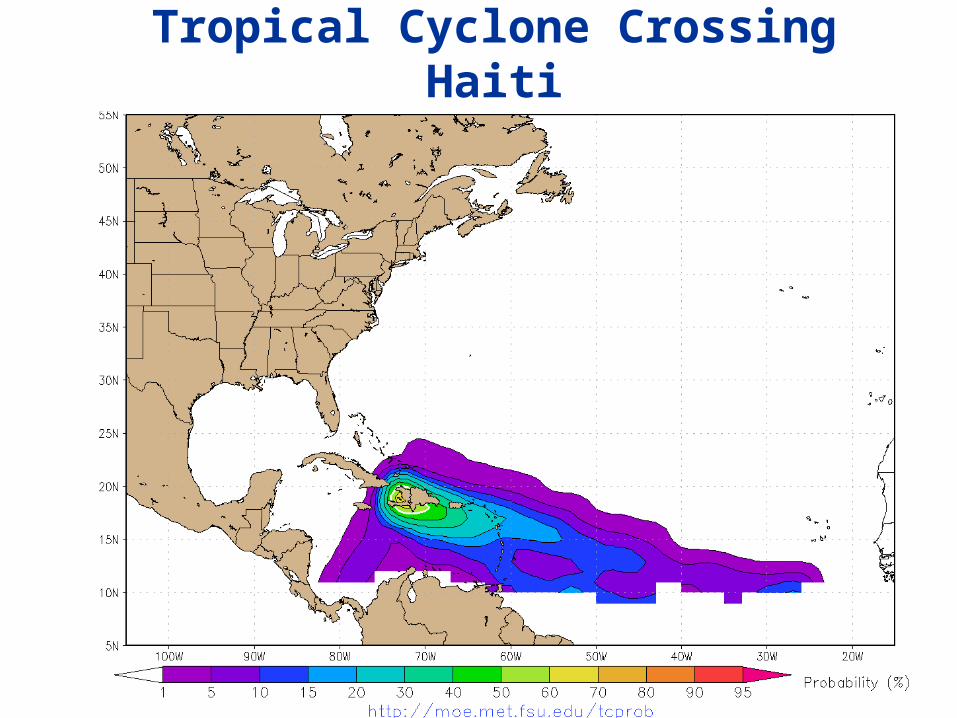
Tropical Cyclone Crossing Haiti

Typhoon crossing Japan
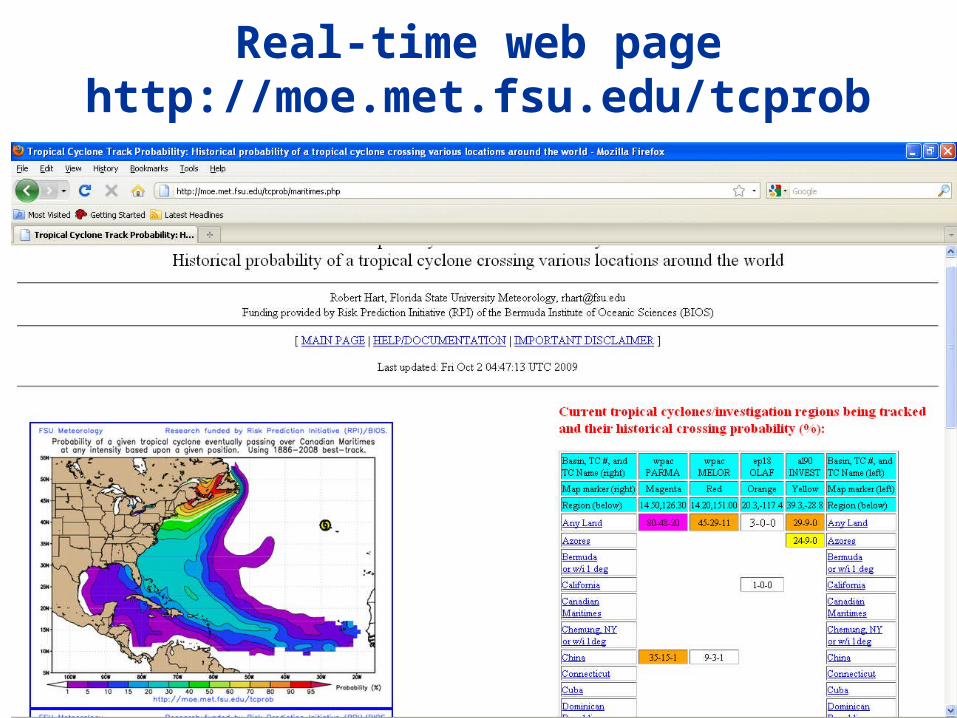
Real-time web pagehttp://moe.met.fsu.edu/tcprob

Real-time web pagehttp://moe.met.fsu.edu/tcprob
Current & Future Additions• Probability swaths for multiple landfall occurrence (e.g., NC
then New England or FL then LA)
• Probability swaths for conditions: “If one landfall has already happened, what is the probability for another and where is it most likely?”
• Using global reanalysis datasets (ERA40, MERRA, JRA) to extend TC tracks beyond best-track tracks, and using these extensions and gridded winds to extend landfall/crossing probabilities to Europe
• Quantify uncertainties through yearly subset intercomparison

Use of landfall output• First and foremost remember that these are climatological averages. Any
given storm will have probabilities well above or below those shown on the web page. This output provides a calibration but is NOT an official forecast.
• Anticipating anomalous landfall risk associated with a developing or formed TC
• Estimating timeframe for landfall if it were to occur using the most likely climatological track
• Comparison of these landfall probability maps to the same from stochastic model sets for further calibration?
• Subduing unrealistically premature forecasts of doom for TCs just exiting Africa?
Part 2: Using recon data to improve forecasting of intensity
• Hurricane intensity forecasting has made far less progress in 20 years+ than track forecasting. It is counterintuitive that there is SO little improvement.
• The benchmarks for hurricane intensity skill are statistical approaches (e.g. SHIPS) that focus largely on the environment– Wind shear, ocean temperature, time of year, etc.
• Measurements of the core (the “eye”) are not sufficiently used, even though theory argues they should be important
• Can we improve the existing benchmarks by incorporating storm core measurements from airplanes (vortex messages)?

A tale of two trends
Images courtesy of NHC
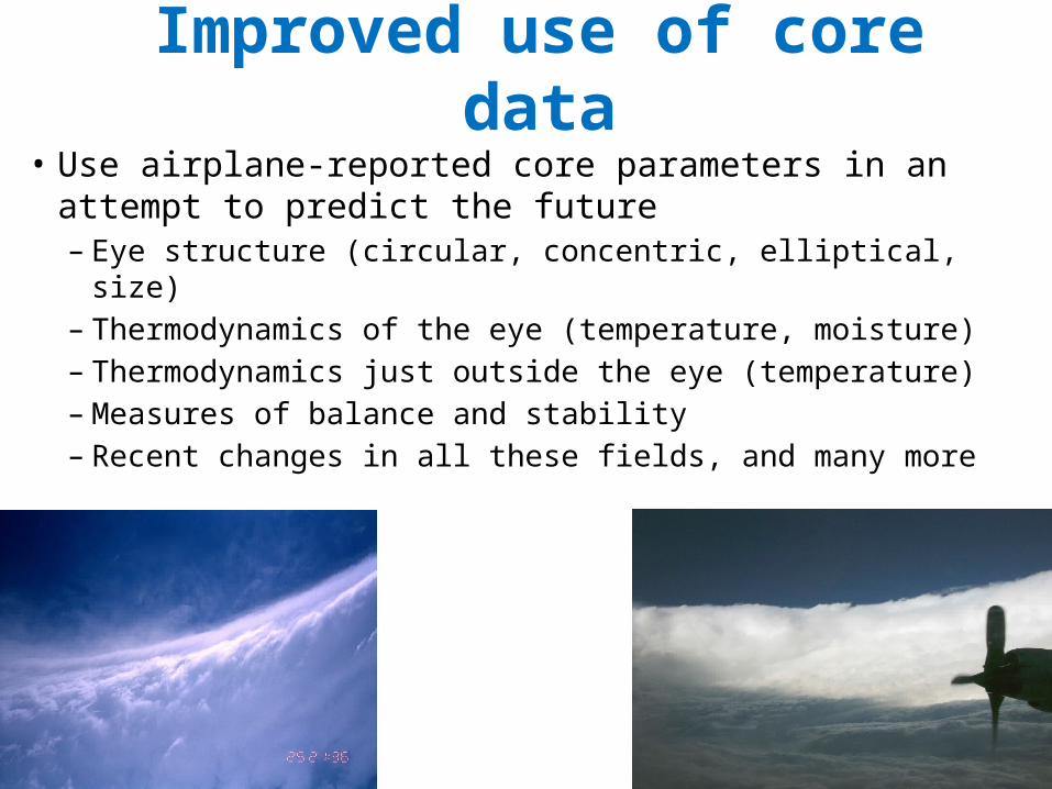
Improved use of core data• Use airplane-reported core parameters in an attempt
to predict the future– Eye structure (circular, concentric, elliptical, size)– Thermodynamics of the eye (temperature, moisture)– Thermodynamics just outside the eye (temperature)– Measures of balance and stability – Recent changes in all these fields, and many more

Example of a flight path
Image courtesy of Google Earth and http://planalytics.files.wordpress.com/2009/09/recon-19z.png

Vortex Message DatasetData used in Atlantic basin VDM Climatology
Dataset Period 1991-2008
Data Source NHC ATCF archives
Flight Level 700 hPa
Total Vortex Data Messages (VDMs)
1929
Number of TCs Included 83

Circular EyeDouble EyeElliptical Eye
What is the average lifecycle of all these storms?
18 Years of Vortex Message Reports with Eye Type
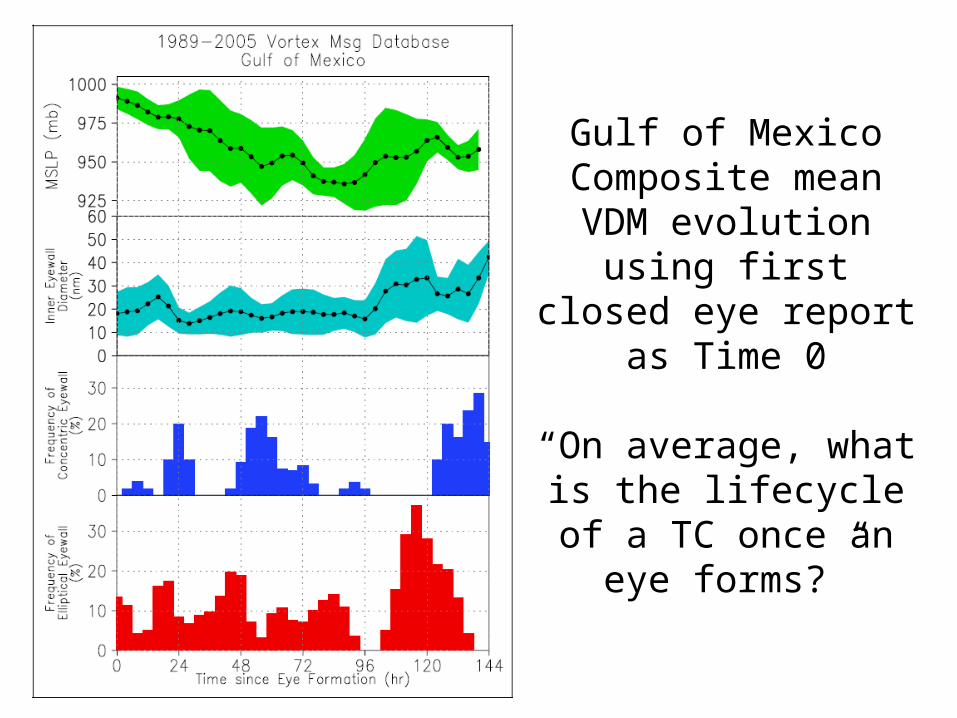
Gulf of Mexico Composite mean VDM
evolution using first closed eye report as
Time 0
“On average, what is the lifecycle of a TC once an
eye forms?”

Graphical Display of Mean Lifecycle

Example case: Wilma (2005)

18 Year Climatology of Atlantic Hurricane Eyes
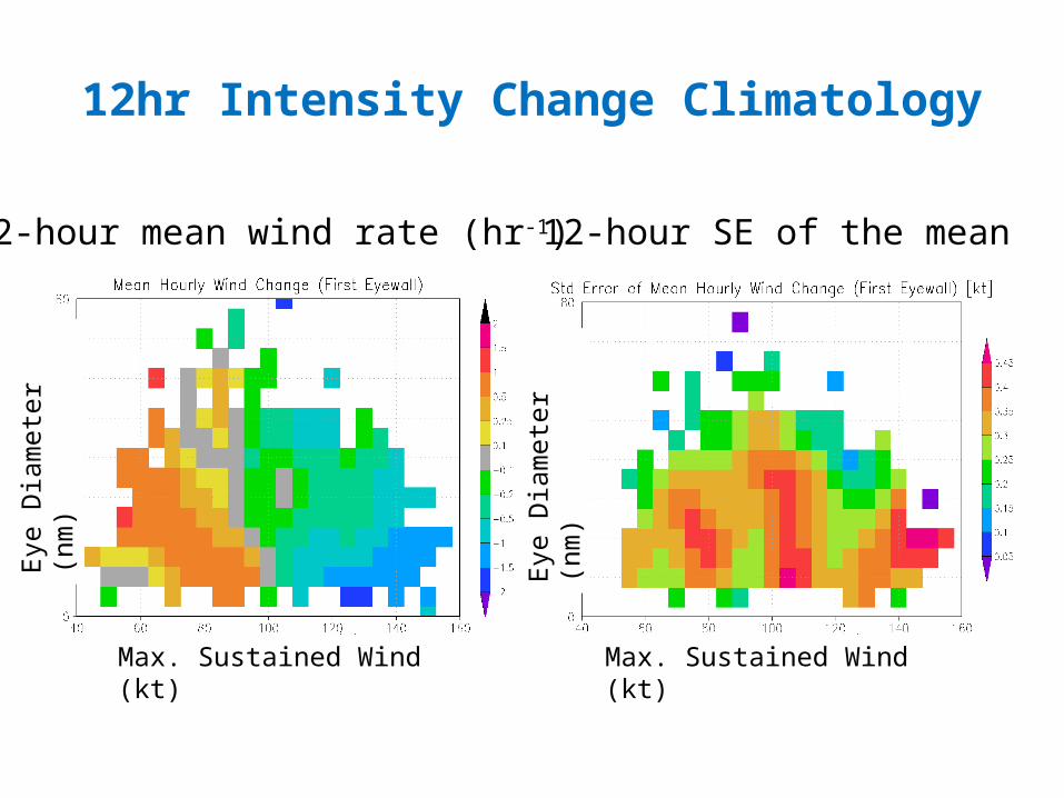
12hr Intensity Change Climatology
12-hour mean wind rate (hr-1) 12-hour SE of the mean
Max. Sustained Wind (kt) Max. Sustained Wind (kt)
Eye
Dia
met
er (n
m)
Eye
Dia
met
er (n
m)

Need for a multi-parameter system
• Two-predictor system leads to forecasts of strengthening for TCs < 90 kt and weakening for TCs > 90 kt => Hardly useful!
• Prediction based solely on eye diameter and maximum wind speed is insufficient to accurately predict TC intensity changes
• What predictors should be useful?

Predictor Examples
• Example raw VDM predictors– Wind speed and surface pressure– Eye temperature and dewpoint
• Example derived predictors– Temperature change across eyewall– Area of eye– Equivalent potential temperature– Inertial stability of the eye– Dewpoint depression of eye * Area of eye– Eyewall tilt

Optimal Predictors Chosen in Forecast
Scheme
Current Intensity (kt)
Predictors (temperature,
moisture, size of eye, etc)

Forecast Performance
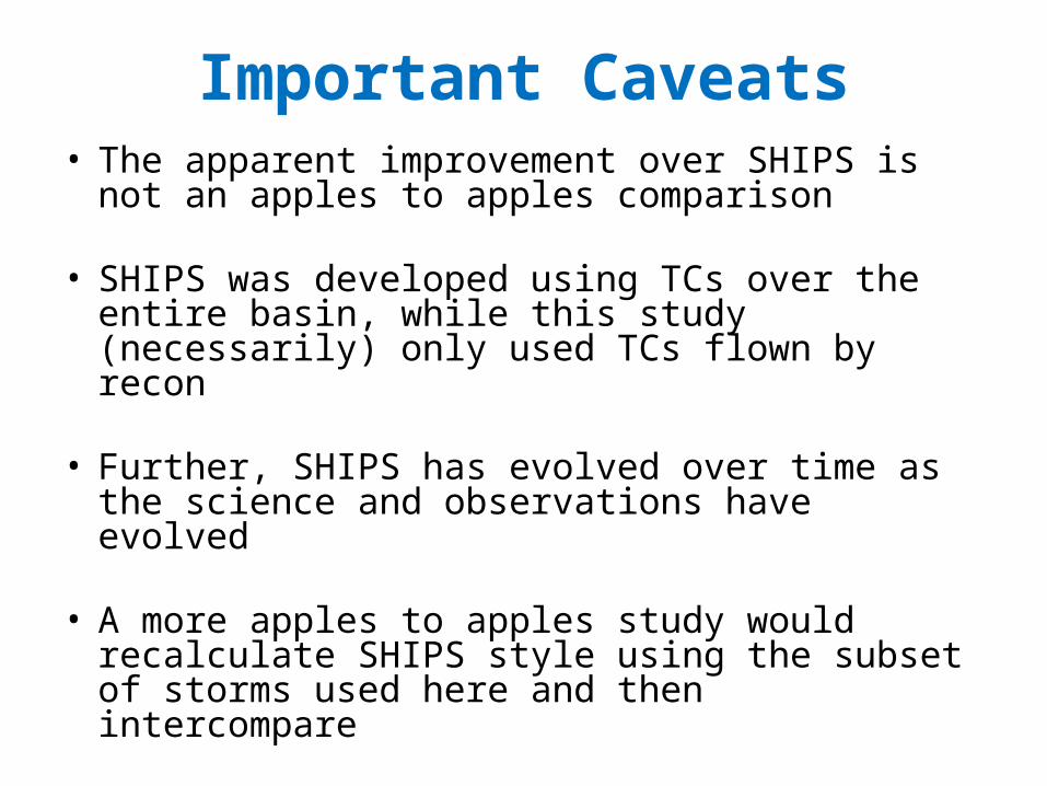
Important Caveats• The apparent improvement over SHIPS is not an
apples to apples comparison
• SHIPS was developed using TCs over the entire basin, while this study (necessarily) only used TCs flown by recon
• Further, SHIPS has evolved over time as the science and observations have evolved
• A more apples to apples study would recalculate SHIPS style using the subset of storms used here and then intercompare

Part 2: Summary and Future Work
• Independent testing showed that new technique is comparable to or surpasses the skill of SHIPS for short-term forecasts for the subset of storms flown by recon.
• Predictability of future TC intensity is strongly a function of initial intensity and is not linear. “Regimes” of decreased predictability do exist.
• Coming this summer: Real-time implementation via web page
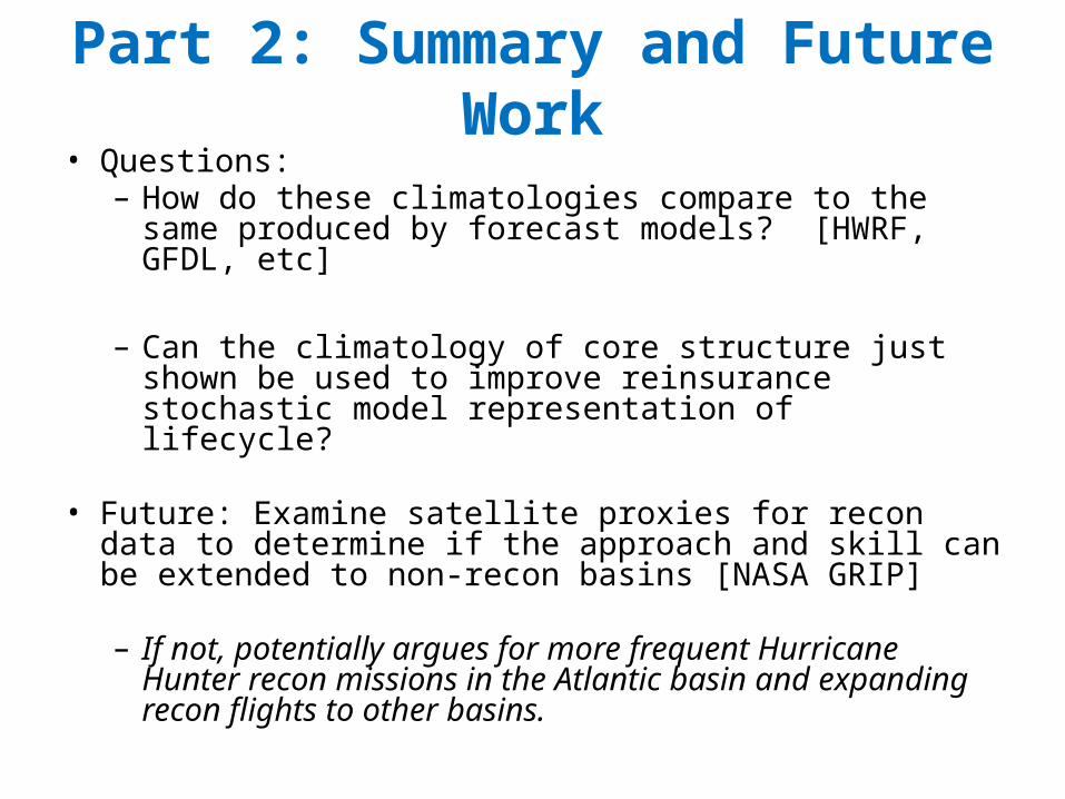
Part 2: Summary and Future Work• Questions: – How do these climatologies compare to the same
produced by forecast models? [HWRF, GFDL, etc]
– Can the climatology of core structure just shown be used to improve reinsurance stochastic model representation of lifecycle?
• Future: Examine satellite proxies for recon data to determine if the approach and skill can be extended to non-recon basins [NASA GRIP]
– If not, potentially argues for more frequent Hurricane Hunter recon missions in the Atlantic basin and expanding recon flights to other basins.
Part 3: Structural guidance• Cyclones are typically classified as tropical or extratropical
• In reality, most cyclones are shades of gray than one extreme or the other, for example:– Tropical cyclones interacting with troughs– Extratropical cyclones interacting with Gulf Stream and
producing convection
• Acknowledging these shades of gray can lead to improvement in analysis and forecasting
• How do we determine what shade of gray for a given cyclone?

41
Images courtesy NCDC

42
Hurricane Gloria (1985)
Hurricane Michael (2000)
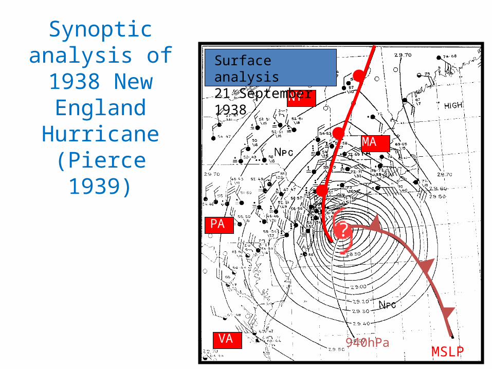
(C. Pierce, Mon. Wea. Rev. 1939) MSLP940hPa
NY
PA
VA
MA
?
Surface analysis 21 September 1938
Synoptic analysis of 1938 New
England Hurricane (Pierce 1939)

44
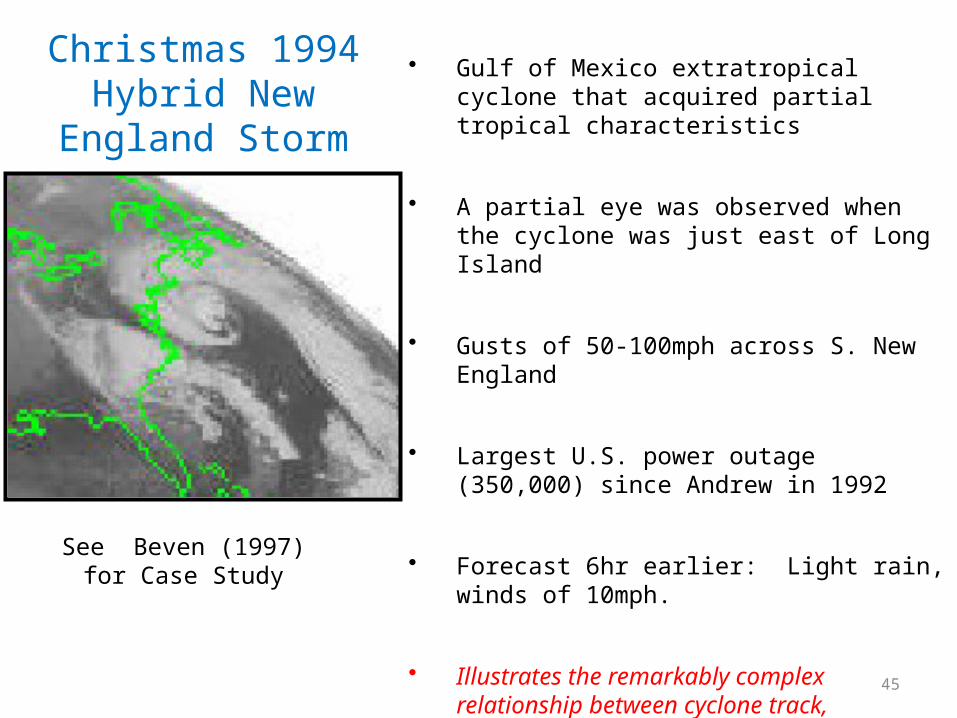
21 December 1994
22 December 1994
23 December 1994 24 December 1994
Example of nonclassic structure
45
Christmas 1994 Hybrid New England Storm
• Gulf of Mexico extratropical cyclone that acquired partial tropical characteristics
• A partial eye was observed when the cyclone was just east of Long Island
• Gusts of 50-100mph across S. New England
• Largest U.S. power outage (350,000) since Andrew in 1992
• Forecast 6hr earlier: Light rain, winds of 10mph.
• Illustrates the remarkably complex relationship between cyclone track, interaction, intensity and structure
See Beven (1997) for Case Study

46
The structure or “phase” of a cyclone important
• Predictability is a function of structure• Model interpretation/trust is a function of structure• It is often not at first apparent what the model is forecasting, or
the nature of cyclone development– Provides insight into the nature of NWP cyclone development that may
otherwise be subtle or even ambiguous
• Intensity envelope is a function of structure
47
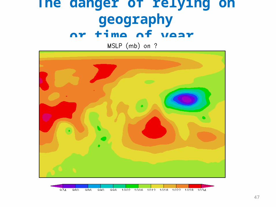
The danger of relying on geographyor time of year.

48
The danger of relying on geographyor time of year.
49
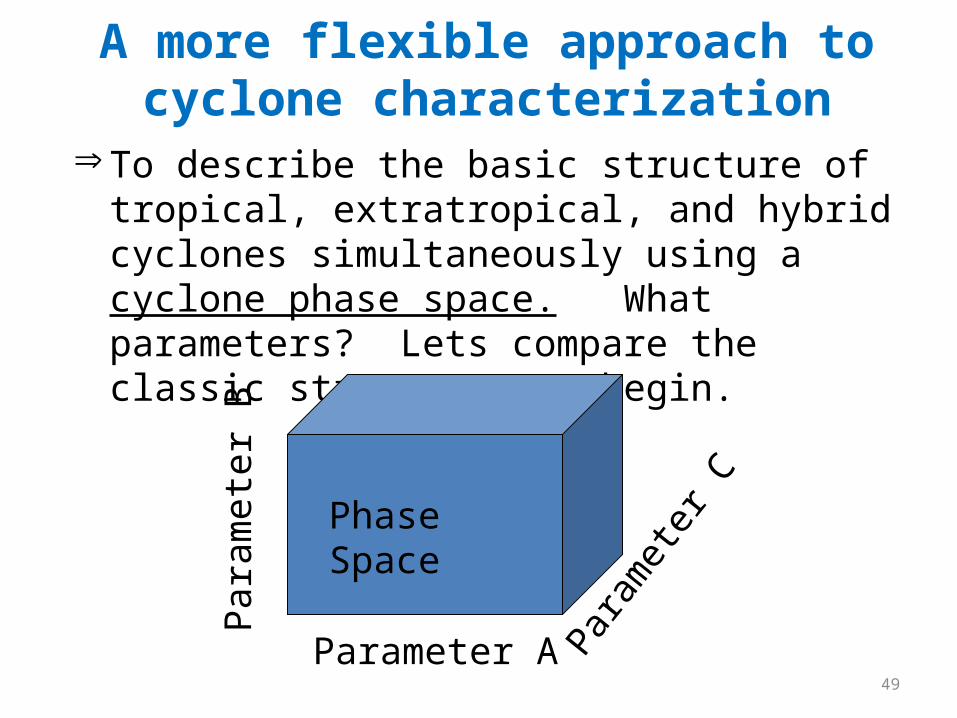
A more flexible approach to cyclone characterization
Þ To describe the basic structure of tropical, extratropical, and hybrid cyclones simultaneously using a cyclone phase space. What parameters? Lets compare the classic structures to begin.
Phase Space
Parameter A
Para
met
er B
Para
met
er C

50
Classic warm-core cyclone: Example: TC
• Intensifies through: sustained convection, surface fluxes.• Cyclone strength greatest near the top of the boundary
layer
L
Wa rm
Cold
Z Troposphere
Stratosphere
Height anomaly
- +

51
Classic cold-core cyclone: Extratropical• Intensifies through: Tilt, baroclinic development,
tropopause lowering. • Cyclone strength greatest near tropopause
L
Cold
Warm
Z Troposphere
Stratosphere
Height anomaly
- +
Warm
Cold

52
Hybrid (non-conventional) cyclone
Troposphere
Stratosphere
Colder
Warmer
Z
Warmer
L Height anomaly
- +
What if an extratropical cyclone moves over warm water?
Characteristics of tropical and extratropical cyclones.
53
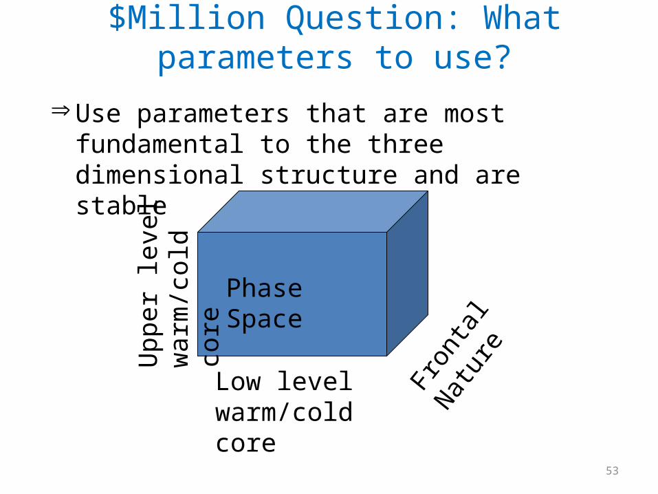
$Million Question: What parameters to use?
Þ Use parameters that are most fundamental to the three dimensional structure and are stable
Phase Space
Low level warm/cold core
Upp
er le
vel
war
m/c
old
core
Fron
tal N
atur
e
54
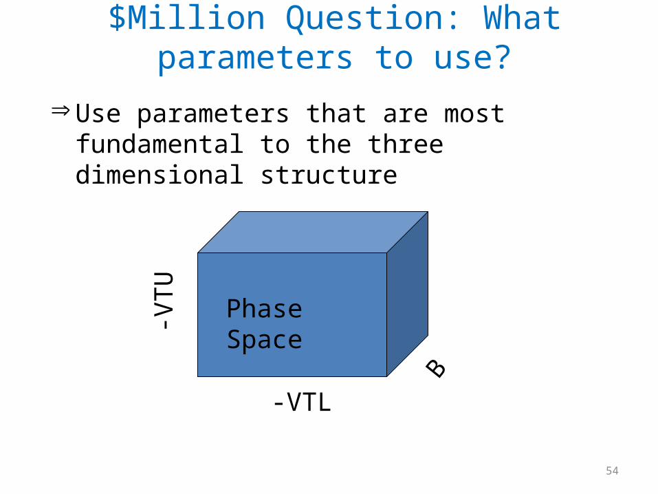
$Million Question: What parameters to use?
Þ Use parameters that are most fundamental to the three dimensional structure
Phase Space
-VTL
-VTU
B

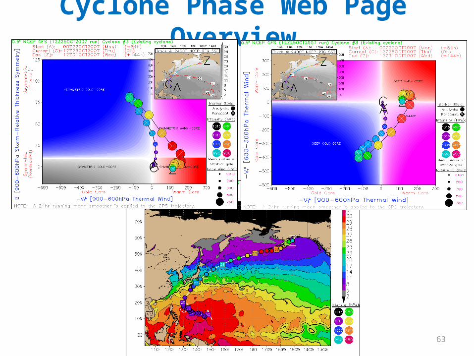
Constructing 3-D phase space from cyclone parameters:B, -VT
L, -VTU
A trajectory within 3-D generally too complex to visualize in an operational setting
Take two cross sections (slices) :
B
-VTL
-VTU
-VTL
Hurricane Mitch (1998)
Case of symmetric, warm-core development and decay
Classic tropical cyclone

Symmetric warm-core evolution: Hurricane Mitch (1998)Slice 1: B Vs. -VT
L

Symmetric warm-core evolution: Hurricane Mitch (1998)Slice 2: -VT
L Vs. -VTU
59
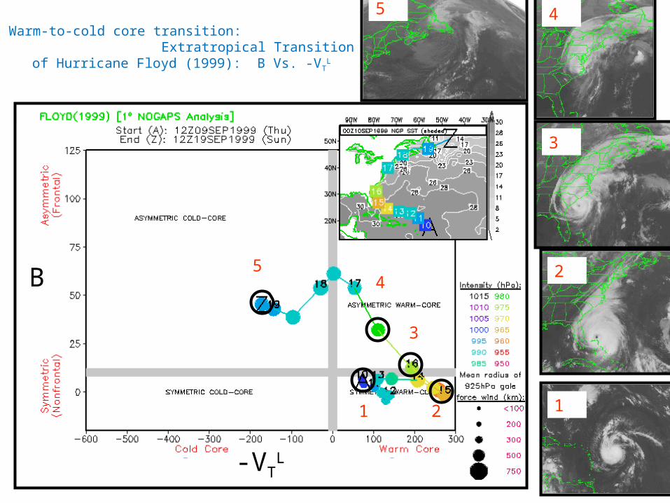
Warm-to-cold core transition: Extratropical Transition of Hurricane Floyd (1999): B Vs. -
VTL
-VTL
B
1 2
3
45
1
2
3
45

60
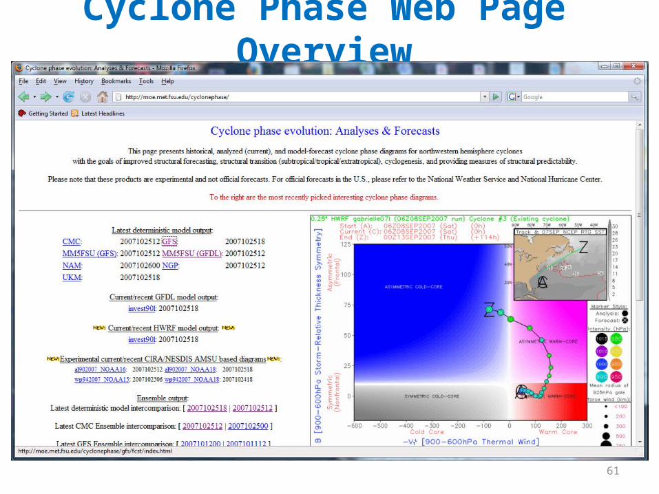
Cyclone Phase Web Page Overview• http://moe.met.fsu.edu/cyclonephase• Model analyses and forecast-based phase
diagrams:– GFS (0,6,12,18 UTC)– CMC (0,12 UTC)– GFDL (0,6,12,18 UTC)– HWRF (0,6,12,18 UTC)– MM5 (FSU) (0,12 UTC)– NAM (0,6,12,18 UTC)– NOGAPS (0,12 UTC)– UKMET (0,6,12,18 UTC)– ECMWF (delayed) (0,12 UTC)
61
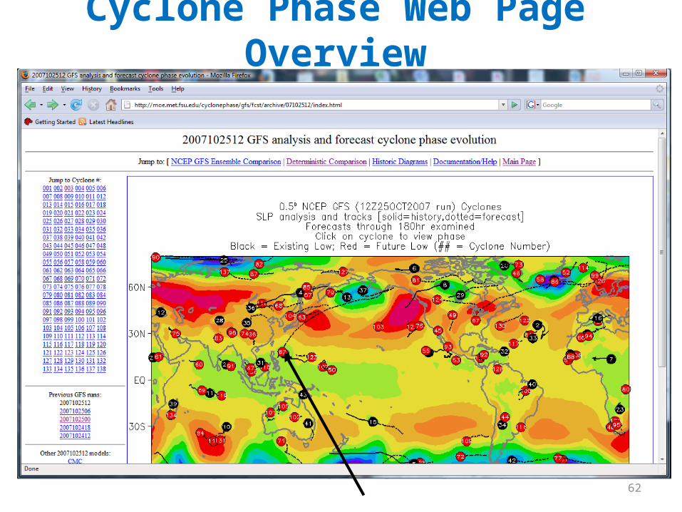
Cyclone Phase Web Page Overview
62
Cyclone Phase Web Page Overview
63
Cyclone Phase Web Page Overview
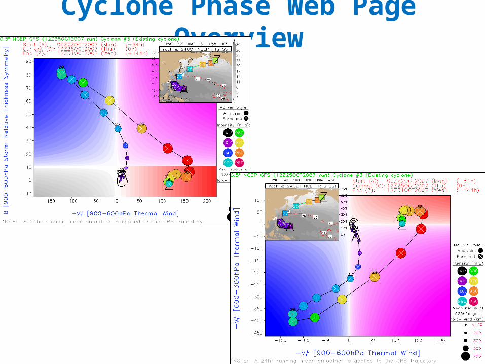
64
Cyclone Phase Web Page Overview

65
Ensemble cyclone phase
• Four sets of ensembles are produced:– All available deterministic models initialized within
6hr of each other– 21 GFS Ensembles– 21 CMC Ensembles– 21 GFS Ensembles + 21 CMC Ensembles
• All aim to provide forecast guidance for structural uncertainty

Multiple model solutions: Measure of structural forecast uncertainty
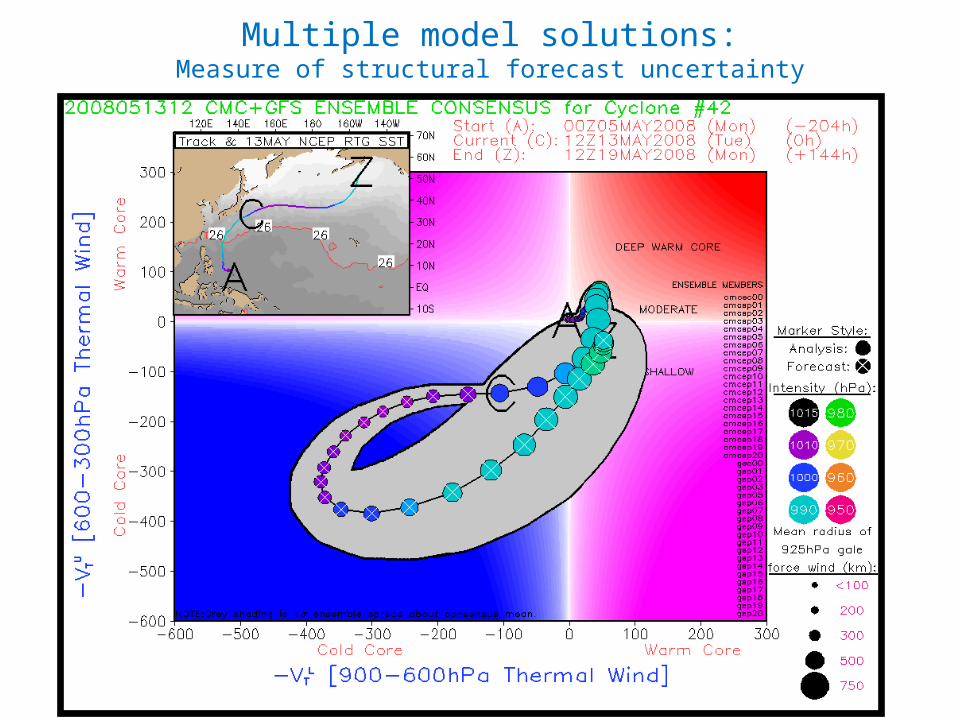
Multiple model solutions:Measure of structural forecast uncertainty
Part 3: Summary• Cyclone Phase Space (CPS) has been used in operations to aid the
diagnosis and prediction of classic & nonclassic cyclone structure
• CPS has been used to help diagnose potential new TCs in the best-track post-season database
• CPS has been used in R&D to help calibrate stochastic model sets
• CPS has been used to identify biases in numerical models and climate models
• There is lots of documentation on the web site and example diagrams. Feel free to email if you have questions.
Concluding Summary• There are a lot of operational and research tools at
FSU, and while potentially helpful…they are NOT official forecasts.
• Many of these tools have received direct use by and feedback from forecasters
• We always welcome requests and suggestions for additions by those using them
• Thank you for your time and attention.

Recent developments: Historic Events and TC Forensics
• 20th Century Reanalysis [Compo et al.]– A new reanalysis that spans 1950s-today (V1) and 1891-
today (V2)
– Developed by assimilating surface data only
– Uses a large ensemble and the relationships between surface data and upper air data during the satellite era to build a series of possible 3D atmospheres
– Can be used for historical and forensic TC studies.
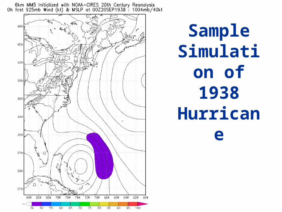
Sample Simulation
of 1938 Hurricane

Sample Simulation of 1938 Hurricane
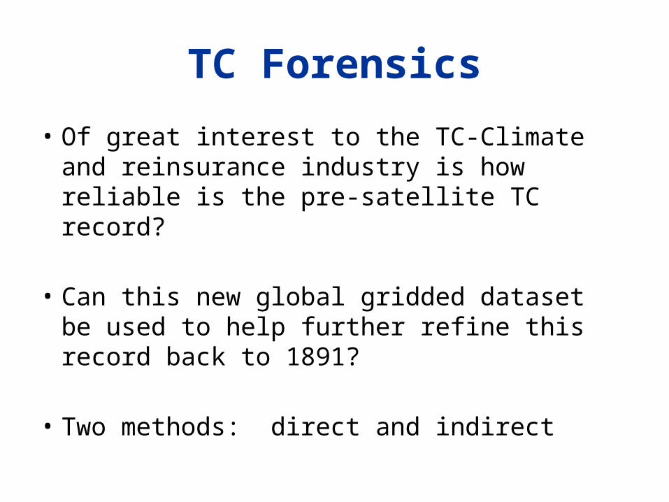
TC Forensics
• Of great interest to the TC-Climate and reinsurance industry is how reliable is the pre-satellite TC record?
• Can this new global gridded dataset be used to help further refine this record back to 1891?
• Two methods: direct and indirect

Forensic Search: Direct
• Seek out cyclone structures throughout the tropics and midlatitudes having a TC-like structure
• While the relationship undoubtedly will be weaker in undocumented TCs, some signature is likely if any sense of cyclonic structure is present at low levels
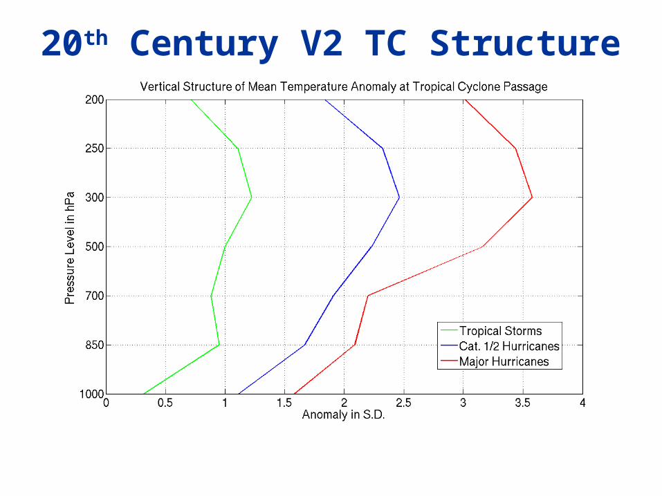
20th Century V2 TC Structure
Forensic Search: Indirect• Even if the thermal search reveals little, the work of THORPEX
scientists has shown there is an indirect avenue
• As a TC interacts with a jet stream, it generates a set of substantial downstream waves
• Even if the TC itself remains hidden in the 20th Century Reanalysis, this “wave train” is unlikely to be.
• Search for such waves and then look for evidence of a TC near the jet

Potential for pre-satellite “hidden” TCs betrayed by their Rossby waves….
Archambault , Keyser,
Bosart(2009)