aids verifier · 2020-04-27 · aids verifier primary objectives for avs is to become familiar with...
TRANSCRIPT
AIDS VERIFIER
PROFESSIONAL QUALIFICATION STANDARD

3
Housekeeping Announcements
• Restroom facilities
• Breaks
• Exits
• Mute Cell Phones
• Ask questions but avoid side-bar discussions
• I will email you these slides
Team Coordination Training – Initial & Recurrent
Response Directorate
Administration

Introductions
• Name
• Division/Flotilla/AOR
• Primary Position
• Background
• Experience with ATON/Navigation/Quals
• What do you want to get out if this course


AV Qualifications
• Complete the PQS
• Complete initial RMS-TCT
• Attend annual RMS-TCT
• Attend annual operations workshop
• Attend any mandatory District AV workshops
• Do NOT have to be coxswain or boat crew
• Do NOT have to have completed ACN

This Course
• This is a 101 course
– Introduction
– Assumes you know nothing
– Gives you enough info to decide if interested in continuing
– Gives you enough knowledge to get the dockside PQS signed off
Objective
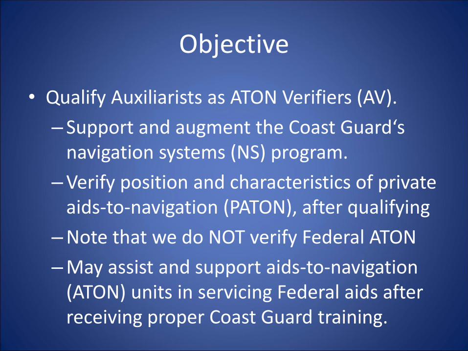
• Qualify Auxiliarists as ATON Verifiers (AV).
– Support and augment the Coast Guard‘s navigation systems (NS) program.
–Verify position and characteristics of private aids-to-navigation (PATON), after qualifying
–Note that we do NOT verify Federal ATON
–May assist and support aids-to-navigation (ATON) units in servicing Federal aids after receiving proper Coast Guard training.
Objective
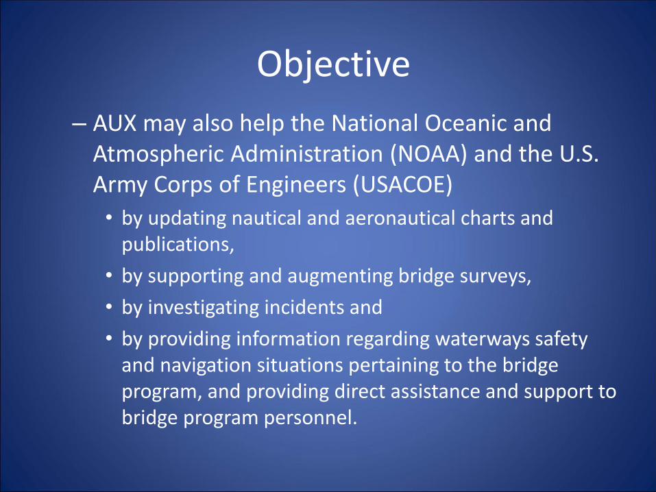
– AUX may also help the National Oceanic and Atmospheric Administration (NOAA) and the U.S. Army Corps of Engineers (USACOE)
• by updating nautical and aeronautical charts and publications,
• by supporting and augmenting bridge surveys,
• by investigating incidents and
• by providing information regarding waterways safety and navigation situations pertaining to the bridge program, and providing direct assistance and support to bridge program personnel.

Aids Verifier
Primary Objectives for AVs is to become familiar with the following:
• The PQS for Aids-verifier.
• All references pertinent to verifying an aid
• Use of the new EXCEL forms; “7054" for checking buoys and fixed atons / patons, and “7055” for bridges, duties after patrol, and where to send forms.
• Use of the 7030 form for patrol credit and verifying credit for "AV". Categories 03 for Patrols, 31,32, 33 for ATONs, PATONs and Bridges , respectively & 41 for other Agency support.

What is Verified
• Watching Properly: The observed structure matches the chart or the light list description
– Position
– Color
– Shape
– Characteristic
• Discrepant: The observed structure does not match the chart or the light list description
Aids Verifier
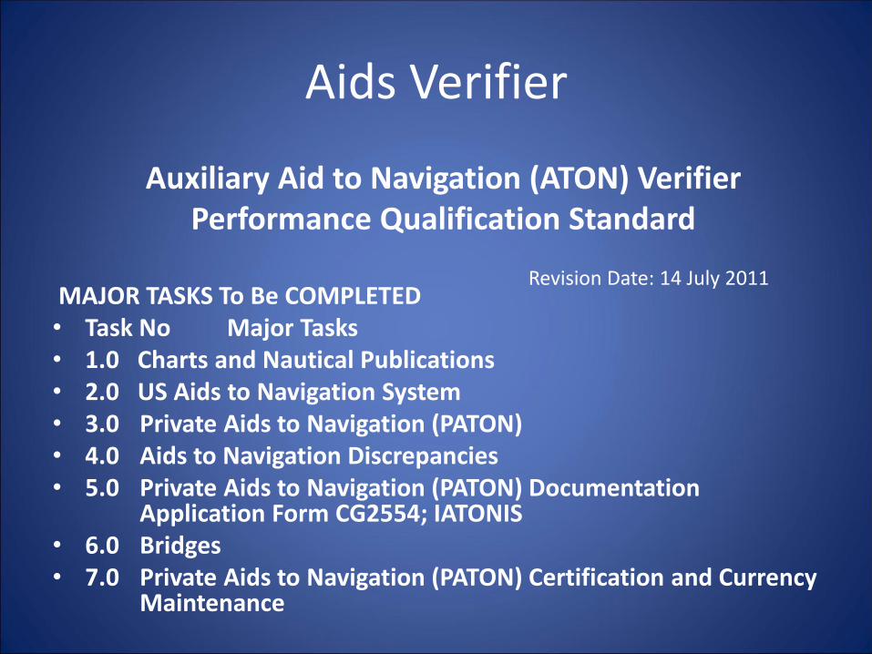
MAJOR TASKS To Be COMPLETED • Task No Major Tasks • 1.0 Charts and Nautical Publications • 2.0 US Aids to Navigation System • 3.0 Private Aids to Navigation (PATON) • 4.0 Aids to Navigation Discrepancies • 5.0 Private Aids to Navigation (PATON) Documentation
Application Form CG2554; IATONIS• 6.0 Bridges • 7.0 Private Aids to Navigation (PATON) Certification and Currency
Maintenance
Auxiliary Aid to Navigation (ATON) Verifier Performance Qualification Standard
Revision Date: 14 July 2011
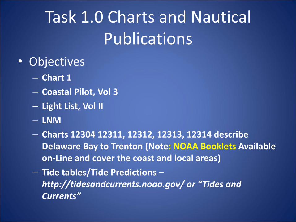
Task 1.0 Charts and Nautical Publications
• Objectives– Chart 1
– Coastal Pilot, Vol 3
– Light List, Vol II
– LNM
– Charts 12304 12311, 12312, 12313, 12314 describe Delaware Bay to Trenton (Note: NOAA Booklets Available on-Line and cover the coast and local areas)
– Tide tables/Tide Predictions –http://tidesandcurrents.noaa.gov/ or “Tides and Currents”
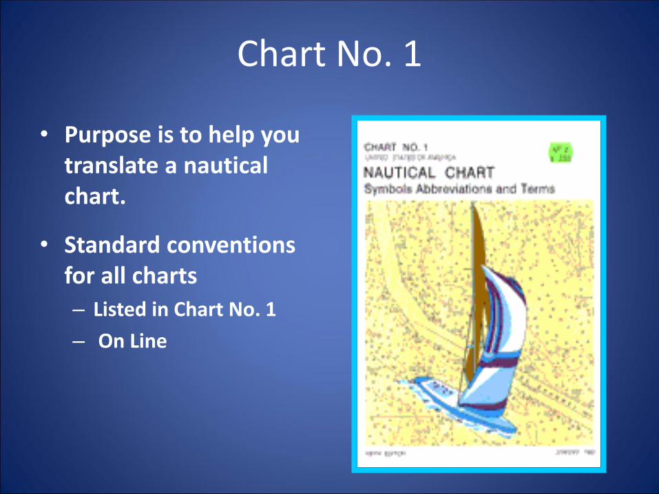
Chart No. 1
• Purpose is to help you translate a nautical chart.
• Standard conventions for all charts
– Listed in Chart No. 1
– On Line

15
Chart No. 1
General
Topography
Hydrography
Aids/Services
Above the surface
Below the surface
Help to the mariner

16
Chart Features
Chart number in national series
Inset
Chart title
Projection & scale
Cautionary notes
Notes
Hydrographic source(s)
Source data diagram
Chart No. 1 – Section & Title

17
D – Cultural Features
Ruins, Ruined Landmark
Motorway
Road (hard surfaced)
Track, Path (unsurfaced)
Railway, with station
Cutting

18
D – Cultural Features
Fixed Bridge
Opening Bridge
Swing Bridge
Lifting Bridge
Draw Bridge
Transporter
Bridge
Power
Transmission
Line

19
E - Landmarks
Tank
Specific Landmark
Spire
Cupola
Tower
Standpipe
Water Tower
Chimney
TV or Radio
Tower
Radar Mast
Radome
Tank
Silo
Grain Elevator

20
H – Tides, Currents
Clearance Datum
Depth Datum
Tidal Range

21
I - Depths
Depth Soundingsat true position
Soundingswhich are unreliable
or taken from
smaller-scale chart
[vertical numbers]
[sloping numbers]
Drying heights above
chart datum (green)[number is underlined]
Least depth in
Narrow channel[number in parentheses]
No bottomat depth shown
SOUNDINGS
22
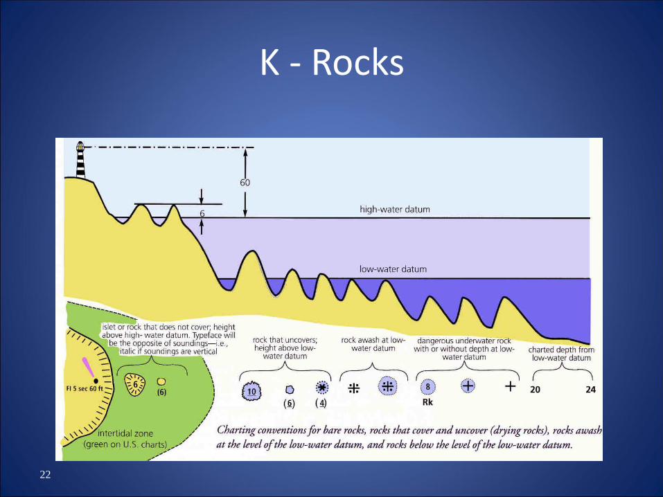
K - Rocks

23
K - Obstructions
Obstructiondepth unknown
Fish Traps,
Weirs, tunnys
Obstructionleast depth
known (sounding)
Obstructionleast depth
known (swept)
Stumps, Pilesall or part time
submerged
Submerged Pilesetc. – exact
position
Fishing stakes
Fish Traps,etc, area
Fish havenor artificial reef
…minimum depth
Shellfishcultivation

24
M – Tracks , Routes
Separation Line
Roundabout
Direction of Flowmandatory
Direction of Flowrecommended
Maritime Limit
Restricted Area
25
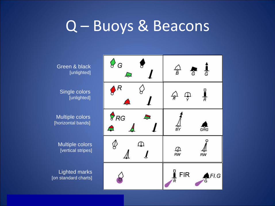
Q – Buoys & Beacons
Green & black[unlighted]
Single colors[unlighted]
Multiple colors[horizontal bands]
Multiple colors[vertical stripes]
Lighted marks[on standard charts]

Horizontal Datum
• Base line or plane from which measurements are
made.
• World wide Geodetic Survey
• Calculated tides
• Datum for water depth is important.
– East coast has two tides very similar.
– West coast has two tides of uneven depth.
– Standard is mean lower low water (MLLW).
– Former standard was mean low water (MLW).

Charts
• NOAA
• Available from marine stores or on line
• Full size or booklet
• Paper charts are going away

Charts
• Longitude
• Latitude
• Nautical mile scale
• Depth curves
• Title block
• Vertical datum
• Compass rose
• Symbols for ATON
• Lighted vs. unlighted
• Nominal range of lights
• Private Aids
• Wreck
• Range

Charts

Latitude and Longitude
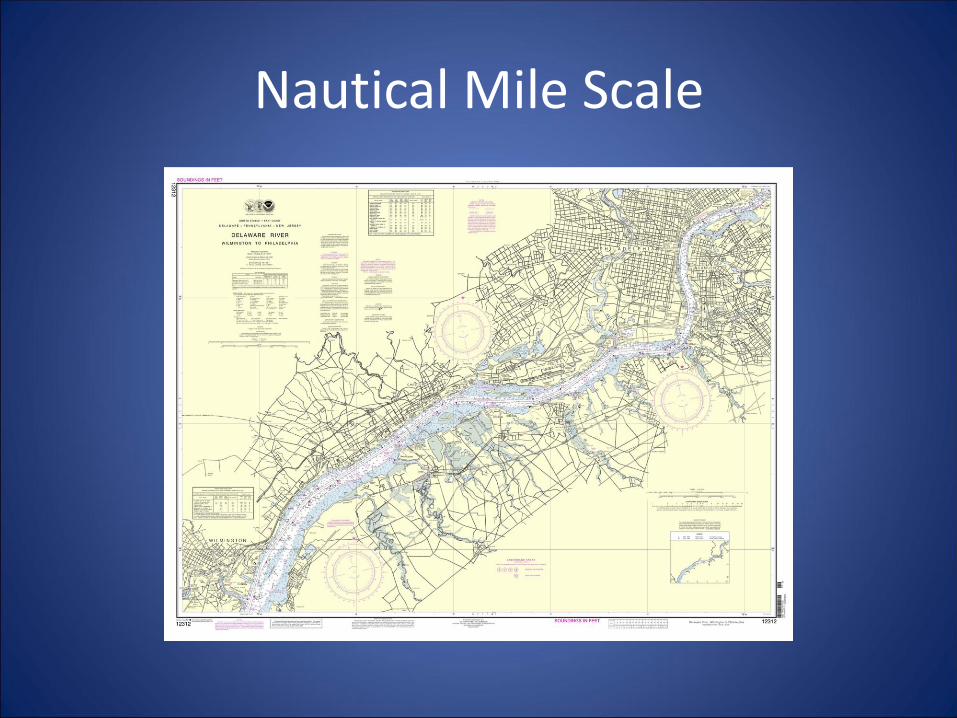
Nautical Mile Scale

Depth Curves

Title Block

Compass Rose

Aids, Lighted, Nominal Range, Wrecks, Ranges

Charts

37
Summary• Charts are your resource for key information
• Navigable waterways
• Ports
• Channels
• Hazards
• Depths
• Bottom conditions
• Direction and Distance
• Landmarks for reference
• Navigation Aids
• Restrictions & regulations
• Information

The Four R’s for Charts
RECENT
RIGHT SCALE
READILY AVAILABLE
REVIEWED BEFORE SAILING

Light List
• Every aid in the AOR
• Available on line
• Divided into geographic areas
• Print out the section that covers your AOR

LIGHT LIST

LIGHT LIST
• Column (1): Light List number.
• Column (2): Name of the aid to navigation.
• Column (3): Geographic position of the aid to navigation in latitude and longitude.
• Column (4): Light characteristic for lighted aid to navigation.
• Column (5): Height above water
• Column (6): Nominal range of lighted aids
• Column (7): The structural characteristic of the aid
• Column (8): Aid remarks, sound signal characteristic including the VHF-FM channel if remotely activated, RACON, light sector arc of visibility, radar reflector, emergency lights, seasonal remarks, and Private AtoN identification.

Coast Pilot
• NOAA
• Available on line
• Everything you need to know about a port that the chart does not tell you

COASTAL PILOT VOL 3
• Much of the content cannot be shown graphically on the charts and is not readily available elsewhere. – Environmental factors of weather, climate, ice conditions, tides, water
levels and currents
– Prominent coastal features and landmarks
– Specific information on vertical clearances
– Wharf descriptions
– Small-craft facilities
– Hazards
– Dredged channels and depths
– Navigation services and regulations
– Pilotage, towing, anchorages
– Routes and traffic separation schemes
– Environmental protection and other Federal laws.


Local Notice to Mariners
• Published by each Coast Guard District.
• Available on line
• Disseminate information important to navigation.
• Include updates to ATONs.
• Indicate temporary changes:– Dredging, marine construction, whale migration, bridge
construction, buoys, special activities, etc.
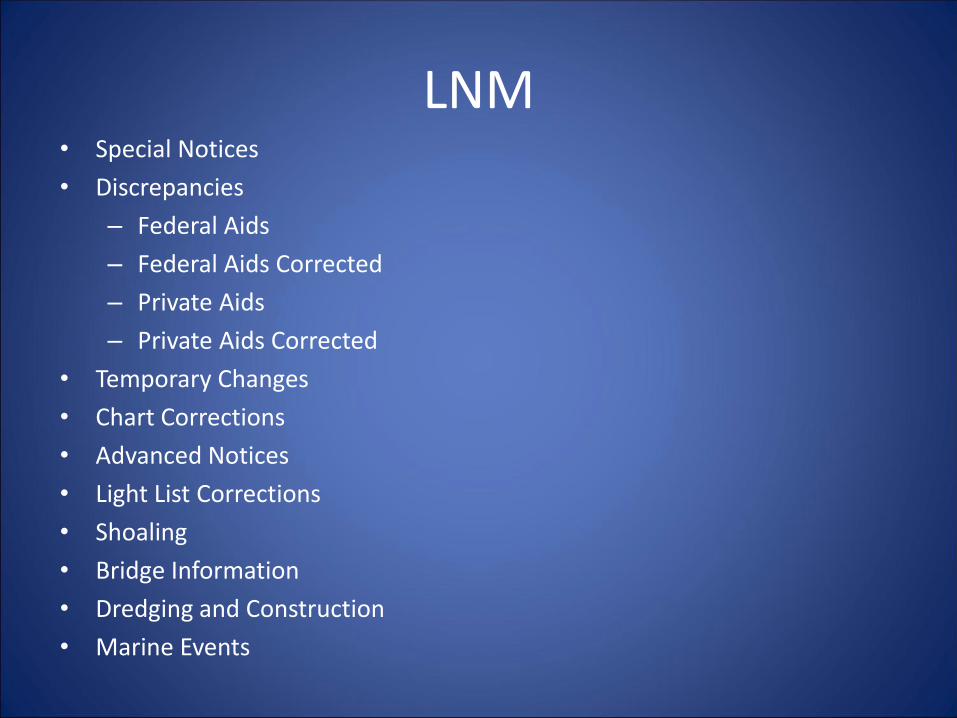
LNM• Special Notices
• Discrepancies
– Federal Aids
– Federal Aids Corrected
– Private Aids
– Private Aids Corrected
• Temporary Changes
• Chart Corrections
• Advanced Notices
• Light List Corrections
• Shoaling
• Bridge Information
• Dredging and Construction
• Marine Events

Task 2.0 US Aids to Navigation (ATON) System
• Objectives– IALA regions for the United States
– Identify the characteristics including color, shape, number or letters, and light colors of navigation aids:
– State the characteristics of lights (flashing, occulting, etc:
– Demonstrate the ability to use a stopwatch for timing a lighted aid.

IALA Regions A and B

Definition of a Buoy
• Any unmanned, floating aid to navigation that is moored to the seabed.
• May be lighted or unlighted.
• The seabed is owned by the ARMY Corps of Engineers (USACE) and is licensed to the Coast Guard who deploy ATONs and authorize private parties to deploy PATONs.
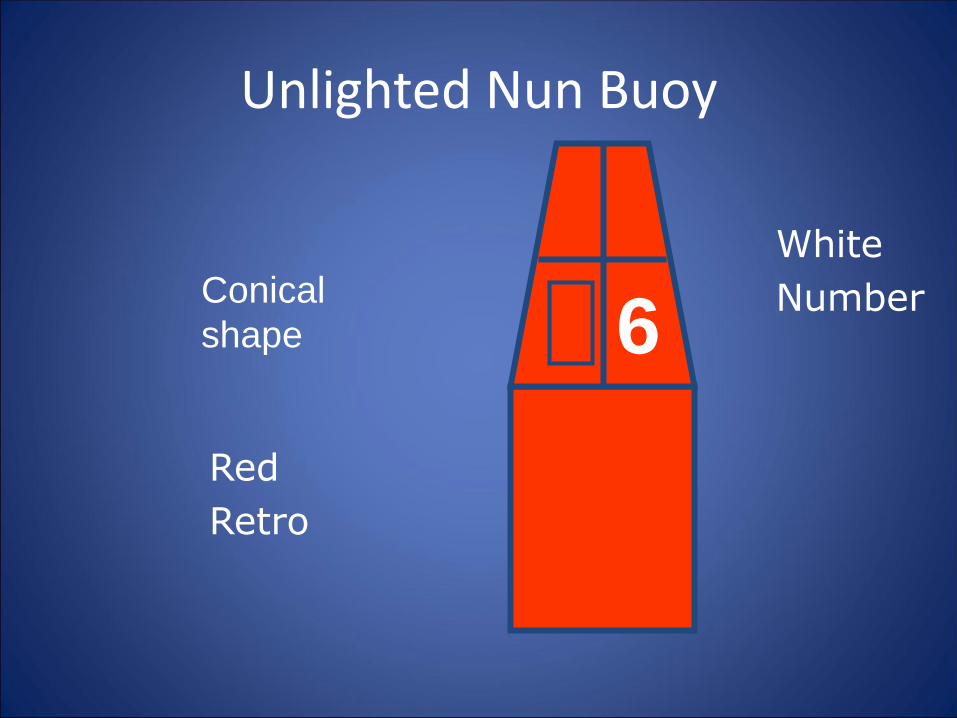
Unlighted Nun Buoy
6Conical
shape
Red
Retro
White
Number
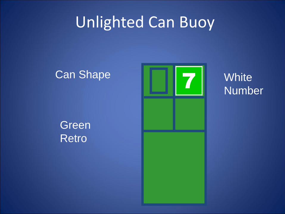
Unlighted Can Buoy
77Can Shape
Green
Retro
White
Number

Lighted Green Buoy

Lighted Red Buoy

Definition of a Beacon
• Any fixed aid to navigation located on a shore or marine site.
• The pilings the beacon is mounted on is a dolphin
• Lighted beacons are called Lights.
–Minor
–Major
• Unlighted beacons are called Daybeacons

Definition of a Daymark
• The daytime identifier of an aid to navigation presenting one of several colors, shapes, numerals or letters.
– The shape may be a square, triangle, rectangle, diamond or octagon
– The color may be green, red, white, yellow orange, multi-colored

Green and Red Daymarks
Green Red

DaybeaconDaymark Mounted on a Dolphin
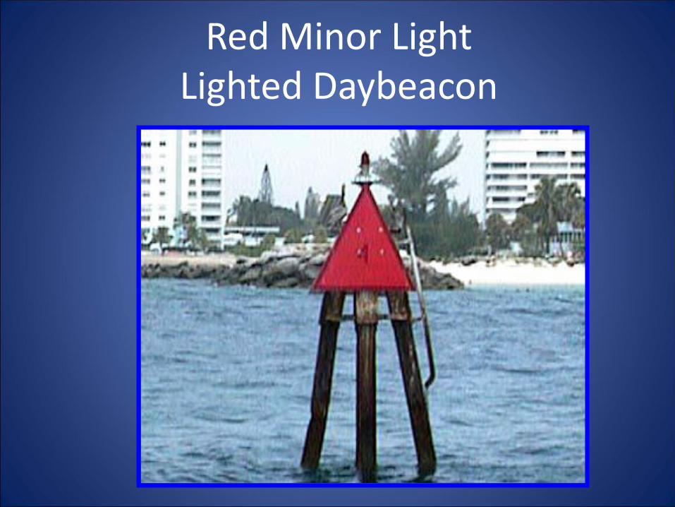
Red Minor LightLighted Daybeacon

Green Minor Light
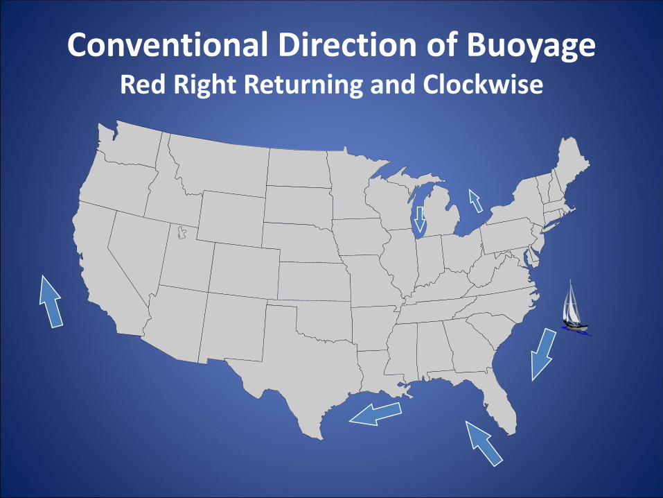
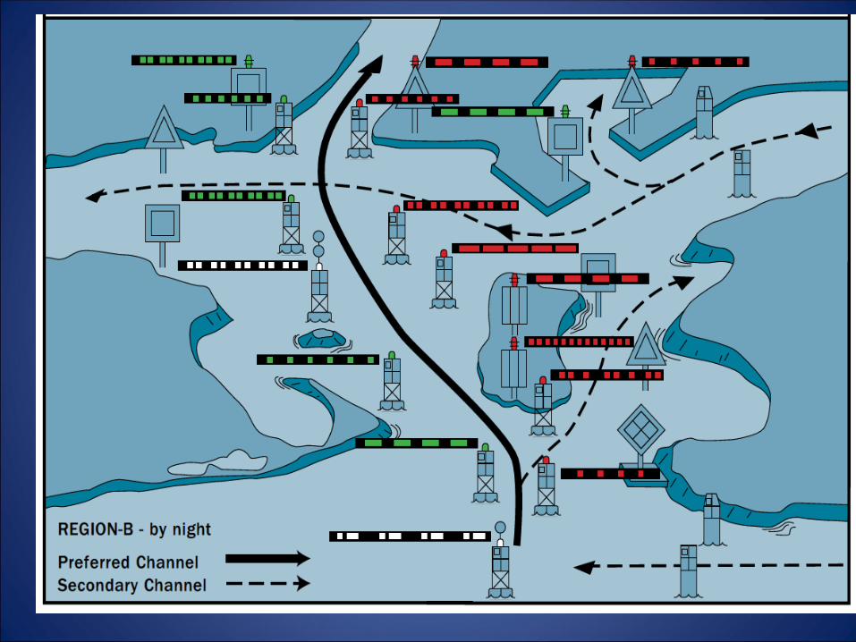
Conventional Direction of BuoyageRed Right Returning and Clockwise

ATON

JUNCTION
Two channels join to form one channel.
Preferred channel buoy is placed upstream.
BIFURCATIONOne channel splits to form two channels.
Preferred channel buoy is placed downstream.
CROSSINGOne channel crosses another channel.
No requirement to mark all four corners.
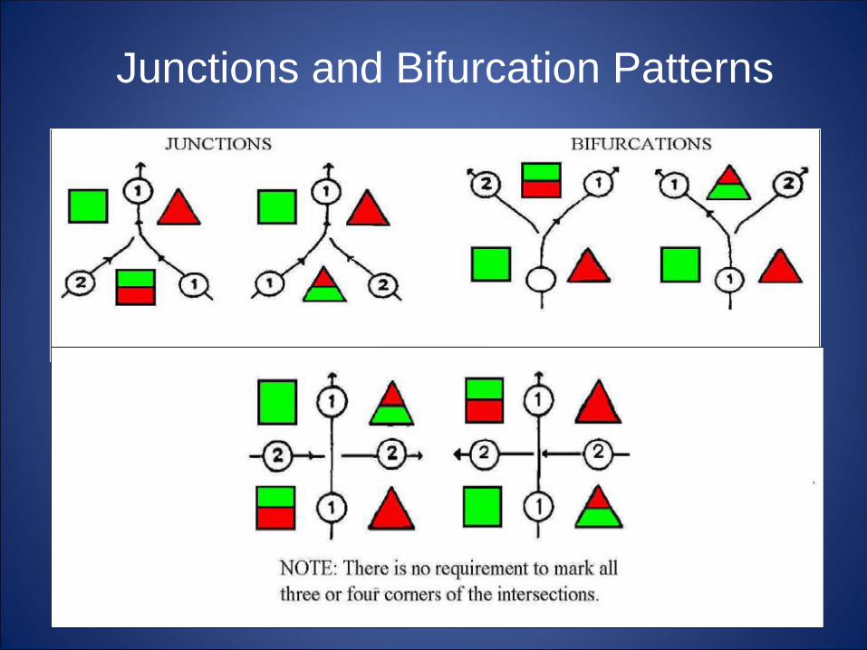
Junctions and Bifurcation Patterns

A good reason to take it slow and
watch where you’re going!
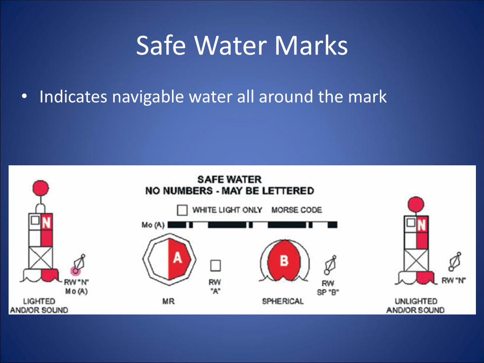
Safe Water Marks
• Indicates navigable water all around the mark
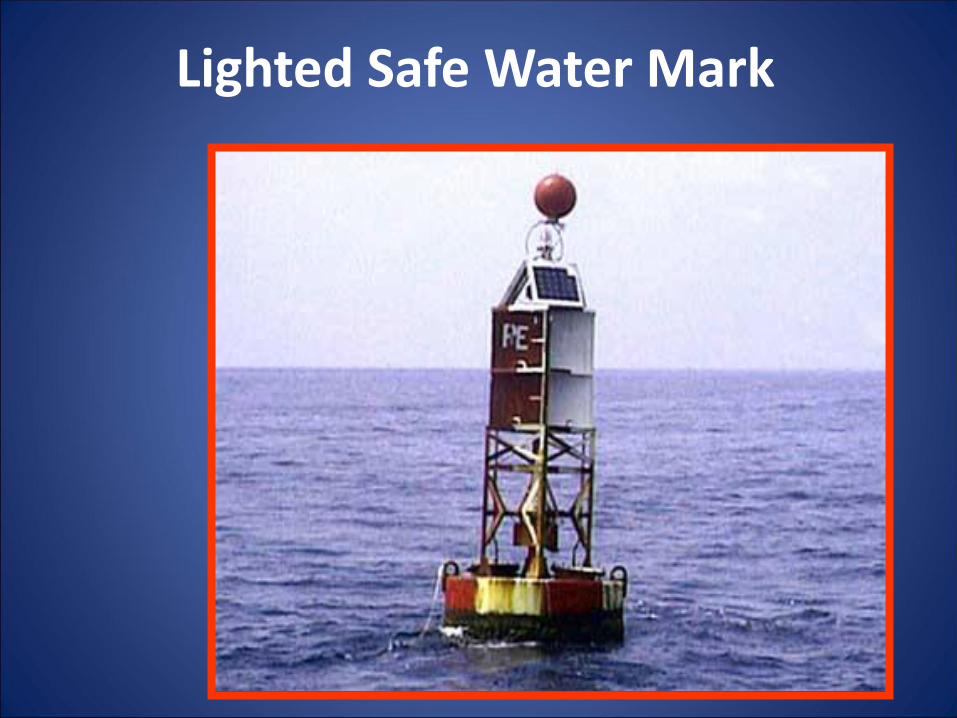
Lighted Safe Water Mark

Isolated Danger Mark
• Marks isolated dangers or obstructions that can be passed on all sides
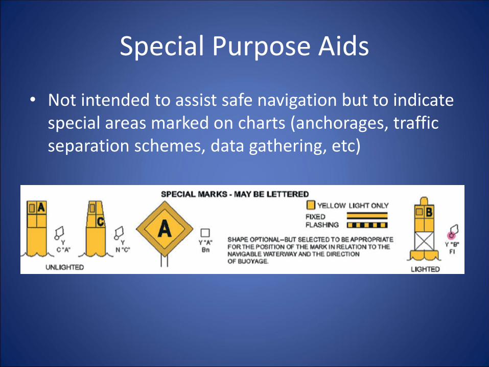
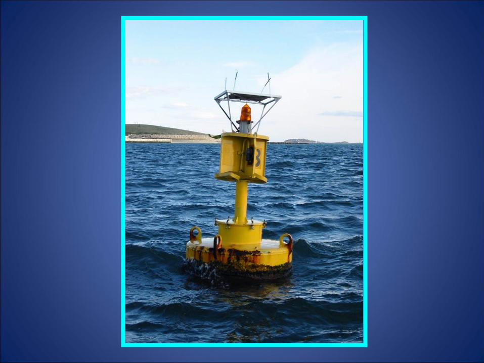
Special Purpose Aids
• Not intended to assist safe navigation but to indicate special areas marked on charts (anchorages, traffic separation schemes, data gathering, etc)

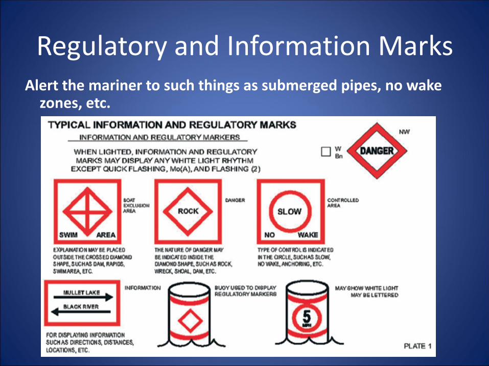
Regulatory and Information MarksAlert the mariner to such things as submerged pipes, no wake
zones, etc.

Restricted Operations Area
These are non-lateral aids.
The accuracy of the location of these aids is usually not a major issue.
The location of these aids in the navigable channel is considered a reportable discrepancy.
These aids are normally “Private.”

Restricted Operations - Minimum Wake

Restricted Operations -Manatee Zone
Bridge
Discrepancy
Report

D
A
N
G
E
R
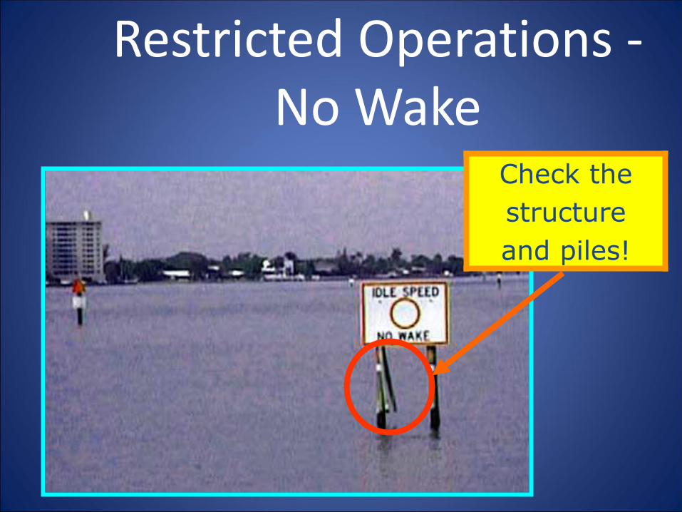
Restricted Operations -No Wake
Check the
structure
and piles!

Restricted Operations - No Wake

Exclusion Area - No Anchoring

Wreck Marks
Purpose: To alert the mariner to wrecks.
Description:
Aid Color: Appropriate to side of channel.
Aid Shape: Appropriate to side of channel.
Character: White lettering “WR”, numbered
in sequence with channel (WR2).
Aid Light: Same as buoy color.
Light Characteristic: Quick Flashing
(unless aid is a preferred channel aid)
WRWR

Location Mark
Some markers will
have no lateral
significance. They
are not designed to
indicate the
channel but rather,
to help you
determine where
you are.
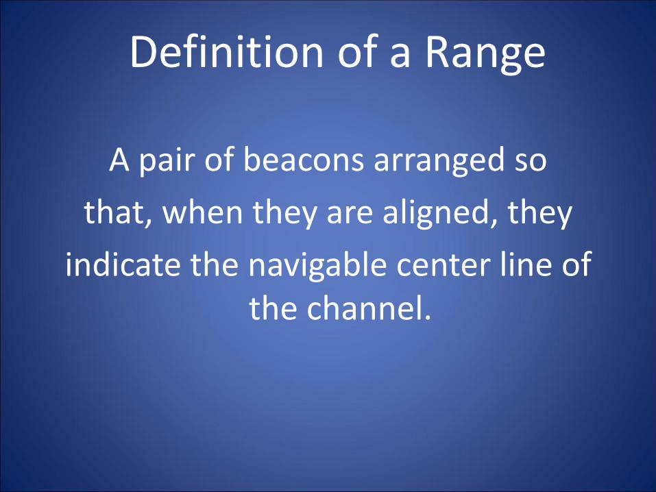
Definition of a Range
A pair of beacons arranged so
that, when they are aligned, they
indicate the navigable center line of the channel.
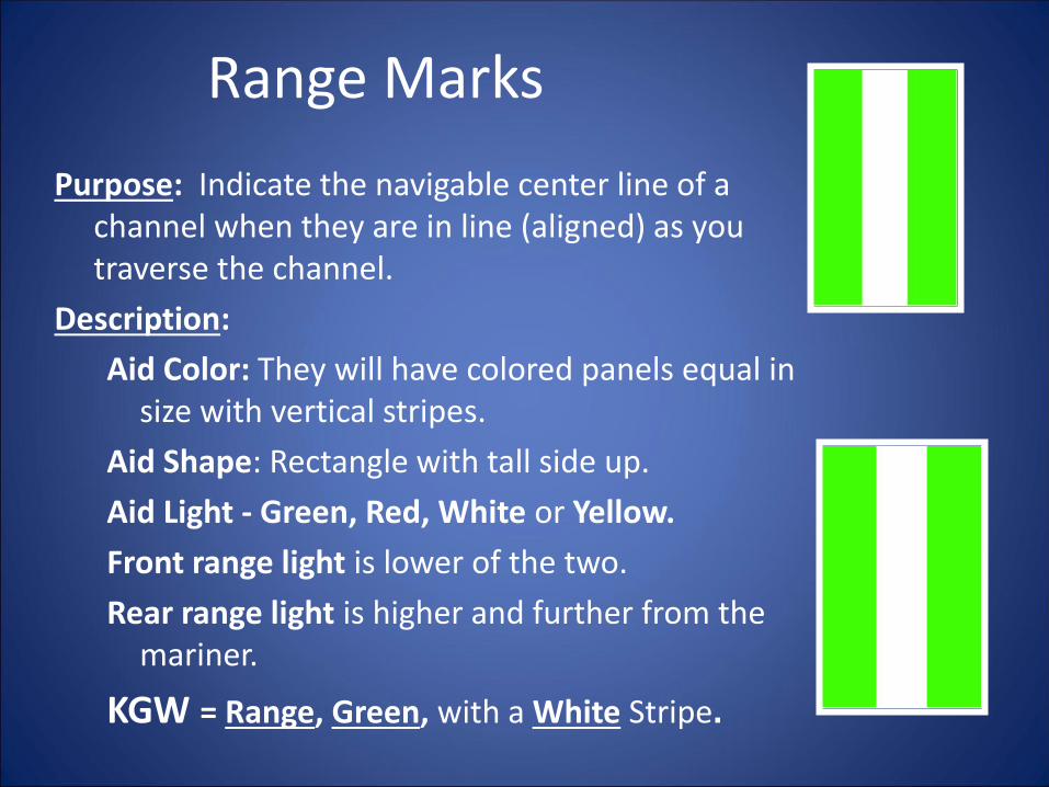
Range Marks
Purpose: Indicate the navigable center line of a channel when they are in line (aligned) as you traverse the channel.
Description:
Aid Color: They will have colored panels equal in size with vertical stripes.
Aid Shape: Rectangle with tall side up.
Aid Light - Green, Red, White or Yellow.
Front range light is lower of the two.
Rear range light is higher and further from the mariner.
KGW = Range, Green, with a White Stripe.

Range Marks
FR – Front Range
Mark
RR - Rear Range
Mark
Intracoastal Waterway Marking System
• Runs from Manasquan, NJ to Brownsville, TX
• Differs only from U.S. marking system in that ICW aids show distinctive identifying symbols
• Conventional Direction of Buoyage is the same as the East and Gulf Coasts

Intracoastal Waterway Marking System
• Identifying Marks
– Starboard Marks:Yellow triangle
– Port Marks: Yellow square
14
13

Intracoastal Waterway Marking System
– Non-lateral Mark: 2” yellow strip along bottom

Light StructuresMajor Lighthouses
Are named. e.g. Boston Light
Symbol is large exclamation point.
Fixed position
Minor Lights
Not named
Same symbol
Fixed position
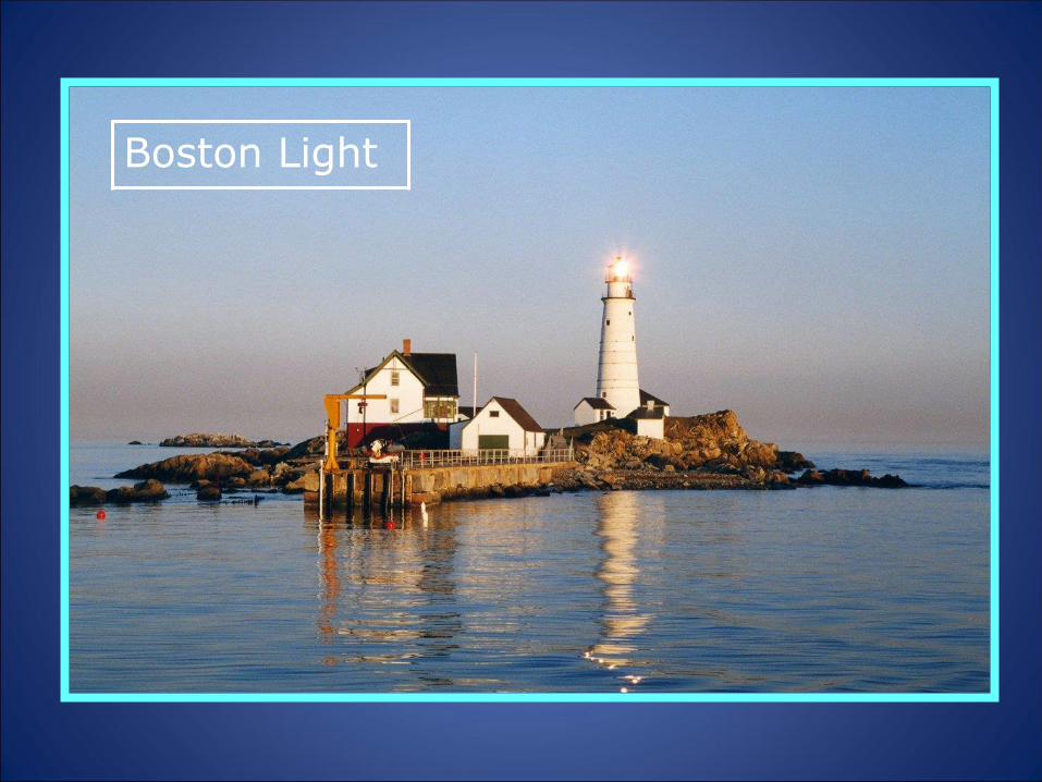
Boston Light
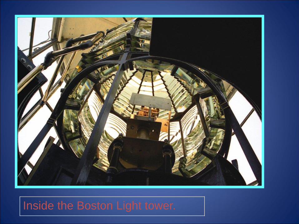
Inside the Boston Light tower.
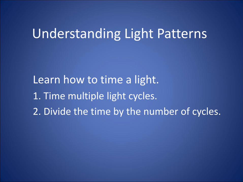
Understanding Light Patterns
Learn how to time a light.
1. Time multiple light cycles.
2. Divide the time by the number of cycles.
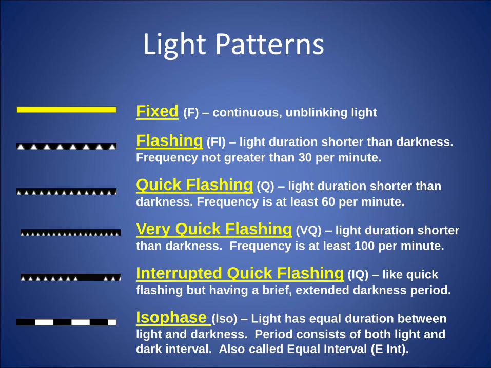
Light Patterns
Fixed (F) – continuous, unblinking light
Flashing (Fl) – light duration shorter than darkness.
Frequency not greater than 30 per minute.
Quick Flashing (Q) – light duration shorter than
darkness. Frequency is at least 60 per minute.
Very Quick Flashing (VQ) – light duration shorter
than darkness. Frequency is at least 100 per minute.
Interrupted Quick Flashing (IQ) – like quick
flashing but having a brief, extended darkness period.
Isophase (Iso) – Light has equal duration between
light and darkness. Period consists of both light and
dark interval. Also called Equal Interval (E Int).

Light PatternsGroup Flashing (Gp Fl (x+x)) – Combination of two
patterns in one period, i.e. 2 flashes followed by three
flashes.
Occulting (Occ) – Opposite of flashing – light is on
more than it is off.
Alternating (AL) – Alternating light changes color.
Special purpose light for situations requiring significant
caution. Example shows AL.WG…alternating white and
green light.
Morse (Mo) – Morse code light signal. Example is
Morse “U” which is two short flashes followed by one
prolonged flash then a period of darkness. Shown as
(Mo(U)) on charts. Typically Mo A short flash followed by
a prolonged flash.
Long Flashing (LFL) – One long flash in a period
with lighted period of at least 2 seconds.
Review the symbols and abbreviations on your NOAA chart for every aid that you
seecheck.
Check that the charted symbols and abbreviations match your on-scene
observations of the aid.
Report any discrepancies to the
Coast Guard and as a chart update
to NOAA.

Chart SymbolsCAN - Green Diamond with
small watch circle
NUN – Red diamond
with small watch circle.
Watch circle overprinted
with magenta when
lighted.
Italics used for buoys
and other floating aids.

Symbols - Daymarks and Minor Lights
Minor Light - Magenta exclamation mark
(teardrop with black dot)
Note the vertical letters used for fixed marks
Green Daymark
Green square.
Red Daymark
Red triangle


Review
• What are the ICW identifiers?
- Starboard Mark:
- Port Mark:
- Non-Lateral: