advances in airborne altimetric techniques for the...
TRANSCRIPT
Advances in Airborne Altimetric Techniques for the Measurement of Snow on Arctic Sea Ice
Thomas Newman, Sinead Farrell, Jacqueline Richter-Menge, Bruce Elder

Ice floe
lead
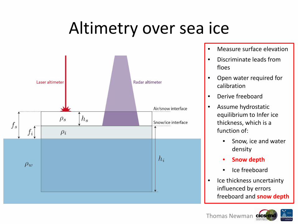
Altimetry over sea ice
Thomas Newman
Altimetry over sea ice • Measure surface elevation • Discriminate leads from
floes • Open water required for
calibration • Derive freeboard • Assume hydrostatic
equilibrium to Infer ice thickness, which is a function of:
• Snow, ice and water density
• Snow depth • Ice freeboard
• Ice thickness uncertainty influenced by errors freeboard and snow depth
Thomas Newman
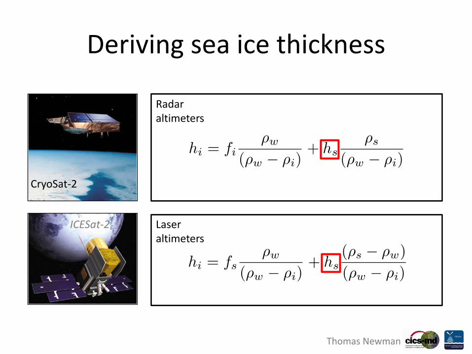
Deriving sea ice thickness
CryoSat-2
ICESat-2
Radar altimeters
Laser altimeters

Thomas Newman
Snow depth uncertainty
CryoSat-2
ICESat-2
Radar altimeters
Laser altimeters
Giles, K.A. et al., 2007. Combined airborne laser and radar altimeter measurements over the Fram Strait in May 2002. Remote Sensing of Environment, 111(2-3), pp.182–194.
Giles, K.A. et al., 2007. Combined airborne laser and radar altimeter measurements over the Fram Strait in May 2002. Remote Sensing of Environment, 111(2-3), pp.182–194.

Thomas Newman
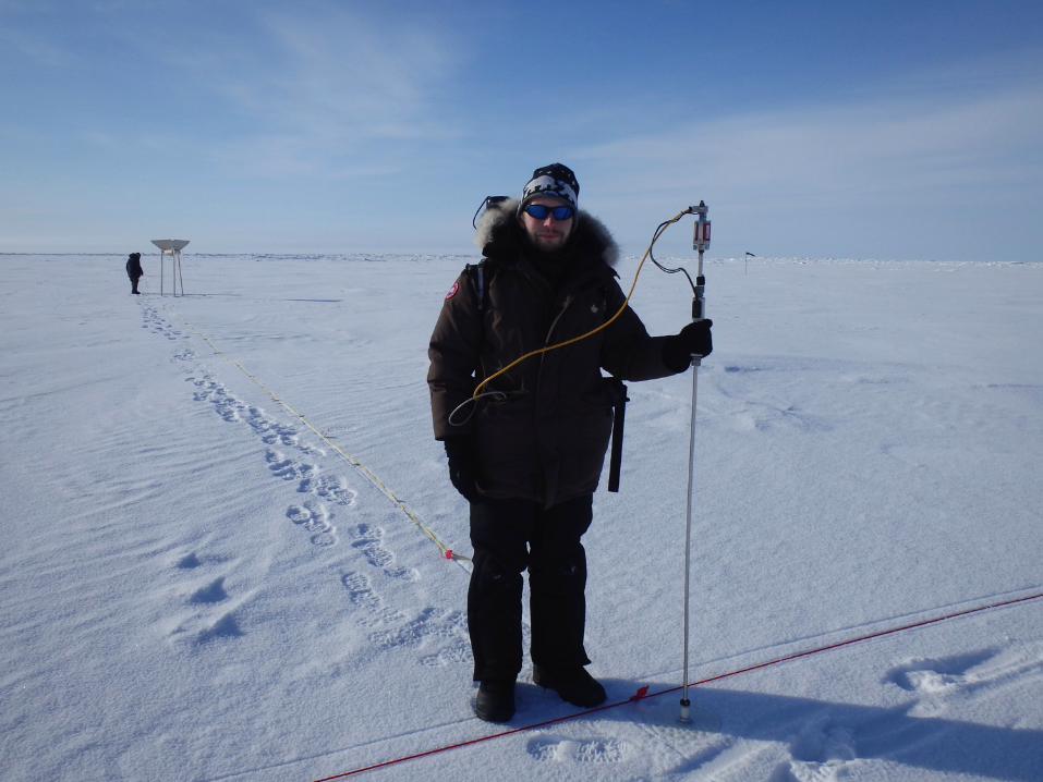
• In-situ measurements used to validate airborne measurements
• Airborne measurements used to validate satellite estimates
• NASA operation IceBridge aircraft providing yearly surveys of Arctic sea ice each March/April
• IceBridge instruments on P-3 aircraft: – Ku-band radar altimeter (13-17 GHz) – Snow radar (2-8 GHz) – Airborne Topographic Mapper (ATM) laser
altimeter – Digital mapping System (DMS) digital
camera
aircraft
satellite
In-situ
In-situ validates aircraft
Aircraft validates satellite
Nested validation approach: Theory
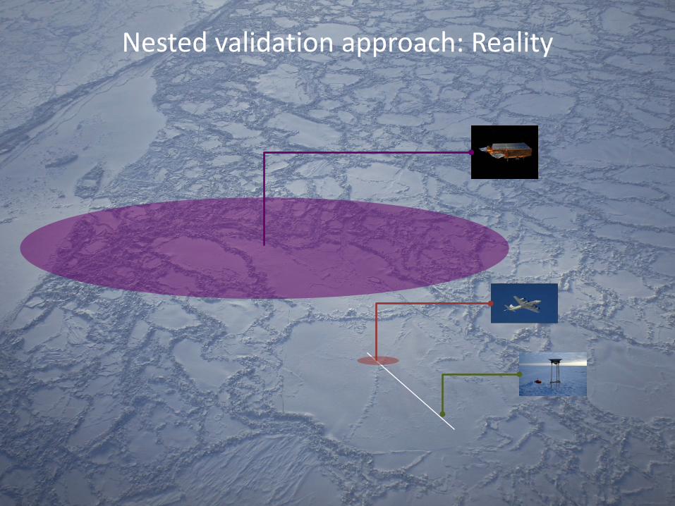
Nested validation approach: Reality
Thomas Newman
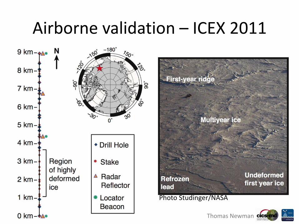
Airborne validation – ICEX 2011
Photo Studinger/NASA
Thomas Newman
Thomas Newman
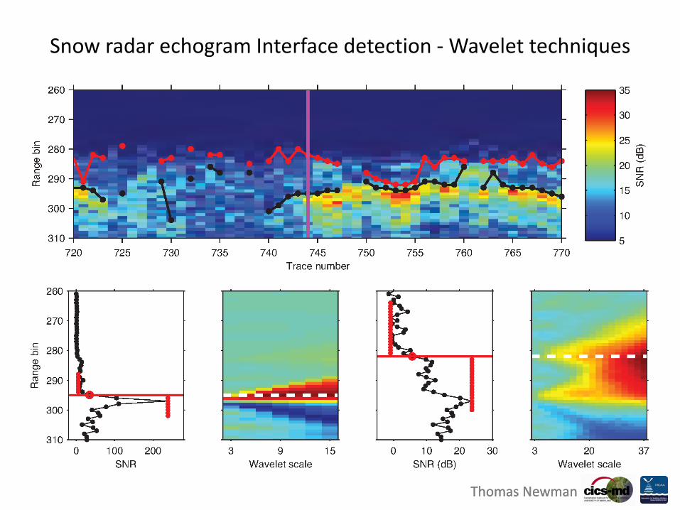
Snow radar echogram Interface detection - Wavelet techniques
Thomas Newman

Thomas Newman
ICEX 2011 point-by-point comparison
Thomas Newman

Thomas Newman
ICEX 2011 – Validation by ice type
Thomas Newman

Thomas Newman Thomas Newman
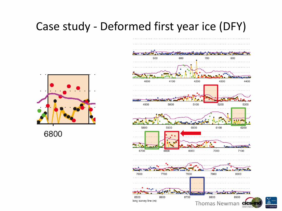
Case study - Deformed first year ice (DFY)
Thomas Newman Thomas Newman
Case study - Deformed first year ice (DFY)
Thomas Newman
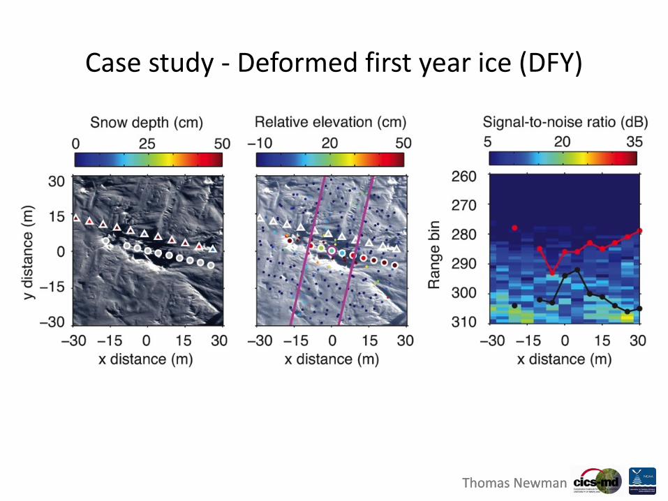
Case study - Deformed first year ice (DFY)
Thomas Newman

Thomas Newman Thomas Newman
Case study - Multiyear ice (MY)

Thomas Newman Thomas Newman
Case study - Multiyear ice (MY)

Thomas Newman Thomas Newman
Case study - Multiyear ice (MY)

Thomas Newman
Off-nadir scattering
Thomas Newman

400 m
60 m
5m-by-5m snow survey grid
2D snow grid

QUESTIONS?