a network of support— forward and direct
TRANSCRIPT

M a r c h / A p r i l 2 0 1 0
Vol. 8 No. 2
A Network of Support—Forward and Direct

On My Mind
NSTs: Leveraging the Power of GEOINTNGA Support Teams (NSTs) leverage the power of geospatial intelligence by putting our experts inside
our mission partners’ footprint.In the current threat environment, GEOINT is a force multiplier for our military servicemembers and our
civilian mission partners. GEOINT helps put other intelligence into context. It is an independent discipline as well as a primary source of confirmation and corroboration. When fused with other intelligence disciplines, GEOINT’s impact increases exponentially.
As a member of the Intelligence Community and a Department of Defense combat support agency, NGA continues to reach out to our partners within and across both communities to apply GEOINT effectively to the hard intelligence problems. But more is required for mission success. NSTs bring that added value to the challenge by integrating GEOINT personnel and services wherever they are needed.
We have our people at locations around the world coordinating and implementing GEOINT strategy with the U.S. Combatant Commands and key federal agencies, as well as with our military service and international partners.
NST personnel know the operations tempo because they work on site with the mission partner for up to five years—and often longer. A typical NST includes imagery analysts, geospatial analysts, information technology specialists, and data and collection managers. These professionals represent a true cross-section of the skills that NGA brings to the fight.
The men and women at the U.S. Central Command NST work with the command team to support our military servicemembers in Iraq and Afghanistan. Our U.S. Southern Command NST experts provide GEOINT resources for the command’s rescue, relief and recovery operations after natural disasters, like the Haitian and Chilean earthquakes, and for its other mission areas, including counterdrug and counternarcoterrorism operations.
When GEOINT is required in the wake of a manmade or natural disaster in the United States, NGA’s Department of Homeland Security NST answers the call. The Federal Emergency Management Agency, part of DHS, is the lead U.S. disaster relief organization. At FEMA’s official request, the DHS NST steps in to collaborate with its experts to determine GEOINT requirements and then mobilizes to deliver those requirements. These are just a few examples of how NSTs partner with host organizations to maximize the power of GEOINT.
NSTs combine NGA’s high level of expertise with longer-term assignments, putting us in a position to proactively tailor our products to enable mission success. At our NSTs, we don’t wait for the host organiza-tions to ask us for GEOINT; the NST embeds our experts inside the host organization’s footprint, working side by side with their team for extended periods.
NSTs are part of the decision-making process, collaborating on site with our partners to determine what kind of GEOINT is needed, where it’s needed and when it’s needed.
Providing timely, relevant and accurate support for the national security of the United States and our allies is our mission. By looking outward and pushing GEOINT forward through our NSTs, we are able to execute our mission more effectively.
Robert B. Murrett Vice Admiral, USN
Director

12 18
Contents
Pathfinder ›› March/April 2010 ›› Vol. 8 No. 2
On the CoverWith its substantial reach, NGA routinely plays a part in numerous success stories. Many of these achievements may not be disclosed in a public forum, but among those that can are found dramatic reminders of the value of geospatial intelligence (GEOINT). Throughout 2008, the agency and its partners repeatedly demonstrated the value of GEOINT and of the advances that NGA pursues to maintain and expand its premier position within the geospatial community. These noteworthy victories are just some of the ways in which NGA fulfills its crucial role in the daily intelligence mission. The first image taken by the GeoEye-1 satellite, over Kutztown University, Pa., illustrates one such accomplishment—NGA’s continuing NextView partnerships with private industry.
More to the Story?The online Classified Pathfinder, which is accessible by members of the Intelligence Community, may in-clude additional information and expanded sections of some Pathfinder articles. The Classified Pathfinder provides a forum for reading and discussing topics at the level of “Unclassified//For Official Use Only” and higher. For information please contact the editor, Heather Cox, at 301-227-2290.
1
Path
finde
r ›› S
epte
mbe
r/O
ctob
er 2
009
2 Letter to Our Readers
›› E Y E S W I D E O P E N
4 NGA Mounts Unprecedented Support for 2008 Olympic
Games
5 GeoEye-1 Satellite Fulfills Agency Requirements
6 NGA Support Team Bolsters SOCOM’s Special Operations
Forces
8 Sidebar: Special Operations Forces Truths
›› E N A B L I N G D E C I S I O N S
10 Successful Terrorist Prosecution Employs NGA Terrain
Models
11 NGA Magnifies the Value of Open Source GEOINT
12 Advancing GEOINT Standards Across the NSG
›› V I S U A L I Z I N G I N T E L L I G E N C E
14 Military GEOINT Cells Foster Closer
Relationship
16 Training Increases Google Earth™ Proficiency
17 Agency Extends Information Technology Infrastruc-
ture
18 Multimedia Communicators Tell the NGA Story in
New Ways
›› R E A C H I N G F O R W A R D
20 Research and Development Highlight
Collaborative Partnerships
21 Ethical Standards Reinforce Agency Focus
22 New System Rewards Effective Performance
›› D E P A R T M E N T S
23 Partnerships: NGA Hosts Afghan Mapping Agencies
for Executive Training
24 New Campus East: NCE Tours Host 2,000 in Two
Months
›› S P E C I A L G E O I N T S U P P L E M E N T
16 19
3
Contents
1
Path
finde
r ›› M
arch
/Apr
il 20
10
2 Letter to Our Readers
›› F E A T U R E S
3 Support Teams Essential to Haiti Earthquake Response
6 Electronic Readers Promise Digital Flight Information Publications
8 GEOINT Keeps TRANSCOM Moving
10 Medical Intelligence Relies on Teamwork
12 Agency Team Delivers GEOINT to Africa
14 NGA Liaison Strengthens Space Operations
›› D E P A R T M E N T S
16 Partnerships: COCOM Support Teams Exemplify Future of NSTs
19 Our Heritage:Knowing the Neighborhood
On the CoverThe National Geospatial-Intelligence Agency makes a big footprint. Almost a third of NGA’s government personnel are externally assigned to over 200 locations. NGA Support Teams, large and small, deploy members worldwide. These geospatial intelligence specialists form a global network—a web of direct support working to resolve the most pressing intelligence issues of our day. Embedded with NGA’s mission partners, and with constant access to the agency’s expansive resources, these forward-facing teams of GEOINT experts work side by side, hand in glove, with those with whom they serve, reaching out to identify needs and assisting with any and all GEOINT requests. Photos courtesy of DOD and NGA. Cover design by Richard Hardwick.
2
Path
finde
r ›› M
arch
/Apr
il 20
10
Published by the National Geospatial-Intelligence Agency Office of Corporate Communications 4600 Sangamore Road, Mail Stop D-54 Bethesda, MD 20816-5003 Telephone: (301) 227-7388, DSN 287-7388 E-mail: [email protected]
DirectorVice Adm. Robert B. Murrett, U.S. NavyDeputy DirectorLloyd RowlandOffice of Corporate Communications, DirectorKimberly ThompsonPublic Affairs, ChiefKaren A. FinnEditor Jason K. MichasAssociate Editor Laura L. LundinArt EditorCarmella BenderGraphic Designer Jason Collins
Contributing AuthorsRobert B. Maj. Larry Colby, U.S. Air Force Michael C. Jay D. Krasnow Damien K. Mike K. Laura L. Lundin Nick W. Dr. Gary E. Weir
SUBMISSIONS The Office of Corporate Communications accepts articles of geospatial intelligence community-wide interest for consideration. Articles are edited for style, content and length. Submit articles by e-mail to [email protected].
The Pathfinder is the National Geospatial-Intelligence Agency publication that promotes public awareness and understanding of geospatial intelligence. The Pathfinder is an authorized Department of Defense publication for members of the Department of Defense. Contents of this publica¬tion are not necessarily the official view of, or endorsed by, the U.S. government, Department of Defense or NGA. Articles in the Pathfinder may be reproduced in whole or in part without permis¬sion, unless stated otherwise. If reproduced, credit the author and the “National Geospatial-Intelligence Agency, the Pathfinder magazine.” Any reproduction of graphics, photographs and imagery is subject to the original copyright.
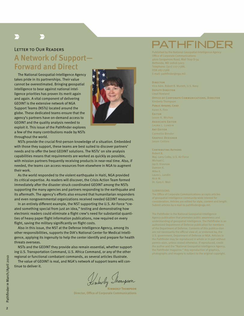
Letter to Our Readers
A Network of Support— Forward and Direct
The National Geospatial-Intelligence Agency takes pride in its partnerships. Their value cannot be overestimated. Bringing geospatial intelligence to bear against national intel-ligence priorities has proven its merit again and again. A vital component of delivering GEOINT is the extensive network of NGA Support Teams (NSTs) located around the globe. These dedicated teams ensure that the agency’s partners have on-demand access to GEOINT and the quality analysis needed to exploit it. This issue of the Pathfinder explores a few of the many contributions made by NSTs throughout the world.
NSTs provide the crucial first-person knowledge of a situation. Embedded with those they support, these teams are best suited to discover partners’ needs and to offer the best GEOINT solutions. The NSTs’ on site analysis capabilities means that requirements are worked as quickly as possible, with mission partners frequently receiving products in near-real time. Also, if needed, the teams can access resources from elsewhere in NGA to augment their work.
As the world responded to the violent earthquake in Haiti, NGA provided its critical expertise. As readers will discover, the Crisis Action Team formed immediately after the disaster struck coordinated GEOINT among the NSTs supporting the many agencies and partners responding to the earthquake and its aftermath. The agency’s efforts also ensured that humanitarian responders and even nongovernmental organizations received needed GEOINT resources.
In an entirely different example, the NST supporting the U.S. Air Force “cre-ated something special from just an idea,” testing and demonstrating how electronic readers could eliminate a flight crew’s need for substantial quanti-ties of heavy paper flight information publications, now required on every flight, saving the military significantly on flight costs.
Also in this issue, the NST at the Defense Intelligence Agency, among its other responsibilities, supports the DIA’s National Center for Medical Intelli-gence, applying its ingenuity to help the center identify and prepare for health threats overseas.
NSTs and the GEOINT they provide also remain essential, whether support-ing U.S. Transportation Command, U.S. Africa Command, or any of the other regional or functional combatant commands, as several articles illustrate.
The value of GEOINT is real, and NGA’s network of support teams will con-tinue to deliver it.
Kimberly Thompson Director, Office of Corporate Communications
2
Path
finde
r ›› M
arch
/Apr
il 20
10

3
Path
finde
r ›› M
arch
/Apr
il 20
10
Support Teams Essential to Haiti Earthquake ResponseBy Laura L. Lundin and Jay D. Krasnow
In response to the Haiti earthquake on Jan. 12, the National Geospatial-Intelligence Agency, using its vast resources and partnerships, provided dynamic and timely geospatial intelligence products to assist federal and nongovernment agencies with the ongoing relief efforts.
As U.S. government agencies, including the Depart-ment of State and the Agency for International Develop-ment, responded to the disaster, many looked to NGA for help with planning and carrying out recovery efforts. Enlisting its network of NGA Support Teams (NSTs), the agency worked closely with U.S. Southern Command, U.S. Strategic Command, the Defense Intelligence Agency and other agencies to make sure the most ef-fective GEOINT products quickly reached those on the ground in Haiti.
Because the NGA teams faced the challenge of managing large volumes of information
effectively and producing GEOINT products under tight deadlines,
the agency formed the Haiti Crisis Action Team (CAT) to
coordinate the around-the-clock GEOINT response with
NGA’s mission partners.
Practicing the collaborative principles of Unified GEOINT Operations (UGO), the agency applied the full capabili-ties of the National System for Geospatial Intelligence (NSG). The leader of the Haiti CAT, as the Americas NSG Operations Executive, enlisted the full gamut of available GEOINT. Employing UGO allowed decision makers, such as the Naval Oceanographic Office and U.S. Transporta-tion Command, to assess the needs of the situation, align efforts and get GEOINT into the hands of emergency responders more efficiently.
Since SOUTHCOM led the Department of Defense’s response to the crisis, NGA expanded its NST of GEOINT professionals at the command’s headquarters in Miami, Fla., and sent down the Domestic Mobile Integrated Geo-spatial-Intelligence System, a self-contained command vehicle operated by experts who are able to produce additional geospatial products on site.
NGA worked closely with other responders to the Haiti earthquake to ensure that GEOINT quickly reached those on the ground.DOD photo

4
Path
finde
r ›› M
arch
/Apr
il 20
10
While panchromatic (black-and-white) imagery pro-vided NGA’s support team at SOUTHCOM with a baseline for analysis, the command needed additional sources and products in order to be effective in its response.
High-resolution, three-dimensional data offered the most practical solution to the needs of the command. As a result, light detection and ranging, more commonly known as LIDAR, proved useful in a variety of areas. LIDAR is an optical remote sensing technology that uses light from a laser to detect and locate objects, using measurements of light properties to collect data on elevation, depth or height.
Within 48 hours of mission authorization, the NST at SOUTHCOM, in collaboration with the Massachusetts In-stitute of Technology Lincoln Laboratory, had deployed, collected, processed, analyzed, stored and disseminated vital GEOINT products.
Within 72 hours, the first mission from Miami was flown over Haiti to image initial United Nations food distribution points, and less than a day later, images and products were in the hands of SOUTHCOM analysts.
The LIDAR technology and NGA’s analysis of the data provided a day-to-day growth rate of internally displaced persons camps. Understanding the growth of the camps assisted relief operations planning, allowing aid workers to determine food distribution locations. LIDAR also identified previously unknown encampments within forested areas.
“We definitely did a better job of using the information to establish a baseline to determine areas of need and areas that had no change,” said a watch officer with SOUTHCOM’s Joint Task Force–Haiti.
Additionally, NST members assessed debris and verti-cal obstructions, helping identify the best travel routes for responders and helicopter landing areas, as well as plan for recovery and clean-up efforts.
The LIDAR missions eventually expanded to include collection of data over a broader area. According to the watch officer, “NGA’s data will also be used to determine floodplains and potential areas susceptible to landslides and mud slides as the rainy season approaches.”
The global reach and collaboration of NGA and its mission partners is evident in other areas as well. For instance, NGA’s support team at DIA provided GEOINT products that assessed the earthquake’s effects on structures in Port-au-Prince as well as assisted with the
search for internally displaced people outside the city’s borders.
NGA’s foreign partners also played a key role in responding to the crisis. The Canadian Directorate of Geospatial Intelligence pulled together a suite of GEOINT products, including topographic line maps, image city maps and route studies between the major cities of Port-au-Prince, Leogane and Jacmel. The United Kingdom Hydrographic Office shipped up-to-date charts to aid in disaster relief planning and operations.
Due to the magnitude of the disaster and the number of agencies and organizations involved, the needs of the mission in Haiti had to be balanced with NGA’s and the combatant commands’ commitments to ongoing opera-tions in other areas, such as Iraq and Afghanistan.
The job of balancing and coordinating those efforts for NGA’s intelligence, surveillance and reconnaissance mis-sion fell to the NGA element at the Defense Intelligence Operations Coordination Center. This team is similar to an NST, but is responsible for coordinating ISR issues between NGA and the combatant commands, while reaching back to access the expertise housed in NGA’s core components.
The team at DIOCC also supports STRATCOM’s Joint Functional Component Command for Intelligence, Surveillance and Reconnaissance, which balances airborne collection resources and assesses the risks of reallocating these resources through careful global force management.
“It’s imperative to balance the competing demands to meet the highest priorities,” said U.S. Army Maj. Jennifer
DOD photo
Responders relied on GEOINT to assist in the earthquake’s aftermath.

5
Path
finde
r ›› M
arch
/Apr
il 20
10
NGA provided a day-to-day growth rate of internally displaced persons camps, allowing aid workers to determine food distribution locations. DOD photo
5
Path
finde
r ›› M
arch
/Apr
il 20
10
Smith-Heys, who is the Airborne Operations division chief with the NGA element to DIOCC and JFCC–ISR. “Haiti offers a great example of how we used global force management to maintain our operations on a global scale.”
For example, SOUTHCOM requested full-motion video support for the mission in Haiti; however, a major-ity of the assets needed for that function resided outside SOUTHCOM’s area of responsibility. NGA’s component at the DIOCC was able to coordinate with NGA and the relevant commands, to allocate the needed collection aircraft.
Furthermore, working with the agency’s Crisis Action Team, the NGA element aligned agency personnel and assets to ensure that sufficient analytic resources within NGA were available to assist the U.S. Air Force’s own efforts to exploit the full-motion video data provided by the Predator collection platforms flown. Between NGA and the Air Force, analysts were able to provide GEOINT analysis and products within 24 hours of collection.
“Using full-motion video collected through the NGA elements’ efforts, commanders of the 82nd Airborne on the ground in Haiti were able to divert friendly forces away from potentially hostile situations,” said Smith-Heys, illustrating just one example of GEOINT’s useful-ness in Haiti.
Although the ISR mission has been scaled down, some assets are still operating to assist with the recovery and reconstruction efforts.
The involvement of NGA and its mission partners in the humanitarian relief effort in Haiti demonstrates the global reach and support of the agency’s mission and reflects the growing importance of GEOINT to the global community. While the recovery for Haiti will take months and even years, an integrated, collaborative community of GEOINT professionals will be on hand to assist when-ever and wherever needed.
Laura L. Lundin and Jay D. Krasnow are public affairs officers in the NGA Office of Corporate Communications.

6
Path
finde
r ›› M
arch
/Apr
il 20
10
Electronic Readers Promise Digital Flight Information Publications By Lt. Col. Larry Colby, U.S. Air Force
Imagine every 28 days lugging 50 pounds or more of paper to your office in cumbersome boxes in order for yourself and your teammates to work. Now substitute “aircraft” for “office.” Depending on the aircraft’s size, you may be dragging pounds of safety of navigation publications around every time you fly. Moving all this paper takes time, extra fuel and a lot of money in print-ing and shipping costs. Yet every Department of Defense pilot does this before each flight.
“Why not just view all this GEOINT [geospatial intel-ligence] flight information publication [FLIP] data on an electronic viewer?” asked Lt. Col. Michael Kitching, chief of the U.S. Air Force NGA Support Team, in June 2009.
The idea of purchasing and testing an electronic reader that can hold over 6,000 pages of data but only weighs about a pound came about after researching how private, corporate and commercial cargo pilots were using digital FLIPs in their cockpits. The Air Force NST purchased and tested an electronic reader at several locations, including an NGA parking garage, to see if it would be feasible for military use. Members of the NST, many of them current and former military pilots, were ecstatic about the idea. Here was a simple, inexpensive product, intended for reading books or newspapers, that allowed viewing NGA FLIPs in digital form.
“This idea and initial results were overwhelmingly favorable,” said Col. William Miles, chief of NGA’s Of-fice of Military Services, which oversees the military NSTs. “Here we have a group of creative civilian and military teammates, supporting their fellow warfighters and intelligence community members, which created something special from just an idea. Best news of all is that they did something about it. This speaks ultra-high volumes about our GEOINT team; this concept embraces our military forces going digital, enables the warfighter to instantly update their critical flight information and brings the warfighter to 21st century technology,” Miles said.
NST members knew they had something remarkable after sharing their findings with other team members in the agency’s St. Louis, Mo., facility. In St. Louis, the
Air Force NST collaborated with staff from the Office of Global Navigation, Aeronautical Services, and the Enter-prise Operations and InnoVision Directorates to form the NGA Electronic Flight Bag Team. With the EFB concept, aircrews would electronically download their flight data from a secure website directly to their device, bypassing the traditional paper route and avoiding the wait for the boxes to arrive. All over the world, aircrews, from Kabul to the Pacific Ocean, would have accurate GEOINT data delivered instantly.
Excited about supporting the warfighter, the team-mates calculated that NGA spends about $23 million a year printing and shipping materials to global aircrews. “From a business model perspective, this has a tre-mendous potential cost savings. NGA could one day reduce their printing costs and delivery costs, while the deployed aircrew would have a rapid delivery of data for their mission without waiting for the mailbag to arrive,” said Kitching. This is also in step with the U.S. military’s Tri-Service Aeronautical Working Groups, which work together on a variety of safety of navigation issues, including a digital aeronautical future.
When compared to the heavy weight of paper FLIPs that must be constantly replaced within thousands of aircraft, the electronic reader is a pleasant alternative. Electronic readers have the potential to replace the majority of each crewmember’s personally issued paper reference library. As estimated in a study published by the Air Force Expeditionary Center’s Air Mobility Battle-lab before the lab’s deactivation in 2008, electronic readers could eliminate approxi-mately 50 pounds per aircraft, in turn reduc-ing aircraft fuel consumption and decreasing operating costs by approximately $3 per flight hour (a calculation incorporating crew salaries, maintenance, fuel, insurance and aircraft costs). In one example noted by the study, a typical airlift squad-ron could save approximately $68,000. Potential savings may also result from fewer excess baggage charges, often $50 to $100 per bag, when a military flight crew flies commercially.

7
Path
finde
r ›› M
arch
/Apr
il 20
10
Members of the U.S. Air Force NGA Support Team view a digital flight information publication on an electronic reader during tests.Photo by Tony Boone
Electronic readers, with NGA’s support, will one day rapidly deliver time-sensitive GEOINT data to warfighters in a more cost-effective manner, saving millions of dollars a year. A variety of electronic readers available on the market are being looked at by NGA. The Office of Aeronautical Services is seeking to identify vendors who have the functional and techni-cal expertise to ingest NGA’s aeronautical flight information documents into any future electronic flight bags. Eventually, the EFB Team would like to help deliver additional digital aero-nautical products to the military services.
U.S. aircrews have been flying with pa-per-based FLIPs since the early airmail operations of the 1920s. However, digital GEOINT data has significantly increased the timeliness and ef-fectiveness of mission planning, situational awareness and target-ing for NGA’s partners. The use of paper in military cockpits is one of the last holdouts; electronic readers are today’s answer, and electronic display of FLIPs in the cockpit is the goal.
Lt. Col. Larry Colby is a staff officer on the NGA Support Team for the U.S. Air Force.
7
Path
finde
r ›› M
arch
/Apr
il 20
10

8
Path
finde
r ›› M
arch
/Apr
il 20
10
GEOINT Keeps TRANSCOM Moving By Nick W. and Mike C.
The NGA Support Team (NST) for the U.S. Trans-portation Command, located at Scott Air Force Base, Ill., consists of a large team of geospatial intelligence (GEOINT) analysts who support TRANSCOM’s mission to provide air, land and sea transportation for the Depart-ment of Defense in times of both peace and war.
TRANSCOM supplies the nation with the world’s most responsive strategic mobility capability, conducting thousands of air, ship and ground movements weekly. Working with TRANSCOM transportation analysts to depict seaports, the NST creates GEOINT with its GeoPort database and supporting software. Additionally, the NST assists the Air Mobility Command’s global air mobility mission with a special air product, the Layered Airfield Graphic. Both GeoPort and Layered Airfield Graphics have matured into a customizable product for a variety of missions.
Seaport ProductionDuring the last three years, the NST’s port produc-
tion has moved from very product-centric to more data-centric. In the past, the imagery analysts cre-ated detailed, static graphics that were not geore-ferenced, along with an excessively detailed port description. Similarly, the graphics were quite detailed, with each part of the port depicted by a point, line or polygon. Port products were recreated every one to three years, some more often. The length of time to complete each port depended on the size of the port as well as the skill level of the analyst and ranged from one week to two months.
The redundant reporting and time-in-tensive graphics were the catalysts for developing GeoPort, which consists of a geospatial database, a layered GeoPDF, a vector product for use in Google Earth™, and a Supplemental Imagery Report (SU-PIR). Analysts extract port features using ArcGIS tools and store them in a common geospatial database with the previously extracted port data, saving significant
amounts of time during each port update. While an initial port update requires about the same amount of time as previous methods, the time saved for revisits is approximately 75 percent per port. Analysts then upload the data into Intellipedia, the Intelligence Community’s classified wiki, for users to access if they desire the raw
The NGA Support Team for the U.S. Transportation Command
developed GeoPort to improve production of port graphics,
such as this one of Haina Port, Dominican Republic.
NGA graphic

9
Path
finde
r ›› M
arch
/Apr
il 20
10
security teams for force protection of aircraft and by pilots for situational awareness before flying into unfa-miliar airfields. NGA Aeronautical Services helps acquire additional data for some of the airfields and is now also producing LAGs as part of its standard production.
Through ingenuity and teamwork with other NGA components, the TRANSCOM NST has transformed port production into a modern, time-saving process with several benefits. The creation of multiple databases allows a myriad of users to take advantage of the work of GEOINT analysts in a number of different formats. More importantly, analysts have turned the significant time saved to performing more analysis in the areas of transportation and logistics that keep TRANSCOM moving assets around the world.
data. Analysts also make a Google Earth™ file for quick visualization. The non-georeferenced static graphic has been replaced with a layered GeoPDF in which users can select the different vector layers, customizing an overlay product to their own specifications and desired detail. The layered GeoPDF can also serve as a Force Protection Graphic or simple base image. The extensive attribu-tion collected during the GeoPort process is embedded within the GeoPDF, creating a standalone product. Each analyst also writes a SUPIR report that demonstrates the value of the product.
Airfield ProductionThe NST’s diverse liaison support to the Air Mobility
Command has developed one standing air product that has endured not only within the NST but also within NGA’s Aeronautical Services. Previously, the command required imagery oriented to the north, with a limited number of graphics depicting parking aprons, tempo-rary housing and the fence line. The requirement for product updates depended on the particular airfield and sometimes needed to be performed on a monthly basis. Though not very time-consuming to create, each product was basic and didn’t convey an adequate amount of information to users.
Building on the components of GeoPort, the NST created Layered Airfield Graph-ics, also known as LAGs, that allow users to customize products to their needs. With limited resources avail-able for feature extraction, the NST applied data that NGA had already collected though the Stereo Airfield Collection program.
The SAC data was available for most of the airfields of interest and at the unclassified level. However, the SAC data was stored in individual shapefiles and was not easy to store and sort through. This drove the NST to create a new geodatabase specifi-cally to store the SAC data and led to the development of the final LAG product.
LAGs are similar to the GeoPort GeoPDFs and are used by Air Force
Nick W. is an imagery analyst embedded in the Joint Intelli-gence Operations Center at the U.S. Transportation Command.
Mike C. is an imagery analyst embedded in the Aeronautical Intelligence Squadron at Air Mobility Command.
The NGA Support Team for the U.S. Transportation Command produced this graphic of Jacmel Airfield, Haiti for the Air Mobility Command to support air transportation missions. NGA Graphic

Medical Intelligence Relies on Teamwork By Damien K.
Comprehensive and significant geospatial intelligence (GEOINT) provided by the National Geospa-tial-Intelligence Agency helps the Defense Intelligence Agency’s National Center for Medical Intelligence ensure successful mission completion.
“The partnership of NGA’s imagery and geospatial intelligence analysts with NCMI’s all-source intelligence analysts has created a model for an effective collabora-tive working relationship,” according to Stephen J., deputy director of the NGA Support Team (NST) to DIA. Applying imagery and geospatial analysis to medical intelligence has proved invaluable to NCMI, the Depart-ment of Defense and the Intelligence Community.
Medical intelligence includes the assessment of po-tential health risks and capabilities that allows planning for proper medical countermeasures and field health-care for deployed forces. NCMI prepares and coordinates integrated, all-source intelligence for DOD and other government organizations on foreign health threats and other medical intelligence issues in support of U.S. interests worldwide.
For instance, NCMI’s medical intelligence helps protect the health of forces deployed to Iraq and Af-ghanistan, as well as personnel stationed at home and throughout the world. NCMI analysts integrate multiple intelligence sources to enable decisions to prepare for, respond to, and control health threats, particularly in situations where foreign countries do not report informa-tion to the press or international health organizations. NGA’s GEOINT provides insight essential to this effort.
The support team at DIA’s NCMI includes experts in imagery and geospatial analysis who regularly engage with the center on three major focus areas: foreign military and civilian medical systems, environmental health risks, and infectious disease risks. NGA collabo-rates directly and daily with NCMI analysts, from initial brainstorming on a problem to fine-tuning the final intel-ligence product.
“The in-house imagery analytical quality and content, and the unique geospatial data, analysis and tools NGA provides, are of paramount value and importance to NCMI and their customers,” according to U.S. Air Force Col. Anthony Rizzo, director of the National Center for Medical Intelligence.
NGA analysts work with NCMI’s Environmental Health Division to
NGA Support Team analysts are called upon to map healthcare facilities to treat deployed U.S. personnel.DOD photo
10
Path
finde
r ›› M
arch
/Apr
il 20
10

produce environmental health intelligence reports such as industrial hazard assessments, industrial facility health risk assessments and chemical and radiological hazard area models. Embedded NGA imagery analysts identify the locations and operations of facilities that could pose a physical or toxicity health threat to U.S. forces operating in a specific area in the event of a catastrophic release. NGA geospatial analysts provide advanced analysis of geography and hydrology to predict the type, location and mobility of water contamination. These advanced analytic techniques greatly enhance the resolution and confidence of NCMI’s assessments of potential health threats to U.S. forces overseas.
As an integral part of NCMI’s effort to maintain the medical intelligence managed by its Medical Capabilities Division, NGA analysts help review a variety of source information used to locate medical facilities and assess healthcare infrastructures.
NCMI is routinely asked to recommend suitable healthcare facilities to treat U.S. personnel deployed overseas in the event of an emergency. “And that’s where [NGA analysts] come in,” said U.S. Navy Cmdr. David Davies, chief of NCMI’s Medical Capabilities Divi-sion. “NGA analysts are often called upon to map loca-tions and other nearby infrastructure.”
Other areas requiring NGA’s expertise include work-ing with NCMI’s Infectious Disease Division. Working with NCMI analysts, dedicated senior GEOINT analysts forecast, track and analyze the occurrence of infectious diseases with pandemic potential. The NGA role and mission in supporting the Infectious Disease Division dramatically increased during the 2009 H1N1 influenza pandemic influenza. “NGA’s success in providing GEOINT to NCMI and the community during the first pandemic in 40 years was due to the mutual understanding, trust and cooperation developed between the two organizations over the last decade,” according to Dr. Kathryn Morici, chief of NCMI’s Infectious Disease Division.
In response to the potential human health threat posed by avian influenza, the NST established the GEOINT Pandemic Working Group in early 2008, about 16 months before the 2009 H1N1 pandemic emerged. Build-ing on strong relationships through regular quarterly
meetings and effective intra- and interagency coopera-tion made the working group very effective within the GEOINT community before and during the pandemic.
The working group capped a successful 2009 by orchestrating the first NGA Pandemic GEOINT Conference with sessions in St. Louis, Mo., and Bethesda, Md., attended by representatives from throughout the govern-ment. Subject matter experts from the U.S. Department of Health and Human Services and the U.S. Centers for Disease Control and Prevention discussed the chal-lenges with influenza surveillance and provided a basic understanding of the biology of the influenza virus.
The conference sessions identified and emphasized the value and utility of GEOINT tradecrafts as applied to pandemic risk mitigation and warning. Attendees also discussed the potential secondary and tertiary pandemic impacts on a global scale.
Whether planning a conference or providing GEOINT analysis, the bond between NGA and NCMI continues to grow. This extensive relationship benefits not only NCMI, but NGA partners in the DOD, the Intelligence Community and elsewhere.
Applying imagery and geospatial analysis to medical intelligence has proved invaluable.
11
Path
finde
r ›› M
arch
/Apr
il 20
10
Damien K. is chief of the NGA Support Team at the Defense Intelligence Agency’s National Center for Medical Intelligence.
DOD photo

Agency Team Delivers GEOINT to Africa By Mike K.
In October 2009, geospatial intelligence (GEOINT) analysts from the NGA Support Team for the U.S. Africa Command and the agency’s Office of Eurasia–Africa attended the AfricaGIS Conference in Kampala, Uganda. This opportunity provided the analysts with insight into the unique challenges facing geographic information system (GIS) professionals in Africa and those working African issues around the globe. Following the confer-ence, the analysts worked for several days out of the Defense Attaché Office of the U.S. Embassy in Kampala providing focused, onsite GEOINT support.
Compared to other continents, there is a dearth of geo-spatial information about many areas of Africa. AfricaGIS provides a forum where geoinformation professionals from Africa and abroad can meet, interact and explore new developments, products and emerging trends and issues. New datasets briefed at the conference, includ-ing rainfall and crop monitoring, roads, vegetation and land cover, and human footprint, will be integrated into the support team’s analysis as required.
The 9th biennial AfricaGIS Conference attracted 481 participants from five continents. Lectures and plenary sessions were divided into four subthemes: Geospatial
Information for Climate Change, Vulnerability and Disas-ter Risk Reduction; Spatial Data Infrastructure in Africa; Geospatial Information Science for Business Solutions, Intelligence, Communication and Education; and Earth Observation and Geospatial Technologies for Integrated Environment and Natural Resources Management.
Representatives from several U.S. government agen-cies, nongovernmental organizations, private industry and academia briefed during the conference, such as the Department of State on “Humanitarian Risk Map-ping,” the U.S. Geological Survey on “Mapping Climate Change” and Columbia University on “Human Features of Climate Change.”
African geoinformation professionals also offered many briefs, revealing a number of local concerns, among them the migratory patterns of pastoral farmers in Kenya, mapping land ownership and boundaries in Ni-geria, livestock development planning in Uganda and the disappearance of Lake Chad. For NGA analysts working African topics, the opportunity to learn firsthand which geospatial issues are troubling African governments and how they are tackling them proved invaluable. Jason B., a geospatial intelligence analyst from the Central and
12
Path
finde
r ›› M
arch
/Apr
il 20
10

Southern Africa Branch who attended the conference commented, “This international platform gives an ana-lyst a unique perspective: observing how Africans use GEOINT to solve African problems.”
Noticeably absent among the topics briefed at the conference was the geospatial analysis of conflict. Many briefers discussed individual factors that could poten-tially cause conflict (water scarcity, climate change, land use), but they were not characterized as such. For future conferences, there is opportunity to demonstrate the value of analyzing second- and third-order geospatial ef-fects of drought, land fragmentation, poorly defined land ownership, competition over scarce natural resources, etc. and how, where and when they may lead to conflict.
Following the conference, the analysts worked out of the embassy for several days supporting one of their key partners, the Kampala Defense Attaché Office. During that time, they created customized GEOINT products supporting the Defense Attaché’s engagements with
NGA Support Team analysts created GEOINT products supporting U.S. Defense Attaché engagements with the Ugandan People’s
Defense Force leadership.U.S. Navy photo
Mike K. is a geospatial intelligence analyst with the NGA Support Team for the U.S. Africa Command.
13
Path
finde
r ›› M
arch
/Apr
il 20
10
Ugandan People’s Defense Force leadership. Working side by side with the Defense Attaché provided an under-standing of their mission and requirements, enabling the NGA team to support them more effectively in the future. The analysts also had the unique opportunity to sit in on a Northern Uganda Country Team meeting, which pro-vided a rare opportunity to observe the inner workings of a U.S. Embassy and all the players involved.
Attending the AfricaGIS conference and working at the embassy in Kampala proved eye-opening and informa-tive. Both new and seasoned African issues analysts found the conference highly beneficial, providing tremendous exposure to new ideas, tradecraft and tech-nology, and supplying additional opportunities to brief projects, further develop existing collaboration networks and gain increased recognition for NGA within the Africa geospatial analysis community.
NGA Liaison Strengthens Space Operations By Robert B.
Space analysts with U.S. Strategic Command at Vandenberg Air Force Base, Calif., now have “one-stop shopping” to fulfill their needs for National Geospatial-Intelligence Agency products and services. A full-time NGA liaison officer has been assigned to STRATCOM’s Joint Functional Component Command for Space. This officer serves as the focal point for providing a full range of geospatial products and services.
JFCC–Space coordinates, plans, integrates, synchro-nizes and executes space operations to accomplish national objectives and support combatant command-ers. In the past, support for JFCC–SPACE was usually provided through temporary duty personnel from the NGA Support Team (NST) at STRATCOM headquarters, Offutt Air Force Base, Neb. NGA recognized the need for a full-time NST staff officer to represent the agency at Vandenberg in supporting JFCC–SPACE.
The JFCC–SPACE Commander has established four key areas with which NGA has aligned its support:
›› Gain and maintain space situational awareness
›› Assist with all-source intelligence fusion, in coordination with the JFCC–SPACE director of intelligence
›› Contribute to the continued development of space command and control, particularly with respect to appropriately established datasharing involving NGA resources
›› Help improve space mission readiness through NGA’s training resources
Behind the liaison function at Vandenberg is an extensive array of interrelated NGA offices and NSTs that specialize in space issues, along with core NGA component offices. These combine to provide an unprecedented level of expertise and resources to the space mission sets.
It all starts with leveraging dedicated NST space re-sources at STRATCOM headquarters. The NST, in concert with the NGA Time Dominant Operations Center, helps enable JFCC–SPACE intelligence analysts to set stan-dards for critical mission information while providing ongoing updates against crucial indicators. This support also calls on specialized NGA analytical resources for longer-term analysis. These combined resources smooth
the progress of space situation awareness for the com-mander of STRATCOM and the component commander of JFCC–SPACE.
The liaison officer joins a team of liaison officers from the Department of Defense and other agencies, embed-ded with JFCC–SPACE intelligence assets ensuring the fullest extent of operationally focused collaboration and complementary intelligence production.
This collaboration at Vandenberg mirrors ongoing intelligence fusion at STRATCOM and in the Washington, D.C., area, which serves to ensure the efficient command and control of space resources.
To augment these efforts, NGA Mobile Training Teams are also providing tailored on-site geospatial training to JFCC–SPACE intelligence personnel.
Whether directed against imagery requirements or col-lection management, mission improvements will remain an ongoing challenge that NGA will continue to help meet. Space may be the “final frontier,” but meeting the needs of JFCC–SPACE is proving to be an adventure.
Robert B. is the NGA liaison officer to the Joint Functional Component Command for Space.
14
Path
finde
r ›› M
arch
/Apr
il 20
10
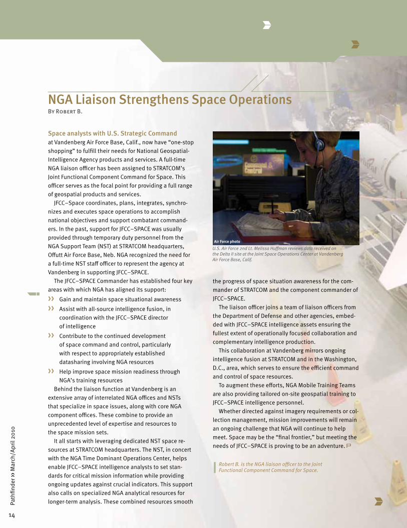
U.S. Air Force 2nd Lt. Melissa Huffman reviews data received on the Delta II site at the Joint Space Operations Center at Vandenberg Air Force Base, Calif.
Air Force photo

15
Path
finde
r ›› M
arch
/Apr
il 20
10
Base contractors work on a Pegasus rocket being prepared
for launch from Vandenberg Air Force Base, Calif.
Air Force photo

Partnerships
COCOM Support Teams Exemplify Future of NSTsBy Laura L. Lundin
The future of geospatial intelligence, or GEOINT, support to the warfighter will not depend on a single product or suite of technologies; instead it will rely on people—analysts, scientists and engineers with the National Geospatial-Intelligence Agency—who provide military commanders, intelligence partners and policy makers with critical analysis and products using an inte-grated, standards-based strategy.
NGA support teams, or NSTs, are vital to the GEOINT products the agency provides. Some of these teams of experts serve as direct, embedded support to the 10 regional and functional combatant commands on a global scale, providing the nation’s military commanders with the analysis and tools that help shape decisions affecting the battlefront.
In mid-2009, NGA stood up the Military Operations Group within the agency’s Analysis and Production Di-rectorate to address the evolution of the NST component to better align with the strategic vision of the National System for Geospatial Intelligence (NSG) and meet the ever-changing intelligence needs of the warfighter.
According to the 2009 NSG Statement of Strategic Intent, “The NSG vision is to create an integrated, collab-orative community of GEOINT professionals embedded with our operational, national and international partners to meet their warfighting and intelligence needs.”
“The mission of the MOG is both to live up to the historical mission of the NSTs and also evolve to become the NSG enabler—to bring the full capabilities of the NSG vision and GEOINT analysis to the COCOMs,” said Joel N. Maloney, director of the MOG.
Because GEOINT encompasses a broad spectrum of imagery, imagery intelligence and geospatial
16
Path
finde
r ›› M
arch
/Apr
il 20
10

information, NGA recognizes the importance of standard-ization and integration to provide the best support to all mission partners.
“It’s important for us to realize the concept of Unified GEOINT Operations and how that absolutely relates to our continued success as we move into the future,” said Maloney. “Our goal is to lead GEOINT at those COCOMs across the board.” And since NGA serves as the functional manager of the NSG, the COCOM NSTs provide the perfect forum through which to carry out that strategic vision.
A History of SupportThe MOG will enable the support teams to represent
an NSG component that is integrated and collaborative in nature. “The MOG is the lens that will help focus the way; the goal is to focus those things that are working well and harmonize and standardize the best practices of the NSTs,” said Maloney.
Working alongside operational partners, the focus will be on using multisource technologies, policies, capabili-ties and expertise to provide everything from foundation-based products that supply baseline information, such as mapping support for targeting missions and GEOINT
support for imagery collections, to special operations missions that require intelligence analysis that coincides with the operations tempo.
The NSTs, which were created in 2001, have a history of support to the COCOMs, providing critical skills in imagery and mapping, as well as helping military per-sonnel and leadership understand the purpose of NGA’s products. With the focus on GEOINT and the creation of the NSG, the COCOM NSTs began to reflect the larger effort of analysis and expand the reach of support.
“The NST concept has matured; now we need to pull together to focus and unify support to the COCOMs to be successful in meeting the mission needs that arise under the demanding intelligence operations tempo,” Maloney said. “We are acting to minimize delays and undertake more responsibility.”
The MOG has been deliberative in its approach, seek-ing to apply the best practices and provide the most innovative technologies and products while reducing duplication and bureaucratic processes that would otherwise complicate the ability to provide accurate analysis when it’s needed.
17
Path
finde
r ›› M
arch
/Apr
il 20
10
Embedded NGA Support Teams serve the regional and functional combatant commands Photo by Tony Boone

Locating NSTs within each command enables the teams to perform critical analysis rapidly and deliver it promptly. The teams draw complementary data from NGA and other agencies when necessary.
The U.S. Southern CommandOne example of this integrated approach is demon-
strated at the U.S. Southern Command NST. At the com-mand’s request, NGA personnel are working proactively to support intelligence, surveillance and reconnaissance (ISR) operations and exercises for U.S. embassies. Over the past months, the NST has supported several short-notice ISR operations to countries all over the SOUTH-COM area of responsibility.
In one recent mission, NST analysts examined thou-sands of still images and hours of video from two days of flight operations over multiple areas in the SOUTHCOM region. Using softcopy data and performing analysis on laptop computers provided by NGA’s Expeditionary Operations, the analysts produced first-phase images and geospatial products quickly. These products were disseminated to analysts at SOUTHCOM headquarters as well as to U.S. embassy personnel for eventual release to the host nation.
The team also provides technical support to the com-mand. One such effort addressed the challenges associ-ated with ISR deployments and involved NST members, including the technical executive, the NGA InnoVision Directorate, the SOUTHCOM deputy director for collec-tions and the U.S. Army Communications Electronics Research Development and Engineering Center. This inte-grated team developed a plan that enabled the WATCH-IT system, which makes imaging possible through tree cover, to be deployed and used by personnel in the field. The NST is leading the effort for permanent integration of the deployable WATCH-IT for use by the command when necessary.
A Global OperationOverall, the 10 COCOM NSTs’ support to the warfighter
comprises more than 500 personnel spread globally among COCOM bases and facilities. In addition, NGA has deployed hundreds of analysts and staff to both the Iraq and Afghanistan theaters, most of whom are embedded with U.S. forces in theater.
To help manage the overall scope and mission for all the NSTs, the MOG works closely with the Analysis and Production Directorate’s regional and functional offices as well as other offices within NGA, such as the Office of Geospatial Intelligence Management, the Source Opera-tions and Management Directorate, the Enterprise Op-erations Directorate, and the InnoVision Directorate—the research and development arm of the agency—in an effort to provide the best products and services as well as examine future needs and capabilities.
“Maintaining and operating a global operation, with teams who are not in the NGA footprint, is challenging, so we must prioritize,” said Maloney. “The undersecretary of defense for intelligence and Joint Chiefs are also engaged in the review process and give us added insight into mission needs. The Director of National Intelligence and Congress help to inform and shape our future allocations.”
The process of standardization has proved chal-lenging. Because each embedded NST brings a unique business process as well as various intellectual and philosophical underpinnings, changing some of the standards and practices can be arduous.
“There is always a trust issue, and a certain amount of a culture shift will need to take place,” Maloney stated. “The future will be challenging, so we need to rebalance our commitments; for mission success, the NSTs will not be static but fluid and work in full transparency as operational needs change.”
With the nation at war on multiple fronts, the sense of urgency that faces the GEOINT community is evident. As Vice Adm. Robert B. Murrett, Director of NGA, empha-sized, “Geospatial intelligence plays a critical role in virtually every Intelligence Community and Department of Defense mission; we will not fail to partner as closely as possible with our counterpart agencies and ensure that GEOINT is effectively utilized whenever and wher-ever it is needed.”
Laura L. Lundin is a public affairs officer in the Office of Corporate Communications.
18
Path
finde
r ›› M
arch
/Apr
il 20
10

19
Path
finde
r ›› M
arch
/Apr
il 20
10
Our Heritage
Knowing the NeighborhoodBy Dr. Gary E. Weir
I grew up in a New York City housing authority project near the City University of New York campus at Queens College. All of my earliest memories play out against a backdrop of seven-story apartment buildings, concrete playgrounds and shooting hoops as darkness descended on Public School 201’s park on hot summer nights, all to the rock ‘n’ roll sounds provided by WNEW-FM. For better or worse, we all carry some of the old neighborhood with us for our entire lives. When Presi-dent Obama reacted vigorously to the recent earthquake in Haiti, he referred to the Haitians as our neighbors in the western hemisphere. Preoccupied with many places in the world, addressing issues from poverty and illness to war and terrorism, Americans sometimes forget the neighborhood in this hemisphere and the important role it has played in the development of the agency and its tradecrafts.
NGA knows our neighbor-hood as well as Eastern Europe, Afghanistan, Iraq or any foreign land because in the years imme-diately after World War II, veteran colleagues in what became the Defense Mapping Agency, or DMA, decided to spend their days exam-ining as much of this hemisphere as possible. In this case, Ameri-can geodesists and cartographers with a sense of adventure, an urge to travel and an affinity for field work left the United States, sometimes for years, and became part of the scene in the Carib-bean, Central America and South America. They joined the Inter-American Geodetic Survey when its work began on April 15, 1946. The IAGS formed a unique community of people who for 48 years surveyed and mapped the neighborhood in support of American foreign policy, commercial ambitions and national de-fense strategy.
Some of the most productive efforts of the IAGS took place during the Kennedy Administration’s ambitious and coordinated outreach to Latin America known as
the Alliance for Progress. When the alliance began at an inter-American conference at Punta del Este, Uruguay, in August 1961, Col. John Unverforth had recently assumed command of IAGS for the U.S. Army Corps of Engineers. His responsibilities and challenges expanded swiftly with the Kennedy initiatives.
On all fronts, DMA proceeded to collaborate with the geographical and cartographic authorities in many Latin American countries to advance the necessary survey work: photographic, hydrographic and geodetic. Aviation support for survey operations along the Caribbean coast of Guatemala in the early 1960s directed by Al Holburn, IAGS, averaged 60 hours each month. The images would contribute to the composition of maps for the region designed to serve both the Latin American countries and the United States.
A Salvadoran survey party with the Inter-American Geodetic Survey. The IAGS surveyed and mapped Latin America.IAGS photoIAGS photo

20
Path
finde
r ›› M
arch
/Apr
il 20
10
With the advent of new electronic distance measur-ing equipment, some of the work went more quickly. At one point, IAGS treated the president of Honduras to a display and demonstration of the role played by the new technology in mapping his country. In 1962 the geodetic survey opened its first project in Paraguay, while also receiving a citation from the State Department for its work in the very delicate negotiations that established the proper border between Nicaragua and Honduras. At the opening of the Alliance for Progress initiative, Jack Staples became the IAGS project engineer in Colombia, working for the new officer in command Maj. Donald Curry. In late 1960, Curry and Staples sent 12 officers and 70 enlisted men in four C-130 transport planes to Bogota to fly the necessary photographic surveys of Colombia and surrounding countries. Doubtless the maps and data derived from those surveys have become particularly important in recent years. DMA surveyors also found themselves in extreme southern Chile placing tide gauges and running levels while experiencing gale force winds, 18 hours of daylight, and 45-foot tides, all under the watchful eyes of penguins and ostriches in the hundreds.
Only in Cuba did the IAGS mission contract. With the rise of Fidel Castro on that island in 1960, American car-tographers and surveyors departed. Remaining as long as they could, Ray Johns and William Hidalgo soon left the island rather swiftly, abandoning some equipment, while ensuring that IAGS had sufficient photo surveys and ground control points for full map coverage of Cuba. Thus DMA had the data on Cuba needed by the Defense Department in 1962 when the missile crisis occurred.
The experience of frequent deployment, living out of vehicles and working with what you could carry served many IAGS surveyors well. It also served DMA and its successor, the National Imagery and Mapping Agency, given both the Latin American products that emerged from that effort and the groundwork laid for NGA Support Team development by our surveyors’ independence
and initiative. Furthermore, as Operation Iraqi Freedom opened in 2003, the skills involved in journeying, living and working in remote areas enabled one IAGS veteran, as the first NIMA officer on site, to carve out a presence for what would soon become the National Geospatial-Intelligence Agency. The roots of NGA’s service in Iraq reach back to this single person, who initially shared his very meager workspace with the command coffee pot. He did not mind. It felt a bit more stable than tracking the U.S. Navy’s Transit satellites with IAGS in pre-GPS days from the roof of a condemned building in Paraguay. NGA’s work in this hemisphere has provided enviable opportunities and helped to refine the way the agency conducts business at all levels. Always remember to value those memories of the old neighborhood.
Dr. Gary E. Weir is the NGA historian.
IAGS photo
An Inter-American Geodetic Survey observation party in Ecuador. IAGS surveyors foreshadowed the NGA Support Teams through their independence and initiative.

21
Path
finde
r ›› M
arch
/Apr
il 20
10
•Act:BetheGlobalGEOINTLeader
•Align:BalanceWarfightingandNationalMissionRequirements
•Acquire:DiscoverandUseallSourcesofGEOINT
•Access:EnsureGEOINTAccess,andQualityAnalysis,withourPartners
•Accelerate:DemandTechnologiesthatDriveCommunitySolutions
•Achieve:Investin,andChallenge,amoreDiverseandExpertWorkforce
•Advance:SeizetheOpportunitiesPresentedbytheNCEEra
NGA FOCUS AREAS
Know the Earth...Show the Way
2010
FA1.indd 1 3/26/2010 1:42:11 PM

www.nga.mil