)4-@ >1 -;61/@5;:?-:0 )4e >1&41e%; -8810
TRANSCRIPT
TERMINOLOGY
KiG No. 34, Vol. 1 9, 202094
What Are Map Projections andWhy Are They So Called?
The development of map projec-tions ran in parallel with the produc-tion of maps and cartography ingeneral. Over time, the developmentof many sciences, technical achieve-ments, and the needs ofeveryday lifeinitiated increasing demand for theproduction of various topographicand thematic maps of various scalesand purposes, which required a con-tinual increase in the number ofmapprojections and the improvement ofthe mathematical basis of maps(Lapaine, Kuveždić 2007).
The beginnings ofmap projectiondate back about two and a half thou-sand years, when Greek scientists firstintroduced mathematical principlesinto the foundations of mapping theEarth and heavens, and began to ap-ply a network ofmeridians and paral-lels. The works of Anaximander, Era-tosthenes, Thales, Apollonius andHipparchus played amajor role in thedevelopment ofcartography.
It is believed that the first map ina map projection was made by ThalesofMiletus in 600 BC. It was a map ofthe celestial sphere in the gnomonicprojection. Among the oldest are ste-reographic and orthographic projec-tions used by the famous Greekastronomer and mathematician Hip-parchus, also for the purpose ofmap-ping the celestial sphere, around 150BC. From that time until today, sev-eral hundred different map projec-tions have been invented.
The recently published CartographicDictionary (Frančula et al. 2020) con-tains this definition ofmap projection:“mapping a curved surface, especiallyan ellipsoid or sphere, into a plane”.The first reactions arrived a few daysago. One refers to the definition ofmapprojection and reads as follows:
"Projection, map - you define it asmapping. It may have been necessary
to take into account that mapping is agerund that refers to an action (pro-jecting), while the projection is theresult ofthat action."
Our definition ofmap projection isidentical to the definition in my art-icle published three years ago in theTerminology section of the journalCartography and Geoinformation(Lapaine 2017).
The name ‘map projection’ con-tains the word ‘projection’. Obvi-ously the problem is in that word,which has a number ofmeanings, asis evident if we peek into any dic-tionary. According to Klaić's Diction-ary ofForeign Words, the word ‘proje-ction’ comes from the Latin projicere,ofwhich the literal translation is ‘tothrow before someone’, ‘to proffer’(Klaić 1978).
If we look, for example, at theCroatian Language Portal (HJP 2006),we can find these definitions of thenoun ‘projection’:1. mat. A flattened image of a set of
points in space obtained by pro-jection, i.e. mapping, in which allthe junctions of the associatedpairs of points: a. either passthrough one point [central projec-tion] b. or are parallel to a given line[parallel projection; especially: or-thogonal projection]
2. mat. An image ofa set ofpoints in aplane obtained by projecting(centrally or parallelly) onto a linein the same plane
3. film An enlarged photographic im-age transferred to the screen usingan optical apparatus
4. fig. a. An idea or thought aboutsomething in the future [develop-mental projection] b. a prediction[projection ofhighway traffic]
5. psych. An unconscious defensivemechanism by which somethingemotionally unacceptable is
unconsciously rejected and attrib-uted (projected) to othersApart from the fact that it is im-
mediately obvious that ‘projection’ isnot unambiguously defined, it seemsthat our critic was right, since ac-cording to the above, a projection isnot mapping, but an image, i.e. theresult of mapping. However, if welook at the School Dictionary of theCroatian Language (Birtić et al. 2017),we find this definition of the noun‘projection’:
“noun. f. 1. mat. mapping thepoints of space onto a plane ortho-gonal ~ points on a line ofoperations bywhich a point is joined to the nearestpoint in a given direction; orthogonal ~points on a plane of operations bywhich a point is joined to the nearestpoint on a given plane 2. An enlargedphotographic image transferred bymeans of an optical device to a canvas
cartographic ~ geo. the manner oftransferring the spherical shapes oftheEarth's surface onto a flat surface.”
This definition, in principle, iscorrect, except for these details: wedistinguish between mapping onto aplane and mapping in a plane. Map-ping onto a plane means that everypoint of the plane is an image of atleast one point, which generally is notnecessarily true. Therefore it would bebetter to say mapping in a plane. Fur-thermore, a map projection is often amapping of the Earth’s sphere or el-lipsoid in a plane, but it can also per-tain to the Moon, Mars, or anotherplanet or planetoid. Finally, geo. is anabbreviation for geography, and mapprojections are an integral part of car-tography, which in Croatia, accordingto the official division of the sciences,is a branch ofgeodesy, not geography(NN 2009, 2012, 2013, 2016).
If we look at the Mathematical Dic-tionary (Gusić 1995), we find that
TERMINOLOGIJA
KiG Br. 34, Vol. 1 9, 202095
Što su kartografske projekcije izašto se tako zovu?
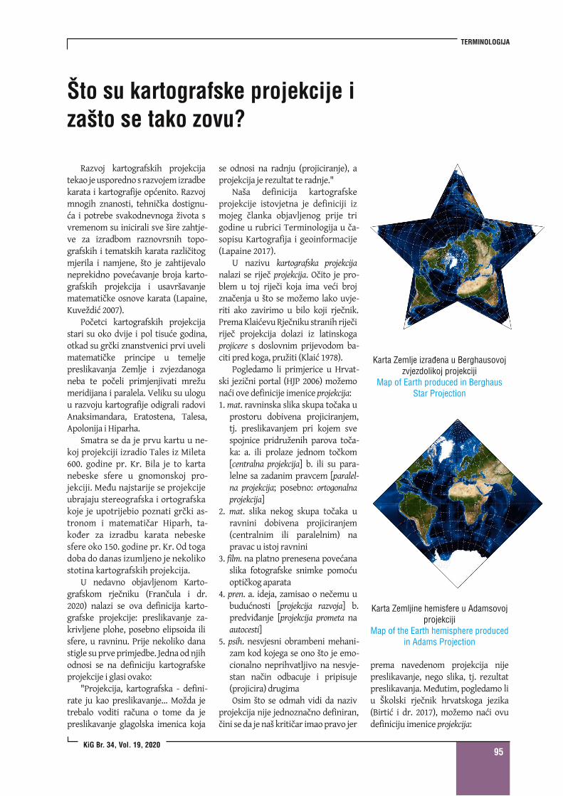
Karta Zemlj ine hemisfere u Adamsovojprojekci j i
Map of the Earth hemisphere producedin Adams Projection
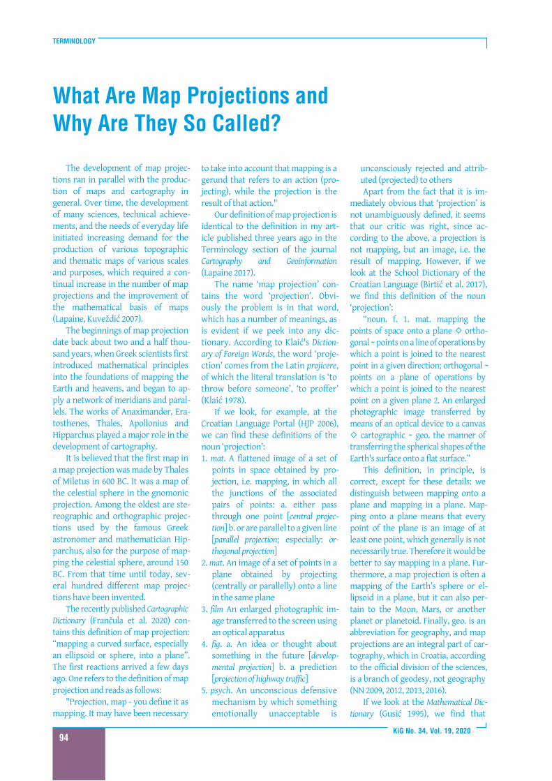
Karta Zemlje izrađena u Berghausovojzvjezdol ikoj projekci j i
Map of Earth produced in BerghausStar Projection
Razvoj kartografskih projekcijatekao je usporedno s razvojem izradbekarata i kartografije općenito. Razvojmnogih znanosti, tehnička dostignu-ća i potrebe svakodnevnoga života svremenom su inicirali sve šire zahtje-ve za izradbom raznovrsnih topo-grafskih i tematskih karata različitogmjerila i namjene, što je zahtijevaloneprekidno povećavanje broja karto-grafskih projekcija i usavršavanjematematičke osnove karata (Lapaine,Kuveždić 2007).
Početci kartografskih projekcijastari su oko dvije i pol tisuće godina,otkad su grčki znanstvenici prvi uvelimatematičke principe u temeljepreslikavanja Zemlje i zvjezdanoganeba te počeli primjenjivati mrežumeridijana i paralela. Veliku su uloguu razvoju kartografije odigrali radoviAnaksimandara, Eratostena, Talesa,Apolonija i Hiparha.
Smatra se da je prvu kartu u ne-koj projekciji izradio Tales iz Mileta600. godine pr. Kr. Bila je to kartanebeske sfere u gnomonskoj pro-jekciji. Među najstarije se projekcijeubrajaju stereografska i ortografskakoje je upotrijebio poznati grčki as-tronom i matematičar Hiparh, ta-kođer za izradbu karata nebeskesfere oko 150. godine pr. Kr. Od togadoba do danas izumljeno je nekolikostotina kartografskih projekcija.
U nedavno objavljenom Karto-grafskom rječniku (Frančula i dr.2020) nalazi se ova definicija karto-grafske projekcije: preslikavanje za-krivljene plohe, posebno elipsoida ilisfere, u ravninu. Prije nekoliko danastigle su prve primjedbe. Jedna odnjihodnosi se na definiciju kartografskeprojekcije i glasi ovako:
"Projekcija, kartografska - defini-rate ju kao preslikavanje… Možda jetrebalo voditi računa o tome da jepreslikavanje glagolska imenica koja
se odnosi na radnju (projiciranje), aprojekcija je rezultat te radnje."
Naša definicija kartografskeprojekcije istovjetna je definiciji izmojeg članka objavljenog prije trigodine u rubrici Terminologija u ča-sopisu Kartografija i geoinformacije(Lapaine 2017).
U nazivu kartografska projekcijanalazi se riječ projekcija. Očito je pro-blem u toj riječi koja ima veći brojznačenja u što se možemo lako uvje-riti ako zavirimo u bilo koji rječnik.PremaKlaićevuRječniku stranih riječiriječ projekcija dolazi iz latinskogaprojicere s doslovnim prijevodom ba-citi pred koga, pružiti (Klaić 1978).
Pogledamo li primjerice u Hrvat-ski jezični portal (HJP 2006) možemonaći ove definicije imenice projekcija:1. mat. ravninska slika skupa točaka u
prostoru dobivena projiciranjem,tj. preslikavanjem pri kojem svespojnice pridruženih parova toča-ka: a. ili prolaze jednom točkom[centralna projekcija] b. ili su para-lelne sa zadanim pravcem [paralel-na projekcija; posebno: ortogonalnaprojekcija]
2. mat. slika nekog skupa točaka uravnini dobivena projiciranjem(centralnim ili paralelnim) napravac u istoj ravnini
3. film. na platno prenesena povećanaslika fotografske snimke pomoćuoptičkog aparata
4. pren. a. ideja, zamisao o nečemu ubudućnosti [projekcija razvoja] b.predviđanje [projekcija prometa naautocesti]
5. psih. nesvjesni obrambeni mehani-zam kod kojega se ono što je emo-cionalno neprihvatljivo na nesvje-stan način odbacuje i pripisuje(projicira) drugimaOsim što se odmah vidi da naziv
projekcija nije jednoznačno definiran,čini se da je naš kritičar imao pravo jer
prema navedenom projekcija nijepreslikavanje, nego slika, tj. rezultatpreslikavanja. Međutim, pogledamo liu Školski rječnik hrvatskoga jezika(Birtić i dr. 2017), možemo naći ovudefiniciju imenice projekcija:
TERMINOLOGY
KiG No. 34, Vol. 1 9, 202096
projection is a term used in math-ematics in various circumstances,but it is always a function that joinsone point to another, or one vectorto another. We differentiate centralprojection in space, central projec-tion in a plane, orthogonal projec-tion in space onto a plane, ortho-gonal projection in space onto aline, orthogonal projection in aplane onto a line, parallel projec-tion, and so on. We have a very sim-ilar definition of projection in ourCartographic Dictionary.
From all this we can conclude thatthe term ‘map projection’ is ratherawkward, as it can lead the uniniti-ated to the wrong conclusion that it isthe result of projection, or mapping,rather than a special type ofmappingthat includes three notions: the areaofdefinition or domain, mapping law,and the area of value or codomain(Lapaine 2017).
Let us now look at the term ‘mapprojection’ in some foreign languages:
Germankartographische Abbildungkartographische ProjektionEnglishmap projectioncartographic projectionSpanishproyección cartográficaFrenchprojection cartographique
Russian
Bulgarian
Czechkartografickézobrazeníkartografická projekceSlovakiankartografickézobrazeniekartograficka projekciaDanishkortprojektionItalianrappresentazione cartograficaproiezione cartograficaNorwegiankartprojeksjonDutchkaartprojectiePolishodwzorowanie kartograficznerzutowanie kartograficzneprojekcja kartograficzneSwedishkartprojektionFinnishkarttaprojektioIt is easy to see that the root ofthe
word ‘projection’ is present in the vastmajority ofthese names.
Where did the name ‘projection’for map projection come from?
One of the oldest books in whichmap projections are interpreted is
Geographia generalis, in qua affectionesgeneralis telluris explicantur... byBernhard Varenius, first published in1664 in Amsterdam. This book iswritten in Latin, and Varenius usesthe word projectura for projection.Richard Blome translated Varenius'book into English and published it in1682 in London. He translated theLatin word projectura as projecture(from the French projecture and theclassical Latin prōiect-, the past parti-ciple ofprōicere -ūra).
In Coup d'œil historique sur la pro-jection des cartes de géographie, d’Avez-ac de Castera-Macaya (1863) explainsthe word ‘projection’: "D'abord le motde projection lui-même aurait touteune histoire, s'il nous fallait racontercomment il fut emprunté au langagecommun par la langue spéciale desgéomètres, et comment par des ap-plications successives, tantôt pluslarges et tantôt plus restreintes, il estvenu à signifier aujourd'hui, dans lesopérations les plus usuelles de la géo-graphie pratique, les divers modes dereprésentation à plat, sur le papier, denotre globe ou de quelqu'une de sesparties (1).
Cette opposition tranchée entre laforme sphérique de la terre et la sur-face plate sur laquelle il s'agit d'entransporter l'image, manifeste aupremier coup d'oeil la difficulté rad-icale de la question, qui se refuse eneffet à une solution rigoureusementexacte. Cependant, comme les méri-diens et les parallèles terrestres part-agent la surface convexe du sphéroïdeen une multitude infinie de quadri-latères étagés par rangées depuisl'équateur jusqu'aux pôles (où ce sontdes triangles qui forment la dernièrerangée), et comme on peut, sans in-convénient sensible, considérer cha-cun de ces trapèzes élémentairescomme offrant une surface plane, leproblème se résout en définitive àfigurer sur le papier (ou sur tel autreplan qu'on aura choisi) des séries dequadrilatères se succédant et s'éta-geant entre eux d'une manière ana-logue à la disposition des facettessupposées du solide sphéroïdal; ou, end'autres termes, à tracer à plat leslignes représentatives des méridiens
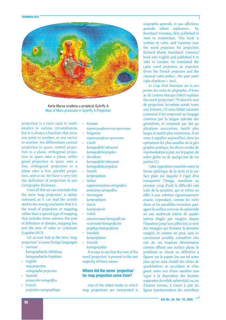
Karta Marsa izrađena u projekci j i Györffy AMap of Mars produced in Györffy A Projection
TERMINOLOGIJA
KiG Br. 34, Vol. 1 9, 202097
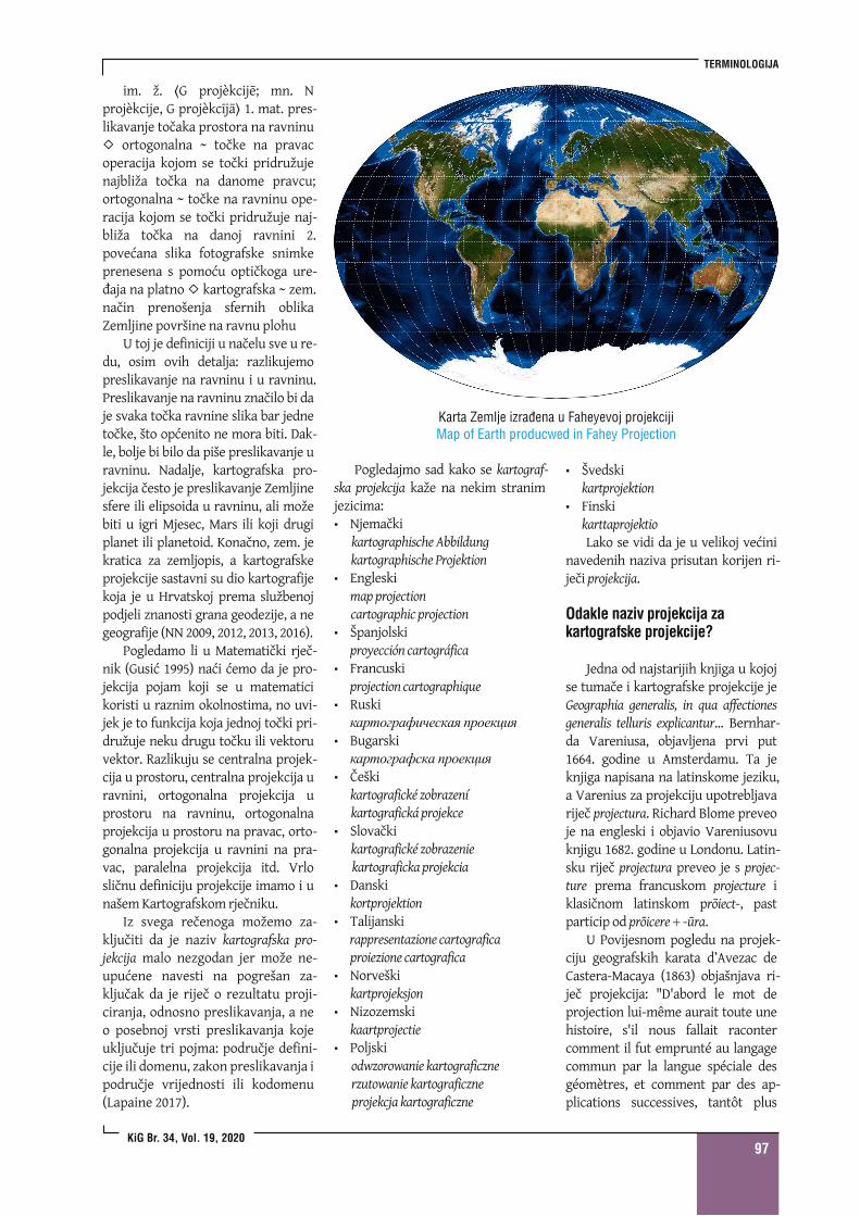
Karta Zemlje izrađena u Faheyevoj projekci j iMap of Earth producwed in Fahey Projection
Pogledajmo sad kako se kartograf-ska projekcija kaže na nekim stranimjezicima:
Njemačkikartographische Abbildungkartographische ProjektionEngleskimap projectioncartographic projectionŠpanjolskiproyección cartográficaFrancuskiprojection cartographiqueRuski
Bugarski
Češkikartografickézobrazeníkartografická projekceSlovačkikartografickézobrazeniekartograficka projekciaDanskikortprojektionTalijanskirappresentazione cartograficaproiezione cartograficaNorveškikartprojeksjonNizozemskikaartprojectiePoljskiodwzorowanie kartograficznerzutowanie kartograficzneprojekcja kartograficzne
ŠvedskikartprojektionFinskikarttaprojektioLako se vidi da je u velikoj većini
navedenih naziva prisutan korijen ri-ječi projekcija.
Odakle naziv projekcija zakartografske projekcije?
Jedna od najstarijih knjiga u kojojse tumače i kartografske projekcije jeGeographia generalis, in qua affectionesgeneralis telluris explicantur... Bernhar-da Vareniusa, objavljena prvi put1664. godine u Amsterdamu. Ta jeknjiga napisana na latinskome jeziku,a Varenius za projekciju upotrebljavariječ projectura. Richard Blome preveoje na engleski i objavio Vareniusovuknjigu 1682. godine u Londonu. Latin-sku riječ projectura preveo je s projec-ture prema francuskom projecture iklasičnom latinskom prōiect-, pastparticip od prōicere -ūra.
U Povijesnom pogledu na projek-ciju geografskih karata d’Avezac deCastera-Macaya (1863) objašnjava ri-ječ projekcija: "D'abord le mot deprojection lui-même aurait toute unehistoire, s'il nous fallait racontercomment il fut emprunté au langagecommun par la langue spéciale desgéomètres, et comment par des ap-plications successives, tantôt plus
im. ž. G projèkcijē; mn. Nprojèkcije, G projèkcījā 1. mat. pres-likavanje točaka prostora na ravninu
ortogonalna ~ točke na pravacoperacija kojom se točki pridružujenajbliža točka na danome pravcu;ortogonalna ~ točke na ravninu ope-racija kojom se točki pridružuje naj-bliža točka na danoj ravnini 2.povećana slika fotografske snimkeprenesena s pomoću optičkoga ure-đaja na platno kartografska ~ zem.način prenošenja sfernih oblikaZemljine površine na ravnu plohu
U toj je definiciji u načelu sve u re-du, osim ovih detalja: razlikujemopreslikavanje na ravninu i u ravninu.Preslikavanje na ravninu značilo bi daje svaka točka ravnine slika bar jednetočke, što općenito ne mora biti. Dak-le, bolje bi bilo da piše preslikavanje uravninu. Nadalje, kartografska pro-jekcija često je preslikavanje Zemljinesfere ili elipsoida u ravninu, ali možebiti u igri Mjesec, Mars ili koji drugiplanet ili planetoid. Konačno, zem. jekratica za zemljopis, a kartografskeprojekcije sastavni su dio kartografijekoja je u Hrvatskoj prema službenojpodjeli znanosti grana geodezije, a negeografije (NN 2009, 2012, 2013, 2016).
Pogledamo li u Matematički rječ-nik (Gusić 1995) naći ćemo da je pro-jekcija pojam koji se u matematicikoristi u raznim okolnostima, no uvi-jek je to funkcija koja jednoj točki pri-družuje neku drugu točku ili vektoruvektor. Razlikuju se centralna projek-cija u prostoru, centralna projekcija uravnini, ortogonalna projekcija uprostoru na ravninu, ortogonalnaprojekcija u prostoru na pravac, orto-gonalna projekcija u ravnini na pra-vac, paralelna projekcija itd. Vrlosličnu definiciju projekcije imamo i unašemKartografskom rječniku.
Iz svega rečenoga možemo za-ključiti da je naziv kartografska pro-jekcija malo nezgodan jer može ne-upućene navesti na pogrešan za-ključak da je riječ o rezultatu proji-ciranja, odnosno preslikavanja, a neo posebnoj vrsti preslikavanja kojeuključuje tri pojma: područje defini-cije ili domenu, zakon preslikavanja ipodručje vrijednosti ili kodomenu(Lapaine 2017).
TERMINOLOGY
KiG No. 34, Vol. 1 9, 202098
et des parallèles terrestres, en unréseau (2) qui formera le canevas (3)de la carte.
Or, nous savons tous que pour ef-fectuer ce tracé, l'on peut recourir àtrois procédés divers de représenta-tion: les vues perspectives, les déve-loppements de surfaces osculatrices,et les systèmes conventionnels. Nousen savons même tous bien davantage,car dans chacune de ces trois séries deproblèmes indéterminés nous con-naissons une quantité de solutionsvariées, quelques-unes parvenues àune sorte de vulgarité, d'autres aucontraire restées en dehors de l'usagecommun, toutes pourvues de dénom-inations plus ou moins exactes, des-tinées à caractériser chacune d'elles,quelquefois par son aspect matériel,mais plus régulièrement par ses pro-priétés spéciales, ou bien par le sou-venir de son inventeur (ce qui n'estque justice), ou par celui du savant in-génieux qui en aura calculé et traduiten formules les lois mathématiques(ce qui n'est peut-être pas d'une aussicomplète équité), ou encore par celuid'un simple vulgarisateur se substitu-ant à l'auteur primitif(ce qui n'est pluséquitable du tout).
Rien qu'à ces quelques mots, àmesure que je parle, je vois affluer survos lèvres tout un catalogue de dé-nominations et de noms propres, où
sepressent, au premier rang, les pro-jections stéréographique, centrale,orthographique, globulaire, plate, ré-duite, conique, homalographique, etles noms de Ptolémée, deMercator, deFlamsteed, de La Hire, de Cassini, deMurdoch, de Lambert, d'Herschel., etceux de Wright, d'Euler, de Lagrange,de Delambre, de Gauss et cent autresencore.
Oui, tous nous savonscela, etcest énorme! énorme. non sansdoute le simple inventaire de latriple catégorie de projections dé-crites ou formulées par les adeptes,mais bien le bagage scientifique de-meuré sousentendu, et qui serésume en ces projections.
Or quelle est, historiquement, lapart des temps et des hommes, ouplutôt la part de chaque époque ou dechaque inventeur, dans cet ensemblede notions et de doctrines perfec-tionnées qu'il nous est permis degrouper aujourd'hui autour du motprojection? Nous avons ici, commeen. toute histoire, à percer l'obscuritédes siècles pour y découvrir les plusanciens vestiges des essais tentés parles premiers pionniers qui ont ouvertla voie.
(1) Dans la rigueur onomastique,que l'usage n'a pas respertée, le motde projection devait être réservé auxreprésentations directement obte-nues d'après les lois de la perspective.Il a pu être étendu avec quelque ap-parence de raison aux développe-ments qui supposaient l'existenced'une projection directe antérieuresur la surface développable; maistoute distinction a bientôt été perduede vue, et le nom de projection s'ap-plique vulgairement aujourd'hui àtout canevas de carte géographique.Cependant, si l'on voulait tenter derétablir quelque exactitude dans lanomenclature relative à cet objet,c'est le mot de construction qu'il fau-drait adopter comme appellation gé-nérale, comprenant, en trois catégo-ries distinctes, les projections assu-jetties aux lois de la perspective, lesdéveloppements subordonnés auxconditions de correlation de la sphèreavec les surfaces développables, et lessystèmes de représentation fondés
sur des combinaisons purementconventionnelles.
(2) L'usage a plus particulièrementconsacré le nom de réseau à l'as-semblage des triangles déterminés surle terrain par les grandes opérationsgéodésiques.
(3) Le mot de châssis est souventemployé aussi comme synonyme decanevas."
Translated into English, this reads:"First ofall, the word projection itselfwould have a whole story ofits own ifwe were to explain how it was bor-rowed from general language to theprofessional language of surveyors,and that by successive applications,sometimes wider and sometimesmore limited, is used today in mostcommon operations of practical geo-graphy, and denotes the differentways ofdepicting our globe or some ofits parts, directly on paper (1).
The sharp contrast between thespherical shape of the Earth and theflat surface to which the image is to betransferred, at first glance, reveals theradical difficulty ofthe issue, which infact rejects a strictly exact solution.However, while the Earth’s meridiansand parallels divide the convex sur-face of spheroids into an infinite mul-titude of quadrilaterals proceeding inrows from the Equator to the poles(where the triangles form the lastrow), and as may be, without any no-ticeable defect, considering that eachof these elementary trapezoids offersa flat surface, the problem is ulti-mately solved by presenting on paper(or another selected flat surface), aseries of consecutive quadrilaterals ina manner analogous to the arrange-ment on a spheroidal body; or, in otherwords, drawing lines in a plane show-ing the network of terrestrial meridi-ans and the parallels (2), that will formthe foundation (3) ofthe map.
However, we all know that threedifferent displaymethods can be usedto produce such a drawing: perspect-ive views, the development of oscil-lating surfaces, and conventionalsystems. We all know much more infact, because in each of these threeseries of indeterminate problems werecognise many different solutions,
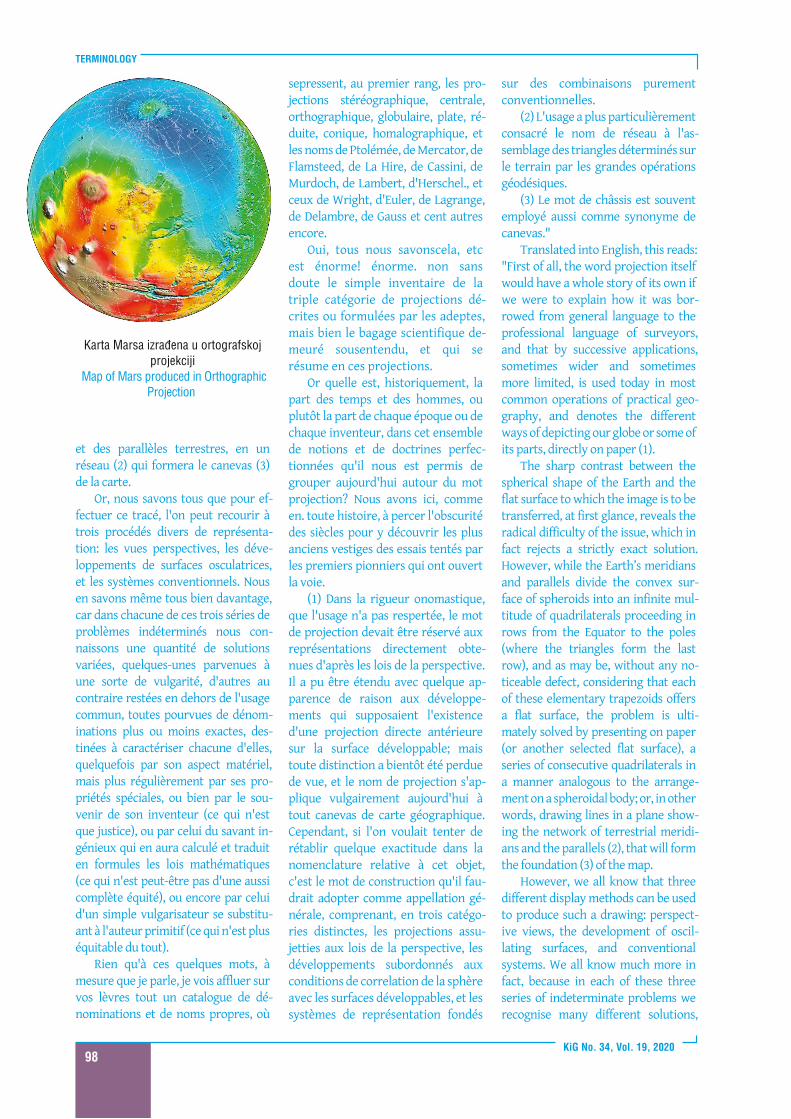
Karta Marsa izrađena u ortografskojprojekci j i
Map of Mars produced in OrthographicProjection
TERMINOLOGIJA
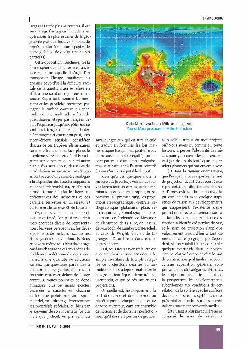
KiG Br. 34, Vol. 1 9, 202099
Karta Marsa izrađena u Mil lerovoj projekci j iMap of Mars produced in Mil ler Projection
larges et tantôt plus restreintes, il estvenu à signifier aujourd'hui, dans lesopérations les plus usuelles de la géo-graphie pratique, les divers modes dereprésentation à plat, sur le papier, denotre globe ou de quelqu'une de sesparties (1).
Cette opposition tranchée entre laforme sphérique de la terre et la sur-face plate sur laquelle il s'agit d'entransporter l'image, manifeste aupremier coup d'oeil la difficulté radi-cale de la question, qui se refuse eneffet à une solution rigoureusementexacte. Cependant, comme les méri-diens et les parallèles terrestres par-tagent la surface convexe du sphé-roïde en une multitude infinie dequadrilatères étagés par rangées de-puis l'équateur jusqu'aux pôles (où cesont des triangles qui forment la der-nière rangée), et comme on peut, sansinconvénient sensible, considérerchacun de ces trapèzes élémentairescomme offrant une surface plane, leproblème se résout en définitive à fi-gurer sur le papier (ou sur tel autreplan qu'on aura choisi) des séries dequadrilatères se succédant et s'étage-ant entre eux d'une manière analogueà la disposition des facettes supposéesdu solide sphéroïdal; ou, en d'autrestermes, à tracer à plat les lignes re-présentatives des méridiens et desparallèles terrestres, en un réseau (2)qui formera le canevas (3) de la carte.
Or, nous savons tous que pour ef-fectuer ce tracé, l'on peut recourir àtrois procédés divers de représenta-tion : les vues perspectives, les déve-loppements de surfaces osculatrices,et les systèmes conventionnels. Nousen savons même tous bien davantage,car dans chacune de ces trois séries deproblèmes indéterminés nous con-naissons une quantité de solutionsvariées, quelques-unes parvenues àune sorte de vulgarité, d'autres aucontraire restées en dehors de l'usagecommun, toutes pourvues de déno-minations plus ou moins exactes,destinées à caractériser chacuned'elles, quelquefois par son aspectmatériel, mais plus régulièrement parses propriétés spéciales, ou bien parle souvenir de son inventeur (ce quin'est que justice), ou par celui du
savant ingénieux qui en aura calculéet traduit en formules les lois mat-hématiques (ce qui n'est peut-être pasd'une aussi complète équité), ou en-core par celui d'un simple vulgarisa-teur se substituant à l'auteur primitif(ce qui n'est plus équitable du tout).
Rien qu'à ces quelques mots, àmesure que je parle, je vois affluer survos lèvres tout un catalogue de déno-minations et de noms propres, où se-pressent, au premier rang, les proje-ctions stéréographique, centrale, or-thographique, globulaire, plate, ré-duite, conique, homalographique, etles noms de Ptolémée, de Mercator,de Flamsteed, de La Hire, de Cassini,de Murdoch, de Lambert, d'Herschel.,et ceux de Wright, d'Euler, de La-grange, de Delambre, de Gauss et centautres encore.
Oui, tous nous savonscela, etc esténorme! énorme. non sans doute lesimple inventaire de la triple catégo-rie de projections décrites ou for-mulées par les adeptes, mais bien lebagage scientifique demeuré so-usentendu, et qui se résume en cesprojections.
Or quelle est, historiquement, lapart des temps et des hommes, ouplutôt la part de chaque époque ou dechaque inventeur, dans cet ensemblede notions et de doctrines perfection-nées qu'il nous est permis de grouper
aujourd'hui autour du mot projecti-on? Nous avons ici, comme en. toutehistoire, à percer l'obscurité des siè-cles pour y découvrir les plus anciensvestiges des essais tentés par les pre-miers pionniers qui ont ouvert la voie.
(1) Dans la rigueur onomastique,que l'usage n'a pas respertée, le motde projection devait être réservé auxreprésentations directement obtenu-es d'après les lois de la perspective. Il apu être étendu avec quelque appa-rence de raison aux développementsqui supposaient l'existence d'uneprojection directe antérieure sur lasurface développable; mais toute dis-tinction a bientôt été perdue de vue,et le nom de projection s'appliquevulgairement aujourd'hui à tout ca-nevas de carte géographique. Cepen-dant, si l'on voulait tenter de rétablirquelque exactitude dans la nomen-clature relative à cet objet, c'est le motde construction qu'il faudrait adoptercomme appellation générale, com-prenant, en trois catégories distinctes,les projections assujetties aux lois dela perspective, les développementssubordonnés aux conditions de cor-relation de la sphère avec les surfacesdéveloppables, et les systèmes de re-présentation fondés sur des combi-naisons purement conventionnelles.
(2) L'usage a plus particulièrementconsacré le nom de réseau à
TERMINOLOGY
KiG No. 34, Vol. 1 9, 20201 00
some ofwhich have reached a kind oftriviality, while others, on the con-trary, have remained out of commonuse; all have more or less exact names,whose purpose is to characterize eachof them, sometimes by a material as-pect, but more often by the particularproperties or in memory of the in-ventor (which is fair), or ofthe geniusscientist who calculates and trans-lates mathematical laws into formulas(which may not be entirely fair), tothat of the simple populariser whoreplaces the original author (which isno longer fair at all).
With these few words, as I speak, Isee a whole catalogue of adjectivesand proper names flowing to yourlips, in which stereographic, central,orthographic, globular, flat, reduced,conic, and homolographic projectionsappear first, along with Ptolemy,Mercator, Flamsteed, La Hire, Cassini,Murdoch, Lambert, d'Herschel, andWright, Euler, Lagrange, Delambre,Gauss, etc., and a hundred others.
Yes, we all know that “etc.” ishuge! Huge. Undoubtedly, it is not asimple list of the three categories ofprojections described or formulatedby followers, but the scientific bag-gage is still implied, and summarizedin those projections.
However, what is historically apart oftime and people, that is, a partof every epoch or every inventor, inthe series of perfected notions anddoctrines that we may today grouparound theword ‘projection’? Here, as
in all of history, we need to breakthrough the ambiguity of the centur-ies to reveal the oldest remnants ofthe attempts by which the first pion-eers paved the way.
(1) In onomastic rigor, the use ofwhich has not been respected, theword ‘projection’ should be reservedfor representations obtained directlyaccording to the laws of perspective.Perhaps the word ‘projection’ exten-ded for some reason to developmentswhich presupposed the existence ofsuch a direct projection onto a surfacethat could be developed; but any dif-ference was soon lost sight of, and theword ‘projection’ is today commonlyapplied to any geographical map.However, if we want to try to re-es-tablish some accuracy in the nomen-clature related to this subject, theword ‘construction’ should be accep-ted as a general term, containing inthree different categories projectionssubject to the laws of perspective, de-velopments subject to the correlationof spheres with surfaces that can bedeveloped and displayed, and displaysystems based on purely conventionalcombinations.
(2) The use of the word ‘network’is especially reserved for the as-sembly oftriangles established in thefield bymajor geodetic operations.
(3) The word ‘frame’ is also of-ten used as a synonym for a mapfield.”
The second part ofselected worksby V. V. Kavrayskiy (1958) consists of
three books in which he deals with thetheory ofmap projections. In the first,General Theory ofMap projections, he ex-plains the word ‘projection’ in severalplaces. So on pages 14-15 he writes, "
Translated into English, this reads:"In mathematics, mapping one sur-face onto another means establishingcorrespondence between the pointsof the two surfaces. In our field of in-terest, any mathematically definedmethod ofmapping all or part of thesurface of the Earth's ellipsoid or
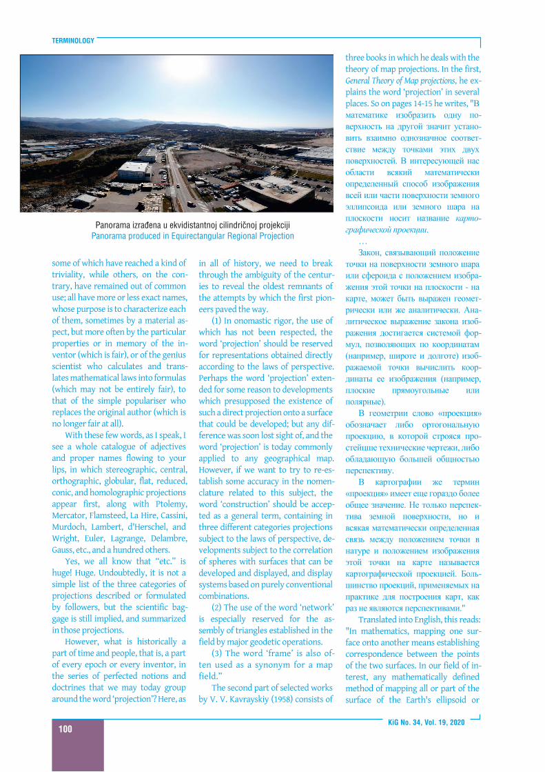
Panorama izrađena u ekvidistantnoj ci l indričnoj projekci j iPanorama produced in Equirectangular Regional Projection
TERMINOLOGIJA
KiG Br. 34, Vol. 1 9, 20201 01
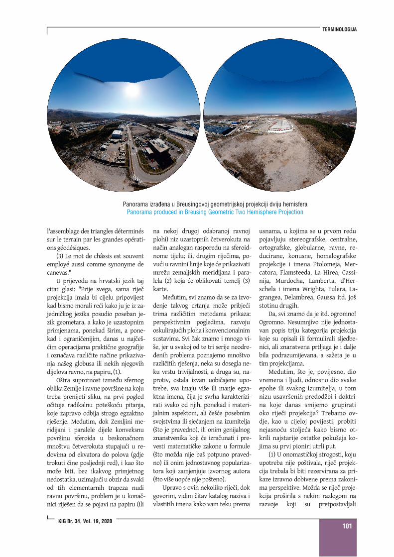
Panorama izrađena u Breusingovoj geometri jskoj projekci j i dvi ju hemisferaPanorama produced in Breusing Geometric Two Hemisphere Projection
l'assemblage des triangles déterminéssur le terrain par les grandes opérati-ons géodésiques.
(3) Le mot de châssis est souventemployé aussi comme synonyme decanevas."
U prijevodu na hrvatski jezik tajcitat glasi: "Prije svega, sama riječprojekcija imala bi cijelu pripovijestkad bismo morali reći kako ju je iz za-jedničkog jezika posudio poseban je-zik geometara, a kako je uzastopnimprimjenama, ponekad širim, a pone-kad i ograničenijim, danas u najčeš-ćim operacijama praktične geografijei označava različite načine prikaziva-nja našeg globusa ili nekih njegovihdijelova ravno, na papiru, (1).
Oštra suprotnost između sfernogoblika Zemlje i ravne površine na kojutreba prenijeti sliku, na prvi pogledočituje radikalnu poteškoću pitanja,koje zapravo odbija strogo egzaktnorješenje. Međutim, dok Zemljini me-ridijani i paralele dijele konveksnupovršinu sferoida u beskonačnommnoštvu četverokuta stupajući u re-dovima od ekvatora do polova (gdjetrokuti čine posljednji red), i kao štomože biti, bez ikakvog primjetnognedostatka, uzimajući u obzir da svakiod tih elementarnih trapeza nudiravnu površinu, problem je u konač-nici riješen da se pojavi na papiru (ili
na nekoj drugoj odabranoj ravnojplohi) niz uzastopnih četverokuta nanačin analogan rasporedu na sferoid-nome tijelu; ili, drugim riječima, po-vući u ravnini linije koje će prikazivatimrežu zemaljskih meridijana i para-lela (2) koja će oblikovati temelj (3)karte.
Međutim, svi znamo da se za izvo-đenje takvog crtanja može pribjećitrima različitim metodama prikaza:perspektivnim pogledima, razvojuoskulirajućih ploha i konvencionalnimsustavima. Svi čak znamo i mnogo vi-še, jer u svakoj od te tri serije neodre-đenih problema poznajemo mnoštvorazličitih rješenja, neka su dosegla ne-ku vrstu trivijalnosti, a druga su, na-protiv, ostala izvan uobičajene upo-trebe, sva imaju više ili manje egza-ktna imena, čija je svrha karakterizi-rati svako od njih, ponekad i materi-jalnim aspektom, ali češće posebnimsvojstvima ili sjećanjem na izumitelja(što je pravedno), ili onim genijalnogznanstvenika koji će izračunati i pre-vesti matematičke zakone u formule(što možda nije baš potpuno praved-no) ili onim jednostavnog populariza-tora koji zamjenjuje izvornog autora(što više uopće nije pošteno).
Upravo s ovih nekoliko riječi, dokgovorim, vidim čitav katalog naziva ivlastitih imena kako vam teku prema
usnama, u kojima se u prvom redupojavljuju stereografske, centralne,ortografske, globularne, ravne, re-ducirane, konusne, homalografskeprojekcije i imena Ptolomeja, Mer-catora, Flamsteeda, La Hirea, Cassi-nija, Murdocha, Lamberta, d'Her-schela i imena Wrighta, Eulera, La-grangea, Delambrea, Gaussa itd. jošstotinu drugih.
Da, svi znamo da je itd. ogromno!Ogromno. Nesumnjivo nije jednosta-van popis triju kategorija projekcijakoje su opisali ili formulirali sljedbe-nici, ali znanstvena prtljaga je i daljebila podrazumijevana, a sažeta je utim projekcijama.
Međutim, što je, povijesno, diovremena i ljudi, odnosno dio svakeepohe ili svakog izumitelja, u tomnizu usavršenih predodžbi i doktri-na koje danas smijemo grupiratioko riječi projekcija? Trebamo ov-dje, kao u cijeloj povijesti, probitinejasnoću stoljeća kako bismo ot-krili najstarije ostatke pokušaja ko-jima su prvi pioniri utrli put.
(1) U onomastičkoj strogosti, kojuupotreba nije poštivala, riječ projek-cija trebala bi biti rezervirana za pri-kaze izravno dobivene prema zakoni-ma perspektive. Možda se riječ proje-kcija proširila s nekim razlogom narazvoje koji su pretpostavljali
TERMINOLOGY
KiG No. 34, Vol. 1 9, 20201 02
Earth's sphere onto a plane is called amap projection.
…The law that connects the posi-
tion of a point on the surface of theEarth's sphere or spheroid with theposition of the image of that pointon the plane - on the map - can beexpressed geometrically or analyt-ically. The analytical expression ofthe mapping law is achieved by asystem offormulas that allow the use
of the coordinates (for example, thelatitude and longitude) ofthe mappedpoint to calculate the coordinates ofits image (for example, planar rect-angular or polar).
In geometry, the word ‘projec-tion’ means either an orthogonalprojection, in which the simplesttechnical drawings are made, or aperspective that is more general.
In cartography, the term ‘projec-tion’ has a much more general
meaning. Map projection is not onlythe perspective of the Earth's sur-face, but also any mathematicallydetermined relationship betweenthe position ofa point in nature andthe position of the image of thatpoint on the map. Most projectionsused to make maps in practice arenot perspectives."
Conclusion
Map projections have been usedfor more than two millennia. Theyare mappings of curved surfaces, es-pecially ellipsoids or spheres, trans-ferred onto a plane, as stated in theCartographic Dictionary (Frančula etal. 2020). The term ‘map projection’entered cartography from mathem-atics, but it does not refer only toprojections known in mathematics,such as perspective or central pro-jection and axonometry, or parallelprojection. The noun ‘projection’ incartography should be understoodconditionally, as it refers to anymapping of a curved surface, mostcommonly a sphere or ellipsoid,onto a plane.
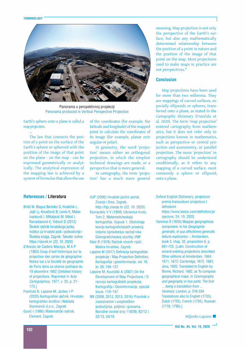
Panorama u perspektivnoj projekci j iPanorama produced in Vertical Perspective Projection
References / Literatura
Birtić M, Blagus Bartolec G, Hudeček L,Jojić Lj, Kovačević B, Lewis K, MatasIvanković I , Mihaljević M, Miloš I ,Ramadanović E, Vidović D (201 2)Školski rječnik hrvatskoga jezika,Institut za hrvatski jezik i jezikoslovlje iŠkolska knjiga, Zagreb. Također onlinehttps://rjecnik.hr (22. 1 0. 2020)
d’Avezac de Castera-Macaya, M A P(1 863) Coup d’oei l h istorique sur laprojection des cartes de géographie:Notice lue a la Société de géographiede Paris dans sa séance publ ique du1 9 décembre 1 862 [Detai led historyof projections. Reprinted in ActaCartographica, 1 977, v. 25, p. 21 -1 73. ]
Frančula N, Lapaine M, Jazbec I -P(2020) Kartografski rječnik, Hrvatskokartografsko društvo i NakladaDominović d.o.o. , Zagreb
Gusić I (1 995) Matematički rječnik,Element, Zagreb
HJP (2006) Hrvatski jezični portal ,Znanje i Srce, Zagreb,http://hjp.znanje.hr (22. 1 0. 2020)
Kavrayskiy V V (1 958) I zbrannye trudy,Tom 2, Matematicheskajakartografi ja, Vypusk 1 , Obshchajateori ja kartograficheskih proekci j ,I zdanie Upravleniya nachal ' n ikaGidrograficheskoj sluzhby VMF
Klaić B (1 978) Rječnik stranih ri ječi ,Matica hrvatska, Zagreb
Lapaine M (201 7) Definici ja kartografskeprojekcije / Map Projection Definition,Kartografi ja i geoinformacije, vol. 1 6,br. 28, 1 36–1 37
Lapaine M, Kuveždić A (2007) On theDevelopment of Map Projections / Orazvoju kartografskih projekci ja,Kartografi ja i Geoinformaci je, specialissue, 1 1 0–1 47
NN (2009, 201 2, 201 3, 201 6) Pravi ln ik oznanstvenim i umjetničkimpodručj ima, pol j ima i granama,Narodne novine broj 1 1 8/09, 82/1 2 i32/1 3, 34/1 6
Oxford Engl ish Dictionary, projectureprema francuskom projecture Ilatinskomhttps://www.lexico.com/definition/projecture, 24. 1 0. 2020.
Varenius B (1 650) Mappas geographicascomponere, in his Geographiageneralis, in qua affectiones generalistelluris explicantur...: Amsterdam,book 3, chap. 32, proposition 6, p.691 -725. [Latin. Construction ofseveral existing projections described.Other editions at Amsterdam, 1 664,1 671 , 1 672; Cambridge, 1 672, 1 681 ;Jena, 1 693. Translated to English byBlome, Richard, 1 682, as To composegeographical maps, in Cosmographyandgeographyin two parts: The first... being a translation from ...Varenius: London, p. 31 6-334.Translations also to English (1 733),Dutch (1 755), French (1 755), Russian(1 71 8, 1 790).]
Miljenko Lapaine�
TERMINOLOGIJA
KiG Br. 34, Vol. 1 9, 20201 03
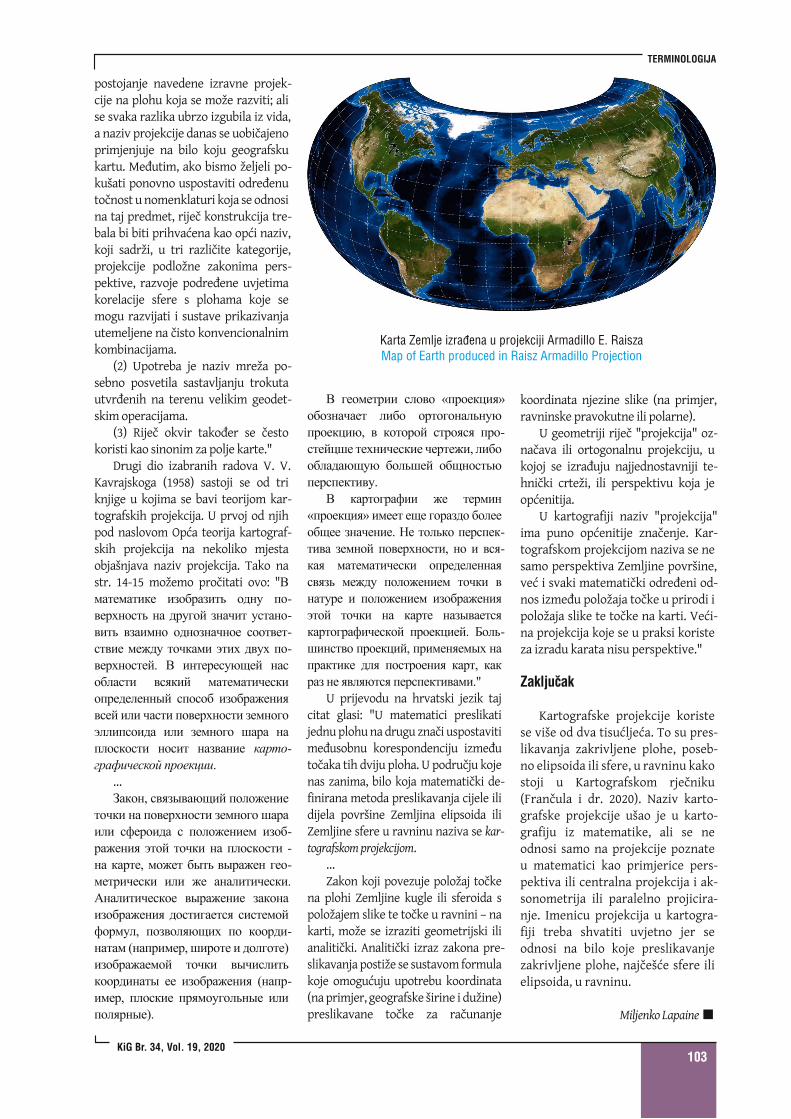
Karta Zemlje izrađena u projekci j i Armadi l lo E. RaiszaMap of Earth produced in Raisz Armadi l lo Projection
postojanje navedene izravne projek-cije na plohu koja se može razviti; alise svaka razlika ubrzo izgubila iz vida,a naziv projekcije danas se uobičajenoprimjenjuje na bilo koju geografskukartu. Međutim, ako bismo željeli po-kušati ponovno uspostaviti određenutočnost u nomenklaturi koja se odnosina taj predmet, riječ konstrukcija tre-bala bi biti prihvaćena kao opći naziv,koji sadrži, u tri različite kategorije,projekcije podložne zakonima pers-pektive, razvoje podređene uvjetimakorelacije sfere s plohama koje semogu razvijati i sustave prikazivanjautemeljene na čisto konvencionalnimkombinacijama.
(2) Upotreba je naziv mreža po-sebno posvetila sastavljanju trokutautvrđenih na terenu velikim geodet-skim operacijama.
(3) Riječ okvir također se čestokoristi kao sinonim za polje karte."
Drugi dio izabranih radova V. V.Kavrajskoga (1958) sastoji se od triknjige u kojima se bavi teorijom kar-tografskih projekcija. U prvoj od njihpod naslovom Opća teorija kartograf-skih projekcija na nekoliko mjestaobjašnjava naziv projekcija. Tako nastr. 14-15 možemo pročitati ovo: "
…
U prijevodu na hrvatski jezik tajcitat glasi: "U matematici preslikatijednu plohu na drugu znači uspostavitimeđusobnu korespondenciju izmeđutočaka tih dviju ploha. U području kojenas zanima, bilo koja matematički de-finirana metoda preslikavanja cijele ilidijela površine Zemljina elipsoida iliZemljine sfere u ravninu naziva se kar-tografskom projekcijom.
…Zakon koji povezuje položaj točke
na plohi Zemljine kugle ili sferoida spoložajem slike te točke u ravnini – nakarti, može se izraziti geometrijski ilianalitički. Analitički izraz zakona pre-slikavanja postiže se sustavom formulakoje omogućuju upotrebu koordinata(na primjer, geografske širine i dužine)preslikavane točke za računanje
koordinata njezine slike (na primjer,ravninske pravokutne ili polarne).
U geometriji riječ "projekcija" oz-načava ili ortogonalnu projekciju, ukojoj se izrađuju najjednostavniji te-hnički crteži, ili perspektivu koja jeopćenitija.
U kartografiji naziv "projekcija"ima puno općenitije značenje. Kar-tografskom projekcijom naziva se nesamo perspektiva Zemljine površine,već i svaki matematički određeni od-nos između položaja točke u prirodi ipoložaja slike te točke na karti. Veći-na projekcija koje se u praksi koristeza izradu karata nisu perspektive."
Zaključak
Kartografske projekcije koristese više od dva tisućljeća. To su pres-likavanja zakrivljene plohe, poseb-no elipsoida ili sfere, u ravninu kakostoji u Kartografskom rječniku(Frančula i dr. 2020). Naziv karto-grafske projekcije ušao je u karto-grafiju iz matematike, ali se neodnosi samo na projekcije poznateu matematici kao primjerice pers-pektiva ili centralna projekcija i ak-sonometrija ili paralelno projicira-nje. Imenicu projekcija u kartogra-fiji treba shvatiti uvjetno jer seodnosi na bilo koje preslikavanjezakrivljene plohe, najčešće sfere ilielipsoida, u ravninu.
Miljenko Lapaine�