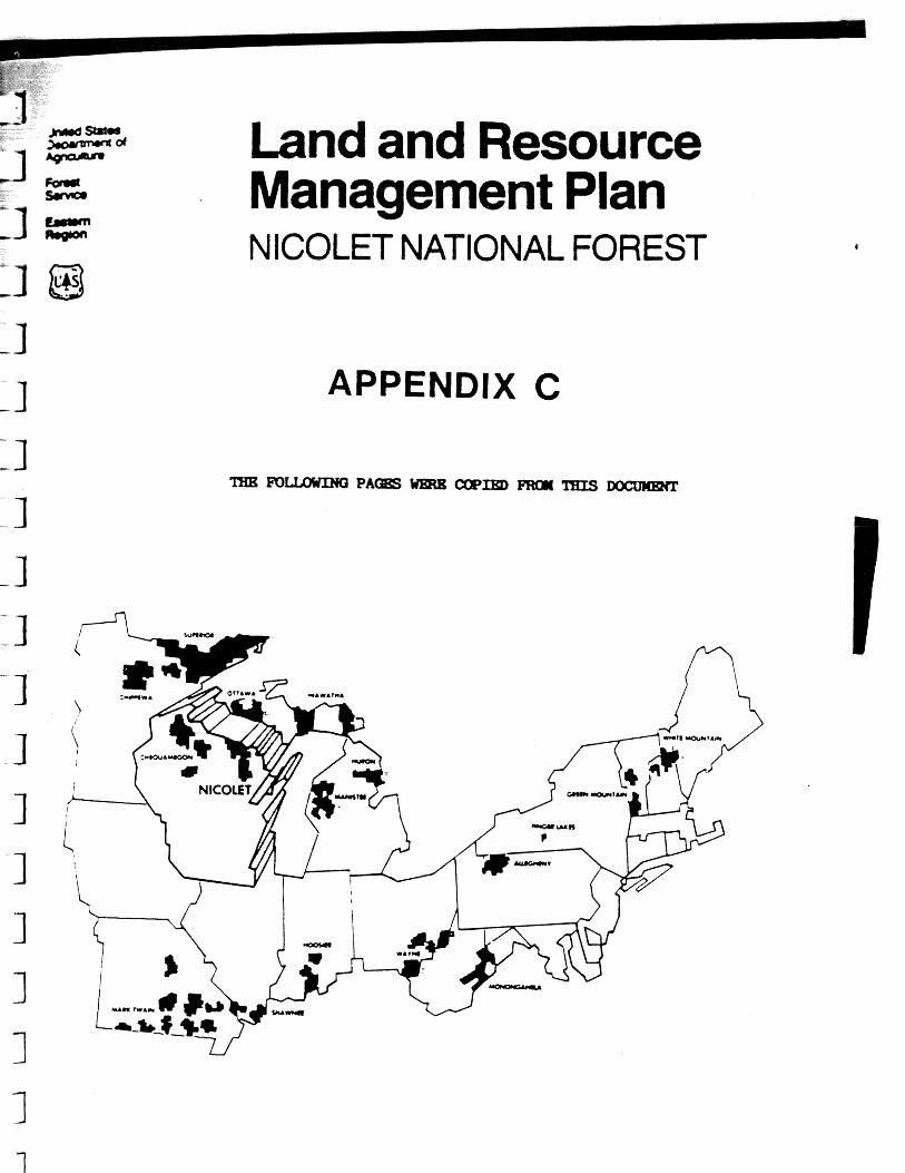
36 - area. · grandma lake wetlands research natural area (rna) lies entirely on lands administered...
TRANSCRIPT

DECISION NOTICE/DSIGNATION ORDER
Decision Notice Finding of No Signif icant Impact
Designation Order
By v i r tue of the authority vested i n me by the Secretary of Agriculture under regulations 7 CFR 2.42, 36 CFR 251.23, and 36 CF'R Par t 219, I hereby es tab l i sh the Grandma - Lake Wetlands Research Natural Area. It s h a l l be comprised of - lands described i n the sect ion of the Establishment Record e n t i t l e d tlLocation".
The Regional Forester has recommended the establishment of t h i s Research Natural Area i n the Record of Decision fo r the Nicolet National Forest Land and Resource Management Plan. That recommendation w a s the r e s u l t of an analysis of the fac tors l i s t e d i n 36 CFR 219.25 and Forest Service Manual 4063.41. Results of the Regional Forester ' s analysis a r e documented i n the Nicolet National Forest Land and Resoyrce Management Plan and Final Environmental Impact Statement which a re available t o the public.
The Grandma Lake Wetlands Research Natural Area w i l l be managed i n compliance with a l l relevant laws, regulations, and manual direct ion regarding Research Natural Areas. It w i l l be administered i n accordance with t h e management direction/prescription ident i f ied i n the Establishment Record.
The Nicolet National Forest Land and Resource Management Plan is hereby amended - - - t o be consistent with the management direct ion ident i f ied i n the Establishment
Record and t h i s Decision Notice/Designation Order. This is a non-significant amendment of the Nicolet National Forest Land and Resource Management Plan (36 CER 219.10(f)) .
The Forest Supervisor of the Nicolet National Forest s h a l l no t i fy the public of t h i s amendment and w i l l mail a copy of the Decision Notice/Designation Order and amended d i rec t ion t o a l l persons on the Nicolet National Forest Land and Resource Management Plan mailing list.
Based on the Environmental Analysis, I f ind tha t the designation of the Grandma Lake Wetlands Research Natural Area is not a major federal action s igni f icant ly affect ing the qua l i ty of the human environment. (40 CFR 1508.27.)
This decision is subject to appeal pursuant to 36 CFR 211 Part 21'7. A Notice of Appeal must be in writing and submitted to:
The Secretary of Agriculture 14th & Independence Ave. , S. W.
Washington. D.C. 20250
and simultaneously to the Deciding Officer:
Chief USDA, Forest Service
P.O. Box 96090 Washington, D . C . 20090-6090
The Notice of Appeal prepared pursuant to 36 CFR 217.9(b) must be submitted within 45 days from the date of legal notice of this decision. Review by the Secretary is wholly discretionary. If the Secretary has not decided within 15 days of receiving the Notice of Appeal to review the Chief's decision, appellants will be notified that the Chief's decision is the final administrative decision of the U.S. Department of Agriculture (36 CFR 217*17(d)

E S T A B L I S m N T RECORD FOR GRANDElft LAKE WETLANDS R E S E A R a NATURAL AREA WITHIN THE
NICOLET NATIONAL FOREST, FLORENCE COUNTY, WISCONSIN
UNITED STATES DEPARTMENT OF AGRICULTLiRE
FOREST SERVICE
U. S. GOVERNMENT P R I N T I N G O F F I C E : 1980 0 - 309-842 6200-7 (10/73)

i b i t 1: Location Map
i b i t 2: Proximity Map
Exhibit 3: Topographic Map
Exhibit 4: Cover Type Map
i b i t 5: Omershlp Map
Exhibit 6: Photographs

EXHIBIT 1
MAP SHOWING LOCATION OF
NICOLET NATIONAL FOREST
EN-IIBIT 1 - Location Map

EXHIBIT 4 COVER TYPE MAP
Art-
S . A . F . -- Type: Area :
No. 5 - Balsam F i r 16 a c r e s ( 6 h a . )
No. 13 - Black SprucelTamarack 140 a c r e s (57 ha. )
No. 16 - Aspen 60 a c r e s (24 ha. )
No. 25 - Sugar Maple/Yellow Birch/Beech 98 acres (40 h a . )
"0" - nonfores ted upland 2 acres ( 1 ha. )
"w" - nonfores ted wetland 135 a c r e s (54 ha. )
Open Water - Grandma Lake 44 a c r e s (18 ha. )
Total: 495 a c r e s (200 ha. )
EEIIBIT 4 - Cover Type Map

EXHIBIT 6 PHOTOGRAPHS
PHOTOGRAPHIC RECORD n
CONClSL OLSCRtPTtOH OF VlLW
and r e d p i n e i n b a c k g r o u n d .
EXHIBIT 6 - Pho tographs

PHOTO Grandma Lake Wetlands RNA - Bog mat on north s i d e o f lake. do by Scirpus hWsenianus and other sedges.
PHOTO

PHOTO 3: Grandma Lake Wetlands RNA - Looking across Grandma Make from south t o north. Major aquat ic macrophyte genera inc ludes Brasenia nuphar.
PHOTO e a s t 4
- - r
tirandma Lake Wetlands RNA - Bog mat of sphagnum & wire-leaved ake. Black spruce; small " is landtt with white & red pine i n back
sedge :ground.

PHOTO 5: Grandma Lake Wetlands RNA - Dragon's-mouth Orchid (Arethusa bulbosa) on bog mat qn south edge of Grandma Lake,
PHOTO 6: Grandma Lake Wetlands RNA - Recent clearcut near south end of lake.


SIGNATURE PAGE
for
RESEARCH NATURAL AREA ESTABLISHMENT RECORD
Grandma Lake Wetlands Research Natural Area
Nicolet National Forest
Florence County, Wisconsin
The undersigned certify that all applicable land management planning and environmental analysis requirements have been met, and that boundaries are clearly identified in accordance with FSM 4063.21, Mapping and Recordation and FSM 4063.41 5e (3) in arriving at this recommendation.
Recommended b
Recommended or, Nicolet National Forest
Recommended
Recommended
TITLE PACE
Establishment Record f o r Grandma Lake Wetlands Research Natural Area within the
Nicolet National Forest , Florence County, Wisconsin

Grandma Lake Wetlands Research Natural Area (RNA) lies e n t i r e l y on lands administered by the Nicolet National Forest i n Forest County, Wisconsin. A l o c a t i o n map (Exhibit I ) , proximity map (Exhibit 2 ) , topographic map (Exhibit
cover type map ( i b i t 4 ) , ownership map (Exhibit 5) and co lo r photographs i b i t 6 ) are i n c l d with t h i s repor t .
Natural f e a t u r e s of primary concern here are a p r i s t i n e , undeveloped bog lake and a su r romding open mat t h a t supports a f l o r a t h a t is both d ive rse and unusual. The balance of t h e wetland within the RNA boundary is a c o n i f e r swamp composed pr imar i ly of tamarack (Larix l a r i c i n a (Du Roi) K. Koch) and black spruce (Picea mariana ( M i l l ) B.S.P.). Northern white-cedar (Thuja occ iden ta l i s L . ) is a l s o present . [ l ] The con i fe r swamp vegetat ion represents Socie ty of American Fores ters (SAF) cover type No. 13 - Black Spruce/Tamarack and Kuchler (1966) type 85 - Conifer Bog.
Uplands wi th in the RNA boundary represent SAF types No. 5 - Balsam F i r , No. 16 Aspen, and No. 25 Sugar Maple/Beech/Yellow Birch. The inclus ion of t h e open bog lake , wetland complex, and upland systems makes t h i s a unique and valuable RNA.
The exceptional n a t u r a l q u a l i t i e s of t h i s a rea were i n i t i a l l y documented i n August 1981 by Wisconsin Department of Natural Resources (WDM) b i o l o g i s t s engaged i n an inventory of northeastern Wisconsin n a t u r a l areas . I n 1982 in tens ive r a r e p l a n t surveys by WDNR bo tan i s t s under con t rac t t o the Fores t Service revealed severa l s i g n i f i c a n t f inds i n the Grandma Lake a r e a (Judziewicz 1983). Most spectacular among these was the discovery of a l a r g e population of a boreal rush (Juncus s t y g i u s ) previously unknown i n Wisconsin. Fur ther d e t a i l s on the a r e a ' s p l a n t s may be found i n the sec t ion on f l o r a .
I n 1986 Grandma Lake Wetlands was proposed as a candidate RNA by the Fores t Service. During the summer of 1986 b i o l o g i s t s of WDNR's Natural Heri tage Program gathered add i t iona l d a t a on the a reas b i o t a and compiled e x i s t i n g information t o enable a thorough assessment of the site's n a t u r a l f e a t u r e s p r i o r t o prepara t ion o f t h e establishment record.
Grandma Lake Wetlands was included i n the list of candidate Research Natural Areas i n the Nicolet National Forest Final Environmental Impact Statement (FEIS). The FEIS (Appendix B) lists t h i s RNA as being 374 acres (151 ha) i n s i z e . The area designated by t h i s Establishment Record is 495 ac res (200 ha) . There a r e no known Federal o r S t a t e endangered o r threatened f l o r a o r fauna species i n t h i s RNA.
LAND MANAG- PLANNING
The Regional Guide f o r the Eastern Region emphasizes i n Management Goal 8 (Appendix A ) :
( a ) The preservat ion of unique ecosystems f o r s c i e n t i f i c purposes
[I] Author i t ies f o r common and s c i e n t i f i c names l i s t e d i n References.

( b ) Areas t o conduct research t o improve the benef i t s of f o r e s t s and rangeland
( c ) The protect ion of unique areas of nat ional s ignif icance
A l l candidate Research Natural Areas have been included i n Management Area 8.1 i n the Land and Resource Management Plan (Forest Plan) (Appendix C ) f o r the Nicolet National Forest. The Record of Decision (ROD) (Appendix D) f o r t h e Forest Plan makes a decision t o protect candidate Research Natural Areas u n t i l a de ta i l ed evaluation on t he s u i t a b i l i t y f o r designation can be completed.
The area surrootlding the Grandma Lake Wetlands WA has been designated Management Area 2.1 which emphasizes an unevenaged hardwood f o r e s t , w i ld l i f e species primarily associated with l a rge stands of unevenaged northern hardwoods and roaded na tura l motorized recreation.
The a rea lies with por t ions of record keeping compartments 69 and 76 on the Florence D i s t r i c t , Nicolet National Forest.
The object ives f o r es tab l i sh ing the Grandma Lake Wetlands Research Natural Area a r e compatible with the general object ives f o r the na tura l area system which a r e :
1, To preserve a wide spectrum of p r i s t i n e representative areas t h a t typ i fy important f o r e s t s i t ua t i ons t h a t have spec ia l o r unique cha rac t e r i s t i c s of s c i e n t i f i c i n t e r e s t and importance.
2. To preserve and maintain genetic d ivers i ty .
3. To pro tec t agains t ser ious environmental disruptions.
4. To serve as reference areas f o r the study of succession.
5. To provide on-s i t e and extension educational a c t i v i t i e s . d
6 . To serve as basel ine areas f o r measuring long-term ecological changes.
7. To serve a s control areas f o r manipulative research.
8. To monitor e f f e c t s of resource management techniques and prac t ices .
Research na tura l areas are f o r nomanipulative research, observation and study. They a l so may assist i n carrying out provisions of spec ia l a c t s , such as the Endangered Species Act and the monitoring provisions of the National Forest Management Act.
The spec i f i c management object ive f o r the Grandma Lake Wetlands RNA is s t a t ed i n the Management Prescr ipt ion Section.

JUSTIFICATION S T A m FOR ESTABLIS- OF 'I7-E AREA
This undisturbed wetland complex possesses a r i ch and unusual f l o r a t h a t includes the only known locat ion f o r boreal rush i n Wisconsin. The lake and adjacent bog mat a l so provide hab i ta t f o r several uncommon and possibly decl in ing animal species. For fu r ther discussion see the sec t ion on fauna.
The Society of American Foresters cover type number 13, Black Spruce - Tamarack is l i s t e d i n the Regional Guide as p r i o r i t y 1 f o r representa t ion i n the Lake S t a t e s Forests including the Nicolet National Forest. P r i o r i t y number 1 cover types are current ly no t represented i n the Region.
The common loon (Gavia immer) has been recommended f o r the Region Nine Regional Fores te r ' s Sensi t ive Species L i s t and is l i s t e d on the Wisconsin S t a t e Watch L i s t . The Wisconsin S t a t e Watch L i s t includes those species about which some problem of abundance o r d i s t r i bu t i on is suspected but not ye t proven. The common loon is present i n t h i s RNA,
The Black Tern (Chlidonias niger) is a l so l i s t e d on the Wisconsin S t a t e Watch L i s t . An ac t ive colony of Black Tern is present i n t h i s RNA.
Establishment of the Grandma Lake Wetlands RNA w i l l provide a complex of open bog lake , wetland, and upland of su f f i c i en t s i z e t o support a var ie ty of research. The RNA a l so contains an extensive list of species , several species of spec i a l i n t e r e s t and i n some cases genera represented by more than one spec ies , i . e . Drosera and Carex. This r ichness of both f l o r a and fauna and the d i s t i n c t i v e cha rac t e r i s t i c s of Grandma Lake make t h i s unique na tura l community a des i rab le addi t ion t o the.RNA system.
PRINCIPAL DISTINGUISHING FEATURES
Grandma Lake Wetlands candidate RNA contains an undeveloped, shallow, softwater seepage lake; an extensive open mat composed ch ie f ly of sphagnum moss, sedges, rushes and low ericaceous shrubs; a conifer swamp dominated by pole-size tamarack and black spruce; and upland f o r e s t of balsam f i r , aspen and maple types. The t r ans i t i on zone between open bog and conifer swamp is occupied by a muskeg of widely s ca t t e r ed , stunted swamp conifers within a matrix of typical bog vegetation.
The lake covers 44.4 acres (18 ha) and has a maximum depth of 9 f e e t (3 m ) (Surface Water Resources of Florence County, 1971). Winterkil l of f i s h probably occurs here due t o the shallow depth. The l i t t o r a l material is mostly muck. The water is l i g h t brown, neu t ra l i n react ion, and very s o f t (methyl purple a l k a l i n i t y only 8 ppm).
Surrounding the lake is a wide, open mat of mosses, sedges and low shrubs of the heath family (Ericaceae). This mat contains other f l o r a which a r e commonly found i n a wetland community and several uncommon species such a s the boreal rush and dragons mouth orchid (Arethusa bulbosa) are present. Much of the mat is dominated by p i tcher p lan t (Sarracenia pupurea) and bog clubmoss (Lycopodium inunda tm) , These a r e discussed i n the sect ion on f l o r a *

- i The conifer swamp i s bes t developed and most extensive on the north end of the
- area. It is qu i t e typ ica l i n s t ruc ture and composition and possesses no known unique cha rac t e r i s t i c s . However, i t shows l i t t l e evidence of recent
=a disturbance and ce r t a in ly enhances the overal l na tura l qua l i ty of the candidate RNA .
LOCATION
Grandma Lake Wetlands candidate M A is located on the Florence D i s t r i c t of the Nicolet National Forest i n Florence County, Wisconsin. Forest Supervisor 's headquarters are a t Rhinelander, Wisconsin.
Lati tude is 45' 49. 00" North, longitude 88' 36. 47" West.
1. Boundary
Being a t r a c t of land i n sect ion 28, 33 and 34 of Township 39 North, Range 15 East , Fourth Pr incipal Meridian, Florence County, S t a t e of Wisconsin.
Beginning a t the South quar ter sect ion of Section 34, thence,
North 89" 44- 45" East along the sect ion l i n e approximately 50 f e e t t o the West r i g h t of way of Forest Road 2158, thence,
Northerly along the West r i g h t of way of Forest Road 2158 approximately 2800 f e e t t o the in te r sec t ion of the South r i gh t of way of Forest Road 2402, thence,
Westerly and Southerly along the South and East r i g h t of way of Forest Road 2402 a dis tance of approximately 3500 f e e t t o the in te r sec t ion of a woods road, thence,
South 63' 45- East 1200 f e e t , thence,
North 80" East 600 f e e t , thence,
South 23' West 1000 f e e t , thence,
South 8' 30- East approximately 1450 f e e t t o a woods road, thence,
Southeasterly along the woods road t o the South sec t ion l i n e of Section 33, thence,
North 89' 47- East 200 f e e t t o the Southwest sect ion corner of Section 34, thence,
North 89' 51- 57" East along the South sect ion l i n e a dis tance of 2635.99 f e e t t o the South quar ter corner of Section 34 and the point of beginning.
This descr ipt ion is unsurveyed and w a s prepared from a 1:12000 sca l e enlargement of the 1970 U.S.F.S. Quad map "Long Lake SE Wisconsin".

2. Area
This Research Natural Area occupies 495 acres (200 ha) .
3. Elevation
The e levat ion of Grandma Lake is 1520 f e e t (463 m ) .
4. Access
The s i te may be reached by dr iving e a s t from the v i l l age of Long Lake, Wisconsin on Forest Road 2156 approximately 4.2 miles (7 km) t o Forest Road 2158. Both Forest Roads 2156 and 2158 are gravel surfaced roads. Turn south on 2158 and t r ave l 2 miles (3 km). Walk west .25 miles (402 m ) t o the e a s t s i d e of Grandma Lake. A sedan vehicle can be used t o reach the RNA from Long Lake, Wisconsin.
5. Maps
In addi t ion t o the loca t ion map, proximity map, cover type map, and ownership map included i n Exhibit 1 of t h i s repor t fu r ther d e t a i l s regarding t h i s area may be found on the Long Lake SE topographic quadrangle map (USGS 7.5' series). This quadrangle map is avai lable a t the Florence D i s t r i c t Office i n Florence, Wisconsin o r i n the Forest Supervisor's Office i n Rhinelander, Wisconsin.
6. Photos
Six color photographs a r e included i n i b i t 5 of t h i s repor t ,
Recent Forest Service a e r i a l photographs 386-63 and 386-64 f o r f l i g h t l i n e 13 taken i n May of 1986 a l s o cover t h i s area. These photos a r e ava i lab le a t the Florence D i s t r i c t Office i n Florence, Wisconsin o r i n the Forest Supervisor 's Office i n Rhinelander, Wisconsin.
AREA BY COVE3 TYPES
The e n t i r e RNA covers approximately 495 acres (200 hec ta res ) .
1. Society American Foresters Types
SAF (Eyre, 1980) cover types included within the RNA a r e l i s t e d below. Although none of these timbered stands a re d i s t i nc t i ve na tura l fea tu res , they do represent those types within the RNA system. An undisturbed fores ted upland w i l l insure wetland s tudies w i l l take place under s t a b l e conditions. Vegetation t ransects typ ica l ly start from and include da ta from the adjacent uplands within the RNA.
SAF cover types on the uplands include No. 5 - Balsam F i r , No. 16 - Aspen, and N o . 25 - Sugar Naple/Beech/Yellow Birch. Much of the mature balsam f i r died during the last budworm outbreak i n the balsam f i r types i n the ea r ly 1980's. Beech is la rge ly absent from the No. 25 type i n t h i s p a r t of Wisconsin; t h i s var ia t ion is noted i n the SAF type descr ipt ions .
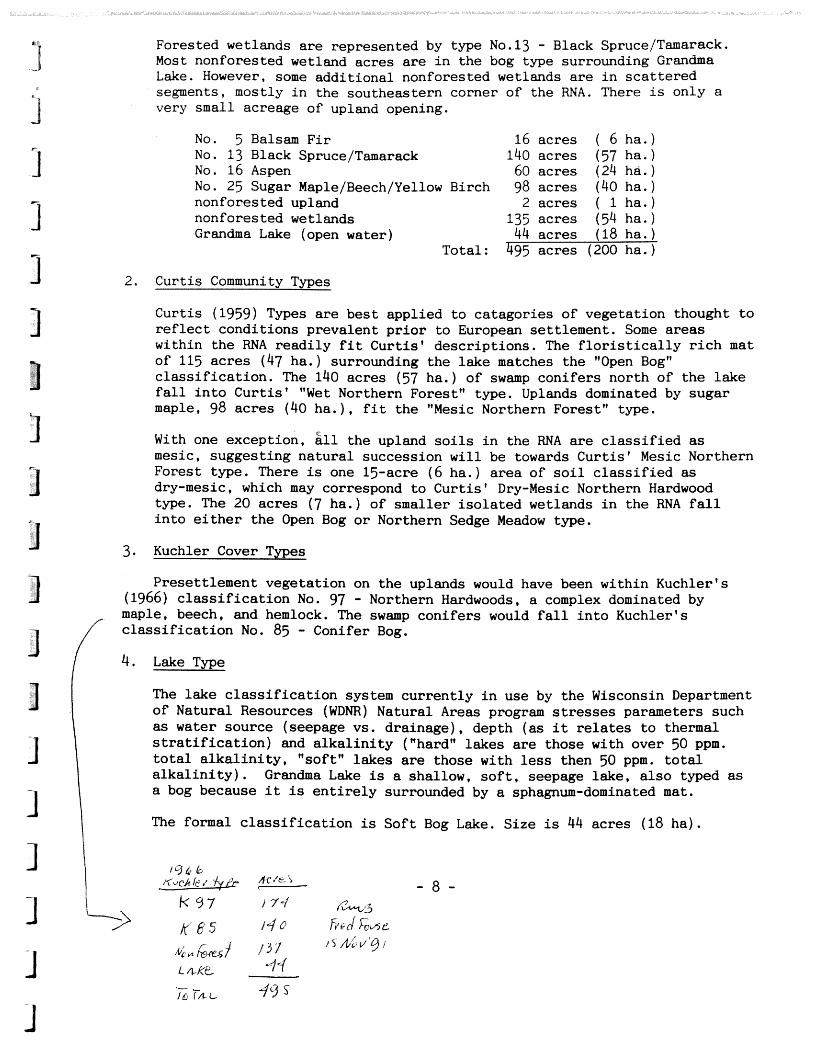
Forested wetlands a r e represented by type No.13 - Black Spruce/Tamarack. Most nonforested wetland acres a r e i n the bog type surrounding Grandma Lake. However, some addi t ional nonforested wetlands a re i n sca t te red segments, mostly i n the southeastern corner of the RNA. There is only a very small acreage of upland opening.
No. 5 Balsam F i r 16 acres ( 6 ha.) No. 13 Black Spruce/Tamarack 140 acres ( 57 hae ) No. 16 Aspen 60 acres (24 h&. ) No. 25 Sugar Maple/Beech/Yellow Birch 98 acres (40 ha. ) nonforested upland 2 acres ( 1 ha. ) nonforested wetlands 135 acres (54 ha. ) Grandma Lake (open water) 44 acres (18 ha. )
Total: 495 acres (200 ha.)
2. Curtis Community Types
Curtis (1959) Types a r e bes t applied t o catagories of vegetation thought t o r e f l ec t conditions prevalent p r i o r t o European settlement. Some areas within the RNA readi ly f i t Cur t i s t descriptions. The f l o r i s t i c a l l y r i c h mat of 115 acres (47 ha. ) surrounding the lake matches the "Open Bog" c l a s s i f i c a t i on . The 140 acres (57 ha.) of swamp conifers north of the lake f a l l i n t o Cur t i s t "Wet Northern Forest" type. Uplands dominated by sugar maple, 98 acres (40 ha . ) , f i t the "Mesic Northern Forest" type.
With one exception, 211 the upland s o i l s i n the RNA a re c l a s s i f i ed a s mesic, suggesting na tura l succession w i l l be towards Cur t i s t Mesic Northern Forest type. There is one 15-acre (6 ha.) area of s o i l c l a s s i f i ed a s dry-mesic, which may correspond t o Curt is ' Dry-Mesic Northern Hardwood type. The 20 acres (7 ha.) of smaller i so la ted wetlands i n the RNA f a l l i n t o e i t h e r the Open Bog o r Northern Sedge Meadow type.
3. Kuchler Cover Types
Presettlement vegetation on the uplands would have been within Kuchler's (1966) c l a s s i f i c a t i on No. 97 - Northern Hardwoods, a complex dominated by maple, beech, and hemlock. The swamp conifers would f a l l i n t o Kuchlerts c l a s s i f i c a t i on No. 85 - Conifer ~ o g .
4. Lake Type
The lake c l a s s i f i c a t i on system current ly i n use by the Wisconsin Department of Natural Resources (WDNR) Natural Areas program stresses parameters such a s water source (seepage vs. drainage), depth ( a s it relates t o thermal s t r a t i f i c a t i o n ) and a l k a l i n i t y ("hard" lakes are those with over 50 ppm. t o t a l a l k a l i n i t y , "soft" lakes a r e those with less then 50 ppm. t o t a l a l k a l i n i t y ) . Grandma Lake is a shallow, s o f t , seepage lake, a l so typed as a bog because i t is e n t i r e l y surrounded by a sphagnum-dominated mat.
The formal c l a s s i f i c a t i on is Sof t Bog Lake. Size is 44 acres (18 ha) .

PHYSICAL AND CLIMATIC CONDITIONS
1, Physical
The RNA is a wetland complex surrounded by gen t ly r o l l i n g topography. f o r e s t Road 2402 and Forest Road 2158 form the northern and a por t ion of the e a s t e r n boundary of t h i s RNA,
2 . C l i m a t e
The c l imate is con t inen ta l , characterized by long, snowy, o f t e n severe ly cold winters and r e l a t i v e l y s h o r t summers with w a r m days and cool n ights . Spring and f a l l are of ten s h o r t , with the t r a n s i t i o n from winter t o summer and summer t o winter q u i t e rapid. Changes i n weather from l a t e f a l l t o e a r l y sp r ing can be expected every few days as frequent storms pass through the a r e a along t h e Colorado and Alberta weather t r acks , P reva i l ing winds a r e northwest t o westerly l a t e f a l l t o e a r l y s p r i n g and from the south the rest of the year. Snowfall of over 1 inch (2.5 cm) can be expected on the average by the second week of November, and t h e r e is a 90 percent p robab i l i ty of snow on the ground during the winter months. Although occasional deep snow years occur, the major snowbelt l ies t o t h e nor th along the Penokee Range and Lake Superior ,
Fros t can be expected occasionally during any of t h e summer months, e s p e c i a l l y i n low-lying areas. The average d a t e of the last f reeze is the l a s t week i n May t o the f i r s t week i n June and t h e f i r s t f r eeze of the f a l l nay occur i n the l a s t week i n August t o the f i r s t week i n September.
The mean high temperature occur8 i n JuJy a t 68 '~ (20'~) and the mean low temperature i n January a t 0 F (-18 C ) . The mean annual p r e c i p i t a t i o n is 30.6 inches (780 mrn) of which 56 inches (142 cm) is snowfall.
The neares t weather s t a t i o n is t h e Nicolet College Weather S t a t i o n j u s t south of Rhinelander, Wisconsin, approximately 41 miles (66 km) southwest of t h e RNA. The e levat ion a t the Grandma Lake Wetlands RNA is 1520 f e e t (463 m ) above sea l e v e l and the e levat ion a t Rhinelander is 1560 f e e t (475 m). The c l ima t ic condit ions a r e comparable a t both s i t e s . Weather d a t a has been co l l ec ted a t Rhinelander s i n c e 1908.
1. Flora DESCRIPTION OF VALUES
Open mat dominants inc lude the usual complement of bog species such as mosses, (Sphagnum s p p . ) , wire-leaved sedges (Carex oligosperma and C, l a s i o c a r p a ) , and ericaeous shrubs such as l ea the r lea f (Chmaedaphne c a l y c u l a t a ) , Labrador t e a (Ledum groenlandicum), pa le l a u r e l (Kalmia p o l i f o l i a ) , bog rosemary (Andromeda glaucophylla) , cot ton g rass (Eriophorum species L . ) , speckled a l d e r (Alnus rugosa) and cranberry (Vaccinimum macrocarpon). Locally, the mat composition is q u i t e unusual, with species such a s bog clubmoss (Lycopodium inundatum), horned bladderwort ( U t r i c u l a r i a cornuta) and a bulrush (Scirpus hudsonianus) assuming dominance.

plants of special i n t e r e s t because they are uncommon include t h e aforementioned J ~ C - s tyg ius , bog arrow grass (Triglochin m a r i t i m u m ) , dragons mouth orchid - (Amthusa bulbosa) and two sedges, Carex l i v i d a and C. t enu i f lo ra . Insectivorous p l a n t s a r e q u i t e common on and a t the periphery o f t h e mat. Among these a r e p i t c h e r p lan t (Sarracenia purpurea), narrow-leaved sundew (Dmsera in termedia) , round-leaved sundew (D. - r o t u n d i f o l i a ) and s e v e r a l bladdefworts ( U t r i c u l a r i a spp. )
Stunted black spruce and tamarack d o t the periphery of the mat and the south s i d e of t h i s wetland. A t t he north end these trees reach a s t a t u r e and densi ty s u f f i c i e n t t o form a semi-closed f o r e s t . Most of t h e trees on t h e nor th s i d e are pole-size, under 30' i n height , less than 6" d.b.h. Nomenclature used i n this repor t f o r trees follows L i t t l e (1979).
The l ake proper was no t in tens ive ly botanized. Comon species noted were white water l i l y (Nymphaea tuberosa) , water s h i e l d (Brasenia schreber i ) and pipewort (Eriocaulon septangulare) . Appendix E contains a list of f l o r a observed within Grandma Lake Wetlands. Nomenclature follow Fernald (1950) and Gleason and Cronquist (1963) . The p o t e n t i a l climax vegetat ion f o r t h i s RNA, Fores t Habitat Types (Kotar. 1988) and ecological land types (Appendix G ) are l i s t e d below:
P o t e n t i a l Forest Ecological Climax Vegetation Habitat Types Land Type Acres Hectares
Sugar maple
Sugar maple- hemlock-yellow bi rch
Sugar maple- hemlock-yellow b i rch
Black spruce- northern white cedar
Black spruce
2. Fauna
Acer-Viola- S tambaugh- 146 59 Osmorhiza Padus
Tsuga- Pence 15 6 Maianthemum
Acer-Tsuga- S tambaugh- 15 6 Dryop teris Padus
Picea-Osmunda Carbondale 120 48
Picea-Chamadaphne- Greenwood 155 63 Sphagnum
Mammals inhab i t ing the a r e a include snowshoe hare (Lepus americanus), mink (Mustela v i s o n ) , muskrat (Ondatra z ibe th icus ) , beaver (Castor candensis) , black bear (Euarctos americanus) and white-tai led deer (Odocoileus v i rg in ianus ) . Nomenclature follows Burt and Grossenheider (1964).
The a r e a has not received in tens ive study, but s i g n i f i c a n t avifauna has been noted. There is an a c t i v e black t e r n (Chlidonias n i g e r ) colony. There a r e
1 nes t ing common loons (Gavia -- immer) and American b i t t e r n (Botaurus l en t ig inosus ) .
- 10 -

mm mm comraon b i r d s i n these wetlands include t h e Lincoln 's sparrow (mlospiza l i n c o l n i i ) , white-throated sparrow (Zonotrichia a l b i c o l l i s ) , ~ ~ h v i f l e Warbler (Ven ivora rufacapil la) , yellow-rumped warbler (Dendroica =rnnata) and common yellowthroat (Geothlypis t r i c h a s ) . Other spec ies t h a t e m observed i n t h e RNA a r e the mallard ( h a s platyrhynchos), black duck ( h a s - rnbr ipes ) , cedar w i n g (Bombycilla cedorum) and semi palmated plover ( m w a d r i u s h i a t i c u l a semipalmatus). Nomenclature follows Bull and Farrand (1977) f o r b i rds .
Leopard f rogs (Rana pipiens) and en f rogs (R, clamitans) were frequent ly encountered on the bog mat and a t the l a k e ' s edge. No formal surveys f o r r e p t i l e s o r amphibians were conducted on the candidate RNA. Nomenclature follows Behler (1979) f o r amphibians.
3. Geology
The lake occupies a depression formed during a r e t r e a t of Wisconsin Stage i c e during the Ple is tocene g lac ia t ions .
Precambrian metamorphic rocks, which make up t h e southern extension of t h e Canadian Shield. under l ie t h i s area . These rocks are dominantly banded. layered and migmatitic gneiss with subordinate amphibolite and b i o t i t e s c h i s t . of the lower Proterozoic Era. There a r e no su r face exposures i n t h i s a rea . The bedrock surface is i r r e g u l a r and s lopes e a s t and southeas t approximately 7-10 feet p e r mile.
The a r e a was g lac ia ted repeatedly during Ple is tocene time. The present surface mater ia l was deposited by the Langlade Lobe during t h e middle- Woodfordian substage of the Wisconsin i c e advance. The sediment is less than 50 meters th ick . The landform is stream-deposited outwash. Topography is hummocky due t o the co l l apse of sediment deposited on s tagnant i c e . (Hoppe, Dave. Nicolet National Fores t S o i l S c i e n t i s t , pers . comm.)
4. S o i l s
Two s o i l s dominate the uplands within the area. Both a r e deep, moderately well drained and developed i n aeol ian mater ia l overlying g rave l ly sand.
Padus s o i l formed i n 20 inches (8 cm) of s i l t loam and Stambaugh developed i n 30 t o 40 inches (12 t o 16 cm) of s i l t loam. Both u n i t s a r e mesic with a r i c h n u t r i e n t s t a t u s . Hardwood product iv i ty is very high. S t a b i l i t y of mixed s tands is low due t o a s t rong successional t rend t o sugar maple.
There a l s o is a u n i t o f upland, deep. w e l l drained s o i l developed i n 15 inches (6 cm) of sandy loam aeol ian mater ia l overlying g rave l ly sand (Pence). This site is dry-mesic with a medium n u t r i e n t s t a t u s . P o t e n t i a l climax vegeta t ion is sugar maple, hemlock. and yellow birch. Sugar maple is no t as dominating i n mid-successional s tands s o the s t a b i l i t y of mixed s t ands is grea te r . The understory is moderately w e l l developed and diverse. The Fores t Habitat Type is Acer/Tsuga/Maianthemum (Kotar. 1988). This u n i t is within the Pence ELT.

There is a s m a l l acreage of l a c u s t r i n e s o i l developed i n 30 inches o f f i n e 10- aeol ian mater ia l overlying f i n e sandy l a k e sediments (Bohemian).
mis is a deep. moderately w e l l drained site u n i t with a mesic moisture regime and a r i c h n u t r i e n t Sta tus . Po ten t i a l climax vegeta t ion is sugar maple, hwlock , and yellow bi rch . Understory d i v e r s i t y is low. The Fores t Habitat Type
- as-
-*
is ~ ~ e r / ~ s u g a / D r y o p t e r i s . This u n i t is included i n t h e Stambaugh-Padus ELT.
me wetland a rea surrounding Grandma Lake is of two s o i l types. A s l i g h t l y ac id to n e u t r a l , deep, very poorly drained organic s o i l formed from both herbaceous p l a n t s is located a t the nor th end of t h e l ake (Carbondale). Vegetation is l a r g e l y swamp conifers with a low d i v e r s i t y of understory species . This is moderately productive bogland may be wi th in t h e Picea/Osmunda Fores t Habi ta t Type. P o t e n t i a l climax vegetat ion would be black spruce and northern white cedar. This u n i t is within the Carbondale ELT,
A second bog s o i l e x i s t s around t h e rest of Grandma Lake. This u n i t is extremely ac id organic matter formed i n remains of bog p lan t s . The u n i t is deep, very poorly drained and may be underlain by sand within 10 f e e t c re en wood). P o t e n t i a l climax overstory is black spruce. Understory vegetat ion d i v e r s i t y is low. The Forest Habitat Type is Picea/Chamadaphne/Sphagnum. This u n i t is within the Greenwood ELT.
5. Lands
A l l land within the research n a t u r a l a rea boundary was purchased under the Weeks Act except t h a t por t ion of the research n a t u r a l a rea t h a t l ies within the SE 1/4 of Section 33. T39N. R15E. The land i n the SE 1/4 of Sect ion 33. T39N. R15E was purchased under the Clark-McNary Act. A l l a cqu i s i t ion f o r t h i s RNA occurred between 1935 and 1939.
The su r face e s t a t e was previously owned by Menominee Bay Shore Lumber Company, Florence County (por t ion of SESW 1/4. Section 34. T39N. R15E) and L. Be Weber (SWSW 1/4. Sect ion 34. T39N. RISE).
The e n t i r e mineral e s t a t e is owned by the United S t a t e s .
The Town of Long Lake has an outstanding p r e s c r i p t i v e right-of-way easement permit t h a t was granted on Ju ly 20, 1951 f o r a 20 foo t ( 6 m ) wide Class E road i n the same loca t ion as Forest Road 2402 along the northern edge o f the RNA.
6. Cu l tu ra l
A c u l t u r a l resource survey has not been completed f o r t h i s RNA and probably w i l l no t be f o r the wetlands within the RNA because of the extremely swampy t e r r a i n . One p r e h i s t o r i c site (Number 03-176) is located on t h e extreme north s i d e of t h e a r e a j u s t within the RNA boundary. The management needs f o r t h i s c u l t u r a l resouce a r e no t expected t o be i n c o n f l i c t with the management ob jec t ive f o r t h e MA.

IMPACTS AND POSSIBLE CONmIm
2. nfieral Resources
ti= mineral e s t a t e is owned by the United S t a t e s f o r t h i s area . No t i n g permits have been issued i n the area . There are no known mineral s o r development a c t i v i t i e s within the boundary of the Nicolet National
Et"ores t *
2. Grazing
mere is no grazing resource located within o r c l o s e t o t h i s RNA. Range grazing on the Nicolet National Forest is nonexistent due t o the l ack o f demand f o r this resource.
3. Timber
The timber management Standards and Guidelines i n the Fores t Plan f o r a Management Area 8.1 a r e cons i s t en t with the s p e c i a l a r e a management object ive . The timber resource w i l l not be regulated; t h a t is, timber management p rac t i ces w i l l not take p lace within the RNA. Management Area 8.1 is excluded from the land base a l loca ted t o timber production.
-u The RNA is located within a 2.1 Management Area i n which the uneven age s i l v i c u l t u r a l system is emphasized. Surrounding s t ands managed i n t h i s manner - w i l l r e s u l t i n very low o r no impact on the RNA.
Approximately 176 ac res (71 ha) of s u i t a b l e f o r e s t land within t h e Nicolet National Forest is withdrawn by establishment of t h i s RNA. This acreage is capable of producing an annual growth of approximately 30.000 board f e e t (137 cu m) of commercial sugar maple sawtimber along with 40 cords (92 cu m ) of aspen and upland con i fe r pulpwood. based on average product iv i ty of s o i l types.
4. Watershed Values -1 . J There is a 44.4 a c r e (18 hectare) body of open water which is Grandma Lake
within t h i s RNA. The a rea of undisturbed upland within t h i s RNA w i l l p ro tec t
1 the s o i l from eros ion and help maintain the water q u a l i t y of Grandma Lake.
- J Grandma Lake is a very softwater seepage lake with a maximum depth of 9 f e e t ( 3 meters) . Water is supplied t o t h e l ake from d i r e c t p r e c i p i t a t i o n on the lake surface and surrounding wetland and from shallow subsurface runoff from the adjacent uplands. Although groundwater discharges t o the nor th i n t o Woods Creek. t o the northwest i n t o Halsey Lake Slough, and t o the south i n t o Riley Creek. Grandma Lake is perched above the groundwater t a b l e and receives no groundwater influence. A water sample col lec ted a t the s i te subs tan t i a ted t h i s f a c t ( s p e c i f i c conductance of 17 umhos, a l k a l i n i t y of 4.6 mg/ l i te r and f i e l d pH
1 of 6.3).
The topographic map f o r t h i s a rea shows a p o t e n t i a l high water o u t l e t i n the
1 southwestern p a r t of the wetlands, but a narrow r idge between the wetland and a drainage t o the southwest was i d e n t i f i e d and no evidence of an o u t l e t was found .

5. Recreation
The area receives l i g h t use by hunters, t rappers , and hikers . A t ~ u r r e n t l eve l s , these a c t i v i t i e s a r e not incompatible with RNA object ives here. AW t racks were noted on the bog m a t on the w
Ji , &he,& j 2 ~ 4 2 5 C-5 h7b/~ 5Gd h7 f i e I%.r/, ~,d 1 hL '
l i ~ $ i *u- r
6 , Wildlife and Plant Values
Several mcomon animals sens i t ive t o hman disturbance breed here. The presence of a t least 5 species of uncomon plants has been documented on the bog mat.
The deer population l eve l is a concern i n t h i s IRNA due t o the possible impact on vegetation. Management pract ices t h a t a re l i ke ly t o a t t r a c t g rea te r numbers of deer t o the immediate v i c in i t y should not be implimented. I f a re turn t o more severe winters takes place o r i f i t becomes p o l i t i c a l l y feas ib le f o r the Wisconsin DM3 t o fu r ther increase the deer harvest , a reduction i n the deer population may occur.
There is periodic beaver a c t i v i t y i n the RNA. There is no aspen food supply c lose t o the waters edge a t Grandma Lake, but beaver w i l l feed extensively on the roots of acquatic vegetation, There is no defined o u t l e t from the lake, SO
there is no opportunity f o r beaver t o dam and flood a g rea te r area. Beaver a re a natural influence across the region and a r e not expected t o be a problem here.
7 , Special Management Values
The RNA is not i n a proposed wilderness, wild and scenic r i v e r o r national recreation area ,
Wilderness l eg i s l a t i on was enacted f o r Wisconsin i n 1984 and established the Blackjack Springs, Headwaters and Whisker Lake Wilderness Areas. Grandma Lake Wetlands RNA lies several miles away from these wilderness areas , Release language included i n the l eg i s l a t i on precluded any addi t ional wilderness s tud ies u n t i l , a t l e a s t , the next planning period,
8. Transportation Plans
Forest Road 2402 and 2158 form a port ion of the border of t h i s RNA. No new road construction is planned f o r t h i s RNA,
Several low standard, Tra f f ic Service Level D roads current ly e x i s t on the west s i de of the RNA and are the r e s u l t of recent harvesting ac t i v i t y . Most of these roads have been closed t o motor vehicle use through the i n s t a l l a t i o n of an earthen bar r ie r . Following establishment a l l roads within the RNA w i l l be closed t o motor vehicle use.

~ t a n d a r d , T r a f f i c Service Level D road forms a por t ion o f t h e west
h e surface water o u t l e t is located i n the nor theas tern corner of Grandma Lake wetlands where a new cu lver t has been i n s t a l l e d under Fores t Road 2402. It drains t o the north and appears t o serve as an overflow during per iods of high ,,ter. A small pocket of dead swamp conifers within the RNA surrounds the o u t l e t . In the development of a management plan f o r t h i s area i t w i l l be necessary t o inc lude maintenace of a f r e e o u t l e t a t t h i s loca t ion .
MANAGEMENT PRESCRIPTION
Management Objective: To preserve f o r s c i e n t i f i c purposes the e x i s t i n g wetland complex including Grandma Lake. the open mat surrounding the l ake , con i fe r swamp and associa ted p l a n t and animal species.
The Forest Plan (Appendix C ) has Forest-wide standards and gu ide l ines and these included Management Area 8.1 which apply t o the Grandma Lake Wetlands RNA.
F i r e suppression and i n s e c t and d i sease control w i l l occur as needed t o achieve the management ob jec t ive f o r the area. F i r e con t ro l methods causing minimum impacts w i l l be used,
Light publ ic r ec rea t ion use is acceptable i n the a r e a but r ec rea t ion use w i l l not be encouraged.
There a r e no plans t o manipulate the e x i s t i n g vegeta t ion,
No fences are required f o r the protec t ion of t h i s area .
Upon establishment of the RNA the following ac t ions w i l l be taken:
A Forest Order w i l l be issued t o p roh ib i t the use of motorized vehic les within the boundary of the Grandma Lake Wetlands Research Natural Area.
Clear ly i d e n t i f y and monument boundary corners and turning p o i n t s on the ground
Consideration w i l l be given i n a l l management p r a c t i c e s ou t s ide t h e boundary of t h i s RNA t o t h e p o t e n t i a l environmental impact on the Grandma Lake Wetlands RNA. Management p r a c t i c e s outs ide t h i s RNA w i l l be designed t o avoid any s i g n i f i c a n t negative impacts t o the area.
The Record of Decision (Appendix D ) f o r the Forest Plan was signed by the Regional ores ter on August 11, 1986.
Future management decis ion w i l l be made i n consul ta t ion with t h e Bureau of Ehdangered Resources, Wisconsin Department of Natural Resources and t h e Region Nine Research Natural Area Corni t tee , U.S. Forest Service ,

m N I S I W l T I V E FU%%FU)S AM) PR-ION
a a i n i s t r a t o r and p ro tec to r of t h i s a rea is:
D i s t r i c t Ranger Nicolet National Forest Florence, Wisconsin 54121
me research coordinator of t h i s a r e a is:
Direc tor USDA - Fores t Service North Centra l Fores t Ekperiment S t a t i o n 1992 Folwell Avenue S t . Paul , Minnesota 55108
The research d a t a f i l e is maintained by:
Direc tor USDA - Fores t Service North Centra l Forest Experiment S t a t i o n 1992 Folwell Avenue S t . Paul , Minnesota 55108
Fores t Supervisor Nicolet National Forest 68 South Stevens S t . Rhinelander , Wisconsin 54501
Research proposals a r e t o be submitted t o the Direc tor , North Centra l Fores t Experiment S t a t i o n , f o r review and approval. The Fores t Supervisor , Nicolet National Fores t , then i s s u e s permits f o r approved non-manipulative research.
P lan t c o l l e c t i o n s w i l l be housed a t t h e Herbarium, Univers i ty of Wisconsin. Madison.
Specia l p ro tec t ion needs are :
I s sue a F o r e s t Order t o p r o h i b i t the use of motorized veh ic les within .
t he M A .
This item was discussed i n more d e t a i l i n the Management P resc r ip t ion Section.
Fores t Orders i ssued f o r t h i s RNA w i l l be posted a t t h e s i t e , Florence D i s t r i c t Off ice i n Florence, Wisconsin and i n t h e Fores t Supervisor ' s Off ice i n Rhinelander, Wisconsin.

I c e r t i f y the enclosed boundary descr ipt ion of the Grandma Lake Research Natural Area was prepared under my d i r e c t supervision.
Seal Date
anonymous, 1983. &ological Land Types on the Nicolet National Forest . The Nicolet Forest In te rd i sc ip l inary Team, 37 p.
anonymous, 1981. Natural Area Inventory of Florence County. Unpublished. WDNR, Bureau of Endangered Resources, Madison, Wisconsin.
anonpous, 1971- Surface Water Resources of Florence County, 1971. WDMI. Madison, Wisconsin.
Behler, J. L . , 1979. he Audubon Society Field Guide t o North American Rept i les and Amphibians, Alfred A s Knopf, New York, 719 p.
Bull , J. and Farrand, J. 1977. The Audubon Society Field Guide t o North American Birds, Eastern Region, Alfred A. Knopf, N e w York, 775 p.
Burt, W. H. and Grossenheider, R. P., 1964. A Field Guide t o the Mammals. Riverside Press. Cambridge, 284 p.
Curt is , J. T., 1959. Vegetation of Wisconsin. University of Wisconsin Press. Madison, Wisconsin.
Eyre, F. H. ( e d . ) , 1980. Forest Cover Types of the United S ta tes and Canada, Society of American Foresters, Washington, D. C . .
Fernald, M. L . , 1950. Gray's Manual of Botany. American Book Company, New York, New York.
Gleason, H. A. and A. Cronquist, 1963. Manual of Vascular Plants of or the astern United S t a t e s and Adjacent Canada. D. Van Nostrand Co., New York, N e w York.
Judziewicz, E. J . , 1983. Field Survey ~ e ~ o r t on the Endangered, Threatened and Rare Vascular Plants of the Nicolet National Forests. U.S. Forest Service. , Contract No. 53-569R-2-00065.
Kotar, J., Coffman, Michael S. , Fe r r i s , James E. and Alyanak, E., 1984. Field Guide Habitat Class i f i ca t ion System f o r upper Peninsula of Michigan and Northeast Wisconsin, Cooperative Research on Forest S o i l s , Michigan Technological University, Houghton, Michigan.
Kuchler, A. W. , 1964. Potent ia l Natural Vegetation of the Conterminous United S t a t e s , Special Publication No. 36 of the American Geographical Society.

\ Poten t ia l Natural Vegetation Map. ') \pW
L i t t l e , Elber t L o Jr., 19'79, Checklist of United S t a t e s Trees (Native and Naturalized), Agriculture Handbook No. 541. Forest Service, U. S. Department of Agriculture.
Robbins, C. S. , Ek~un, B., and Zim, M, S . , 1966. Birds of North Anrepica, A Guide t o Fie ld Iden t i f i ca t ion , Golden Press , New York, 340 p.
Sutherland, D. W. S . , 1978. Comon Narnes of Insec t s and Related Organisms, Entomological Society of America, 132 p.

Appendix A: Regional Guide - Management Goal 8
Appendix B: Nicolet Forest Plan - Opportunities f o r Research Natural Areas/ Sc i en t i f i c Areas
Appendix C: Nicolet Forest Plan - Forest-wide Standards and Guidelines
Appendix D: Record of Decision. Nicolet Forest Plan FEIS - Special Areas
Appendix E: Grandma Lake Wetlands Plant L i s t
Appendix F: Breeding Bird Surveys
Appendix G: Ecological Land Type Descriptions

Untmf Star-
Regional Guide for the Eastern Region
Mlhrm~h* ws*
APPEND
THB F0LK)WING PAGES WEZU COPIED FROM THIS

Management Goal 8
This g o a l w i l l emphasize t h e following:
a ) The prese rva t ion of unique ecosystems f o r s c i e n t i f i c purpoees 1 b) Areas t o coaduct research t o improve the b e n e f i t s of f o r e s t s and
rangeland
c ) The p r o t e c t i o n of unique a r e a s of n a t i o n a l s i g n i f i c a n c e
These a r e a s w i l l inc lude a wide range of ecosystems f o r des ignated research n a t u r a l a r eas , experimental f o r e s t s , wild and scen ic r i v e r s , and o the r unique a r e a s of n a t i o n a l s ign i f i cance .
A system of roads and t r a i l s may provide access f o r admin i s t r a t ive pur- poses and r e c r e a t i o n a c t i v i t i e s i f compatible wi th the purpose. of the area. Msnagement of t hese systems w i l l depend on the o b j e c t i v e of the 1 a r e a , w i th motorized and nomoto r i zed access o f t e n being regula ted . F a c i l i t i e s and s t r u c t u r e s w i l l be present and w i l l be designed t o be compatible wi th the n a t u r a l surroundings. Evidence of human a c t i v i t i e s w i l l vary , but gene ra l ly w i l l be c o n t r o l l e d t o reduce i ts e f f e c t on the a rea .
The s i z e of t h e a r e a s w i l l vary, depending on t h e intended purpose.

ST S GUDELINES FOR CMWT GOAL 8
Vegetat ive Management
Vegetat ive maagemeat w i l l be governed by t h e s p e c i a l a r e a management ob j ec t ives .
Ai r Q u a l i t y
F o r e s t s w i l l adv i se t h e Regional F o r e s t e r of a r e a s where r edes igna t ion t o Class I a i r - q u a l i t y a r e a i s necessary t o p r o t e c t wi lderness o r o t h e r unique Nat iona l F o r e s t System lands.
2200 RANGE MANAGEMENT
Forage management w i l l comply w i t h t h e s p e c i a l a r e a management o b j e c t i v e s *
2300 RECREATION MANAGEMENT
Recreat ion Oppor tun i t i e s
Locat ion o f r e c r e a t i o n a l developments w i l l be determined wi th p r i o r i t y g iven t o c o r r e c t i n g h e a l t h and s a f e t y problems, p r o t e c t i n g the environ- ment, complementing prescr ibed r e c r e a t i o n oppor tun i t i e s , and meeting publ ic demand.
Fea ture t h e ROS c l a s s e s t h a t are c o n s i s t e n t wi th t h e s p e c i a l a r e a management ob j ec t ives .
T r a i l s
T r a i l s w i l l be cona i a t en t wi th t he s p e c i a l area management ob j ec t ives .
O f f -Road VeNclee (ORV)
OW use w i l l be r e s t r i c t e d t o des igna ted road8 and t r a i l u , u n l e s s o the rv i se provided f o r by law, r egu la t i on , o r t he special area management o b j e c t i v e s f o r each area.
C u l t u r a l Resources
F o r e s t w i l l set p r i o r i t i e s f o r and w i l l schedule e v a l u a t i o n of c u l t u r a l resources f o r t h e Nat ional Reg i s t e r of X l s t o r i c Places .

ST S AND GUICIELINES FOR G M N T GOAL 8
Assess the na ture and degree of damage t o c u l t u r a l resources caused by vandalism, v i s i t o r use, and n a t u r a l d e t e r i o r a t i o n and i d e n t i f y p ro tec t ive measures t o be implemented.
Areas having unique c u l t u r a l resource va lues of n a t i o n a l s ign i f i cance will be i d e n t i f i e d f o r s p e c i a l management, inc luding enhancement and in t e rp re t a - t i on , C u l t u r a l resource i n t e r p r e t a t i o n i n o t h e r s p e c i a l management a reas w i l l be c o n s i s t e n t wi th each a r e a ' s purpose,
Visua l Qual i ty
Visual q u a l i t y ob jec t ives w i l l be c o n s i s t e n t wi th s p e c i a l a r e a management objec t ives .
2400 TIMBER MANAG-NT
S i l v i c u l t u r a l Systems
Everraged o r uneven-aged systems may be used on experimental f o r e s t s . On unique a r e a s o t h e r than experimental f o r e s t , Fores t o r a r e a management p l ans w i l l s p e c i f y the systems t o be used.
Harvest Cutt ing Methods
Harvest c u t t i n g methods must be cons ie t en t with t h e o b j e c t i v e s s t a t e d f o r t h i s Regional g o a l and a s shown i n t h e t a b l e t i t l e d : Harvest Cutting Methods i n the Eas tern Region by Fores t v p e s , Regional Management Goals and Subregion, Appendix C,
Clearcut t ing w i l l be used only where i t i s t h e optimum method t o meet the goa l ob jec t ives . Forest Plans w i l l spec i fy condi t ions and s i t u a t i o n s f o r v a r i a t i o n from t h e appropr i a t e harves t c u t t i n g method s p e c i f i e d i n Appendix C.
Temporary Openings Created by t h e Appl ica t ion of Even-& ed S i l v i c u l t u r e
The maximum s i z e of temporary openings c r e a t e d by even-aged management i s 40 a c r e s , except a s provided i n 1-4 below:
1. 370 a c r e s i n jack p ine type f o r K i r t l and ' s Warbler h a b i t a t on the ffuron-Manistee National Fores t
ARDS AND GUUDELINES FOR
2. 200 a c r e s i n aspen, b i rch , c o n i f e r types w i th in a r e a s mnaged f o r moose h a b i t a t on t h e Super ior Nat iona l Fo re s t
3. 300 a c r e s i n des igna ted s p e c i a l managelwnt a r e a s on t h e mawatha, Ottawa, Chequamegon, and Huron-EIaniatee Nat ional F o r e s t s f o r sharp- t a i l e d grouse and s a n d h i l l c r ane
4. Except ions i n the NFKA r egu la t i ons , which a r e :
a) On a n i n d i v i d u a l s a l e b a s i s a f t e r 60 days p u b l i c n o t i c e and review by the Regional Fo re s t e r
b) A s a r e s u l t of n a t u r a l c a t a s t r o p h i c condi t ion , such a s f i r e , i n s e c t and d i s e a s e a t t a c k , o r windstorm
Crea t ion of temporary openings and d e f i n i t i o n of t h e i r s i z e s w i l l be f u r t h e r governed by the s p e c i a l area management ob j ec t ives .
Management I n t e n s i t y and U t i l i z a t i o n
For t h e purpose of determining ha rves t l e v e l s , t h e u t i l i z a t i o n s tandards i n Table 3-2 w i l l apply.
F o r e s t s w i l l cons ide r a range of management i n t e n s i t i e s when developing p r e s c r i p t i o n s , y i e l d s , and ou tpu t values . Vhen determining i n t e n s i t y lev- els, t h e fo l lowing p r a c t i c e s w i l l be considered: s i t e p r epa ra t i on , seed- i ng , p l an t ing , p rescr ibed f i r e , precommercial and commercial th inn ing , r e l e a s e , f e r t i l i z a t i o n , and i n t e g r a t e d p e s t management. P r a c t i c e s w i l l be employed when c o s t e f f i c i e n t and needed t o meet t h e o b j e c t i v e s of the re l evan t Regional goal .
S i l v l c u l t u r a l s t anda rds w i l l i nco rpo ra t e g e n e t i c improvement p r i n c i p l e s and p rac t i ce s .
Fo re s t P lans w i l l s p e c i f y management p r a c t i c e s t o be used t o o b t a i n des i r ed cond i t i ons f o r each t h e type t o be harves ted .
Minimum s t and s i z e f o r t imber product ion normally w i l l be 1 0 ac re s . F o r e s t s w i l l s p e c i f y except ions .
2500 W A m AND SOIL RESOURCE HANAGEMENT
Manage r i p a r i a n a r e a s using p r a c t i c e s t h a t a r e c o n s i s t e n t w i th resource cond i t i ons , management o b j e c t i v e s , and des igna ted water u s e b

STAM)ARI)S GUIDELINES FOR AGPLENT GOAL 8
Const ruc t ion and r e h a b i l i t a t i o n of s t r u c t u r e s and f a c i l i t i e s w i l l p reserve t he b e n e f i c i a l v a l u e s of f l o o d p l a i n s and wet lands, w i l l p r o t e c t p u b l i c s a f e t y , and w i l l be c o s t e f f i c i e n t .
Heavily d i s t u r b e d a r e a s , such a s borrow p i t i and minera l developments, when r e s t o r e d , w i l l meet t h e o b j e c t i v e s of t h i s goa l . Water bodies may be cre- a ted when sur f ace runoff and s o i l c o n d i t i o n s permit.
Control measures t o m i t i g a t e e r o s i o n w i l l be commensurate w i t h t h e s o i l c h a r a c t e r i s t i c s , expected u se , and management o b j e c t i v e s of t h e a rea .
2600 WILDLIFE HABITAT MANAGEMENT
W i l d l i f e
P r o t e c t e x i s t i n g sp r ing seeps and o t h e r water a r e a s t h a t a r e c r i t i c a l t o win te r ing w i l d l i f e . Each Fo re s t w i l l i d e n t i f y s i t e s t h a t r e q u i r e pro- t e c t i o n p r i o r t o implementing a d j a c e n t r e sou rce management a c t i v i t i e s .
Favor s e l e c t i v e t rea tment o f t r ansmis s ion l i n e r i g h t s - o f r a y vege t a t i on t o improve w i l d l i f e forage.
W i l d l i f e h a b i t a t management w i l l comply w i t h s p e c i a l a r e a management o b j e c t i v e s .
F i s h h a b i t a t management w i l l comply v i t b s p e c i a l a r e a management ob j ec t ives .
Endangered, Threatened, and S e n s i t i v e Spec i e s
I d e n t i f y and manage p o t e n t i a l n e a t trees (2-3) w i t h i n a c t i v e and p o t e n t i a l ba ld e a g l e o r osprey n e s t i n g areas.
2700 SPECIAL USES M N A G M N T
U t i l i t y Transmission Cor r ido r s
NOTE: See a l s o 7700 Transpo r t a t i on System, Corr idors .
Permit only t h o s e f a c i l i t i e s t h a t are r e q u i r e d t o s e r v e r e c r e a t i o n a l o r a d m i n i s t r a t i v e f a c i l i t i e s . Except ions w i l l be cons idered on a n i n d i v i d u a l bas i s .

STANI)BRDS ANI) GUUDELINES FOR HANAG-NT GOAL 8
U t i l i t y D i s t r i b u t i o n Systems
Approval of a p p l i c a t i o n f o r d i s t r i b u t i o n systems c ross ing Nat iona l Fores t System l ands (such a s u t i l i t y r i gh t s -o f -way se rv ing i n d i v i d u a l res idences) w i l l be determined i n d i v i d u a l l y , c o n s i s t e n t with t h e s t anda rds and guide- l i n e s f o r t h i s Regional management goa l .
LS ANI) GEOLOGY . Mineral Explora t ion
Surf ace-dis turbing exp lo ra t i on ( inc luding c o r e d r i l l i n g ) w i l l be permit ted wherever i t i s compatible w i th t he management o b j e c t i v e s of t h e a r ea .
Eiineral Development
USDA consent t o mineral e x t r a c t i o n p l ans w i l l be determined i n d i v i d u a l l y , based on t he r e l a t i v e va lue of t he sur face /subsur face resources and on cons is tency wi th t h e s t anda rds and g u i d e l i n e s i n t h i s Regional management goa l .
5100 FIRE MANAGEMENT
Prescr ibed f i r e may be used t o e s t a b l i s h o r maintain vege t a t i on under e s t a b l i s h e d resource management p re sc r ip t i ons .
A c t i v i t y f u e l s w i l l be managed a t a l e v e l commensurate with t h e al lowable f i r e i n t e n s i t y and r a t e of spread t h a t meets resource o b j e c t i v e s i n es tab- l i s h e d p r e s c r i p t i o n s . Treatment along highways and ad j acen t p r o p e r t i e s w i l l meet a p p l i c a b l e S t a t e laws.
Fuelbreak management w i l l be addressed i n t h e development of management prescriptions, w i t h l o c a t i o n s and a i z e based on a n a l y s i s of probable f i r e l oca t ions , expected f i r e i n t e n s i t i e s , and p o t e n t i a l veraus a l l o v a b l e ne t resource va lue change.
Wi ld f i r e prevent ion, de t ec t i on , and suppression, a s w e l l a s f u e l s manage- ment, i nc lud ing fue lb reaks and hazard reduct ion, w i l l be planned, based on a n a n a l y s i s of probable f i r e l oca t ion , expected f i r e i n t e n s i t i e s , poten- t i a l n e t resource va lue change, and r i s k t o h e a l t h and s a f e t y , and w i l l be addressed i n t h e development of management preacr ip t iona .
S T m W S AM) GUIDELINES FOR MANACNNT GOAL 8
5400
Surface Ownership
Avoid errcumbering land a v a i l a b l e f o r exchange wi th land uses t h a t compro- mise land exchange o p p o r t u n i t i e s , k 7 300 BUIXBINGS AND STRUCTURES
L i m i t b u i l d i n g s and s t r u c t u r e s t o t h o s e needed t o suppor t t h e s p e c i a l a r e a management o b j e c t i v e s .
7400 PUBLIC HEALTH AMD POLLUTION CONTROL ACTIVITIES
Water Supply
Drinking water may be provided. I f provided, i t must meet Federa l and S t a t e r e g u l a t i o n s and be p ro t ec t ed t o ensu re i t s cont inued q u a l i t y .
S o l i d Waste
L a n d f i l l d i s p o s a l sites may be a l l o v e d on ly a s permi t ted by t h e s p e c i a l a r e a management o b j e c t i v e s .
7 700 TRANSPORTATION SYSTEM
Roads - C o l l e c t o r s and l o c a l roads v i l l be designed, cons t ruc t ed , and managed f o r t r a n s p o r t i n g f o r e s t p roducts and suppor t ing a d m i n i s t r a t i v e use.
Provide l o c a l roads as needed t o comply wi th s p e c i a l area management ob j ec t ives .
Roads may be c l o s e d t o p u b l i c u s e o r r e s t r i c t e d by v e h i c l e type o r season of uae.
Roads will be maintained t o a t l e a s t maintenance l e v e l I11 i f passenger c a r t r a v e l i s in tended , maintenance l e v e l I1 i f passage of v e h i c l e s i s l i m i t e d , o r maintenance l e v e l I i f c lo sed t o v e h i c u l a r t r a f f i c .
A l l temporary and short- term roads w i l l be planned and c o n s t r u c t e d t o be. revege ta ted . Revegeta t ion w i l l be accomplished i n a reasonable per iod of t i m e , no t t o exceed 1 0 y e a r s a f t e r t e rmina t ion o f t h e c o n t r a c t , l e a s e , o r permit.

ST S AND GUIDELINES FOR
Identify a l l existing road. and deternine those needed for adniniatrative and public use. Unnecessary roads w i l l be obliterated.
Corridors
Corridors up to one-half mile wide w i l l be identified for each arterial or collector road (including Forest Highvaya that meet this definition) to be construe ted or recons tructed.

Table 3-21
T a r g e t s f o r Loca t ing , E v a l u a t i n g , and E s t a b l i s h i n g Research N a t u r a l Areas f o r t h e E a s t e r n Region, January 1982
( S o c i e t y o f American F o r e s t e r Numbers and F o r e s t Cover Types)
I I -
P r i o r i t y U l P r i o r i t y f12 P r i o r i t y 1 3
I I
Chippewa, S u p e r i o r , N i c o l e t , Chequamegon, Ottawa, Hiawatha,
23 E a s t e r n hemlock 24 Hemlock-yellow
r e d oak-red maple
c h e s t n u t oak 38 Tamarack 5 2 White oak-black 39 Black ash-American
elm-red maple 55 Nor thern red o a k
r e e n Mountain and White Mountain Ha t i o n a l F o r e s t s
F o r e s t Cover Types Unrepresen ted F o r e s t
5 B a l s a m f i r 13 Black spruce- t amarack 16 Aspen 1 7 P i n c h e r r y 19 Gray b i rch- red maple 2 2 White pine-hemlock 24 Hemlock-yellow b i r c h 2 7 Sugar maple 30 Red s p r u c e-yellow
b i r c h 31 Red spruce-sugar
maple-beech 33 Red spruce-balsam
f i r 35 Paper b i rch- red
spruce-balsam f i r 3 7 Nor thern whi te-cedar 38 Tamarack 4 5 P i t c h p i n e 46 E a s t e r n r e d c e d a r 55 Nor thern r e d o a k
107 White s p r u c e 1 0 8 Red maple
F o r e s t Cover Types
1 8 Paper b i r c h 25 Sugar maple-beech-
y e l l o w b i r c h 32 Red s p r u c e
1
Cover Types Represented Once Represen ted Twice

Final Environmenta
Land and Resource Management Plan
NICOLET NATIONAL FOREST
APPENDIX B

Wflderness
The N i c o l e t has th ree designated wi ldernesses, t o t a l i n g 33,258 acres:
Black jack Springs conta ins a se r ies o f spr ings i n an area o f s l i g h t l y r o l l i n g and fo res ted topography w i t h a wh i te pine-red oak component. The spr ings f low i n t o the Deerskin River , a popular t r o u t stream t h a t forms the n o r t h wi lderness boundary.
Headwaters W i lderness i s comprised of th ree areas separated by grave l roads. These areas conta in vegeta t ion and topography rep resen ta t i ve o f nor thern Wisconsin. Te r ra in i s genera l l y f l a t w i t h hardwood r i dges and fo res ted swamp, muskeg and bog lowlands.
Whisker Lake conta ins several smal l lakes se t i n a f o r e s t c o n s i s t i n g o f wh i te pine, hardwoods, aspen and some v i r g i n red p ine. The lakes prov ide f i s h i n g oppor tun i t i es f o r people as w e l l as eagle and osprey.
The pr imary a c t i v i t i e s occu r r i ng i n these areas are hunt ing, f i sh ing , camping and t r a i l uses.
These areas have been congress iona l ly designated as wi lderness. Because o f the congressional mandate, there i s no v a x a t i o n poss ib le through d i f f e r e n t a l t e r n a t i v e management, concerning the amount of wi lderness acres on the N i c o l e t . I n May 1984, when wi lderness l e g i s l a t i o n was enacted fo r t h e Headwaters H i lderness, re lease 1 anguage was included i n the l e g i s l a t i o n prec lud ing any a d d i t i o n a l w i lderness s tud ies u n t i 1 a t l e a s t the next p lann ing per iod, and o ther areas o f the Fores t t h a t are no t designated as w i lderness are t o be managed f o r m u l t i p l e uses.
Opportunities for Research Natural Areas/Scientific Areas
Research Natura l Areas (RNA's) are f o r m a l l y designated areas t h a t represent n a t u r a l eco log ic communities. The i r purpose i s t o promote and p r o t e c t n a t u r a l d i v e r s i t y i n a l l i t s forms. These areas are ava i l ab le f o r nonmanipulat ive research and s c i e n t i f i c study. As p a r t of the f o r e s t p lann ing process the f o r e s t s were t o i d e n t i f y areas i n the Forest Plan t h a t cou ld be evaluated i n the f u t u r e f o r poss ib le add i t i ons t o the RNA system. P r i o r i t y was t o be g iven t o those ecosystems t h a t were represented by o n l y one o r two loca t ions . Act ions t o evaluate t h e i d e n t i f i e d areas w i l l f o l l o w t h e Forest Plan process. Establishment records w i l l be prepared f o r q u a l i f i e d areas. These documents must be approved by the Chief o f the Forest Serv ice t o o f f i c i a l l y e s t a b l i s h t h e
" Research Natura l Areas.
S c i e n t i f i c Areas are s i m i l a r t o RNA's bu t are f o r m a l l y designated by t he S t a t e of Wisconsin. Ded ica t ion o f new S c i e n t i f i c Areas w i t h i n the
Affected Environment 3 - 8

Table 3-1
Name -
SITES RECOMKNDED FOR POTENTIAL RESEARCH NATURAL AREAS AND/OR STATE SCIENTIFIC AREAS (Management Area 8.1)
A l v i n Creek Headwaters Atk ins Lake Barney Creek B a s t i l e Lake Bru le R iver C l i f f s Slocke Lake Grandma Lake Wetlands Hagar Mountain
Kentuck Lake Swale Snow Fa1 1s Creek Waupee Lake Wisconsin Slough
Sco t t Lake-Shelp Lake Giant White Pine Grove Bose Lake Hardwoods P i ne-Oa k Grove South Branch Grove McCaslin Mountain
Approx. Town Range . Sect ion - - Acres
Nat ional Forest w i 11 be through negot iated management agreements w i t h the S ta te fo l l ow ing the Forest Plan process.
Eighteen areas of the N i c o l e t are c u r r e n t l y i d e n t i f i e d t h a t need evaua- t i o n t o determine i f they represent t he q u a l i t i e s o f a RNA, and/or a S ta te S c i e n t i f i c Area. These areas are l i s t e d i n Table 3-1. A l l areas w i l l be assigned t o Management Area 8.1. The i r na tu ra l i n t e g r i t y w i l l be pro tec ted u n t i l they can be evaluated t o determine t h e i r s ta tus . Addi- t i o n a l areas may be l i s t e d and evaluated throughout t he p lann ing per iod.
Some of these areas have a l ready been placed i n spec ia l categor ies. The Bose Lake Hardwoods was designated a S ta te S c i e n t i f i c Area (No. 119) i n 1969 and as a Natura l Landmark by the Secretary o f the I n t e r i o r i n
. 1980. Sco t t Lake-Shelp Lake and Giant White Pine Grove were designated S ta te S c i e n t i f i c Areas (No. 117 and No. 118) i n 1969. Three o f the areas: Sco t t Lake-Shelp Lake. Giant White Pine Grove, and Black jack Springs White Pine-Red Oak are w i t h i n designated wi lderness.
If through the eva lua t i on process those areas do no t q u a l i f y as RHA's o r S ta te S c i e n t i f i c Areas, they w i l l then be assigned as Specia l Areas as described i n the f o l l o w i n g sect ion.
3 - 9 Affected Environment

Special Areas
Several areas have been i d e n t i f i e d t h a t meet c r i t e r i a f o r cons idera t ion as spec ia l areas. These c r i t e r i a i nc lude unique p l a n t and animal comun-
. i t i e s and geo log ica l formations. The 7 1 s i t e s are l i s t e d i n Table 3-2. The values o f each area are no t l i s t e d t o avoid undue a t t e n t i o n t o them u n t i l s p e c i f i c boundaries are se t and t h e i r management i s determined, o r through eva lua t i on i t i s decided t h a t they do not q u a l i f y as Spec ia l Areas. This w i 11 be done i n cooperat ion w i t h the S ta te of Wisconsin f o l l o w i n g the Forest Plan process. For t h e i r p ro tec t i on , a l l areas are placed i n Management Area 8.1.
Wild. Scenic and Recreation Rivers
Three r i v e r s o r i g i n a t i n g w i t h i n the boundaries o f t he Nico1,et Nat iona l Fores t and one boundary r i v e r are e l i g i b l e fo r scenic o r r e c r e a t i o n r i v e r s ta tus . The r i v e r s are the Pine, Popple, Pesht igo and Brule. I n 1983, a task fo rce was assigned t o rev iew these r i v e r s and make a p r e l i m i n a r y de terminat ion o f the r i v e r ' s q u a l i f i c a t i o n s .
The task f o r c e determined t h a t none o f the r i v e r s were e l i g i b l e f o r f ede ra l w i l d c l a s s i f i c a t i o n . A1 1 the r i v e r segments were accessib le by road, had developments on p r i v a t e lands a long the r i v e r s and conta ined v i s i b l e evidence o f ongoing land management. I t was a l so repor ted t h a t t h e r i v e r s considered would meet the c r i t e r i a f o r scenic o r r e c r e a t i o n c l a s s i f i c a t i o n . The Nat iona l Forest land areas adjacent t o the r i v e r s cou ld be managed f o r a f u l l range o f resource use i f c e r t a i n standards and gu ide l i nes were fo l lowed.
Adopting those standards f o r management o f the Nat iona l Forest lands would no t prec lude des ignat ion o f t he r i v e r s as scenic o r r e c r e a t i o n r i v e r s i n the Federal system. Based on t h i s f i nd ing , t he Forest Serv ice determined t h a t t he Pine, Popple, Peshtigo, and Bru le R ivers be p laced i n Management Area 9, w i t h no regu la ted harvests scheduled f o r the f i r s t decade i n these c o r r i d o r s .
Refer t o Appendix C f o r a more d e t a i l e d ana lys is o f these p o t e n t i a l scenic and r e c r e a t i o n r i v e r s .
Yet 1 a d s
Wetland areas on the N i c o l e t are found on the Carbondale and Greenwood Eco log i ca l Land Types (ELT's) . Low1 and c o n i f e r and swamp hardwoods are t h e predominant t imber types. Other c l a s s i f i c a t i o n s o f 1 and types found i n the wetlands are sedge meadow, marsh, shrub swamp, bog, and open water. Approximately 153,000 acres, o r 23% of the Fores t i s c l a s s i f i e d as wetland. (See Table D-1A, Appendix D f o r acreage breakdown.)
Af fected Environment 3 - 10
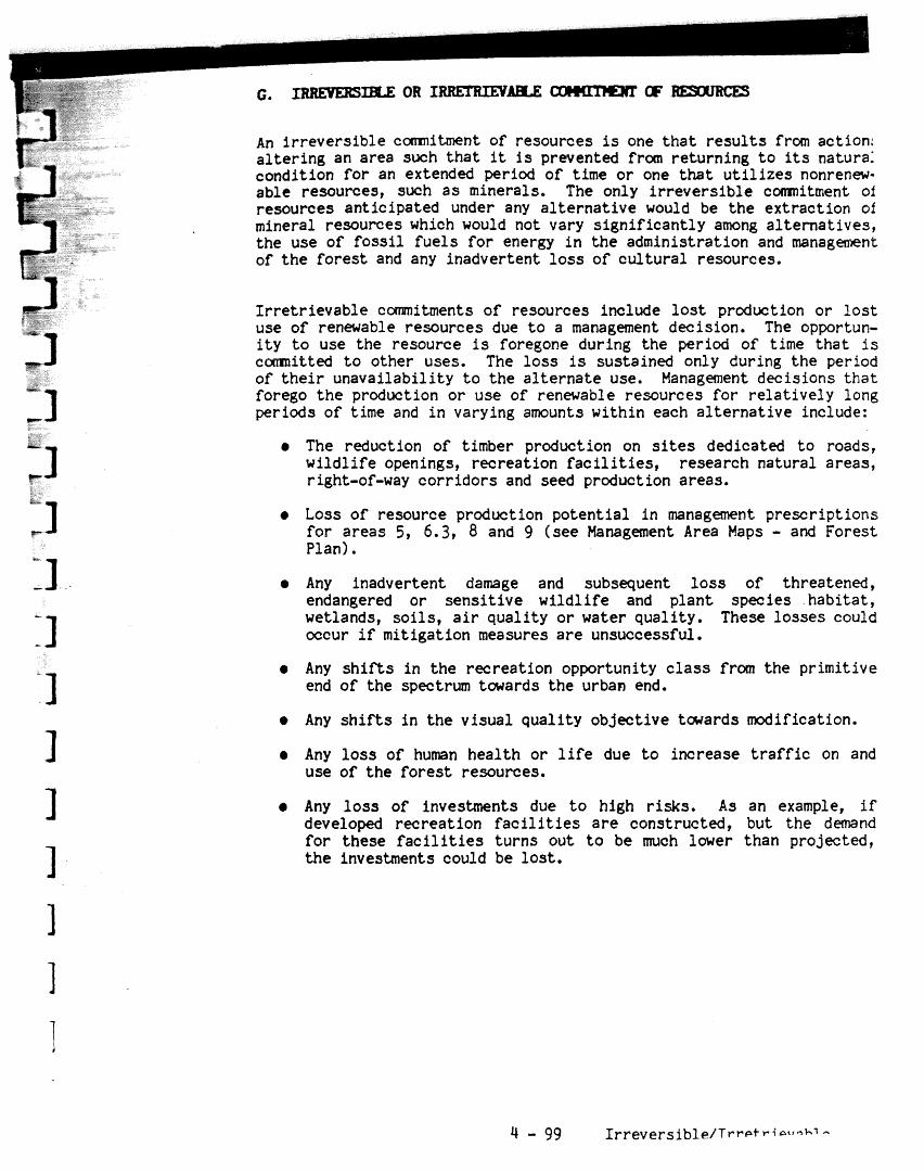
An irreversible c r n i m n t of resources is one t h a t r e su l t s from action: a l te r ing an area such tha t it is prevented frcm returning t o its natura: condition for an extended period of time or one t h a t u t i l i z e s nonrenw- able resources, such a s minerals. The only i r revers ib le c m i t m e n t of resoumes anticipated under any a l te rna t ive would be the extraction of mineral resources which would not vary s ignif icant ly among al ternat ives , the use of fos s i l fue l s fo r energy i n the administration and manag of t h e fores t and any inadvertent l o s s of cu l tura l resources,
I r re t r ievable c m i t m e n t s of resources include l o s t production or l o s t use of renewable resources due t o a management decision. The opportun- i t y t o use the resource is foregone during t he period of time tha t is
i t t e d t o other uses. The l o s s is sustained only during the period of t h e i r unavailabil i ty t o the a l te rna te use. Management decisions t h a t forego the production o r use of renewable resources for re la t ively long periods of time and i n varying amounts within each a l te rna t ive include:
* The reduction of timber production on s i t e s dedicated t o roads, wi ld l i fe openings, recreation f a c i l i t i e s , research natural areas, right-of-way corr idors and seed product ion areas.
Loss of resource production potential i n management prescriptions for areas 5, 6.3, 8 and 9 (see Management Area Maps - and Forest Plan).
a Any inadvertent damage and subsequent l o s s of threatened, endangered or sens i t ive wi ld l i fe and plant species habi ta t , wetlands, so i l s , a i r quali ty o r water quali ty. These losses could occur i f mitigation measures a r e unsuccessful.
e Any s h i f t s i n the recreation opportunity c l a s s from the primitive end of the spectrum towards the urban end.
* Any s h i f t s in the visual quali ty objective tcktards modification.
a Any l o s s of human health o r l i f e due t o increase t r a f f i c on and use of the fores t resources.
e Any loss of investments due t o high risks. As an example, i f developed recreation f a c i l i t i e s a r e constructed, but the demand fo r these f a c i l i t i e s turns out t o be much lower than projected, t he investments could be los t .
Land and Resource Management Plan NICOLET NATIONAL FOREST
APPENDIX C

The Forest-wide standards and guidel ines conta in d i r e c t i o n t h a t app l i es t o t h e e n t i r e Nicolet National Forest. When t h e appropr ia te p rac t i ces apply, t h e following standards and guidel ines a r e t o be used (exceptions where they do not apply a r e noted). They a r e l i s t e d here:
Work t o achieve informed public consent during development of land and resource management plans and programs p r i o r t o t h e i r implemen- t a t i o n .
Implement a public information and education program i n coordination with o the r public and p r iva te organizat ions t o reduce t h e number, i n t e n s i t y , and c o s t of c o n f l i c t producing and resource damaging s i t u a t i o n s .
Iden t i fy Fores t r e la ted oppor tuni t ies t h a t w i l l help ind iv idua l s and l o c a l c m n i t i e s enhance t h e i r s e l f - suff ic iency and t h e i r f ee l ings of s o c i a l well-being.
Iden t i fy oppor tun i t i e s i n which individuals and volunteer organi- z a t i o n s can a s s i s t i n t h e management of t h e National Fores t .
Do not allow resource management a c t i v i t i e s t o preclude t h e r i g h t of American Indians t o express and exerc i se t h e i r t r a d i t i o n a l re1 igion.
Plan 3@lementation Assure t h a t implementation of t h i s plan is done through in tegra ted resource management. All pro jec t a c t i v i t i e s must be dr iven by mul t ip le use ob jec t ives a s described i n t h e I
plan. Resource needs ( recreat ion, w i l d l i f e , timber, v i sua l , s o i l , I
water, e t c ) must be speci f ied and predetermined p r i o r t o projec t 1 planning i n an in tegra ted manner and in accordance with t h i s plan. 1
Standards and Guide1 ines

NEWL Process
= Air Quality
Pest ic ide Use
Does not apply t o ).(A 5 o r 9.1. Favor native species when restoring d i s - turbed areas or providing vegetative screening. Ensure diversity of vegetative types by following t h e composition objectives of the Manage- ment Area. Openings, regenerat ion, old growth, mast producers, wetlands, forage, thermal cover and other vegetative types w i l l be interspersed among the management areas a s specified.
L i m i t whole t r e e removal t o s o i l s w i t h suf f ic ien t nutrient content and nutrient storage capacity t o support the new stand of vegetation and maintain s o i l productivity.
A decision t o implement any proposed action t h a t could a f fec t resources, land uses and environmental quali ty not covered under t h i s Forest Plan sha l l be preceded by an environmental analysis. The Forest Supervisor w i l l use the r e su l t s of the analysis t o determine i f any documentation is required by the National Environmental Pol icy Act.
A l l actions i n the annual program of work a re covered by the Forest Plan. Any project ident i f ied i n the Forest Plan must be assessed t o determine if environmental e f f ec t s w i l l occur. The Nicolet w i l l f i l e a decision notice on the annual program of work.
Mitigating measures fo r forest management a c t i v i t i e s affecting a i r quali ty w i l l be specified, and control will be coordinated w i t h regulatory agencies.
Present and potential impairment of Forest resources a t t r ibu tab le t o a i r pollution w i l l be identified, and the Regional Forester w i l l be advised.
Pesticides w i l l be used only a f t e r consideration of other a l ternat ives c lear ly demonstrates pesticide use is
Standards and C I I ~ A P I fnnc 2~

s Recreation Opportunities
e s s e n t i a l t o meet management ; obJectives. Consideration w i l l be given t o t h e environmental accept- a b i l i t y , econ~mic ef f ic iency, v i sua l impact and biological ef fec t iveness of ava i l ab le a l t e r n a t i v e s .
Al ternat ives include s i l v i c u l t u r a l , mechanical, manual, prescribed f i r e , b io logical , and chemical treatments.
Whenever possible, t h e appl ica t ion of herbic ides i n re ten t ion zones ( s e e 2300 - Visual Q u a l i t y Objectives) should occur s o t h a t t h e vegetation is deadened in t h e f a l l of the year.
Use only p e s t i c i d e s reg i s t e red by t h e Environmental Protec t ion Agency (EPA) in f u l l accordance with t h e Federal Insec t i c ide , Fungicide and Roden- t i c i d e Act, a s amended, except a s otherwise provided by regulat ions, orders, o r permits issued by t h e EPA. I n addi t ion , c e r t a i n pes t i c ide uses requ i re Regional Fores ter approval.
Recreation developments w i l l be placed with p r i o r i t y given t o protec t ing t h e environment, correct- ing hea l th and s a f e t y problems, complementing prescribed recreat ion oppor tuni t ies and meeting demand.
A l l new const ruct ion o r improvements made t o e x i s t i n g f a c i l i t i e s w i l l provide f o r handicapped access. This w i l l include campground f a c i l i t i e s , with handicap access t o t o i l e t s , water fountains, and b a r r i e r f r e e walkways.
Campgrounds, m i m i n g beaches, picnic areas , boat launches and o the r in tens ive use s i t e s w i l l be provided primari ly a t experience Levels 11, 111 o r TV. Recreation s i t e s t h a t compl irnent and encourage dispersed use a r e featured,
Standards and Guidelines

These a r e the practices used on the Nicolet t o produce recreation benefits. (These do not apply t o HA's 5, 6.3, 8.1, 8.2 and 9.1.)
Nomharge Developed Recreation Construction Practices:
practice consists of a l l work necessary t o survey and construct new developed recreation noncharge s i t e s , including Level I1 campgrounds, Level I11 and IV m i m i n g and picnicking s i t e s , boat launches and interpret ive s i t e s . Costs of supporting f a c i l i t i e s , such a s parking l o t s , t o i l e t s , t r a i l s , signs, water wells, etc. a r e included with construction costs.
Projected work plans w i l l include detailed s i t e and f a c i l i t y drawings approved by the Dis t r ic t Ranger and Forest Supervisor i n advance of construction act ivi ty .
New Area Campsite Construction Practices:
This practice consis ts of the construction of new recreation experience Level I11 charge campgrounds. Costs of supporting s i t e s ( m i m i n g and boating) and f a c i l i t i e s , such a s in te r ior t r a i l s , a r e included i n the construction costs. Cost of the camp u n i t s includes cos ts of water wells, vault t o i l e t s , tables, f i r e rings, signs, t en t pads, vegetative management, etc. These costs a r e prorated over the t o t a l number of new camp units.
Vegetation w i l l be managed t o maintain growth and health of a l l l eve ls of vegetation, remove hazardous and over-mature t rees and allow sunlight t o reach the fores t f loor. A s a minimum, infor- mational signing i n a l l areas w i l l be provided for v i s i t o r services.
The degree of law enforcement needed t o protect the users and t o ensure adherence t o pol ic ies w i l l be provided.
Recreation Rehabilitation
Visual Resarrce Management
Recreation area rehabi l i ta t ion w i l l be undertaken with pr ior i ty given t o correcting health and safety problems, protecting the environment, changing camp unit design t o ease administration and refurbishing worn f a c i l i t i e s .
The visual resource w i l l be routinely considered i n a l l fores t projects. Projects w i l l borrow from l ine , form, color and texture of the characteris- t i c landscape. Management a c t i v i t i e s w i l l a t l e a s t meet the visual quali ty objective of modification.
Standards 2nd C l r i ~ a l i II n

Visual Q u a l i t y Objec t ives
Management o f t h e v i s u a l resource will be accomplished t h r u t h e appl i - c a t i o n o f v a r i o u s des ign techniques p l u s enhancement and r e h a b i l i t a t i o n p r o j e c t s . The o b j e c t i v e of v i sua l resource management is t o ensure t h a t ~ n a g e m e n t a c t i v i t i e s meeting o the r resource needs e i t h e r maintain o r upgrade t h e v i s u a l resource.
Visual q u a l i t y o b j e c t i v e s ( V Q O f s ) a r e depic ted on maps loca ted a t t h e F o r e s t S u p e r v i s o r i s O f f i c e and Ranger District o f f i c e s . Examples o f VQO a r e a s can be found i n Appendix E. Guidance on achieving these o b j e c t i v e s is given throughout t h e s t anda rds & g u i d e l i n e s sec t ion .
Management o f t h e v i s u a l resource w i l l be d i r e c t e d towards t h e a t ta inment o f t h e fol lowing v i s u a l q u a l i t y ob jec t ives :
R- - This VW provides f o r managernent a c t i v i t i e s which a r e not v i s u a l l y evident . A c t i v i t i e s may only r epea t form, l i n e , c o l o r and t e x t u r e which a r e found f requent ly i n t h e c h a r a c t e r i s t i c landscape. Reductions i n c o n t r a s t t o form, l i n e , c o l o r o r t e x t u r e should be accomplished during management a c t i v i t i e s o r i m e d i a t e l y a f t e r . Vegetat ion composition. o b j e c t i v e s w i l l be t h e same a s they a r e i n each o f t h e management a reas , however, b ig trees w i l l be fea tured i n t h e long-lived spec ies . Temporary openings may be 40 a c r e s but a r e designed t o appear smaller . Perma- nent openings a r e placed t o c r e a t e a view o f scenic land f e a t u r e s p lus add d i v e r s i t y i n foreground areas . Roads a r e less evident and i n t e r s e c t i o n s a r e kep t t o a minimum, There is l i t t l e c o n t r a s t i n c o l o r s a s road d e b r i s is removed f o r t h e first 100 feet i n t h e foreground and t h e road d i t c h e s , shoulders and banks a r e seeded when cons t ruc t ion is com- p le ted . Temporary roads a r e o b l i t - e r a t e d wi th in two y e a r s a f t e r t h e i r use, Wherever poss ib l e , road c l o s u r e devices, o t h e r t han gates , w i l l be
Standards and Guidel ines t

used. These devices should be natura l appearing and subordinate t o the sur- rounding landscape. Evidence of rnan- agement a c t i v i t i e s is low. Enhance- ment and r e h a b i l i t a t i o n p ro jec t s a r e given highes t p r i o r i t y f o r implemen- t a t i o n i n re tent ion foreground.
areas, however, big t r e e s w i l l be featured in t h e long-lived species. Temporary openings may be 40 ac res but a r e designed t o appear smaller. Evidence of management a c t i v i t i e s a r e moderate but lessened wi th in 1 year. When roads a r e t o be closed, consid- e ra t ion should be given s o t h a t t h e road c losure device is subordinate t o t h e surrounding landscape. P a r t i a l re tent ion a reas a r e second in prior- i t y f o r implementat ion of enhancement and r e h a b i l i t a t i o n projec ts .
Trails
- Management a c t i v i t i e s may dominate t h e o r ig ina l character- i s t i c landscape. These a c t i v i t i e s , however, must borrow from na tu ra l ly es tabl ished form, l i n e , co lo r and t e x t u r e s o a s t o appear natura l o r compatible t o t h e na tu ra l surround- ings. Few visua l enhancement o r re- h a b i l i t a t i o n p ro jec t s w i l l be planned in modification foreground areas.
Materials t h a t blend w i t h t h e s i t e w i l l be used t o t h e ex ten t p r a c t i c a l t o build and maintain t r a i l s and/or recreat ion f a c i l i t i e s . Rustic appearing s igns and blazes w i l l be used t o d i r e c t and con t ro l use.
Management of National Recreation T r a i l s w i l l be compatible with standards incorporated i n t h e Act e s tab l i sh ing t h e t r a i l and in the t r a i l management plan.
Standards and Guide1 ineq 11 3

Vehicles (OW)
Cultural Resaurces
The Fores t w i f l not groom snowmobile t r a i l s . These t r a i l s w i l l be maintained through agreements with t h e respect ive count ies ,
Where compatible, t r a i l s w i l l serve dual o r multipurpose use, such a s f o r snowmobile and hunter-walking t r a i l s .
The Nicolet ORV policy bas ica l ly allows motor veh ic les on a l l National Fores t roads except those roads t h a t a r e closed by signing, gat ing o r o ther road c losure devices. The policy p r o h i b i t s veh ic le t r ave l off of a road,
Under S t a t e laws, vehicl e s operated on roads must be s t ree t - l ega l or l e g a l l y exempted. Vehicles t h a t a r e not s t r ee t - l ega l o r exempted are prohibited from use on t h e Nicolet.
Most t r a i l s a r e meant f o r snowmobile o r foo t t r a v e l , but those t r a i l s t h a t look l i k e roads a r e gated o r other- wise closed t o o the r vehic les ,
The policy al lows snowmobiles t o be operated on designated snawmobile t r a i l s and on unsnowplawed roads.
The pol icy al lows f o r exceptions by pennit with o f f road veh ic le use by handicapped persons.
Conduct c u l t u r a l resource surveys and needed evaluat ions on a l l a reas t o be a f fec ted by e a r t h d i s tu rb ing p ro jec t s and design a c t i v i t i e s t o avoid, mini- mize, o r mi t iga te adverse e f f e c t s .
The Nicolet w i l l schedule t h e inven- t o r y o f c u l t u r a l resources on a l l National Fores t System lands giving p r i o r i t y t o a r e a s with high p o t e n t i a l f o r disturbance, completing surveys by 1990.
A c u l t u r a l resource overview d e t a i l i n g t h e h i s to ry , ethnography and prehis tory r e l a t i v e t o t h e Nicolet has been developed.
Standards and Guidelines
Interpretive Service
Standards and Gu ide1 ines
Concurrent w i t h the annual program of cu l tura l resource inventory, both si te-specific and thematic evalua- t ions of identified cu l tura l resource properties have been and continue t o be conducted within the framework of National Register of Historic Places e l i g i b i l i t y c r i t e r i a . Those s i t e s found National Register-eligible, a s well a s those not yet evaluated, have been preserved from potential manage- ment related impacts. A program of cu l tura l resource s i t e maintenance and protection has been implemented. Th i s program is aimed a t assessing the nature and degree of damage t o cu l tura l resources caused by vandalism, v i s i t o r use and natural deterioration, and serves t o identify protection needs.
Cultural and h is tor ic values i n re la t ion t o broader resource manage- ment objectives a r e approached and examined on a case-by-case basis. The Forest has maintained a c lose association wi th the Wisconsin S ta te Historic Preservation Officer (SHPO), providing copies of a l l reports re la t ive t o the program, and in a l l cases, the Forest has requested SHPO comment on the treatment of cul tural resource properties,
Opportunities fo r the interpretation of cu l tu ra l resources fo r public education and enjoyment a r e being developed. Selected cu l tura l resource properties have been signed, inter- pretive exhibi ts a r e being developed, and cu l tura l resource brochures have been dis t r ibuted through the Nicolets continued contact with interested public and private organizations.
Develop interpretat ive programs and materials t ha t support Forest activ- i t i e s and programs, and explain the correlation of resource management direction t o public i n t e re s t s and concerns. Programs w i l l be based on audience analysis and on land managerst needs,

These standards and guidel ines do not apply t o M A 1 s 5 or 9.1:
Diversity
Vegetative Practices
Divers i ty o f t r e e spec ies within s tands w i l l be maintained over time, 'Where timber s tands c o n s i s t primarily of red pine, jack pine, white pine and o the r con i fe r s , t h e r e w i l l be intermingled s tands such a s aspen, oak, o r o ther mixed t r e e species arranged i n a manner t h a t breaks up t h e cont inui ty o f c o n i f e r stands. The maximum s i z e f o r c o n i f e r s tands w i l l be 1000 acres. Th i s condition is d e s i r a b l e f o r d ive r se w i l d l i f e h a b i t a t , v i sua l v a r i e t y , and a s an a i d t o protec t ing t h e area from w i l d f i r e , i n s e c t s and disease.
Forested s tands w i l l general ly be a t l e a s t t e n a c r e s i n s i z e . Stand shape should blend w i t h t e r r a i n and other na tu ra l f ea tu res (b io logical , hydrological) t o avoid a r t i f i c i a l geometric pat terns .
Harvest Methods Harvest c u t t i n g methods a r e explained i n Appendix A. For each timber type t h e harves t method t o be used and r o t a t i o n ages a r e shown l a t e r i n t h i s sect ion. When managing f o r uneven aged stands, r e t a i n t h e sound t r e e s 24" and g r e a t e r t h a t a r e within view (0-300 feet) from travelways o r use areas. Unsound trees may be l e f t t o meet v i s u a l o r w i l d l i f e needs un less they a r e a public hazard.
Clearcut t ing , where prescribed, has been determined t o be t h e optimum method. When c l e a r c u t s occur i n re ten t ion and p a r t i a l r e t en t ion areas , r e s idua l vegetat ion ( o t h e r than reserve trees) 1" dbh o r g r e a t e r w i l l be c u t i n t h e inmediate foreground (0-300 f t ) o f travelways, use a r e a s o r water bodies,
Timber harves t p r a c t i c e s a r e l i s t e d on t h e following pages:
Standards and Guidelines

Timber Harvest Methods (Practices Used)
These a r e t h e p rac t i ces used on t h e Nicolet National Fores t t o produce timber benef i t s .
Even aged Harvest Pract ices:
' Regenerate by c lea rcu t t ing using f u l l tree, t r e e length o r shortwood logging. Do not leave res idual red pine when area is t o be regenerated .
t o red pine t o avoid sirococcus in fec t ions on t h e new stand.
Begin thinning harvest a t 30-50 years o f age, except f o r aspen, jack pine, paper b i rch o r balsam. Follow thinning regimes of red pine, white pine and white spruce Manager's Guides. Manager's Guides may vary between types.
Species Rotation Age CMAI* Old Growth
Aspen 40-80 50-60 60-90 B e F i r 50-80 50-60 70- 100 J. Pine 50-80 50-60 50-90 R e Pine 80- 120 50-60 100-250 W e Pine 80- 120 50-60 120-220 W e Spruce 80- 120 50 90- 120
'Culmination of Mean Annual Increment
Shelterwood Harvest Pract ices :
Paper Birch
Regeneration c u t t o 70-80% of crown c losure favoring l a r g e diameter, high crown paper birch. Remove overstory when regeneration is estab- l i shed (about waist high and 1000 trees per acre) . To maintain paper birch, s i t e preparat ion should be done p r i o r t o harvest , i f possible.
Begin thinning harvest when stand w i l l produce operable volume. Thin a t ,
10-20 year in te rva l s . Maintain 100 square f e e t of basal area (B/A).
Species Rotation Age C MA]: Old Growth
P. Birch 60-80 50 70-1 00
She1 terwood Harvest Pract ices:
Northern Hardwoods, White Pine & Hemlock
Regenerate evenage s tands by two-cut o r 3 s tage shelterwood method, using any logging method t h a t doesn' t degrade t h e s i t e o r cause excessive damage t o res idual stand. Regeneration cu t 10 years before f i n a l harvest . Remove overstory when regeneration is 3-4 f e e t in height. (Ref: North Central guides f o r stocking)
Standards and Guidelines

Begin thinning harvest when stand w i l l produce operable volume. Thin a t 10-20 year intervals favoring species such a s yellow birch, ash , basswood and hemlock. Follow stocking guides i n North Central Guide 39,
Species Rotat ion Age CMAI Old Growth
Hardwood 80-1 10 GI. Pine 80-1 10 Hemlock 80-1 10
Shelterwood Harvest Practices:
Lowland Conifer
Regenerate evenage stands by two cut shelterwood method, t rac tor logging. Regeneration cut t o 60-70% crown closure favoring large diameter cedar, spruce and tamarack with overstory removed l a t e r . Scarify before or a f t e r harvest fo r s i t e preparation.
For lowland conifer types, enter stand a t age 50-60 t o remove mature bal sam.
Species Rotation Age C M A I Old Growth
L. Co'nifer 100-120 80 100-200
Selection Cutting Practices:
Regeneration of stand is achieved through unevenage management using the single t r e e selection harvest system. Thin stand through a l l s i ze c lasses leaving the following basal areas:
20-24" DBH 20 Sq. Ft. 15-19" DBH 26 Sq. Ft. 10-14" DBH 22 Sq. Ft. 5- 9" DBH 16 Sq. Ft. 0- 4" DBH 8 Sp . F L
92 Sq. Ft.
Begin thinning t o develop stand s t ruc ture when stand w i l l produce operable volume. Harvest entry period approximately every 20 years u n t i l regulated stand is developed, then enter approximately every 10-20 years.
There is no rotat ion age fo r unevenage management stands.
Standards and Guidelines

Reserve Trees Selected reserve trees w i l l be retained in a r e a s t h a t a r e cut . These reserve t r e e s should be a combination of s i n g l e t r e e s , groupings of t r e e s and reserve is lands. Single t r e e s reserved should genera l ly be within 200 feet of the c u t t i n g u n i t perimeter. See Nicolet Manual - Supplement f o r se lec t ion c r i t e r i a .
Provide snags t o meet requirements of w i l d l i f e species a s discussed i n 2600 ( W i l d l i f e Habitat Management).
Ternporary Openings Ternporary openings w i l l vary in s i z e and shape t o blend with t h e surrounding f o r e s t environment. The maximum s i z e of temporary openings w i l l be 40 ac res (25 a c r e s i n Manage- ment Areas 6.2 and 9.2) unless:
1. There has been 60 days public no t i ce given on an individual proposal and t h e exception has been approved by t h e ' ~ e ~ i o n a i Fores ter , o r
2. There has been a natura l ca tas t roph ic condit ion, such a s f i r e , windstorm o r an insec t o r d i sease a t t ack , and t h e proposed ac t ion plan has been approved by t h e Regional Forester .
Temporary openings w i l l general ly be separated by a stand o f a t l e a s t t en ac res and a d i s t ance of 500 fee t . They w i l l be considered a s temporary openings u n t i l t h e new t r e e s have reached a height t h a t is equal t o o r g rea te r than 20 percent of t h e height of t h e surrounding vegetation.
Ternporary opening guidel ines should be developed on a p ro jec t by projec t b a s i s with in tegra ted resource management input. The maximum temporary opening t o be allowed is 40 acres.
Standards and Guidelines 48

Suggested guides for tanporary 0pXIings a r e listed below, In order t o meet visual qual i ty objectives, the open area tha t can be seen a t any one point from a travelway, stream, use area o r water body should not exceed the following suggested guide1 ines:
zravelwav- or strean
f AREA * I I
I - - _ i
1 Part. 1 1 - 1 M I
-USE-- t Bef;en I i t I
I
Motorized1 10 Ac ' 20 Ac f 40 Acf Nonmotor 1 5 ~ c i I O A C 1 3 0 ~ ~ :
* The actual s i z e may be 40 acres but the area seen a t any one point is shown above.
l&2 T r m t r e a m
In general, there w i l l not be any temporary openings result ing from timber management a c t i v i t i e s immediately adjacent t o lakes and streams with the following exception. Lakeshore and streamside vegetation manipulation, when necessary t o maintain or enhance the visual and wi ld l i fe resource, w i l l comnonly consis t of underplanting and thinning with t h e long-term objective of long lived big t rees . When it is necessary t o c rea t e a temporary opening next t o a lake o r stream, the s i z e of t h i s opening seen from any position on t h e shoreline should not exceed 5 acres (note t h a t the actual opening s i z e may be la rger but only 5 acres can be seen) .
Standards and Guidelines
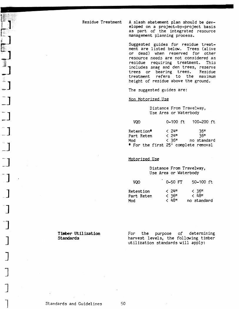
Residue Treatment A s l a s h abatement p lan should be dev- eloped on a project-by-project b a s i s a s p a r t o f t h e i n t e g r a t e d resource management planning process ,
Suggested gu ides f o r r e s i d u e t r e a t - ment a r e l i s t e d below. T rees ( a l i v e o r dead) when reserved f o r o t h e r r e sou rce needs a r e no t considered a s r e s i d u e r e q u i r i n g t r ea tmen t , T h i s i nc ludes snag and den trees, r e se rve trees o r bear ing trees. Residue t r ea tmen t refers t o t h e maximum he ight of r e s idue above t h e ground.
The suggested gu ides a r e :
Dis tance From Travelway, Use Area o r Waterbody
Retent ion* < 24n 36" P a r t Reten < 24" 36" Mod < 36" no s tandard * For t h e first 25' complete removal
Dis tance From Travelway, Use Area o r Waterbody
Retent i on < 24" < 36n P a r t Reten < 36" < 48" Mod < 48fi no s tandard
Tfmber Utilization Standards
Standards and G u i d e l i n e s 50
For t h e purpose o f determining h a r v e s t l e v e l s , t h e fo l lcwing t imber u t i l i z a t i o n s t anda rds w i l l apply:

Harvest Level Proj,tion, (36 CFR 219.9)
Ha rdwoud Sawlogs 2/
Aspen Sawlogs 9.0
Softwood Sawlogs
Hardwood Pulpwood
Softwood Pulpwood
3/ 4.0 70 sound &
reasonably 4.0 s t ra ight it/
1/ Plus trim allowance.
Only logs tha t meet grade 3 o r be t t e r factory logs a r e considered ~ w l o g s . ~ o g s l e s s than grade 3 (construction grade or local use) and appraised posit ive can be considered sawlogs a t Forest option. Caution: On integrated sa les where only grade 3 and bet te r logs a r e considered a s s ~ l o g s , a grade 4 or construction grade log may not meet pulpwood specifications bffauae of percent soundness.
Y 70 percent appl ies t o ro t , voids and char. Mechanical type I defects such a s weep, crook, spider heart and ring shake, & a l h ( & be considered.
&' Reasonably s t ra ight : m e n the t r u e center line of a minimum length p i w e does hot deviate more than one-half t he inside diameter of the -11 end, plus 1 inch from a s t r a igh t l i n e drawn between the centers of the ends of t he piece.
Y A m i n i m u m tree must include a t l e a s t one piece tha t meets minuman specifications.
Standards and Guidelines i

mifictal Reforestation
S i t e Preparation These a r e t h e a r t i f i c i a l reforesta- t i o n p r a c t i c e s and standards t h a t w i l l be used on t h e Nicolet f o r s i t e preparation:
Prepare sites f o r a r t i f i c i a l regeneration by mechanical and/or herbic ide treatment o r prescribed burning. Objectives of treatment may include reduction of a c t i v i t y f u e l s but main purpose o f treatment is t o prepare seed bed by exposure of mineral s o i l and reduction of competition,
Planting
Provide f i l t e r s t r i p s a s needed when applying mechanical and/or herbicide treatment within o r adjacent t o r ipa r ian a r e a s and other ownership.
Protec t s lopes g r e a t e r than 25% on Pence-Vilas Ecological Land Types from e ros ive forces.
These a r e t h e p rac t i ces t h a t w i l l be used f o r p lant ing on t h e Nicolet:
Treatment c o n s i s t s o f hand o r machine planting of t r e e seedl ings o r tube- l i n g s on na tu ra l o r prepared s i t e s . P rac t i ce a l s o includes a minor amount of d i r e c t seeding and s c a t t e r planting f o r w i l d l i f e and v i sua l management purposes. Tree stock planted should be of t h e highest genet ic q u a l i t y t h a t is economically avai lable . Normal stocking r a t e s a r e shown below.
Prac t i ce includes f i l l in , replanting and first and t h i r d year stocking surveys, i n addi t ion t o survival counts. Surveys beyond t h e t h i r d year survey w i l l be required before some p lan ta t ions can be c e r t i f i e d a s es tabl ished,
Standards and Guidelines
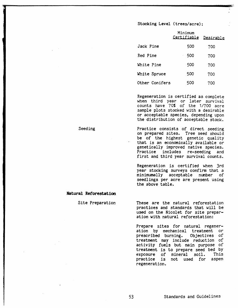
Stocking Level ( t r e e s l a c r e ) :
Seeding
Natural Reforestation
S i t e Preparation
Jack Pine
Red Pine
White Tine
White Spruce
Other Conifers
Regeneration is c e r t i f i e d a s complete when t h i r d year o r l a t e r survival counts have 70% of t h e 1/700 acre sample p l o t s stocked with a des i rab le o r acceptable species, depending upon t h e d i s t r i b u t i o n of acceptable stock.
P r a c t i c e c o n s i s t s o f d i r e c t seeding on prepared s i t e s . Tree seed should be o f t h e highest genet ic q u a l i t y
- t h a t is an economically ava i l ab le o r gene t i ca l ly improved nat ive species. P rac t i ce includes re-seeding and f i r s t and t h i r d year survival counts.
Regeneration is c e r t i f i e d when 3rd year stocking surveys confirm t h a t a minimumally acceptable nunber of seedl ings per a c r e a r e present using t h e above table .
These a r e t h e na tu ra l r e fo res ta t ion p r a c t i c e s and standards t h a t w i l l be used on t h e Nicolet f o r site prepar- a t i o n wi th na tu ra l refores ta t ion:
Prepare s i t e s f o r na tu ra l regener- a t i o n by mechanical treatment o r prescribed burning. Objectives o f treatment may include reduction of a c t i v i t y f u e l s but main purpose o f t reatment is t o prepare seed bed by exposure o f mineral s o i l . T h i s p r a c t i c e is not used f o r aspen regeneration.
Standards and Guidelines

Protect s lopes g r e a t e r than 25% on Pence-Vilas ELT's from eros ive forces ,
These a r e t h e natura l r e fo res ta t ion standards t h a t w i l l be used on t h e Nicolet f o r site prep:
Prepare s i t e s f o r na tu ra l regener- a t ion by removing res idua l overstory t r e e s following harvest . Method is mainly hand f e l l i n g but may include some amount of machine work, such a s shear blading. This method app l i es t o a r e a s where ob jec t ive is overstory removal without f u e l treatment o r a ground s c a r i f i c a t i o n ,
For pure aspen regeneration following treatment, l i v e res idual overstory cannot exceed 10 square f e e t of basal area ,
Natural Regeneration Prac t i ce c o n s i s t s o f regenerating f o r e s t a r e a s by na tu ra l seed f a l l o r sprouting on natura l o r prepared seed beds. Costs included cons i s t of determining i f adequate regeneration is present p r i o r t o f i n a l harvest i n t h e shelterwood system o r c e r t i o i n g regeneration has occurred within f i v e years following t h e f i n a l harvest.
Standards and Guidelines
Regeneration is c e r t i f i e d when t h e following stocking l e v e l s a r e met o r exceeded :
Aspen
Oak
Birch
Other Hdwds
Minimum

r Stand Imprw
Chemical Ref ease
Hand Release
Prac t i ce c o n s i s t s of releasing des i red species from competing vegetat ion by a e r i a l (he l i cop te r o r a i rp lane) o r ground appl ica t ion of a chemical agent t o deaden unwanted vegetat ion* P r a c t i c e includes a small amount of hand work t o clean up edges o r missed s p o t s following treatment. (Refer t o 2100-Pesticide Use.) Release treatment is applied one o r more years a f t e r desired species a r e es tabl ished by planting, d i r e c t seeding o r natura l regeneration,
Proposed a e r i a l app l i ca t ions of p e s t i c i d e s w i l l be evaluated through an environmental a n a l y s i s process. The Fores t Supervisor of t h e Nicolet N,F. must approve a l l uses of pes t ic ides .
A l l app l i ca t ions w i l l conform t o t h e purposes and methods approved by t h e Environmental Protec t ion Agency and issued i n accordance wi th regis tered l a b e l ins t ruc t ions ,
Areas t r ea ted with p e s t i c i d e s w i l l be posted a t po in t s of probable public entry. Notices w i l l include t h e type of mater ia l applied and t h e da te o f appl ica t ion. Posted n o t i c e s w i l l be removed 90 days a f t e r applicat ion.
Projec t p lans f o r appl ica t ion of p e s t i c i d e s (ground o r a e r i a l ) w i l l include contingency plans f o r containment and clean-up o f accidenta l sp i l l age .
P r a c t i c e c o n s i s t s o f re leas ing es tabl ished des i red species from competing vegetat ion by c u t t i n g o r g i r d l i n g with hand too l s . Release treatment is applied a f t e r des i red spec ies a r e es tabl ished by planting, d i r e c t seeding, o r na tu ra l regenera t ion .
Standards and Guidelines

Riparian Areas
Because of t h e charac te r of t h e Nicolet National Fores t watershed, the limits on t h e proportion of t h e drainage t o be t r e a t e d a t any one time by vegeta t ive removal a r e high, and general ly not of concern. Changes in t h e timing o r quant i ty of water flow a s a r e s u l t of proposed f o r e s t - management a c t i v i t i e s a r e s l i g h t .
Preserve t h e benef ic ia l values of f loodpla ins and wetlands, protec t public sa fe ty and be c o s t e f f i c i e n t in t h e const ruct ion, management, protect ion, maintenance and rehabil- i t a t i o n p rac t i ces i n a l l a reas of s t r u c t u r e s and f a c i l i t i e s . Review r ipa r ian area p r a c t i c e s on a case-by- case b a s i s t o ensure t h a t t h e prac- t i c e is compatible with t h e r ipar ian area and the p r a c t i c e has a low r i s k f o r t h e following: - causing detr imental temperature o r
water chemistry changes. - introducing pes t i c ides i n t o surface and groundwater, - deposit ing undesired sediment. - blocking stream flow.
Management a c t i v i t i e s proposed f o r r ipa r i an zones adjacent t o l akes and streams, such a s timber harvesting, road construction, s i t e preparation o r TSI work, w i l l be reviewed by the hydrologist , landscape a r c h i t e c t , w i l d l i f e b i o l o g i s t and/or s o i l scien- tist p r i o r t o t h e i r implementation.
Standards and Guidelines
In r ipa r ian a reas adjacent t o l akes and streams, l i m i t heavy equipment use t o periods when ground is dry o r frozen. Provide f i l t e r s t r i p s a s needed when applying mechanical and/ o r herbic ide treatment within o r adjacent t o r ipa r i an areas. The following can be used a s a guide:
Slopes t o - hlldth of Fi- Under 5% 10-25 t
5020% 25-50' Over 20% slope break o r 50 f t .
Watershed Disturbance
Minimize r i sk of flood loss , res tore and preserve floodplain values, and protect wetlands.
Heavily disturbed areas, such a s borrow p i t s and mineral developnents, w i l l be restored under an approved s i t e reclamation plan approved pr ior t o surface disturbance. Water bodies my be created when surface runoff and s o i l conditions permit, i f they meet t he needs of impoundments. See 2600 - Wildlife Habitat Management.
Treat a l l disturbed areas tha t a re subject t o erosion fo r erosion pre- vention preferably w i t h i n the growing season i n which the disturbance occurs. When obl i te ra t ing roads or closing short-term roads, use erosion control pract ices outlined i n Water- shed Structural Measures Handbook (FSH 2509.12).
Use erosion control practices for roads, skid t r a i l s , and other s o i l disturbing uses when slopes exceed 25% on Pence-Vilas ELTf s.
Consider enhancement of s o i l productivity when opportunities a r e economically feasible.
Minima Viable Populations In cooperation with t h e W I Dept. of Natural Resources, monitor habi ta t conditions and population trends of management indicator species. Assess the impact of management practices on management indicator species and t h e i r habi ta t t o insure tha t m i n i m viable populations a r e sustained.
mnagement Indicator Species
The e f f e c t s of the Forest Plan on wi ld l i f e and f i s h w i l l be monitored. However, because it would be impos- s i b l e t o track the e f fec ts of the Plan on each of the Nicolet ts 368 species of w i ld l i f e and f i s h , 32 were selected a s management indicator species tha t were f e l t t o represent most hab i t a t s and the majority of a l l
Standards and Guide1 ines

Exis t ingIPotent ia l Essent ia l Bald Eagle Habitat
other spec ies on t he Nicolet. These species a r e l i s t e d in t h e FEIS on page 3-33, with t h e i r associated hab- i t a t and t h e number of o ther species they a r e ind ica to r s fo r . The selec- t i o n process is noted i n a document on f i l e a t t h e Superv i so r t s Office - Rhinelander, Wisconsin. The monitor- ing o f management indicator species is covered i n Table 17 of Chapter 5.
Federally Endangered, Because d isc los ing t h e loca t ions Threatened and Sensitive of threatened, endangered and Species s e n s i t i v e species may jeopardize
them, a l l such loca t ions w i l l be kept conf ident ia l and disclosed only f o r management and val id research and study purposes.
Exist ing and po ten t i a l , e s sen t i a l bald eag le hab i t a t , a s iden t i f i ed using c r i t e r i a from t h e "Northern S t a t e s Bald Eagle Recovery Plan," w i l l be managed with t h e following emphasis: 1. Low human disturbance. 2. Land acquisi t ion/adjustment
- p r i o r i t y . 3. Open road densi ty f o r Management Areas 1.2, 2.2, 3.2 and 4.2 equal t o o r l e s s than e x i s t i n g densi ty. Low road const ruct ion standards. 4. F i s h e r i e s management t o maintain an adequate f i s h prey base. 5. Manage toward maintaining and in- creasing white pine. Reserve ex i s t ing and po ten t i a l nes t and perch t r ees .
1 6. Work with t h e U.S. Air Force t o help mi t iga te low f l y i n g a i r c r a f t disturbance.
r+l
Bald Eagle and Osprey Bald eagle and osprey nest ing a reas Nests, Great Blw Hem and g r e a t blue heron rookeries w i l l Rookeries be governed by t h e following
requirements: 1. Manage t o con t ro l disturbances within approximately 330 f e e t of each eag le nes t , osprey nes t o r g rea t blue heron rookery. 2. Manage t o con t ro l s i g n i f i c a n t changes i n t h e landscape within approximately 660 feet of an eagle o r osprey nes t o r g r e a t blue heron rookery.
Standards and Guidelines

3. Restr ic t management a c t i v i t i e s t ha t resu l t in adverse disturbance t o nesting birds w i t h i n approximately 1,320 f e e t of an eagle nest, osprey nest o r great blue heron rookery during the nesting period.
Potential Essential Gray Wolf Habitat
Sensitive Species
Potential essent ia l wolf habi ta t is described in the FEIS on page 3-30. Within these areas, the open road density w i l l be l e s s than two milesl square mile. A proportion of both high and l a w standard roads w i l l be closed. There w i l l be an emphasis t o reduce the t o t a l road density and lower the overall road standard. Habitat fo r t h e wolf's mairi prey, the white-tailed deer, w i l l be maintained or increased (except i n Managemnent Area 5). Land acquisit ion and adjustment w i l l receive high pr ior i ty consideration.
A l i s t i n g of candidate sensi t ive species fo r the Nicolet, together with the probable e f fec ts of management practices on them, is given i n the matrix of Table 15. ( A f ina l sens i t ive species list w i l l be developed by the Regional Forester using each Forest s candidate l ist . ) Species not selected a s sensi t ive species w i l l be considered species of Nicolet Forest concern and s t i l l be managed according t o the standards and guidelines given below. The complete Candidate Sensi t ive Spwies L i s t Evaluation Process, developed i n cooperation with the Wisconsin DNR and the Nature Conservancy, is on f i l e a t t h e Nicolet Supervisort s Off ice, Rhinelander, Wisconsin.
A biological evaluation is required where negative e f f ec t s a r e shown t o be possible for species w i t h knmn locations. However, i f standards and guidelines o r other protection measures (such a s inclusion i n a RNA or 8.1 Management Area, o r Forest-wide al locat ion of essent ia l habi ta t ) eliminate negative e f f e c t s of management practices, a biological evaluation w i l l not be needed.
Standards and Guidelines

TABLE 15 - EmCTS OF NNK;WHI PRACTICES ON CANDIDATE
and ida t e u.
Stnsi t I ve
c rc 0a-I d n c 4 u L - 4 L c a v a
Pine Harm - +Bobcat + + + - 0 + + + Comnon Loon
*Sandhill Crane + + + + + + 0
'Black Tern + + .
.Upland Sandpiper + + + Coarmon Merganser 0
Goshauk +
a - - Cooper's Hawk - - .-
Her1 in - - - RedShouldercd Hawk - - o
Osprey (.. - - -. *Marsh Hawk + Long-ea red O w l -.
'Barred O w l 0
-1 *Spruce Grouse -. - *Solitary Vireo 0
ms-- 'Eastern Bluebird + %rasshopper Sparrow + *LeContet s Sparrow + *Savannah Sparrow
*- -I *vesper Spar rov + + *Clay-Colored Sparrow + Lincoln's Sparrou
*BlackburnIan Warbler 1 Wood Turtle .I,
*Redside Dace S r e a t e r Redhorse
I *Missouri Rock-Cress - - -.
*Rugulose Crape Fern *Calypso -. .. *Stoloniferous Sedge - - ..
-1 Northern Bog Sedge + Sheathed Sedge + Ram1 s Head Ladyt s Slipper + Stygian Rush + White Adderf s Houth + Small Round-Leaved Orchid + Braun's Holly Fern + - Foara Flower Small Purple Bladderwort + Dwarf Bilberry
@Ginseng Showy Lady's Slipper
'l I - Nqat ive Effect i + Positive Effect
Blank No Effect
1 S t a n d a r d s and G u i d e l i n e s

Candidate
Sensitive
Species
Fn ii '3
c 2 aJ 0
0 aJ cr a0 E m W
- o n e L) c c a 0 c m 0-4 0 0
C -+ 3 - c d U L 4 0 L1 a+ a C Y
( b U 3 - I 3 u U o u 3 5n ('-a L a U L W C U "0 u W 1 -
C W L J U N O P I m r P 7 J U c l ) - > Y aJ Z W L * c n -L;z 0 0 m a m r0
u > u u S s 4 c s 4 nrcn % L m * x c (
D s x a o o m P C S L 0
W c d W - Q i L u t t ( d . . E W a a E L U 9J L r r U
il L -urn U
' u " 0 - U
" o G \ S r & c d z Q k d L L U . P L c ) U P) (Y aJ E * h 6IV: W W a a C fa navl
9 u , P 1 k 2 L. V f c a rP cd O G h
a * > M A Q ! i> i is s.C M M 3 3 u 4 & P1
'4- aJ
n u c d m ~ u m ~ ~ u Q W O .
E ~ ~ c a c a - ~ p ~ * * O O ~ J U - * , ,,-* W a r c S > vl
Pine Marten 'Baht h m m Loon
"Sandhill Crane 'Black Tern *Upland Sandpiper Comnon Merganser Goshawk Cooper's Hawk Merlin Red-Shouldered Hawk Osprey
*Marsh Hawk Long-eared O w l
*Barred O w l *Spruce Grouse 'Solitary Vireo "Eastern Bluebird .Grasshopper Sparrow *LeContet s Sparrow *Savannah Sparrow *Vesper Sparrow *Clay-Colored Sparrow Lincoln's Sparrow
"BlackburnIan Warbler Wood Turt le
'Redside Dace q r e a t e r Redhorse "Missouri Rock-Cress *Rugulose Grape Fern 'Calypso *Stolonifemus Sedge Northern Bog Sedge Sheathed Sedge Ram's Head Lady's Slipper Stygian Rush White Adder's Hooth Small iiound-leaved Orchid Braunfs Holly Fern Foam Flcwer Small Pw-pl e Bladderwort Dwarf Bilberry
"Ginseng Showy Lady's Slipper
*Protection .or mitigation covered a t the fo res t levci rf planning. A l l o thers w i l l be evaluated a t the project level. Biological evaluations not needed if s i t e review indicates no probable negative e f f e t s ,
S t a n d a r d s a n d Guide1 ines
The following standards and guide- l i n e s apply s p e c i f i c a l l y to , o r were developed s p e c i f i c a l l y f o r , ident i - f i e d candidate s e n s i t i v e species a s a r e s u l t of t h e evaluation process and the developnent of t h e matrix:
Pine Harten, Bobcat. Maintain t h e ex i s t ing 120,000 a c r e area closed t o dry-land trapping. This area was o r i g i n a l l y es tabl ished i n 7962 t o protec t re in t roduct ions of f i she r .
C- Loon. For small undeveloped l akes with a high percentage of National Forest ownership and with ex i s t ing o r po ten t i a l loon nesting, cooperate with town boards, the W I DNR, and p r i v a t e r ipa r i an land- owners t o develop r e s t r i c t i o n s on motors. Res t r i c t Fores t Service developed recreat ion on these lakes.
Sandhill Crane, Upland Sandpiper, Marsh Ha&, Eastern Bluebird, Gm per Sparrow, Le Contets spa Savannah Sparrow, Vesper Sparrar, Clay-Colored Sparrar, Dwarf BFlberry. Maintain e x i s t i n g upland sod openings and reclaim selected previously planted upland sod openings (3 a c r e s and l a r g e r in s i z e ) . Some maintenance w i l l be done through prescribed burning t o favor remnant open grassland vegetation.
Sandhill Crane, Lincolnt s Sparmv. Maintain and reclaim se lec ted l a rge bogs i n an open and brushy condition.
Ccnmn Loon, Black Tern, Cmmon Merganser, Osprey, Redside Dace, Greater Redhorse. Chemical f i s h con t ro l proposals w i l l be subjected t o an environmental evaluation in waters containing o r being used by these species.
Ginseng. Harvesting of ginseng with out a permit (Form 2400-14) is a v io la t ion of 36 CFR 261.6(h). D i s t r i c t Rangers w i l l not grant permits of harvest ing of ginseng from National Fores t Lands.
Standards and Guide1 i nes

Calypso, Stolmiferooa Sedge, Mothern Bog Sedge, -thed Sed€!e Lady's Slipper, Stygian Adderrs Mouth, Small Rauld-Leaved Orchid, 11 Purple Bladderwort, Shary Ladyis Slipper. Control beaver ( i n conjuction with t h e WDNR) and remove beaver dams in a r e a s of known r a r e p lan t sites threatened by f looding. Also protected under Management Area 8.1.
Wood Turtle. Retain a lde r along streams known t o have populations of t h i s species.
Spruce rouse. As al located i n the Forest Plan, emphasize Jack pine i n por t ions of management areas 4.1 t h a t do not have lowland con i fe r stands. The jack pine, by age c l a s s , w i l l be s p a t i a l l y d i s t r i b u t e d t o t h e extent possible.
Pine Marten, Bobcat, Cannon Herganser, Longeared Owl, Barred
- O w l , Solitary V i r e o , Blackburnian Warbler, Hissoori Rock-cress, Rugulose Grape Fern, Braunis Holly Fern, Foam Flower. Protected under general s tandards and guide1 ines and when occuring i n o r placed in one of t h e following areas: wilderness, research na tu ra l a r e a d s c i e n t i f i c areas , spec ia l a reas , management a r e a s 8.1, and 1.2, 2.2, 3.2, 4.2, 6.2 and 9.2 management areas .
Goshawk, RedShatldered Hawk. Within known t e r r i t o r i e s t h e following pro- t e c t i o n guides w i l l be adhered to :
1. Incorporate nes t s i t e s i n t o a stand with a minimm s i z e o f 20 a c r e s t o be designated old growth. (Some t e r r i t o r i e s w i l l need t o be l a r g e r t o r e t a i n t h e i r product iv i ty . ) 2. Stands imnediately adjacent (within a minimum of 300 f e e t ) t o t h e designated t e r r i t o r y (old growth stand) w i l l not be c lea rcu t if p r a c t i c a l s i l v i c u l t u r a l a l t e r n a t i v e s a r e avai lable .
Standards and Guide1 i n e s

3. Generally, no new roads w i l l be b u i l t o r ex i s t ing ones reconstructed within t h e designated t e r r i t o r y (o ld growth s tands) , o r within 300 feet of nests . Exist ing roads w i l l be closed where possible. Where roads a r e b u i l t , seasonal r e s t r i c t i o n s w i l l be imposed on t h e i r use. 4. Human disturbance, t o the extent possible, w i l l be eliminated o r re- duced between February 1st and August I s t , ( t h e most c r i t i c a l nest ing period being April 1st t o May 15th). 5. The effects on raptor t e r r i t o r i e s w i l l be analyzed through t h e Integra- ted Resource Manangement implemen- t a t i o n process.
The following standards and guidel ines do not apply t o MA 5 OR 9.1:
Permanent Openings Exist ing and newly constructed permanent openings a r e d i s t r ibu ted throughout t h e management areas. Where possible, they a r e well dispersed and located between con t ras t ing timber types and a l s o where they can serve a s log landings, f i re breaks o r v i s t a s . Constructed openings w i l l be shaped t o blend i n with t h e surrounding landscape and be a minimum of 1 a c r e in s i z e . During t h e const ruct ion of these openings t h e res idue treatment guides found in t h e timber sec t ion should be followed. Permanent sod is t h e primary object ive , but clover, upland brush and savannah condit ions a r e a l s o represented. Maintenance of e x i s t i n g openings is t h e highest p r i o r i t y and w i l l be by mechanical moving, herbicides, prescribed f i r e ,
,- - 1 o r handcutting. They w i l l range i n s i z e from one t o severa l acres .
-1 Approximately 3% of t h e F o r e s t ' s upland a c r e s w i l l be i n permanent openings. Detailed p ro jec t guide- l i n e s a r e contained i n Nicolet Supplement 10.
Favor treatment of transmission l i n e rights-of-way vegetat ion t o improve w i l d l i f e forage.
Standards and Guidelines
NomForest Wetlands Manage selected wetlands f o r water- foul , furbearers , and other game and nongame w i l d l i f e . Maintain a r t i f i c i a l nes t and r e s t i n g s t r u c t u r e s f o r waterfowl. These s t r u c t u r e s should be located a s unobtrusively a s possible. Manage water & vegetation through wetland pond and impoundment const ruct ion, beaver management, prescribed burning, maintenance of r i p a r i a n aspen, seeding o r planting. Detai led p ro jec t guidel ines a r e contained i n Nicolet Supplement 11.
Wi ld l i f e impoundment construction sites w i l l be se lec ted i n cooperation with t h e Wisconsin DNR and permits w i l l be secured. Highest p r i o r i t y s i t e s a r e those t h a t w i l l enhance e x i s t i n g bald eagle, osprey, and g r e a t b lue heron nes t ing t e r r i t o r i e s , o r i d e n t i f i e d po ten t i a l eagle hab i t a t . Special considerat ion w i l l be given t o protec t ing t h e cold water t r o u t resource. I n t e r d i s c i p l i n a r y review and approval w i l l precede construction. Actual design and const ruct ion w i l l incorporate na tu ra l f e a t u r e s and manufactured i s l ands and peninsulas f o r w i l d l i f e and v i sua l enhancement. I n t e r p r e t i v e signing w i l l be provided. Compl e t ed impoundments w i l l be placed on a 3-5 year p a r t i a l . o r f u l l drawn-down schedule unless modified because of t h e presence o r use o f t h e impound- ment by threatened, endangered o r s e n s i t i v e species.
C r i t e r i a f o r impoundment location:
Organic s o i l l a y e r . Under 6" th ick Extensive f l o a t i n g . None acceptable
mats Watershed/impound- . Greater than
ment r a t i o 0.75 Spec i f i c Conduct . . Greater than 25
micro mhoslcm Water l e v e l control . As beaver-proof
S t r u c t u r e a s poss ib le Water depth. . . , . Some por t ions
more than 6 f e e t deep f o r f i s h survival
Standards and Guidelines

Shallow small woodland ponds w i l l be constructed on selected s i t e s t o pro- vide a permanent water source for wi ld l i fe and for f i r e control. E x i s t - ing intenni t tent ponds or wetlands can be deepened or new areas of high water tab le can be selected for con- struction. S i t e selection is based on nearness t o permanent water, access, and soil/water t ab le information.
Riparian Transition Zones The following ~ i l d l i f e ~ f i s h e r i e s management considerations w i l l be given t o riparian areas which comprise narrow zones between land and water, and between uplands and wetlands. Manage- ment can vary from emphasis toward old growth; special timber type management fo r hemlock, balsam f i r , cedar, white pine, white birch and lowland hardwoods; aspen and alder treatment t o e i ther promote beaver, o r discourage them (along t rout waters); maintenance of conifer cover, and cavity and snag t rees ; and selected t r e e f e l l i ng for f i sh cover.
Old Growth
Reserve Trees
Standards and Guidelines
5% of a l l managed upland timber stands, except fo r uneven aged hard- wood, w i l l be managed a s old growth.
Old growth designated stands a re not thinned o r harvested unt i l well beyond nornlal rotation age. Designated stands a r e distributed throughout the Forest and a l l timber types a r e represented, but emphasis is on long-rotation species. Old growth short-rotation species w i l l '
not be located i n retention areas. Selection c r i t e r i a and management schemes a r e contained in Nicolet Supplement 1 5.
Snags, snag replacements, woody ground debris, cavi ty t r ees and other selected t r ees valuable t o wi ld l i fe w i l l be retained i n a l l managed areas. Special consideration is given t o riparian zone areas, essent ia l habi ta ts fo r threatened, endangered and sensi t ive species, and stands containing mast t r e e species and hemlock. I n retention and pa r t i a l

Upland Game Bird Areas
Deer Yards
r e t e n t i o n a reas , s i n g l e reserve trees should gene ra l ly be wi th in 200 f e e t of t h e per imeter o f t h e c u t a rea . S e l e c t i o n c r i t e r i a and numbers per a c r e a r e contained i n Nicolet Supplement 13 and 18.
I
Some d i v e r s e F o r e s t a r e a s wi th in each management a r e a a r e managed with an emphasis f o r upland game b i r d s and t h e walking hunter . Veeeta t ion L
composition is predominately aspen wi th mixtures o f balsam f i r , lowland 1
c o n i f e r s and a lde r . Average even aged s tand s i z e is 20 a c r e s o r l e s s . Many of t h e t ravelways a r e closed t o
I v e h i c l e t r a f f i c , and maintained i n I sod cover. In t e r spe r sed wi th in t h e s e a reas , maintain 5-705 sod and brush openings, 1-3 a c r e s i n s i z e .
Information s igning and small parking a reas , u sua l ly seeded, may be provided. Areas a r e spread a c r o s s t h e Fores t t o d i s p e r s e use.
Designated deer ya rds wi th in manage- ment a r e a s a r e managed f o r winter ing deer . Stand s i z e f o r s t a n d s managed even aged is approximately 20 a c r e s o r less. Maintain o r i nc rease c o n i f e r s , e s p e c i a l l y hemlock, whi te pine, jack pine, balsam f i r , spruce and ceda r a s pure s t a n d s and a s components i n mixed s tands . Maintain brush openings one a c r e and l a r g e r c o n s i s t e n t w i th management ob jec t ives . D i s t r i b u t e t imber ha rves t ing s p a t i a l l y and evenly over time, Much o f t h e commercial t imber ha rves t ing is t o be done during t h e winter . Deta i led p r o j e c t gu ide l ines a r e contained i n Nicole t Supplement 14,
Hunter-walking t r a i l s occur both a s dense systems wi th in upland game b i r d a r e a s and a s s c a t t e r e d loop t r a i l s . Hunter-walking t r a i l s a r e loca ted mainly on c losed o r s easona l ly c losed road l o c a t i o n s . T r a i l s a r e dayl ighted t o a l low f o r l u s h herbaceous growth and maintained through mowing. Where poss ib le , t r a i l s a r e loca ted i n
S t anda rds and G u i d e l i n e s E

aspen, balsam f i r , o r along conifer swamp o r a l d e r edges. T r a i l systems a r e d i s t r i b u t e d throughout the Forest t o d i sperse hunter use.
F i sher ies management w i l l be coordin- a ted with t h e S t a t e of Wisconsin and on boundary water with t h e S t a t e of Michigan. Maintain Class I and se lec ted Class I1 t r o u t waters f r e e flowing. Maintain r ipa r ian a r e a s (approx. 200 feet on each s ide ) in a combinat ion of long-1 ived hardwoods o r c o n i f e r s and i n a meadow o r shrub- meadow condition. These a r e a s should follow topography and s o i l condit ions s o a s t o appear na tu ra l and avoid a s t r a i g h t edge appearance. EPA regis- te red chemicals a r e permitted t o remove rough f i s h o r maintain stream- s i d e meadow. There a r e selected streams in tens ively surveyed and managed f o r t r o u t f i s h i n g with con- s t ruc ted bank and in-stream struc- tures . Road access may vary depending on angler use and h a b i t a t maintenance needs (from every 1/4 mile of stream t o every mile of stream). Small park-
* ing areas , usual ly seeded, and infor- mational s igning may be provided.
Vegetation canopy i n and along streams should be manipulated t o provide water temperatures within t h e prescribed ranges t o meet t h e f i s h e r i e s object ive .
Standards and Guidelines 68
Manage h a b i t a t adjacent t o selected warm water (nontrout) streams & l akes t o maintain v iab le populations of beaver and o the r fu rbeare r s and a s s w i a t e d aquat ic species.
Conduct surveys and provide f o r l ake f i s h e r i e s management on those waters capable o f supporting a v iab le f i s h population. Maintain and improve f i s h populations and cover and spawning improvenent s t ruc tu res . Use permitted EPA reg i s t e red chemicals t o remove s tunted o r rough f i s h , o r t o f e r t i l i z e se lec ted waters.

Artificial Westn)en Art i f i c i a l nest and den s tmc tu res -m
Structures w i l l be made of materials t ha t blend wi th t he s i t e and d o not detract from the natural landscape. They w i l l be concentrated in the most productive habi ta t based on f i e l d inventories. Waterfovl nest boxes w i l l be placed i n ident i f ied brood habi ta t , Squirrel boxes w i l l be concentrated i n oak stands where natural dens a r e lacking and where oak is t o be regenerated naturally. Bluebird and Kestrel boxes w i l l be placed on the edges of openings 10 acres o r larger . Nest boxes w i l l be erected for smaIler, cavity-nest ing b i r d s only i n recreation areas.. Floating loon nesting islands w i l l be placed i n secluded bays of selected lakes over 50 acres i n s i z e (coordinate wi th Wisconsin DNR). Osprey platforms w i l l be placed i n cooperation w i t h the Wisconsin DNR.
(Does not apply t o Management Area 5)
Applications fo r proposed use of National Forest lands w i l l be tor,-
sidered on a case-by-case basis. Items t o consider when reviewing a proposed use appl i c a t ion include s u i t a b i l i t y of the proposed use i n the management area associated standards and guide1 ines, environmental factors , recreation opportunity c lass i f ica t ion , visual qual i ty objective of the area and other uses of the affected land.
Uti l i ty Tranlllnnissicm Provide fo r u t i l i t y d i s t r ibu t ion and Distribution Corridors corridors. Emphasize use of exis t ing
corr idors when granting appropriate new rights-of-way. Cables up t o 34.5 kv must be buried, with the exception of those run over short distances i n case of road relocations.
U t i l i t y transmission corr idors w i l l not be allawed t o c ross Management Area 5 (wilderness). A s a guide, new corr idors w i l l be located a s follows with respect t o roads:
Standards and Guide1 ines
RETEKTION AND PARTIAL RLTENTION: Consideration w i l l be given t o locating overhead u t i l i t i e s out of v i e w from the traveling public.
M3DIFICATION: Overhead u t i l i t i e s may be located adjacent t o roads.
Rights-of-way serving i n d i v i d u a l
Standards and Guidelines
- - case-by-case basis.
The following standards and guidelines apply only t o federally owned lands and minerals.
A11 lands w i l l be available fo r exploration tha t does not d i s t u r b the land surface. The reasons fo r closing an area t o land-disturbing exploration must be supportable and docunented.
Hardrock minerals and mineral materials exploration w i l l continue t o be handled under a p r o g r a m t i c env ironmen t a l assessment; and developmental d r i l l i n g and extraction of hardrock and leasable minerals w i l l be permitted on a case-by-case basis on National Forest System lands available fo r such ac t iv i ty , a s long a s environmentally acceptable.
(Does not apply t o MA 5.) Surface- disturbing exploration (including core d r i l l i ng ) w i l l be permitted in most areas, especially where there is a potential t o discover minerals of compelling dcmestic significance ( a s defined by U.S. Department of t h e In te r ior ) .
(Does not apply t o MA 5.) USDA consent t o mineral extraction plans w i l l be determined individually, based on the r e l a t ive value of the surface/subsurface resources and on consistency with the standards and guidelines in t h i s Regional managernen t goal.

Gravel
federal rJiimm1~
Exploration
Mining
3
Integrated Pest Management
(Does not apply t o MA 5.1 The f a i r market value of a l l mineral mater ia ls s h a l l be determined p r i o r t o t h e i r use o r sa le . A record s h a l l be maintained of t h e quant i ty and q u a l i t y of a l l mineral ma te r i a l s used o r sold.
No mate r i a l s source s h a l l be u t i l i z e d u n t i l a p i t management plan has been approved. It is required t h a t t h e area be developed and rehab i l i t a t ed according t o t h e p i t management plan.
The procedure on use of Federal surface f o r explora t ion w i l l be governed by reserved o r outstanding r i g h t s indicated by t i t l e chain of ownership.
Land management dec i s ions must not preclude t h e a b i l i t y o f p r iva te mineral owners t o make reasonable use of t h e surface, a s defined by deed and public law.
A special-use permit o r l e a s e is not required fo r nondestructive explor- a t ion , such a s geologic mapping, geochemical s t u d i e s o r geophysical surveys, where timber c u t t i n g o r motorized use does not occur.
Requests f o r su r face use of Federal land f o r mining o f non-federal minerals w i l l be evaluated on a case-by-case bas is .
I
Use integra ted p e s t management I
methods t o minimize o r prevent t h e development of pes t problems. Where unavoidable, s e l e c t t h e so lu t ion t h a t provides t h e most b e n e f i c i a l methods based on object ives , e f fec t iveness , safe ty , environmental protect ion, and c o s t .
Standards and Guide1 i n e s

Fuel Management
W i l d f i r e prevention, de tec t ion and suppression, and f u e l s management, including fuelbreaks and hazard reduction, w i l l be planned, based on an ana lys i s of probable f i r e locat ion, expected f i r e i n t e n s i t i e s , po ten t i a l ne t resource value change, and r i s k t o hea l th and safety.
Activi ty f u e l s w i l l be managed a t a l e v e l comnensurate with t h e allowable f i re in tens i ty and r a t e of spread t h a t meets resource object ives. Treatment along highways and adjacent p roper t i e s w i l l meet applicable s t a t e laws.
Construction and timber harvest a c t i v i t y f u e l s which c o n s t i t u t e a f i r e hazard may be offered a s fuelwood before o ther disposal methods a r e considered.
Fuel break construction, locat ion and s i z e w i l l be determined by expected f i r e locat ions , i n t e n s i t i e s , and value a t r i sk . . Constructed f u e l breaks w i l l follow na tu ra l topography and/or o ther natura l f e a t u r e s where possible. Otherwise, t h e edge o f these f u e l breaks w i l l vary s o a s not t o c r e a t e a s t r a i g h t edge appearance.
Agreements f o r f i r e detec t ion and suppression on National Forest System lands, by cooperating f i r e f ight ing agencies, must de f ine suppression ac t ion comnensurate with es tabl ished resource management p resc r ip t ions and f i r e suppression ac t ion plans.
(Does not apply t o MA 5.) Suppress w i l d f i r e a s necessary and by means and methods appl icable t o t h e a rea t h a t t h e f i re is burning i n t o p ro tec t National Forest lands, o the r ownerships, adjacent owners and 1 i v e s and property. Operations under permit w i l l be required t o provide adequate f i r e protect ion.
Standards and Guidelines

Prescribed Fire (Does not apply t o m 5.) Prescribed f i r e w i l l be used f o r ecological , s i l v i c u l t u r a l , v i sua l , w i l d l i f e and rec rea t iona l purposes.
Selected a r e a s i n t h e Pence Vi las ELT w i l l be maintained i n an open sod, brush and savannah condit ion f o r t h e perpetuation o r development of natura l remnant vegetation. Such a r e a s w i l l serve a s e s s e n t i a l h a b i t a t f o r s e n s i t i v e species, a s well a s fo r blueberry production, by burning
A l l prescribed fires w i l l have an approved plan a s described in PSM 5150. Examples of a r e a s addressed i n t h i s plan include:
Control l i n e s , weather r e s t r i c t i o n s , con t ro l forces , a i r qua l i ty and seasonal r e s t r i c t i o n s .
During prescribed f i r e s , spec ia l considera t ion w i l l be given t o smoke s e n s i t i v e a r e a s t h a t may l i e downwind of t h e burn. Contingency plans w i l l be developed t o assure impacts a r e minimized and l e g a l requirements a r e met. Examples of s e n s i t i v e a r e a s a re :
I 1. Major highways ( i .e . Highways
8,64,70) 2. Towns, p r i v a t e homesites 3. Threatened, endangered and
s e n s i t i v e species t e r r i t o r i e s .
4. Hospitals , schools, a i r p o r t s
Residents within one mile of planned burns w i l l be n o t i f i e d o f t h e loca- t i o n and time of igni t ion . Preference w i l l be given t o times when wind d i r e c t i o n is away from neighboring residences and s e n s i t i v e areas. I Prescribed f i r e should be accomplish- ed i n t h e absense of a i r inversions. To assure t h a t smoke is dispersed
I before t h e onset of s t a b l e nighttime condit ions, it should genera l ly be completed before 6:00 pm, although sa fe ty and con t ro l needs may
I n e c e s s i t a t e a l a t e r completion time. I
Standards and Guidelines

When in i t i a t ing a prescribed fire, an easily extinguishable t e s t f i r e will --- be se t . ~ e h i v i o r of t h i s f i r e w i l l determine whether o r not t o proceed wi th t h e planned burning. -
Permit prescribed f i r e i n or - - i a t e ly adjacent t o developed
recreation s i t e s only during nonoccupancy periods.
Permit low intensity f i r e s over buried cul tural resource sites. but - --- do not permit on surface sit&.
Standards and Guidelines
Ensure t h a t the Forest is available t o a l l persons for legimate uses w i t h a minimum of res t r ic t ions. Provide for the health and safety of v i s i t o r s and t h e i r property, and protect Forest resources and f a c i l i t i e s .
Law enforcement w i l l be comnensurate wi th frequency, severity and types of violat ions comnitted.
A t a l l f a c i l i t i e s , apply recomnended security measures tha t a re cost e f f ic ien t in relation t o risk and value of potential loss.
Adjust cooperative law enforcement agreements i n accordance w i t h tri-year evaluations of Forest law enforcement needs and services available.
Emphasize cooperation with s t a t e , county and municipal police agencies.
Regular patrol of Forest Sew ice ins ta l la t ions by both Forest Service personnel and cooperative law enforcement of f icers w i l l take place on the bas i s of a writ ten schedule during peak periods of act ivi ty .
Forest Service law enforcement capabili ty w i l l be maintained, par t icular ly in dispersed areas.

Visi tors will be informed of rules and regulations governing National Forest lands.
Security of Forest Service f a c i l i t i e s w i l l be maintained.
The Forest w i l l annually plan the level of law enforcment needed forest-wide or area-wide i n terms of t o t a l patrol un i t s for cooperative law enforcement and t o t a l person days for in-service law enforcement.
+;yr; 1 ,a, -- . ..? 2-
Surface Ownership Land adjustments (purchase or exchange) must s a t i s fy one or more of the following purposes: ( 1 accomplish objectives of public law or regulations, (2) meet demand for National Forest System resources, (3) resu l t i n more e f f i c i en t land- mnership patterns or ( 4 ) resul t i n lower resource management costs.
Acquire only the in t e re s t needed t o achieve land management objectives.
Avoid encumbering land available fo r exchange with land uses tha t compro- mise land exhange opportunities.
Pr ior i ty parcels fo r acquisit ion include:
1. Existing and potential essent ia l habi ta t fo r bald eagles, gray wolves and sens i t ive species.
2. Tracts with unique ecological, s c i en t i f i c , o r recreational qua l i t i e s including land bordering portions of undeveloped lakes and r ivers .
3. Tracts t ha t consolidate land holdings and provide management access needs.
4. Lands t h a t add t o t h e efficiency of resource management.
Standards and Guidelines

Pr ior i ty parcels for exchange or trade include:
1. Lands outside the Forest boundary.
2. Isolated parcels.
3. For t respass resolution.
4. To reduce landlines and corner monumentation needs.
5. Tracts tha t a r e d i f f i c u l t t o manage due t o right-of-way problems, special use permits and section and quarter section subdivisions.
6. For municipal expansion needs.
Subsurface h e r s h i p Consider subordination or acquisition of subsurface r igh ts when a l l of the following a r e met:
1. Conflicts between surface values and mineral a c t i v i t i e s cannot be mutually resolved,
2. The public benefits from the surface values exceed the cos ts of acquiring subsurface rights.
3. The cost is consistent w i t h budget pr ior i t ies .
2 3 Q Q - r n (Does not apply t o MAts 5 o r 9.1.)
Buildings and s t ructures may be pro- vided t o support resource management objectives.
== Solid Waste
Water Supply
Refuse generated or deposited on National Forest System lands should be disposed of through comnunity o r area wide systens tha t comply wi th Federal regulations.
(Does not apply t o MA 5, 6.3 o r 9.1.) Drinking water may be provided. If provided, it mst meet Federal and S ta t e regulations and be protected t o ensure its continued quality.
Standards and Guidelines 76
Roads
D e n s i t y of Roads
The Nicolet inventories and recog- nizes a l l roads tha t the public is driving wi th a t l e a s t a 4-wheel drive some portion of the year.
Arter ia l and col lector roads a re i n place and w i l l only require mainten- ance o r reconstruction. bintenance w i l l be a t a level 111 or higher.
Local road construction and recon- s t ruct ion w i l l be designed t o be su i tab le for transporting forest products and accomodating planned motorized recreation uses.
A l l temporary and short-term roads w i l l be planned and constructed t o be revegetated. Revegetation w i l l be accomplished i n a reasonable period of time, not t o exceed 10 years a f t e r the termination of the contract, lease, o r permit.
The Forest a s a whole w i l l have a f ina l average density of approximate- l y 3 miles of a l l roads ( level A-D) per square mile. Some of these roads w i l l be closed. In management areas 1 through 4 and 6.2, t he t o t a l (open and closed) average density w i l l be up t o 4 miles per square mile. I n managememt areas 6.3, 9.1 and 9.2, the density w i l l be only a s needed fo r access t o adjacent areas o r t o protect resources.
Road Construction/ The construction/reconstruction r a t i o Reconstruction Ratio for C and D level roads w i l l be 20%
construction and 80% reconstruction.
Road Construction/ Road standards fo r construct ion/ Reconstruct ion Standards reconstruction w i l l be of the leve l
needed f o r management, with lower standards used wherever possible.
Traff ic service l eve l s a r e defined on t h e following page. Additional information on fores t roads can be found in Appendix F of t h i s Plan, including a more detailed explanation of the t r a f f i c service levels.
Standards and Guide1 ines

1 weather operat
e r of Lanes . . Traveled-way Width. Shoulders . . . . .
. . . . . Turnouts
Curve Widening . , . . . . . Clearance Clearing Width. . . Design Speed . . .
ions
Horizcntal Alignment. . Vertical Alignment. . Dra inage . . . . . . . Surfacing . . . . . . .
. . . . Closure Device. traintenance Level . . .
r e guidelines only):
TRAFFIC SERVICE L N E L A
fu l ly surfaced - sui table for passenger c
. . Double o r s ingle (generally double) . . Double = 22-24'? single = 12-14' . . 1-2' shoulder; Cut Slopes - 2:1, up t o 4:1 (generally 2 1 ) ; F i l l Slopes = 2:1 . . 1000f rnax, or intervis ible; 750' desired, 10' width; 75' min length . . Based on Cr i t ica l Vehicle . . Normally; 4 ' Horizontal & 1 4 Vertical . . Single Lane - 5' on cu ts L 2-5' on f i l ls Double Lane - 5' on cut and f i l l slopes . . up t o 40 MPH
, . 500' m i n i r m radius (desired = 800'1, Exceptions w i l l be signed . . 12% m a x i m ; 0.5% min; 8% rnax desirable . . Permanent - Designed not t o impede t r a f f i c . . Fully surfaced fo r a l l weather operations, asphalt or aggregate . . May be gated . . 3, 4 a n d 5
r:' TRAFFIC SERVICE LEVEL B
A T 1 weather travel . operat ions, fu l ly surfaced - sui table for passenger
Hlmber of Lanes . . . . . . Single or double (generally single) Traveled-way Width. . 12-14' (comnercial hauling) ;
10' (adrnin & reel Shoulders . . . . . . . . . Cut Slopes = 2:1
F i l l slopes = 2: 1 Turnouts . . . . . . . . . 1000' max or intervis ible: 750'
Curve Widening . . . Clearance. . . . . . . . . Clearing Width. . . . . . . Design Speed . . . . . . . Horizontal Alignment. . . . Vertical Alignment. . . . . - Drainage . . . . . . . . . Surfacing. . . . . . . . . Closure Device. . . . . . . Maintenance Level . . . . .
Standards and Guidelines
' - - desired; 10' width; Design Vehicle length, 50' t rans i t ion minimum. Based on Cr i t ica l Vehicle Normally; 4' ~o r i zon ta l -h 14 Vertical 5' on cu ts & 2-5' generally on fills Up t o 25 MPH 300' m i n i m radius (desired = 350'1, Exceptions w i l l be signed 141 maximum; 0.5% rnin; 8% max desirable Permanent - Designed not t o impede t r a f f i c Fully surfaced fo r a l l weather operations, with aggregate May be gated 3, 4 and 5
car

-Br
IC SERVICE LEVEL C
Mixed use - generally open road sui table fo r passenger ca r t ravel , may be res t r ic ted during off season and wet periods.
Number of Lanes . . . Single Traveled-way Width. ' . . 12' Minimum (Comnercial hauling);
10' (Adrnin & Rec) Shoulders . . . Cut Slopes = 2:1, up t o 1/4:1
F i l l Slopes = 2:1 t o I : ? Turnouts . .. . . . . . . 1OOO1 Maximum Curve Widening . . . . . . Based on Cr i t i ca l Vehicle Clearance . . . . . . . . . Normally; 4' Horizontal & 14' Vertical Clearing Width. . . . . . . Normally; 2-5' on cu ts h 2' on f i l ls Design Speed . . . . . . . up t o 40 MPH Horizontal Alignment. . 75' minimum radius, 200' desired Vertical Alignment. . 18% maximum; 0.5% minimum; 8012% maximum
desirable Drainage . . . . . . . . . Permanent Drainage for Resource Protection Surfacing (Base Course) . . Spot Surfacing (may be fu l ly surfaced
. [4-6" thick] fo r bearing capacity) closure Device. . . . . . . May be gated Maintenance Level . . . . . 2 or 3
TRAFFIC SERVICE LEVEL D
Single use, not designed fo r mixed t r a f f i c - generally t r a f f i c res t r ic ted with a gate, o r road closed. Not sui table fo r passenger car t r a f f i c (public vehicle t r a f f i c discouraged).
Number of Lanes . . . Single Traveled-way Width. . 12' Minimum (Comnercial Hauling) Shoulders . . . . Cut Slopes = 2:1, up t o ve r t i ca l in
su i tab le s o i l s Turnouts . . . . . . . . . 1000f Maxim, not required if road
gated (use natural openings) Curve Widening . . . . . . Based on Cr i t i ca l Vehicle Clearance . . . . . . . . . Normally; 4' Horizontal & 14' Vertical Clearing Width. . . . . . . Normally; 2' in cu t s and 2' i n fil ls Design Speed. . . . . Up t o 15 MPH Horizontal Alignment. . 50f minimm radius Vertical Alignment. . 18% m a x i m , 0.5% m i n i m ; 10-14% m a x i m
desirable Drainage . . . . . . . . . Permanent Drainage designed t o minimize
maintenance or temporary s t ruc tures i f environmentally acceptable
Surfacing (Base Course) . . Spot Surfacing fo r bearing capacity Closure Device. . . . . . . Generally closed by gating o r ear th mound Maintenance Level . . . . . 2, o r 1 when closed t o vehicular t r a f f i c
Standards and Guidelines f

0pedClosed Roads I n management areas 1.2, 2.2, 3.2 and of 2 miles per square
mile of roads ( level A-Dl w i l l be open; a l l others w i l l be closed t o public vehicles. Sane of these areas may be managed wi th l e s s than two miles per square mile of open road t o provide habi ta t fo r the gray wolf.
I n management areas 1.1, 2.1, 3.1 and 4.1, selected C and D level roads may be closed t o meet s i t e specific management objectives, Existing roads not needed for management w i l l be obliterated.
I n management area 6.2, retain the existing open roads, or reduce t h e existing density.
Maintenance Refer t o Appendix F fo r maintenance standards.
Road Visual lbnagement The following suggested guides may be used t o coordinate road management with visual resource objectives.
Road Closure RETENION: transplanted vegetation, rocks, and logs contouring t o blend i n with surrounding terrain. Gates w i l l be used only a s the exception for temporary road closures if the road is t o be used fo r administrative purposes a t l e a s t once a year.
PARTIAL RETENTION: ear th mounds, rocks, t rees , logs, gates.
Construction/ Reconstruction
WDIFICATION: gates, mounds, t rees , logs.
RRENTION: remove debris within 100' of intersection, seed shoulders, ditches, and banks within 90 days a f t e r construction/reconstruction.
PARTIAL RETENTION: r a v e debris within 50' of intersection, seed shoulders,banks, and di tches within 1 year,
MODIFICATION: seed shoulders, banks and ditches within 2 years i f needed.

Sign ing
RmENTION: r econ tou r f i rs t 100' t o blend w i t h sur rounding t e r r a i n then t r a n s p l a n t and seed.
PARTIAL REENTION: r econ tou r first 50'. Then t r a n s p l a n t and seed.
M3DIFICATION: seed and p l a n t first 50'. Rediteh t o i n h i b i t use.
RETEflION: wood s u p p o r t s
PARTIAL RETWION: meta l suppo r t s
MODIFICATION: metal suppo r t s ,
S t anda rds and Gu ide l i ne s

On t h e fol lowing pages are the Management Area descr ipt ions . Included with the Hanaganent Areas are the prescr ipt ions and the standards and gu ide l ines that apply only to t h e s p e c i f i c Management Areas. The Forest- wide standards and gu ide l ines a l s o apply t o each Management Area if appropriate.
Standards and Guidelines

TABLE 16
SEECTION OF LAM) TO MANAGEMEK AREAS (Acres and Percent of Net National Forest Acres)
MCMT DESIRED COM>ITION ACRES/ Afi- - - - - - - OF P W
1.1 Mixed fores t w i t h large aspen component, wild- 75,000 l i f e emphasis, roaded natural recreation. 12%
1.2 Mixed fores t w i t h large aspen component, wild- 16,200 l i f e emphasis, semiprimitive motorized 2% recreation,
Unevenage hardwood fores t , wi ld l i fe associated 128,200 wi th shade tolerant vegetation, roaded natural 20% recreation.
Unevenage hardwood fores t , wi ld l i fe associated 37,100 wi th shade tolerant vegetation, semiprimitive 6% motorized recreation.
Evenage hardwood forest , wi ld l i fe associated 85,100 with a variety of t r e e stands, roaded natural 13% recreation.
Evenage hardwood forest , w i l d l i f e associated a, 800 wi th a variety of t r e e stands, semiprimitive 4% motorized recreation.
Upland softwood forest , w i l d 1 i f e associated 68,000 wi th coniferous vegetation, roaded natural 10% recreation,
Upland softwood fores t , wi ld l i fe associated 6,700 with coniferous vegetation, semiprimitive 1% motorized recreation,
Wetland softwood forest , wi ld l i fe associated 1,600 with wetlands, limited recreation. 0%
Management Areas

TABLE 16 (continued)
SELECTION OF LAND TO HANAGEHENT AREAS (Acres and Percent of Net National Forest Acres)
SKI ' DESIRED C0M)ITIOM ACRES/ .-- ----- - - - - - - . B F T H E L ~ P E R C E f l -
5 Congressionally designated wilderness. 33,258
6.1 Older forest with a variety of t r e e species, 0 low improved road density, semiprimitive 0% motorized recreat ion opportunities.
Diverse forest w i th a variety of tree species, 13,600 low improved road density, semiprimitive 2% nonmotorized recreation opportunities.
Wildlife emphasis primarily on wetlands tha t 58,600 are not sui table fo r timber management. 1 0%
Intensive developed recreation areas.
Forest areas t o provide a se t t ing f o r unique 6,253 biological, geographical, o r cul tural values. 1%
Fore3t areas t o conduct research t o improve the benefits of the Forest.
Natural Succession Forest, with wildife 73,600 species and recreation tha t occurs solely 11% a s a resul t of federal ownership of the land.
River corridors.
Note: Management Areas 1.1, 1.2, 2.1, 2.2, 3.1, 3.2, 4.1, 4.2, 4.3 and 6.2 include wildlige openings, road corridors, etc., accounting fo r the different t o t a l sui table forest land acreage shown on page 29.
&ma~emen t Areas
This goal w i l l emphasize the following:
a ) . The preservation of unique ecosystems for scientific purposes.
b). The protection of unique areas of biological significance
This management area occurs nla in ly in small t r a c t s (usually l e s s than 100 acres) wherever management information has revealed the uniqueness of the s i t e . The vegetative condition may range from a undisturbed ecosystem t o a condition highly nlodified by past actions. Roads may be present o r nearby b u t a r e often closed t o protect t h e uniqueness of the area.
Management of the land and vegetation ranges from modified use t o com- p le te protection. Occasional recreation use may occur, but travelways and f a c i l i t i e s a r e located t o protect the areas. When f a c i l i t e s a r e present, they a r e designed t o protect the special values from human use.
Included a r e National Landmarks, 18 candidate Research Natural Areas, S t a t e Sc ien t i f ic Areas and other ecological special areas a s described in the . FEIS on pages 3-8 t o 3-12. These a r e not displayed on t h e accompanying LMP maps.
National Forest Land: 6,253 acresi
Management Practices: There a r e no scheduled management practices fo r t h i s area.
* Reference pages 3-9 and 3-11 of t h e FEIS (Tables 3-1 and 3-21

Proposed Probable -I.%&I995 1994z2Pqfj
Total Road Const rue t ion Miles 3 3
----- ------ ------ A b d . 1 b.J V U
Roads Obli tera ted Miles 3 5
Total Roads Open - Tots1 R m d s Closed
Miles M i l m e
66 n
66 n
Wild1 ife O~ening Maintenance Acres 110 110
Vegetative Management In MA 8.1, manage vegetat ion only t o protec t unique values o r t o protec t adjacent property from f i r e o r pests.
Recreation Opportunities Feature prirnaril y Roaded Natural Motorized recreat ion cons i s t en t with t h e spec ia l area management objec- t ives.
V i s u a l Ouality
T r a i l s
Visual Qua l i ty w i l l be cons i s t en t with specia l area management object ives.
T r a i l s w i l l be cons i s t en t with t h e spec ia l area management object ives.
Timber management w i l l be consis tent with t h e specia l a rea management objective--not regulated.
Si lv icul tural Systems Even aged o r uneven aged systems may be used on experimental fo res t s . On
Management Area 8
unique a r e a s o ther than experimental f o r e s t s , area management plans w i l l specify t h e systems t o be used.

F i s h
W i l d l i f e w i l l be present , bu t w i l d l i f e .' h a b i t a t may be inc iden ta l t o t h e purpose of t h i s goal .
Favor s e l e c t i v e t rea tment of transmis- s i o n l i n e rights-of-way vegeta t ion t o be c o n s i s t e n t wi th t h e purpose of t h e o b j e c t i v e s o f t h i s a rea .
Wild1 i fe h a b i t a t management w i l i comply wi th t h e s p e c i a l area m n a g m e n t ob jec t ives .
F i sh h a b i t a t elanagmtent w i i l comply wi th t h e s p e c i a l a r e a management ob jec t ives .
Pernlits for. study o r eva lua t ion of unique resource va lues will be granted t o q u a l i f i e d agencies and indiv iduals . Other uses a r e not appropr ia te ,
Uses t h a t would i n t e r f e r e wi th research work w i l l no t be permitted.
Suppt-ess fires using ground a t tack hand t o o l methods. Prescribed f i re is permitted when an environmental assessment determines t h a t t h e r e s u l t s would b e n e f i t t h e s i te ' s unique values.
TTOD_- T T
Roads Provide l o c a l roads a s needed t o comply wi th s p e c i a l a r e a management ob jec t ives .
Refer t o Appendix F f o r maintentinee s tandards ,
Management Area 8

Hanagement dree 8.1 Vegetative w i t ion Pementagcs
by District
Jack P i n e i - ! I - I I i - 1 1 4 . 1 1 2 ; I Balsam F i r I 43 1 t - 1 1 30 1
f - 1 1 5 1 i
I 16 f Red P i n e I 1 - I I 1 - ' I r - l I - " t
Mx.Hardwood I - 1
White Bi rch
UE'ums I i I I I t i i t 1 I 1
I Hardwoods ! - 1 1 - 1 1 - 1 r - 1 Conifers I 43 1 D 51 1 i 1 ; j 1 8 9 : 1 37 1 Cedar 1 1 1 1 - 7 1 1 5 1 I - ! Untyped 1 - 1 I l - f I - I 1 - ' I 1 - 1
i 4 i
Sedge Meadow I - 1 I - i 1 1 1 1 - I Marsh
I * I I - I 1 - I
I 1 1 5 1
1 - t I
l l i Shrub Swamp 1 7 1 I - 1 I - 1 1 1 1 Bog ( 49 1 14 ; : 1 8 0 , I 1 1 1 1 57 1 . . . L . . . . . L C - . - . . * . a * * . . . .... . l - ~ . ~ . . . . - . . . . . L . . ~ I . - I . . ) L . * L . C * . . . . ( . . . - - - - - - a w
E = Existing Vegetation Composition
D = Desired Vegetation Composition (to be determined by natural succession)
* Less Than 1%
Management Area 8

Record of Decision Final Environmental Impact Statement Land -I and Resource Management
-
rran NICOLET NATIONAL FOREST
APPENDIX D

RECORD CF DECISION
for
USDA, FOREST S m C E
FINAL ENVIRONHENTAL IMPACT STATEMENT Nicolet National Forest
Land and Resource Management Plan
Florence, Forest, Langlade, Oconto, Oneida, and Vilas Counties, Wisconsin

ial beas Another aspect of fores t divers i ty is tha t provided by s i t e s tha t a r e unique habi ta ts of s c i en t i f i c or cul tural in te res t of national, regional, or s t a t e wide s igni f i - cance. These s i t e s may be occupied by ra re plants or represent the best places t o conduct fores t research t o discover new knowledge about the fores t eco-system.
The Forest Plan ident i f ies 89 s i t e s t h ~ t xere located mainly by surveys contracted by the Forest Service early in the planning process. Eighteen of these s i t e s are believed t o be of significance worthy of addition t o the National Research Natural Area system. Others may qualify fo r inclusion in the State of Wisconsin Scient i f ic Area system. The Forest Plan w i l l protect these areas un t i l more detailed evaluations on the i r su i t ab i l i t y f o r designation can be completed.
The fores t planning precess recognized tha t the special qua l i t i es of these s i t e s were not available from other lands while other resource needs could be met from lands where special qua l i t i es were absent.. Special areas were given a protected s ta tus in a l l a l ternat ives considered so there is no difference in the alternatives.
Designation as special areas may cause controversy i f protection of the special values precludes u t i l i za t ion of other resource opportunities tha t may be available from the s i t e . There is no known resource opportunity ?reeluded tha t could not be met on other lands.
Island-Bio- A proposal t o study the theory of Island Biogeography has G-tCraph~ developed in to a s ignif icant issue. The proposal recom-
mends delaying selected management ac t iv i t i e s , such as timber harvest, wi ldl i fe habi ta t projects and road con- s t ruct ion on approximately 25% of t i k Tlsrest fo r a long period of time. ?his delay would allow fo r the possi- b i l i t y of study of the theory a t some time in the future.
The people who raised the issue of Island Biogeography ere particularly concerned tha t habi ta t must be provided f o r species requiring large areas cf re la t ively undis turb~d ~ l d growth forests . These people believe tha t such habi ta t is becoming scarce and i f l o s t can lead
-1 t o the extinction of many species. Furthermore, these people believe tha t the most logical g!ace such habitat can be protected is in the National Forests.
.I
There is strong opposition against t h i s proposal. The opposition f e l t they had not been adequately informed and involved in the discussions. They viewed t h e proposal as an e f fo r t t o have more land preserved without any management ac t iv i t i e s . The proposal is also viewed as an attempt t o ge t additional wilderness es tabl ished w i t h o u t xilder,qess designation by Congress.
Reasons fo r t h e Decision
M. RIW TO APPEAL This dec is ion is subject t o appeal i n accordance with t h e provis ions of 36 CFR 211.18. Notice of appeal must be i n wr i t i ng and submitted to:
Floyd J. Marita, Acting Regional F o r e s t e r , Eastern Region, USDA-Fores t Se rv ice , 310 West Wisconsin Avenue, Milwaukee, Wisconsin 53203.
Right t o Appeal
The n o t i c e of appeal must be submitted wi th in 45 days a f t e r t h e d a t e of t h i s dec i s ion , o r 30 days a f t e r t h e Notice of Ava i l ab i l i t y o f t h e F i n a l EIS is published i n t h e Federa l Regis te r , whichever is l a t e r . A statement of reason t o support t h e appeal and a reques t f o r o r a l p re sen ta t ion , if des i r ed , must a l s o be submitted wi th in these time l i m i t s .
An appeal of t h i s dec i s ion does not h a l t F o r e s t Plan imp- lementation. A s t a y of t h e dec i s ion must be requested. A s t a y may be requested a t any time during t h e appeal period u n t i l a dec i s ion on t h e appeal is made by t h e Chief , USDA Fores t Service.
No dec i s ion on s i t e - s p e c i f i c p r o j e c t s a r e made i n t h i s document although a number of p r o j e c t s a r e i d e n t i f i e d . Those p r o j e c t s i d e n t i f i e d i n var ious p a r t s of t h e Plan o r F i n a l EIS a r e only included i n o rde r t o c l a r i f y d i scuss ions , i l l u s t r a t e a p o i n t o r t o show t h a t F o r e s t Plan goa l s and ob jec t ives can b e achieved.
F i n a l dec i s ions on s i t e - s p e c i f i c p r o j e c t s w i l l be made during F o r e s t Plan implementation a f t e r appropr i a t e a n a l y s i s and documentation meeting NEPA requirements. P a r t i e s d i s s a t i s f i e d wi th a s p e c i f i c p r o j e c t should appeal t h e s i t e - s p e c i f i c dec i s ion once it is made.
The appeal process f o r p r o j e c t s is t h e same a s t h a t described above f o r the F o r e s t Plan, except n o t i c e of appeal must be s e n t t o t h e person making t h e dec is ion . This w i l l normally be a District Ranger o r t h e F o r e s t Supervisor.
~ c t l f l ~ e g i o n a l Fores t e r Date

Comon Natne B a l s a m F i r Red Maple Bog Rosemary Dragons Mouth Paper Birch Dwarf Birch Water Shie ld Grass Pink
carex ol igospema Carex t enu i f lo ra Chmaedaphne ca lycu la ta Drosera i n t e m e d i a Drosera ro tund i fo l i a Dulichium arundinaceum Eriocaulon septangulare Eriophorum spissum Dense Eriophorum virginicum Gaylussacia baccata Juncus s tygius Kalmia p o l i f o l i a Larix l a r i c i n i a Ledum groenlandicum Lycopodium inundatum Menyanthes t r i f o l i a t a Nuphar advena Nymphaea tuberosa Picea mariana Pinus s trobus Pla tanthera s p Potamogeton natans P o t e n t i l l a p a l u s t r i s Rhamnus a l n i f o l i a Rhynchospora cap i l l acea Rhynchospora fusca
Sarracenia purpurea
I Scheuchzeria p a l u s t r i s Scirpus hudsonianus Smilacina t r i f o l i a Triadenurn f r a s e r i
Leatherleaf Narrow Leaved Sundew Round Leaved Sundew Pond Sedge Pipewort Cotton Grass Rusty Cotton Grass Huckleberry Stygian Rush Pale Laurel Tamarack Labrador Tea Bog Clubmoss Buckbean Yellow Pond L i ly White Water Li ly Black Spruce White Pine Fringed Orchid Comon Pondweed Marsh Cinquefoil Alder Buck thorn Hair Beak Rush Beak-rush Willow P i tcher P lan t Arrow G r a s s
Swamp False Solomon's Sea l Bog S t . John's Wort

Triglochin m a r i t i m u m Typha l a t i f o l i a Ut r icu la r ia cornuta Ut r icu la r ia intermedia Ut r icu la r ia vu lgar i s Vaccinirun oxycoccos Viola macloskeyi pal lens Xyr i s s p Thuja occ iden ta l i s
Comon Bog Arrow-grass Comon Cat-tail Horned Bladderwort Flat-leaved Bladderwort Great Bladderwort Small Cranberry Smooth b i t e Violet Yellow-eyed Grass Northern White Cedaa
[*] By Er ic Epstein, Ecologist, Natural Heritage Section, Bureau of Endangered Resources. Wisconsin Department of Natural Resources, Box 7921. Madison. Wisconsin 53707.

ix F. Page 2 reeding B i r d Survey
S i t e #665 - Gr
Nicolet NF - Breeding B i r d Survey
Census H i s tory
S i t e Number: 665
Di s t r i c t : Florence
Year Code Description
1990: 6450 Nashville Warbler 5580 White-throated Sparrow 6590 Chestnut-sided Warbler 5830 Lincoln's Sparrow 7590 H e r m i t Thrush 6190 Cedar Waxwing 5810 Song Sparrow
No. Recorded
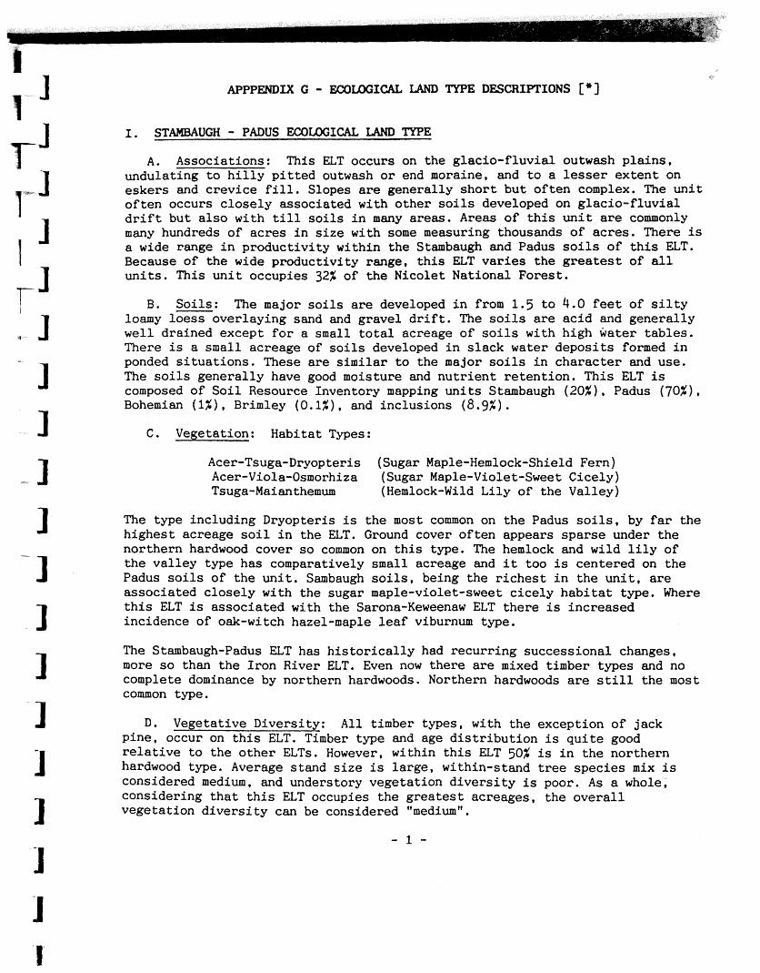
m1w LANI) TYPE DESCRIPTIONS [*I
I. S UGH - PADUS I.=COUX;ICAL LAMI TYPE
A. Associations: This ELT occurs on the g lac io - f luv ia l outwash p l a i n s , undulat ing t o h i l l y p i t t e d outwash o r end moraine, and t o a lesser ex ten t on eskers and c rev ice f i l l . Slopes a r e genera l ly s h o r t bu t o f t e n complex. The u n i t o f t e n occurs c l o s e l y associated with o the r s o i l s developed on g lac io - f luv ia l d r i f t but a l s o with till s o i l s i n many areas. Areas of t h i s u n i t are commonly many hundreds of ac res i n s i z e with some measuring thousands o f ac res . There is a wide range i n product iv i ty within the Stambaugh and Padus s o i l s o f t h i s ELT. Because of t h e wide product iv i ty range, t h i s ELT v a r i e s the g r e a t e s t of all u n i t s . This u n i t occupies 32% of t h e Nicolet National Forest .
B. Soi l s : The major s o i l s are developed i n from 1.5 t o 4.0 f e e t of s i l t y loamy l o e s s over laying sand and gravel d r i f t . The s o i l s a r e a c i d and genera l ly w e l l drained except f o r a small t o t a l acreage of s o i l s with high water t ab les . There is a small acreage of s o i l s developed i n s l a c k water depos i t s formed i n ponded s i t u a t i o n s . These a r e similar t o the major s o i l s i n charac te r and use. The s o i l s genera l ly have good moisture and n u t r i e n t r e ten t ion . This ELT is composed of S o i l Resource Inventory mapping u n i t s Stambaugh (20%). Padus (70%), Bohemian (1%). Brimley (0.1%). and inclus ions (8.9%) .
C, Vegetation: Habitat Types:
Acer-Tsuga-Dryopteris (Sugar Maple-Hemlock-Shield Fern) Acer-Viola-Osmorhiza (Sugar Maple-Violet-Sweet Cicely) Tsuga-Maianthemum (Hemlock-Wild L i l y of the Valley)
The type including Dryopteris i s the most common on t h e Padus s o i l s , by f a r the h ighes t acreage s o i l i n the ELT. Ground cover o f t en appears spa rse under t h e northern hardwood cover s o common on t h i s type. The hemlock and wild l i l y of the va l l ey type has comparatively small acreage and i t too is centered on the Padus s o i l s of t h e u n i t . Sambaugh s o i l s . being the r i c h e s t i n t h e u n i t , a r e associa ted c l o s e l y with the sugar maple-violet-sweet c i c e l y h a b i t a t type. Where t h i s ELT is associa ted with the Sarona-Keweenaw ELT the re is increased incidence of oak-witch hazel-maple l e a f viburnum type.
The Stambaugh-Padus ELT has h i s t o r i c a l l y had recur r ing success ional changes, more s o than the I ron River ELT. Even now the re a r e mixed timber types and no complete dominance by northern hardwoods. Northern hardwoods a r e s t i l l the most common type.
D. Vegetative Diversi ty: A l l timber types, with the exception of jack pine , occur on t h i s ELT. Timber type and age d i s t r i b u t i o n is q u i t e good r e l a t i v e t o the o t h e r ELTs. However, within t h i s ELT 50% is i n the northern hardwood type. Average stand s i z e is l a r g e , within-stand t r e e spec ies mix is considered medium, and understory vegetat ion d i v e r s i t y is poor. As a whole, considering t h a t t h i s ELT occupies t h e g r e a t e s t acreages, the o v e r a l l vegetat ion d i v e r s i t y can be considered "medium".

A. Associations: This ELT occurs on l eve l outwash p la ins and te r races , undulating t o h i l l y p i t t e d outwash o r end moraine, and on long, narrow, steep- - sided eskers and crevice fill- Slopes are general ly shor t but o f ten i r regu la r . The u n i t is of ten i n c lose associa t ion with the o ther g l ac i a l - f l uv i a l s o i l s . Association with the organic s o i l s is of ten a complex i n r e l a t i v e l y s m a l l parcels. Areas of t h i s un i t , o f t en occur i n associa t ion with I ron River and Carbondale un i t s where g lac ia l - f luv ia l drdnways t r m s e c t t he mordne. This ELT occupies 14% of the Nicolet National Forest.
B. Soi l s : S o i l s were developed i n a th in , loamy loess cap 10 t o 20 inches
1 thick over sand, o r sand and gravel g lac i a l - f l uv i a l d r i f t . These s o i l s are ac id ic , droughty, and w e l l drained over most of t he un i t . Included are small
J acreages of s o i l s with water tab les near the surface . Gravel content is of ten high. Areas of eskers and crevice f i l l a re e s s e n t i a l l y gravel deposits . This ELT is composed of S o i l Resource Inventory mapping u n i t s Pence-Crivitz (85%). Worcester-Poskin (5%), and inclusions (10%).
C. Vegetation: Habitat type: Tsuga-Maimthemum (Hemlock-Wild Li ly of the Valley). Cover types on t h i s u n i t a r e extremely diverse . A h i s t o ry of f i r e , of ten c lose associa t ion with other ELT un i t s of very d i f f e r en t character , and an a b i l i t y t o support many species successfully i f not always w e l l , account f o r much of t h i s d ivers i ty . The ecological mix i n small areas is of ten high but there a r e a l so many areas of a s i ng l e timber type.
Common tree species a r e aspen, oak, red maple, paper bi rch, white pine, jack pine, red pine, sugar maple, balsam f i r , and white spruce. Pine planta t ions a r e common.
D. Vegetative Diversity: Although pine and aspen predominate, t h i s ELT has the most balanced d i s t r i bu t i on of timber types. With over ha l f its acreage i n short- l ived species. i t has the po ten t ia l f o r wide d i s t r i bu t i on of age c lasses occurring i n stands t h a t a r e medium i n s i z e compared t o other ELTs. The mix of tree species within stands and understory d ive r s i t y is high. This ELT is considered the most d iverse , "high", i n terms of vegetation.
111. CARBONDALE EXXILOGICAL LAND TYPE
A. Associations: This ELT occupies areas associated with the surface drainage network. This network appears t o have been formed a t the time of high melt water deglaciat ion. Organic swamps now occupy what was a landscape of f a r more open water. Areas range from less than 40 t o hundreds of acres. These areas are s t rongly controlled by ground-water, but the re a r e wide di f ferences i n flow- through. The d i f f e r en t conditions cause wide var ia t ions i n growth of many species from one swamp t o another o r even within a swamp, depending on the degree t o which surface and subsurface waters ca r ry nu t r ien t s and oxygen i n and metabolic by-products out . This un i t occupies 16% of the Nicolet National Fores t .

B. Soi ls : Soils are s l i a t l y acid t o a lka l ine pea t s and mucks formed from the remains of both woody and herbaceous plants . Most of the a reas are deep organics, but some are only a few f e e t t o mineral s o i l . This u n i t is composed of S o i l Resource Inventory mapping un i t s Carbondale (92.0%) , Minoqua (1.0%) , Cable 0 % ) Bruce (0.1%). mci inclusions (5.9%).
C. V e ~ t a t i o n : s un i t is la rge ly i n swamp conifers but the re is of ten a sca t te red mix of black ash, paper birch, and formerly, elm. White cedar domfnates many stands. ~ l d e r - i s a very common component i n fores ted stands and is of ten the dominant species d o - watercourses. Per iodic f looding by beaver
maintains at as along streams i n sedge meadows.
D. Vegetative Diversity: The swamp conifer type and b e t t e r drained nonforested wetlands d o a h a t e this ELT. Within-stand tree species d ive r s i t y is low. However, the understory vegetation is highly d iverse i n both number of species and var ia t ion i n density. Age c l a s s d i s t r i b u t i o n is low due t o the low percentage of shor t - l ived types. Overall, the ELT has "lowtt vegeta t ive d ivers i ty .
A. Associations: This ELT occupies depressional areas throughout the Forest. It is commonly i n a landscape of g lacio-f luvia l landforms. Most areas are i so la ted pockets without surface drainage. Some a reas appear t o be the more drainage-isolated p a r t s of l a rge r wetlands. The areas were formed i n ponded water following deglaciat ion. Remnant ponds a r e not uncommon and they usually occur near the cen te r of the area. Areas range from less than 40 t o hundreds of acres i n s i ze . Water t ab les a r e a t o r above the surface most of the year. This un i t occupies 1% of the Nicolet National Forest.
B. Soi l s : The s o i l s of the u n i t a r e extremely acid peats and mucks formed from the remains of bog plants . Most of the areas a r e more than 10 f e e t deep and have a few f e e t of organics over sand. Some of the areas a r e ground water re la ted , but most appear t o be perched s i t ua t i ons sealed by co l l o ida l mucks formed on old l ake bottoms. This ELT is composed of S o i l Resource Inventory " mapping un i t s Greenwood (95.0%) . Kinross ( 1.8%) . Deford (3.0%) . and inclusions (3.0%)
C. Vegetation: Vegetation is pr incipal ly sphagnum moss, cranberry, l e a the r l ea f , bog l a u r e l , bog rosemary, labrador t e a , and black spruce. Only a few species can e x i s t a t a l l i n these oxygen and nu t r i en t def ic ien t low areas. Tree growth is poor.
D. Vegetative Diversity: Vegetation within t h i s ELT is t h a t associated with stagnated water areas such as bogs and black spruce swamps. Even though the d ive r s i t y of a l l the understory vegetation is high i n both numbers of species and densi ty , overa l l d ive r s i t y of t h i s ELT is "low".
[*] Excerpted from Ecological Land Types on the Nicolet National Forest , anonymous, 1983.
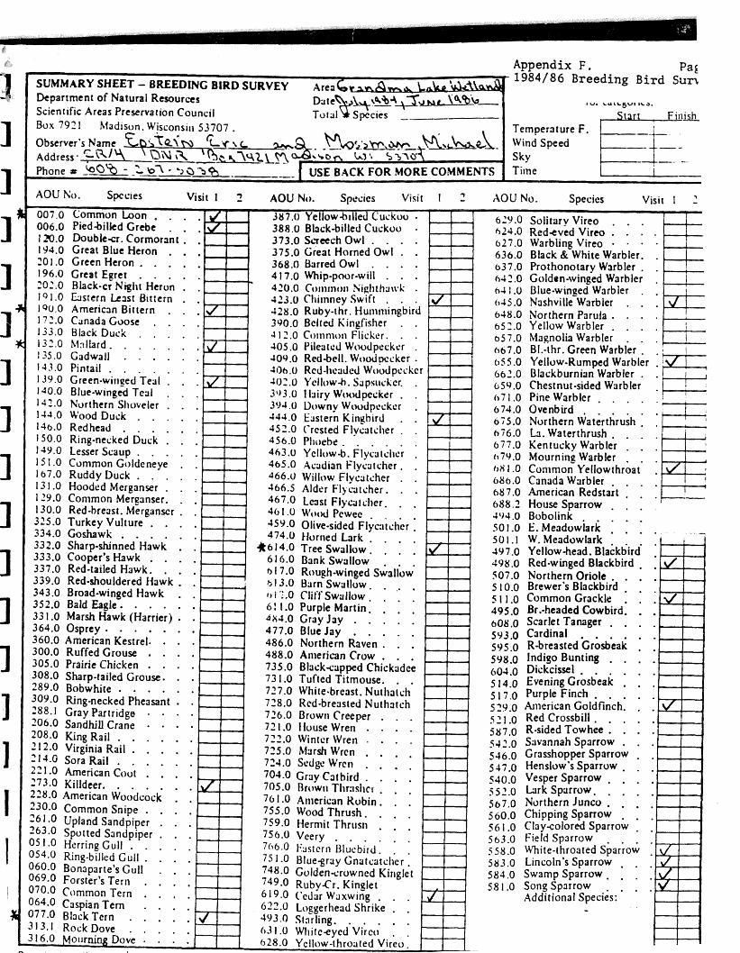
irco . . . .
rert Eerer . . , . . rp-poor-wilt . . . Black-cr Nigllt Heron . .
191.0 t r r e r n l s r Btttern . . 190.0 American Bittern . . . 172.0 Canada Goox . . . . 648.0 Northern Parula . . . .
652.0 Yellowwarbler . . . . 133.0 Black Duck . . , . . 05 7.0 Magnolia Warbler . . 132.0 Mnllard. . . . . . . 667.0 BI.-thr. Green warbier . . 135.0 Gadwail . . . . . . 143.0 Pintail . . . . . . . 0 5 5 .O Yellow-Rumped Warbler .
662.0 Blackburnian Warbler . . 139.0 Green-wir~ped Teal . . . 1 W . O Blue-w~nged Teal . , +
654.0 Chestnut-sided Warbler . 142.0 Northern Slloveler . . . (17 1.0 Pine Warbler . , . . .
1-fd.O Wood Duck . . . . . 674.0 Ovenbird . . . . .
5 2 j -0 Red Crossbill . . . . . j(17.0 R-sided Towhee . . . . 542.0 Savannah Sparrow . . . j J6.0 Grasshopper Sparrow . . 547.0 Henslow's Sparrow . . .
756.0 Veery . , . . . .
. . . .
. . . .
. . . . - . . . .
.
Weather Codes: Enter Beaufort Numbers on front of data sheet.
Ekaufort lh.lk Indicators of Wind Speed
0 Less than I Smoke rises vertically I I t o 3 Wind direction shown by smoke drift 2 4 to 7 Wind felt on face; leaves rustle * 3 8 t o 1 2 . Leaves and small twigs in constant motion;
wind extends light flag 4 13 to 18 Raises dust and loose paper: small branches . are moved.
5 19 to 24 Small trees in leaf begin to sway; crested wavelets form on inland waters.
I Sky Condition: Enter these Weather Bureau code numbers on data sheet. i
0 Clear or a few clouds 1 Partly cloudy (scattered) or variable sky. . 2 Cloudy (broken) o r overcast 4 Fog or smoke 5 Drizzle 8 Shower(s)
i Additional Comments: