2,mohit and austin,weather for kids
DESCRIPTION
An informational book about the basics of weather.TRANSCRIPT
Weather: The Basics
By: Mohit Rao and Austin Chin
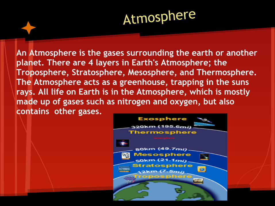
Atmosphere
An Atmosphere is the gases surrounding the earth or another planet. There are 4 layers in Earth's Atmosphere; the Troposphere, Stratosphere, Mesosphere, and Thermosphere. The Atmosphere acts as a greenhouse, trapping in the suns rays. All life on Earth is in the Atmosphere, which is mostly made up of gases such as nitrogen and oxygen, but also contains other gases.
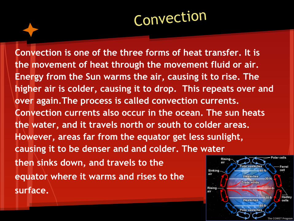
Convection
Convection is one of the three forms of heat transfer. It is the movement of heat through the movement fluid or air. Energy from the Sun warms the air, causing it to rise. The higher air is colder, causing it to drop. This repeats over and over again.The process is called convection currents. Convection currents also occur in the ocean. The sun heats the water, and it travels north or south to colder areas. However, areas far from the equator get less sunlight, causing it to be denser and and colder. The water then sinks down, and travels to theequator where it warms and rises to the surface.
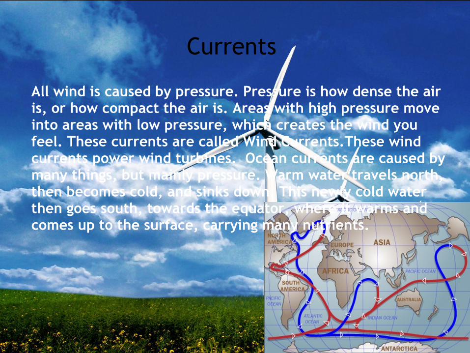
Currents
All wind is caused by pressure. Pressure is how dense the air is, or how compact the air is. Areas with high pressure move into areas with low pressure, which creates the wind you feel. These currents are called Wind Currents.These wind currents power wind turbines. Ocean currents are caused by many things, but mainly pressure. Warm water travels north, then becomes cold, and sinks down. This newly cold water then goes south, towards the equator, where it warms and comes up to the surface, carrying many nutrients.
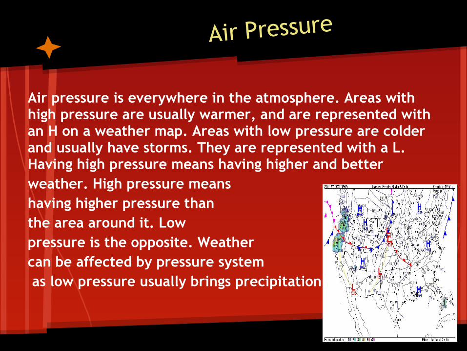
Air Pressure
Air pressure is everywhere in the atmosphere. Areas with high pressure are usually warmer, and are represented with an H on a weather map. Areas with low pressure are colder and usually have storms. They are represented with a L. Having high pressure means having higher and better weather. High pressure means having higher pressure than the area around it. Low pressure is the opposite. Weathercan be affected by pressure system as low pressure usually brings precipitation.
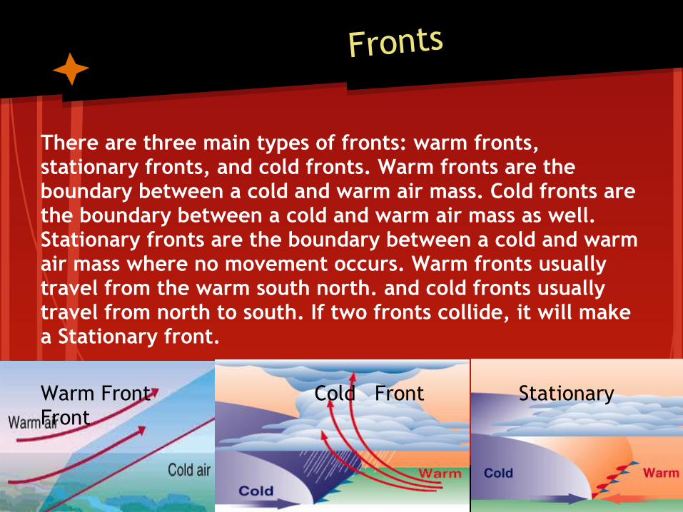
Fronts
There are three main types of fronts: warm fronts, stationary fronts, and cold fronts. Warm fronts are the boundary between a cold and warm air mass. Cold fronts are the boundary between a cold and warm air mass as well. Stationary fronts are the boundary between a cold and warm air mass where no movement occurs. Warm fronts usually travel from the warm south north. and cold fronts usually travel from north to south. If two fronts collide, it will make a Stationary front.
Warm Front Cold Front Stationary Front
Hurricanes and Tornados
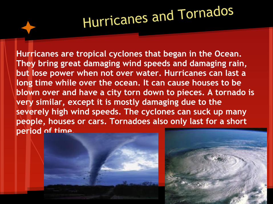
Hurricanes are tropical cyclones that began in the Ocean. They bring great damaging wind speeds and damaging rain, but lose power when not over water. Hurricanes can last a long time while over the ocean. It can cause houses to be blown over and have a city torn down to pieces. A tornado is very similar, except it is mostly damaging due to the severely high wind speeds. The cyclones can suck up many people, houses or cars. Tornadoes also only last for a short period of time.
The Sun and Sun's energy
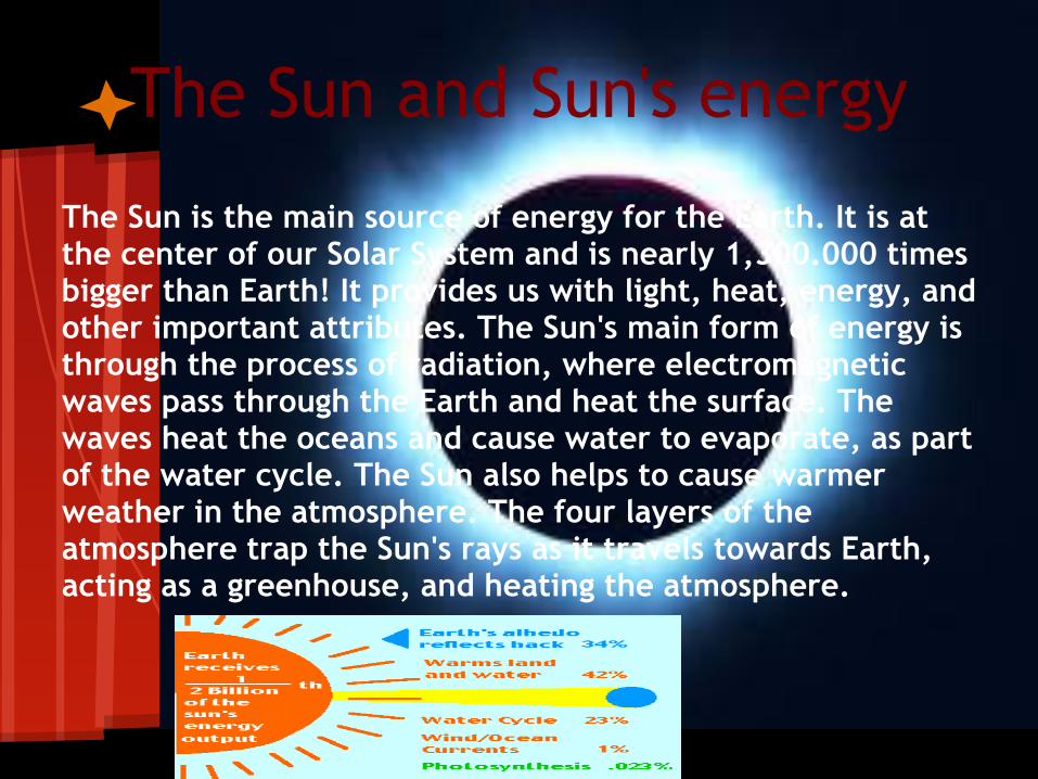
The Sun is the main source of energy for the Earth. It is at the center of our Solar System and is nearly 1,300.000 times bigger than Earth! It provides us with light, heat, energy, and other important attributes. The Sun's main form of energy is through the process of radiation, where electromagnetic waves pass through the Earth and heat the surface. The waves heat the oceans and cause water to evaporate, as part of the water cycle. The Sun also helps to cause warmer weather in the atmosphere. The four layers of the atmosphere trap the Sun's rays as it travels towards Earth, acting as a greenhouse, and heating the atmosphere.
Weather Maps
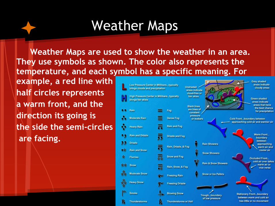
Weather Maps are used to show the weather in an area. They use symbols as shown. The color also represents the temperature, and each symbol has a specific meaning. For example, a red line with half circles representsa warm front, and the direction its going is the side the semi-circles are facing.
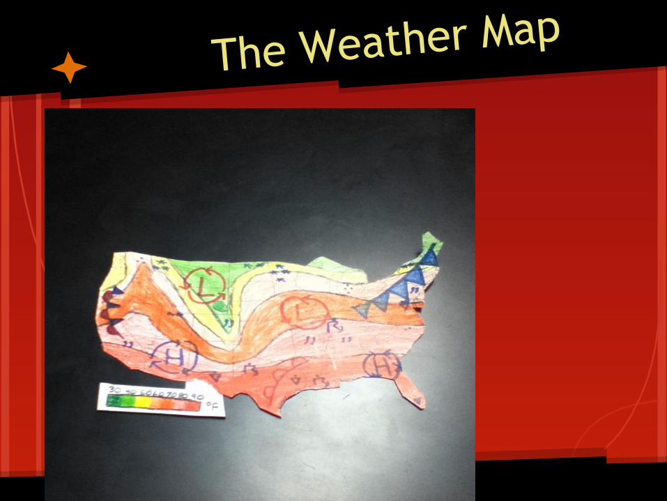
The Weather Map
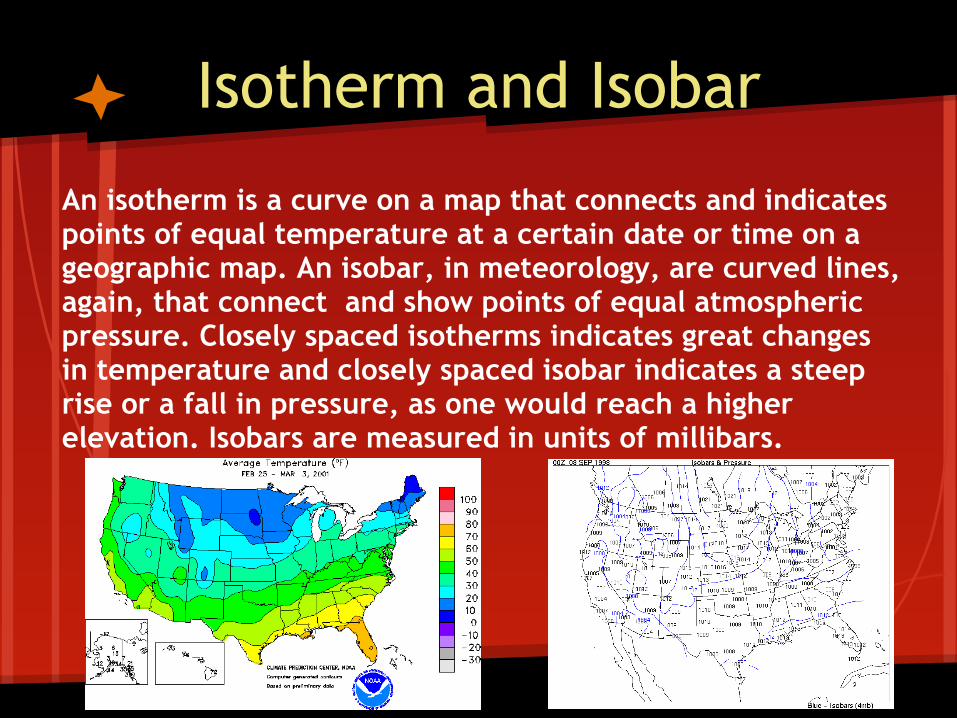
An isotherm is a curve on a map that connects and indicates points of equal temperature at a certain date or time on a geographic map. An isobar, in meteorology, are curved lines, again, that connect and show points of equal atmospheric pressure. Closely spaced isotherms indicates great changes in temperature and closely spaced isobar indicates a steep rise or a fall in pressure, as one would reach a higher elevation. Isobars are measured in units of millibars.
Isotherm and Isobar
Types of Clouds
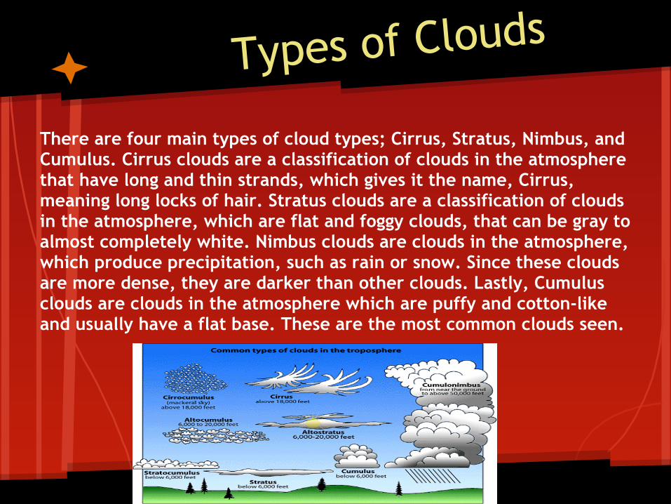
There are four main types of cloud types; Cirrus, Stratus, Nimbus, and Cumulus. Cirrus clouds are a classification of clouds in the atmosphere that have long and thin strands, which gives it the name, Cirrus, meaning long locks of hair. Stratus clouds are a classification of clouds in the atmosphere, which are flat and foggy clouds, that can be gray to almost completely white. Nimbus clouds are clouds in the atmosphere, which produce precipitation, such as rain or snow. Since these clouds are more dense, they are darker than other clouds. Lastly, Cumulus clouds are clouds in the atmosphere which are puffy and cotton-like and usually have a flat base. These are the most common clouds seen.
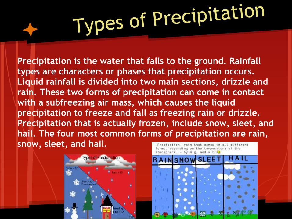
Types of Precipitation
Precipitation is the water that falls to the ground. Rainfall types are characters or phases that precipitation occurs. Liquid rainfall is divided into two main sections, drizzle and rain. These two forms of precipitation can come in contact with a subfreezing air mass, which causes the liquid precipitation to freeze and fall as freezing rain or drizzle. Precipitation that is actually frozen, include snow, sleet, and hail. The four most common forms of precipitation are rain, snow, sleet, and hail.
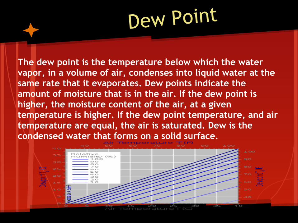
Dew Point
The dew point is the temperature below which the water vapor, in a volume of air, condenses into liquid water at the same rate that it evaporates. Dew points indicate the amount of moisture that is in the air. If the dew point is higher, the moisture content of the air, at a given temperature is higher. If the dew point temperature, and air temperature are equal, the air is saturated. Dew is the condensed water that forms on a solid surface.
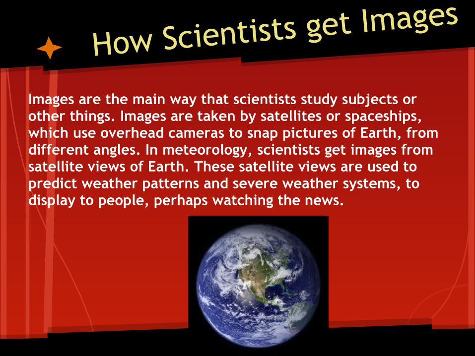
How Scientists get Images
Images are the main way that scientists study subjects or other things. Images are taken by satellites or spaceships, which use overhead cameras to snap pictures of Earth, from different angles. In meteorology, scientists get images from satellite views of Earth. These satellite views are used to predict weather patterns and severe weather systems, to display to people, perhaps watching the news.
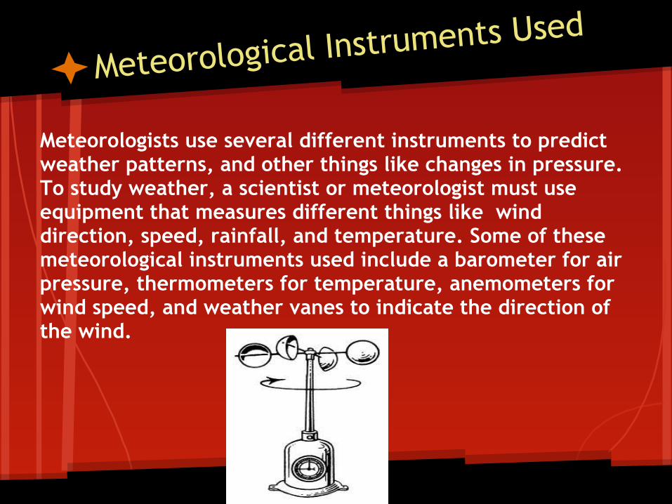
Meteorological Instruments Used
Meteorologists use several different instruments to predict weather patterns, and other things like changes in pressure. To study weather, a scientist or meteorologist must use equipment that measures different things like wind direction, speed, rainfall, and temperature. Some of these meteorological instruments used include a barometer for air pressure, thermometers for temperature, anemometers for wind speed, and weather vanes to indicate the direction of the wind.
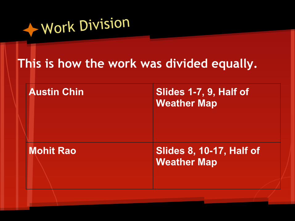
Work Division
This is how the work was divided equally.
Austin Chin Slides 1-7, 9, Half of Weather Map
Mohit Rao Slides 8, 10-17, Half of Weather Map