2010 tri-city water follies air show air crew briefing
TRANSCRIPT
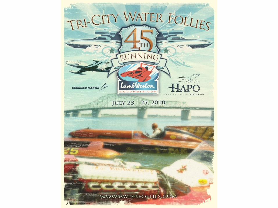


2010 Tri-City Water Follies Air Show
2010 Tri-City Water Follies Air Show
Air Crew Briefing

Introductions Air Show Dir/ Air Boss – Scott Meyer Assistant Air Boss – Jim Gibson Tower Liaison – Hyrum Wadsworth FAA FSDO – Jim Bening Bergstrom POC – Malin Bergstrom

Roll call-Viper West-USN VF-125-John Klatt-Bill Stein-Ace Maker T-33-Bad Yak -Boat Race Director-FSDO-Official’s Helicopter-Banner Tow-Bergstrom POC’s

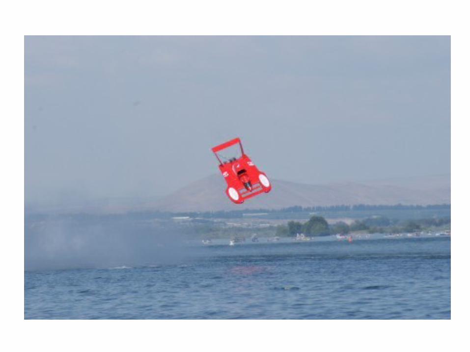
We are not your typical Airshow
We are a remote show over water, with crowds on both North & South sides of the river.
The boat race dictates what happens during the course of the day.
Delays due to boat crashes, etc may affect your performance scheduled time.


Weather Briefing

Waiver
Standard provisions Don’t hit the bridge Don’t fly under the bridge unless you
are a boat Don’t break the sound barrier

Frequencies ATIS 125.65 Ground 121.8 Tri-Cities Tower 135.3 Show Control 123.45 Discreet 123.15

Temporary Flight Restriction Location: PSC 190 @ 2.5nm Radius: 5nm Height: Surface to 17,000’ msl Times:
7/23 Friday 1120-1150L (Modified) 1415-1445L 1515-1545L
7/24 Saturday 1130-1145L (Modified) 1415-1445L 1515-1545L
7/25 Sunday 1150-1220L (Modified) 1415-1445L 1515-1545L
Entry: By ATC authorization only.
Purpose: High performance/ military jet aerial demonstrations.

Jet A/C ShowBox
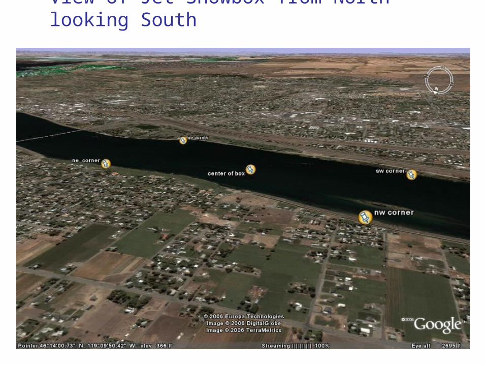
View of Jet Showbox from North looking South
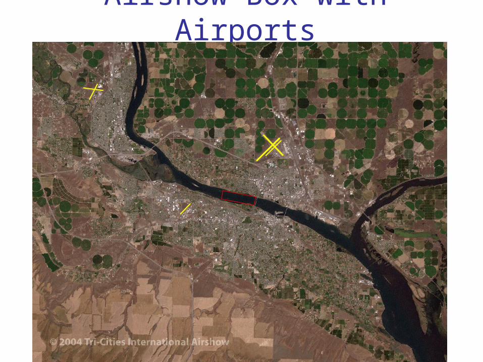
Airshow Box with Airports


Safety Issues Knock it off! – Go wings Level We will advise what comes next Let us know if you see something KIO Loss of Radio Contact
Flare from the Barge Rescue Boats go in circles on course

Benty HoldBetween3500-5000’
J-O-J HoldHold over Jump-Off-Joe Mtn, E of I82.
McNary [email protected] W118.58.10
Benty [email protected] W119.25.17.98
I82
J-O-J [email protected]
Entry RoutesPerformers have two holding areas and 3 Initial Entry Points (IP’s) and two Final Fixes (FF’s) to the Show Box. Performers are to report these fixes to the Air Boss when approaching the Show Box.
Benty IP : Physical location is over Red Mountain. McNary IP : Physical location is at the peninsula off of the Dist: 10.5 nm to W. End of Box (11nm to ). McNary Slough. Dist: 8nm to Blue Bridge (9nm to ).
J-O-J IP: Physical location is over Jump-Off-Joe Mtn. Hwy and Cable Bridges: These Bridges are distinctive andDist: 7nm to Blue Bridge (8nm to ). located off the ends of the Show Box.
Air Show Control Point -Center of Boat Race TrackN46.13.65 W119.09.23
CAUTION: Obstruction at E. end of BoxHwy 395 (Blue) Bridge Elev: 608’ msl
VAR 17º30’E
Hwy Bridge
Cable Bridge
Entry Routes

Escape RoutesAdvise the Air Boss when you are within 1-minute of completing your show routine and which Escape Route you will be taking. If you do not specify the route it will be assigned by the Air Boss. You will be instructed to contact Tri-City Tower or Chinook Approach leaving the show box. When contacting ATC advise them on your Escape Route and destination. ATC will provide pattern entry (to PSC) or departure instructions. Maintain VFR and the track/altitude restrictions until contact is established with ATC and appropriate instructions are received.
Air Show Control Point -Center of Race TrackN46.13.65 W119.09.23
CAUTION: Obstruction at E. end of BoxHwy 395 (Blue) Bridge Elev: 608’ msl
Columbia River EscapeLow: AOB 2500’Hi: 8000-10000’PSC TWR: 133.25/ 323.3APCH: 128.75/ 380.2
Snake River EscapeLow: AOB 2500’Hi: 8000-10000’PSC TWR: 133.25/ 323.3APCH: 128.75/ 380.2
VAR 17º30’E
HWY BRIDGE
CABLEBRIDGE
Exit Routes
135.3
Columbia River EscapeLow: AOB 2500’Hi: 8000-10000’PSC TWR: 135.3 / 323.3APCH: 128.75 / 380.2
Snake River EscapeLow: AOB 2500’Hi: 8000-10000’PSC TWR: 135.3 / 323.3APCH: 128.75 / 380.2

Grant County Airport (MWH)57nm NW PSCElev: 1185’Primary Runway: 32RLength/Width: 13,001 x 100’
Grant County Approach: 126.4/Tower: 118.25Ground: ATIS: 119.05MWH VORDME: 115.0
Alternate Emergency
Landing Field

REMEMBER

If you haven’t done it don’t do
it here!

Stay Hydrated!

Sun Screen!

Points of Contact
• Bergstrom Aircraft 509-547-6271
• Malin Bergstrom 509-521-7117
• Michel Pelletier 509-531-4647
• Hyrum Wadsworth 509-830-7419
• Scott Meyer 509-492-6049

TIME HACK!

The End!
• Have a great, safe and fun show !