1. volcanic outgassing. 2. ~32°n, 18°w 3. hudson river
TRANSCRIPT

1. Volcanic outgassing
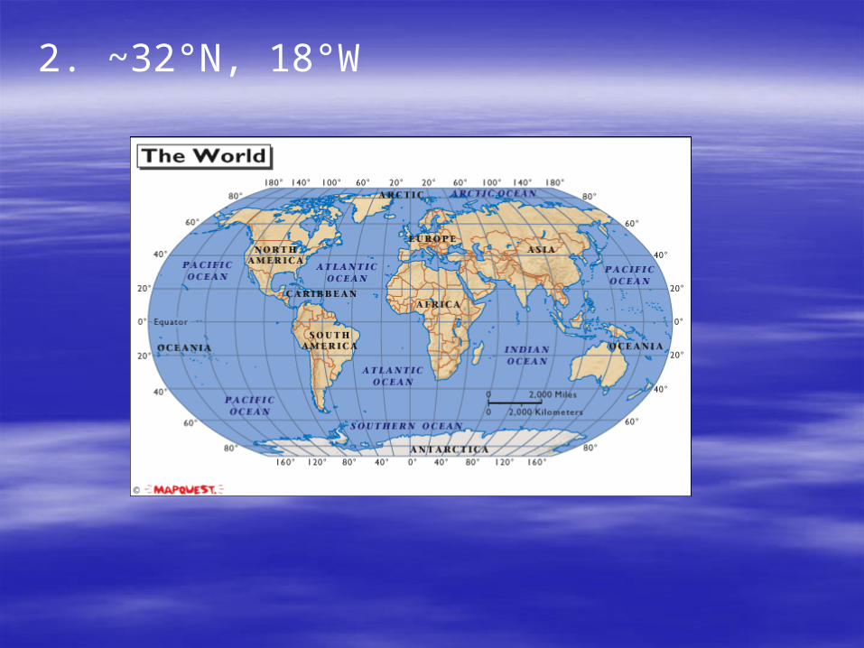
2. ~32°N, 18°W
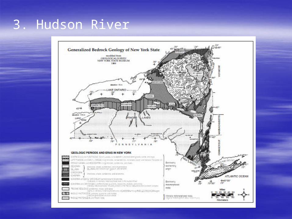
3. Hudson River
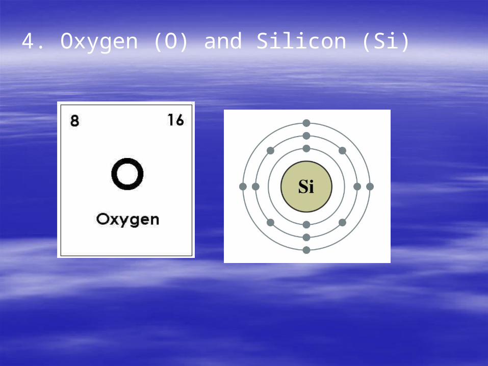
4. Oxygen (O) and Silicon (Si)
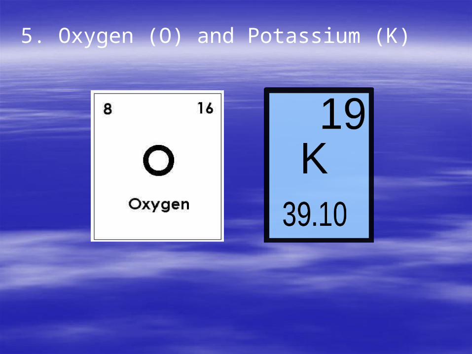
5. Oxygen (O) and Potassium (K)

6. Nitrogen and Oxygen (O)
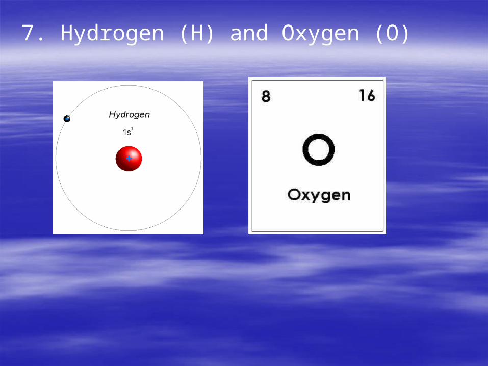
7. Hydrogen (H) and Oxygen (O)
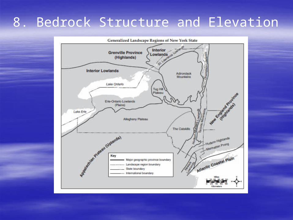
8. Bedrock Structure and Elevation

9. It is equal to your latitude in the Northern Hemisphere.
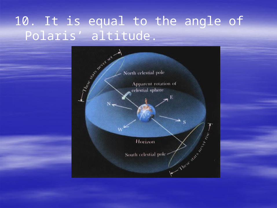
10. It is equal to the angle of Polaris’ altitude.
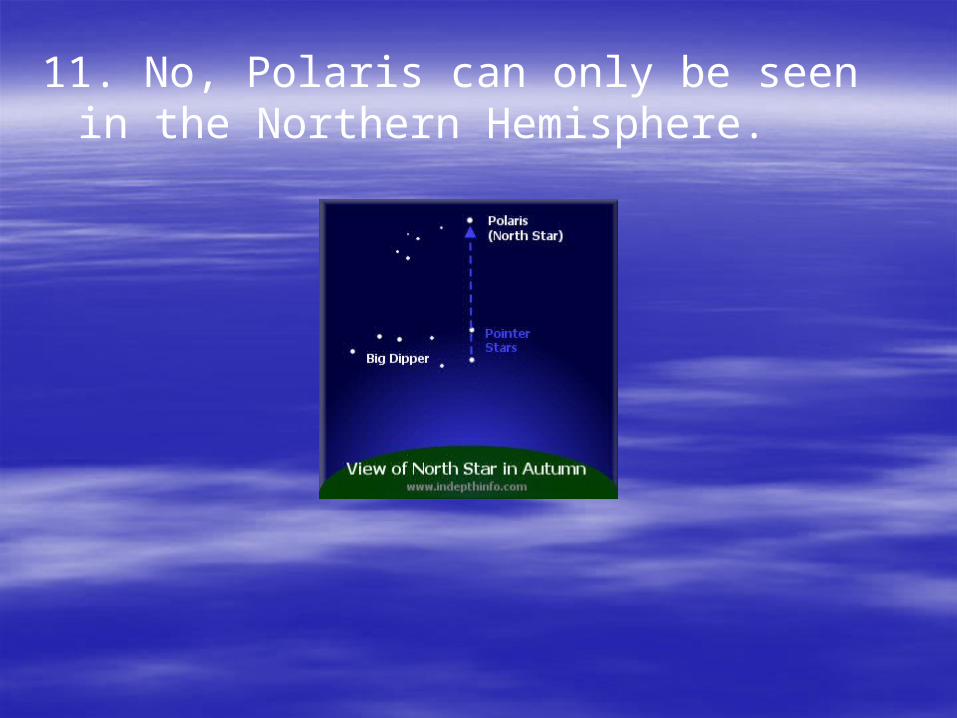
11. No, Polaris can only be seen in the Northern Hemisphere.

12. Massena, NY
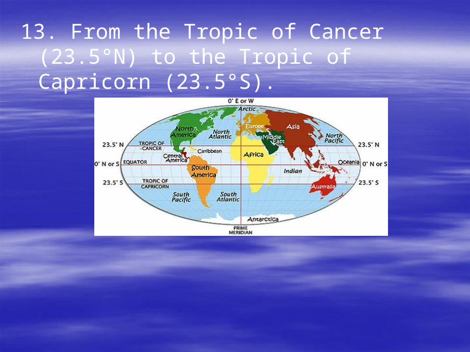
13. From the Tropic of Cancer (23.5°N) to the Tropic of Capricorn (23.5°S).

14. See ESRT p.14
Troposphere (all weather occurs here only)
Stratosphere (ozone layer here)
Mesosphere
Thermosphere

15. Seismic Waves

16. See ESRT p.10
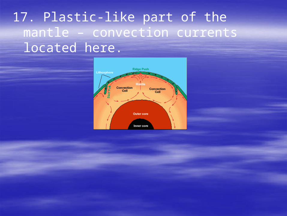
17. Plastic-like part of the mantle – convection currents located here.
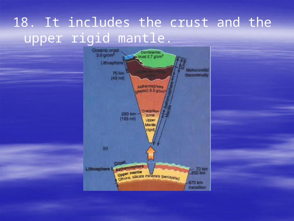
18. It includes the crust and the upper rigid mantle.
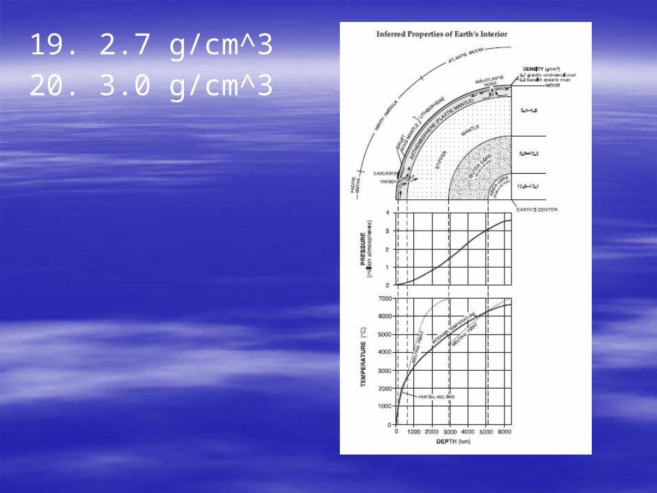
19. 2.7 g/cm^3
20. 3.0 g/cm^3

21. 30° of longitude apart

22. Earth’s rotation rate = 15°/hr
Ex. The two cities are 2 hours apart.
23. A) 15°
B) 90° (equals to the latitude)
C) 12 hours

24. He was a Greek scientist who came up with the 1st recorded size of the Earth.

25. Choice (1)
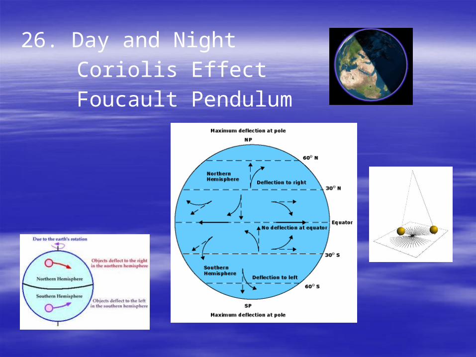
26. Day and Night
Coriolis Effect
Foucault Pendulum
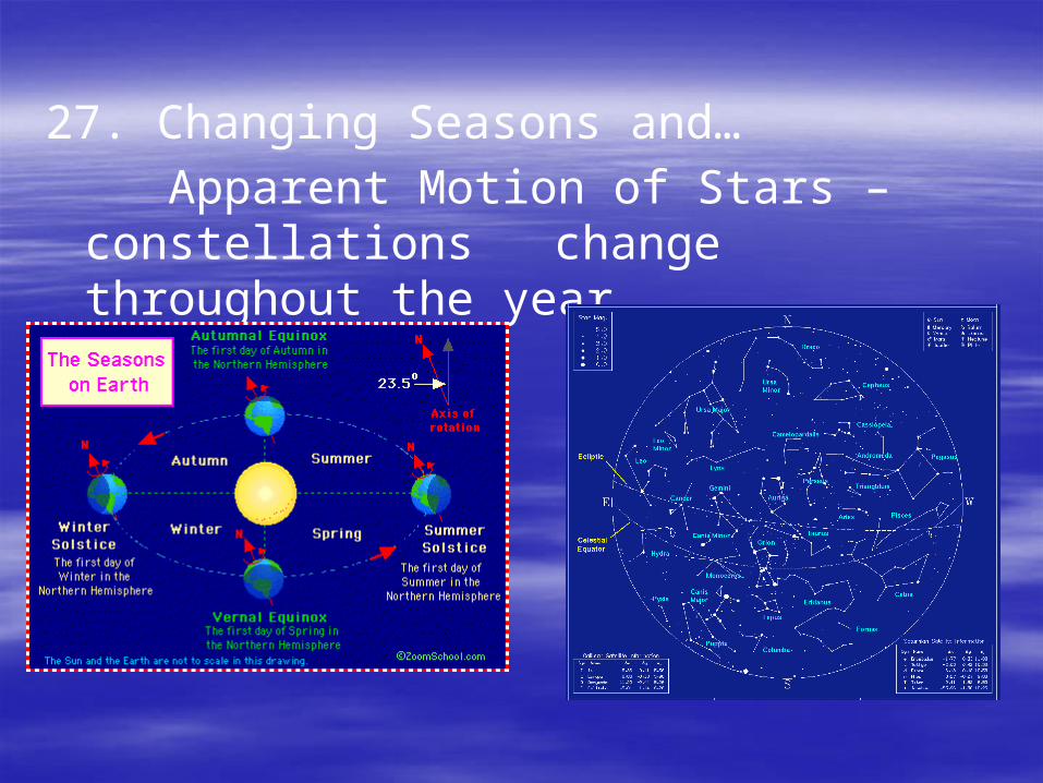
27. Changing Seasons and…
Apparent Motion of Stars – constellations change throughout the year
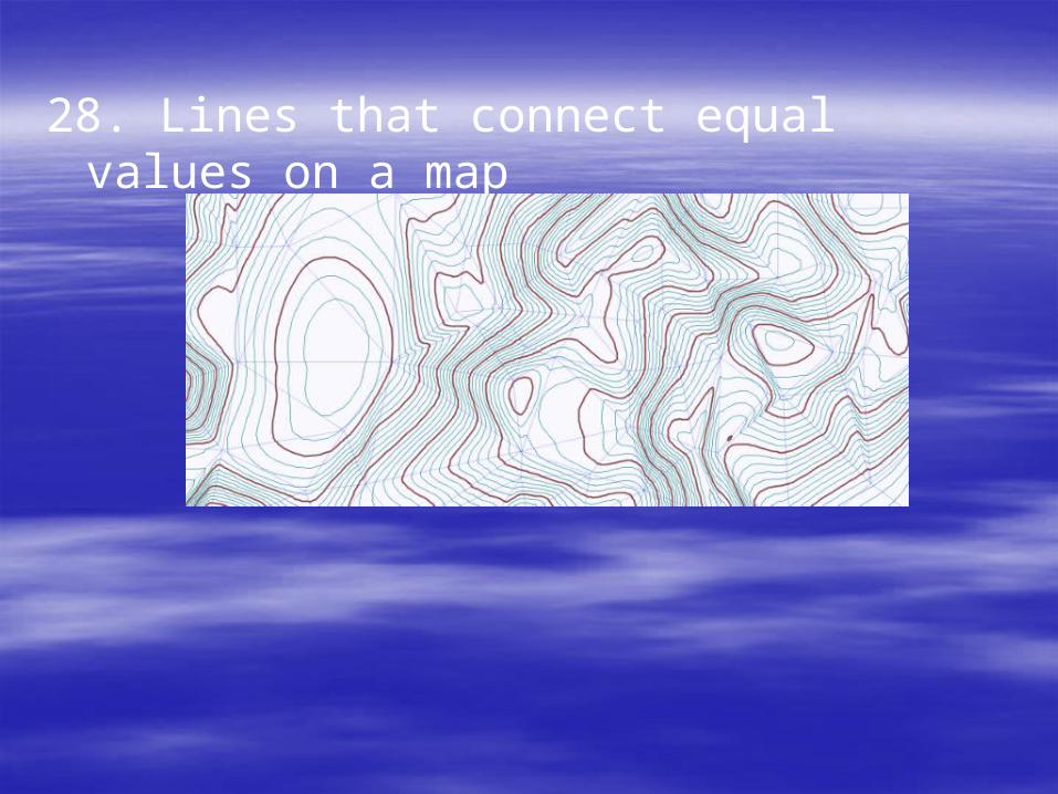
28. Lines that connect equal values on a map
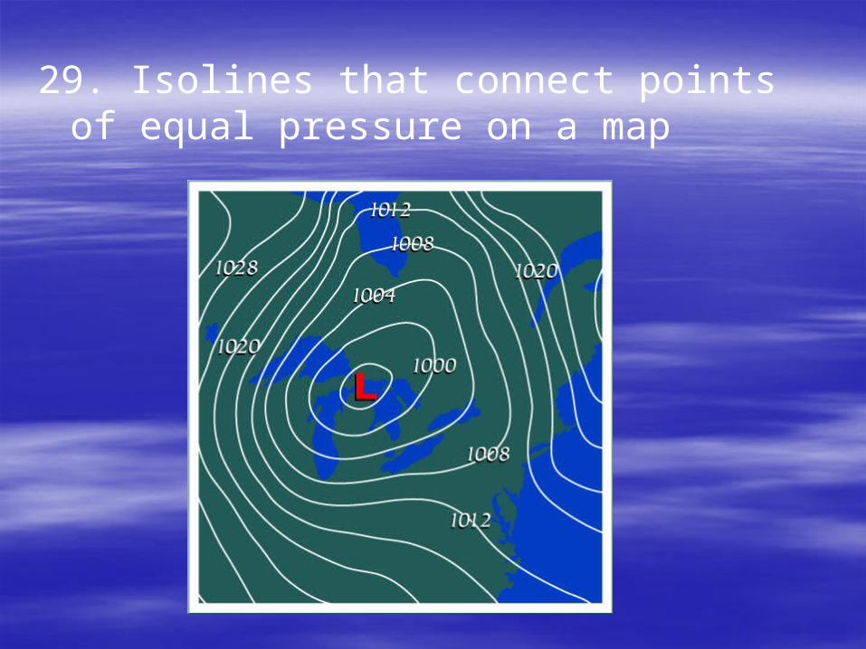
29. Isolines that connect points of equal pressure on a map
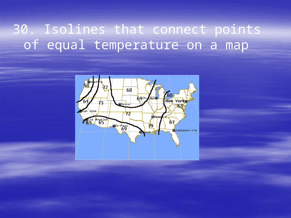
30. Isolines that connect points of equal temperature on a map
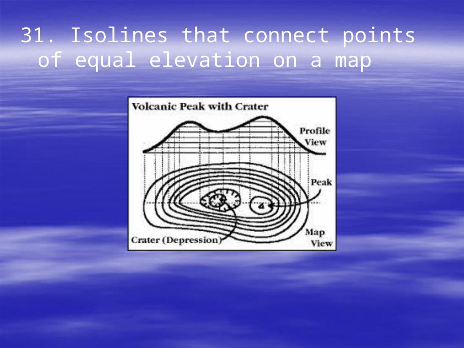
31. Isolines that connect points of equal elevation on a map
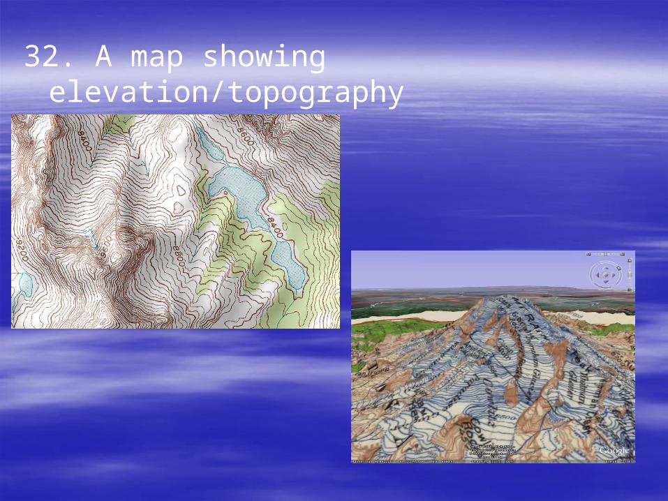
32. A map showing elevation/topography

33. The increment from one contour line to the next.

34. It shows where the elevation decreases.
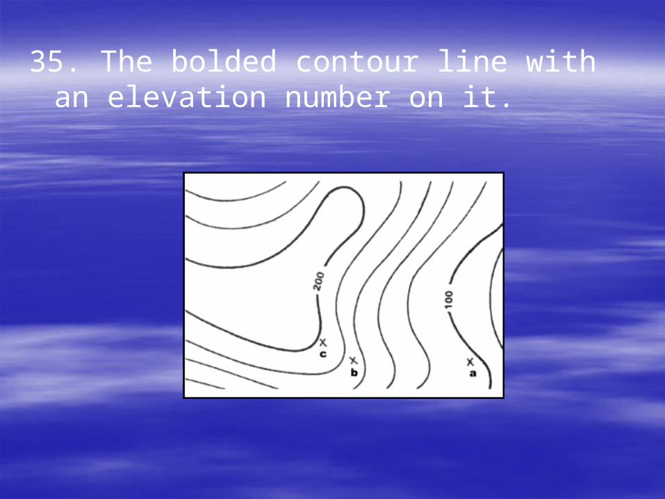
35. The bolded contour line with an elevation number on it.

36. As gradient increases, steepness also increases (direct relationship).
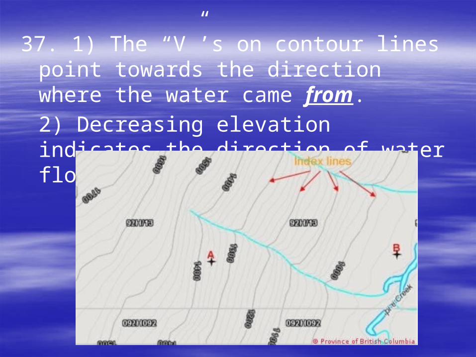
37. 1) The “V”’s on contour lines point towards the direction where the water came from.
2) Decreasing elevation indicates the direction of water flow.

38. Compass direction specified as an angle
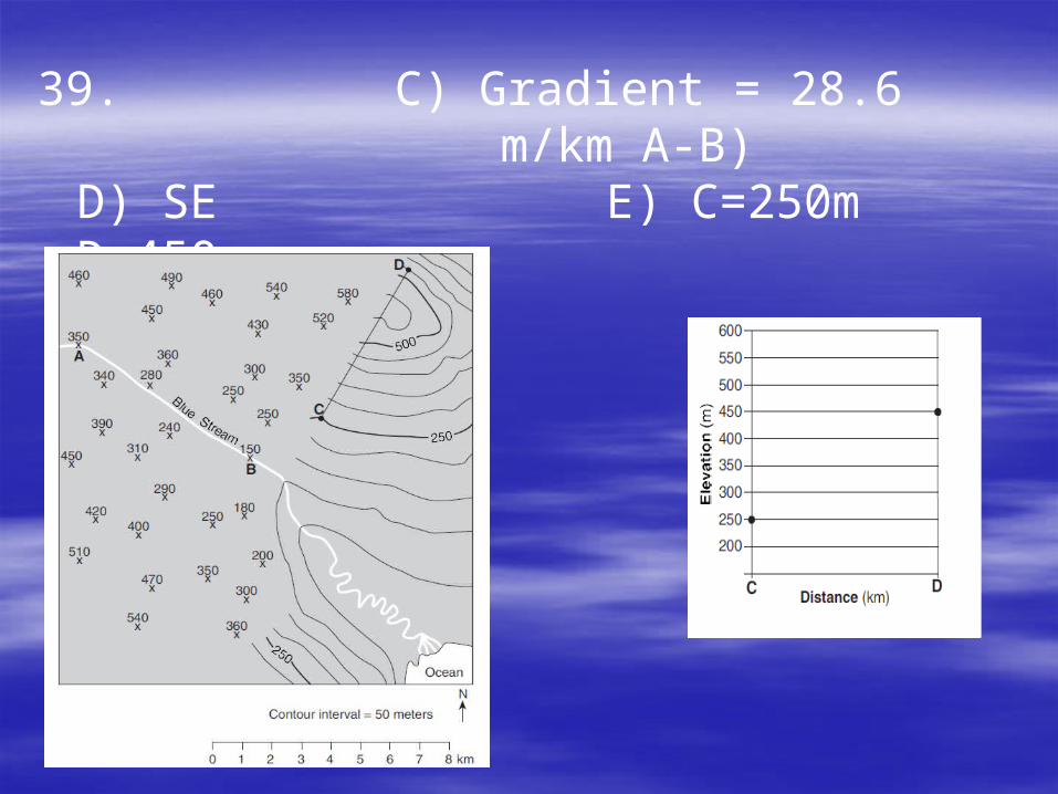
39. C) Gradient = 28.6
m/km A-B) D) SEE)
C=250m D=450m
F)

40. The closer the contour lines, the greater the slope (steepest).
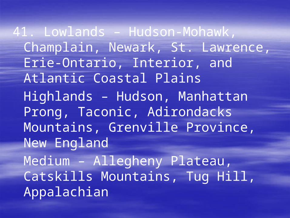
41. Lowlands – Hudson-Mohawk, Champlain, Newark, St. Lawrence, Erie-Ontario, Interior, and Atlantic Coastal Plains
Highlands – Hudson, Manhattan Prong, Taconic, Adirondacks Mountains, Grenville Province, New England
Medium – Allegheny Plateau, Catskills Mountains, Tug Hill, Appalachian

Be able to interpret all the following ESRT reference tables and charts:
Page 1 – Average chemical composition of Earth’s crust, hydrosphere and troposphere
Page 2 – Generalized landscape regions of NYS
Page 3 - Generalized bedrock geology of NYS – know how to calculate distance between NYS cities in miles and / or kilometers
Page 5 – Tectonic Plates – be able to determine latitude and longitude of different features (Ex. Hot spots, trenches, etc.)
Page 10 – Inferred Properties of Earth’s Interior
Page 14 (top) – Selected Properties of Earth’s Atmosphere