1-1 osm and opendata
TRANSCRIPT

Mapping Financial Services Uganda
Eastern Region and Kampala
© HOT Tanzania & Uganda: Ketty Adoch, Mhairi O’Hara, Geoffrey Kateregga, Douglas Ssebaggala, Paul Uithol

Outline
• Project Introduction• Open data• OpenStreetMap• Navigation• Contributing• Sharing data

Crowdsourcing Financial Service Locations (Pilot Program) - Mapping Financial Access
Points.
Project Introduction

Collecting financial service locations has been challenging....
● High cost
● Risk of stale data
● Model not self-sustaining
● Hard to scale-up to larger areas
● Lost opportunities for entrepreneurship
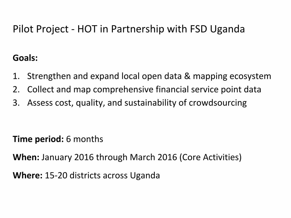
Pilot Project - HOT in Partnership with FSD Uganda
Goals:
1. Strengthen and expand local open data & mapping ecosystem
2. Collect and map comprehensive financial service point data
3. Assess cost, quality, and sustainability of crowdsourcing
Time period: 6 months
When: January 2016 through March 2016 (Core Activities)
Where: 15-20 districts across Uganda
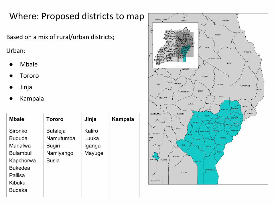
Where: Proposed districts to map
Based on a mix of rural/urban districts;
Urban:
● Mbale
● Tororo
● Jinja
● Kampala
Mbale Tororo Jinja Kampala
Sironko Bududa Manafwa Bulambuli Kapchorwa BukedeaPallisa KibukuBudaka
Butaleja Namutumba BugiriNamiyangoBusia
KaliroLuukaIganga Mayuge
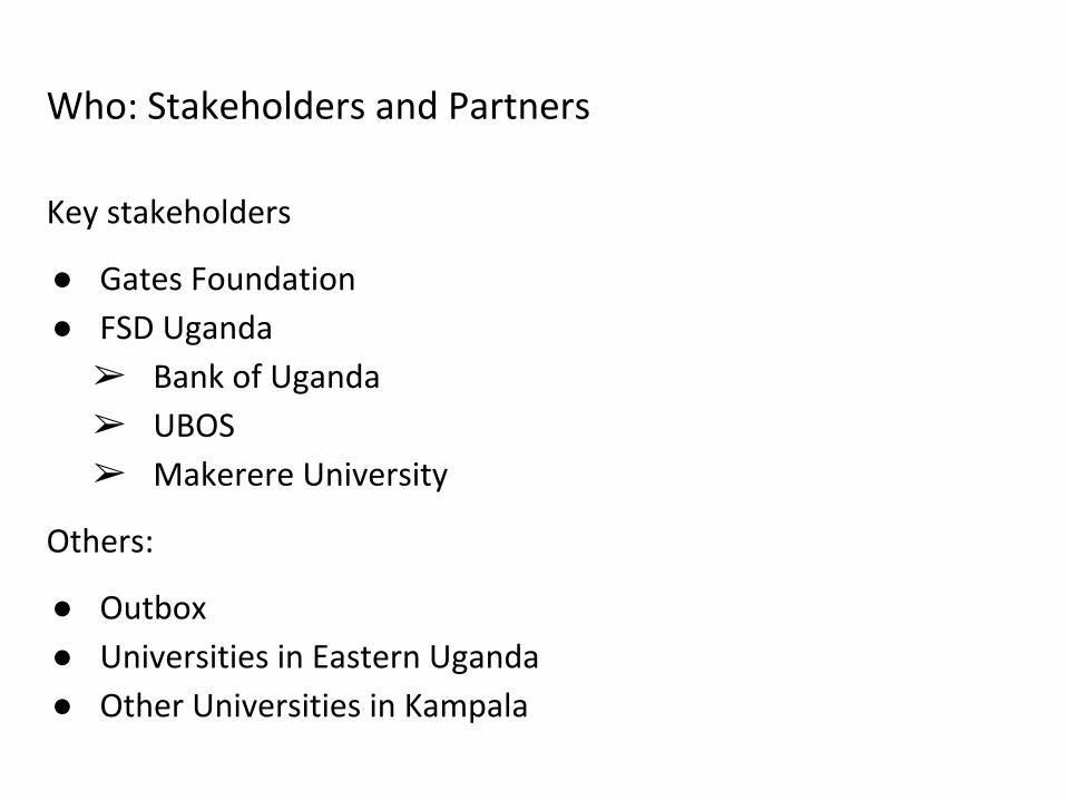
Who: Stakeholders and Partners
Key stakeholders
● Gates Foundation
● FSD Uganda
➢ Bank of Uganda
➢ UBOS
➢ Makerere University
Others:
● Outbox
● Universities in Eastern Uganda
● Other Universities in Kampala

How: General approach
● Identify key stakeholders & communities
● Build and train 3 groups, each consisting of:○ 1 supervisor
○ 3 mapping teams; 2 to 3 team members, 1 team lead
○ (so around 10 to 13 persons total)
● Team members are the students/volunteers per visited district.
● Use bodaboda’s, rent cars/taxis
● Mobile money agents’ collaboration
● Seasonal and General elections breaks
Outline• Project Introduction• Open data• OpenStreetMap• Navigation• Contributing• Sharing data
Open data
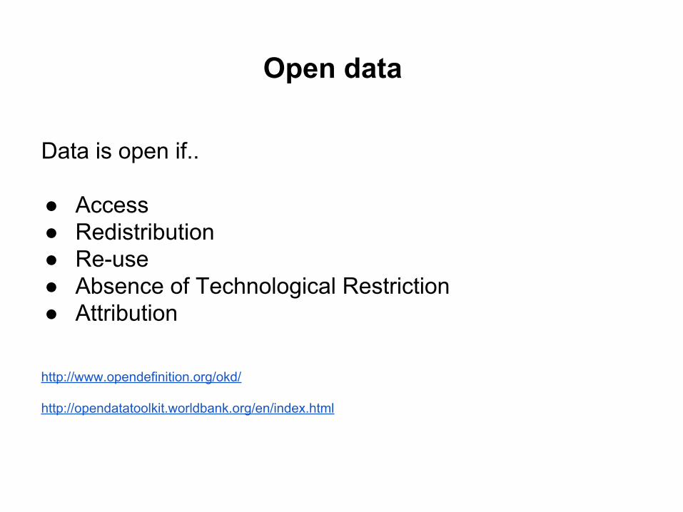
Data is open if..
● Access● Redistribution● Re-use● Absence of Technological Restriction● Attribution
http://www.opendefinition.org/okd/
http://opendatatoolkit.worldbank.org/en/index.html

The Wheel of Open Data…….

Towards an Open Government

OpenStreetMapOpen Data
OpenStreetMap is open data: you are free to use it for any
purpose as long as you credit OpenStreetMap and its
contributors.
Collaborative project to create a free editable world map

● Local Knowledge● Community Driven● Inspired by the success of Wikipedia● Built by a community of mappers that contribute and maintain
data about roads, trails, cafés, railway stations, and much more, all over the world.
How does it work?
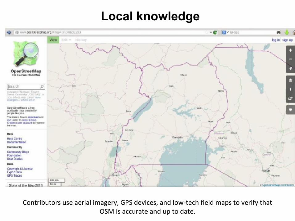
Local knowledge
Contributors use aerial imagery, GPS devices, and low-tech field maps to verify that OSM is accurate and up to date.
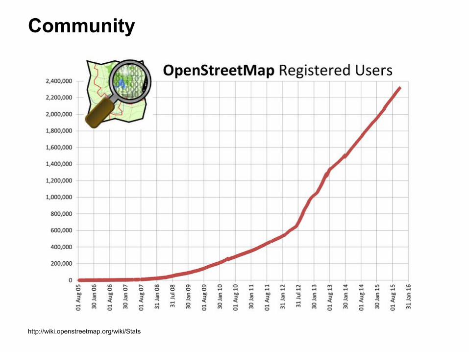
Community
http://wiki.openstreetmap.org/wiki/Stats
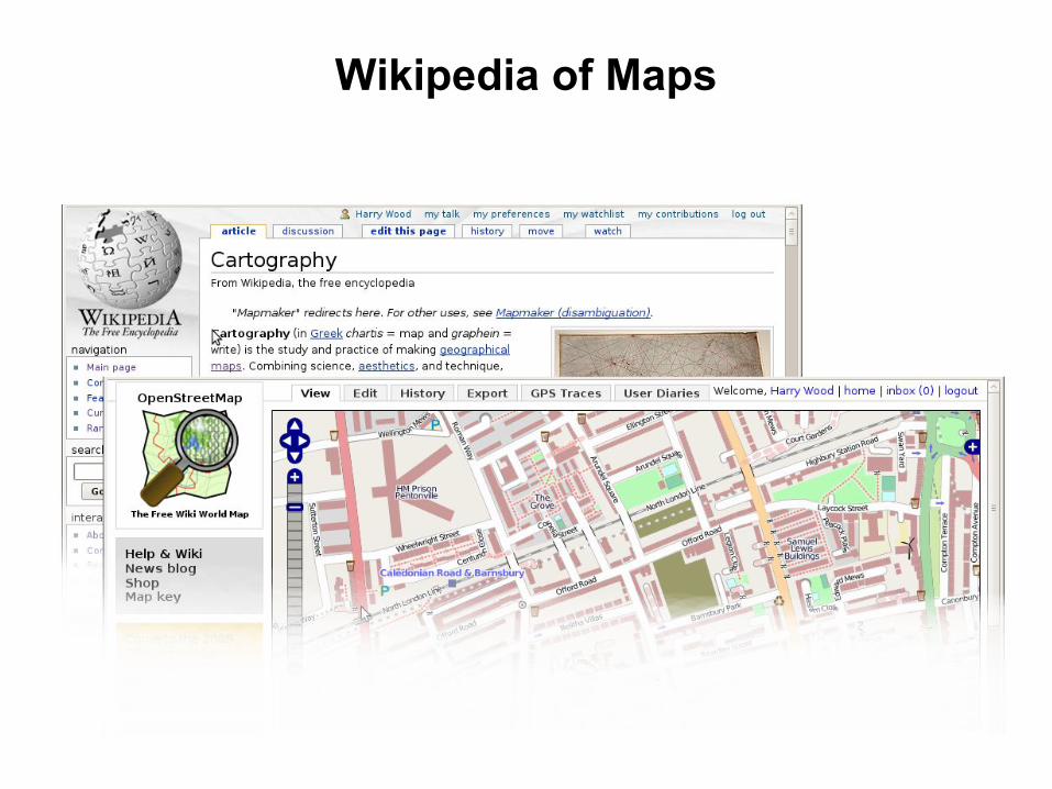
Wikipedia of Maps

Data objects
http://wiki.openstreetmap.org/wiki/Stats

The data
● All Vector Data● Free-tagging system
○ (meaning every object in the database can carry an unlimited number of attributes)
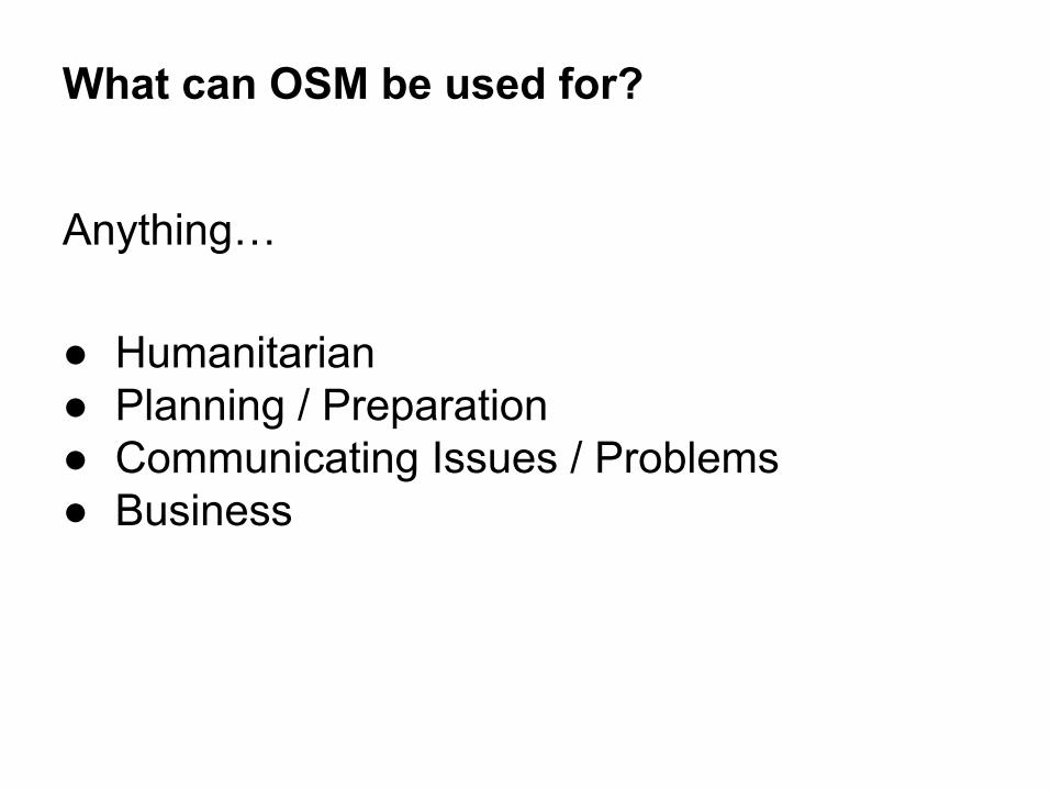
What can OSM be used for?
Anything…
● Humanitarian● Planning / Preparation● Communicating Issues / Problems● Business
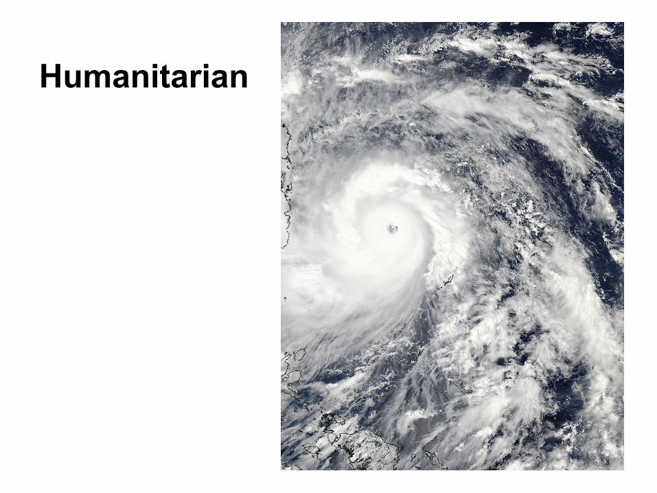
Humanitarian
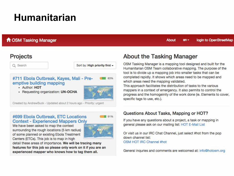
Humanitarian
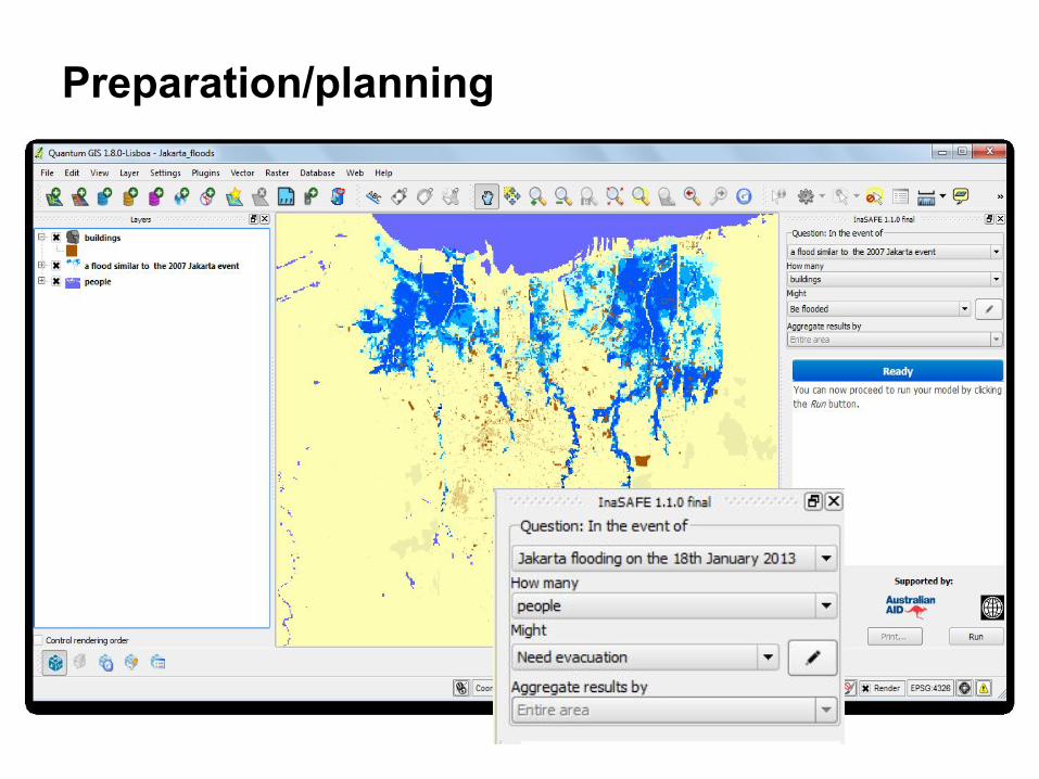
Preparation/planning
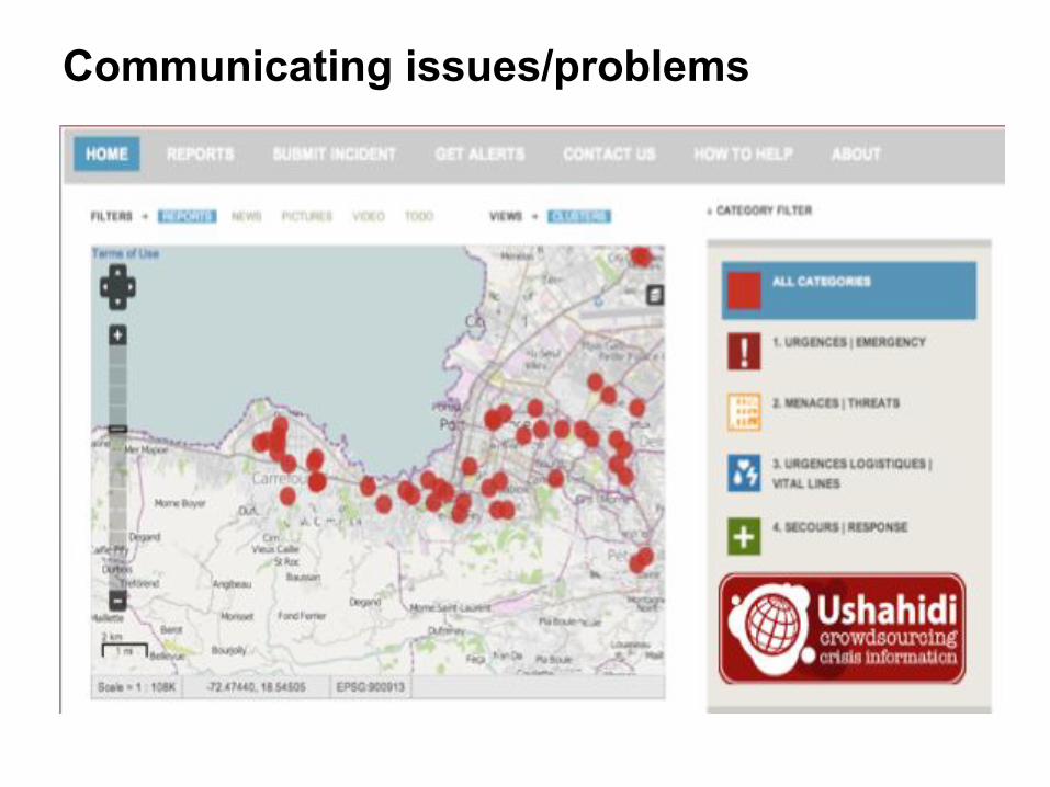
Communicating issues/problems

Navigating the map
● Left mouse to drag the map● Mouse wheel to zoom
Contributing
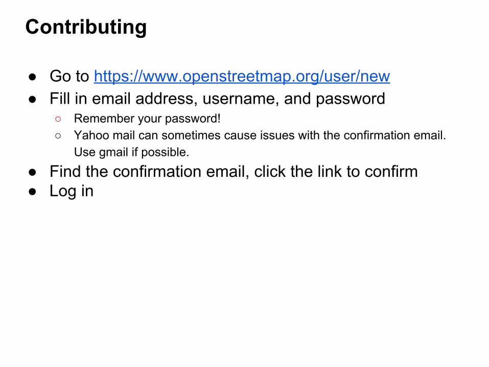
● Go to https://www.openstreetmap.org/user/new● Fill in email address, username, and password
○ Remember your password!○ Yahoo mail can sometimes cause issues with the confirmation email.
Use gmail if possible.
● Find the confirmation email, click the link to confirm● Log in


Map layers (Rendering)
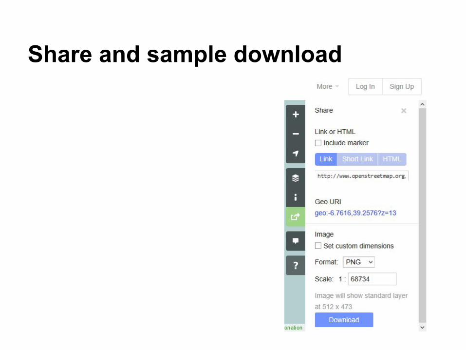
Share and sample download
Outline• Project Introduction• Open data• OpenStreetMap• Navigation• Contributing• Sharing data