surveying · surveying - natural site - medium or large-scale surveying ... piste - autopiste...
TRANSCRIPT
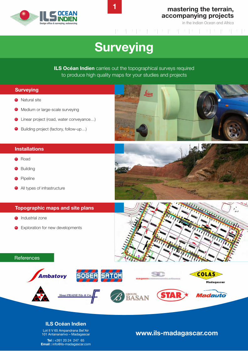
ILS Océan Indien carries out the topographical surveys required to produce high quality maps for your studies and projects
Surveying
References
Surveying
- Natural site
- Medium or large-scale surveying
- Linear project (road, water conveyance…)
- Building project (factory, follow-up…)
Installations
- Road
- Building
- Pipeline
- All types of infrastructure
Topographic maps and site plans
Industrial zone
Exploration for new developments
www.ils-madagascar.com
1 mastering the terrain,accompanying projects
in the Indian Ocean and Africa
www.ils-madagascar.comILS Océan Indien
Lot II V 65 Ampandrana Bel’Air101 Antananarivo – Madagascar
Tel : +261 20 24 247 65 Email : [email protected]
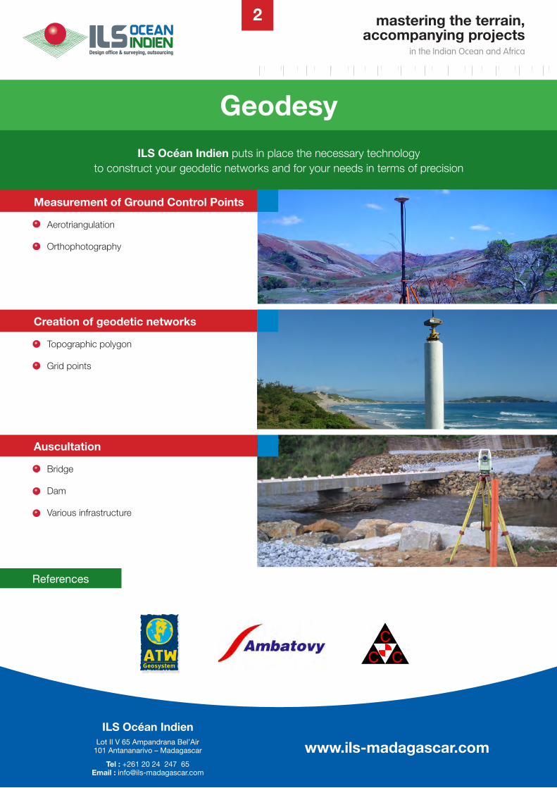
ILS Océan Indien puts in place the necessary technology to construct your geodetic networks and for your needs in terms of precision
Geodesy
Measurement of Ground Control Points
Aerotriangulation
Orthophotography
Creation of geodetic networks
Topographic polygon
Grid points
Auscultation
Bridge
Dam
Various infrastructure
2
References
mastering the terrain,accompanying projects
in the Indian Ocean and Africa
www.ils-madagascar.comILS Océan Indien
Lot II V 65 Ampandrana Bel’Air101 Antananarivo – Madagascar
Tel : +261 20 24 247 65 Email : [email protected]
ILS Océan Indien conducts underwater surveys: river studies, shorelines for harbour development or any other projects in flooded zones.
Bathymetry
Marine charts
- Hypsometric tinting
- Seabed modelling
Bathymetric plans
Harbour development
Dredging
Cable / pipeline installation
3
Echo sounders
- Single-beam
- Multi-beam
- Lateral sonar
References
mastering the terrain,accompanying projects
in the Indian Ocean and Africa
www.ils-madagascar.comILS Océan Indien
Lot II V 65 Ampandrana Bel’Air101 Antananarivo – Madagascar
Tel : +261 20 24 247 65 Email : [email protected]
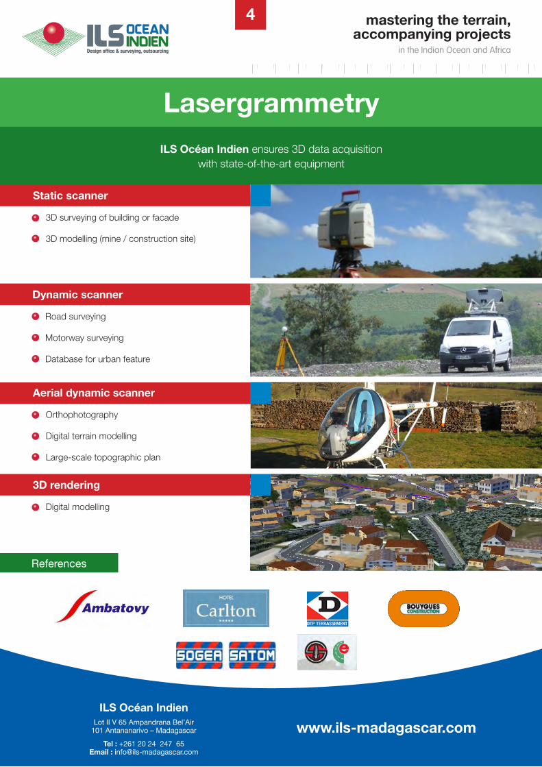
ILS Océan Indien ensures 3D data acquisition with state-of-the-art equipment
Lasergrammetry
Static scanner
- 3D surveying of building or facade
- 3D modelling (mine / construction site)
Dynamic scanner
Road surveying
Motorway surveying
Database for urban feature
Aerial dynamic scanner
Orthophotography
Digital terrain modelling
Large-scale topographic plan
3D rendering
Digital modelling
4
References
mastering the terrain,accompanying projects
in the Indian Ocean and Africa
www.ils-madagascar.comILS Océan Indien
Lot II V 65 Ampandrana Bel’Air101 Antananarivo – Madagascar
Tel : +261 20 24 247 65 Email : [email protected]
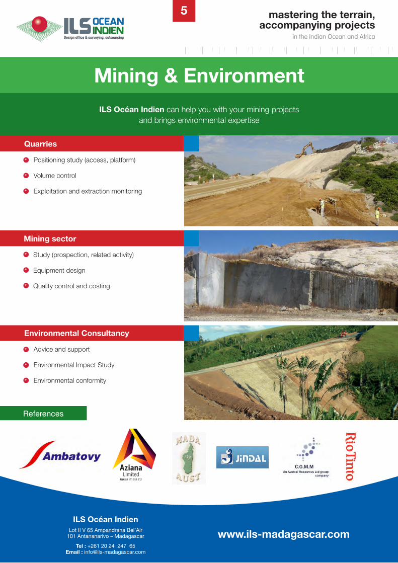
ILS Océan Indien can help you with your mining projects and brings environmental expertise
Mining & Environment
5
Quarries
Positioning study (access, platform)
Volume control
Exploitation and extraction monitoring
Mining sector
Study (prospection, related activity)
Equipment design
Quality control and costing
Environmental Consultancy
Advice and support
Environmental Impact Study
Environmental conformity
References
mastering the terrain,accompanying projects
in the Indian Ocean and Africa
www.ils-madagascar.comILS Océan Indien
Lot II V 65 Ampandrana Bel’Air101 Antananarivo – Madagascar
Tel : +261 20 24 247 65 Email : [email protected]
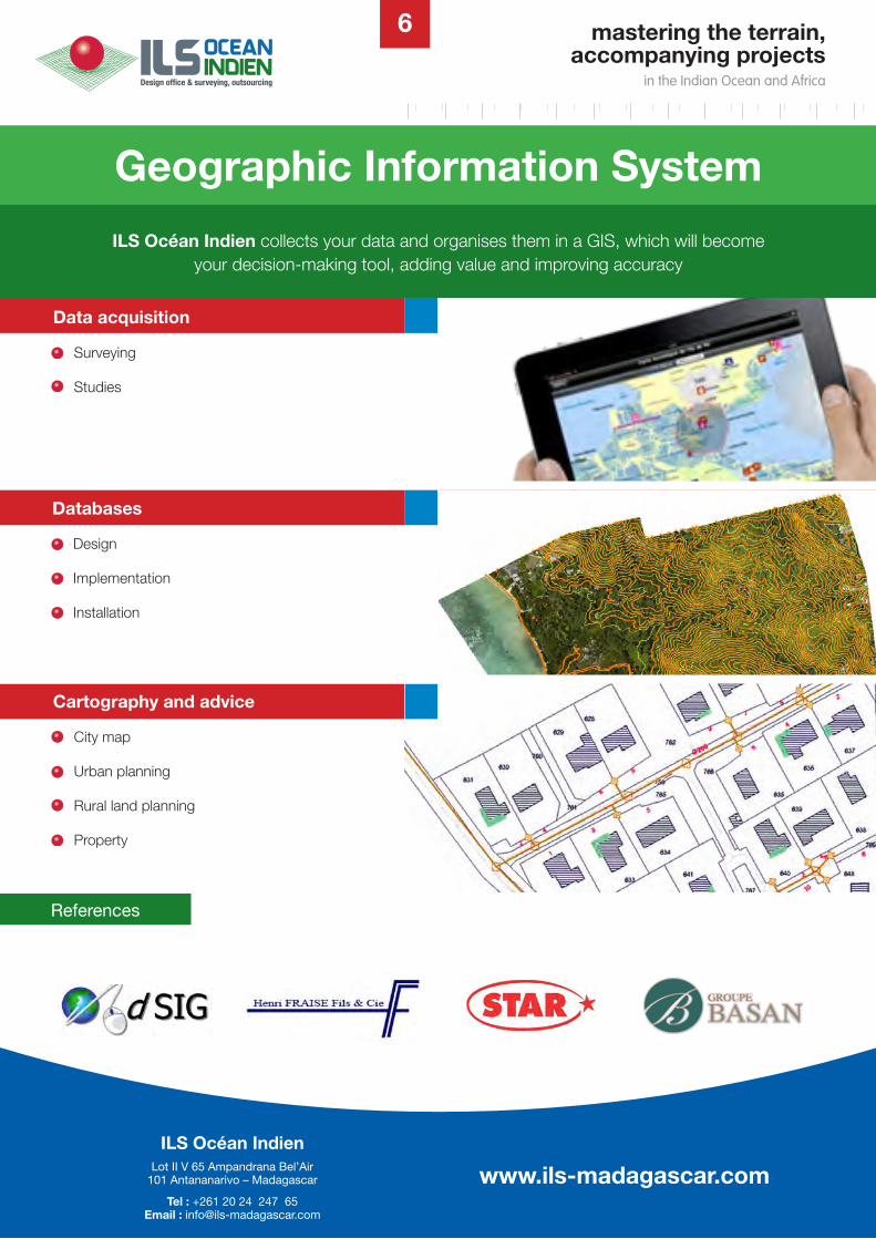
ILS Océan Indien collects your data and organises them in a GIS, which will become your decision-making tool, adding value and improving accuracy
Geographic Information System
Data acquisition
Surveying
Studies
Databases
Design
Implementation
Installation
Cartography and advice
- City map
- Urban planning
- Rural land planning
- Property
6
References
ILS Océan Indien Lot II V 65 Ampandrana Bel’Air
101 Antananarivo – Madagascar
Tél : +261 20 24 247 65 Email : [email protected]
www.ils-madagascar.com
mastering the terrain,accompanying projects
in the Indian Ocean and Africa
www.ils-madagascar.comILS Océan Indien
Lot II V 65 Ampandrana Bel’Air101 Antananarivo – Madagascar
Tel : +261 20 24 247 65 Email : [email protected]
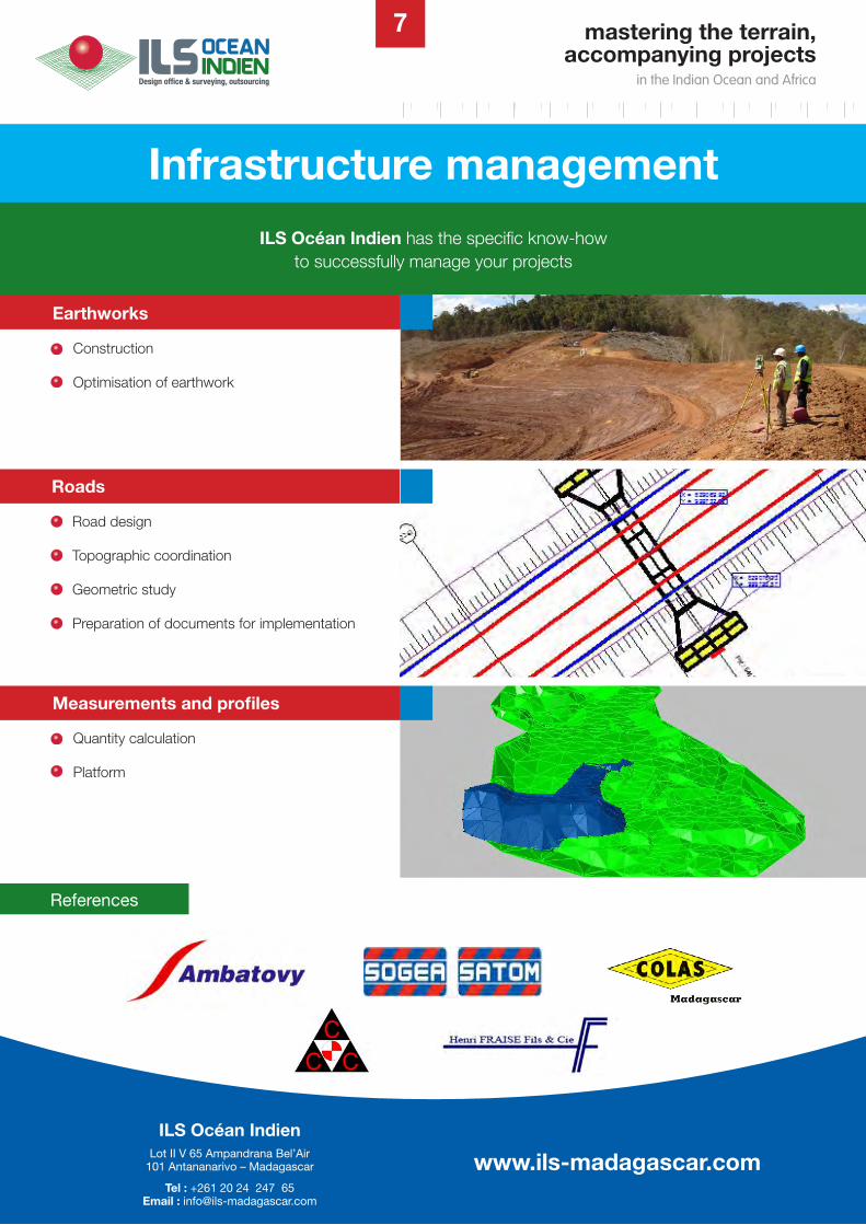
ILS Océan Indien has the specific know-how to successfully manage your projects
Infrastructure management
Earthworks
- Construction
- Optimisation of earthwork
Roads
- Road design
- Topographic coordination
- Geometric study
- Preparation of documents for implementation
Measurements and profiles
- Quantity calculation
Platform
7
References
mastering the terrain,accompanying projects
in the Indian Ocean and Africa
www.ils-madagascar.comILS Océan Indien
Lot II V 65 Ampandrana Bel’Air101 Antananarivo – Madagascar
Tel : +261 20 24 247 65 Email : [email protected]
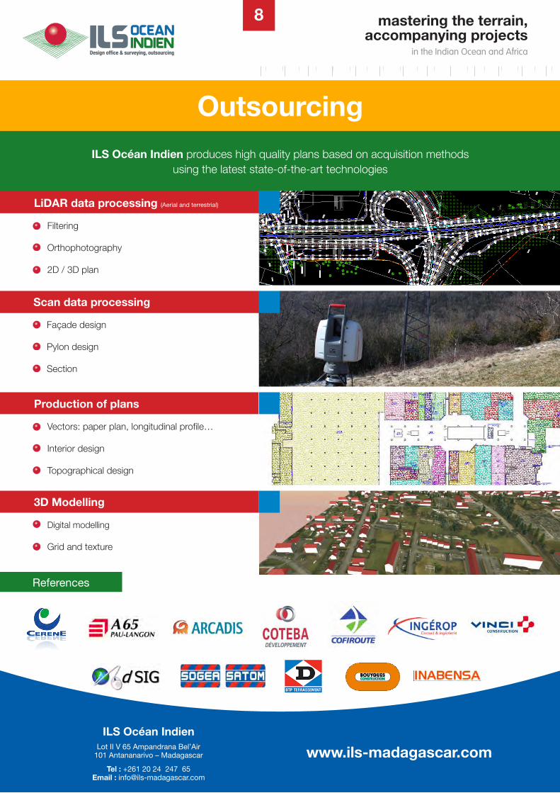
ILS Océan Indien produces high quality plans based on acquisition methods using the latest state-of-the-art technologies
Outsourcing
LiDAR data processing (Aerial and terrestrial)
Filtering
Orthophotography
2D / 3D plan
Scan data processing
Façade design
Pylon design
Section
8
References
Production of plans
Vectors: paper plan, longitudinal profile…
Interior design
Topographical design
3D Modelling
Digital modelling
Grid and texture
mastering the terrain,accompanying projects
in the Indian Ocean and Africa
www.ils-madagascar.comILS Océan Indien
Lot II V 65 Ampandrana Bel’Air101 Antananarivo – Madagascar
Tel : +261 20 24 247 65 Email : [email protected]
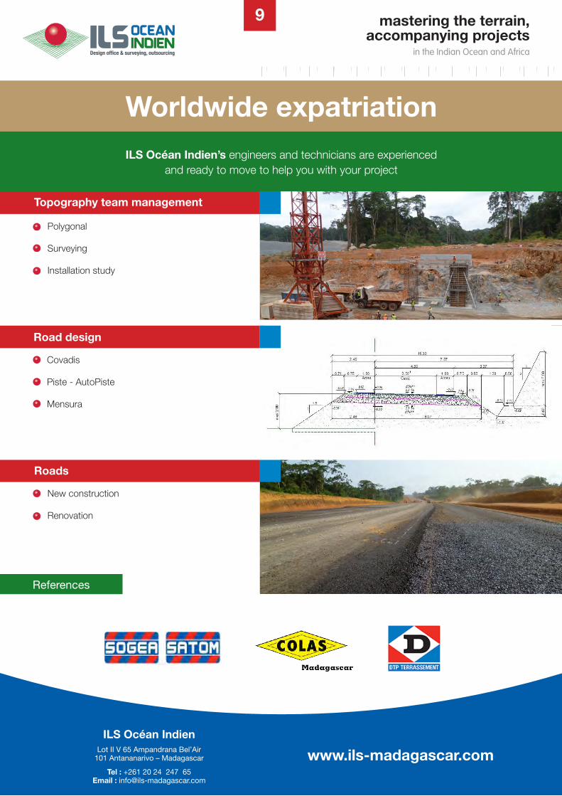
ILS Océan Indien’s engineers and technicians are experienced and ready to move to help you with your project
Worldwide expatriation
Topography team management
Polygonal
Surveying
Installation study
Road design
Covadis
Piste - AutoPiste
Mensura
Roads
New construction
Renovation
9
References
mastering the terrain,accompanying projects
in the Indian Ocean and Africa
www.ils-madagascar.comILS Océan Indien
Lot II V 65 Ampandrana Bel’Air101 Antananarivo – Madagascar
Tel : +261 20 24 247 65 Email : [email protected]