© crown copyright met office enhanced rainfall services paul davies
Post on 19-Dec-2015
215 views
TRANSCRIPT

© Crown copyright Met Office
Enhanced rainfall services Paul Davies
© Crown copyright Met Office
Contents
This presentation covers the following areas
• Lessons learnt following 2007 floods
• Upgrade to NSWWS.
• Extreme Rainfall Alerts.
• Decision making tools
• Questions.

© Crown copyright Met Office
Tewkesbury: 20th July 2007

© Crown copyright Met Office
Gloucester CC Report
“That the Meteorological Office and the EnvironmentAgency review their existing Severe Weather Warning and Flood Warning systems in order to incorporate an additional category of the highest risk that is only issued in exceptional circumstances.
This would avoid the public and organisations becoming complacent of the significance of the warnings”
Extreme warnings

© Crown copyright Met Office
Use of probabilities: improvements made to the Met Office NSWWS
• Enhance web display for “traffic light” alert
• Differentiate between severe weather and extreme weather events
• Introduction of routine Severe Weather Advisory
© Crown copyright Met Office
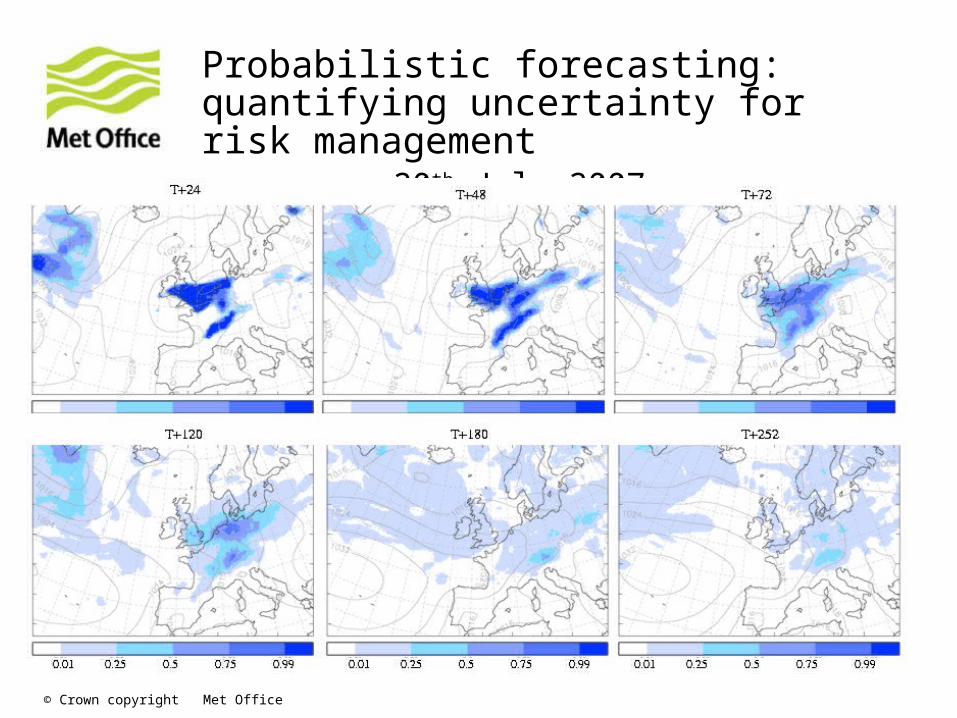
Probabilistic forecasting: quantifying uncertainty for risk management 20th July 2007
© Crown copyright Met Office
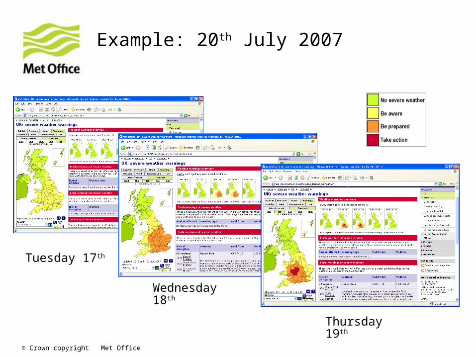
Example: 20th July 2007
Tuesday 17th
Wednesday 18th
Thursday 19th

© Crown copyright Met Office
“The nation's current flood defences are focused almost entirely on river and coastal flooding, but about two thirds of last summer's floods were caused by
surface water, often following heavy rainfall”
Sir Michael Pitt
7th May 2008
Surface water floods

© Crown copyright Met Office
The Pitt Review
PITT REVIEW RECOMMENDATION 6
“The Environment Agency and the Met Office should work together, through a joint centre, to improve their technical capability to forecast, model and warn against ALL sources of flooding.”

© Crown copyright Met Office
Extreme Rainfall Alert service“A tremendous amount of water came down with very little warning and the surface water drainage couldn't handle it”
Somerset Fire Service re heavy rain on Thursday 29th May 2008

© Crown copyright Met Office
Extreme rainfall that could lead to surface water flooding.
Accumulation Period (hours)
1 3 6
Risk of severe surface water flooding
30 40 50
Bromley, London. Flooding depth results using Halcrow surface water model and 30mm/hr rain rates

© Crown copyright Met Office
Extreme Rainfall Alert (ERA)
• Environment Agency - Met Office partnership
• 6 months trial service to emergency responders since July 2008
• Extreme rainfall alerts produced by 24x7 Met Office “wet bench” forecasters supported by Environment Agency, supplemented by bespoke STEPS and time-lagged 4km UK model precipitation products
• Environment Agency liaison & support facilitated by presence of Agency staff throughout the trial

© Crown copyright Met Office
Extreme Rainfall Alert service
Cornwall CC reported that a recent alert had let to a pre-emptive deployment of the fire service and as a result they carried out a rescue from a car where floodwaters were rising a foot every 20 minutes.

© Crown copyright Met Office
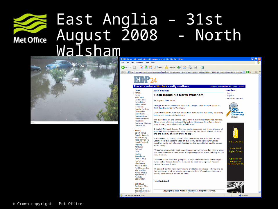
East Anglia – 31st August 2008
ERA Early Alert issued at 1046 on 31st August 2008
HR Radar for 1630 on 31st August 2008
(Black >16mm/hr, clear > 32mm/hr)
© Crown copyright Met Office
East Anglia – 31st August 2008 - North Walsham
© Crown copyright Met Office
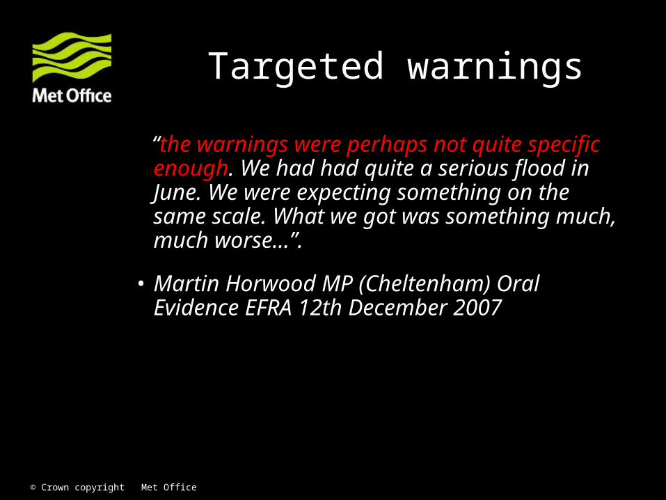
“the warnings were perhaps not quite specific enough. We had had quite a serious flood in June. We were expecting something on the same scale. What we got was something much, much worse...”.
• Martin Horwood MP (Cheltenham) Oral Evidence EFRA 12th December 2007
Targeted warnings
© Crown copyright Met Office
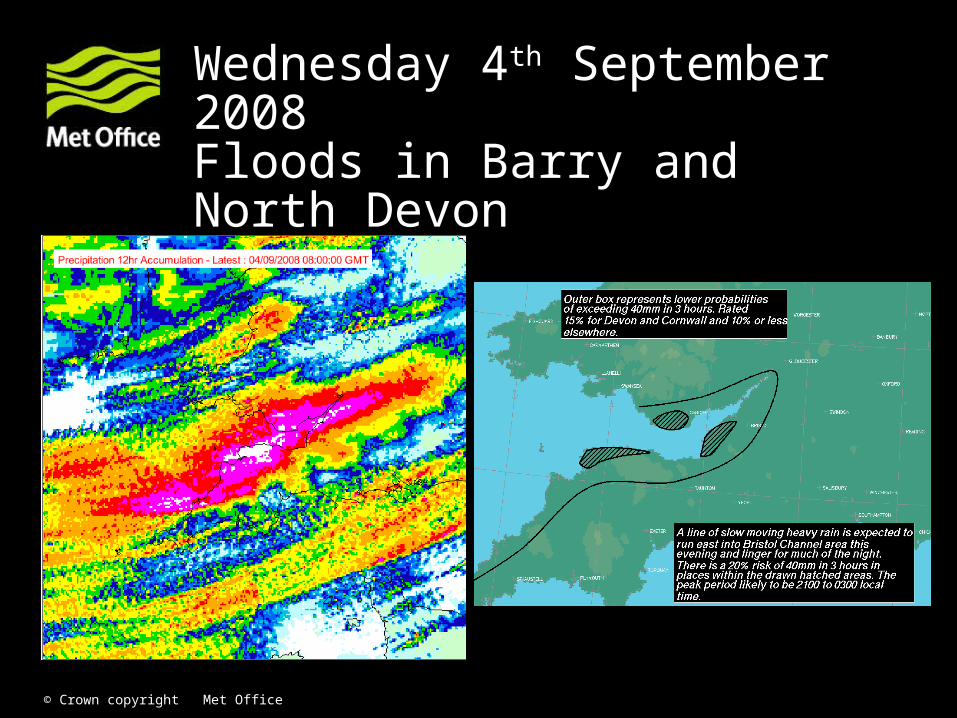
Wednesday 4th September 2008Floods in Barry and North Devon

© Crown copyright Met Office
Morpeth floods 6th September

© Crown copyright Met Office
Benefits of increased model resolution. Morpeth floods valid 06UTC Saturday 6th September 2008
12km 4km 1.5km
The 4km model produced rainfall totals over 100mm of rain in 24 hours in the Morpeth area and over 150mm in 36 hours over the Cheviot hills nearby. These values compare favourably with observations

© Crown copyright Met Office
ERA. Probability of exceeding 100mm in the 24-hour period 15 UTC 5th to 15 UTC 6th September from a time-lag ensemble combining UK 4km model forecasts from
03, 09 and 15 UTC 5th September 2008.
Observed 3 day rainfall totals 4-6th September

© Crown copyright Met Office
Water UK Report
“Water companies and Water UK should work closely with the Met Office and the environmental agencies further to develop specific industry requirements for weather information and advanced severe weather warnings and to obtain a better understanding of the potential severity of rain storms that might give rise to large scale flooding events”
Decision making tools
© Crown copyright Met Office
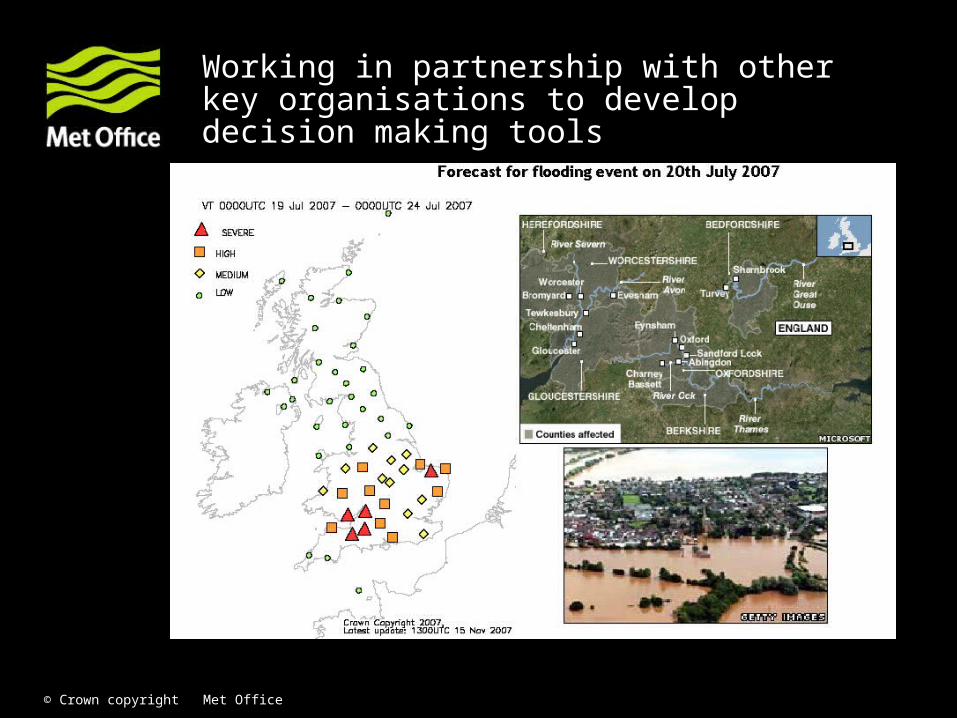
Working in partnership with other key organisations to develop decision making tools

© Crown copyright Met Office
Summary
• The Met Office has a major programme of investment in improving UK forecasts which is especially focussed on providing better, smaller scale rainfall forecasts.
• This programme interacts both with the Environment Agency and academic community in developing new science and the end users in addressing real needs. ERA is a good example of the benefits of close joint working
• Met Office can provide early warning of intense precipitation and future decision making tools

© Crown copyright Met Office
Questions and answers