women in science & math conference melican middle school
TRANSCRIPT

IAP - 12.310 Introduction to Weather Forecasting
Lecture 4:The Polar Front and Extra-tropical Cyclones
• Recap on Front experiment• Polar front• Satellite images• Cyclones develop in the Polar Front• Met Ed video of cyclogenesis• Eddies experiment

Global scale: the Polar Front
Transition from dome of
polar air to tropical air is
the Polar Front

Real time data, polar view
Fronts experiment

Real data:
Isosurface oftemperature
(note the dome of cold air over the pole)

Loop
Real data:
Isosurfaces of temperatureand wind
(note the dome of cold air over the pole and the accompanying upper level jet, located in the regions of largest frontal slope)

Yesterday: 140121 12z, 500mb temperature in C
Polar front is “wavy” with cold air intrusions over North America and Asia
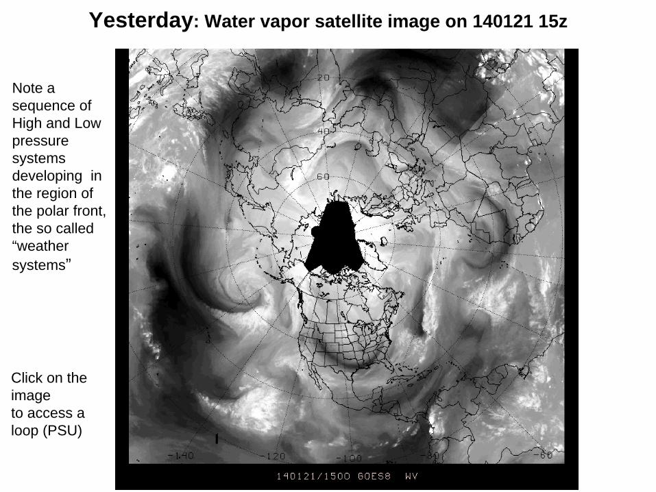
Yesterday: Water vapor satellite image on 140121 15z
Click on the image to access a loop (PSU)
Note a sequence of High and Low pressure systems developing in the region of the polar front, the so called “weather systems”

Yesterday: The upper level jet on 140121 12z
The weather systems move from west to east with the jet

Cyclone model
Cyclones develop on the Polar Front
Gfks23

Cyclones facts:
1. develop along the Polar Front,
2. stir the north-south temperature gradient, and are responsible for the poleward transfer of heat,
3. move from west to east with the jet,
4. have a lifetime of ~5 days.

Eddies experiment -to understand how the cyclones form
Two main ingredients:
1. Earth rotation
2. North south temperature difference (warming of the equator and cooling of the pole)
For more on the experiment, see http://paoc.mit.edu/labguide/circ_exp_fast.html

Scale of phenomena and precipitation

Precipitation ForecastingFactors to consider:• Availability of moisture
• Magnitude of vertical velocitysynoptic scale: L= 1000Km w = few cm/sfrontal scale: L= 100km w = 10 cm/sconvective scale: L= 100m-1Km w= 1-10 m/s
• Orographic effectsEnhanced precipitation in upslope regionsDeserts on downwind sides of mountains
In general,when forecasting precipitation,
life is complicated