west bengal state council of technical …webscte.org/pdf/3rd sem_9_mine survey.pdf · 2.7 chaining...
TRANSCRIPT

Curricular structure for Part –II (3rd
Sem.) of the Full time Diploma Course in Mine Surveying
Note:
1. As per statutory provision of Director General of Mines Safety (DGMS) students have to
undergo two months of Industrial Training after the completion of Part-I (Sem-II)
examination. Therefore, Industrial Training has been kept under the subject-
Professional Practice-I and its syllabus has been framed accordingly.
2 Due to the two months of continuous Industrial Training, length of the session of Part-II
(Semester-3rd) is reduced to eight to nine weeks. Therefore, weekly no. of periods for
some important subjects has been increased to cover the syllabus properly.
3 Total Marks-100 has been allotted to Professional Practice-I keeping in view the DGMS
approval and importance of the Industrial Training for students of Mining Survey Dept.
WEST BENGAL STATE COUNCIL OF TECHNICAL EDUCATION
TEACHING AND EXAMINATION SCHEME FOR DIPLOMA IN ENGINEERING COURSES
COURSE NAME-MINE SURVEYING
DURATION OF COURSE- 6 SEMESTERS
SEMESTER- THIRD, SEMESTER DURATION- NINE WEEKS
SR.
No.
SUBJECT CREDITS PERIODS EVALUATION SCHEME
L TU PR Internal Scheme ESE PR Total
Marks TA CT Total
1 Environmental
Engineering
4 4 10 20 30 70 100
2 Basic Surveying-I 4+2=6 4 4 10 20 30 70 100 200
3 Basic Surveying-II 4+2=6 4 4 10 20 30 70 100 200
4 Methods of Mining 4 4 10 20 30 70 100
5. Computer Aided Design
and Drafting
3 6 100 100
6 Professional Practice-I 2 3 100 100
Grand Total 25 16 17 40 80 120 280 400 800
STUDENT CONTACT HOURS PER WEEK:33 HOURS
Theory and Practical period of 60 minutes each.
L-Lecture, TU-Tutorials, PR- Practical, TA-Teacher’s Assessment, CT-Class Test ,ESE-End Semester Exam

Syllabus for Environmental Engineering
Name of the Course: Diploma in Mining Survey
Subject: Environmental Engineering
Subject Code: MNSR/S3/T1/ENV Semester: Third
Duration: 6 months Maximum Marks: 100
Teaching Scheme Examination Scheme
Theory: 4hours/week Mid Semester Exam: 20 Marks
Tutorial: Nil Attendance, Assignment & Interaction: 10 Marks
Practical: Nil End Semester Exam: 70 Marks
Credit: 4
Aim:
Sl. No. The aim of this subject is
1. To impart knowledge of environment and different types of pollution
2. To impart knowledge about causes and preventive measures against air pollution
3. To impart knowledge about causes and preventive measures against water pollution
4. To impart knowledge about causes and preventive measures against soil pollution
5. To impart knowledge about causes and preventive measures against noise pollution
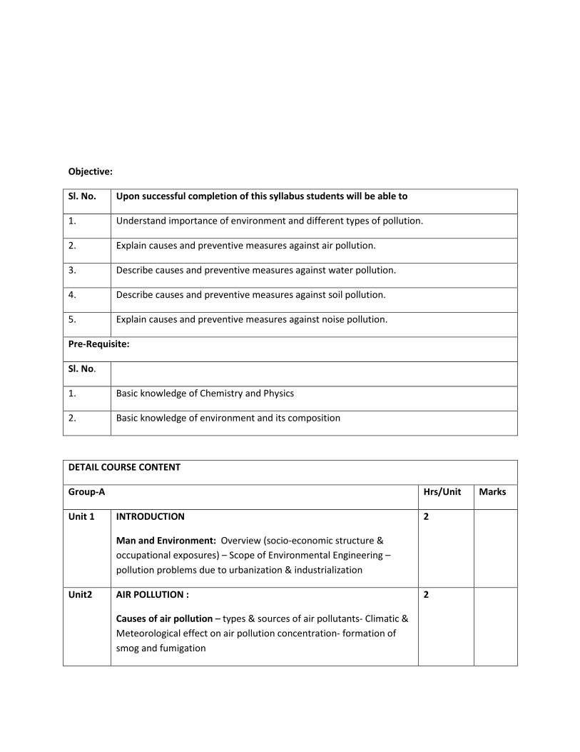
Objective:
Sl. No. Upon successful completion of this syllabus students will be able to
1. Understand importance of environment and different types of pollution.
2. Explain causes and preventive measures against air pollution.
3. Describe causes and preventive measures against water pollution.
4. Describe causes and preventive measures against soil pollution.
5. Explain causes and preventive measures against noise pollution.
Pre-Requisite:
Sl. No.
1. Basic knowledge of Chemistry and Physics
2. Basic knowledge of environment and its composition
DETAIL COURSE CONTENT
Group-A Hrs/Unit Marks
Unit 1 INTRODUCTION
Man and Environment: Overview (socio-economic structure &
occupational exposures) – Scope of Environmental Engineering –
pollution problems due to urbanization & industrialization
2
Unit2 AIR POLLUTION :
Causes of air pollution – types & sources of air pollutants- Climatic &
Meteorological effect on air pollution concentration- formation of
smog and fumigation
2
Unit 3 Analysis of Air Pollutants
Cllection of Gaseous Air Pollutants- Collection of Particulate
Pollutants – Analysis of Air Pollutants like : Sulphur dioxide – Nitrogen
oxide – Carbon monoxide – Oxidants &Ozone – Hydrocarbons –
Particulate Matter
3
Unit 4 Air Pollution Control Measures & Equipment
Control of Particulate Emission – Control of Gaseous Emission – Flue
Gas Treatment Methods : Stacks Gravitational and Inertial Separation,
Settling Chambers, Dynamic Separators, Cyclones, Filtration, Liquid
Scrubbing, Spray Chambers, Packed Towers, Orifice and Ventury
Scrubbers, Electrostatic Precipitators, Gas/solid Adsoruption, Thermal
Decomposition
4
Unit 5 Methods &Approach of Air Pollution Control
Controlling smoke nuisance – Develop air quality criteria and
practical emission standards – Creating zones suitable for industry
based on micrometeorology of air area – Introducing artificial
methods of removalof particulate and matters of waste before
discharging to open atmosphere
3
Group –B WATER & ENVIRONMENT
Unit 6 Water Sources
Origin of waste water – Types of water pollutants and their effects
2
Unit 7 DDIIFFFFEERREENNTT SSOOUURRCCEESS OOFF WWAATTEERR PPOOLLLLUUTTIIOONN
Biological Pollution (point & non-point sources) – Chemical Pollutants:
Toxic Organic & Inorganic Chemicals – Oxygen demanding substances – Physical Pollutants: Thermal Waste – Radioactive waste
– Physiological Pollutants: Taste affecting substances – other forming
substances
3
Unit 8 WATER POLLUTION & ITS CONTROL
2
Adverse effects on: Human Health & Environment, Aquatic life, Animal
life, Plant life — Water Pollution Measurement Techniques – Water
Pollution Control Equipments & Instruments – Indian Standards for
Water Pollution Control
4

GROUP – C SOIL & ENVIRONMENT
Unit 9 SOIL POLLUTING AGENCIES & EFFECT OF SOLUTION
Liquid & Solid Wastes – Domestic & Industrial Wastes – Pesticides – Toxic: Inorganic & Organic Pollutants – Soil Deterioration – Poor
Fertility, Septicity, Ground Water Pollution, Concentration of Infecting
Agents in Soil
3
Unit 10 SOLID WASTE DISPOSAL
Dumping domestic & Industrial Solid Wastes: Advantages &
Disadvantages – Incineration: Advantages & Disadvantages –
Sanitary Land Field: Advantages & Disadvantages – Management of
Careful & Sanitary Disposal of Solid Wastes
4
GROUP – D NOISE AND ENVIRONMENTAL MANAGEMENT SYSTEM
Unit 11 NOISE POLLUTION & CONTROL
Noise Pollution: Intensity, Duration – Types of Industrial Noise – Ill
effects of Noise – Noise Measuring & Control – Permissible Noise
Limits
2
Unit 12 ENVIRONMENTAL LEGISLATIONS, AUTHORITIES & SYSTEMS
6
Air & Water Pollution Control Acts & Rules (Salient Features
only) – Functions of State / Central Pollution Control Boards –
Environmental Management System: ISO 14 000 (Salient
Features only
4
E X A M I N A T I O N S C H E M E
GGRROOUUPP
MODUL
E
OBJECTIVE QUESTIONS SUBJECTIVE QUESTIONS
TO BE
SET
TO BE
ANSWERED
MARKS PER
QUESTION
TOTAL
MARKS
TO BE
SET TTOO BBEE AANNSSWWEERREEDD
MARKS PER
QUESTION
TOTAL
MARKS
A
1
10
20
1
20
FOUR
ANY FIVE, TAKING AT
LEAST ONE FROM
EACH OF THE
GROUPS A & B, AND,
AT LEAST ONE FROM
THE GROUPS C & D
10
10 X 5 =
2
3
4
5
B
6
5
TWO 7
8
C 9
5 TWO 10

D 11, 12
5 TWO TAKEN TOGETHER 50
Text Books/ Reference Books
Name of Authors Title of the Book Edition Name of
the
Publisher
1. Kormondy
2. Odum
3. J. Turk & A. Turk
4. Dix
5.
6. Dr. A.K. De
7. D. Lal
Concept of Ecology Prentice-Hall of India, N.
Delhi
Fundamental of Ecology
Environmental Science
Environmental Pollution
Pollution Control Acts, Rules and
Notification / Central Pollution Control
Board, New Delhi
Environmental Chemistry
Water Supply & Waste Water
Prentice-
Hall of
India, N.
Delhi
Central
Pollution
Control
Board,
New Delhi

Syllabus for Basic Surveying-I
Name of the Course: Diploma in Mining Survey
Subject: Basic Surveying-I
Subject Code: MNSR/S3/T2/BS-I Semester: Third
Duration: 6 months Maximum Marks: 200
Teaching Scheme Examination Scheme
Theory: 4 hours/week Mid Semester Exam: 20 Marks
Tutorial: Attendance, Assignment & Interaction: 10 Marks
Practical: 4 hours/week End Semester Exam: 70 Marks
Credit:4+2= 6 Sessional Exam:
Internal Marks= 50; External Marks= 50
Aim:
Sl. No. The aim of this subject is
1. To impart knowledge of surveying and its classification
2. To impart knowledge of linear measurement by chains and tapes
3. To impart basic ideas about different instruments used in chain surveying
4. To impart concept of different steps/methods , errors and corrections applied in chaining
5. To make students able to calculate area and volume of the field of irregular boundry and
plans by different methods.
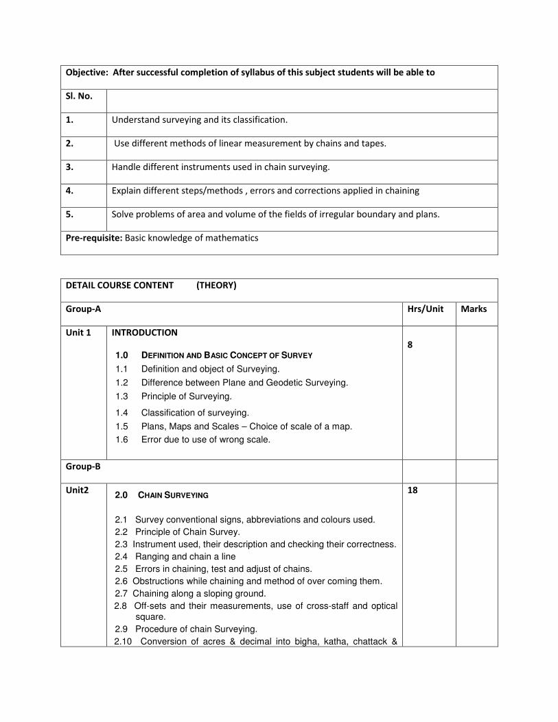
Objective: After successful completion of syllabus of this subject students will be able to
Sl. No.
1. Understand surveying and its classification.
2. Use different methods of linear measurement by chains and tapes.
3. Handle different instruments used in chain surveying.
4. Explain different steps/methods , errors and corrections applied in chaining
5. Solve problems of area and volume of the fields of irregular boundary and plans.
Pre-requisite: Basic knowledge of mathematics
DETAIL COURSE CONTENT (THEORY)
Group-A Hrs/Unit Marks
Unit 1 INTRODUCTION
1.0 DEFINITION AND BASIC CONCEPT OF SURVEY
1.1 Definition and object of Surveying.
1.2 Difference between Plane and Geodetic Surveying.
1.3 Principle of Surveying.
1.4 Classification of surveying.
1.5 Plans, Maps and Scales – Choice of scale of a map.
1.6 Error due to use of wrong scale.
8
Group-B
Unit2 2.0 CHAIN SURVEYING
2.1 Survey conventional signs, abbreviations and colours used.
2.2 Principle of Chain Survey.
2.3 Instrument used, their description and checking their correctness.
2.4 Ranging and chain a line
2.5 Errors in chaining, test and adjust of chains.
2.6 Obstructions while chaining and method of over coming them.
2.7 Chaining along a sloping ground.
2.8 Off-sets and their measurements, use of cross-staff and optical square.
2.9 Procedure of chain Surveying.
2.10 Conversion of acres & decimal into bigha, katha, chattack &
18

hectares and inversely.
2.11 Numerical problems.
GROUP-C
Unit 3 3.0 Computation of Areas and Volume:
3.1 Computation of Area: Computation of areas from plans by various method: -
(i) Graphical, (ii) Divide into triangles, (iii) Divide into squares,
(iv) By ordinates, (v) Mid-ordinate rule, (vi) Average ordinate method, (vii) Trapezoidal rule, (viii) Simpson’s rule.
Planimeter – different types, description of different parts, areas by
planimeter,
3.2 Computation of volume: Prismoidal formula, trapezoidal
formula, volume from spot levels and volume from contour plan.
10
PRACTICAL: Code: MNSR/S3/P1/BS-1
Sl. No. Name of Experiment
1. Recognizing and handling chain surveying equipments, such
as chain, ranging road, tape etc.
2. Ranging a line with eyes, measuring distance, taking off-sets.
3. Chain surveying of small plot including details.
GGRROOUUPP
Unit OBJECTIVE QUESTIONS SUBJECTIVE QUESTIONS
TO BE
SET
TO BE
ANSWERED
MARKS PER
QUESTION
TOTAL
MARKS
TO BE
SET TTOO BBEE AANNSSWWEERREEDD
MARKS PER
QUESTION
TOTAL
MARKS
A 1 7 ANY
TWENTY
1 20 x 1
=20
THREE FIVE, TAKING AT
LEAST ONE FROM
EACH GROUP
10
10 X 5 =
50 B 2 12 FOUR
C 3 6 THREE
List of Text/Reference Books
Title Author/Authors Publisher
Surveying(Vol-I) S.Duggal Tata McGraw Hill

Surveying & Levelling N. Basak Tata McGraw Hill
Surveying & Levelling(Vol-1) T.P Kanetkar Pune Vidyarthi Griha Prakashan
Surveying(Vol-I ) Dr. K.R. Arora Standard Book House
Surveying(Vol-I) Dr. B.C. Punamia Laxmi Publications Pvt Ltd.

Syllabus for Basic Surveying-II
Name of the Course: Diploma in Mining Survey
Subject: Basic Surveying-II
Subject Code: MNSR/S3/T3/BS-II Semester: Third
Duration: 6 months Maximum Marks: 200
Teaching Scheme Examination Scheme
Theory: 4hours/week Mid Semester Exam: 20 Marks
Tutorial: Nil Attendance, Assignment & Interaction: 10 Marks
Practical: 4hours/week End Semester Exam: 70 Marks
Credit:4+2=6 Sessional Exam:
Internal Marks= 50; External Marks= 50
Aim:
Sl. No.
1. To impart introductory knowledge about reference lines(meridian)
2. To impart concept of angular measurement with respect to reference lines(bearing)
3. To impart basic ideas about different instruments used for measuring bearings
4. To impart concept of different steps/methods of plane table surveying
5. To impart basic ideas to find out the unknown station point on plan
Objective:
After successful completion of this syllabus students will be able to
1. Describe different types of meridians and the factors affecting their positions
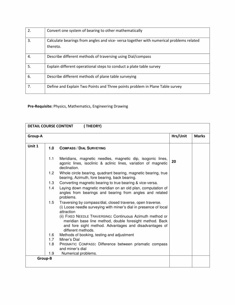
2. Convert one system of bearing to other mathematically
3. Calculate bearings from angles and vice- versa together with numerical problems related
thereto.
4. Describe different methods of traversing using Dial/compass
5. Explain different operational steps to conduct a plate table survey
6. Describe different methods of plane table surveying
7. Define and Explain Two Points and Three points problem in Plane Table survey
Pre-Requisite: Physics, Mathematics, Engineering Drawing
DETAIL COURSE CONTENT ( THEORY)
Group-A Hrs/Unit Marks
Unit 1 1.0 COMPASS / DIAL SURVEYING
1.1 Meridians, magnetic needles, magnetic dip, isogonic lines,
agonic lines, isoclinic & aclinic lines, variation of magnetic declination.
1.2 Whole circle bearing, quadrant bearing, magnetic bearing, true bearing, Azimuth, fore bearing, back bearing.
1.3 Converting magnetic bearing to true bearing & vice-versa.
1.4 Laying down magnetic meridian on an old plan, computation of
angles from bearings and bearing from angles and related problems.
1.5 Traversing by compass/dial, closed traverse, open traverse. (i) Loose needle surveying with miner’s dial in presence of local
attraction (ii) FIXED NEEDLE TRAVERSING: Continuous Azimuth method or
meridian base line method, double foresight method. Back
and fore sight method. Advantages and disadvantages of
different methods.
1.6 Methods of booking, testing and adjustment
1.7 Miner’s Dial 1.8 PRISMATIC COMPASS: Difference between prismatic compass
and miner’s dial
1.9 Numerical problems.
20
Group-B
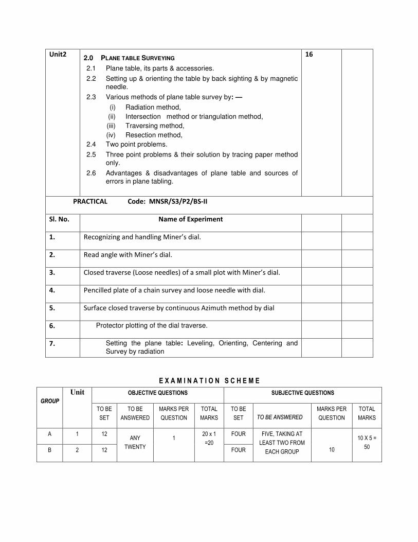
Unit2 2.0 PLANE TABLE SURVEYING
2.1 Plane table, its parts & accessories.
2.2 Setting up & orienting the table by back sighting & by magnetic
needle.
2.3 Various methods of plane table survey by: —
(i) Radiation method,
(ii) Intersection method or triangulation method,
(iii) Traversing method,
(iv) Resection method,
2.4 Two point problems.
2.5 Three point problems & their solution by tracing paper method
only.
2.6 Advantages & disadvantages of plane table and sources of
errors in plane tabling.
16
PRACTICAL Code: MNSR/S3/P2/BS-II
Sl. No. Name of Experiment
1. Recognizing and handling Miner’s dial.
2. Read angle with Miner’s dial.
3. Closed traverse (Loose needles) of a small plot with Miner’s dial.
4. Pencilled plate of a chain survey and loose needle with dial.
5. Surface closed traverse by continuous Azimuth method by dial
6. Protector plotting of the dial traverse.
7. Setting the plane table: Leveling, Orienting, Centering and
Survey by radiation
E X A M I N A T I O N S C H E M E
GGRROOUUPP
Unit OBJECTIVE QUESTIONS SUBJECTIVE QUESTIONS
TO BE
SET
TO BE
ANSWERED
MARKS PER
QUESTION
TOTAL
MARKS
TO BE
SET TTOO BBEE AANNSSWWEERREEDD
MARKS PER
QUESTION
TOTAL
MARKS
A 1 12 ANY
TWENTY
1 20 x 1
=20
FOUR FIVE, TAKING AT
LEAST TWO FROM
EACH GROUP
10
10 X 5 =
50 B 2 12 FOUR

Name of Authors Title of the Book Name of the Publisher
Surveying(Vol-I) S.Duggal Tata McGraw Hill
Surveying & Levelling N. Basak Tata McGraw Hill
Surveying &
Levelling(Vol-1)
T.P Kanetkar Pune Vidyarthi Griha
Prakashan
Surveying(Vol-I ) Dr. K.R. Arora Standard Book House
Surveying(Vol-I) Dr. B.C. Punamia Laxmi Publication Pvt. Ltd.
Plane Surveying Alak De S. Chand &Company

Syllabus for Methods of Mining
Name of the Course: Diploma in Mining Survey
Subject: Methods of Mining
Subject Code: MNSR/S3/T4/MOM Semester: Third
Duration: 6 months Maximum Marks: 100
Teaching Scheme Examination Scheme
Theory: 4hours/week Mid Semester Exam: 20 Marks
Tutorial: Nil Attendance, Assignment & Interaction: 10 Marks
Practical: Nil End Semester Exam: 70 Marks
Credit: 4
AIM:
Sl. No.
1. To impart introductory knowledge of methods mining
2. To impart concept of different underground methods of mining
3. To impart basic ideas about the equipments used for extraction of coal /minerals
4. To impart concept of different opencast methods of mining
OBJECTIVE:
Sl. No. After completion of the syllabus of this subject students will be able to
1. understand different mining methods
2. explain different underground methods of mining
3. handle the equipment used for extraction of coal /minerals
4. explain different opencast mining methods
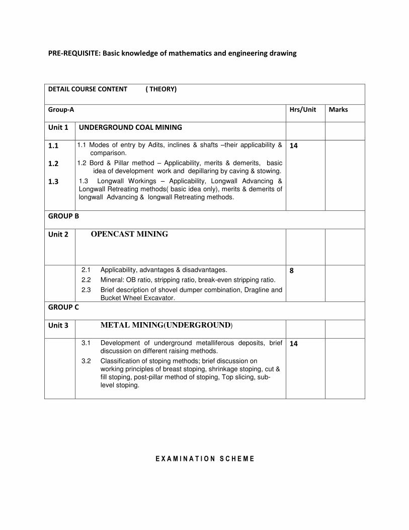
PRE-REQUISITE: Basic knowledge of mathematics and engineering drawing
DETAIL COURSE CONTENT ( THEORY)
Group-A Hrs/Unit Marks
Unit 1 UNDERGROUND COAL MINING
1.1
1.2
1.3
1.1 Modes of entry by Adits, inclines & shafts –their applicability &
comparison.
1.2 Bord & Pillar method – Applicability, merits & demerits, basic
idea of development work and depillaring by caving & stowing.
1.3 Longwall Workings – Applicability, Longwall Advancing &
Longwall Retreating methods( basic idea only), merits & demerits of
longwall Advancing & longwall Retreating methods.
14
GROUP B
Unit 2
OPENCAST MINING
2.1 Applicability, advantages & disadvantages.
2.2 Mineral: OB ratio, stripping ratio, break-even stripping ratio.
2.3 Brief description of shovel dumper combination, Dragline and
Bucket Wheel Excavator.
8
GROUP C
Unit 3 METAL MINING(UNDERGROUND)
3.1 Development of underground metalliferous deposits, brief
discussion on different raising methods.
3.2 Classification of stoping methods; brief discussion on
working principles of breast stoping, shrinkage stoping, cut &
fill stoping, post-pillar method of stoping, Top slicing, sub-
level stoping.
14
E X A M I N A T I O N S C H E M E
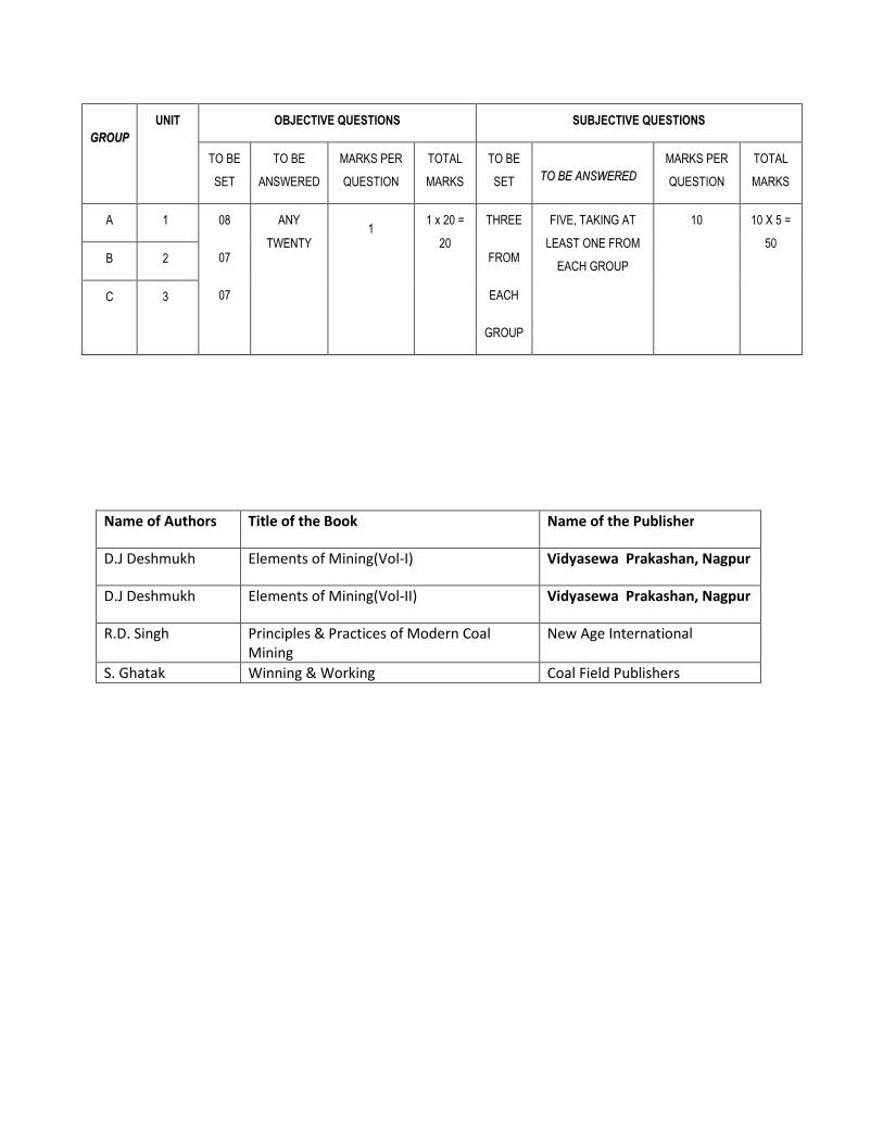
GGRROOUUPP
UNIT OBJECTIVE QUESTIONS SUBJECTIVE QUESTIONS
TO BE
SET
TO BE
ANSWERED
MARKS PER
QUESTION
TOTAL
MARKS
TO BE
SET TTOO BBEE AANNSSWWEERREEDD
MARKS PER
QUESTION
TOTAL
MARKS
A 1 08
07
07
ANY
TWENTY
1 1 x 20 =
20
THREE
FROM
EACH
GROUP
FIVE, TAKING AT
LEAST ONE FROM
EACH GROUP
10 10 X 5 =
50
B 2
C 3
Name of Authors Title of the Book Name of the Publisher
D.J Deshmukh Elements of Mining(Vol-I) Vidyasewa Prakashan, Nagpur
D.J Deshmukh Elements of Mining(Vol-II) Vidyasewa Prakashan, Nagpur
R.D. Singh Principles & Practices of Modern Coal
Mining
New Age International
S. Ghatak Winning & Working Coal Field Publishers

COMPUTER AIDED DESIGN & DRAFTING
Name of the Course: Diploma in Mining Survey
Subject: COMPUTER AIDED DESIGN & DRAFTING
Subject Code: MNSR/S3/P3/ACAD Semester: Third
Duration: 6 months Maximum Marks: 100
Teaching Scheme Examination Scheme
Theory: Nil Mid Semester Exam: Continuous internal
assessment of 50 marks
Tutorial: Nil Attendance, Assignment & Interaction:
Practical: 6 hrs/week End Semester Exam: External assessment of 50
marks
Credit: 3
AIM
Sl. No.
1. To impart introductory knowledge of drawing by computer
2. To impart concept of different computer drawing components (drawing menu)
3. To impart basic ideas about using different menu to draw an object
4. To impart concept of making multiple copies of the object
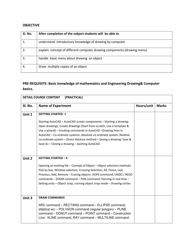
OBJECTIVE
Sl. No. After completion of the subject students will be able to
1. understand introductory knowledge of drawing by computer
2. explain concept of different computer drawing components (drawing menu)
3. handle basic menu about drawing an object
4. Draw multiple copies of an object
PRE-REQUISITE: Basic knowledge of mathematics and Engineering Drawing& Computer
basics.
DETAIL COURSE CONTENT (PRACTICAL)
Sl. No. Name of Experiment Hours/unit Marks
Unit 1 GETTING STARTED –I
Starting AutoCAD – AutoCAD screen components – Starting a drawing:
Open drawings, Create drawings (Start from scratch, Use a template &
Use a wizard) – Invoking commands in AutoCAD –Drawing lines in
AutoCAD – Co-ordinate systems: Absolute co-ordinate system, Relative
co-ordinate system – Direct distance method – Saving a drawing: Save &
Save As – Closing a drawing – Quitting AutoCAD
Unit 2 GETTING STARTED – II
Opening an existing file – Concept of Object – Object selection methods:
Pick by box, Window selection, Crossing Selection, All, Fence, Last,
Previous, Add, Remove – Erasing objects: OOPS command, UNDO / REDO
commands – ZOOM command – PAN command, Panning in real time –
Setting units – Object snap, running object snap mode – Drawing circles
Unit 3 DRAW COMMANDS
ARC command – RECTANG command – ELLIPSE command,
elliptical arc – POLYGON command (regular polygon) – PLINE
command – DONUT command – POINT command – Construction
Line: XLINE command, RAY command – MULTILINE command

Unit 4 EDITING COMMANDS
MOVE command – COPY command – OFFSET command – ROTATE
command – SCALE command – STRETCH command – LENGTHEN
command –TRIM command – EXTEND command – BREAK command –
CHAMFER command – FILLET command – ARRAY command – MIRROR
command –MEASURE command – DIVIDE command – EXPLODE
command – MATCHPROP command – Editing with grips: PEDIT
Unit 5 DRAWING AIDS
MOVE command – COPY command – OFFSET command – ROTATE
command – SCALE command – STRETCH command – LENGTHEN
command –TRIM command – EXTEND command – BREAK command –
CHAMFER command – FILLET command – ARRAY command – MIRROR
command –MEASURE command – DIVIDE command – EXPLODE
command – MATCHPROP command – Editing with grips: PEDIT
Unit 6 CREATING TEXT
Creating single line text – Drawing special characters – Creating
multiline text – Editing text – Text style
Unit 7 BASIC DIMENSIONING
Fundamental dimensioning terms: Dimension lines, dimension text,
arrowheads, extension lines, leaders, centre marks and centrelines,
alternate units – Associative dimensions – Dimensioning methods –
Drawing leader
Unit 8 INQUIRY COMMANDS
AREA – DIST – ID – LIST – DBLIST – STATUS – DWGPROPS
Unit 9 EDITING DIMENSIONS
Editing dimensions by stretching – Editing dimensions by trimming &
extending – Editing dimensions: DIMEDIT command – Editing dimension
text: DIMTEDIT command – Updating dimensions – Editing dimensions
using the properties window – Creating and restoring Dimension styles:
DIMSTYLE
Unit 10 HATCHING
BHATCH, HATCH commands – Boundary Hatch Options: Quick tab,
Advance tab – Hatching around Text, Traces, Attributes, Shapes and
Solids – Editing Hatch Boundary – BOUNDARY command
Unit 11 BLOCKS

The concept of Blocks – Converting objects into a Block: BLOCK, _BLOCK
commands – Nesting of Blocks – Inserting Blocks: INSERT, MINSERT
commands – Creating drawing files: WBLOCK command – Defining Block
Attributes – Inserting Blocks with Attributes – Editing Attributes
Unit 12 PLOTTING DRAWINGS IN AUTOCAD
PLOT command – Plot Configuration – Pen Assignments – Paper Size &
Orientation Area – Plot Rotation & Origin – Plotting Area – Scale
Unit 13 PRACTICE WITH COMPLETE DRAWING
Each student is required to prepare a set of orthographic projections of a
building. The drawing of the building will be supplied by the teacher-in-
charge.
Name of Authors Title of the Book Name of the Publisher
Vishal Sharma AUTOCAD Dhanpat Rai Publishing
company (P) Ltd
D M Kulkarni, A P
Rastogi, A K Sarkar
Engineering Graphics with AutoCAD PHI Learning
Dinesh Maidasani AutoCAD 2010 Laxmi Publication

Syllabus for Professional Practice-I
Name of the Course: Diploma in Mining Survey
Subject: Professional Practice-I
Subject Code: MNSR/S3/P4/PP-I Semester: Third
Duration: 6 months Maximum Marks: 100
Teaching Scheme Examination Scheme: Continuous assessment
Theory: Nil Mid Semester Exam:
Tutorial: Nil Attendance, Assignment & Interaction:
Practical: 03 End Semester Exam:
Credit: 2 Internal: 50 External: 50
Objective:
This subject contains two months continuous training in different coal and metal mines.
Students will be able to develop concept about mines and their different activities. The
following topics will guide them to understand different types of surveying and related
measuring instruments. After completion of field training, through theoretical and practical
classes, they will be guided to prepare the training report and present seminar.
SL.NO. Topics to be covered
1 Type of chain handled its make, its length, division, each link length, chain sketch.
Chaining procedure in level and slope ground, method of booking.
2 Methods of offsetting, planimeter if available, different parts (sketch), method
of using it, calculation of area by planimeter. Stock measurement.
3 Types of dial available, its make, least count, different parts; prismatic compass if
available, different parts, methods of surface and underground dial survey practice in

the mine.
4 Position of Bench Mark, its R.L. reference stations with its co-ordinates,
type of level instruments available in the mine, different parts(with sketch) , least
count, mode of station fixing at underground.
5 Contour interval, Methods of plotting of contours, contour gradient, water danger plan
and spot level.
6 Plane table surveying whether used or not. If yes, then methods adopted.
7 Ventilation appliance study: V- door, air crossing, fan H.P., gauge.
8 Plan preparation, storing, enlargement, reduction.