wes marshall, p.e. university of connecticut january 2007 ce 276 site design introduction to site...
Post on 20-Dec-2015
221 views
TRANSCRIPT

Wes Marshall, P.E. University of ConnecticutJanuary 2007
CE 276Site Design
Introduction to Site DesignChapter 1 – Contours & Land Form

Chapter 1Contours & Form
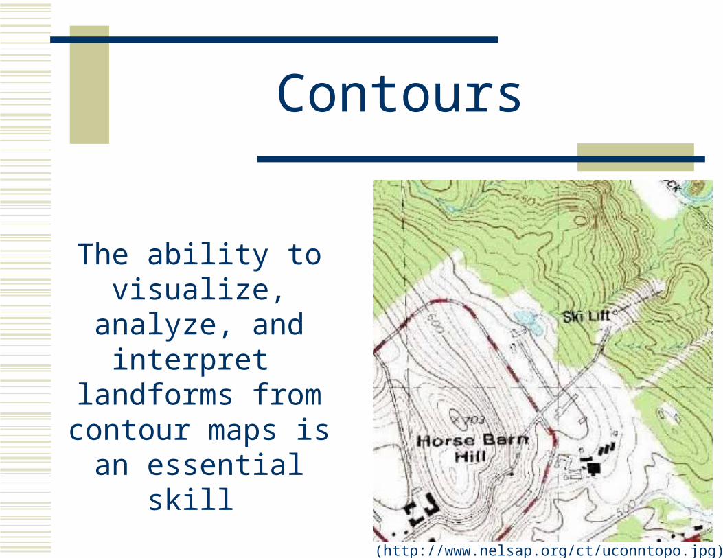
Contours
The ability to visualize, analyze,
and interpret landforms from
contour maps is an essential skill
(http://www.nelsap.org/ct/uconntopo.jpg)
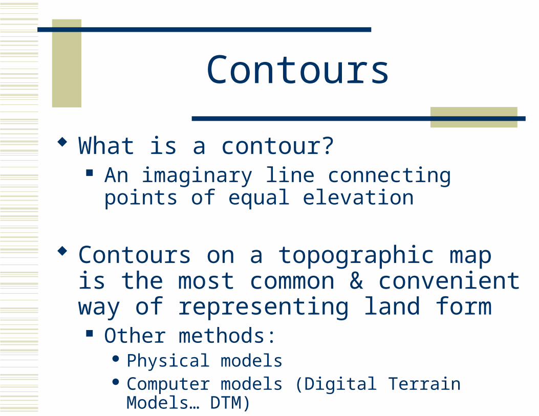
Contours
What is a contour? An imaginary line connecting points of equal
elevation
Contours on a topographic map is the most common & convenient way of representing land form Other methods:
Physical models Computer models (Digital Terrain Models… DTM)

Visualizing Contours
(Booth, Basic Elements of Landscape Architecture)

Visualizing Contours
(http://www.rbgilbert.com/images/harvardstadium10.jpg)

Visualizing Contours
(http://www.uconnhuskies.com/AllStories/MFootball/2003/04/17/20030417a.html)
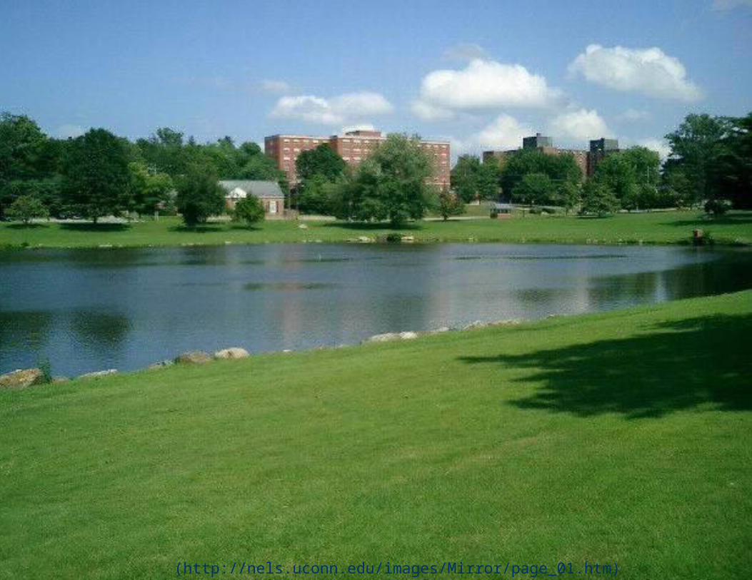
(http://nels.uconn.edu/images/Mirror/page_01.htm)
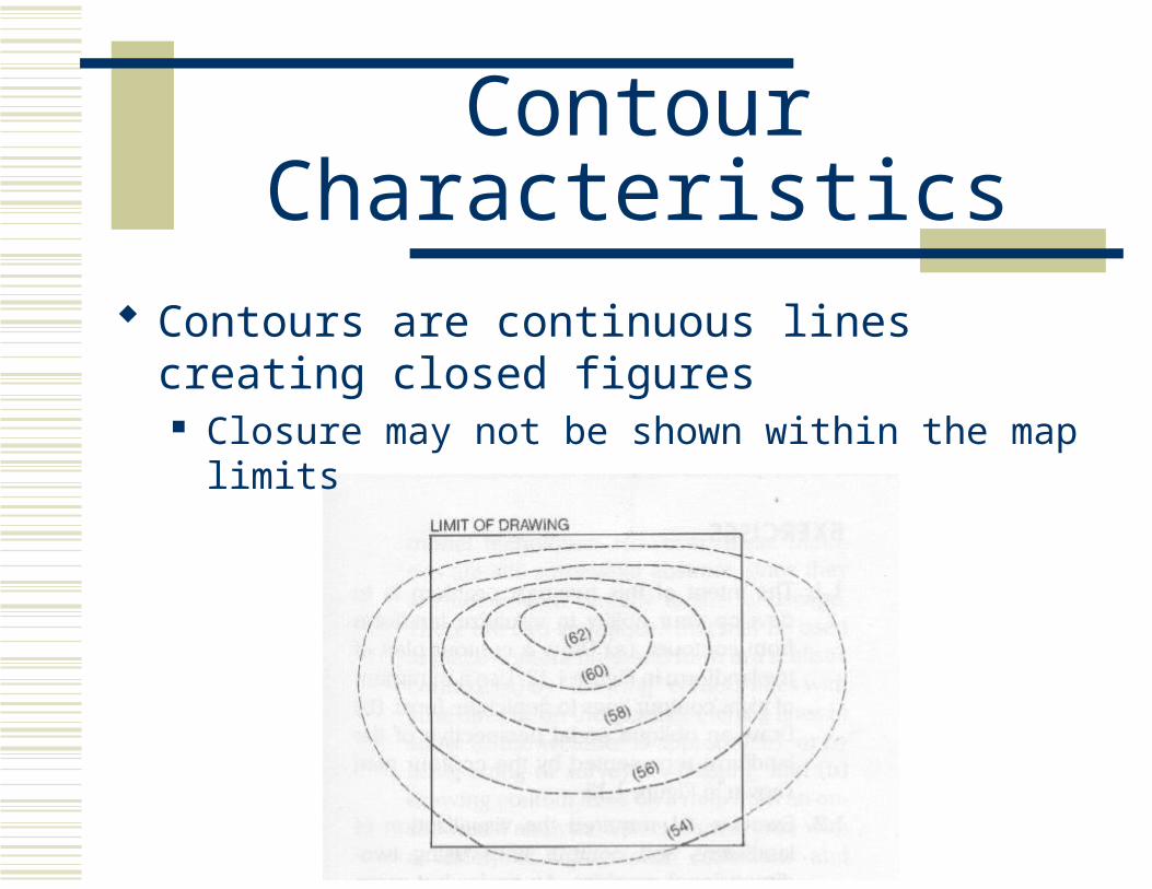
Contour Characteristics
Contours are continuous lines creating closed figures Closure may not be shown within the map limits
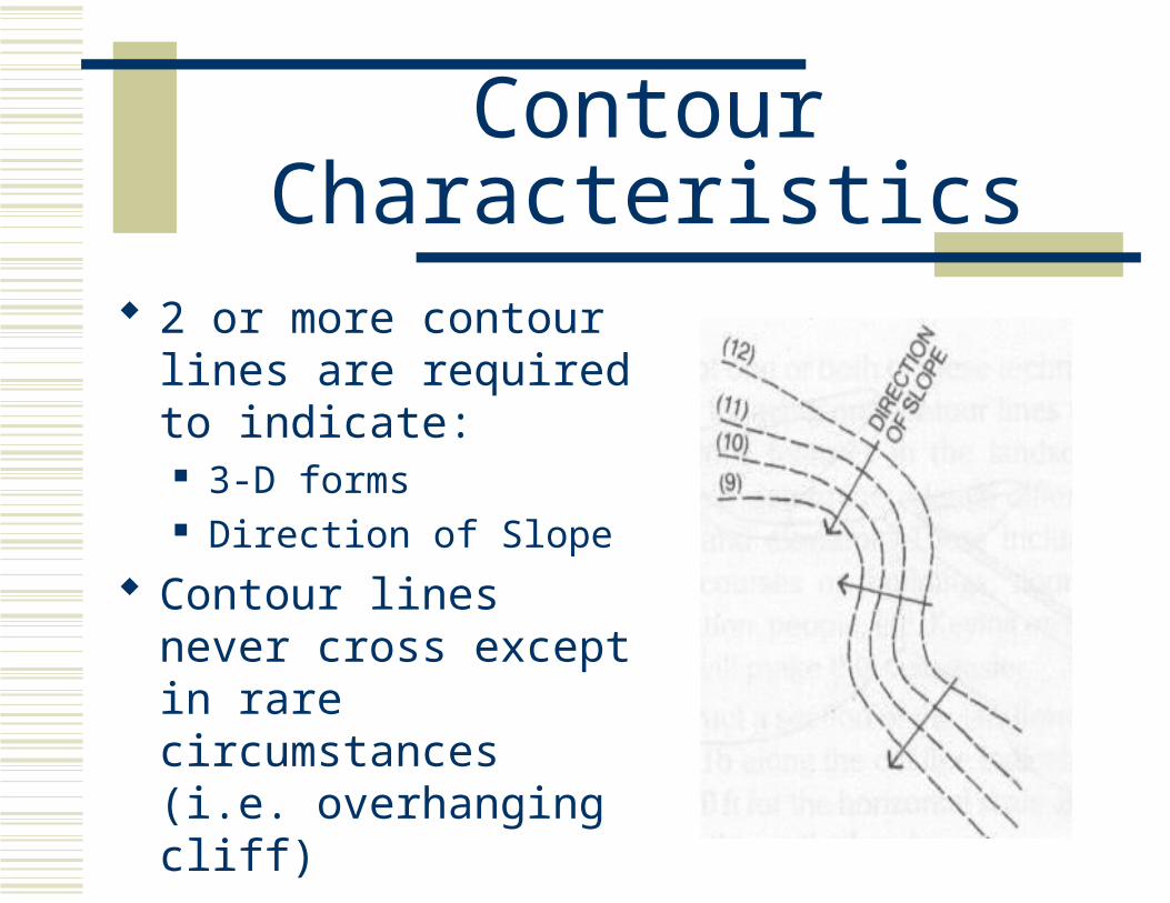
Contour Characteristics
2 or more contour lines are required to indicate: 3-D forms Direction of Slope
Contour lines never cross except in rare circumstances (i.e. overhanging cliff)

Contour Characteristics
The steepest slope is perpendicular to the contour line This is because it has the greatest
vertical change in the shortest horizontal distance
Thus, water flows perpendicular to contour lines

Contour Characteristics
Equally spaced contour lines indicate a constant, or uniform, slope As contour lines get
closer together, the slope is getting steeper
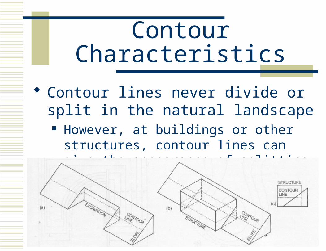
Contour Characteristics
Contour lines never divide or split in the natural landscape However, at buildings or other structures,
contour lines can give the appearance of splitting

Landforms
Various types of landforms Ridge Valley Summit Depression Uniform Slope Convex and Concave slopes Gap Saddle

Ridge & Valley
Ridge Raised elongated
landform typically with a highpoint
Valley Elongated depression
forming between the space of two ridges
The two are interconnected because the ridge side slopes create the valley walls
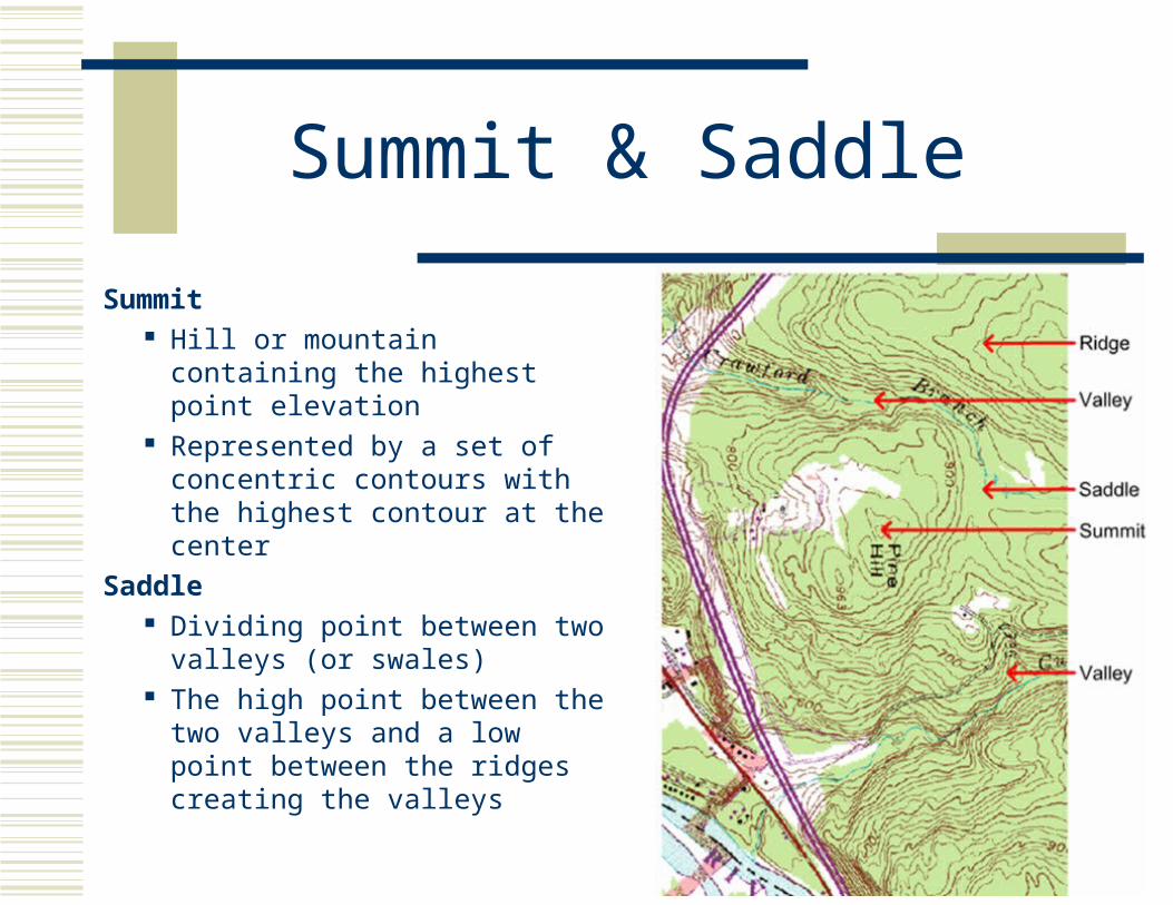
Summit & Saddle
Summit Hill or mountain containing the
highest point elevation Represented by a set of
concentric contours with the highest contour at the center
Saddle Dividing point between two
valleys (or swales) The high point between the two
valleys and a low point between the ridges creating the valleys

Saddle, Summit, & Valley
Depression
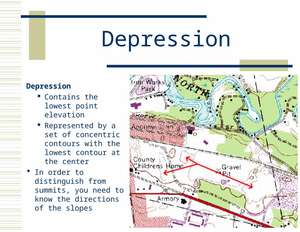
Depression Contains the lowest
point elevation Represented by a set
of concentric contours with the lowest contour at the center
In order to distinguish from summits, you need to know the directions of the slopes

Uniform Slope
Uniform Slope Constant slope Contour lines
spaced at equal distances
More typical in constructed landscapes than in the natural environment
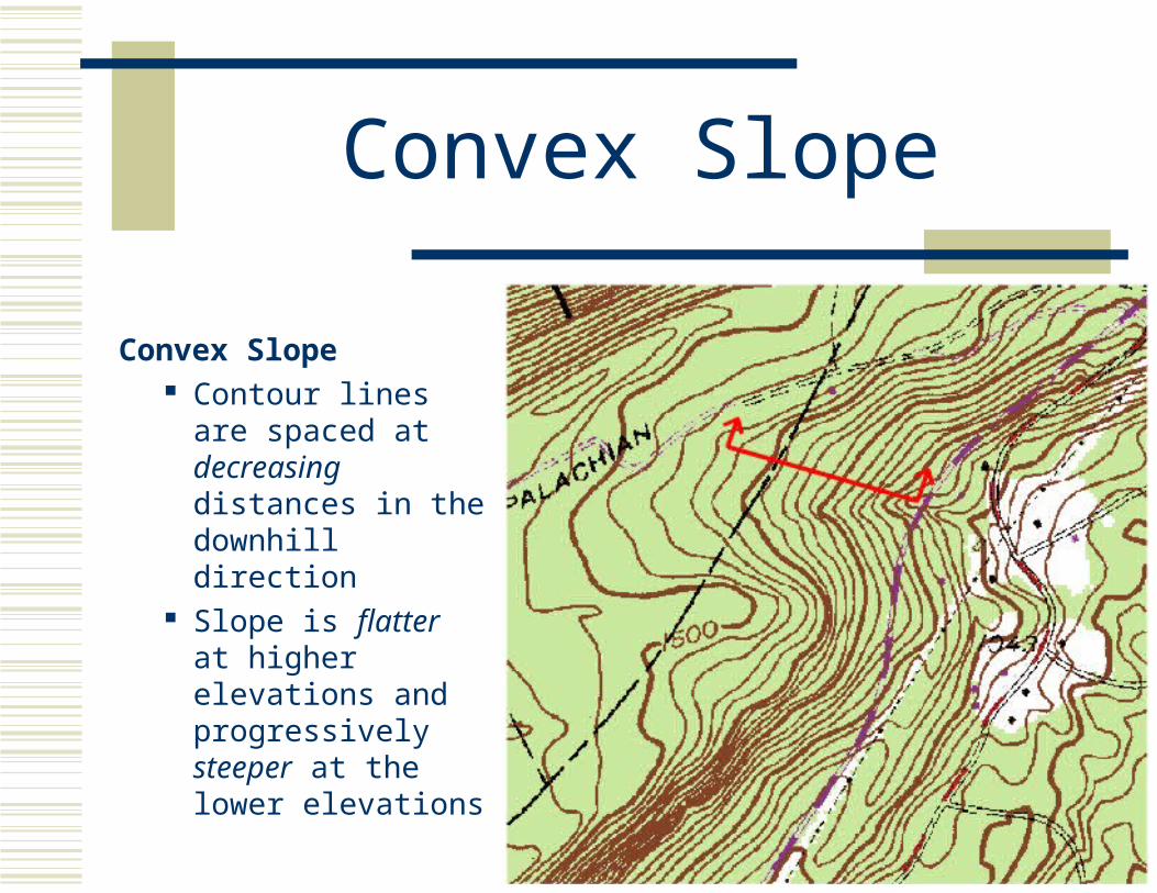
Convex Slope
Convex Slope Contour lines are
spaced at decreasing distances in the downhill direction
Slope is flatter at higher elevations and progressively steeper at the lower elevations

Concave Slope
Concave Slope Contour lines a re
spaced at increasing distances in the downhill direction
Slope is steeper at higher elevations and progressively flatter at the lower elevations

Convex & Concave Slopes
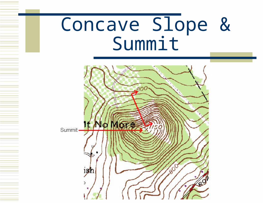
Concave Slope & Summit

Convex Slope & Valley

Gap
Gap Distinct break in
ridgeline
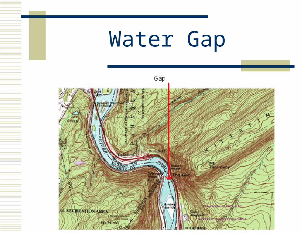
Water Gap
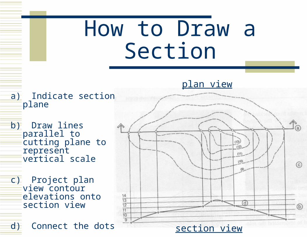
How to Draw a Section
a) Indicate section plane
b) Draw lines parallel to cutting plane to represent vertical scale
c) Project plan view contour elevations onto section view
d) Connect the dots
plan view
section view
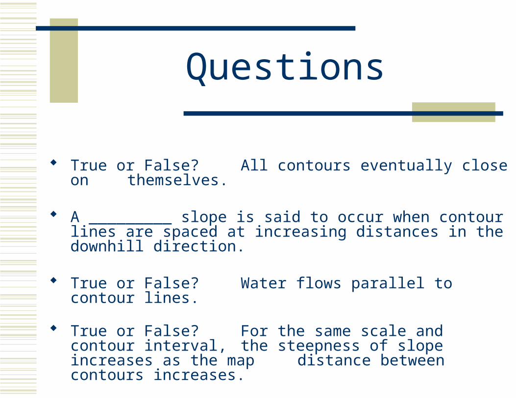
Questions
True or False? All contours eventually close on themselves.
A _________ slope is said to occur when contour lines are spaced at increasing distances in the downhill direction.
True or False? Water flows parallel to contour lines.
True or False? For the same scale and contour interval, the steepness of slope increases as the map distance between contours increases.