wegeographers.files.wordpress.com€¦ · web viewteachers were pupils of carl ritter, and even...
TRANSCRIPT
7Schools of Geography
A philosophical foundation to the subject of geography was given by Immanuel Kant, while Alexander von Humboldt (1769-1859) and Carl Ritter (17794859) developed the subject as an independent branch of knowledge. From the middle of the 19th century up to the Contemporary period, there occurred many philosophical changes in the definition, concepts and approaches of the discipline. The major concepts and methodologies were, however, developed by the Germans, followed by the French, British, American and Soviet Scientists. In the present chapter, a brief account of the different schools of geography has been given.
THE GERMAN SCHOOL OF GEOGRAPHY
German's contribution to the development of geography is enormous. In the 18th and 19th century, the Germans made great strides and put the subject on a sound footing. They gave it a philosophical and scientific base. In the post-Humboldt and Ritter period, a definite change in the role of universities occurred. During their lifetime, the major role of the universities was to train students in classical languages, theology, law and logic. It was in the middle of the 19th century when courses for various physical, biological and social sciences were standardized, and students were allowed to select their optional subjects. In Germany, the first university was established in 1809, but there were very few universities till the end of the 19th century in which geography was taught. At the initial stage, the growth of geography was very slow, and the teachers of geography did not have a proper geography background. Most of the geography
202 Schools of Geography
teachers were pupils of Carl Ritter, and even they were not sufficiently proficient in geography as they had backgrounds of other disciplines. Some of them were trained in history, while others had the background of mathematics, biology, physical sciences, geology and engineering. It was during this period that a number of geographical societies were established. These societies published geographical literature and information about the earth.1 In the second part of the last century, geographers all over the world tried to define the subject. The German scholars also gave several definitions of geography2, and tried to delineate its scope. Some of the important concepts of geography advocated and defined by the German scholars are given in the following section.
The middle of the 19th century was a period of political turmoil in Europe. There was a great demand for maps and charts by military officers and administrators since they wished to learn about the physical and cultural conditions of different nations and regions of the world. Owing to practical utility of maps, anything that could be plotted on maps was considered geography.
Oscar Peschel (1826-1875)Oscar Peschel, a leading German geographer, was appointed as a professor at the University of Leipzig in 1871. Paschel was the editor of Das Ausland—a periodical in which articles about the geography of foreign countries used to be published.3 Peschel started comparing different parts of the world and developed comparative geography. With the help of maps, he studied fiords of Norway and put forward the hypothesis that the fiords were fissures in the earth's crust that had been occupied and gouged out by glaciers.4 Moreover, Paschel laid the foundation of modern physical geography. He was primarily concerned with the study of landforms. In his studies of landforms and physical geography, he, however, ignored man as an important component of the discipline of geography. He died at the age of 49 and his book on physical geography was published posthumously.
Ferdinand von Richthofen (1833-1905)In 1871, at the end of the Franco-Prussian War, Germany was unified and the German Empire came into existence. The end of the
Schools of Geography 203
Franco-Prussian War led to heavy demand for the teaching ofgeography. Under these circumstances, new geography textbooks were written, and geography was introduced in ten universities of the country. At this stage, Ferdinand von Richthofen who was essentially a geologist andthe founder of modern geomorphology, pleaded for the cause of geography. Richthofen was trained in geology, and as a geographer, he was primarily interested in geomorphology (study of landforms). He visited China and prepared a map of coalfields of China.6 He also noted the loess formations of Northern China and tried to explain their genesis.
In the opinion of Richthofen, the purpose of geography is to focus attention on the diverse phenomena that occur in interrelation on the face of the earth. The methodology he suggested for the study of geography was that first the physical setting (relief, climate, soil, vegetation, fauna, flora) of a region be studied and then the adjustment of man in that setting be examined. According to him, the main objective of geography is the exploration of the relationship of man to the physical earth and to the biotic features. For a substantial period, this objective and methodology remained the basic pattern of geographical studies not only in Germany but also in other parts of the world.
Richthofen was the first German scholar to differentiate between the 'general' and the 'regional' geography. He emphasized the point that regional geography must be descriptive to highlight the salient features of a region. Moreover, it should try to seek regularities of occurrence and patterns of such unique features to formulate hypothesis and to explain the observed characteristics. General geography, according to him, deals with the spatial distribution of individual phenomena in the world. For systematic regional study, he emphasized the need of fieldwork,8 Richthofen distinguished the different methods of study in areas of different size, which he named
204 Schools of Geography
(in order to increasing size): (i) Erdteile (major divisions of the world); (ii) Lander (major regions); (iii) Landschaften (landscape or the small regions); and (iv) Ortlichkeiten (localities).9 He insisted that Erdkunde (Geography) must refer to a study of the earth where the lithosphere, the atmosphere, the biosphere and the hydrosphere are in contact with each other.
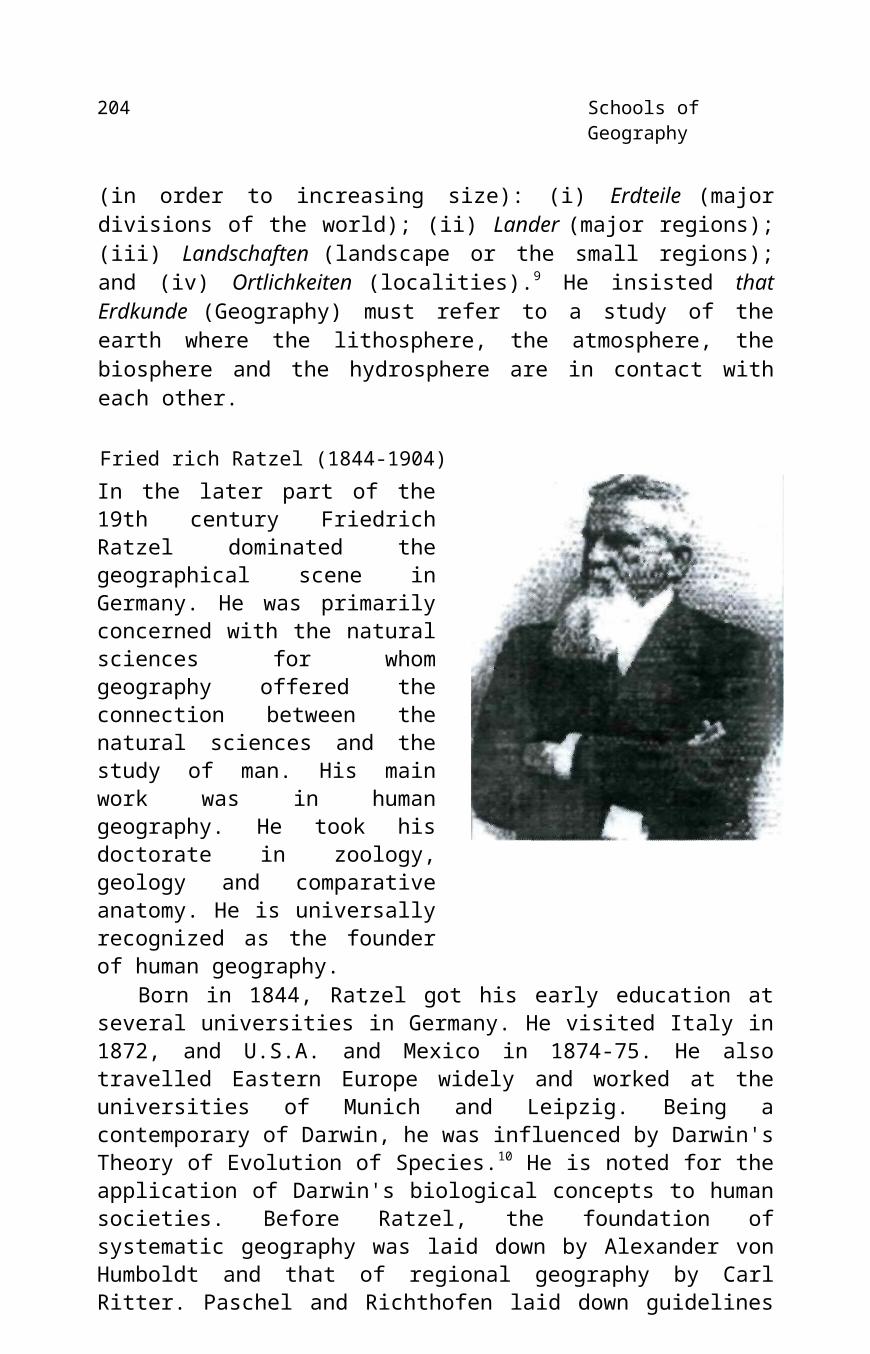
Fried rich Ratzel (1844-1904)In the later part of the 19th century Friedrich Ratzel dominated the geographical scene in Germany. He was primarily concerned with the natural sciences for whom geography offered the connection between the natural sciences and the study of man. His main work was in human geography. He took his doctorate in zoology, geology and comparative anatomy. He is universally recognized as the founder of human geography.
Born in 1844, Ratzel got his early education at several universities in Germany. He visited Italy in 1872, and U.S.A. and Mexico in 1874-75. He also travelled Eastern Europe widely and worked at the universities of Munich and Leipzig. Being a contemporary of Darwin, he was influenced by Darwin's Theory of Evolution of Species.10 He is noted for the application of Darwin's biological concepts to human societies. Before Ratzel, the foundation of systematic geography was laid down by Alexander von Humboldt and that of regional geography by Carl Ritter. Paschel and Richthofen laid down guidelines for the systematic study of the earth's features. It was Ratzel who compared the mode of life of the different tribes and nations, and thus made a systematic study of human geography. His interest in tribes, races and nations was keen and after doing adequate fieldwork he coined the term 'anthropogeography', describing it as the major field of geographical study. Ratzel took Ritter's human geography still further,

Schools of Geography 205
sub-dividing it into anthropogeography and political geography. He is best known for his organic theory of state (lebensraum) in which he compares the evolution of the state to that of living organism.
Ratzel, a scholar of versatile academic interests, was a staunch German. It was because of his patriotism that at the outbreak of Franco-Prussian War in 1870, he joined the Prussian Army and was wounded twice during the war. After the unification of Germany (1871), he devoted himself to the study of the modes of life of Germans living outside Germany. For this purpose, he visited Hungary and Transylvania. Germans were in majority in these countries. He continued his mission and in 1872 crossed the Alps to visit Italy.
In 1874-75, Ratzel reached the United States and Mexico and thereby expanded his sphere of study.11 In the United States, he started studying the economy, society, and habitat of the original inhabitants and tribes, and especially the mode of life of the Red Indians. Moreover, he focused his attention on Negroes, Africans, and Chinese living in the Central U.S.A., the Middle West and California. On the basis of his field study, he tried to formulate some general concepts regarding the geographic patterns resulting from contact between aggressive and expanding human groups and the retreating groups.12
At the completion of his field study in U.S.A. and Mexico, he returned to Germany in 1875 and was appointed Professor of Geography in 1876 at the University of Leipzig. In 1878, and 1980 he published two books on North America dealing with physical and cultural geography. However, the book for which Ratzel is acknowledged all over the world—Anthropogeographie—was completed between 1872 and 1899. The main focus of this monumental work is on the effects of different physical features and locations on the style of life of people. This first volume of Anthropogeographie is a study of man and earth relationship, while in the second volume the influence of man on environment has been discussed. Ratze's work was based on the concept that physical environment controlled human activities. The Anthropogeographie of Ratzel suggests the geography of man in terms of individuals and races (anthropological geography). Ratzel believed that society ought not to
206 Schools of Geography
be left suspended in the air. Subsequently, he dispelled any lingering determinism by insisting that the human being joins in nature's game and that milieu externe was a partner, not a slave of human activity.
In Antbropogeograpbie, Ratzel used deductive approach to present the first systematic study of the geography of man. The first volume of Antbropogeographie was organized in terms of physical features and their influence on human culture while in the second volume he analyzed human activities and human cultures in relation to the physical environment.13 This environment-dominated-man response approach was reserved for his second volume. This second approach was influenced by the chronological approach.
Ratze's deterministic approach became very popular outside Germany, especially in France, England and the United States. Ms. Allen Churchill Semple was one of his pupils and a staunch supporter of his environmental superiority philosophy.
Ratzel was influenced by Darwin's Theory of Evolution of Species.14 He applied Darwin's concept to human societies. This analogy suggested that groups of human beings must struggle to survive in particular environments as much as plant and animal organisms must do. This is known as 'Social Darwinism'.15 Thus, Ratzel's basic philosophy was also "survival of the fittest" in a physical environment.
In the 1890s his active campaigning to persuade Germany to acquire overseas colonies and build up its naval fleet to challenge Britain. His thinking expressed the spatial consequences of the Darwinist struggle for survival. According to the 'laws' of territorial growth, states must expand to thrive, and "higher forms of civilization must expand at the expense of lower". These laws were supposedly natural, but given the recent unification of Germany, the inter-state rivalry in Europe (General Schlieffen was already up his plan for invasion of France) and its empires (Africa was carved up at the Berlin Conference in 1884-5). Ratzel's views accorded with Germany's territorial designs. After his death and after the First World War, German geopoliticians revived Ratzel's ideas to suit their
* The phrase "survival of the fittest" was coined by Spencer—an English philosopher—in 1876.
Schools of Geography 207
own ambitions and, as a result, his writings were condemned by Anglo-American geographers. Had Germany won the war then perhaps Mackinder would have suffered in his stead.
In 1897, Ratzel wrote Political Geography in which he compared 'state' to an organism.16 He emphasized the fact that a state, like some simple organism, must either grow or die and can never stand still.17 It was this philosophy of lebensraum ('living space') which created the controversy of superior and inferior races by claiming that the superior peoples (nations) have a right to expand their territory (kingdom)—'living space'—at the expense of inferior neighbours. He expounded his views saying: when a state extends its frontiers at the expense of a weak state this is a reflection of its internal strength. The superior nations thus ruling over the inferior peoples fulfil a natural organic necessity. It was Ratzel's philosophy which governed the German policy in the thirties which finally led to the outbreak of the Second World War.
While discussing the effect of physical environment on human groups, Ratzel explained that human societies made progress in stages. These stages are: (i) hunting and fishing; (ii) hoe-culture; (iii) crops cultivation where land is ploughed; (iv) mixed farming, where farming and herding are mixed; (v) unmixed herding; and (vi) horticulture. He, however, argued that it is not necessary that all the societies have to pass through the same stages of economy.
In those days, there was enormous increase of knowledge and information, data were being accumulated on a large scale from different parts of the earth. Each region, having a different physical environment, was providing different modes of production and different styles of life. It was Ratzel who tried to build a 'fundamental unity in diversity'. The controversy regarding dichotomy between physical and human geography started during Ratzel's time. There were scholars like George Gerald, who held the view that geography is the study of earth-body as a whole without reference to man. Gerald was of the opinion that exact laws can be made only if man is excluded from geography, because the behaviour of man is highly unpredictable. This radical viewpoint, declaring physical geography as the sphere of geography, was mooted by Ratzel who averred that man is an important ingredient of the discipline of geography. He stressed the principle of unity in diversity, stating that in diverse physical
208 Schools of Geography
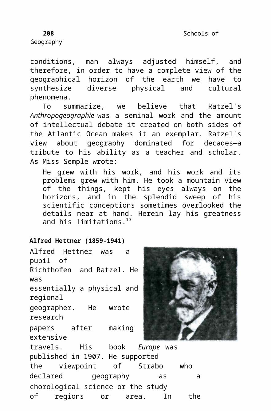
conditions, man always adjusted himself, and therefore, in order to have a complete view of the geographical horizon of the earth we have to synthesize diverse physical and cultural phenomena.
To summarize, we believe that Ratzel's Anthropogeographie was a seminal work and the amount of intellectual debate it created on both sides of the Atlantic Ocean makes it an exemplar. Ratzel's view about geography dominated for decades—a tribute to his ability as a teacher and scholar. As Miss Semple wrote:
He grew with his work, and his work and its problems grew with him. He took a mountain view of the things, kept his eyes always on the horizons, and in the splendid sweep of his scientific conceptions sometimes overlooked the details near at hand. Herein lay his greatness and his limitations.19
Alfred Hettner (1859-1941)Alfred Hettner was a pupil ofRichthofen and Ratzel. He wasessentially a physical and regionalgeographer. He wrote researchpapers after making extensivetravels. His book Europe waspublished in 1907. He supportedthe viewpoint of Strabo whodeclared geography as achorological science or the studyof regions or area. In thechorological concept of geography, the geographer is required tostudy many immaterial (race, ethnicity, religion, language, customs,traditions, etc.), as well as material phenomena. He should not givepreference either to the material or immaterial phenomena. Thus, inthe study of areal differentiation, they are on the same plane. Heelaborated the importance of distribution of phenomena and stressedthe significance of regional geography. He was of the opinion thatgeography is a field in which things have to be described in their arealcontext on the face of the earth, much as history was the field inwhich things are to be considered in their time context.

Schools of Geography 209
Hettner claimed that geography is an idiographic (regional) rather than monothetic (systematic/general).20 In his opinion, the distinctive subject of geography was the knowledge of the earth areas as they differ from each other. Man was included as an integral part of nature of an area and thus "mere description has been replaced in all branches of geography by search of causes". The concept that "the unity of geography is in methods" was advocated by him. In his opinion, the procedure of study of relationship should be from "man to nature, rather than from nature to man".
Hettner rejected the view that geography could be either general or regional. Geography, like other fields of learning, must deal in both the unique things (regional geography) and with universals (general geography), but the study of regions is the main field of geography. This theory of uniqueness (regional geography) attracted the attention of German geographers for decades and is still the point of controversy in geography. After Hettner, regional studies were made with the outline of location, geology, surface features, climate, vegetation, natural resources, settlement distribution, economy, transport systems and political divisions.21
Hettner's approach invited criticism also. Those who criticized were of the opinion that Hettner tried to give more weight to physical environment, ignoring the cultural factors. For example, there is a direct relationship between the density of population, economy, social institutions, religious beliefs, cultural traits, and political policies. Moreover, many of the interrelations observed in regional studies were in the process of change through time.22 Many of the nomadic herders start settling down and adopt sedentrized life under the impact of socio-cultural and political factors.
Landschafts Kunde
The concept of landschafts kunde (landscape science) gained popularity in Germany at the beginning of the 20th century. According to this concept, the existing landscape of a meso or micro region is the result of exogenetic, historical and cultural forces. In the study of landscape, not only man is taken as an important agent of environment but also invisible features like wind, air, temperature and humidity. Landschaft is thus a homogeneous area with a more or less uniform

210 Schools of Geography
appearance, which is the subject matter of geography and in which biotic and abiotic things are studied in relation to each other.
The research work done in the early parts of the 19th century gave rise to the idea that general geography makes use of general concepts and is essentially analytical; while regional geography deals with a unique situation and is essentially synthetic in nature. This was an erroneous concept. In fact, the concept of chorology (examination of areal association of things of diverse origin) can be applied to general (systematic) geography as well as to the studies of segments of the whole earth surface23 or a region.
Albrecht PenckAlbrecht Penck was a leading German geographer of the early part ofthe 20th century, who formulated the concept of 'geomorphology',was trained in geology. Penck was a professor at Vienna from 1885 to1906. He was associated with Eduard Suess, who prepared maps of themajor geological regions of the world. He founded the principles oflandforms evolution and showed how the systematic study of featurescan be approached from the chorological (regional) point of view. In1910, Penck postulated the hypothesis that classification of climatescan be made with the help of studyof landforms even where themeteorological data are notavailable. He was the first to pointout that evaporation increases withhigher temperature. He alsopointed out that the effectiverainfall, i.e., the difference betweenrainfall of a place, and run-off plusevaporation is directly dependenton the prevailing temperature.Moreover, he considered man alsoas an important agent who carvesout the face of the earth.24 Penckstressed the importance of accuratemaps, showing relief features for a
Schools of Geography 21 I
systematic study of geography. The idea of topographical maps was thus put forward by him. It was because of his suggestions that topographical maps on the large scale, i.e., one inch to one mile, showing the major relief features, water bodies, vegetations and the work of man, started being prepared. Penck introduced the term 'Gestalt', borrowed from Psychology in Geography. He used this to express the unified from of larger areas (whole). In his opinion, "geography is a bridge between the natural and social sciences".
Penck's pioneering ideas inspired many young scientists to pursue research in the field of geomorphology and climatology. Wladimir Koppen—the Russian-born German climatologist—started studying world climate on the lines advocated by Penck. For his climatic study, he took into consideration the observable relief features, besides the recorded temperature and rainfall data. Between 1884 and 1918, Koppen made several attempts to produce a satisfactory classification of climates. For his classification, he took into consideration temperatures, vegetation, rainfall effectiveness to temperature and seasonal and annual variations of temperature and rainfall. With the help of these indicators, Koppen arrived at certain regularities in the temperature and rainfall distribution. He established that moisture deficiencies exist throughout the year, on the western margins between 20° and 30° in both the hemispheres and similarly the continental areas on the same latitude are more cold in winter and more warm in summer than the parts lying in the vicinity of water bodies (oceans, seas).
In the field of oceanography also, Germans made a substantial contribution. Gerhard Schott studied the motion, temperature, salinity, colour, ocean deposits, configuration, ocean climates, geological structures of ocean basins, ocean organisms, the routes of ocean trade and air routes over oceans.25 Schott prepared a world map in which ocean regions were delineated on the basis of various indicators.
During the first fifteen years of the 20th century, Germans made great strides in the field of geography. This was a period of rapid growth and increasing productivity of geographical concepts and literature. The period after the First World War was a lean period in which most of the geographers who did not agree with government
212 Schools of Geography
policies remained silent. Many of the Jews were placed in confinement. In spite of the political problems and difficulties created by government for academics, there were notable contributions in the field of urban and agricultural geography. Walter Christaller put forward the Central Place Theory with the set objective of functional organization of space. Similarly, von Thunen advocated the Crop Intensity Theory. Thus, there was stress on landscape planning during the two wars. Again, during the period, attention of the German geographers was focused on geo-politics. Houshofer, in 1924, being inspired by the ideas of Kjellen and Ratzel, was convinced that state is a living organism which needs space to grow. Houshofer, through his writings, probably influenced Nazi policies. With the defeat of the Nazis in the Second World War in 1945, Houshofer was put on trail at Nuremburg. In 1946, he committed suicide.
After the Second World War, Germany was divided. There was political turmoil and socio-economic crisis. Universities and libraries were ruined. However, within a short period of about fifteen years (1945-1960), Germans again emerged as a force in the field of geography. In 1947, a new geographical periodical entitled Erdkunde appeared. The Germans started studying landscape with the help of new and sophisticated statistical tools and techniques. Now, there is more stress on variation from place to place as the function of latitude, altitude, distance from the sea and direction fronrthe nearest coast. In the post-war period, the new trend is that of 'cultural determinism' in place of environmental and physical determinisms. The new emphasis on culture is called 'social geography. The Germans are now trying to interpret landscape with the help of attitudes of people and their technical skill since these are felt to be the vital parts of man's culture. Moreover, an integrated approach to studying landscape is now in evidence. In this effort scholars of physical and social sciences are being involved.
German geographers and cartographers made notable contributions in the art of map-making during the 19th and 20th centuries. For many years, the von Sydow maps and atlases, with some wall maps, were widely used. The Perthes Firm published Stieler's Atlas, under the supervision of A.H. Pattermann. In 1845-47, Pattermann, while working with W&AK Johnston in Edinburgh, prepared the Physical Adas.

Schools of Geography 213
THE FRENCH SCHOOL OF GEOGRAPHY
The geographical ideas and concepts, which originated with Ratzel and his disciples, spread in the neighbouring countries. Alexander von Humboldt, who wrote and published his thirty volumes in Paris, created intellectual fervour in French scholars. In the middle of the 19th century, in France as in Germany, geography was taught by historians, geologists, military personnel and engineers. Even the chair of geography in the Sorbonne (Paris) was occupied by a historian who was attached to the Faculty of Letters. The major contribution made by French scholars is given in the following section.
Phillippe Buache (1752) was the first French scholar who criticized the prevalent method of representation of population, economic and other data in administrative units.26 He felt that the right method of representation of geographical data is in the frame of natural region. According to him, a river basin was the best kind of natural region.27 Subsequently, Baron Coquebert (Director of French Statistical Office, 1796) proposed a division of the national territory into natural regions with a brief description of each of them. This effort created interest in regional divisions in France. But this approach was contradicted by Omalius d' Halloy in 1833 who prepared a geological map of France to establish the relation between landforms and soils and the underlying rocks.About this time (1870) there occurred a major breakthrough in the expansion of geographical knowledge. Soon several geographical societies were established in the various universities of France. The real take off in the field of geography in France, however, started during the period of Vidal de Lablache. The French geographers were concerned with the unique character of areas.
(
Vidal de LablacheVidal de Lablache (1848-1918) is known as the founder of human geography. He was essentially a scholar of classical languages. His interest in geography developed in 1865 when he was studying archaeology at Athens. Later on, Vidal taught geography at the University of Nancy from 1872 to 1877, and then joined Ecole as Professor of Geography. In 1891, he founded a new professional periodical for the publication of best geographical writings. The
214 Schools of Geography
periodical was called Annates de geographic In 1894, Vidal published the first edition of the Atlas Generate Vidal Lablache. From 1896 to the time of his death (1918), he was Professor of Geography at the University of Sorbonne. During his career, he devoted himself to the cause of geography, and trained geography teachers over a period of about 26 years.
While delivering his first lecture at the Sorbonne University on February 2, 1899, he laid stress upon the relationship between man and his immediate surroundings (milieu) which could best be studied in small homogeneous areas. In France, such homogeneous areas are known as pays.29 In his opinion, the concept of country is inseparable from its inhabitants.
Vidal was a strong opponent and critique of the environmental deterministic approach. He was influenced by the writings of Ratzel, and from his second volume of Antbropogeograpbie, Vidal advocated the concept of 'possibilism' as postulated by Febvre. His basic approach towards the study of man and environment—the two major components of geographical study—was that nature (milieu) sets limits and offers possibilities for human settlement, but the way man reacts or adjusts to these given conditions depends on his own traditional way of living.30 Lablache insisted that human being "joins in nature's game" and the milieu externa (external environment) was a partner, not a slave of human activity. He opined that "nature is never more than an adviser". Vidal's belief was endorsed by the historian L. Febvre in a famous phrase: "There are not necessities but everywhere possibilities." And, man as a master of these possibilities is the judge of their use. Febvre, however, regarded geography as a natural science, rather than a social science. He considered the earth's surface as the terrestrial organism. He coined the concept of genres de vie (lifestyle) He was convinced that genres de vie were themselves reflective of nature, even as they transformed it. He always conceived of human geography as natural, not a social science (Buttimer, 1971).
Schools of Geography 2 I 5
Vidal de Lablache's book Tableau de la Geographie de la France was a good addition to the literature of geography. In this work, Vidal attempted a harmonious blending of physical and human features in the Tableau (France Plateau). He also tried a synthesis of pays. Vidal's book deals with the recognizable regional units of France one by one and shows that each pay has its own distinctive agriculture due to its soil and water supply, and also due to the economic specialization made possible by the demands of the people living in towns. Far from reducing the individuality of each pay, modern trade had accentuated it by making their agriculture distinctive. Settlement showed a clear relationship to soil and water; for in some areas it was scattered and in others in the form of compact villages. Many of the pays had for generations been recognized as separate from, but complementary to their neighbours These pays were, however, not homogeneous as in some there were local deposits such as limon over chalk which gave sharply contrasting soils reflected in difference in land use.31 The Tableau is a deeply human work with a firm physical base. From this time, French geographers published a series of regional monographs.
Vidal de Lablache was opposed to the idea of drainage basin as a unit of study. While criticizing the idea of taking drainage basin as the unit of study, he felt that such a unit will create many complications in understanding the reality of a region. For example, the Central Massif of France is a well demarcated natural region in toto, but if it is divided into drainage basin units, then the culture, institutions, traditions and attitudes of the people cannot be properly understood. Regarding the method of geographical study he held the view that the basic objective of geography is to study the phenomena mutually interacting in a segment of the earth surface (pays).
In the opinion of Vidal de Lablache, the relatively small regions {pays) are the ideal units to study and to train geographers in geographical studies. The tradition of micro region study still persists in France. Many French geographers consider regional geography as best suited to doctoral work. He was, however, of the opinion that regional studies at the meso and macro levels can be of practical utility which can help in the planning of areas. It was with this objective that he prepared a scheme to study the larger regions of the world—covering the whole world. This programme was partly carried out by Lucien Gallors after Vidal's death.32
216 Schools of Geography
Vidal's monumental work Human Geography was posthumously published in 1921 as he died suddenly in 1918. The partially completed work—Human Geography—was given final shape by Emmanuel de Martonne—son-in-law of Vidal de Lablache. In this book, Vidal started with aims and objectives of human geography; the principle of terrestrial unity and the concept of man and environment (milieu); man as a geographical factor; the patterns of civilizations; circulation (means of transport); and cultural regions and cities.33 The chapter scheme of Vidal's book reveals the pattern on which he tried to examine the man-environment interrelationship.
Prior to Vidal, the Germans, especially the followers of Ratzel, strongly favoured deterministic approach for the study of man-nature interaction. Vidal had a clear insight in the weaknesses of deterministic arguments, realizing the futility of setting man's natural surroundings in opposition to his social milieu and of regarding one as dominating the other. He considered it even less useful to tackle these relationships along systematic lines in the hope of discovering general laws governing the relationship between man and nature.
According to Vidal, it is unreasonable to draw boundaries between natural and cultural phenomena; they should be regarded as united and inseparable. In an area of human settlement, nature changes significantly because of the presence of man, and these changes are the greatest where the level of material culture of the community is the highest. The animal and plant life of France during the 19th century, for example, was quite different from what it would have been had the country not been inhabited by man for centuries. It thus becomes impossible to study the natural landscape as something separate from the cultural landscape. Each community adjusts itself to prevailing natural conditions in its own way, and the result of adjustment may reflect centuries of development. Each single small community, therefore, has characteristics which will not be found in other places, even in places where the natural conditions are practically the same. In the course of time, man and nature adapt to each other like a snail in its shell. In fact, the relationship between man and nature becomes so intimate that it is not possible to distinguish the influence of man on nature and that of nature on man.34 The area over which an intimate relationship between man and nature has developed through centuries constitutes a region.35 The
Schools of Geography 217
study of such regions should be the task of a geographer. Vidal, therefore, argued for regional geography as the core of geography. According to him:
Human societies, like those of plants and animal world, are composed of different elements subject to the influence of environment. No one knows what winds brought them together; but they are living together side by side in a region which has gradually put its stamp upon them. Some societies have long been part of the environment, but others are in process of formation, continuing to recruit numbers and to be modified day-by-day.Societies have always begun to seek ways of satisfying their needs in the
immediate vicinity. Vidal believed that population is a constantly changing phenomenon. Mankind has in common with all other forms of life the tendency toward expansion. Man is the most adaptable and mobile organism on the face of the earth. He ensured that the population did not spread like a drop of oil; at the beginning it grew in clumps like corals.36
Vidal used the following illustration in order to underline the long association between the major factors governing the development of a community. While the surface of a shallow lake is being swept by a gust of wind, the water is disturbed and confused but after a few minutes the contours of the bottom of the lake can clearly be seen again.37 Similarly, war, epidemics and civil strife can interrupt the development of a region and bring chaos for a while, but when the crisis is over the fundamental developments reassert themselves.
Vidal's model fitted well in the agricultural societies of France and other western countries of Europe. During the medieval period, these societies were agrarian. After the industrial revolution the situation has changed in the developed countries and now in such societies 'cultural determination seems to be more conspicuously dominant. Up to the industrial revolution, Vidal's approach was well suited to explaining the development of European agricultural landscape. In those parts of the world where industrialization is yet to take place, his hypothesis and theory of possibilism has great utility.38
After the industrial revolution in France, the traditional physical setting was disturbed. The railway tracks, canals, roads and industrial complexes initiated the decline of the traditional local self-sufficient economy. Industry was developed on the basis of new cheap and rapid
118 Schools of Geography
means of transport and large scale production for a wider market.39 These developments reduced the value of the regional method in a growing number of areas.
In the late part of his life, Vidal reached the conclusion that with the industrial development the best in French life was vanishing. For future, he suggested that we should study the economic interplay between a region and the city centre which dominates it rather than the interplay of natural and cultural elements.
As a result of Vidal's efforts, by 1921, there were 16 departments of geography in France, one in each of the 16 universities.40 Interestingly enough, all the chairs of geography were occupied by the pupils of Vidal de Lablache. Thus, geography in France owes much to Vidal, and he is rightly considered as the 'father of human geography' who advocated and pleaded for 'possibilism'.
The Principle of Terrestrial UnityLablache developed the idea of 'terrestrial unity'. In his opinion, the dominant idea in all geographical progress is that of terrestrial unity. The concept of the earth as a whole, whose parts are coordinated, where phenomena follow a definite sequence and obey general laws to which particular cases are related, had earlier entered the field of science by way of astronomy. In the words of Ptolemy, geography is "the sublime science which sees in the heavens the reflection of the earth". But, the conception of terrestrial unity was confined to the domain of mathematics. It did not become part of the branch of geography until the time of Lablache. In his opinion the phenomenon of human geography is related to terrestrial unity by means of which alone can they be explained. They are everywhere related to the environment, itself the creature of a combination of physical conditions.
The idea of terrestrial unity was borrowed from the botanical geography which was the first to use a conception of environment. Alexander von Humboldt, with his usual foresight pointed out how mportant is the appearance of vegetation in determining the character of a landscape. The general appearance of vegetation is certainly the most characteristic feature of a region. Absence of it is striking. Vegetation not only accentuate landforms, but give to the landscape by their shape, colour, and manner of grouping a common, individual
Schools of Geography
character. Steppe, savanna, silva etc., are collective terms which give an idea of such an ensemble. The rivalry of plants among themselves is so active that only those best adapted to the environment are able to survive. Even so, only a state of unstable equilibrium is maintained Adaptation finds expression in different ways, in the height, size, and position of leaves, hairy covering, fibrous tissues, root, development, etc. Not only does each plant provide as best it can for the carrying of its own vital activity, but many different plant associations are formed so that one may profit by the proximity of other. Whatever the variety of species living side by side, whatever the external differences in the process of adaptation, the entire plant population has a common stamp not to be mistaken by trained eye.
Similarly, animals with their power of locomotion and man with his intelligence are better able than plants to cope with the environment. Thus environment, as a composite, is capable of grouping and holding together heterogeneous plants, animals and mankind in mutual vital interrelationship. This idea seems to be the law governing the geography of living creatures. This law of terrestrial unity is universally applicable to peoples of indigenous origin, ephemeral, migratory character.
In the study of man and environment this perspective is quite conspicuous. Prehistoric research has shown that man has been established since time immemorial in widely diverse parts of the globe, equipped with fire and fashioning tools; and however rudimentary his industries, the modifications that the face of the earth has undergone because of them cannot be ignored. The paleolithic hunter and earliest neolithic agriculturists destroyed certain species of plants and animals and favoured others. That these hunters and agriculturists operated independently of one another, in different localities, is proved by the various methods of making fire still in use. Man has influenced the living world longer and more generally than supposed.
There are numerous races, ethnic groups, and sub-races living in different physical environments in the various parts of the world. Nevertheless, all such heterogeneous groups blend in a social organization which makes of the population of a country/region a unit when looked at in its entirety. It sometimes happens that each of the element of composite whole is well established in certain mode of

220 Schools of Geography
life; some as hunters, other agriculturists, other shepherds; if such is the case, they cooperate with and supplement with one another. It most often happens, except in some migratory Gypsies, Gitanos, Zingani, Gaddis, Bakarwals, and some of the desert tribes like Badwins. Human societies, like those of vegetation and animal world, are composed of different elements subject to the influence of environment. No one knows what winds brought them together, nor whence, nor when; but they are living side by side in a region which has gradually put its stamp on them. The lifestyle of most of the societies of the world are in adjustment to their physical environment. The principle of terrestrial unity is of vital importance and is universally applicable.
Jean Brunhes
Born in 1869, Jean Brunhes was a disciple of Vidal de Lablache. After studying history and geography, he prepared himself for the conceptual framework of human geography. On the lines of his master, he tried to identify the scope and method of human geography. His main work, Geographic Humaine: essaide Classification Positive was published in 1910. He limited human geography41 to: (1) unproductive occupation of soil; (2) things connected with the conquest of plant and animal worlds; (3) the destructive economy— 'robber economy' or violent attack on nature which may result in poverty. Moreover, he held the view that these three sets of observable phenomena did not mark the boundary of geographical regions. Beyond these phenomena, the geography of history, i.e., distribution of population—production, transport exchange and political societies (territory, routes, frontiers, groups of states), social geography—are these too are important components of a geographical region. He considered regional geography "the range of observation is well-nigh unlimited, including epidemics, physical aptitudes, moral habits and social rules, property rights, social organization, collectivization, stock companies and social anarchy in large cities". All these may be studied by a geographer as long as he sees any relationship between them and the facts of the earth surface. He opined that nature is not mandatory but permissive. All these physical and cultural factors, therefore, need to be taken into account for undertaking a comprehensive study of a region. In his method of

Schools of Geography 221
geographical study, he emphasized two principles: (i) principle of activity, and (ii) principle of interaction.42
Principle of Activity
Jean Brunhes was of the opinion that the physical and cultural phenomena are in a state of perpetual change and they must be studied in the temporal change, instead of taking them as static in the time scale. He held the view that "everything is either growing or diminishing", "expanding or shrinking" and nothing is "stable and static". For example, the heights of mountain peaks, sea level, ice sheets, glaciers, size of valleys, deltas, volcanoes, and forests are continuously changing in their shape, size and altitude. So, in order to understand the interrelationship of physical and cultural components of a meso or micro unit, the principle of activity is to be kept in mind to arrive at a just synthesis.
Principle of InteractionThe idea of principle of interaction Jean Brunhes borrowed from Vidal de Lablache, who advocated the principle of terrestrial whole. Brunhes assumed that geographical phenomena (both physical and social) are closely interrelated with one another, and must be studied in all their numerous combinations or by keeping in mind their permutations and combinations. The idea of terrestrial whole or terrestrial unity was a fundamental concept which later on inspired 'regional systhesis'. All the physical and human forces are thus closely bound together because of the endless interrelations of the conditions they bring out.
In support of his principle of interaction, Brunhes examined the relationship between animals and cultivated plants, and determined with what forms of soil exploitation, with what kinds of cultivation and with what type of economic organization, these animals are generally associated. In brief, our efforts are based fundamentally on the great geographical principle of interaction, for man is like plants and animals, and therefore, the concept of interaction should dominate every complete study of geographical facts. The forces of physical nature are bound together in their consequences, in relations and in the consequence of these relations.

222 Schools of Geography
Elisee Reclus (1830-1905)Reclus was first and foremost an uncompromising idealist. He was the most successful of Ritter's students. He derived his main principles and ideas concerning geography from Ritter. He was expelled from the teacher seminary at Montauban in his very first year because he supported the ideals of the 1848 revolution. When only 20 years old he went to Berlin to study theology, but began toattend the popular lectures of Carl Ritter, which awakened his interest in geography. Returning to France in the autumn of 1851, Reclus resumed his political activity. Resisting the coup d'etat of Napoleon III in the same year, he was obliged to flee to England with his brother (Dunbar, 1981, p.155). Reclus then travelled extensively in North and South America, more in order to observe than to do research. Sustained research was, in fact, beyond his means, for Reclus had to make a living from the meagre wages he could earn as a tutor and worker en route. In 1857, he returned to France and befriended the leading anarchist, Mikhail Bakunin (1814-76). From that time onwards, Reclus belonged to the inner circle of the secret anarchist association Fratemite Intemtionale. In 1871, he took active part in the Paris Commune but was captured during the first days of fighting. He was held in prison for almost a year. A sentence of deportation to New Caledonia was commuted to ten years' banishment as a result of the active intercession from geographical societies and such leading personalities as Charles Darwin. Reclus chose to settle in Switzerland in his exile. Although promised a readership in geography in the Universite Libre in Brussels in 1892, the university reneged on the appointment for fear of demonstrations after an outbreak of anarchist violence in France in the autumn of 1893. A support committee for Reclus started to collect money and eventually founded the New University of Brussels where Reclus was professor for the last years of his life, refusing to take any salary since his modest needs could be satisfied by the income from his books.
■■ >M
■

Schools of Geography 223
Elisee Reclus was a social anarchist. He got recognition as a leading French geographer with a work of systematic physical geography called La Terre (1866-7). He is, however, best remembered for his 19-volume regional geography Nouvelle Geographic Universelle (1875-94). The clarity and accuracy of this work made it much more popular than Ritter's Erdkundey which had been its exampler in many respects. Reclus' work became a model for a range of encyclopaedic studies of the geography of the world and of particular countries.
Reclus was probably the most productive geographer of all time. In the ending part of his life, he wrote L3 Homme et la Terre (mostly published posthumously in 1905-8), which may be described as Social Geography. This book gives a historical account of humanity's life on earth and its use of its resources. Reclus also wrote travel handbooks and articles. Although he was the best known French geographer of his time, Reclus never held a university chair in France and had to earn a living from his writing. Because of his political and social anarchistic activities he was obliged to live abroad in exile and hence could not directly influence the development of French academic geography.
Like Ritter whose some lectures he attended, Reclus was mainly interested in the human aspect of geography. He had a sharp eye for the inequalities of human conditions around the world, and made it a central theme of his books.
Reclus devoted his political life to social justice, social conditions were inevitably always discussed in his books. He described the poverty and relief among the poor of London. Reclus also established a connection between geography and modern town planning and sociology. He was possibilist who also recognized that human kind could have negative influences on the environment. He influenced and had close contacts with Frederic le Play, the French sociologist and Sir Patrick Geddes, the Scottish biologist, social scientist and planner. Geddes, although not an anarchist, became a close friend of Reclus in the last decade of Reclus' life. 43 He spread Reclus' ideas in Britain and was most interested in his ideas on social geography, which he found a suitable basis for the development of his work on applied research and planning.
Reclus was a prolific writer. He became "the Ritter of France". His style was lucid, detailed, systematic, and balanced. He

224 Schools of Geography
documented his writings with 3,000 maps, giving a very accurate picture of different world societies. In his work, L'bomme et la Terre (The Earth and Its Inhabitants), he asserted that man is not the product of his environment but an important part of it. Reclus declares:
Man may modify (his dwelling place) to suit his own purpose, he may overcome nature, as it were, and convert the energies of the earth into domesticated forces. "One must seek the gradual changes in the historical importance of the configuration of the land" and in studying space "we must take into account another element of equal value-time".44
Reclus was keenly interested in the conservation of nature and natural beauty. He was concerned about the destruction of the beauties of nature, and believed that man, in developing resources and building his works, should give grace and majesty to the scenery. But, as Reclus said, through abuse of his powers "the barbarian gives to the earth he lives on an aspect of rough brutality", and in extreme cases "where all grace and poetry have disappeared from the landscape, imagination dies out, the mind is impoverished, and a spirit of routine and servility takes possession of the soul". Rural life is for these reasons preferable to the life of towns.45
Reclus pointed out that man has destroyed natural flora and wild animals and replaced them with his own cultivated crops and domesticated animals. He has changed the balance of nature,j sometimes to his disadvantage, by introducing "ruptures in the harmony of nature". What is needed is "a robust education face to face with nature"...This will give us the grandest development of the "real love of nature". Thus, Reclus discussed man-nature interrelationship in a very scientific way.
Emmanuel de MartonneThe Vidalian approach which dominated the scene of French geographical writings in the late 19th and early 20th centuries, was vigorously pursued by his disciples and successors. Emmanuel de Martonne (1873-1955) was a pupil and son-in-law of Vidal de Lablache. Martonne, from the beginning, specialized in physical geography and his special area of concentration was Central Europe. He had received training in geology, geo-physics and biology.
Schools of Geography 225
He studied the physical geography of Carpath tans. He was also interested in studying the problem of glacial erosion of the Alps. In 1904, he met William Morris Davis in the United States on the occasion of the Eighth International Geographical Congress and was much impressed by his work on geomorphology. The most popular works of Martonne include Traite de Geographic Physique and La France Physique. He inspired many French geographers to work in the field of physical geography.46
Albert DemangeonAlbert Demangeon (1872-1940) was also one of the outstanding pupils of Vidal de Lablache. He started his career as a school teacher and while teaching at Picady, he produced a monograph entitled La Picardie et les regions veisines. This dissertation was highly appreciated and he was appointed in the University of Lile where he remained until 1911.
Though Demangeon was a close friend of Martonne, he concentrated mainly on human geography. Demangeon devoted most of his time in editing Annals and contributed to this journal 31 articles and 89 notes.47
Demangeon made valuable contributions to the spatial variations of farmsteads, which he pursued throughout his life. He wrote on transport geography, population and international economics. He also made a classification of lands and prepared land use maps. He advised his students to work on major population groups of the Far East, the relations of the Whites and the Negroes, irrigation in arid countries, and the growth of great cities.
Demangeon was a teacher of innumerable qualities and possessed great vision. He was a modest person of polite nature. His contribution to the Vidalian tradition is widely acknowledged.
After the weakening of the Vidalian tradition, geography was studied with a new approach during the inter-war period. With the introduction of new tools and techniques, stress was laid on analytical study. This trend was more visible in the field of agricultural geography. The French scholars also adopted sophisticated statistical techniques. This trend led to interdisciplinary approach, and to developing regional synthesis. Among the younger generation, there is greater emphasis on locational analysis of phenomena. There is

226 Schools of Geography
increasing cognizance of the branches of climatology, botany, and sociology. The new trend shows that the spatial phenomena cannot be explained simply by correlation as expressed by Vidal de Lablache; they need to be explained as a part of the geographical whole (ensemble).
In brief, recent researchers are and have been oriented less towards description and regional analysis in a regional presentation, and more towards explanation with a genetic prospective. In physical geography, there is greater emphasis on process and systems of erosion, and reconstituting the stages of morphogenetic evolution. In human geography, emphasis has been placed on economic factors of production and consumption, economic systems and regimes, zones of influence, economic regionalization, the analysis of traffic flow, far more so than on the relations of these with natural milieu.48 Regional geography in France is now more concerned with describing and explaining the complexity of the organization of space. To achieve this goal, there is more use of detailed maps, and above all aerial photographs.49