unstats.un.org · web viewjoint research centre of the european commission. 2017. world atlas of...
TRANSCRIPT

Last updated: 23 January 2018
Goal 15: Protect, restore and promote sustainable use of terrestrial ecosystems, sustainably manage forests, combat desertification, and halt and reverse land degradation and halt biodiversity lossTarget 15.3: By 2030, combat desertification, restore degraded land and soil, including land affected by desertification, drought and floods, and strive to achieve a land degradation-neutral worldIndicator 15.3.1: Proportion of land that is degraded over total land area
Institutional information
Organization(s):United Nations Convention to Combat Desertification (UNCCD) and partners, including the Food and Agriculture Organization of the United Nations (FAO), United Nations Statistics Division (UNSD), United Nations Environment (UNEP), United Nations Framework Convention on Climate Change (UNFCCC) and Convention on Biological Diversity (CBD).
Concepts and definitions
Definitions:Land degradation is defined as the reduction or loss of the biological or economic productivity and complexity of rain fed cropland, irrigated cropland, or range, pasture, forest and woodlands resulting from a combination of pressures, including land use and management practices. This definition was adopted by and is used by the 196 countries that are Party to the UNCCD.1 (see also Figure 1)
Land Degradation Neutrality (LDN) is defined as a state whereby the amount and quality of land resources necessary to support ecosystem functions and services and enhance food security remain stable or increase within specified temporal and spatial scales and ecosystems (decision 3/COP12).2
Total land area is the total surface area of a country excluding the area covered by inland waters, like major rivers and lakes.3
The measurement unit for this indicator is the spatial extent (hectares or km2) expressed as the proportion (percentage or %) of land that is degraded over total land area.
SDG indicator 15.3.1 is a binary - degraded/not degraded - quantification based on the analysis of available data for three sub-indicators to be validated and reported by national authorities. The sub-indicators (Trends in Land Cover, Land Productivity and Carbon Stocks) were adopted by the UNCCD’s governing body in 2013 as part of its monitoring and evaluation approach.4
1 United Nations Convention to Combat Desertification. 1994. Article 1 of the Convention Texthttp://www2.unccd.int/sites/default/files/relevant-links/2017-01/UNCCD_Convention_ENG_0.pdf 2 http://www2.unccd.int/sites/default/files/sessions/documents/ICCD_COP12_20_Add.1/20add1eng.pdf 3 Food and Agriculture Organization of the United Nations4 By its decision 22/COP.11, the Conference of the Parties established a monitoring and evaluation approach consisting of: (a) indicators; (b) a conceptual framework that allows for the integration of indicators; and (c) indicators sourcing and management mechanisms at the national/local level.http://www.unccd.int/en/programmes/Science/Monitoring-Assessment/Documents/Decision22-COP11.pdf
1

Last updated: 23 January 2018
The method of computation for this indicator follows the “One Out, All Out” statistical principle and is based on the baseline assessment and evaluation of change in the sub-indicators to determine the extent of land that is degraded over total land area.
The One Out, All Out (1OAO)5 principle is applied taking into account changes in the sub-indicators which are depicted as (i) positive or improving, (ii) negative or declining, or (iii) stable or unchanging. If one of the sub-indicators is negative (or stable when degraded in the baseline or previous monitoring year) for a particular land unit, then it would be considered as degraded subject to validation by national authorities.
Concepts:The assessment and quantification of land degradation is generally regarded as context-specific, making it difficult for a single indicator to fully capture the state or condition of the land. While necessary but not sufficient, the sub-indicators address changes in different yet highly relevant ways: for example, land cover or productivity trends can capture relatively fast changes while changes in carbon stocks reflect slower changes that suggest a trajectory or proximity to thresholds.6
As proxies to monitor the key factors and driving variables that reflect the capacity to deliver land-based ecosystem services, the sub-indicators are globally agreed upon in definition and methodology of calculation, and deemed both technically and economically feasible for systematic observation under both the Global Climate Observation System (GCOS) and the integrated measurement framework of the System of Environmental-Economic Accounting (SEEA). The ultimate determination of the extent of degraded land made by national authorities should be contextualized with other indicators, data and ground-based information.
An operational definition of land degradation along with a description of the linkages among the sub-indicators is given in Figure 1.
5 https://circabc.europa.eu/sd/a/06480e87-27a6-41e6-b165-0581c2b046ad/Guidance%20No%2013%20-%20Classification%20of%20Ecological%20Status%20(WG%20A).pdf 6 http://www2.unccd.int/sites/default/files/documents/2017-08/LDN_CF_report_web-english.pdf
2

Last updated: 23 January 2018
Figure 1: Operational definition of land degradation and linkage with the sub-indicators.
Land cover refers to the observed physical cover of the Earth’s surface which describes the distribution of vegetation types, water bodies and human-made infrastructure.7 It also reflects the use of land resources (i.e., soil, water and biodiversity) for agriculture, forestry, human settlements and other purposes.8 This sub-indicator serves two functions for SDG indicator 15.3.1: (1) changes in land cover may point to land degradation when there is a loss of ecosystem services that are considered desirable in a local or national context; and (2) a land cover classification system can be used to disaggregate the other two sub-indicators, thus increasing the indicator’s policy relevance. This sub-indicator is also expected to be used for reporting on SDG indicators 6.6.1, 11.3.1 and 15.1.1.
There is an international standard for the sub-indicator on land cover9 which includes the Land Cover Meta Language (LCML), a common reference structure (statistical standard) for the comparison and integration of data for any generic land cover classification system. LCML is also used for defining land cover and ecosystem functional units used in the SEEA, and closely linked to the Intergovernmental Panel on Climate Change (IPCC) classification on land cover/land use.
7 Di Gregorio, A. 2005. Land cover classification system (LCCS): classification concepts and user manual. Food and Agriculture Organization of the United Nations, Rome.8 FAO-GTOS. 2009. Land Cover: Assessment of the status of the development of the standards for the Terrestrial Essential Climate Variables. Global Terrestrial Observing System, Rome.9 https://www.iso.org/standard/44342.html
3

Last updated: 23 January 2018
Land productivity refers to the total above-ground net primary production (NPP) defined as the energy fixed by plants minus their respiration which translates into the rate of biomass accumulation that delivers a suite of ecosystem services.10 This sub-indicator points to changes in the health and productive capacity of the land and reflects the net effects of changes in ecosystem functioning on plant and biomass growth, where declining trends are often a defining characteristic of land degradation.11
The international standard for calculating NPP (gC/m²/day) from remotely-sensed, multi-temporal surface reflectance data, accounting for the global range of climate and vegetation types, was established in 1999 by the U.S. National Aeronautics and Space Administration (NASA) in anticipation of the launch of the Moderate Resolution Imaging Spectroradiometer (MODIS) sensor.12 The Land Productivity Dynamics (LPD) methodology and dataset, developed by the Joint Research Centre of the European Commission13 and used in the UNCCD pilot programme, employs this international standard to calculate NPP time series trends and change analyses.
Carbon stock is the quantity of carbon in a “pool”: a reservoir which has the capacity to accumulate or release carbon and is comprised of above- and below-ground biomass, dead organic matter, and soil organic carbon.14 In UNCCD decision 22/COP.11, soil organic carbon (SOC) stock was adopted as the metric to be used with the understanding that this metric will be replaced by total terrestrial system carbon stocks, once operational. SOC is an indicator of overall soil quality associated with nutrient cycling and its aggregate stability and structure with direct implications for water infiltration, soil biodiversity, vulnerability to erosion, and ultimately the productivity of vegetation, and in agricultural contexts, yields. SOC stocks reflect the balance between organic matter gains, dependent on plant productivity and management practices, and losses due to decomposition through the action of soil organisms and physical export through leaching and erosion.15
For carbon stocks, IPCC (2006) contains the most relevant definitions and standards, especially with regard to reference values applicable for Tier 2 and 3 GHG reporting.16 In this regard, the technical soil infrastructure, data transfer and provision of national reporting data is also standards-based.17
Rationale:In the last decade, there have been a number of global/regional targets and initiatives to halt and reverse land degradation and restore degraded land. Starting in 2010, these include the Aichi Biodiversity Targets, one of which aims to restore at least 15% of degraded ecosystems; the Bonn Challenge and its regional initiatives to restore more than 150 million hectares; and most recently the Sustainable Development Goals (SDGs), in particular SDG target 15.3.
10 Millennium Ecosystem Assessment. 2005. Ecosystems and human wellbeing: a framework for assessment. Island Press, Washington, DC.11 Joint Research Centre of the European Commission. 2017. World Atlas of Desertification, 3rd edition. JRC, Ispra.12 Running et al. 1999. MODIS Daily Photosynthesis (PSN) and Annual Net Primary Production (NPP) Product (MOD17): Algorithm Theoretical Basis Document https://eospso.gsfc.nasa.gov/sites/default/files/atbd/atbd_mod16.pdf13 Ivits and Cherlet. 2013. Land-productivity dynamics towards integrated assessment of land degradation at global scales. European Commission JRC Technical Report. https://publications.europa.eu/en/publication-detail/-/publication/1e2aceac-b20b-45ab-88d9-b3d187ae6375/language-en/format-PDF/source-49343336 14 IPCC. 2006. IPCC Guidelines for National Greenhouse Gas Inventories: Agriculture, Forestry and other Land Use. Prepared by the National Greenhouse Gas Inventories Programme: Eggleston H.S., Buendia L., Miwa K., Ngara T. and Tanabe K. (eds). IGES, Japan.15 Smith, P., Fang, C., Dawson, J. J., & Moncrieff, J. B. 2008. Impact of global warming on soil organic carbon. Advances in agronomy, 97: 1-43.16 IPCC. 2006. ibid17 https://www.iso.org/standard/44595.html
4
Last updated: 23 January 2018
For each of the sub-indicators, countries can access a wide range of data sources, including Earth observation and geospatial information, while at the same time ensuring national ownership.18 The use of the existing national reporting templates of the UNCCD,19 which include the indicator and sub-indicators, provides a practical and harmonized approach to reporting on this indicator beginning in 2018 and every four years thereafter.20 The quantitative assessments and corresponding mapping at the national level, as required by this indicator, would help countries to set policy and planning priorities among diverse land resource areas, in particular:
to identify hotspots and plan actions of redress, including through the conservation, rehabilitation, restoration and sustainable management of land resources; and
to address emerging pressures to help avoid future land degradation.
Comments and limitations:SDG indicator 15.3.1 is a binary -- degraded/not degraded -- quantification based on the analysis of available data that is validated and reported by national authorities. Reporting on the sub-indicators should be based primarily, and to the largest extent possible, on comparable and standardized national official data sources. To a certain extent, national data on the three sub-indicators is and can be collected through existing sources (e.g., databases, maps, reports), including participatory inventories on land management systems as well as remote sensing data collected at the national level.
Regional and global datasets derived from Earth observation and geospatial information can play an important role in the absence of, to complement, or to enhance national official data sources. These datasets can help validate and improve national statistics for greater accuracy by ensuring that the data are spatially-explicit. Recognizing that the sub-indicators cannot fully capture the complexity of land degradation (i.e., its degree and drivers), countries are strongly encouraged to use other relevant national or sub-national indicators, data and information to strengthen their interpretation.
As regards slow changing variables, such as soil organic carbon stocks, reporting every four years may not be practical or offer reliable change detection for many countries. Nevertheless, this sub-indicator captures important data and information that will become more available in the future via improved measurements at the national level, such as those being facilitated by the FAO’s Global Soil Partnership and others.
While access to remote sensing imagery has improved dramatically in recent years, there is still a need for essential historical time series that is currently only available at coarse to medium resolution. The expectation is that the availability of high-resolution, locally-calibrated datasets will increase rapidly in the near future. National capacities to process, interpret and validate geospatial data still need to be enhanced in many countries; good practice guidance for the monitoring and the reporting of the sub-indicators in other processes will assist in this regard.
Methodology
18 United Nations General Assembly. 2015. Transforming our world: the 2030 Agenda for Sustainable Development. Resolution adopted by the General Assembly on 25 September 2015 (A/RES/70/1).19 http://www2.unccd.int/sites/default/files/relevant-links/2017-12/20171107_Template_Final_EN.pdf 20 http://www2.unccd.int/sites/default/files/sessions/documents/2017-09/ICCD_CRIC%2816%29_L.3-1715758E.pdf
5

Last updated: 23 January 2018
Computation Method:
By analysing changes in the sub-indicators in the context of local assessments of climate, soil, land use and any other factors influencing land conditions, national authorities can determine which land units are to be classified as degraded, sum the total, and report on the indicator. A conceptual framework, endorsed by the UNCCD’s governing body in September 2017,21 underpins a universal methodology for deriving the indicator. The methodology helps countries to select the most appropriate datasets for the sub-indicators and determine national methods for estimating the indicator. In order to assist countries with monitoring and reporting, Good Practice Guidance for SDG Indicator 15.3.122 has been developed by the UNCCD and its partners.
The indicator is derived from a binary classification of land condition (i.e., degraded or not degraded) based primarily, and to the largest extent possible, on comparable and standardized national official data sources. However, due to the nature of the indicator, Earth observation and geospatial information from regional and global data sources can play an important role in its derivation, subject to validation by national authorities.
Quantifying the indicator is based on the evaluation of changes in the sub-indicators in order to determine the extent of land that is degraded over total land area. The sub-indicators are few in number, complementary and non-additive components of land-based natural capital and sensitive to different degradation factors. As a result, the 1OAO principle is applied in the method of computation where changes in the sub-indicators are depicted as (i) positive or improving, (ii) negative or declining, or (iii) stable or unchanging. If one of the sub-indicators is negative (or stable when degraded in the baseline or previous monitoring year) for a particular land unit, then normally it would be considered as degraded subject to validation by national authorities.
The baseline year for the indicator is 2015 and its value (t0) is derived from an initial quantification and assessment of time series data for the sub-indicators for each land unit during the period 2000-2015. Subsequent values for the indicator during each monitoring period (t1-n) are derived from the quantification and assessment of changes in the sub-indicators as to whether there are has been positive, negative or no change for each land unit relative to the baseline value. Although the indicator will be reported as a single figure quantifying the area of land that is degraded as a proportion of land area, it can be spatially disaggregated by land cover class or other policy relevant units.‐As detailed in the Good Practice Guidance for SDG indicator 15.3.1, deriving the indicator for the baseline and subsequent monitoring years is done by summing all those areas where any changes in the sub-indicators are considered negative (or stable when degraded in the baseline or previous monitoring year) by national authorities. This involves the:
(1) assessment and evaluation of land cover and land cover changes;(2) analysis of land productivity status and trends based on net primary production; and (3) determination of carbon stock values and changes, with an initial assessment of soil organic carbon as the proxy.
21 http://www2.unccd.int/sites/default/files/sessions/documents/2017-09/ICCD_COP%2813%29_CST_L.1-1715678E_0.pdf 22 http://www2.unccd.int/sites/default/files/relevant-links/2017-10/Good%20Practice%20Guidance_SDG%20Indicator%2015.3.1_Version%201.0.pdf
6

Last updated: 23 January 2018
It is good practice to assess change for interim and final reporting years in relation to the baseline year for each sub-indicator and then the indicator. This facilitates the spatial aggregation of the results from the sub-indicators for each land unit to determine the proportion of land that is degraded for the baseline and each monitoring year. Furthermore, it ensures that land classified as degraded will retain that status unless it has improved relative to the baseline or previous monitoring year.
Land degradation (or improvement) as compared to the baseline may be identified with reference to parameters describing the slope and confidence limits around the trends in the sub-indicators, or to the level or distribution of conditions in space and/or time as shown during the baseline period. The evaluation of changes in the sub-indicators may be determined using statistical significance tests or by interpretation of results in the context of local indicators, data and information. The method of computation for SDG indicator 15.3.1 is illustrated in Figure 2.
Figure 2: Steps to derive the indicator from the sub-indicators, where ND is not degraded and D is degraded.
The area degraded in the monitoring period tn within land cover class i is estimated by summing all the area units within the land cover class determined to be degraded plus all area units that had previously been defined as degraded and that remain degraded:
A(Degraded )i ,n=∑j=1
n
Arecent i , n+¿ Apersistent i ,n ¿ (1)
Where:
A(Degraded )i ,n is the total area degraded in the land cover class i in the year of monitoring n (ha);
Arecent i ,n is the area defined as degraded in the current monitoring year following 1OAO assessment of the sub-indicators (ha);
Apersistent i ,n is the area previously defined as degraded which remains degraded in the monitoring year following the 1OAO assessment of the sub-indicators (ha).
7

Last updated: 23 January 2018
The proportion of land cover type i that is degraded is then given by:
Pi ,n=A (degraded )i ,nA ( total )i ,n
(2)
Where
Pi ,nis the proportion of degraded land in that land cover type i in the monitoring period n;
A(Degraded )i ,n is the total area degraded in the land cover type i in the year of monitoring n (ha);
A( total)i ,n is the total area of land cover type i within the national boundary (ha).
The total area of land that is degraded over total land area is the accumulation across the m land cover classes within the monitoring period n is given by:
A(Degraded )n=∑i
m
A(Degraded)i ,n (3)
Where
A(Degraded )n is the total area degraded in the year of monitoring n (ha);
A(Degraded )i ,n is the total area degraded in the land cover type i in the year of monitoring n.
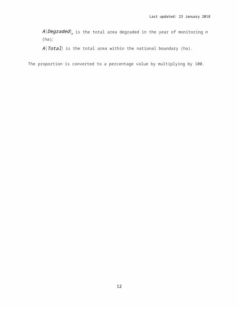
The total proportion of land that is degraded over total land area is given by:
Pn=A(Degraded )n
∑i
m
A (Total)(4)
Where
Pn is the proportion of land that is degraded over total land area;
A(Degraded )n is the total area degraded in the year of monitoring n (ha);
A(Total ) is the total area within the national boundary (ha).
The proportion is converted to a percentage value by multiplying by 100.
8
Last updated: 23 January 2018
Disaggregation:The indicator can be disaggregated by land cover class or other spatially explicit land unit.
Treatment of missing values:At country level
For countries where no data or information is available, the UNCCD and its partners can provide default estimates from regional or global data sources that would then be validated by national authorities.
At regional and global levels
The land area of countries with missing values (i.e., there is no default data) would be excluded from regional and global aggregation.
Regional and global aggregates:The indicator can be aggregated to the regional and global level by summing the spatial extent of land that is degraded over total land area for all countries reporting in a specific region or globally.
Sources of discrepancies:Data reported by the countries themselves will follow a standardized format for UNCCD national reporting23 that will include the indicator and sub-indicators as well as their data sources and explanatory notes. Differences between global and national figures may arise due to differences in spatial resolution of datasets, classification approaches (i.e. definition of land cover classes) and/or contextualization with other indicators, data and information.
The UNCCD reporting format helps to ensure that countries provide references for national data sources as well as associated definitions and terminology. In addition, the reporting format can accommodate more detailed analysis of the data, including any assumptions made and the methods used for estimating the indicator and sub-indicators.
Methods and guidance available to countries for the compilation of the data at the national level:All data are provided to UNCCD by countries in the form of a national report following a standard reporting template,24 which includes the quantitative data for the indicator and sub-indicators as well as a qualitative assessment of indicator trends. The reporting template ensures that countries provide the full reference for original data sources as well as national definitions and methodology.
Detailed guidance on how to prepare the country reports and how to compute the indicator and sub-indicators is contained in the UNCCD reporting manual and in the Good Practice Guidance for SDG indicator 15.3.1,25 respectively.
Quality assuranceThe UNCCD reporting templates has built-in quality check functionalities (e.g., range checks). Once received, national reports will undergo a review process by the UNCCD and its partners to ensure data integrity,
23 http://www2.unccd.int/sites/default/files/relevant-links/2017-12/20171107_Template_Final_EN.pdf 24 http://www2.unccd.int/sites/default/files/relevant-links/2017-12/20171107_Template_Final_EN.pdf 25 http://www2.unccd.int/sites/default/files/relevant-links/2017-10/Good%20Practice%20Guidance_SDG%20Indicator%2015.3.1_Version%201.0.pdf
9

Last updated: 23 January 2018
correctness and completeness, the correct use of definitions and methodology as well as internal consistency.
A help-desk system26 has been set up as a single point of contact for countries to get answers to questions and gain assistance on reporting issues.
Data Sources
Description:National data on the three sub-indicators is and can be collected through existing sources (e.g., databases, maps, reports), including participatory inventories on land management systems as well as remote sensing data collected at the national level. Datasets that complement and support existing national indicators, data and information are likely to come from multiple sources, including statistics and estimated data for administrative or national boundaries, ground measurements, Earth observation and geospatial information. A comprehensive inventory of all data sources available for each sub-indicator is contained in the Good Practice Guidance for SDG Indicator 15.3.1.
The most accessible and widely used regional and global data sources for each of the sub-indicators are briefly described here.
1) Land cover and land cover change data are available in the:
(1) ESA-CCI-LC,27 containing annual land cover area data for the period 1992-2015, produced by the Catholic University of Louvain Geomatics as part of the Climate Change Initiative of the European Space Agency (ESA); or
(2) SEEA-MODIS,28 containing annual land cover area data for the period 2001-2012, derived from the International Geosphere-Biosphere Programme (IGBP) type of the MODIS land cover dataset (MCD12Q1).
2) Land productivity data represented as vegetation indices (i.e., direct observations), and their derived products are considered the most independent and robust option for the analyses of land productivity, offering the longest consolidated time series and a broad range of operational data sets at different spatial scales. The most accurate and reliable datasets are available in the:
(1) MODIS data products,29 averaged at 1 km pixel resolution, integrated over each calendar year since 2000; and
(2) Copernicus Global Land Service products,30 averaged at 1 km pixel resolution and integrated over each calendar year since 1998.
26 http://support.unccd.int/27 https://www.esa-landcover-cci.org/ 28 https://modis.gsfc.nasa.gov/data/dataprod/mod12.php 29 https://modis.gsfc.nasa.gov/data/dataprod/mod13.php 30 http://land.copernicus.eu/global/
10

Last updated: 23 January 2018
3) Soil organic carbon stock data are available in the:
(1) Harmonized World Soil Database (HWSD), Version 1.2,31 the latest update being the current de facto standard soil grid with a spatial resolution of about 1 km;
(2) SoilGrids250m,32 a global 3D soil information system at 250m resolution containing spatial predictions for a selection of soil properties (at six standard depths) including SOC stock (t ha-1);
(3) Global SOC Map, Version 1.0,33 which consists of national SOC maps, developed as 1 km soil grids, covering a depth of 0-30 cm.
In the absence of, to enhance, or as a complement to national data sources, good practice suggests that the data and information derived from global and regional data sets should be interpreted and validated by national authorities. The most common validation approach involves the use of national, sub-national or site-based indicators, data and information to assess the accuracy of the sub-indicators derived from these regional and global data sources. This could include a mixed-methods approach which makes use of multiple sources of information or combines quantitative and qualitative data, including the ground-truthing of remotely sensed data using Google Earth images, field surveys or a combination of both.
Collection process:Data on the indicator and sub-indicators will be provided by national authorities (“main reporting entity”) to the UNCCD in their national reports following a standard format every four years beginning in 2018 or through other national data platforms and mechanisms endorsed by the UN Statistical Commission. This will include the original data and reference sources, and descriptions of how these have been used to derive the indicator and sub-indicators. Eligible (i.e. developing) countries will receive financial and technical assistance in preparing their national reports from the UNCCD and its partners.
Once received, national reports will undergo a review process by the UNCCD and its partners to ensure the correct use of definitions and methodology as well as internal consistency. A comparison can be made with past assessments and other existing data sources. Regular contacts between the main reporting entity and UNCCD secretariat via a help desk system, and through regional, sub-regional, and national workshops, will form part of this review process, enable data adjustments when needed, and contribute to building national capacities. The data will then be aggregated at sub-regional, regional and global levels by the UNCCD and its partners.
Data Availability
Description:In many countries, national data for one or more of the sub-indicators are available. Regional and global data are available for all three sub-indicators and can be disaggregated at the national level for interpretation and validation by national authorities. Communication and coordination with national statistical systems, NSO
31 http://www.fao.org/soils-portal/soil-survey/soil-maps-and-databases/harmonized-world-soil-database-v12/en/ 32 https://www.soilgrids.org/ 33 http://54.229.242.119/apps/GSOCmap.html
11
Last updated: 23 January 2018
representatives and UNCCD national focal points in a transparent manner will include an assessment of data needs and capacity building for monitoring and reporting on the indicator when necessary.
Time series:Annual since the year 2000.
Calendar
Data collection:The data collection process for UNCCD reporting has begun with the first reporting period scheduled for 2018 and subsequent reporting every four years.
Data release:Data from the 2018 reporting period will be released by February 2019 in national, sub-regional, regional and global formats.
Data providers
The ministries or agencies (“main reporting entity”) that host the UNCCD National Focal Points, in conjunction with National Statistical Offices and specialized agencies, will prepare UNCCD national reports that include indicator 15.3.1 and the sub-indicators. Otherwise national data will be procured through national data platforms and mechanisms endorsed by the UN Statistical Commission.
Data compilers
UNCCD
References
All references for this indicator are provided in the footnotes
Related indicators
2.4.1; 6.6.1; 11.3.1; 15.1.1; 15.2.1
12